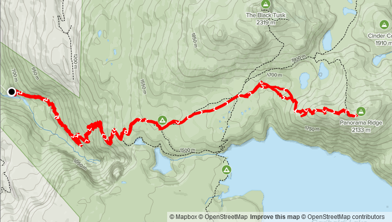
Elevation: 1,790m
Distance: 26.79km
Total Time: 9 hours 30 minutes (not including over night)
Date: April 4th, 2021
My friend Mike messaged me on the Tuesday about doing an overnight camping trip at Radium Lake for this long weekend’s Sunday night. I had a quick look at the area and it seemed there weren’t many easily climbed mountains in the winter. The past year, I’ve also only really been doing day trips and so the idea of camping overnight didn’t initially appeal to me. After thinking it over, I decided to look around for summits that we could camp on or near and still make it in the winter.
That’s when I arrived on the Garibaldi Lake area. I hadn’t been out there since the summer of 2017, but I knew it had a wide variety of peaks and based on other trip reports it looked amazing in the winter. With that, I countered to Mike about doing a late-day ascent up one of the peaks in Garibaldi and over-nighting to catch the sunset. He was in and I also reached out to Jacob he responded with a quick “yes” as well.
I hadn’t yet picked which summit(s) to go for, so I started asking around. There were a few interesting combinations that came up after I reached out the SWBC Peak Baggers and Mountain Runners group. There was Mount Price and Clinker Peak or Cinder Cone and Empetrum Peak and the more obvious Panorama Ridge. All looked tempting, but Mount Price and Panorama Ridge looked to have the best views. Panorama Ridge is a 2133m peak and is the most popular ascent in the summer time as it has 360 views over Garibaldi Lake and the surrounding region. Due to it’s less popular nature, I was leaning more towards Mount Price. It stands at 2052m and is directly across the lake from Panorama Ridge. It also boasts amazing views, so there wasn’t much to lose out on with either peak.
Avalanche conditions were calling for low, moderate, moderate with solar aspects and cornices being the main issues. There was also a high pressure system coming in for Sunday/Monday so the weather looked to be really promising. I figured we could make the final decision on-site as the route to Mount Price and Panorama Ridge starts from the same trail head. With that, we agreed to head off from Vancouver at 9:00am on the Sunday. That would give us about 8.5 hours of day light if we arrived at the trail head for 11:00am. Also worth noting that there are two official trail heads for accessing the Garibaldi Lake area: Rubble Creek and Cheakamus Lake. I was informed from the SWBC Peak Bagging group that only Rubble Creek was plowed in the winter, so we settled on Rubble Creek as the starting point.
When Sunday morning finally arrived, I woke up around 7:30am to discover that Mike had to bail at the last minute due to a work injury. That left just Jacob and I. He was still in and so we continued as planned. We left Vancouver just past 9:00am and made it to the trail head for 11:10am or so. Jacob had picked up a new backpack and gear for staying overnight, so we spent a bit of extra time gearing up at the car. Finally, at 11:29am we started off from the Rubble Creek.
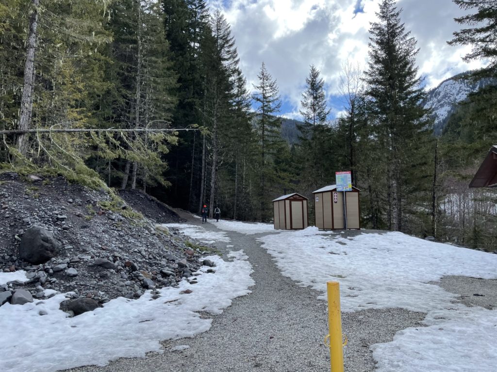
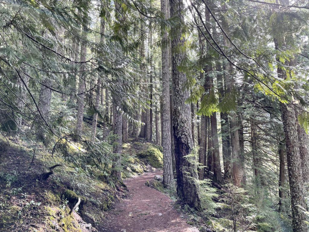
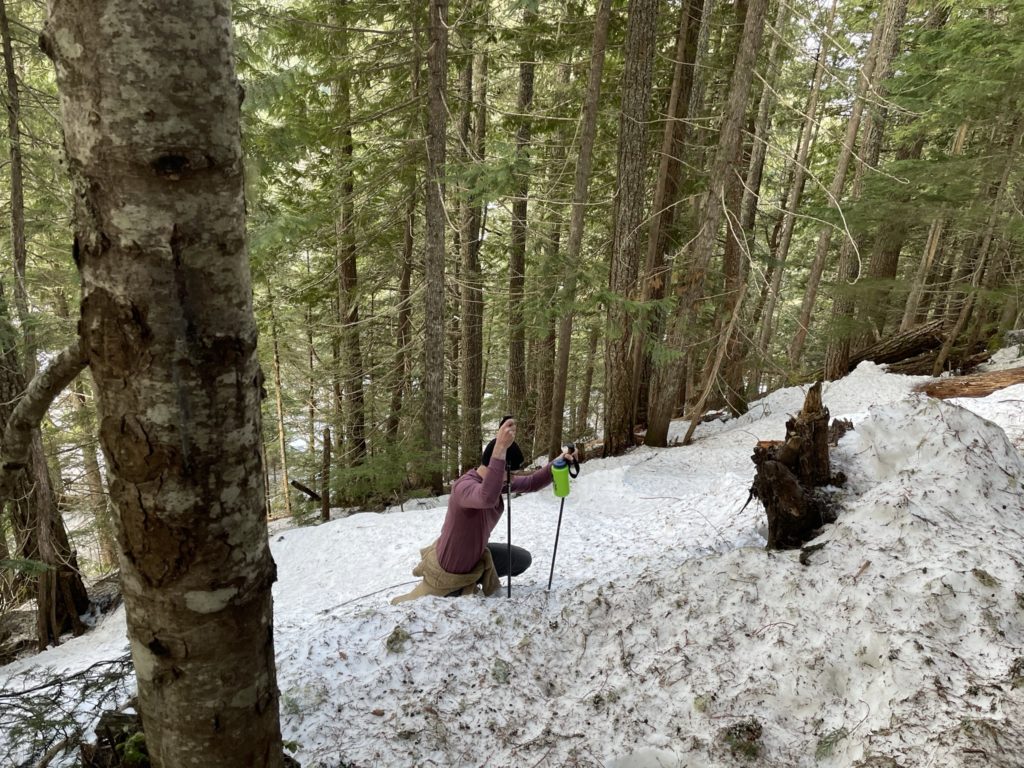
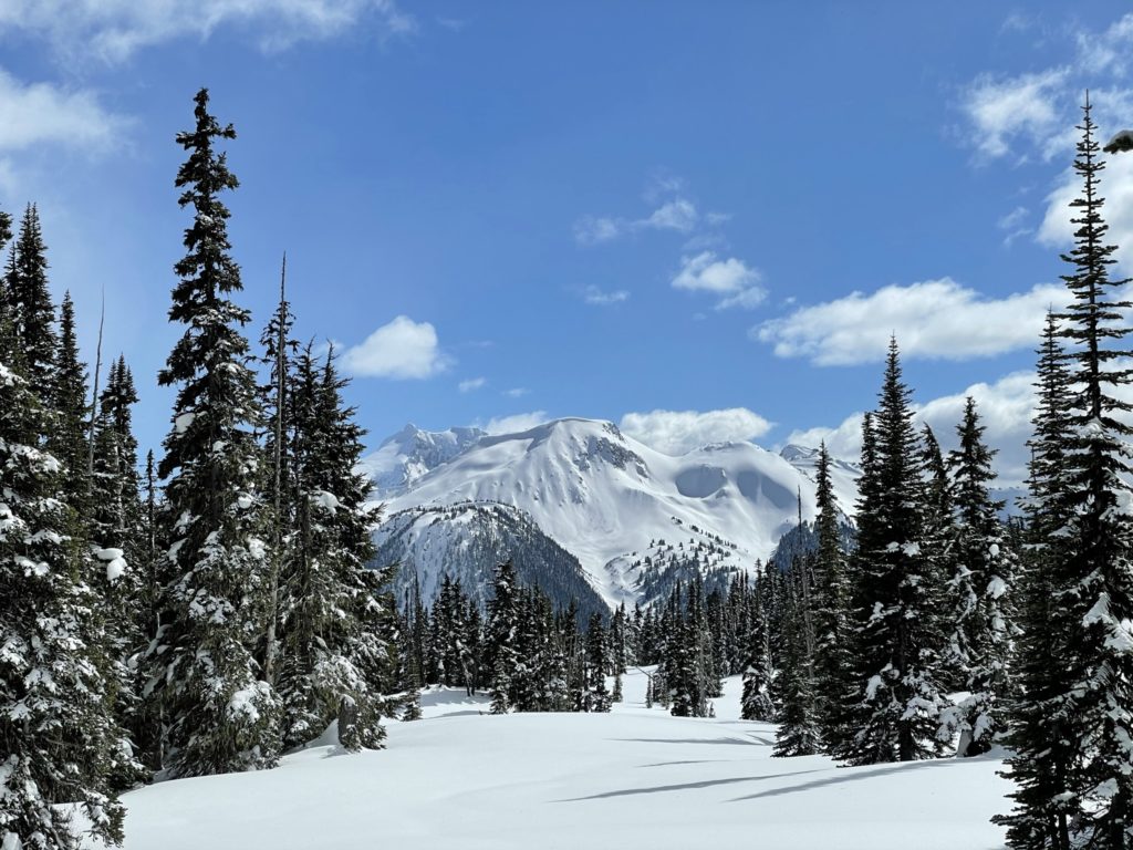
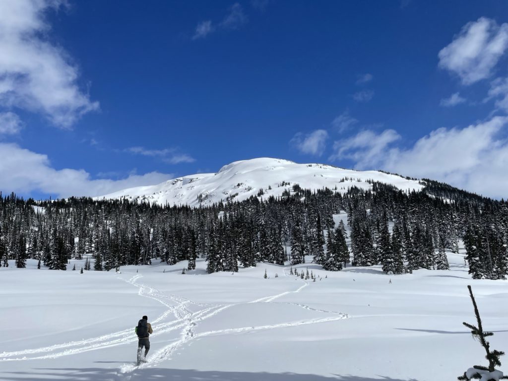
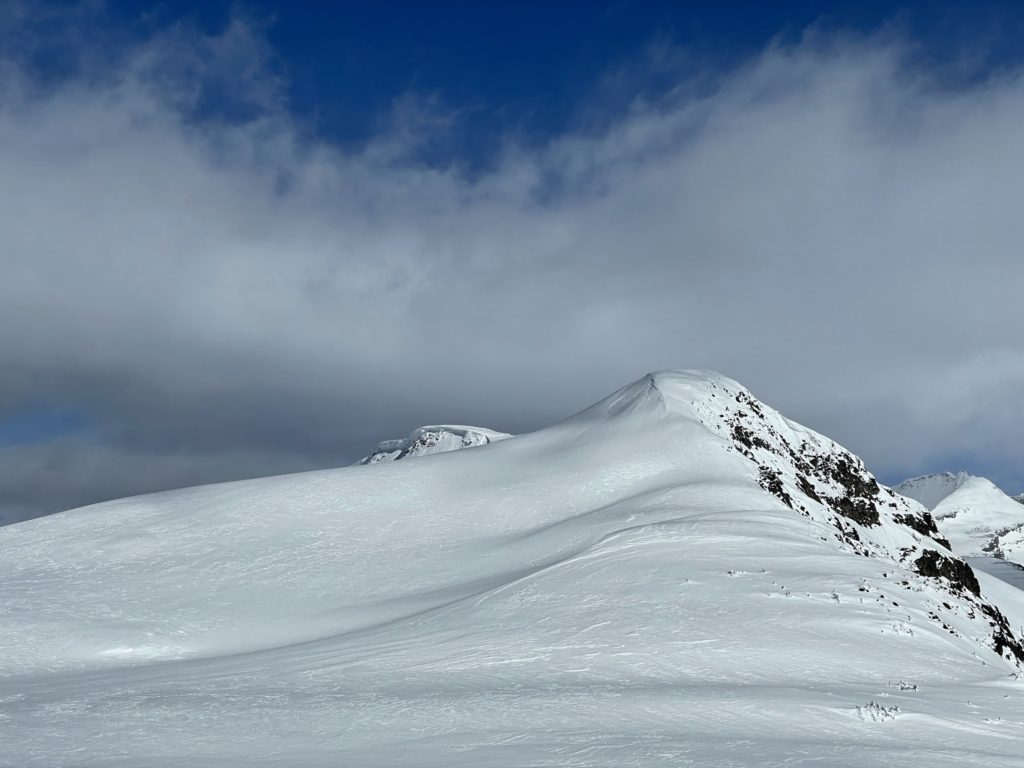
The trail started at about 500m in elevation and wound up a forested slope alongside Rubble Creek. We hit snow around 700m which quickly turned into hard packed ice from so many travelers. Despite that, we made a good pace and reached the Taylor Meadows camp site in ~2 hours with a total gain of around 1000m in elevation across 8km of travel distance. We paused there for a quick lunch and then walked a bit further to a small clearing where we could now see Mount Price and Clinker Peak. From this vantage I could see Mount Price was actually quite steep and appeared to have some wet loose avalanche activity near our intended route. With that, I made the choice to hit Panorama Ridge instead and Jacob happily obliged.
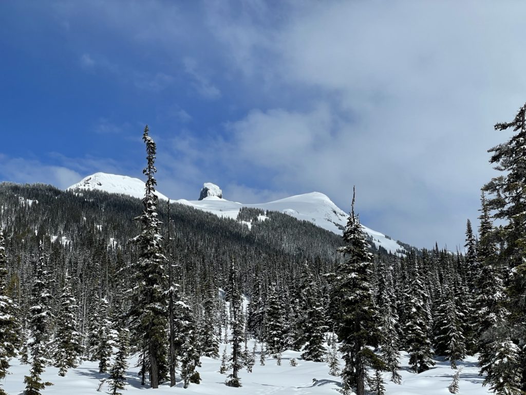
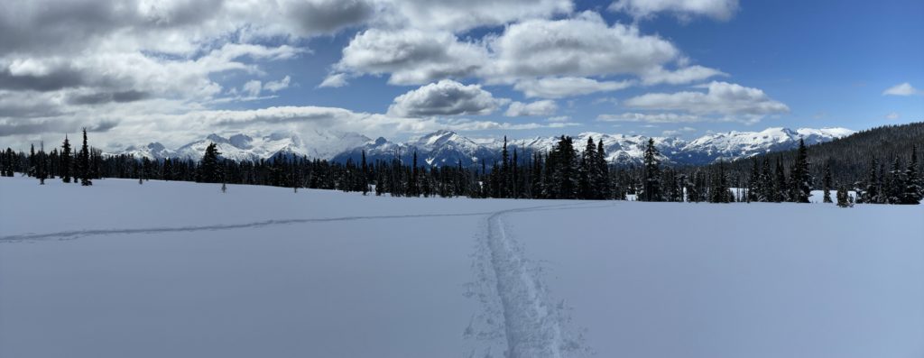
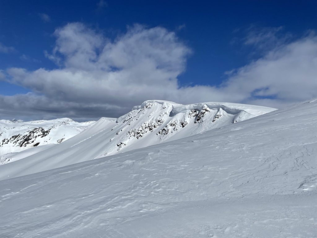
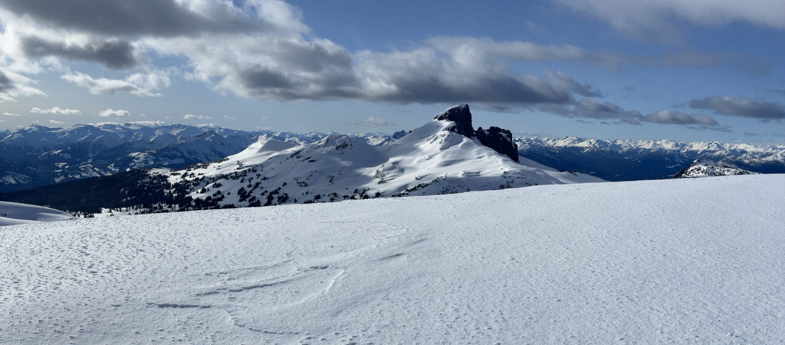
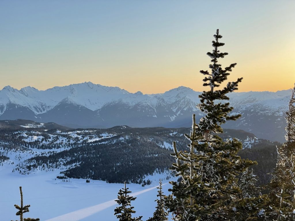
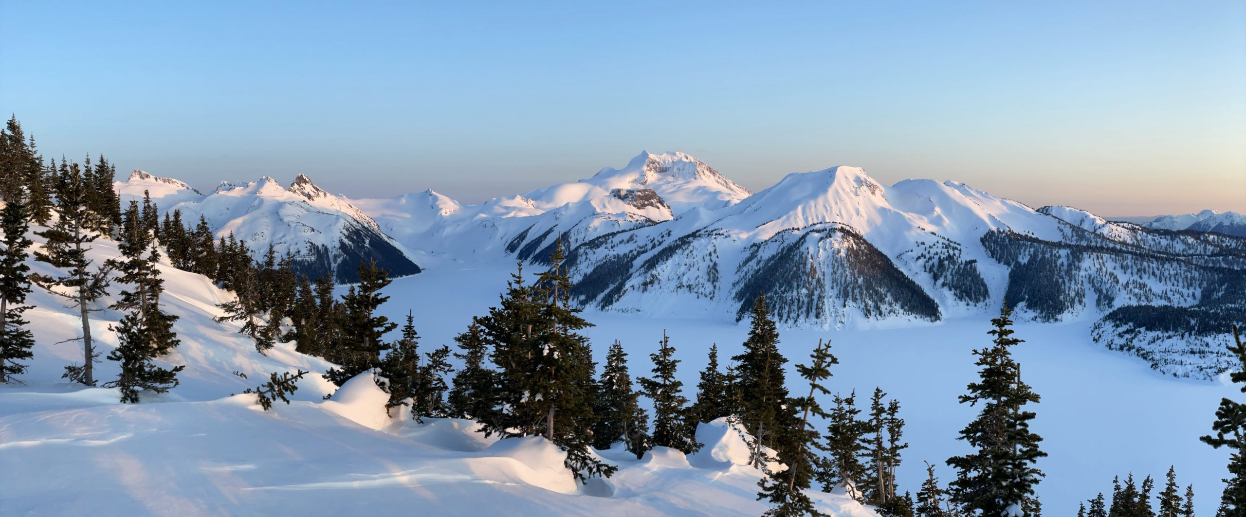
As we continued along the route to Panorama Ridge, the trees really started to open up and eventually spit us out into a blank snow field. From there we could easily see the Black Tusk, the Tantalus Range, Mount Price and others. The route was easy going as the terrain was relatively flat and we were just following existing ski tracks. We crossed paths with a number of groups coming back from Panorama Ridge attempts and received some interesting bits of information. The first group failed to reach the base due to lack of snow shoes and another individual also suffered the same fate when attempting it in runners. Finally, a third group gave us some critical beta on the route. When they attempted the normal summer route, they discovered massive cornices and opted to bail off. They made a second attempt approaching from Mimulus Lake but found it was too steep and called it a day.
Using this info, Jacob and I decided to make an attempt on the Western aspect as it didn’t look too steep, had no cornices and we could see existing skin tracks part way up. Not long after making that decision we run into the skiers who had made said tracks. They said the snow had a firm wind crust and while bad for skiing should be fine on snowshoes. The sun had been hitting the slope for a few hours already though, so there was some concern about the conditions. In any event, we pressed on.
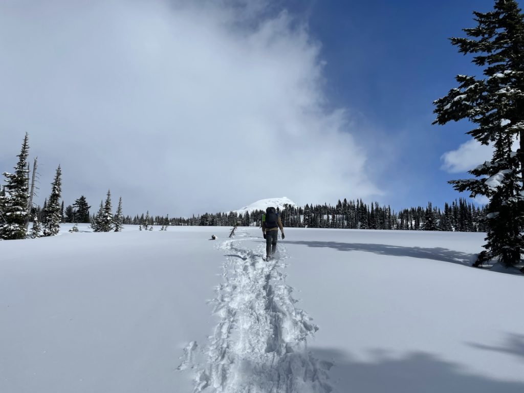
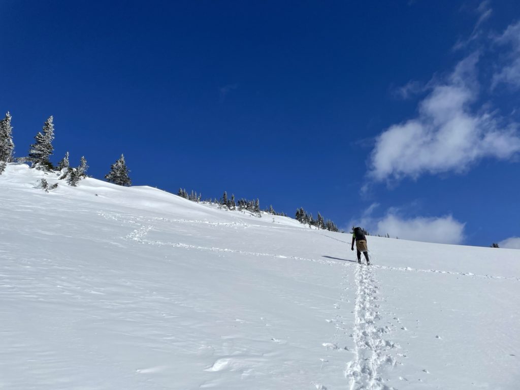
At about the 10km mark, we veered off from the standard summer route and made a more direct line for Panorama Ridge. This involved losing a bit of elevation down in to a small amphitheater of sorts before regaining elevation on Panorama Ridge’s Western base. Here we continued to follow the existing ski tracks up and by this point some new skiers had caught up and passed us. Ever since lunch at Taylor Meadows I had started to gas out as I wasn’t used to hauling up so much gear (tent, bag, etc). Nevertheless, I pushed on and tried to keep pace with Jacob.
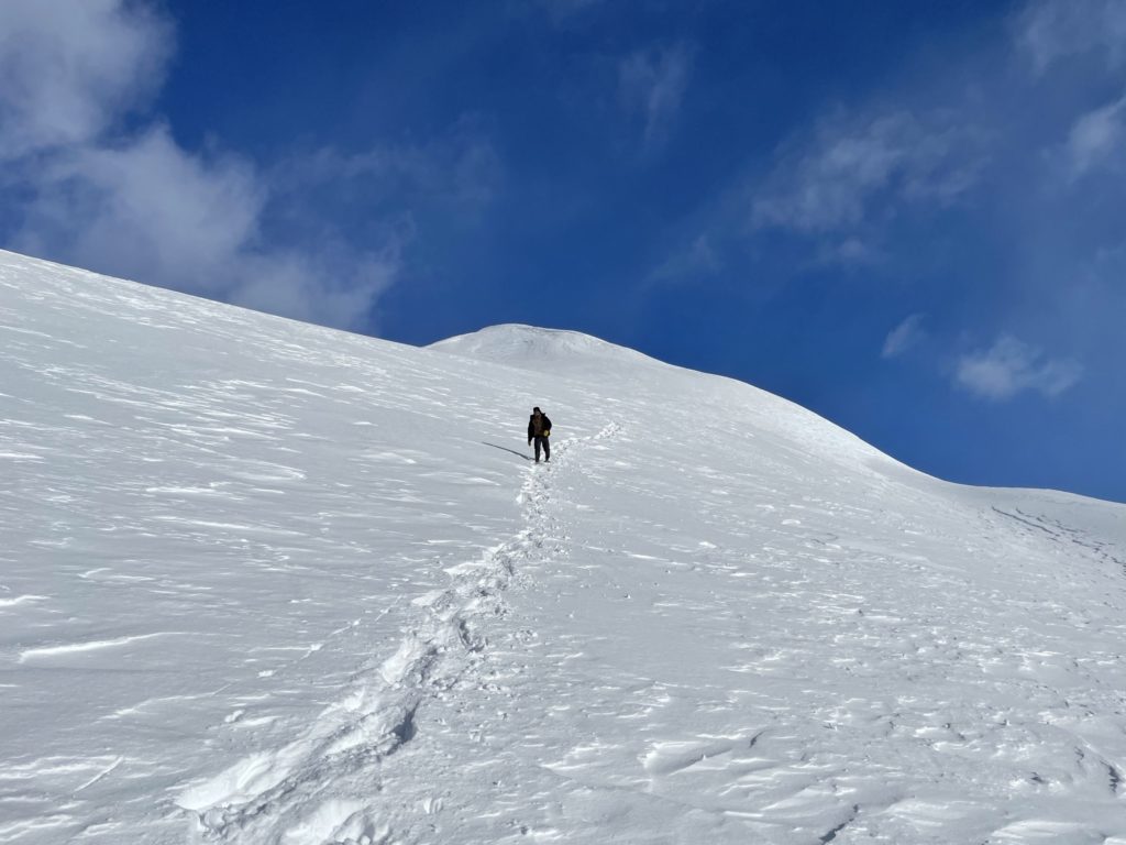
As we pushed up through the lower sections I noticed quite a few slopes exceeded 30 degrees, so beware this route does involve avalanche terrain. At around 1900m in elevation the skiers ahead of us reached as high as they wanted to go and wished us luck to the top. There were still tracks ahead including fresh snow shoe prints so we simply continued to follow those. Between 1900m and 2000m the snow was quite variable from all the sun exposure. Lots of isothermal/rotten snow then changing to hardened wind crust and everything in between. Thankfully, this section of the route was a relatively moderate pitch, so no real concerns.

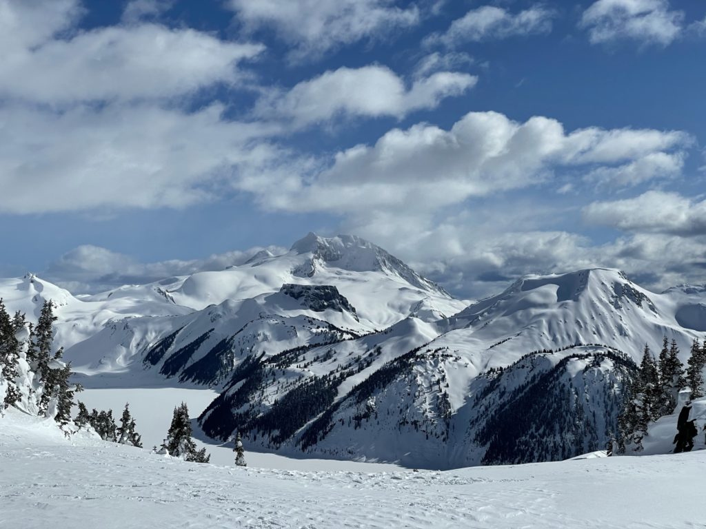
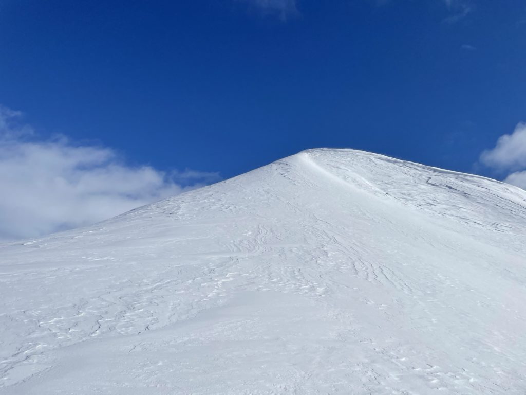
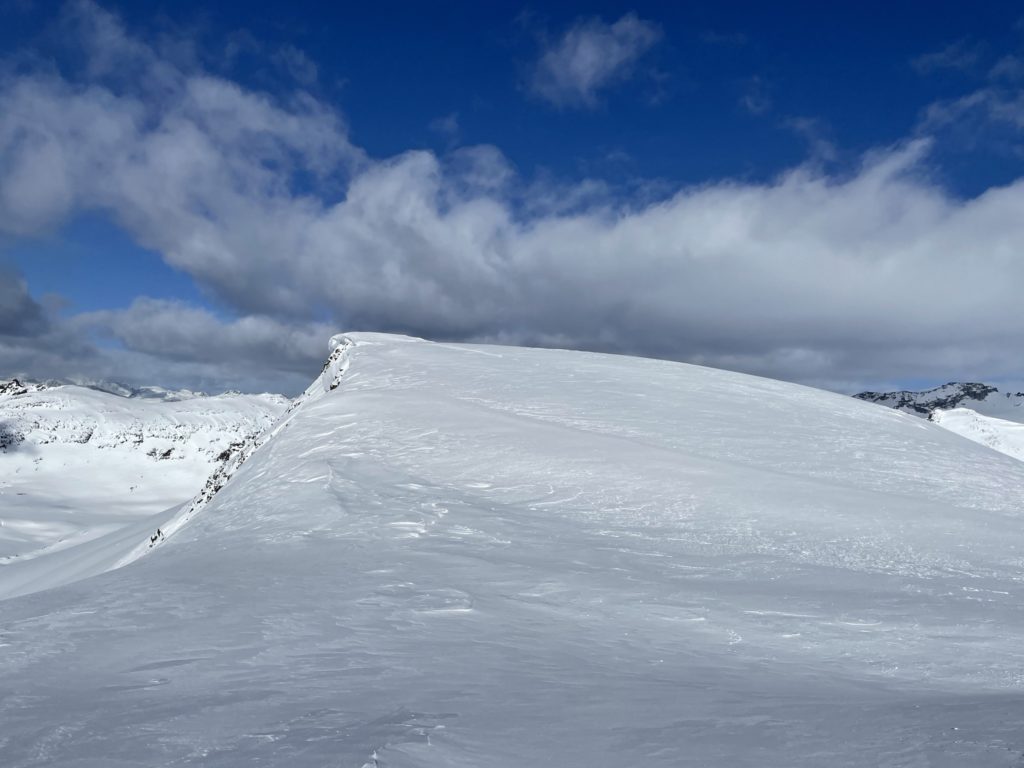
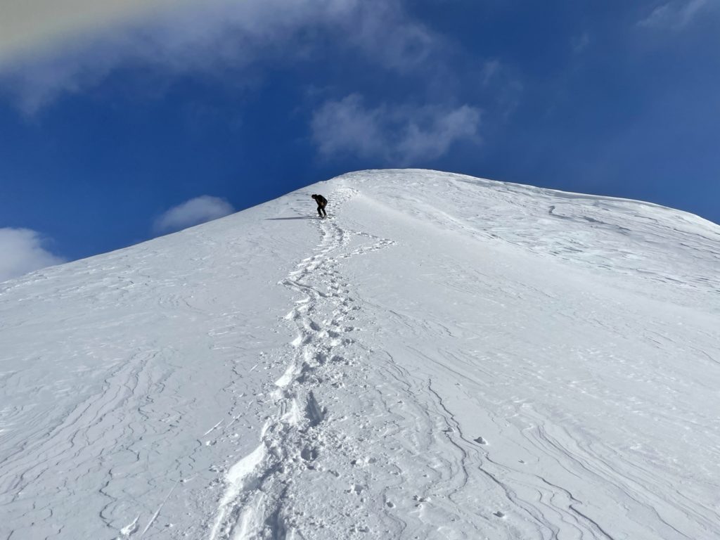
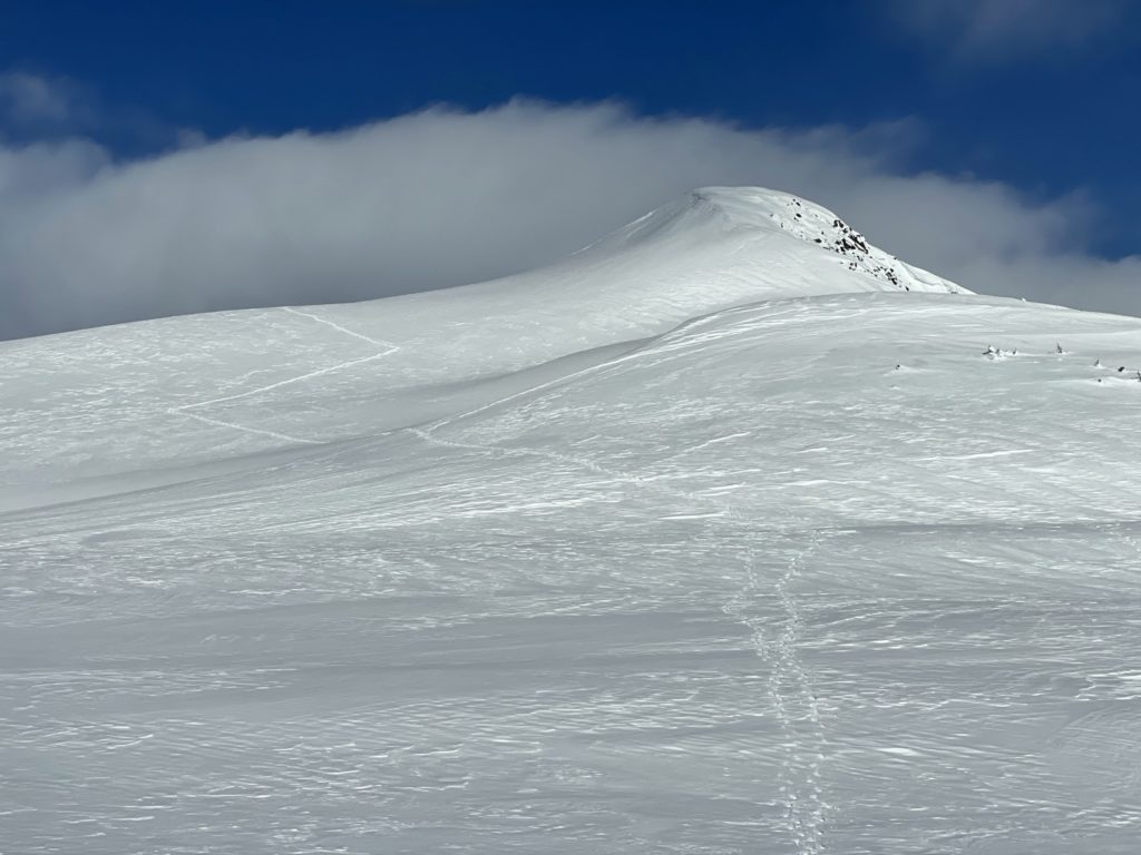
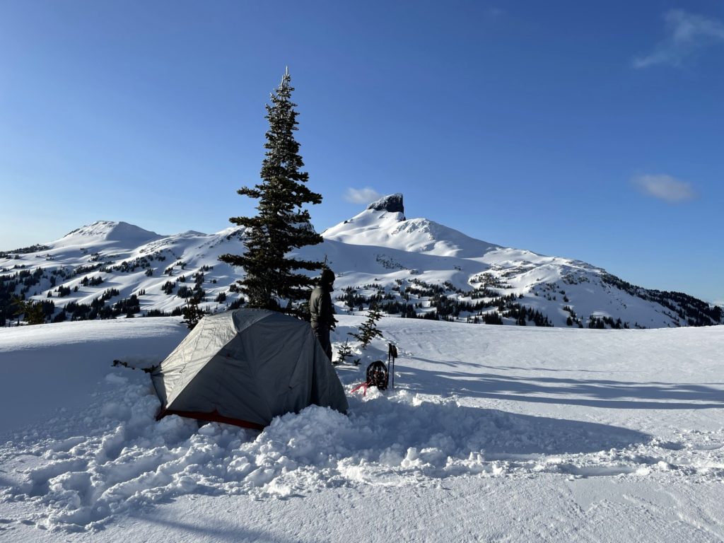
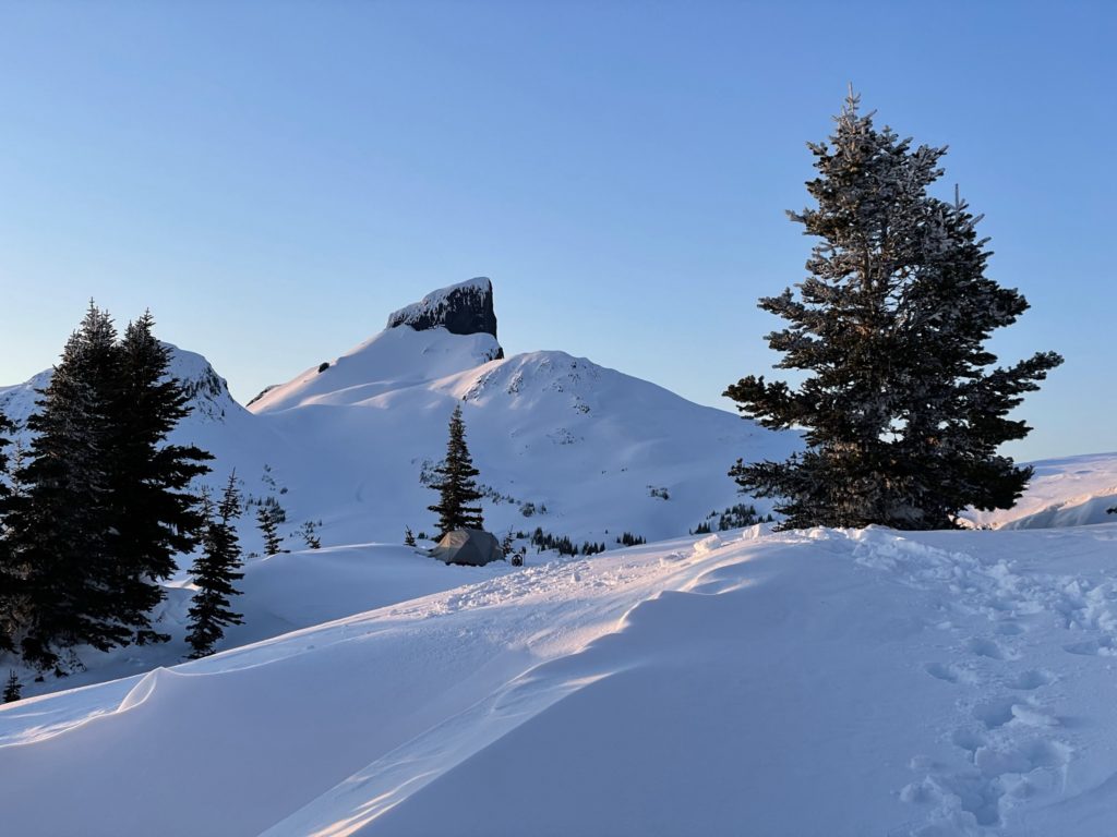
At 2000m we topped out on a small ridge below the summit. Here we found the lone snowshoer and a skier they had come up with taking in the views. I went over to see if they were considering the summit at all, but the snowshoer didn’t like the snow conditions and so they were headed down. Ahead of us, looking towards the summit, was a small roll down to a flat ridge and then a steep snow pitch to pointy summit peak of sorts. No more tracks to follow and we’d have the summit to ourselves. Looking at the map it seemed the true summit was still beyond this pinnacle, but we couldn’t see exactly what lay ahead. I could also see the huge cornices guarding the summer route with some about to break off, so I was happy we had chosen an alternate ascent.
We were debating making the steep snow ascent or not as the snow was messy coming up, but ultimately decided to at least go up to it and check it out. We ditched our heavy packs and started our way over. As we approached the base of the pitch, the snow felt firm and I felt comfortable pushing on. We made a few zig-zags up the first steep roll and then pushed straight up the last pitch to the “pinnacle”. From the top of the pinnacle I could see the rest of the summit ridge and I realized the crux of the route was now behind us. We stepped down wind blown snow step and reached the true summit ridge around 5pm. From there it was an easy walk to the top, being mindful of the cornices on the Northern side.
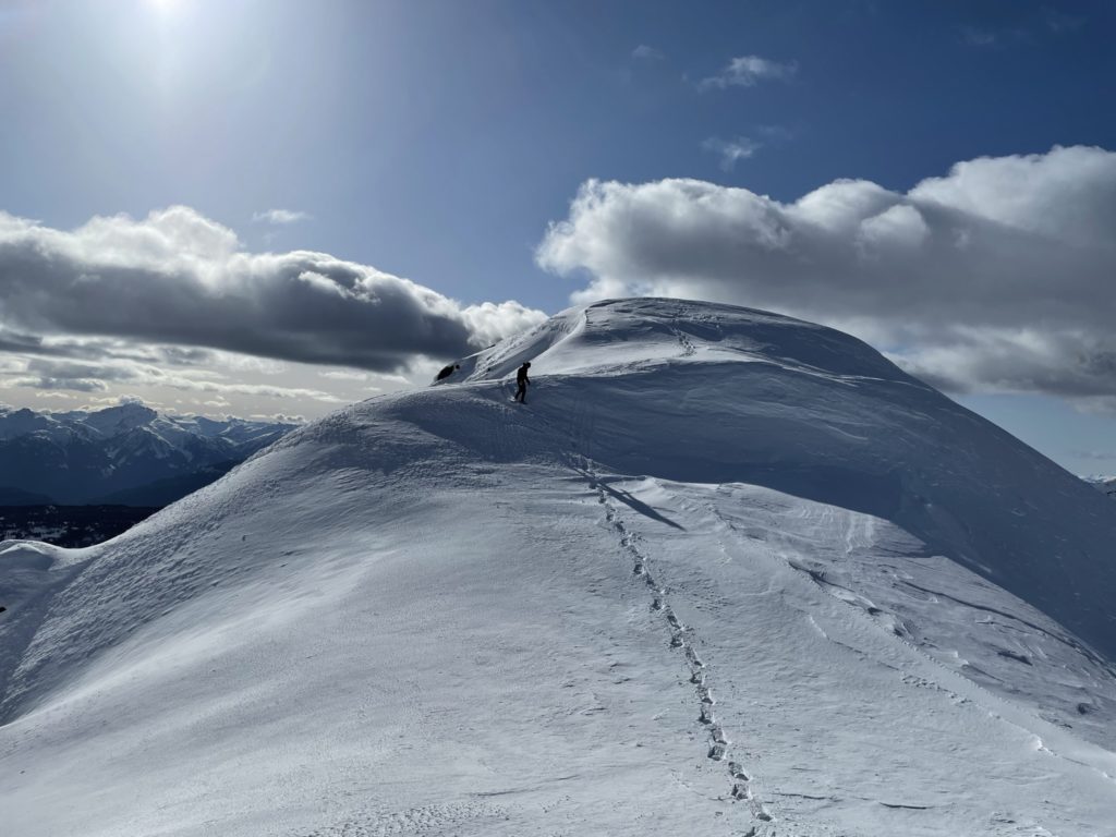
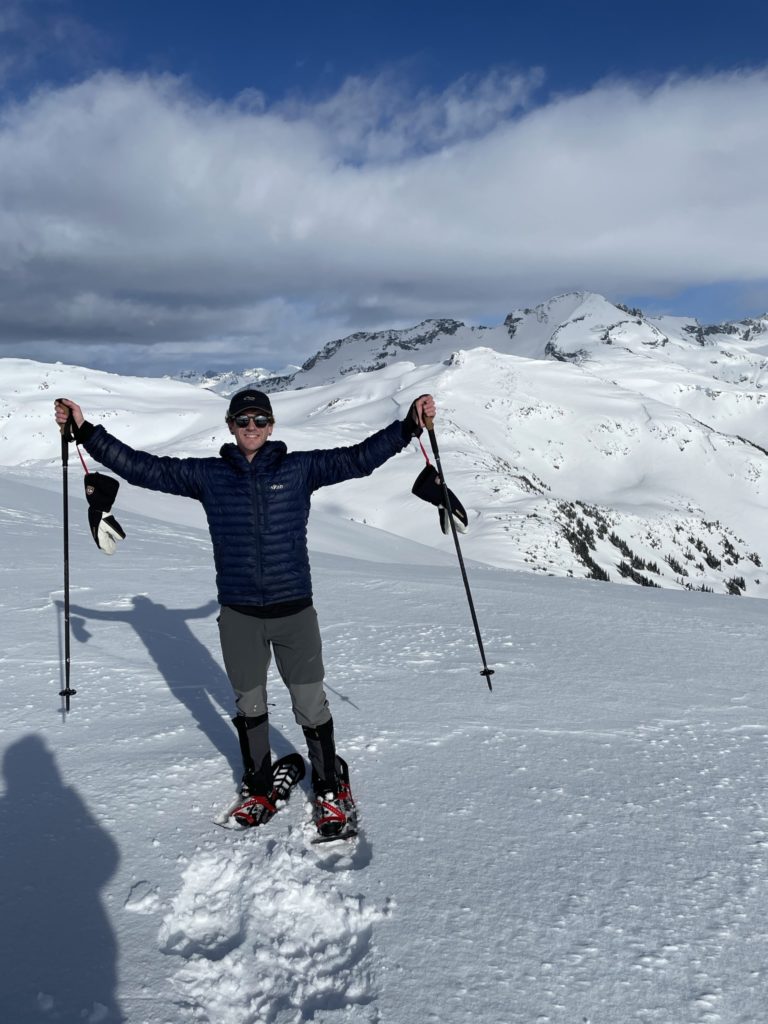
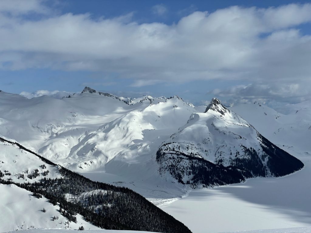
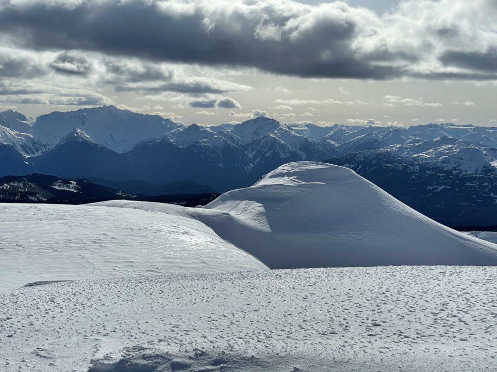
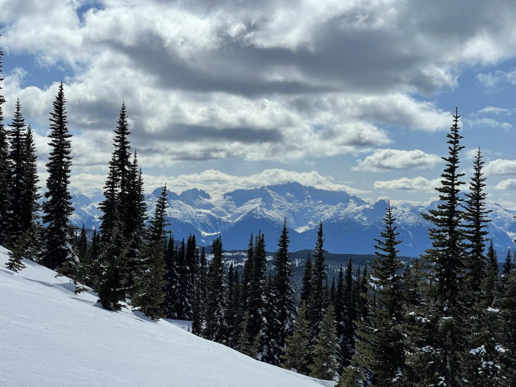
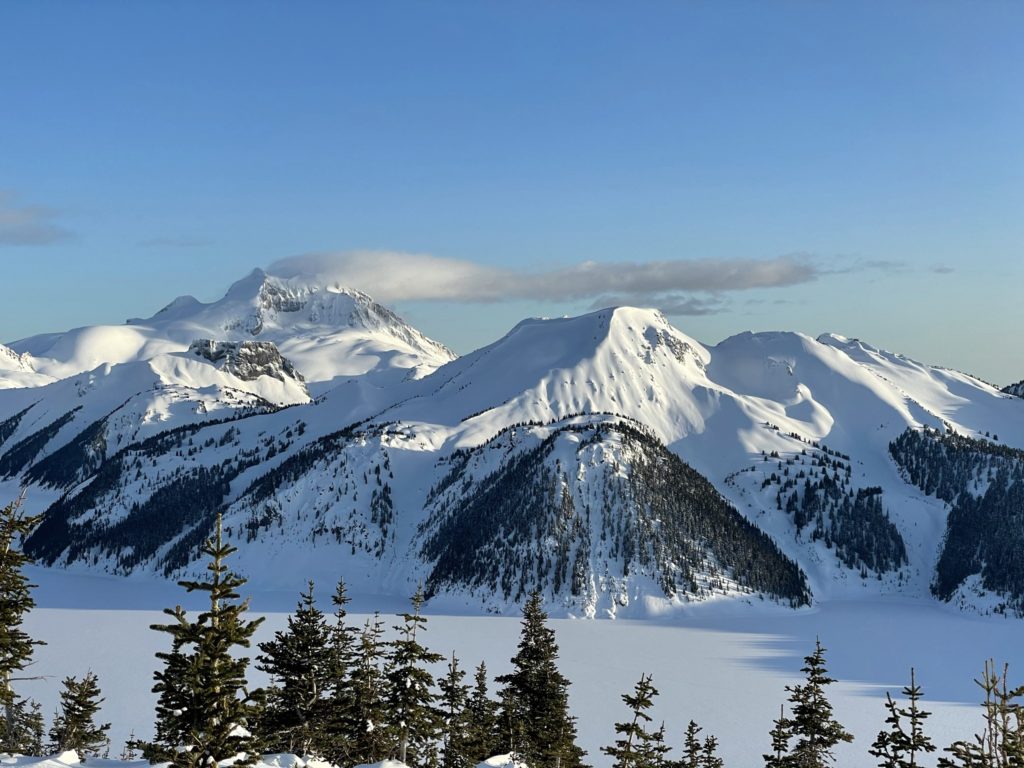
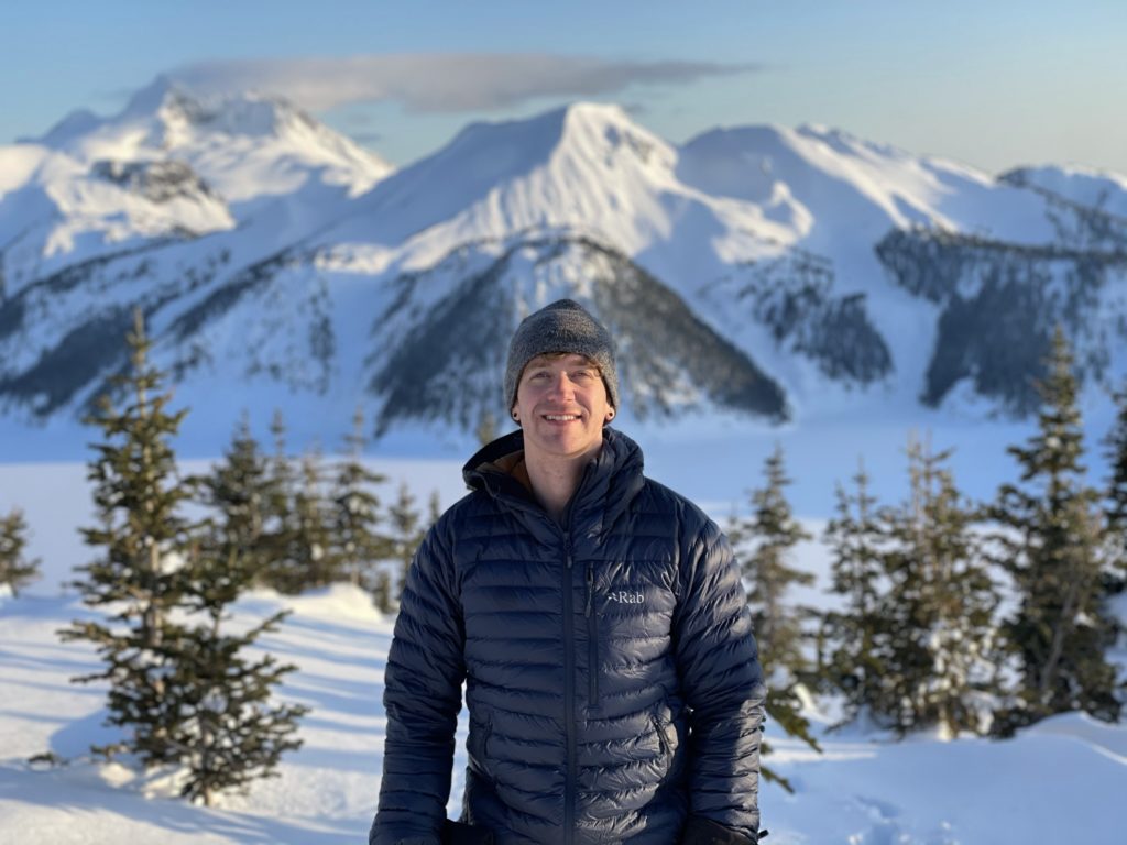
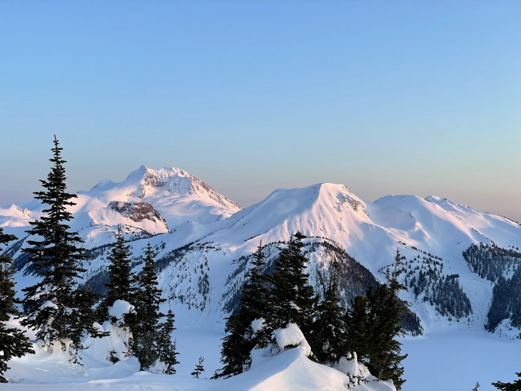
The views from the summit were second to none. From the top we had unending views of Gentian Peak, Castle Towers, the Sphinx, Guard Peak, Garibaldi and so many others. I can definitely see why this hike is so popular in the summer. Luckily for us, we had the whole place to ourselves. Jacob and I stuck around at the top for 30 minutes or so and then headed back down. When we reached the steep snow pitch it required some careful foot placement to avoid slipping, but we made it down with relative ease.
Once we regained the small ridge, we grabbed our backpacks and started our way down again. In my head I was originally planning to camp at the very top, but when I reached the summit I quickly realized it would be far too windy for any chance of sleep. With that, I opted to find a more sheltered spot lower down on the ridge that would still afford us nice sunset views. At around the 1850m mark, we found exactly what we were looking for and set up the tent for the night. We stayed up to watch the sunset and began boiling snow to resupply all the water we used up.
I had a stretch goal for us to hit Cinder Cone on the following morning, but we had the unfortunate luck of running out of gas, from two canisters, while boiling water. As a result, we ended up with only 2L of water between each other and no hot meal for dinner/breakfast. Without enough water/food to make an additional peak we made the decision to just head home in the morning and settled in for a cold night of sleep.
I don’t normally sleep well outdoors and this time around was no different. Worse perhaps, because I never truly got warm all night. At around 7:30am, I finally gave up on trying to catch more sleep and joined Jacob in an attempt to pack up and head out. I had to force my feet into my frozen boots, but warmed up pretty quickly after that. During my packing I also discovered my phone had died in the night, so no more photos on the way down. We packed up the rest of our stuff in about 20 minutes and started our descent.
There’s not much to speak of beyond this point as we just followed the established trail all the way back down. With a dead phone, I couldn’t capture any of the beautiful morning shots, but I still paused frequently to take mental pictures. After 3 hours or so, we were back at the car and drove back to Vancouver for a sunny day of relaxation.