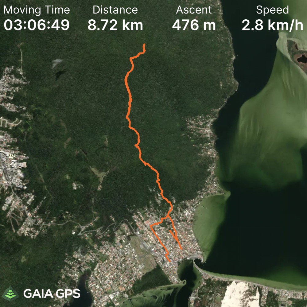
Elevation Gain: 595m
Distance: 9.03km
Total Time: 3 hours 45 minutes
Date: Februrary 10th, 2022
After a successful month tagging peaks in Argentina I was now heading to Florianopolis, Brazil for a break from the mountains. The goal was to do some surfing, swimming and just general exploring. Old habits die hard though and I couldn’t help but see if there were any summits near the hostel I’d be staying at. Naturally, there was one within walking distance of the hostel called Morro da Lagoa. From the map there appeared to be an existing trail to the summit and at 493m, it should be easy enough to grab.
I didn’t start thinking about this summit until a few days in of swimming and surfing. It seems I’m only good for a few days rest before the next mountain starts creeping it’s way in to my plans. In any event, I finished a day of surfing and felt like getting some more exercise before the evening was over. Morro da Lagoa seemed like the perfect option. It’d be a bit close with sunset time, but I knew for the distance and elevation it should be doable.
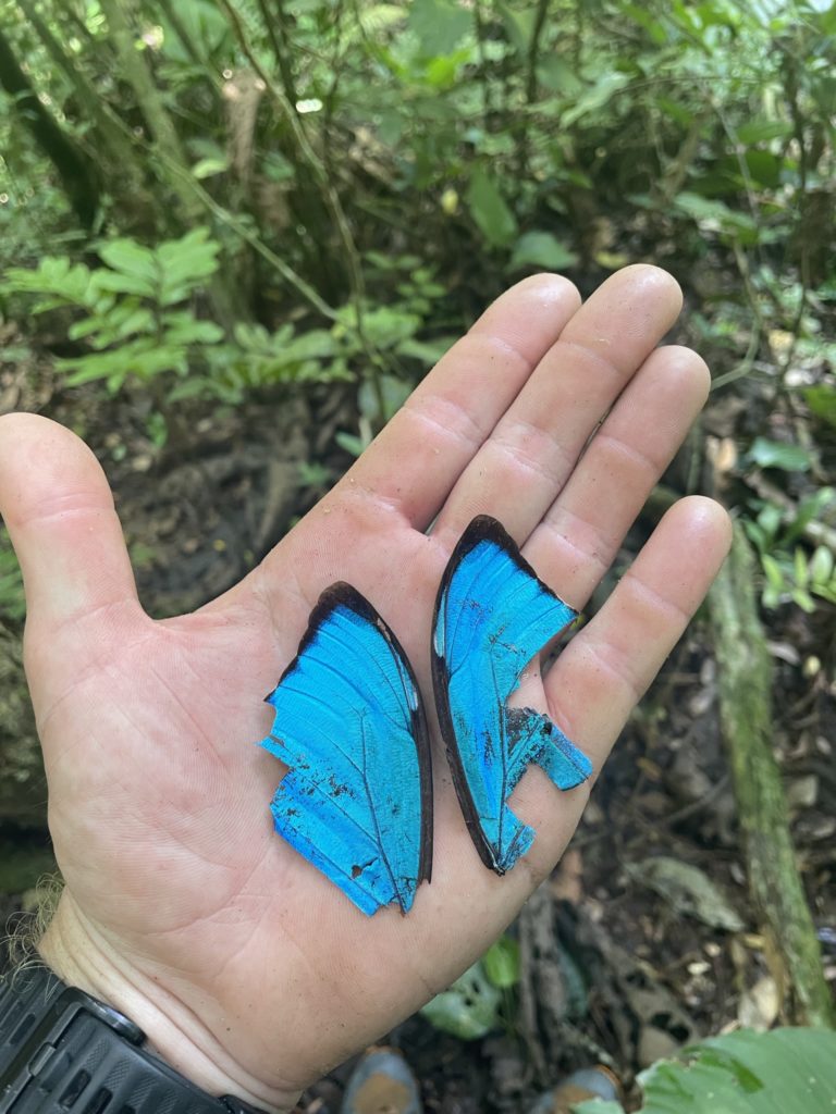
I set off from the hostel around 5pm and wound up the steep hillside roads towards a sanctuary (the starting point). Nonchalantly, I started a good pace down the trail into the darkening forest. About 15m in something moved across the corner of my eye and I reflexively backed away. Scanning around I saw the culprit. A huge spider web spanning across the entire trail. Dead center was its creator, a 5-6cm spider that was bigger than anything I’d seen in Canada.
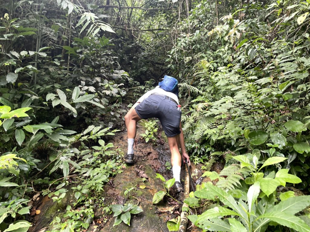
I swatted the web away successfully, but now I had the realization I was indeed in a rain forest. There were going to be more of these spiders and potentially snakes and who knows what else. I continued up the trail, now with a pole to catch anything lurking ahead. But I didn’t make it far. The trail quickly grew more overgrown and my pace slowed considerably. I simply wasn’t going to make it before dark if I had to check for spiders, snakes, disappearing trails and more along the way. I opted to turn around and call this attempt off.
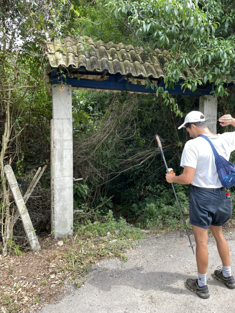
The next day, I was lucky to run into a new hostel guest, Adam, who was keen to give it a go together. We decided to leave much earlier in the day to give ample time for spotting webs. Once again I found myself up the winding roads to the sanctuary and then the trail head shortly after.
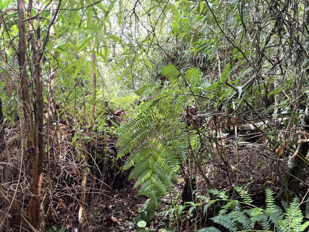
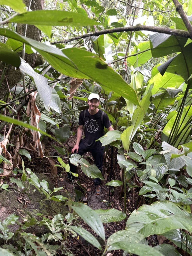
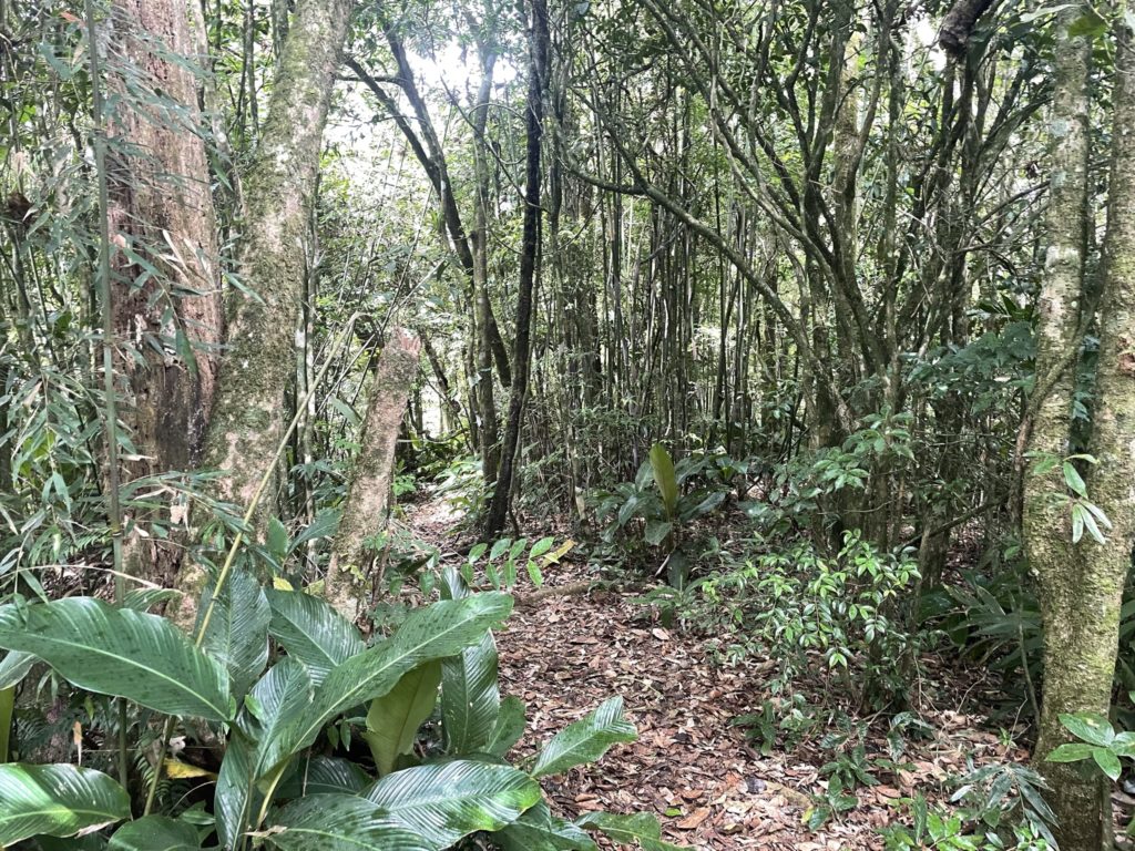
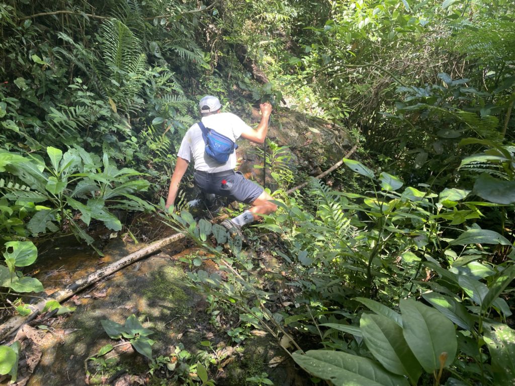
I took the lead through the forest first and to my surprise a new spider web stretched across the path in almost the same spot as last evening. I swatted it away again and we continued on. Now Adam and I were on high alert. Armed with a trekking pole, each, we walked forward and swatted the hopefully empty air with each step. As we passed my original turnaround point, the forest continued to get more overgrown. It became glaringly obvious that this trail was now seldom used, if at all. A foot path still guided us through some of the more over grown sections, but eventually we reached the base of a wet slabby section. We pushed up the slabs until we lost the trail. Then with some back tracking we found an obscured foot path at climber’s left and continued up.
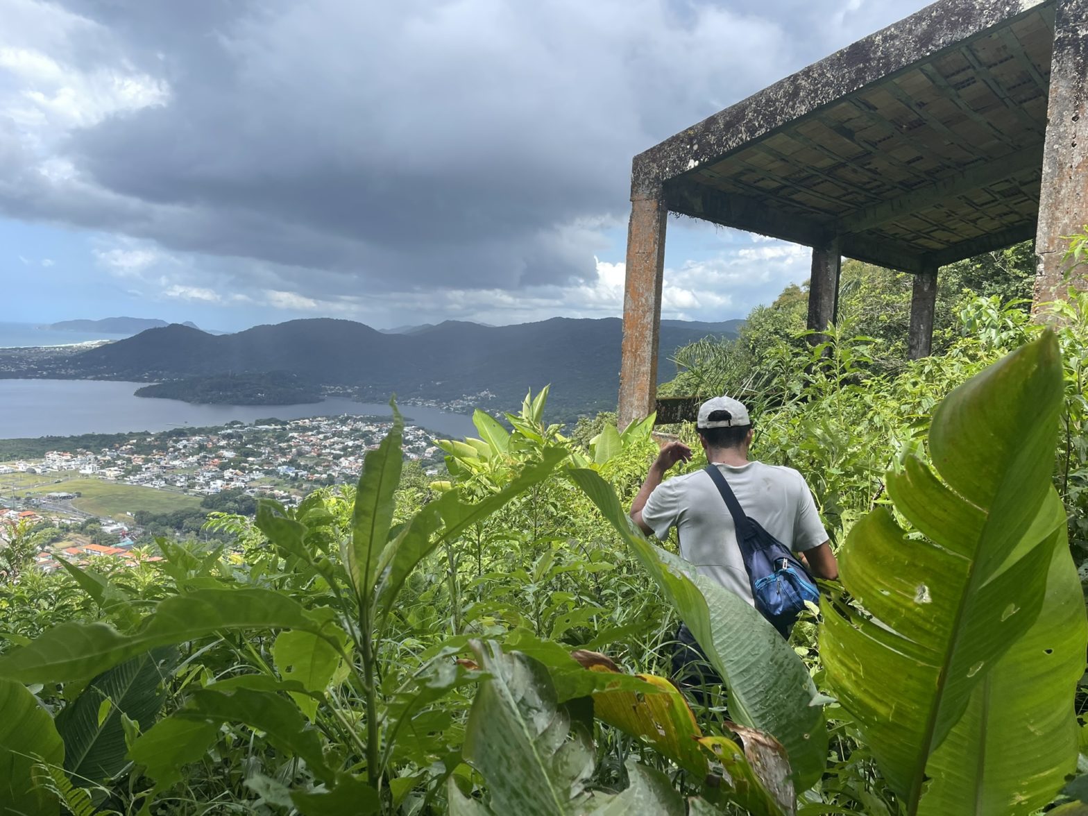
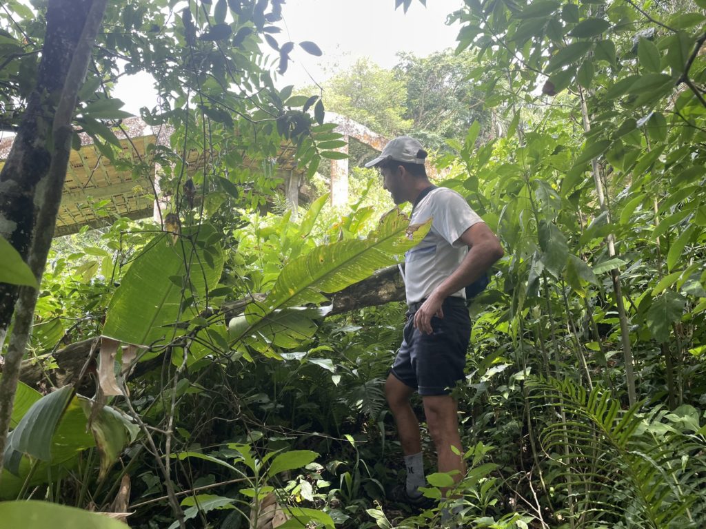
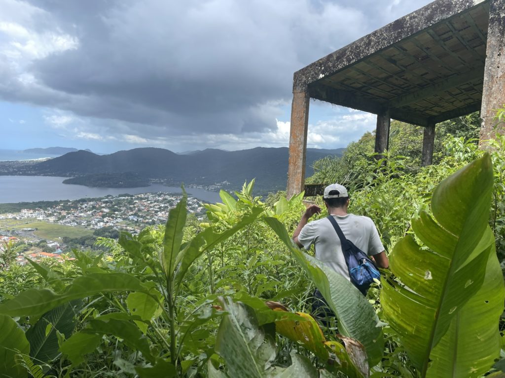
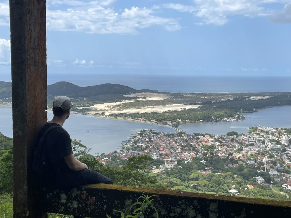
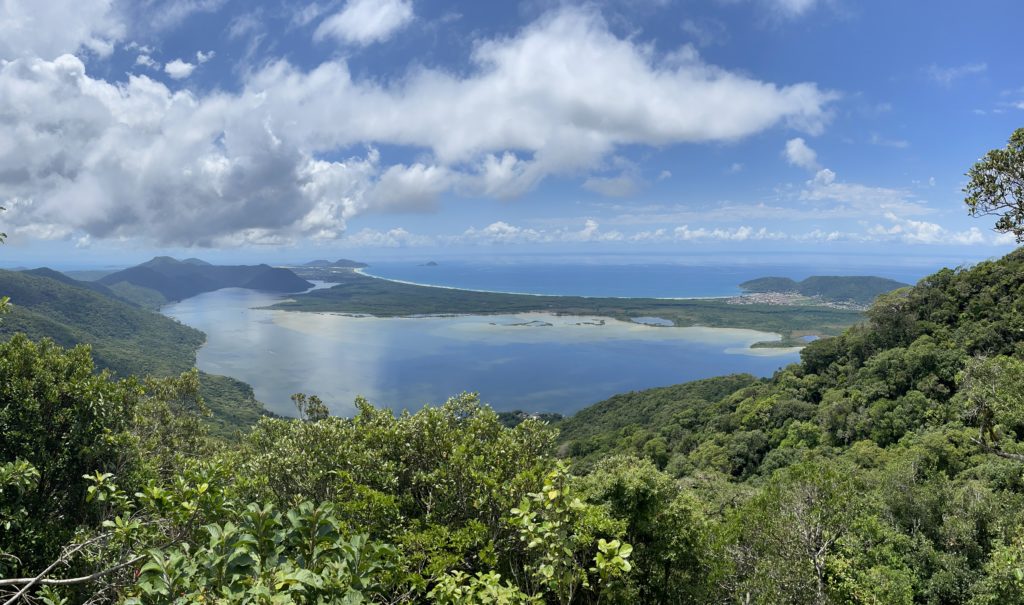
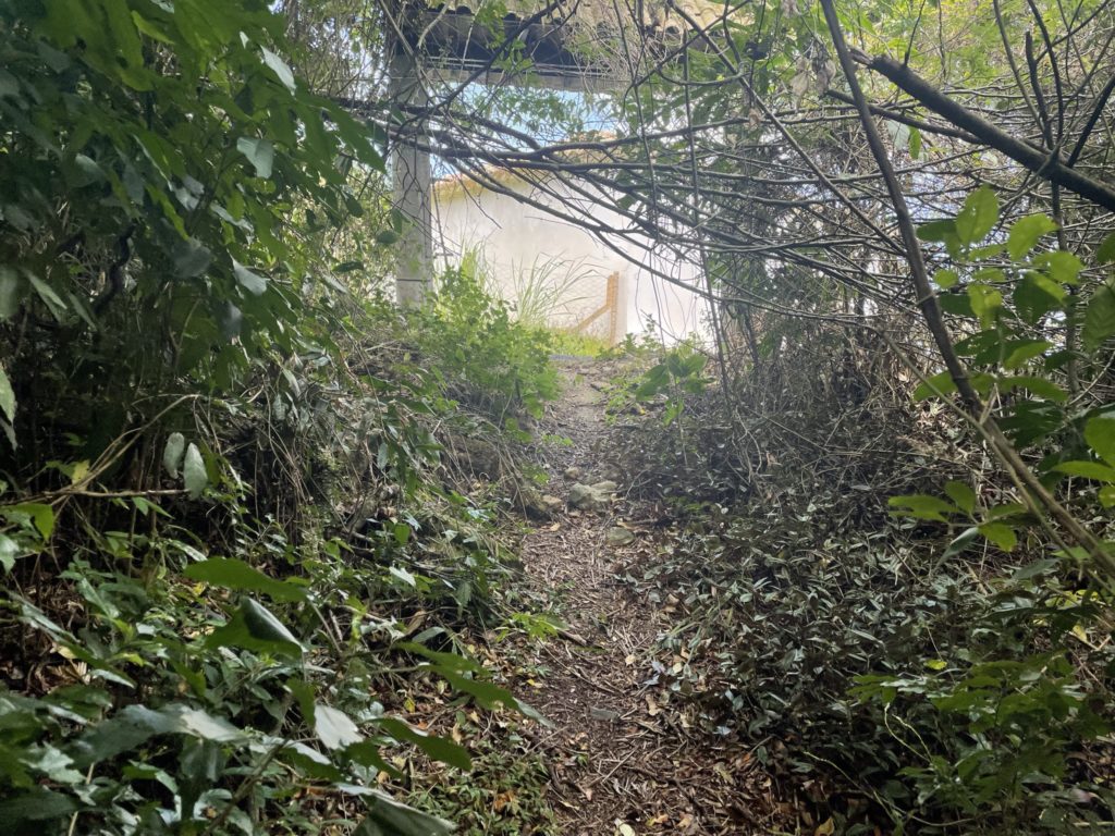
I think perhaps two or three more times we lost the trail and had to back track and fan out to find the path. Eventually we reached a notable landmark on the map called Rampa Voo Livre. When we reached the forest edge we found remnants of a land clearing in the process of being reclaimed by the jungle. Centered on this parcel of land was an abandoned concrete structure. Only a roof and supporting beams were present with the flora reaching as high as the second floor. Adam lead the way bushwhacking through dense brush to make it to the structure. With a small mantle move we made our way on top and stopped to have lunch. The clearing revealed a phenomenal panorama over Lagoa da Conceicao and made for the perfect resting point.

After our break we bushwhacked back to the forest and continued west looking for the remaining trail. Perhaps 15m further we popped out of the edge of the forest to discover a totally cleared section of land beyond the stucture. No bushwhacking required and there appeared to be an old service road that would take us further towards the summit. As it turns out the “trail” beyond Rampa Voo Livre is actually a winding service road that leads all the way to the main roads, if you were so inclined.

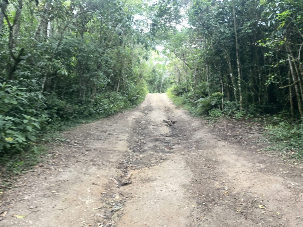
For us we planned to go the opposite way and to our surprise the “trail” continued to be a wide service road. We reached a junction around 450m in elevation and here it narrowed down to a smaller trail. Still, it was nothing like we had encountered in the lower sections. In short order we reached the summit amidst dense forest and no views. Looking on the map I saw the trail continued a bit further past the summit and we decided to investigate. 20m further and the trail broke out on to an amazing viewpoint over the lagoon. Well worth the extra steps beyond the summit to get this view.

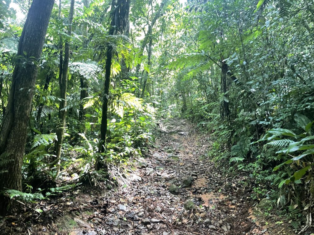
We took our time on the viewpoint, grabbing the usual menagerie of photos and then headed back when the sun became too much. Returning down the road was easy and we were back at the concrete lookout before long. We dove back into the forest and followed the foot path with relative ease back towards the trail head. At one point, we went too far north and had to back track again. The lower sections required more attention, but we had the existing GPS track now to aid on the return. I was relieved when we reached the trail head again as we were now out of the “spider zone” and could walk with a relaxed stance again.
I imagine at one point this trail was much more straightforward to ascend, but it proved to be pretty full on for a first “jungle experience”. If you are looking for an easy way to the summit, the road network on the upper sections will be the easiest and safest. If you’re looking for the more adventerous route, I would strongly recommend a GPS device or experience navigating in this type of terrain. For us, we would have been pretty screwed with out the GPS.