Elevation Gain: 1,611m
Distance: 8.39km
Total Time: 5 hours 16 minutes
Date: May 31st, 2024
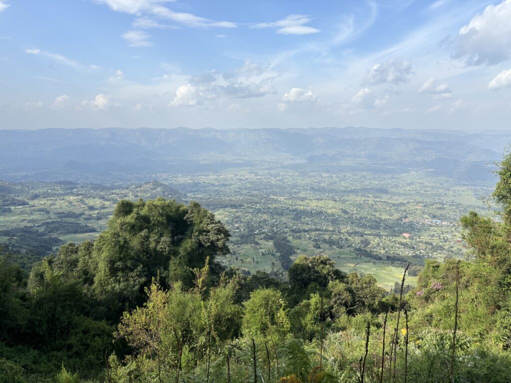
Rwanda is by no doubt an amazingly beautiful country filled with verdant green farm fields, winding mountainous roads and a bustling population recovering from the deep wounds of not to distant genocide. Most people visit for the cultural experience or to see the wildlife; especially the mountain gorillas located around the Volcano National Park. That’s how Andrea and I found ourselves there in May of 2024. Her parents had invited us along for a trip through Kenya and Rwanda to view the wildlife. It just so happened that we had one free day in our itinerary around Volcano National Park and we were super excited to take advantage with a hike. There’s one big down side though. Rwanada isn’t Canada. You can’t just hike at your discretion through the wilderness or even on established trails. Especially within the park. There are dangerous animals and contentious border relations that make having a guide a legal requirement to hike any of the peaks. Andrea and I weren’t phased though and we started planning out which guided offering would be the best. Our first hurdle was arranging for a 4×4 to get us to any of the trail heads as Andrea’s family would take the shared 4×4 to their own hike. Thankfully our guide for Rwanda was able to arrange one for us and now we just had to pick which summit.
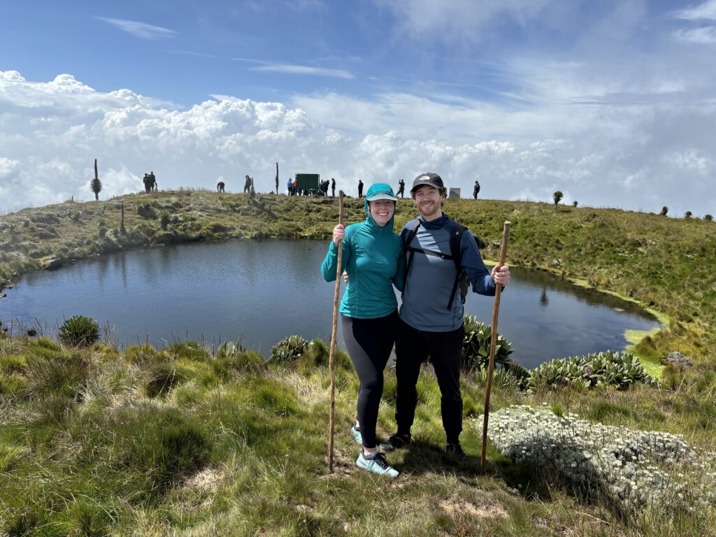
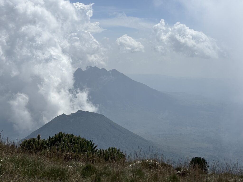
The most interesting one looked to be Mount Sabinyo; a jagged multi-spire volcano at the center of the park. Unfortunately, there’s no trails from the Rwandan side that go to the top, so that’s a no go. The peak most pushed on us by park guides was Mount Bisoke. It’s host to a beautiful summit lake that’s filled the caldera and is by far the most popular in the park. After some more in-depth research we discovered that the guides do not allow anyone to go to the true summit as it borders with the DRC and there is some agreement between the countries to give a buffer here. The only successful accounts I found were where the guides had been ignored or a member snuck off and all required some form of confrontation. This really didn’t appeal to either of us so that more or less left two options: Mount Mgahinga or Mount Muhabura. There’s a third summit: Karisimbi, but it requires a two day approach so there’s no way to make it work.
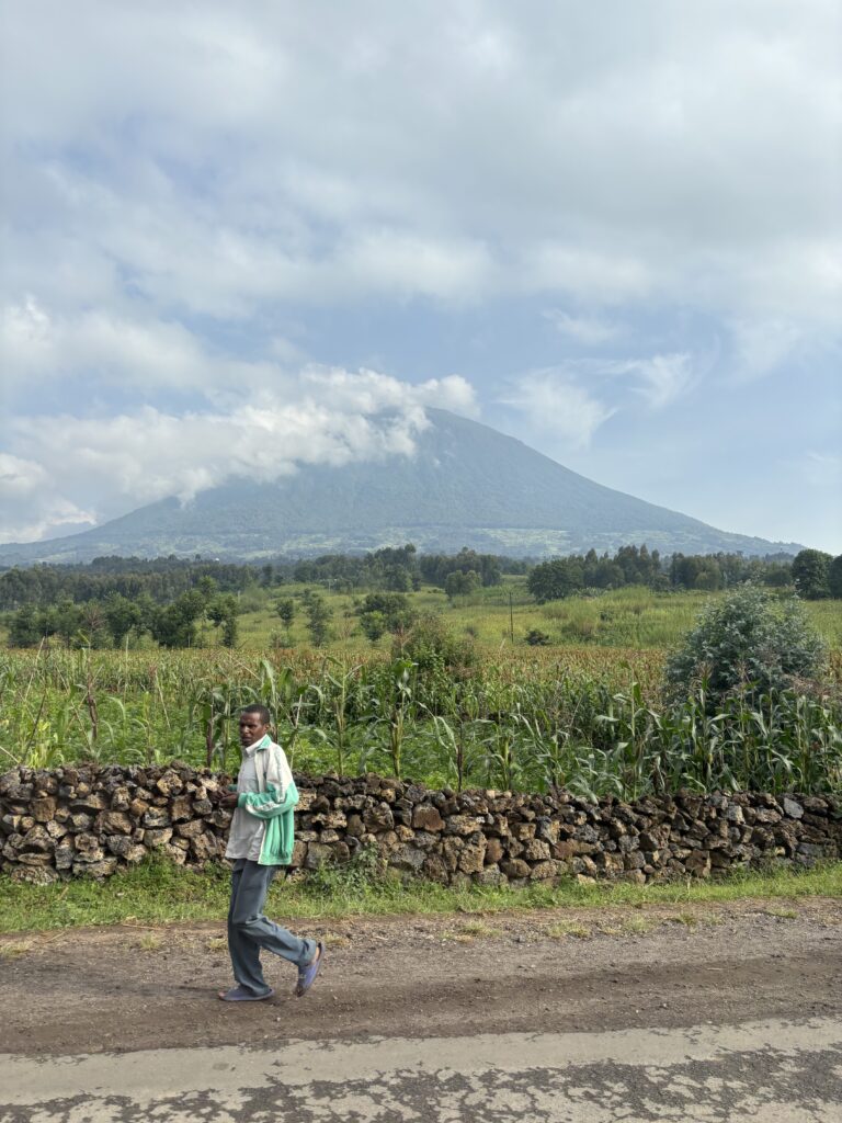
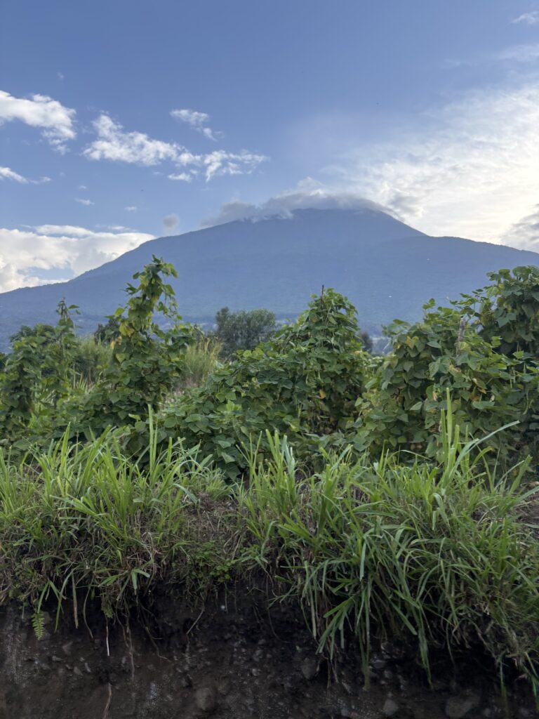
After much deliberation we decided on Muhabura. There was some apprehension as there’s a narrow window to actually hike to the summit. The guided activities all start around 7:30am, but you won’t reach the trail head until 9am and there’s a 1pm turn around time. Given the summit is over 4000m and 1600m of elevation to be gained on trail, it’s no small task. I had concerns there wouldn’t be enough time and I surmise that most groups do not make it even close in this time frame. Andrea was feeling confident and I knew from my own altitude experience it could be done, so Muhabura it was! Coincidentally, my friend Steven had just climbed this peak a few months prior so we more or less knew what to expect.
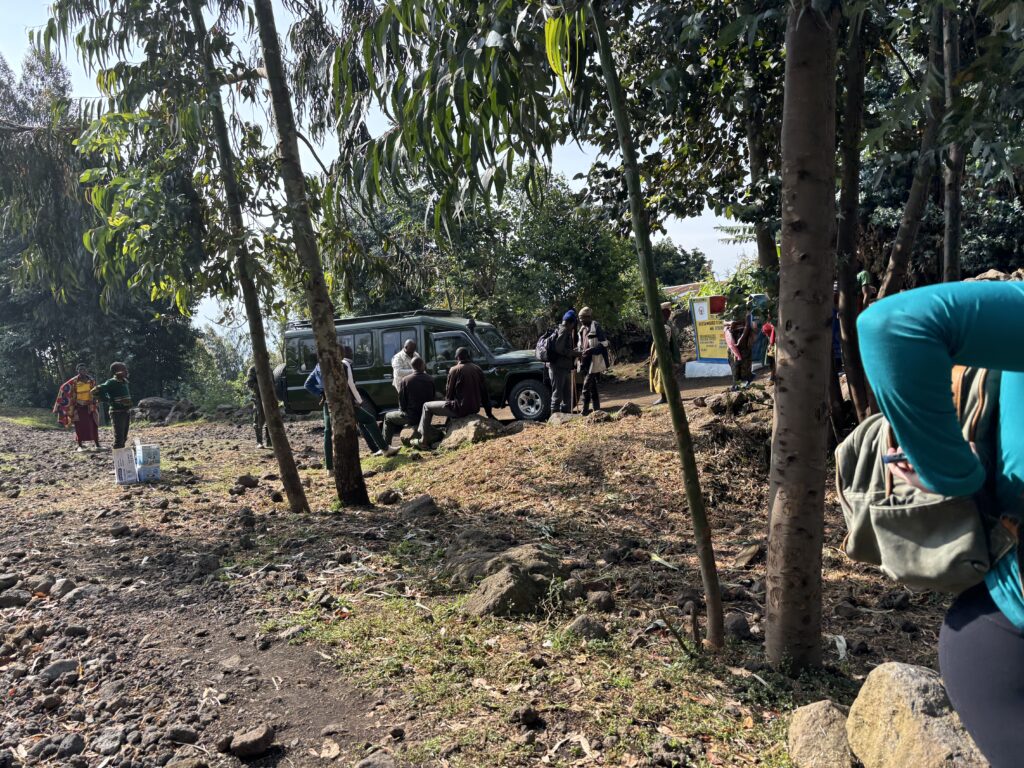
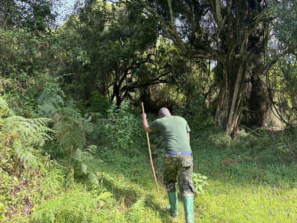
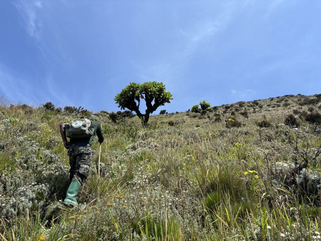
The cost of the trip was around $80USD each as I recall and it came with a guide and 6 or 7 military soldiers that would be required to guide us to the top. A pretty small fare for an overkill entourage. On the day off, we showed up to the park entrance and did the usual toil work before getting in our vehicle and driving ~1.5 hours along nice roads until the last few kilometers. We stopped at the outskirts of a small town where our guide gathered one porter and then started up a trail through the farm fields on the lower flanks of Muhabura.
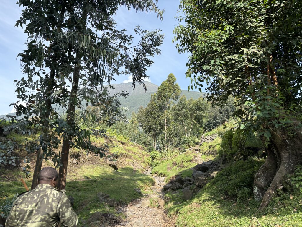
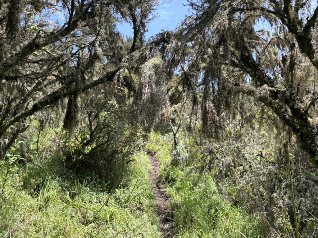
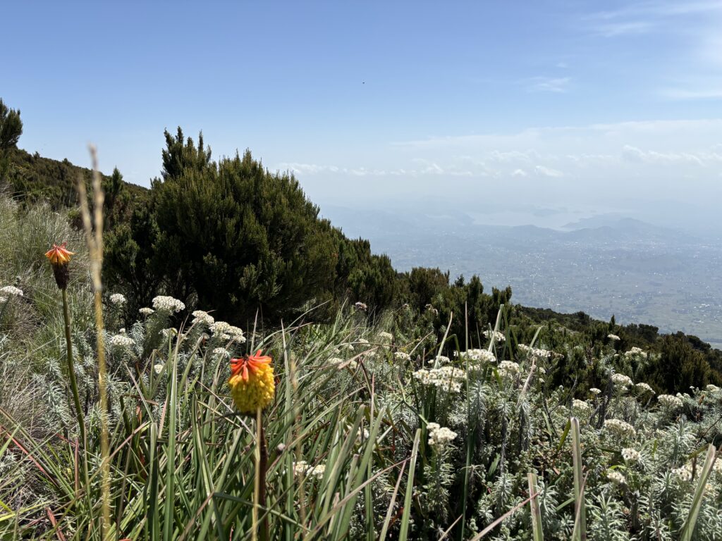
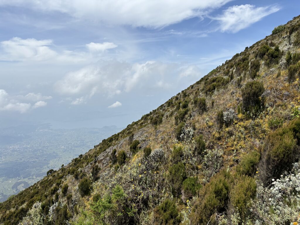
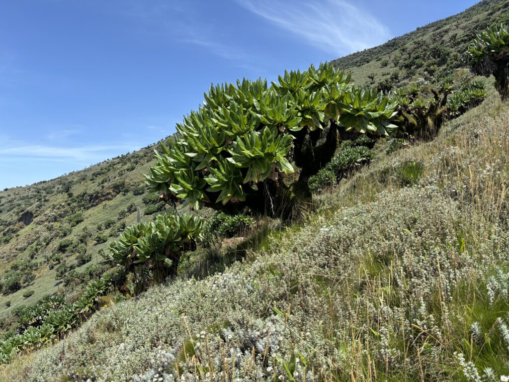
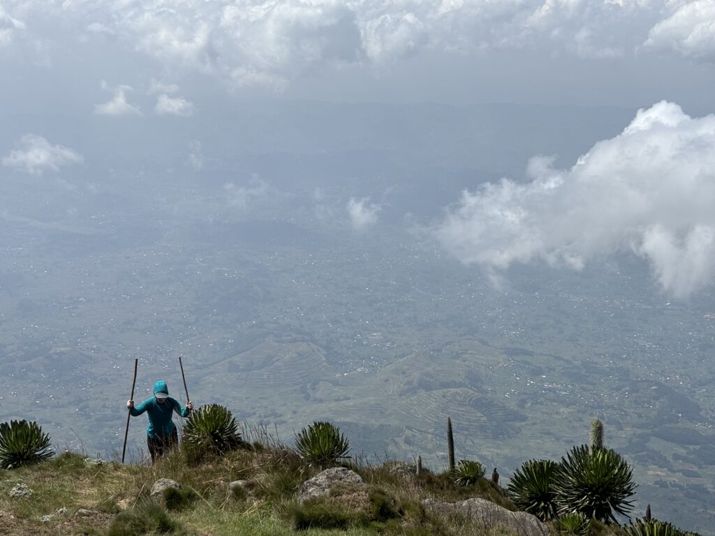
This trail took us to the edge of the park where the military escort was awaiting us and then we started our hike up through the steep jungle. There’s not much to say here as it’s an established trail, albeit steep and we simply followed the guide. At about 3200m things got more interesting as we could now see the long ridge line up to the summit. The elevation effects also start kicking up a notch around here, but we were mostly on track and continued behind the guide.
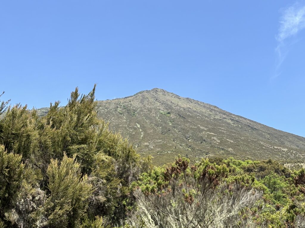
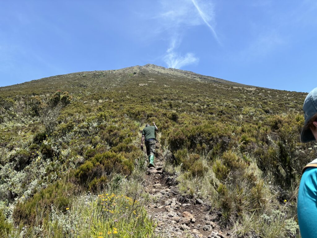
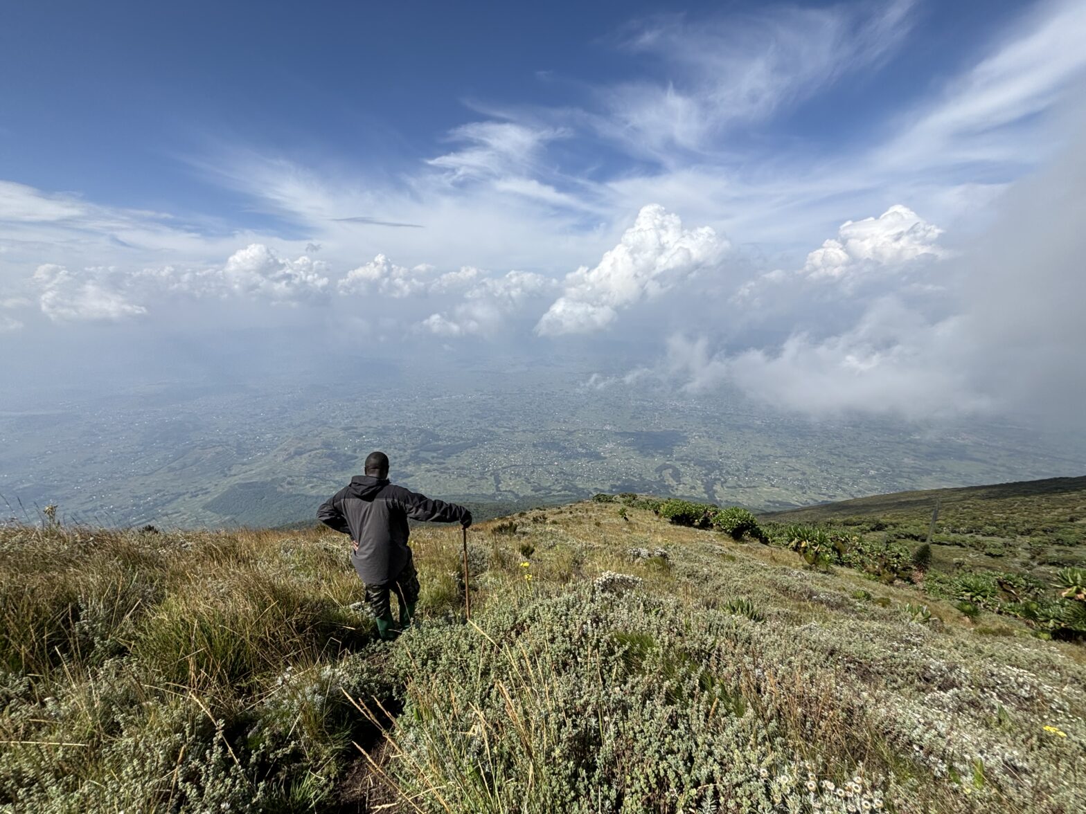
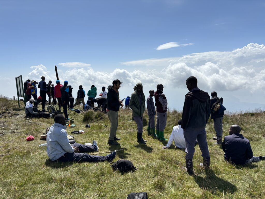
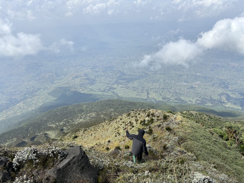
About 1 or 200m below the west shoulder our guide started to get more concerned about the turn around time. Andrea had been feeling the altitude by now, but kept trucking along. Just above the shoulder the guide finally suggested that we split off to help speed things up. That, to my surprise, lit a fire under Andrea and she left her bag with the porter, armed herself with two hiking poles and went full steam ahead in an effort to avoid a forced turn around. The extra gusto paid off and we were soon on the last section of the ridge to the summit. Above we could see a large group who had approached from the Uganadan side.
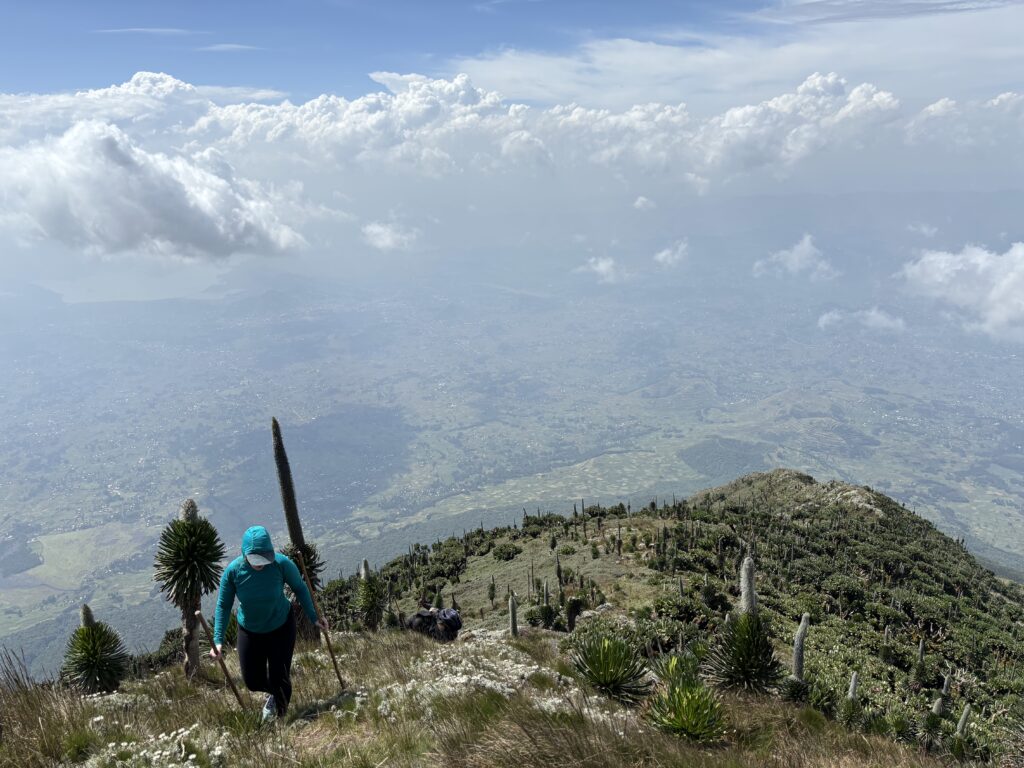
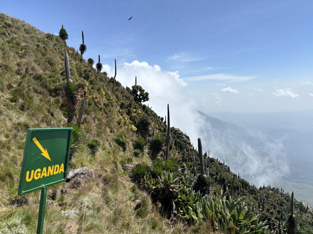
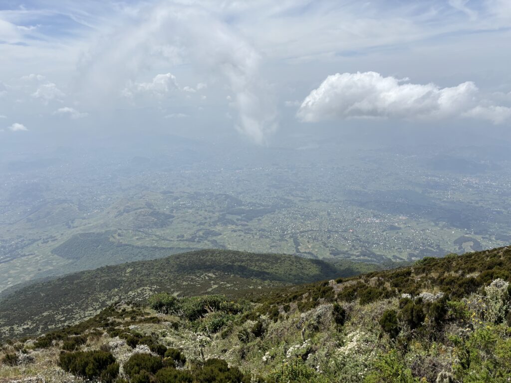
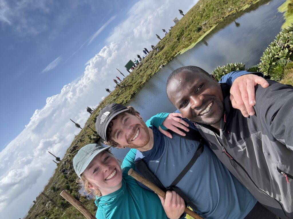
As we crested the summit there was a big relief in both of us that we had made it without being turned back. Our guide John had graciously allowed us to go 30 minutes past the deadline and now even set some time aside on the summit for us to relax. He shared some exceptionally tasty home made tea with us and we hung out for another 20 minutes before finally having to return. We departed after some customary summit sign photos and followed the same path all the way back. By some luck we avoided any afternoon showers and had a very easy descent down the steep trail and into the forest. Our driver was waiting for us at the trail head and whisked us off the park entrance and then home shortly after.
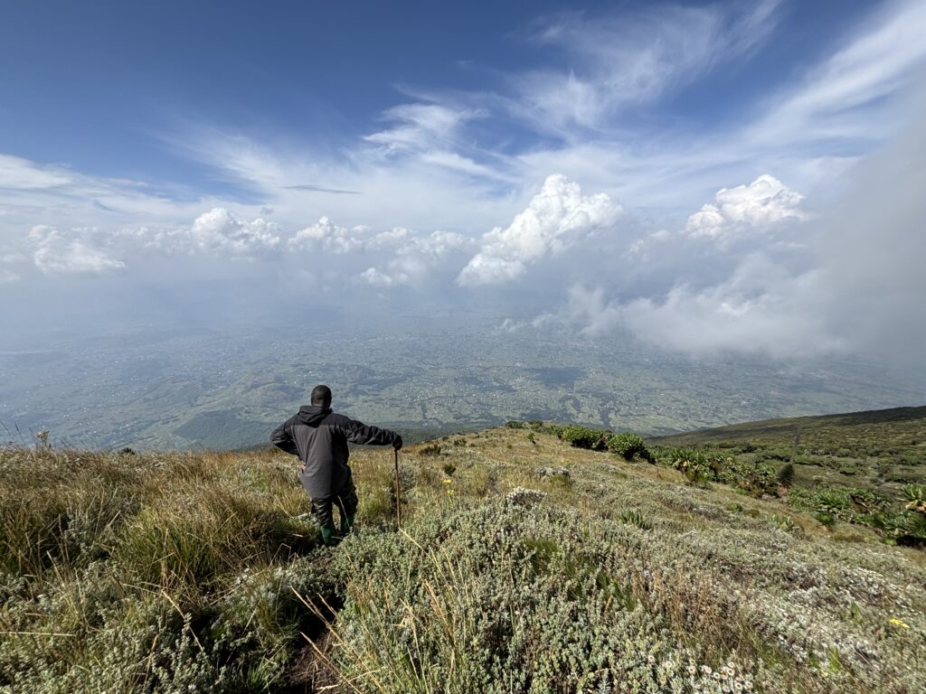

I found the summit to be quite beautiful and as far as hiking is concerned very straightforward. However, the red tape is not worth it at all for the summits in a country like Rwanda. I’d really only go for other reasons and include these peaks as a side excursion if you can make the time for it. I’m not a fan of using guides, but there’s no other option out there and it makes me realize how I take our BC wilderness for granted at times.