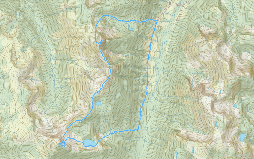
Elevation Gain: 1,185m
Distance: 11.27km
Total Time: 7 hours 39 minutes
Date: July 20th, 2024
Nlaka Peak is a relatively obscure summit tucked away near the Kookipi Creek headwaters. It’s host to an amazing alpine lake at its base and surrounded by long running granitic ridge line that leads to a summit on either side. I came across this peak while perusing Bivouac and it had all the hallmarks of a great adventure. The summit itself is not technical and thanks to new logging into the valley, the approach should be fairly reasonable as well. However, the 2021 floods destroyed much of the access from Kookipi to Nahathlatch and that meant playing a waiting game to get in there. By 2024, much of the roads had been repaired but in order to build more resilient infrastructure the north end of Kookipi has still been kept close for more extensive road works. I was getting impatient at this point and started wondering about alternative approaches. Eventually I found out that one can drive all the way up East Harrison, Shovel Creek and then reach the south end of Kookipi Creek. I discovered that 4WD groups were getting in there a few times a year but it wasn’t until late 2023 that a report showed I could get all the way to Kookipi West 400 branch needed for Nlaka.
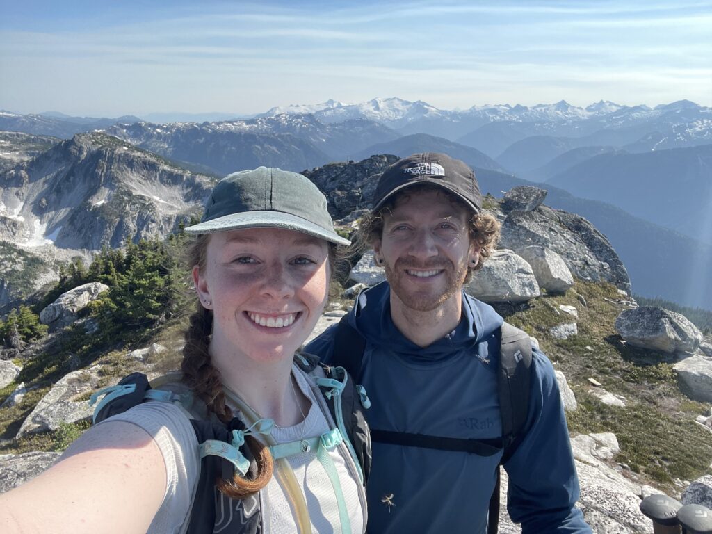
With the access question mostly solved, now came the timing! I had just done 2 weekends of back to back alpine objectives and desperately needed a rest weekend. Andrea was in the same boat and we both had a huge trip coming up, so why not go for Nlaka Peak! The last report on Kookipi showed a decent wash out, so we decided to bring bikes if we could get within 10km of the start and I also picked out a back up objective with guaranteed access along the way. Our main goal was Nlaka Peak, but we planned to connect the ridge from Nlaka N3 to Nlaka Peak to make for a nice ridge ramble.
Andrea and I set off from Vancouver on Saturday morning and cruised down East Harrison without any issues. Once we hit the Shovel Creek section, the road degraded heavily and slowed us down considerably. There weren’t any cruxy sections but lots of loose rocks, boulders, etc that necessitated slow driving. We reached Kookipi Creek at the pass and then held our breathes anticipating some show stopper road issue around the corner. Such an issue never appeared and we soon reached Kookipi West 400. The road looked very recently repaired as we passed by some heavy machinery staged near an old washout. I think it was by pure luck that we timed the repairs and we actually made it all the way to our planned starting point. No bikes required this time.


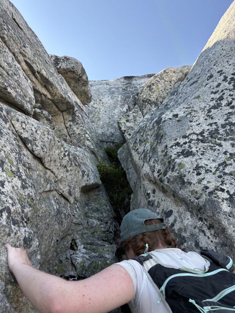
I pulled up underneath a long running cut block that would put us into a forested cirque on the north east side of Nlaka N3. From the top of the cutblock it was maybe 2-300m of elevation gain to the cirque. We hopped out and started up the cutblock. To my surprise it was quite open and easy going and after 100m of elevation gain we reached the end. The forest above was quite open until we reached the cirque after which things got quite bushy. This isn’t Chehalis levels of bushy though. Most of the vegetation were thing bushes that were easy to push aside. We continued along the cirque until we hit a long running boulder field and hopped along until just below the north ridge. Andrea then lead us up a steep heather field that took us all the way to the ridge proper.


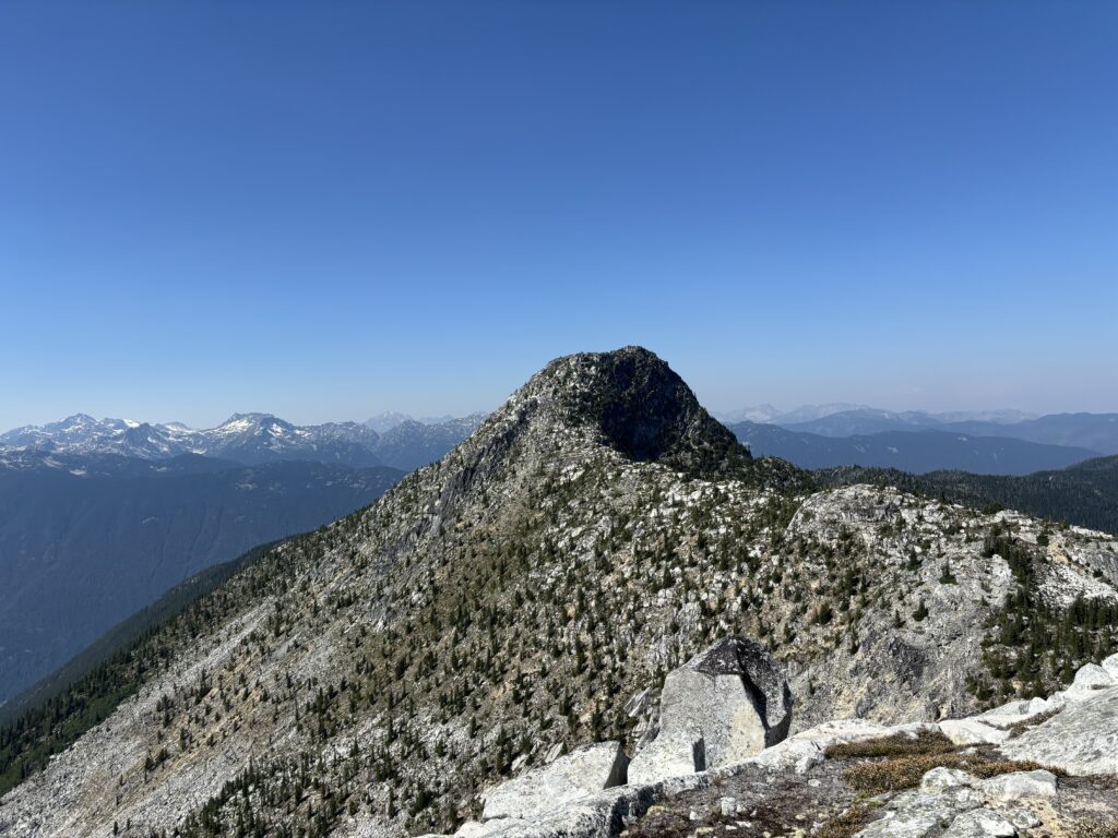
From the ridge we circled around to the west side and scrambled up a few 3rd/4th class ledges and walked the rest of the way to the summit. Sadly the summit area was littered with two old drum barrels and a DND survey post. There were still plenty of unobstructed views to be had though. We found a ledge overlooking the ridge to Nlaka Peak and sat down for some lunch.


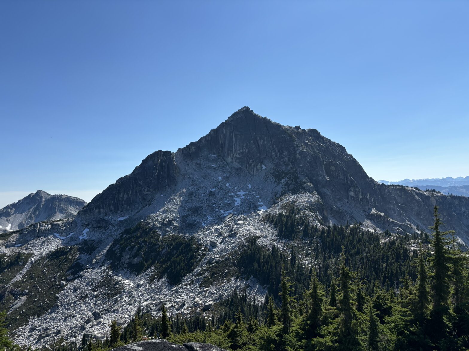
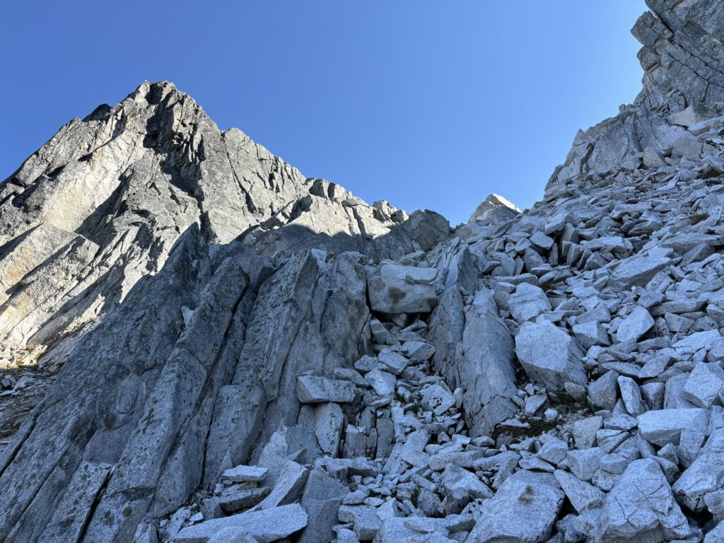
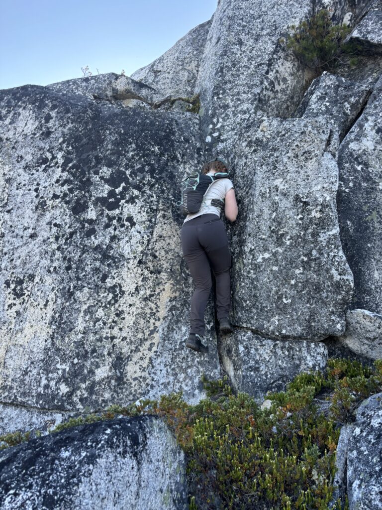
After that we headed down the ridge and followed its up and downs all the way to the base of Nlaka Peak. There was no bush to speak of just a few sections of scrambling and otherwise very pleasant ridge travel. Now on the north east side of Nlaka we could see the north side looked more like a climbing route, but the south east side offered a talus gully up to the east ridge and that looked like the best bet. We traversed across a large boulder field and then up the gully without issues. Finally, we made a few 3rd and 4th class moves up ledge systems to finally reach the summit along the south east ridge.


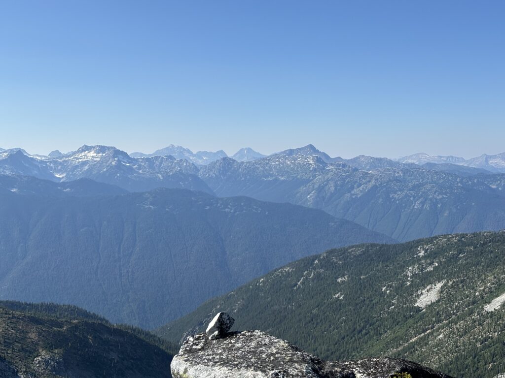

The whole area was amazing and my only regret was not having a bit more time to continue along the ridge system. One could feasibly do a horseshoe traverse all the way around to Mount Ichor over a day or two. The terrain is perfect for it. We didn’t bother staying too long on the summit as we both wanted to catch a swim in the lake below before the sun set too low. From the summit we reversed course and then scrambled down the large boulder field to the south side of the lake. The terrain around the lake appeared steep from afar but was straight forward to hike around and found a perfect shallow section of the lake to swim in.


To our surprise the water was a perfect temperature. I’m normally a coward when it comes to the cold water, so the fact that I was able to briefly swim is a testament to how nice it was. Once the sun dipped over the ridge we hopped out, dried off and headed for the outflow of the lake. From afar we had scoped a line down as most of the terrain below is cliff band. Again by some luck we located a 3rd class line along the waterfall below the lake and avoided cliffs on all sides. We headed roughly north east from the lake through dense bush (denser than the ascent) before the forest opened up again some 100m of descent later.


Now it was another short 1-200m of descent before hitting a new cutblock and then an easy road walk after that.