
Elevation Gain: ~3100m
Distance: ~48km
Total Time: 3 days
Date: June 30th to July 2nd, 2024
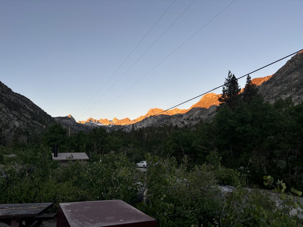
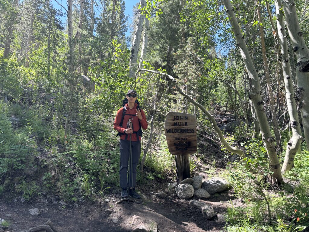
Brayden and I had been planning a 9 day excursion for the July long weekend as he happened to have the week off and my company runs a one week shut down. We had some grand ideas around Chilko Lake and some obscure summits in south west BC with the ability to pick either depending on weather. Unfortunately, 2024 was continuing its streak of unorthodox weather systems with an unusually temperamental June. I watched anxiously as the incoming low pressure systems threatened to shut us out of the mountains altogether. Finally, on Wednesday, with a clear picture for the weekend I began to hunt down better weather elsewhere. I scrolled through the weather map further and further south until the first good consistent weather appeared…. in California. Uh-oh, that’s a long ass drive and a huge area of possibilities to cover. Not knowing really any of the ranges, outside of Yosemite, I went to the usual suspects for ideas and looked at classic routes on Mountain Project and Steph Abegg’s site. One route popped out instantly. The Evolution Traverse. It appeared to be a 4 day traverse through the high sierras on immaculate granite interspersed with climbing up to the 5.8 range covering 9 different summits. That sounded perfect! Now how do I tell Brayden our new plan involves a 17 hour drive each way? Well thankfully, Brayden hates bad weather has much as I do and it took no convincing what so ever. So with that, we packed 9 days worth of supplies and left Vancouver Friday evening, California bound. We made one stop in Oregon and then continued our drive the following day all the way to Aspendell and found an open spot at the Sabrina Lake campground at midnight.
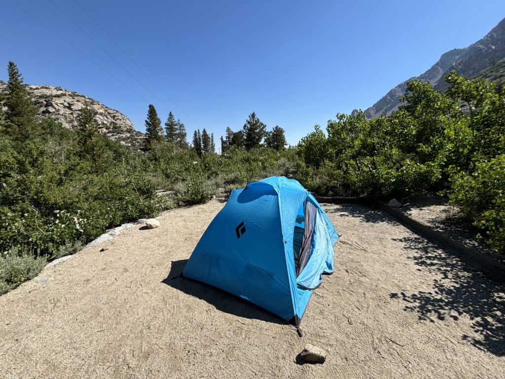
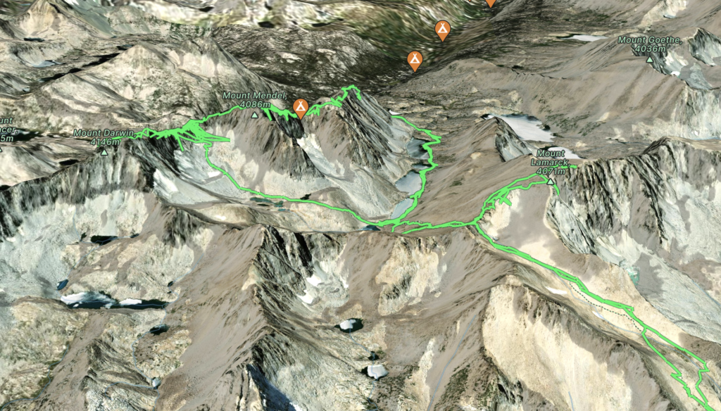
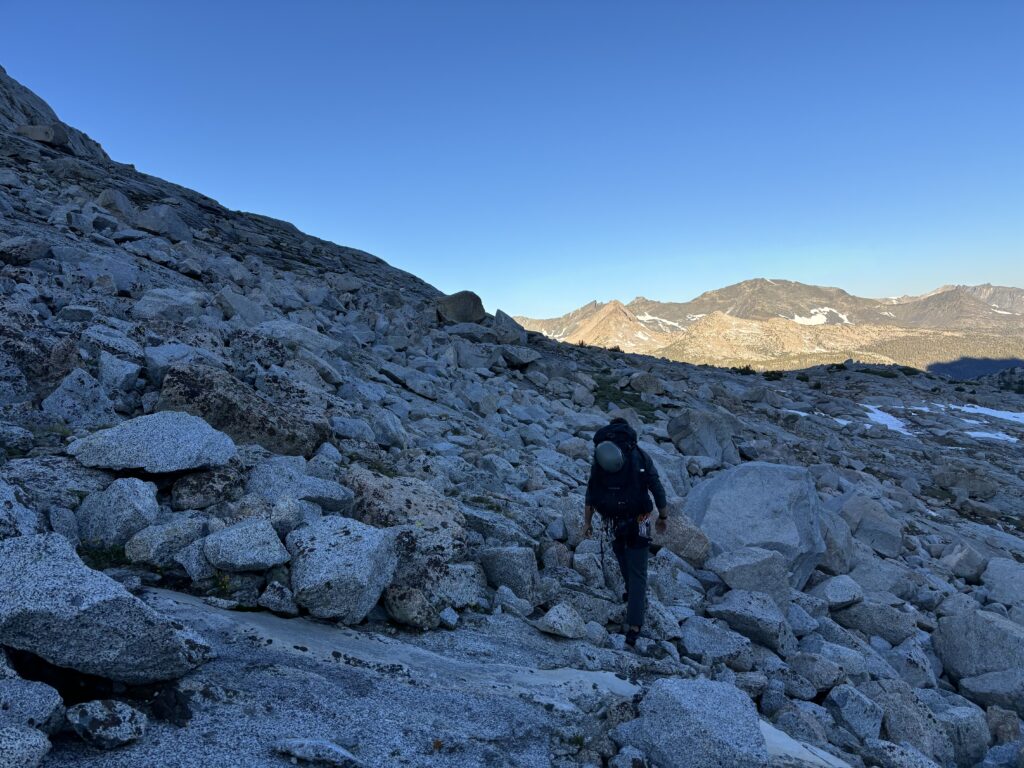
The first day of the traverse would involve around 13km and 1200m of elevation gain to reach the base of Mount Stephen Jay Gould and would mark the start of the traverse proper. I had planned for us to sleep near the trail head the first night at ~2700m to acclimatize and then the base of Mount Gould would offer another night of acclimatization at 3500m before the traverse. Most of the summits we’d be on would be at or above 4000m and so the elevation is not to be ignored. We also over-provisioned as a contingency, not being familiar with the area and that meant climbing and lugging up 30lb-35lb packs. That might not seem like a lot, but climbing low 5th at 4000m with heavy packs did not sound trivial to either of us.
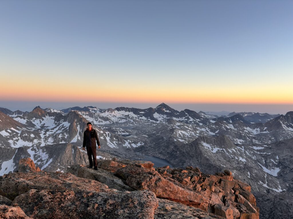
Our first leg of the journey, was not a particularly huge day so we opted for a chill morning start and I don’t think we had foot to dirt until 10:30am or so. We cruised through the dry forested slopes and past Lamarck Lakes up to the long broad slopes of Mount Lamarck itself. We had reached about 3700m at this point and started to slow down as the elevation was letting itself be known. Nonetheless we pressed on to the Lamarck col where Brayden suggested we tag on Mount Lamarck itself. It’s not part of the traverse, but you pass within a kilometer or so of the summit and so it would be silly not to go do it. There’s also the added bonus of a bit more acclimatization by going up to 4100m. We ditched our heavy packs and scrambled up to the summit only to realize there’s an even higher point a few hundred meters north. Confused, we looked at our maps and realized this must be another summit named from the bottom or something. The officially named Mount Lamarck is not in fact the true summit, but a point further north called “Mount Lamarck North” marks the true high point. With that, we made a short and easy walk over to the true summit and then headed back down to the col.
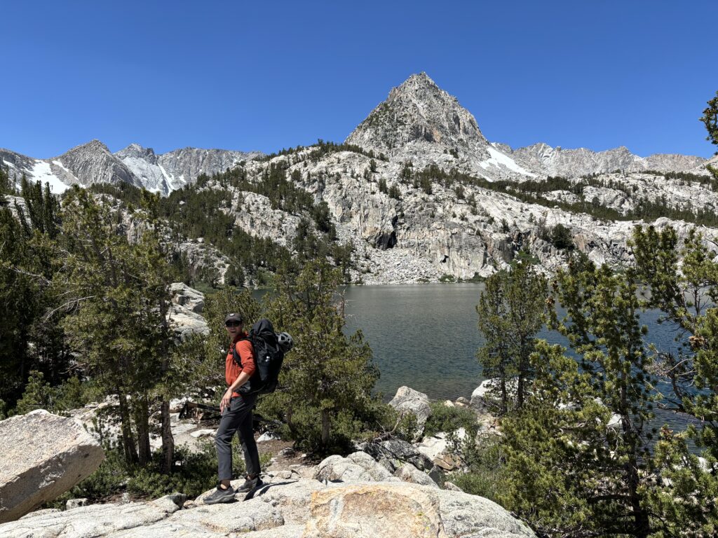
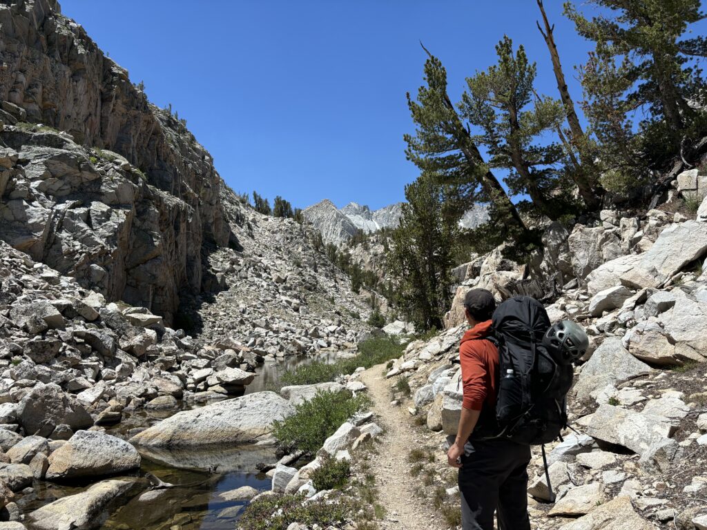
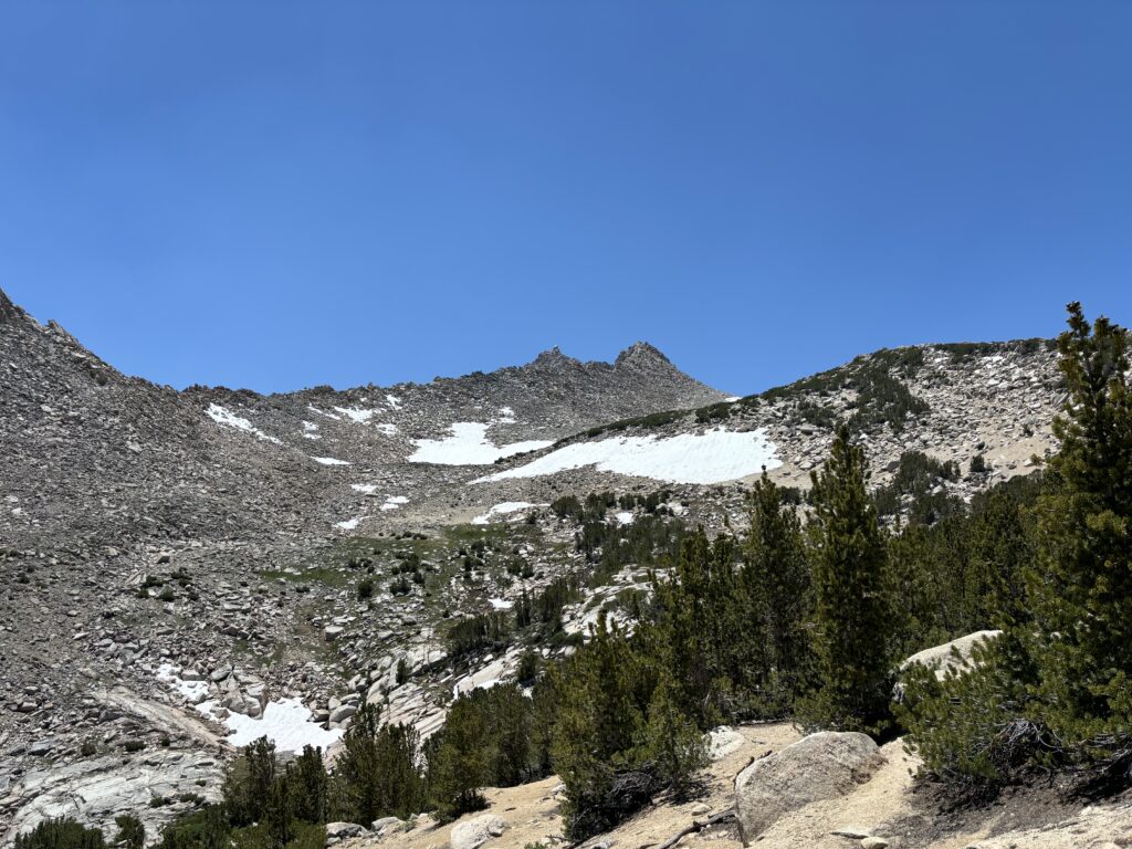
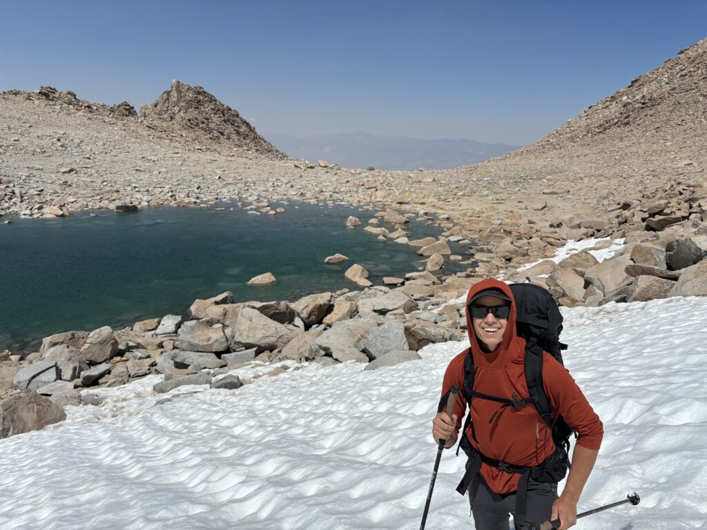
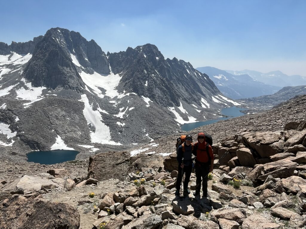
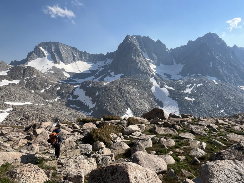
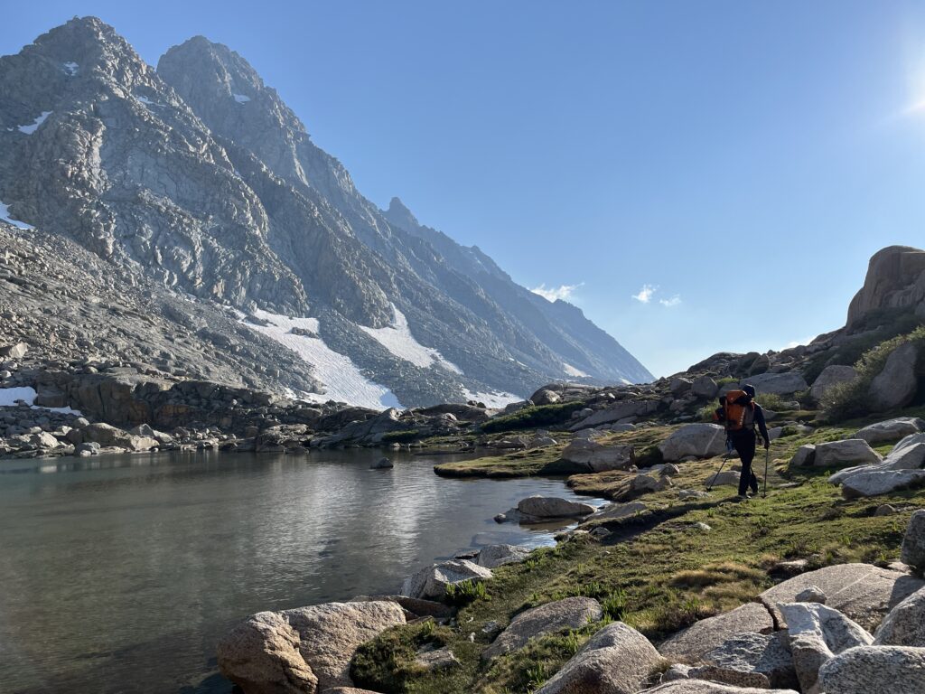
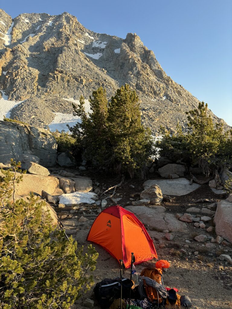
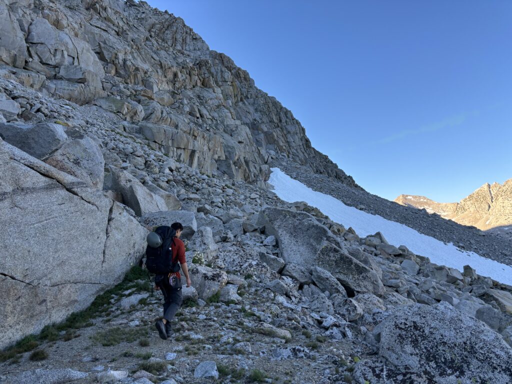
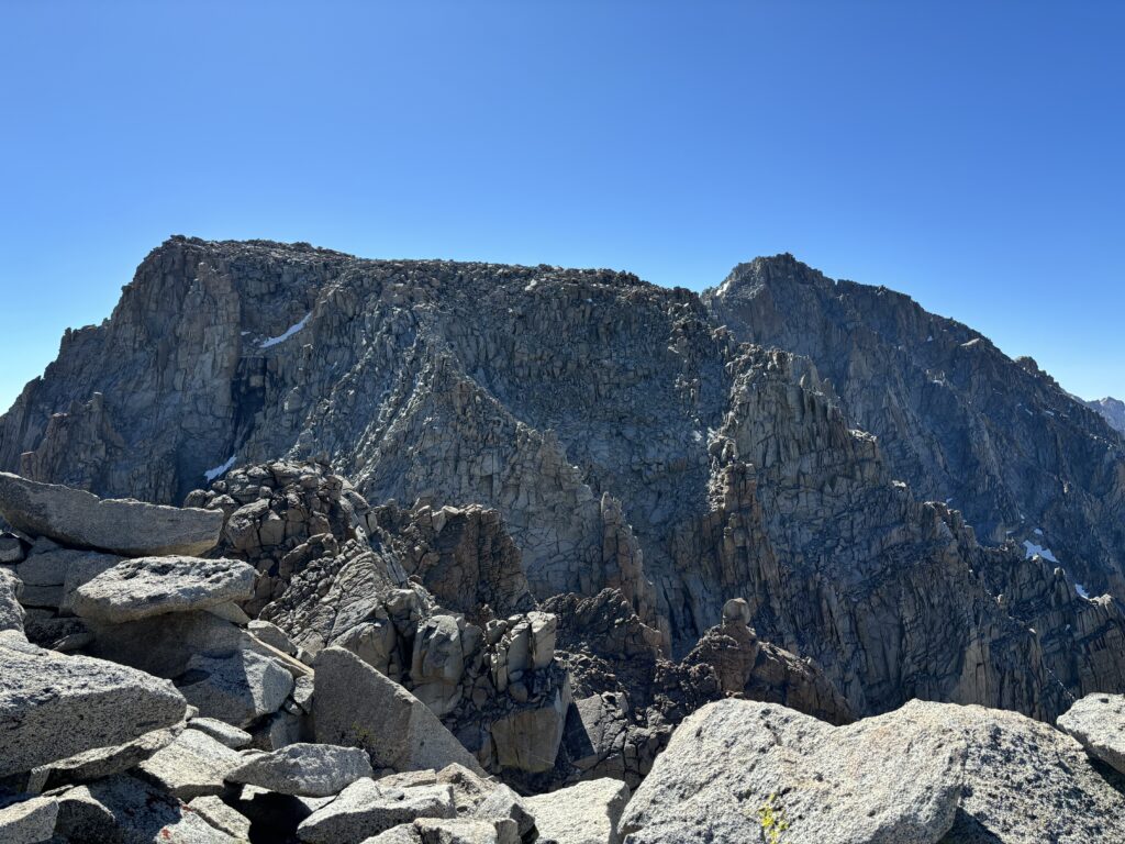
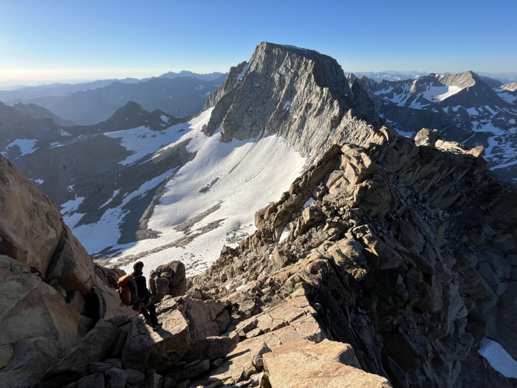
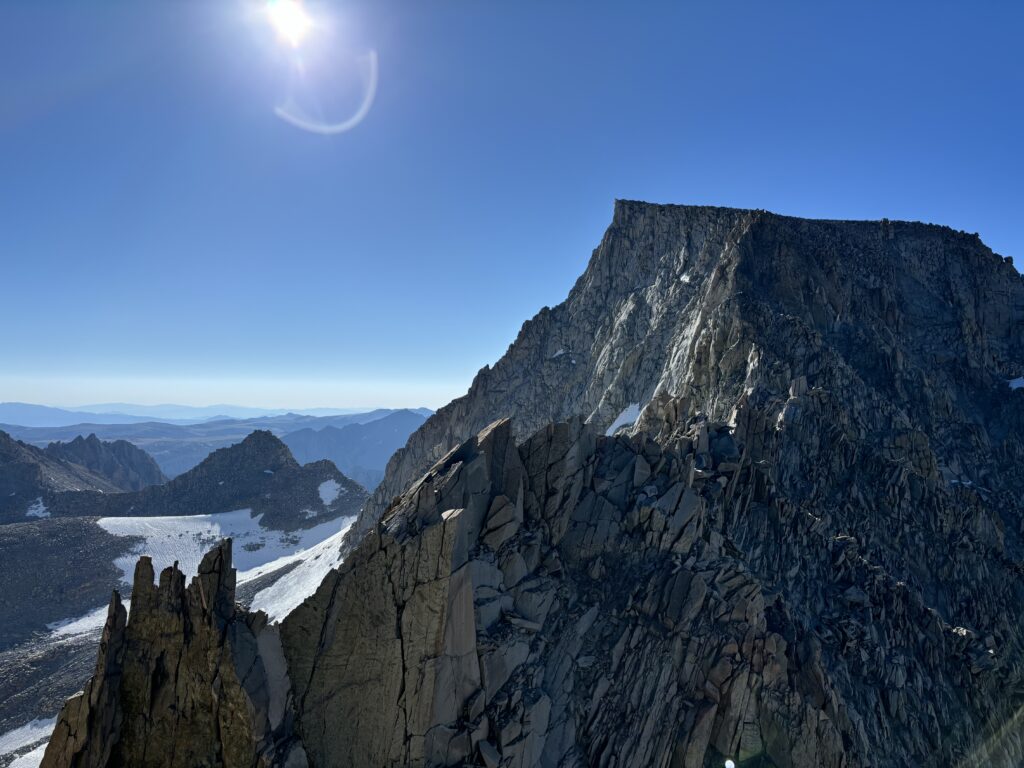
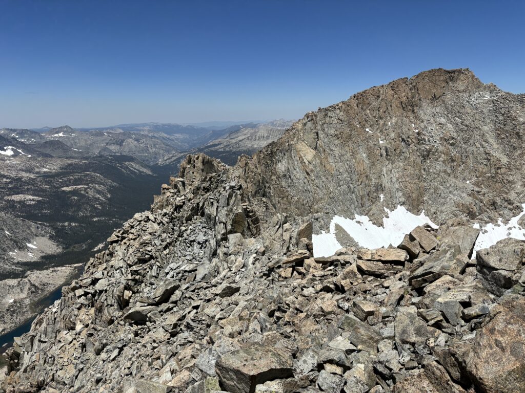
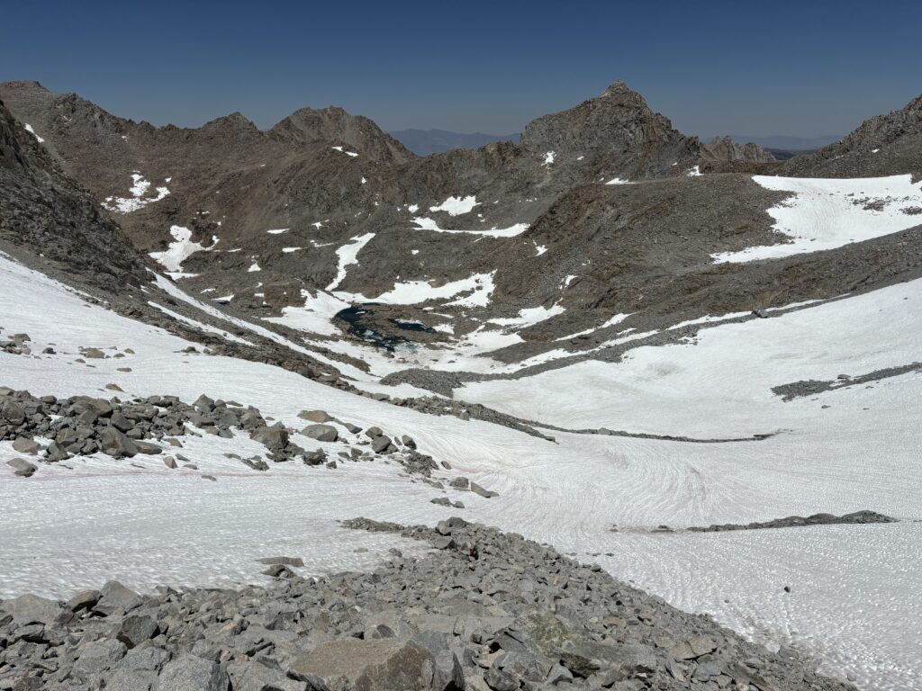
Both of us felt decently exhausted after our first summit, but there’s still a ways to go so we gathered our packs and followed the trail down from the col. Below us was about 400m of elevation loss to a series of lakes in Darwin Canyon. I knew this part was going to be a slog on the way back, but for now we had gravity on our side. We also had our first good views of the ridge traverse and it looked both massive and inspiring. As we descended the trail more or less disappeared and we ended up too far south and had to traverse back to the lakes where we could locate the trail again. From there it was a fun hike along the lakes until just before the start of the “Darwin Bench”. This was around 3500m which is roughly as low as we wanted to go for the start of Mount Gould. We opted to traverse west across glacial bed rock and found a perfect sheltered camp site just a 6-700m short of the typical traverse start. The mosquitoes were exceptionally aggressive, but we found some reprieve in the lest wind sheltered slabs nearby and got to cooking dinner. As the sunset, we headed in for bed and a massive day ahead of us.
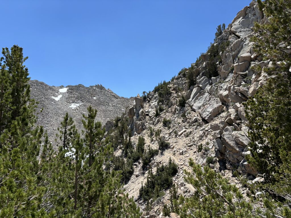
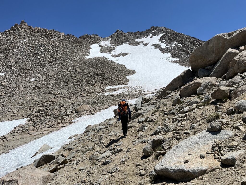
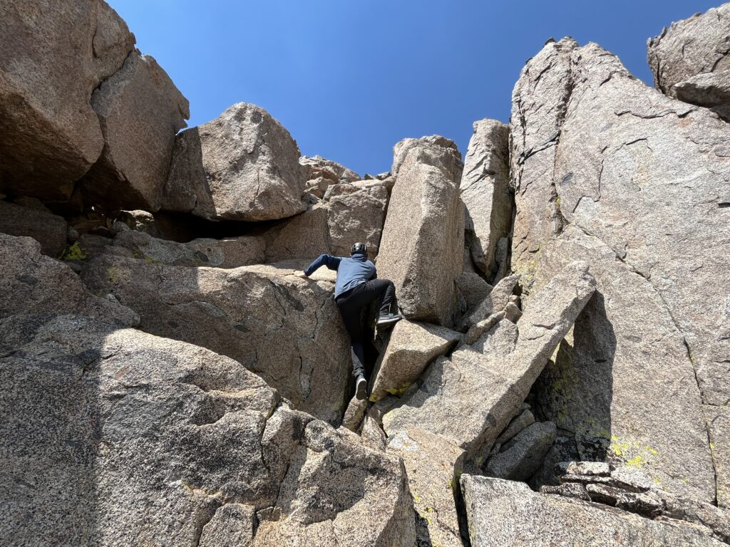
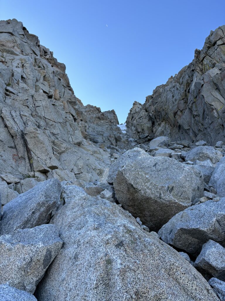
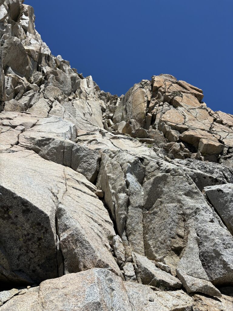
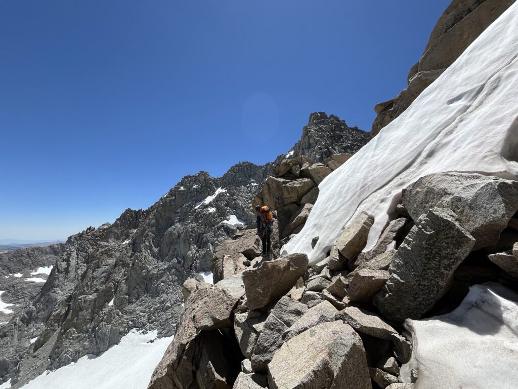
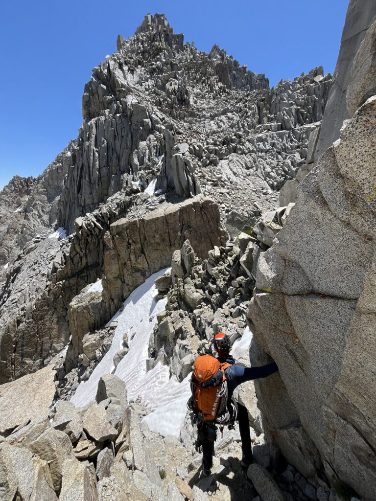
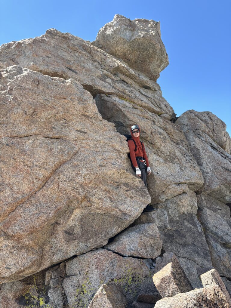
Our alarms went off around 5:30am, but it took easily an hour to pack up camp and get going. We set off towards the large gully that marks the start of the traverse and found only a small sliver of snow visible at the top. For the most part we stuck to the center of the gully and then traversed left onto 4th class slabs below the snowed in section. The elevation was undoubtedly tough and the heavy packs weren’t helping. It took us close 2 hours gain the ridge crest and then the difficulties really kicked up.
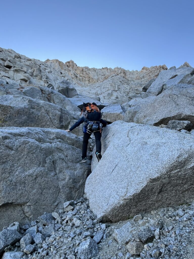
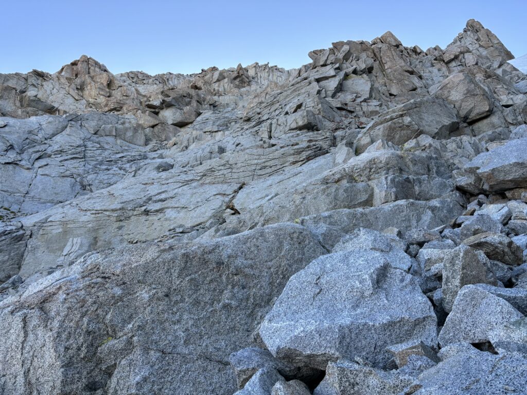

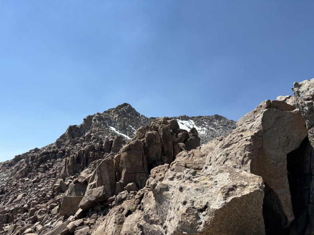
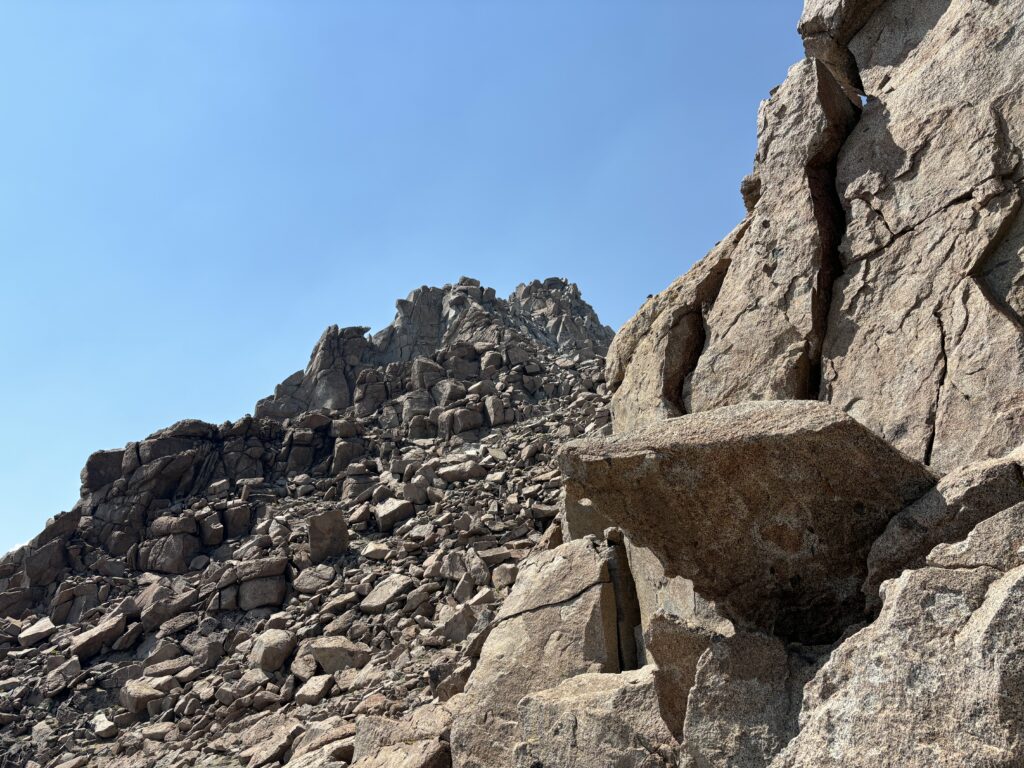
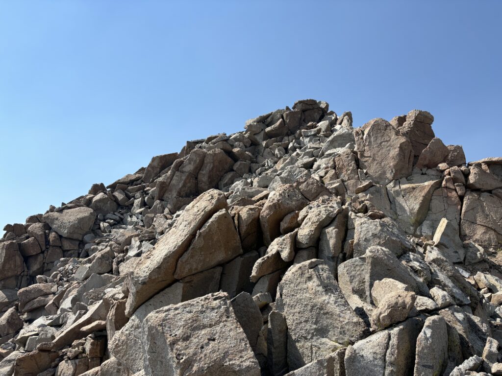
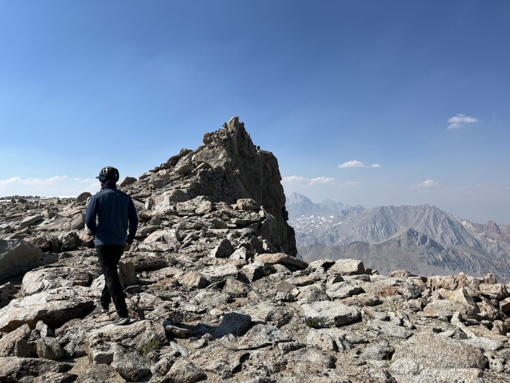
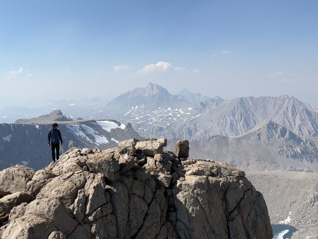
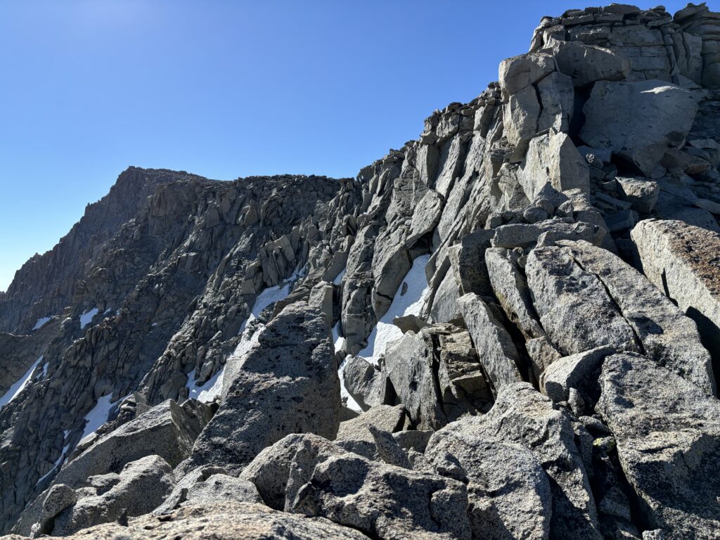
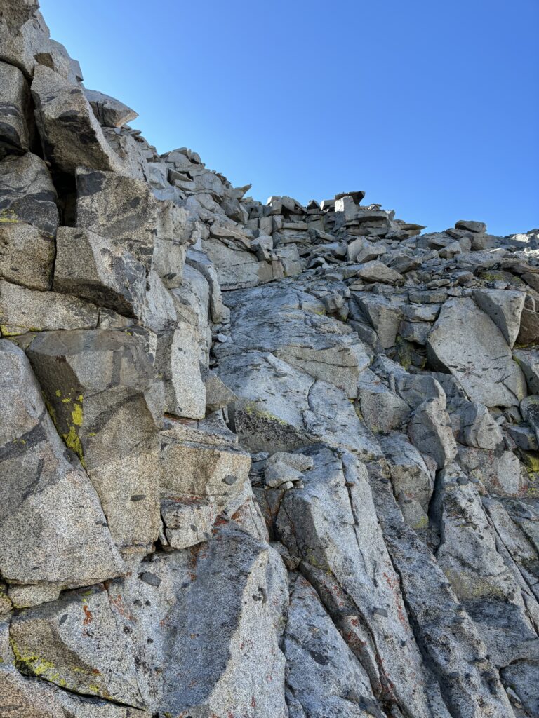
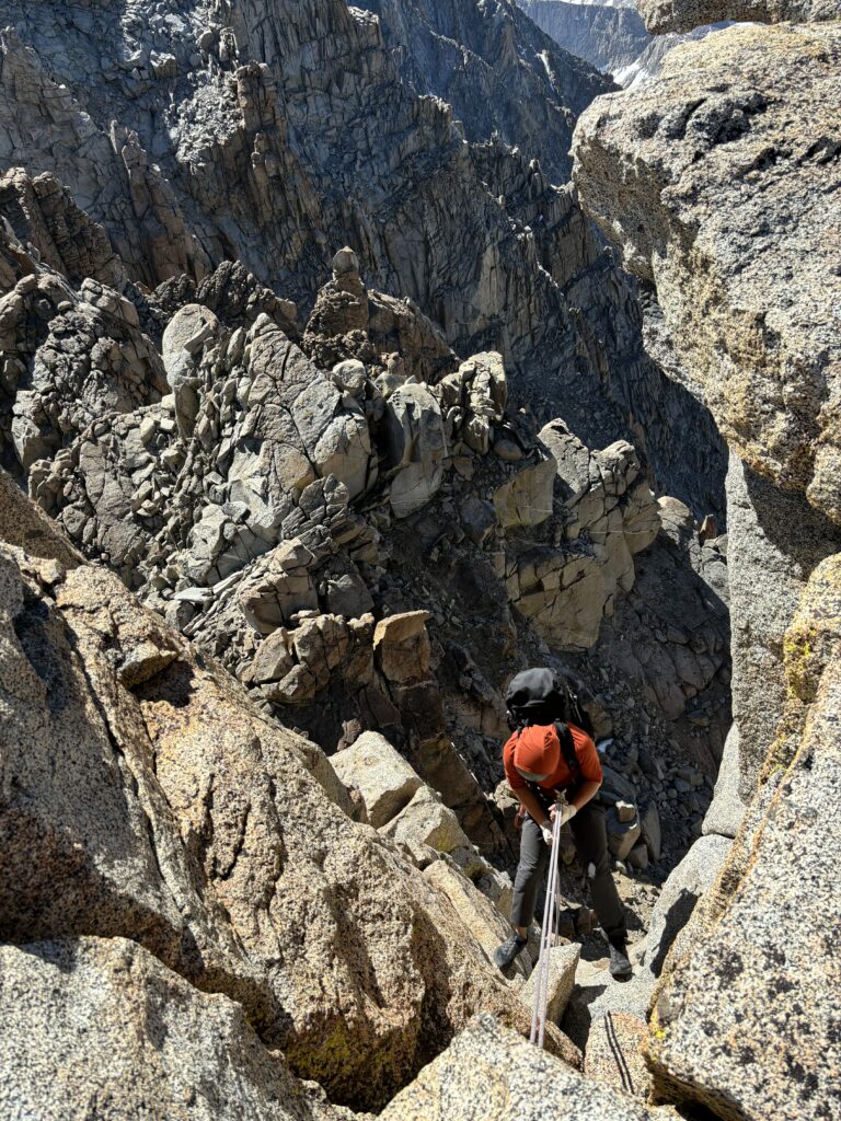
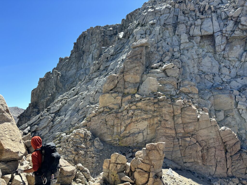
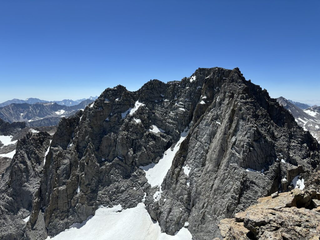
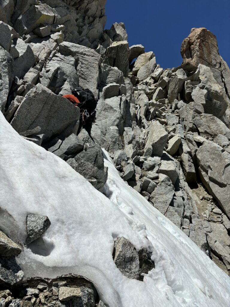
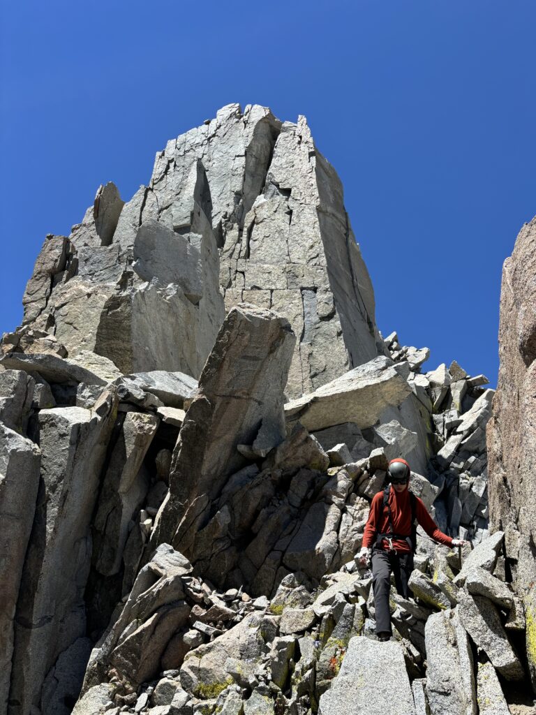
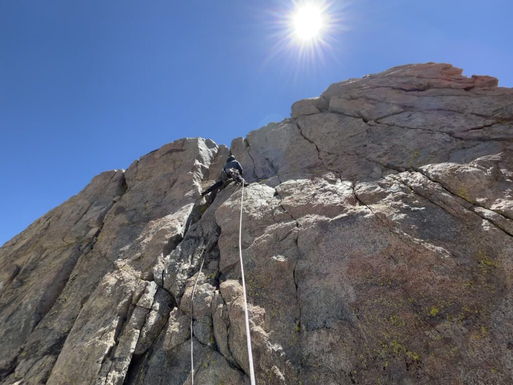
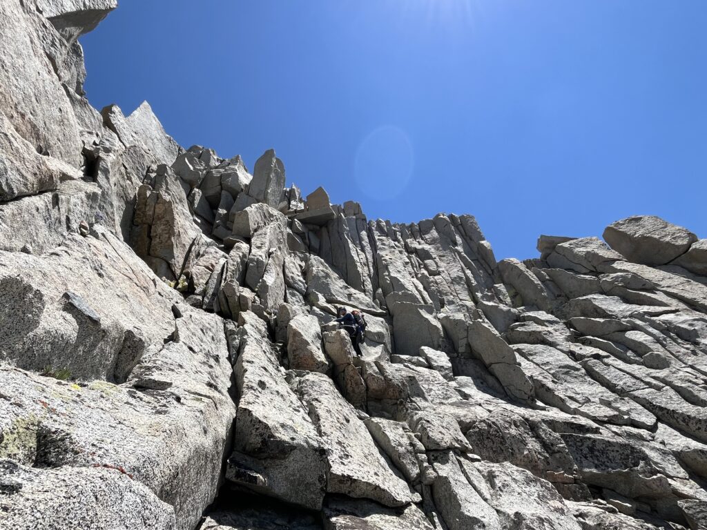
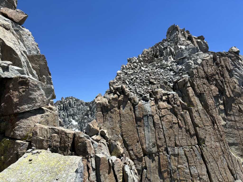
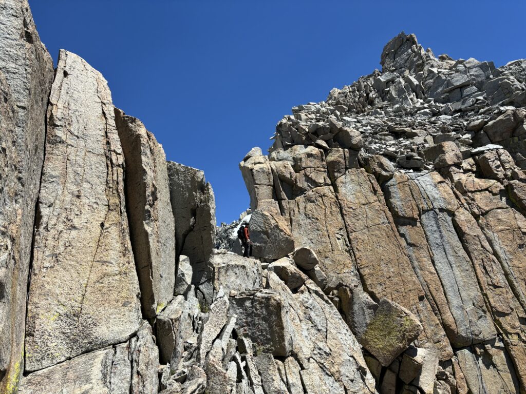
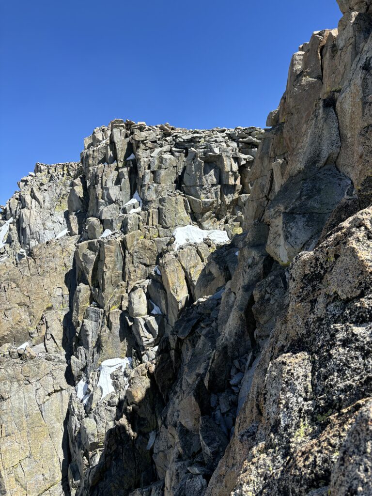
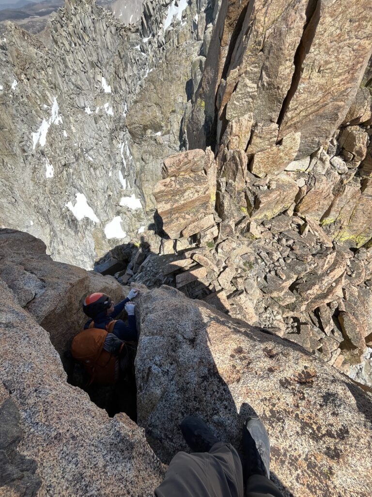
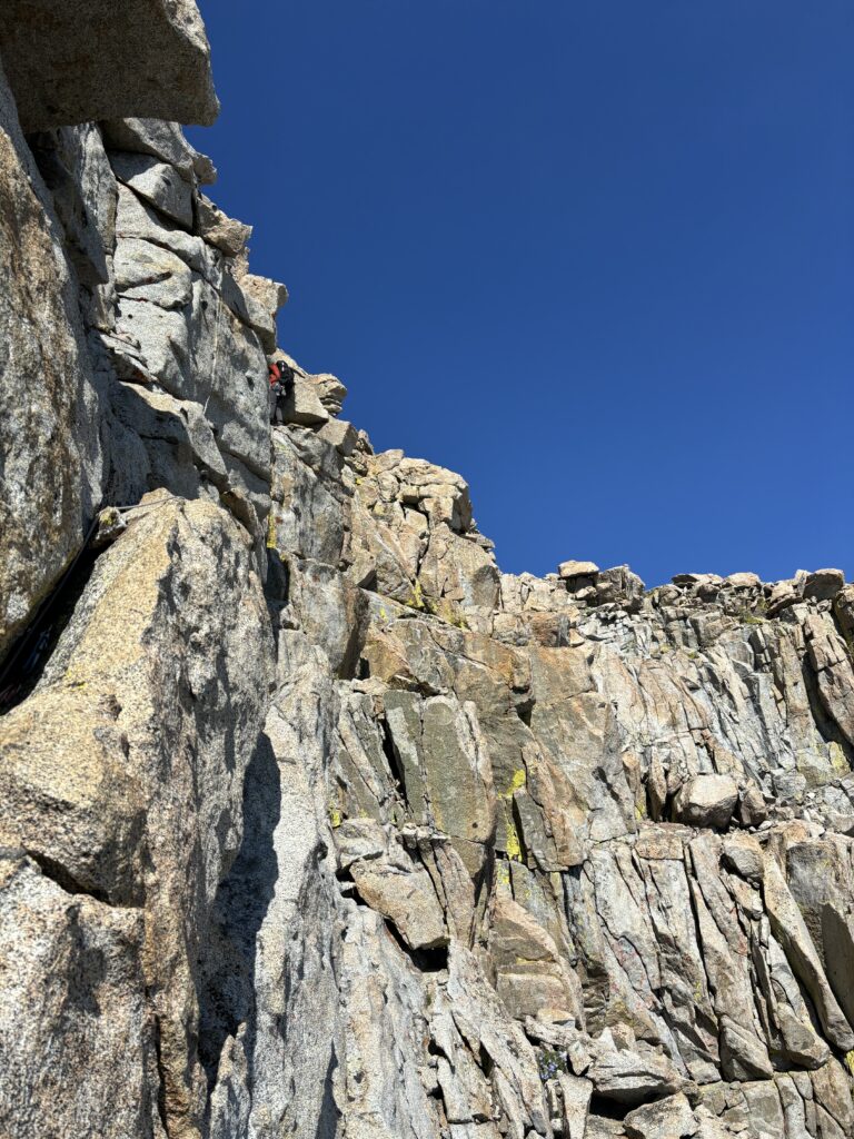
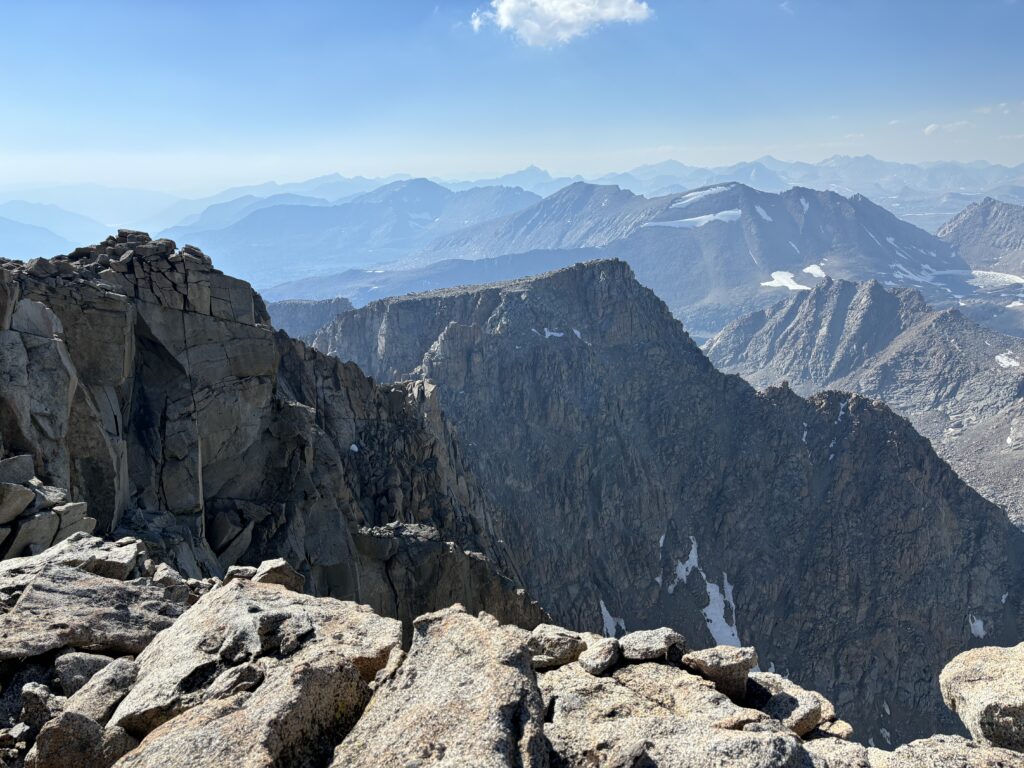
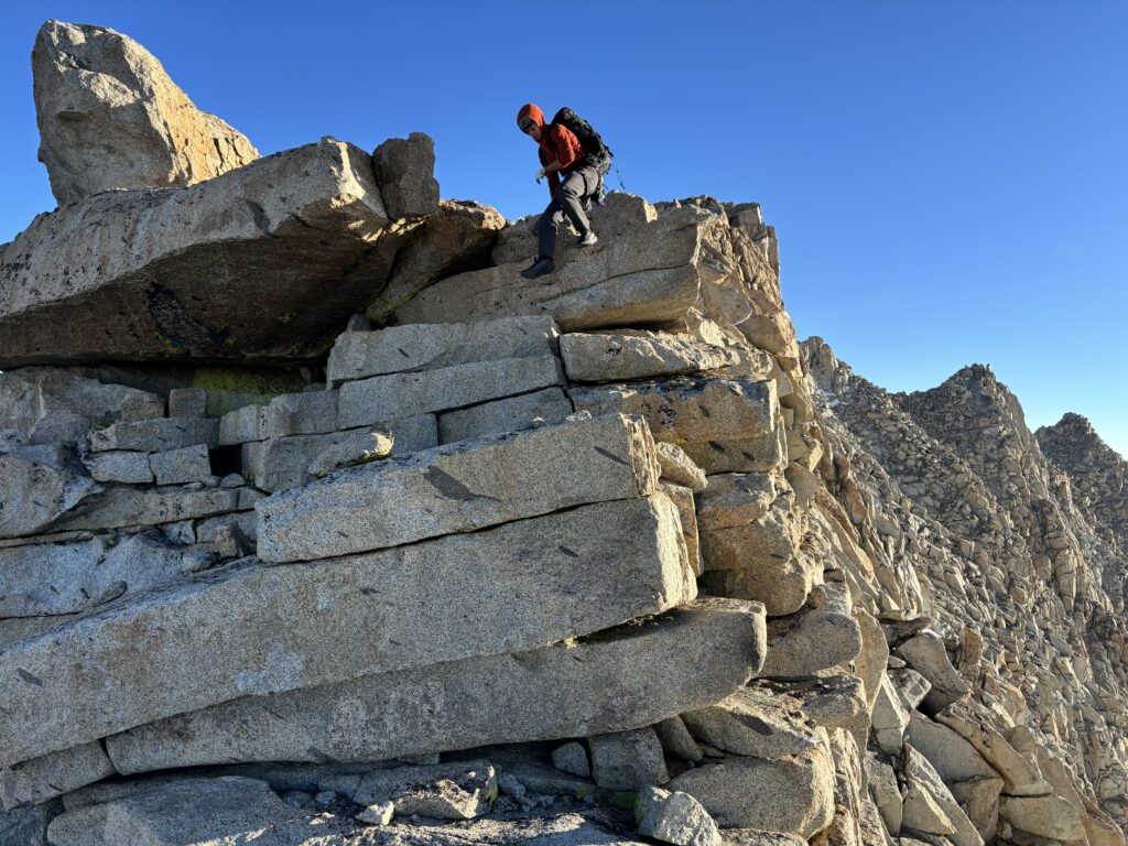
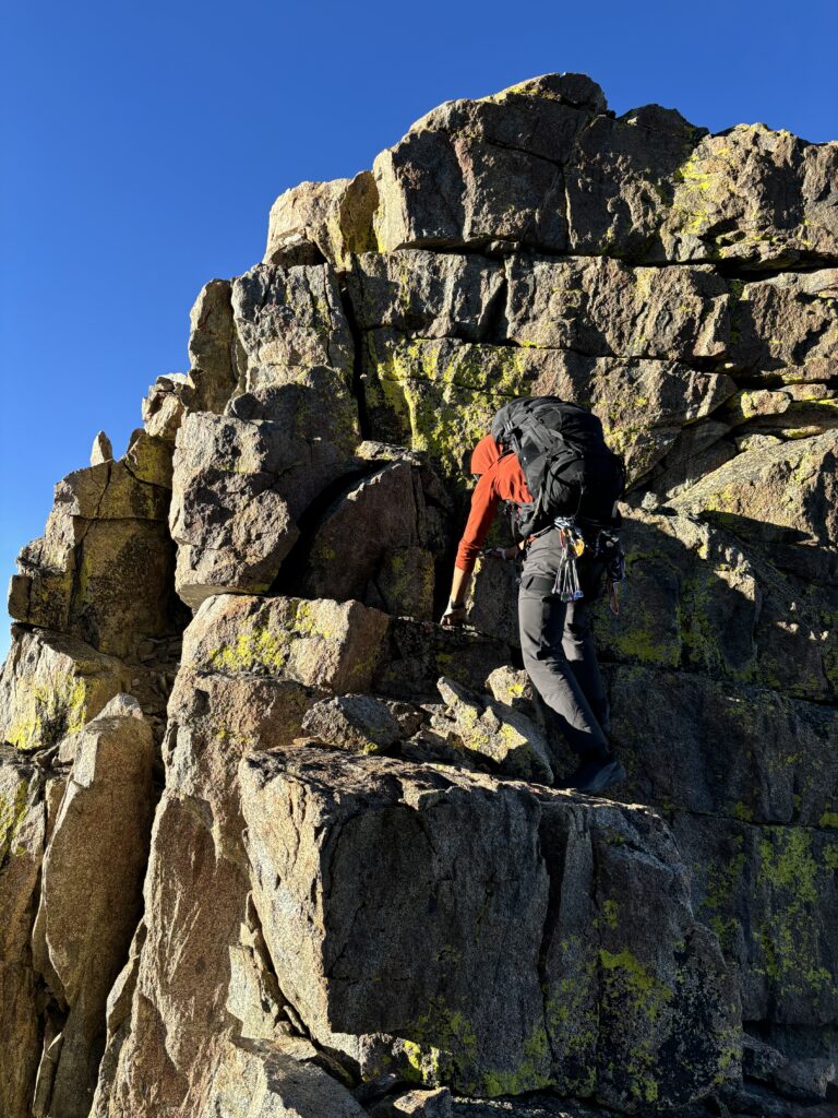
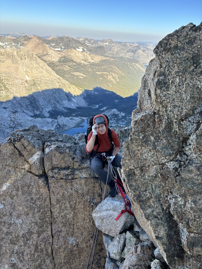
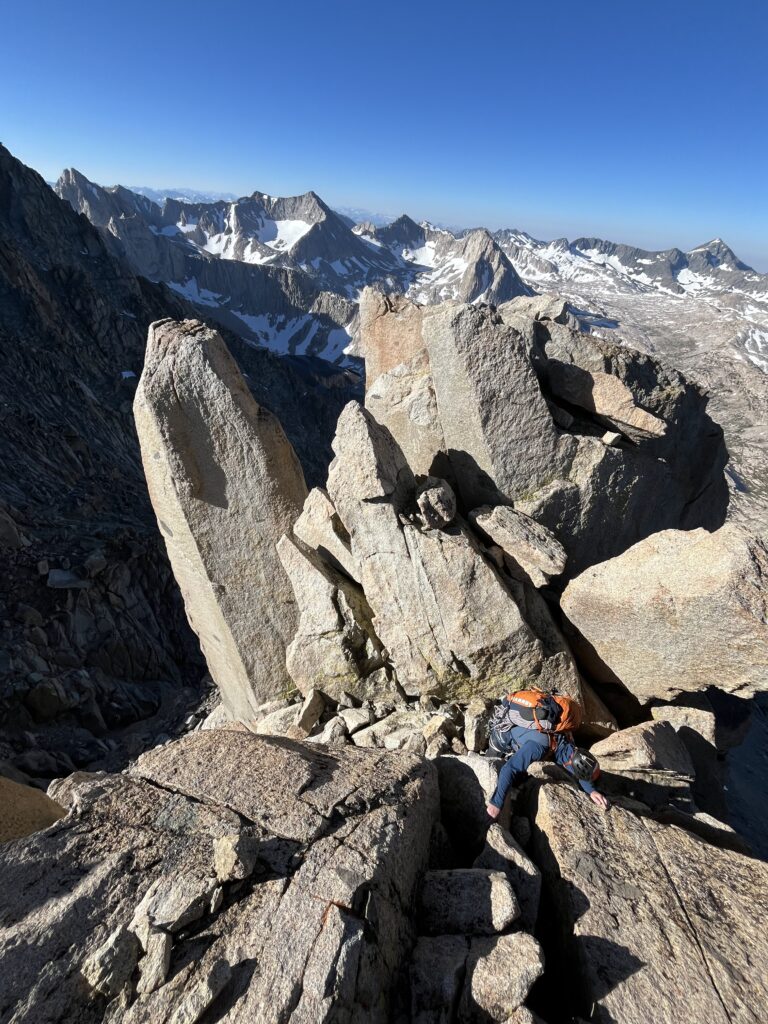
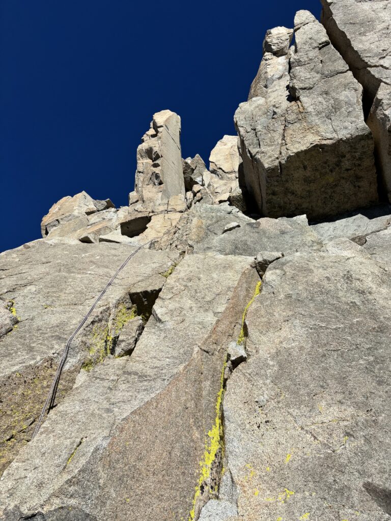
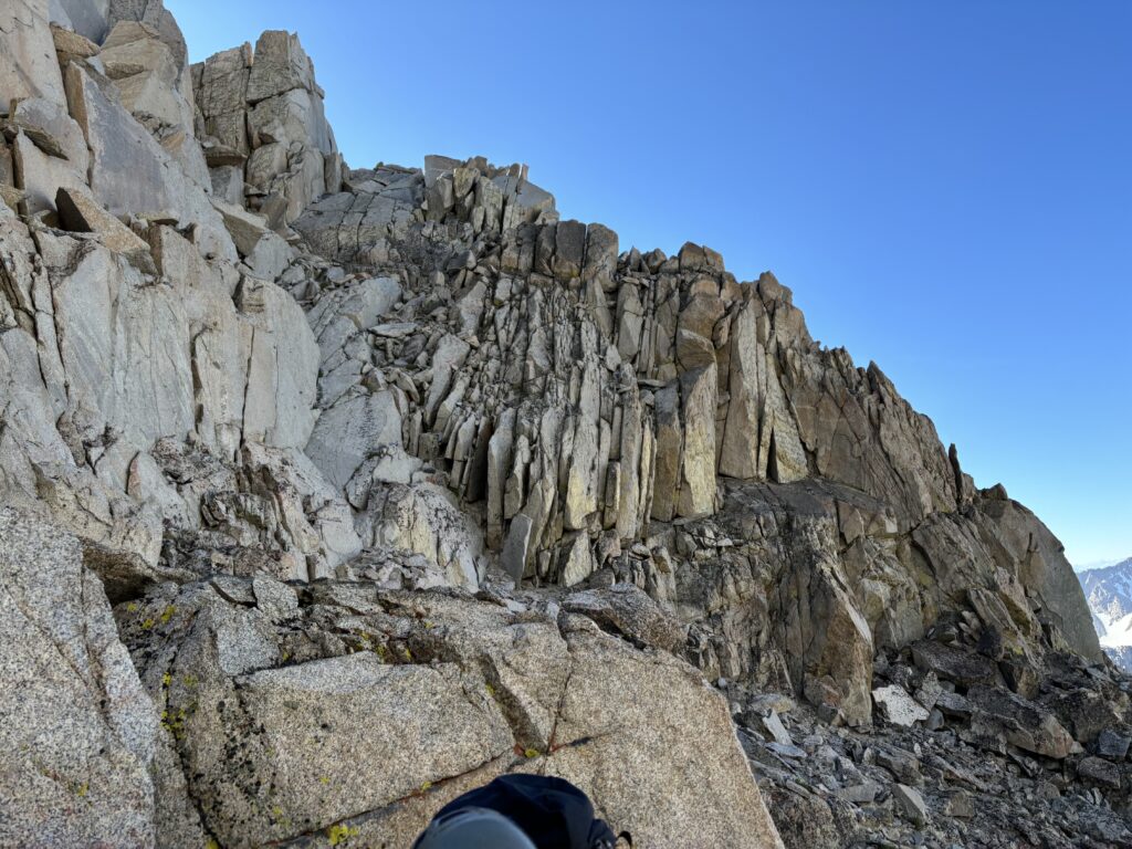
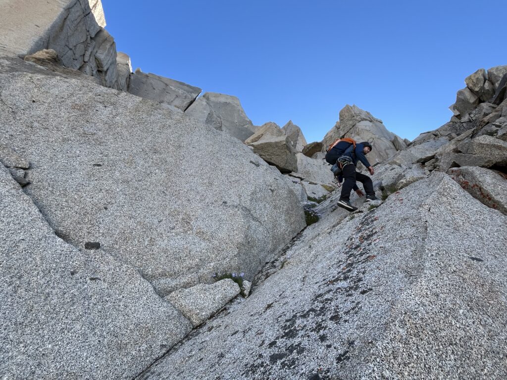
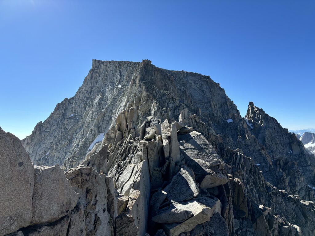
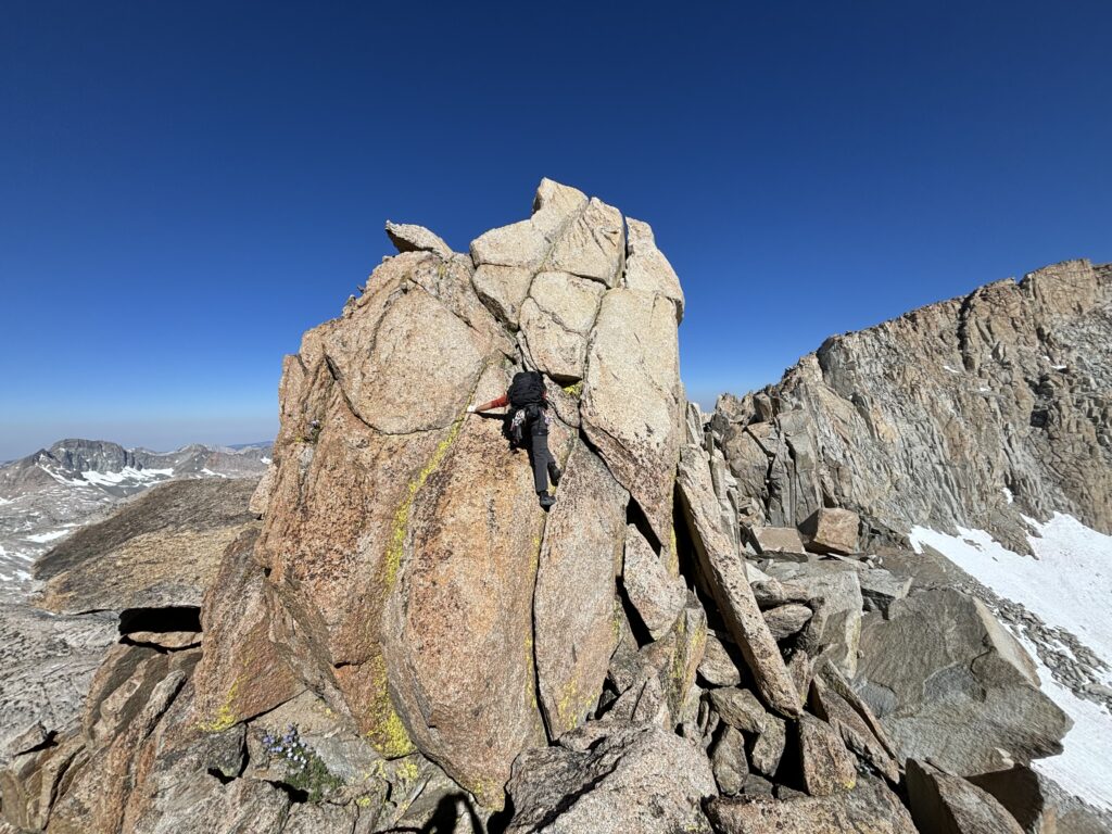
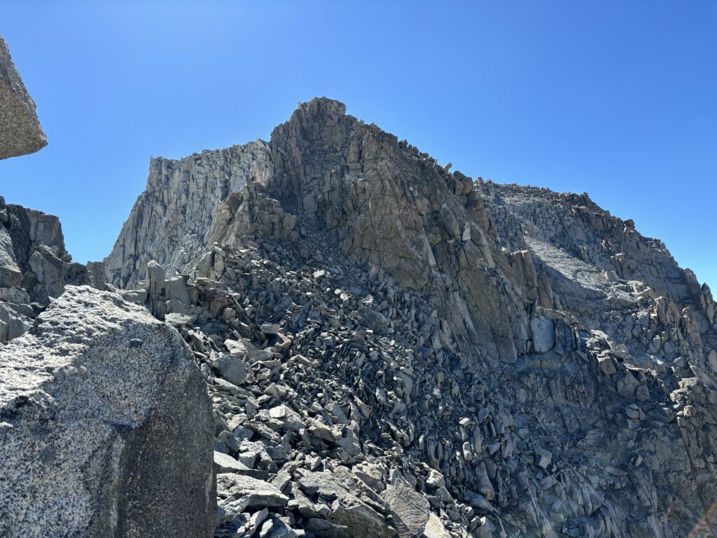
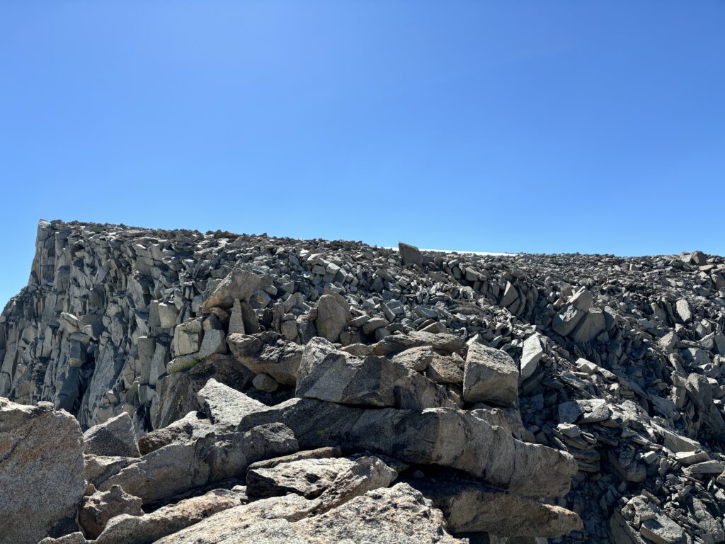
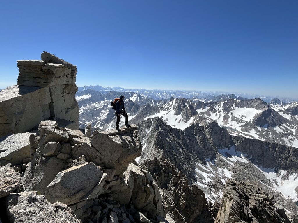
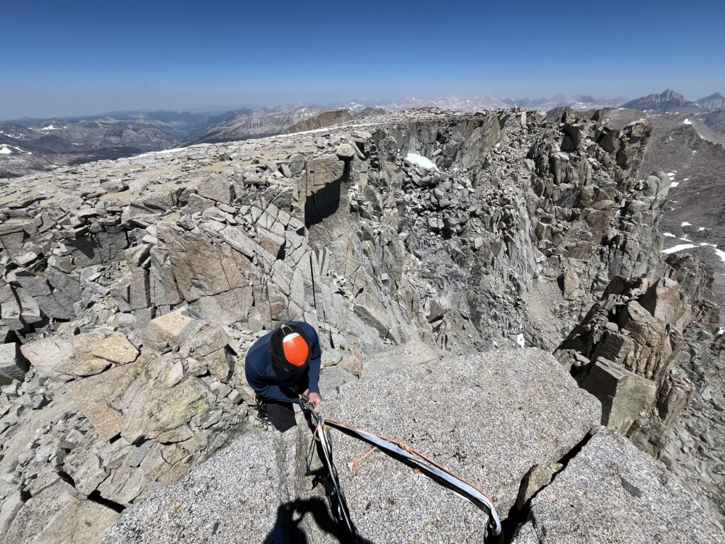
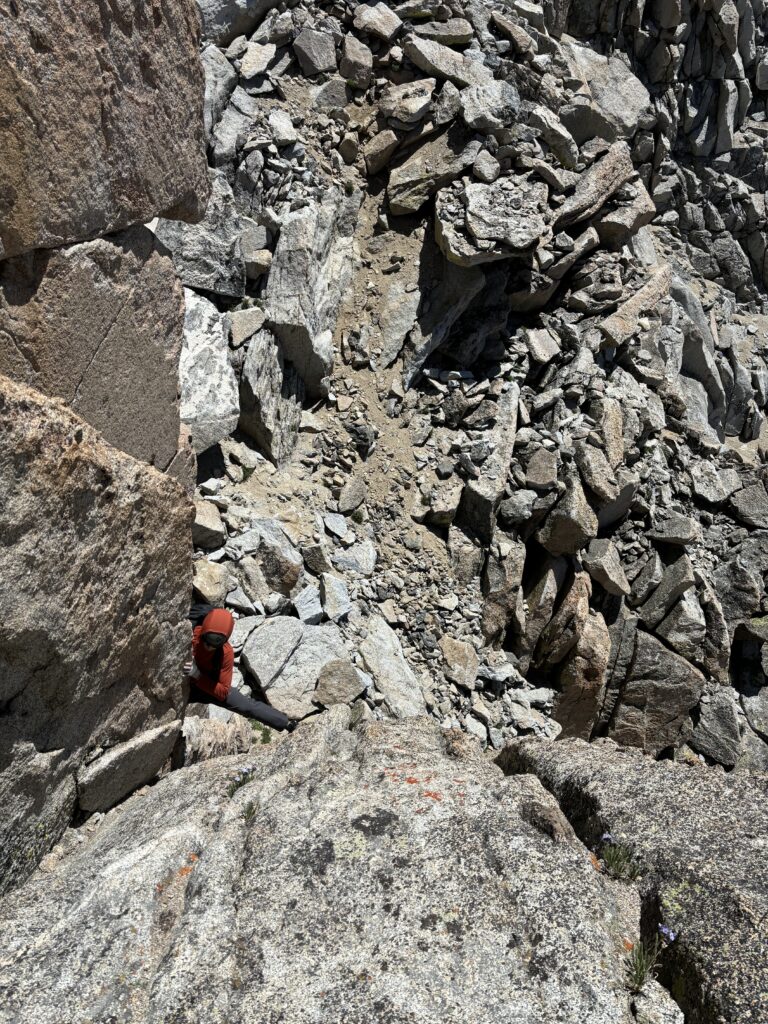
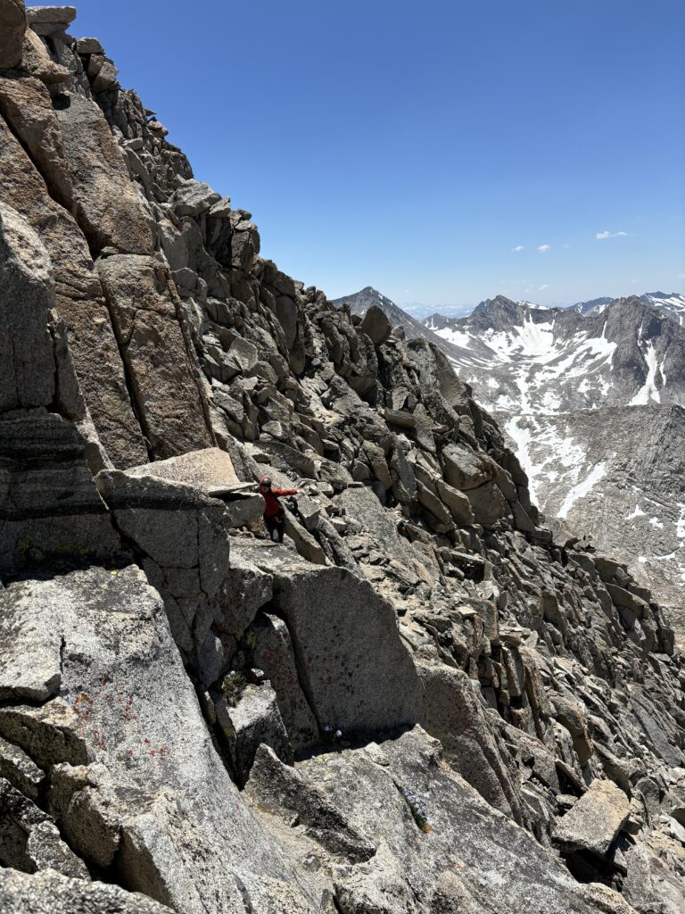
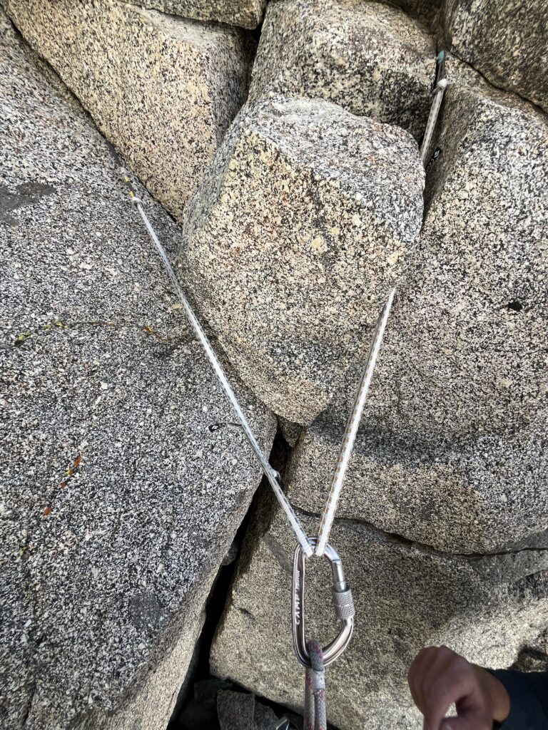
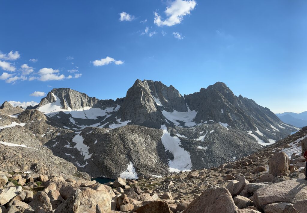
Ahead was not some streamlined granite ridge with sections of climbing interspersed. Rather, it was a complex and fragmented place with huge granite blocks perched in precarious and somewhat gravity defying positions. We weaved in around gendarmes and tried to keep the terrain to 3rd and 4th class, but it proved challenging to do. Even in looking back at photos it’s hard to state exactly what route we took, but around mid way down the ridge we did our first rappel. The anchor was in an awkward position with old tat, so we had to replace the webbing and hang out over a ledge to get set up. Brayden went first and then I followed and we continued on along the ridge. A second impasse came up shortly after and this time the webbing was in better shape so we set off on another rappel. From there we traversed onto the west side on sandy slopes and then climbed up low 5th class cracks on the east side of the crest to gain the summit.

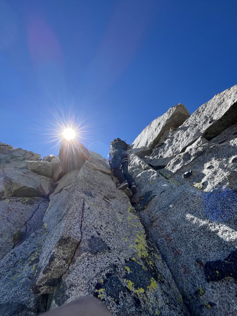
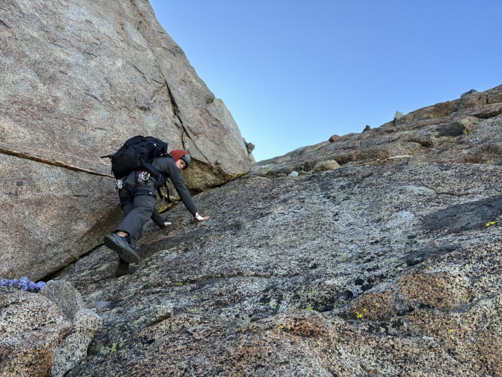
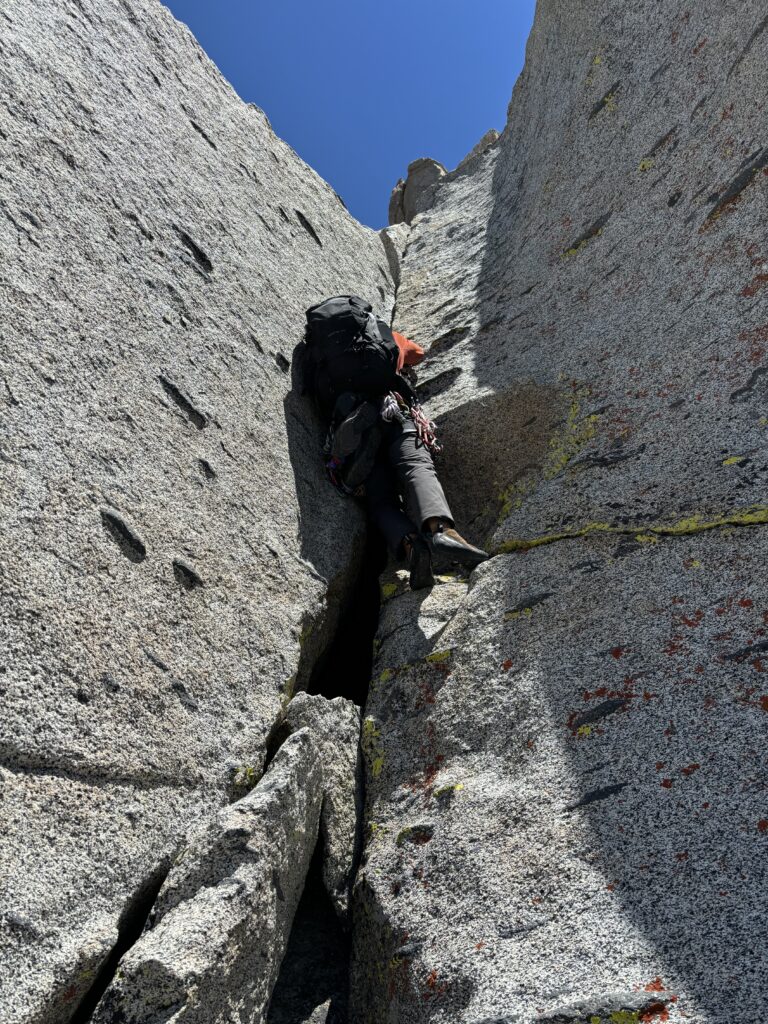
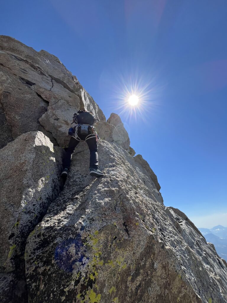
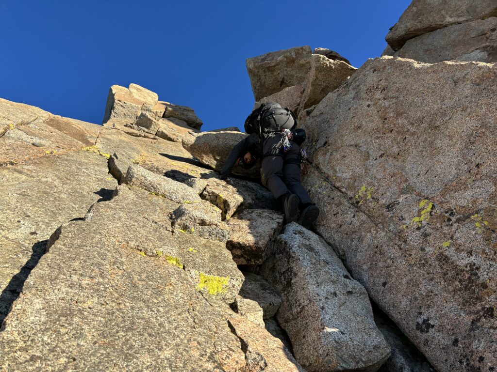
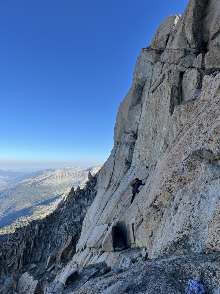
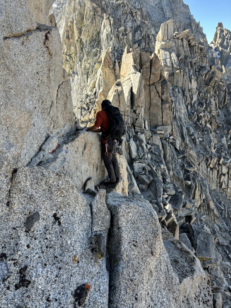
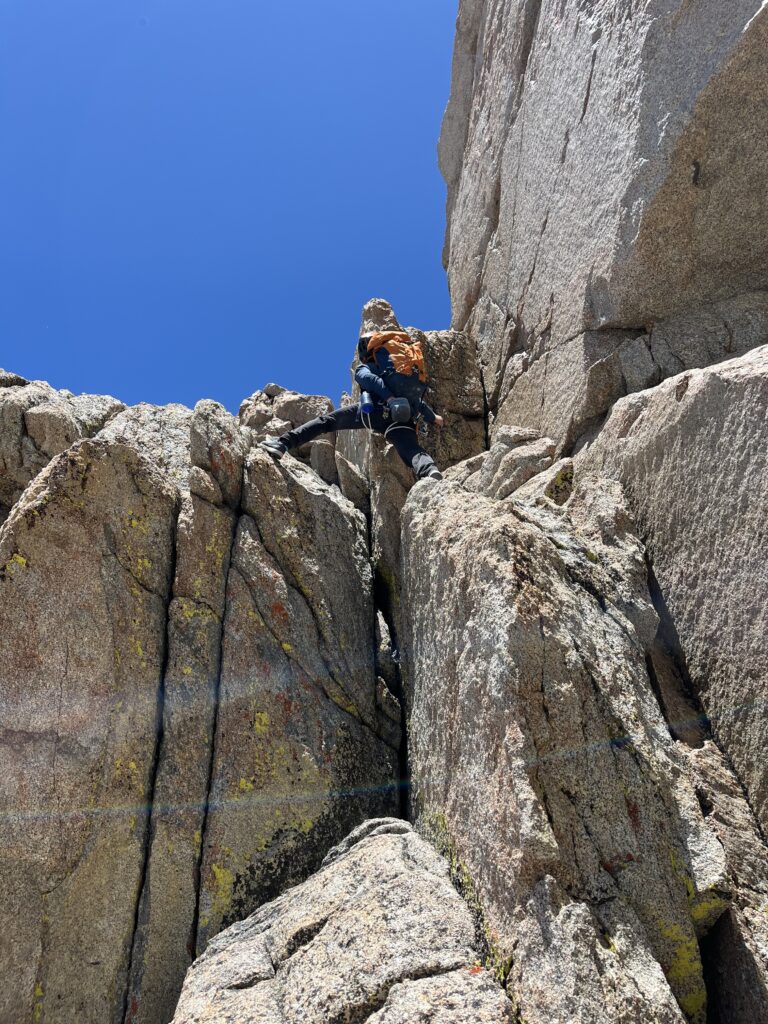
By now it was 11am and it was looking unlikely we’d make it to the Haeckel col as was originally planned. We now set our sights on making it to Darwin by sunset as the section of ridge line to Mendel looked more promising. Twenty minutes later we set off for the next part of the journey. The first order of business was an exposed and sandy 4th class down climb through a gully. We then traversed a ways on the east side of the ridge, but got cliffed out and spent a great deal of time trying to find a reasonable route through. Eventually we climbed over to the west side again and then swapped over once more traversing across a short snow band. A short section of scrambling later landed us at the first section of climbing. A 5.6 cliff band that many people simply solo. Neither of us felt keen to do this with 30lb backpacks so we roped up. I asked to lead this first pitch as I knew an offwidth pitch was coming next and Brayden is a master of the wide.
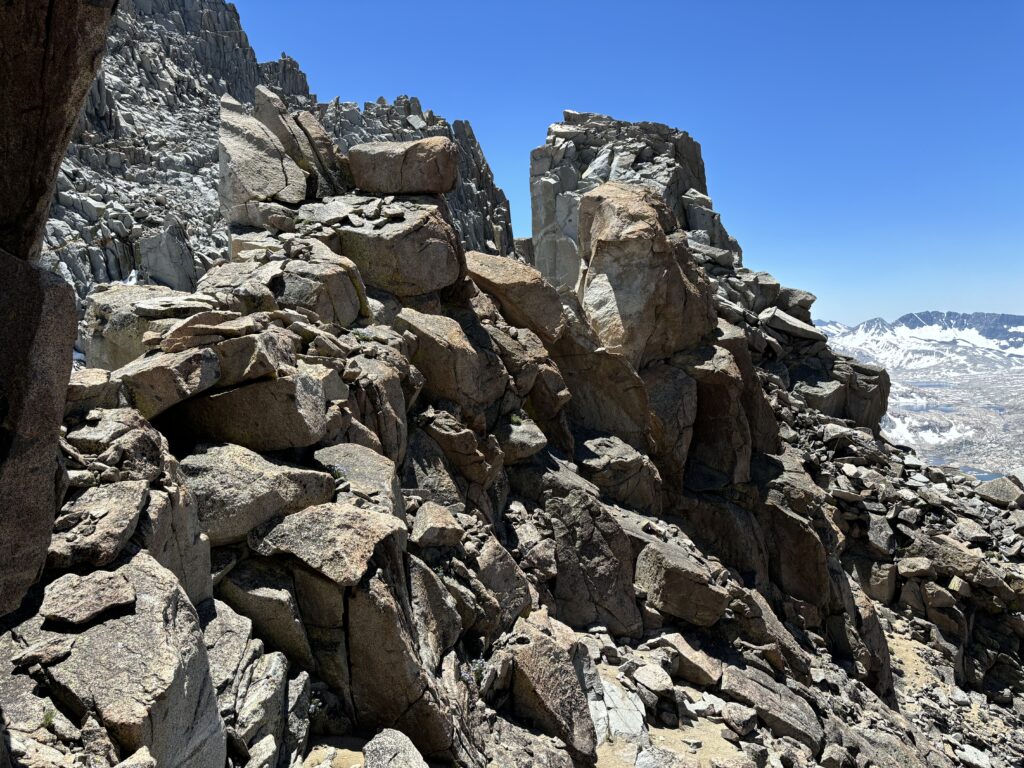
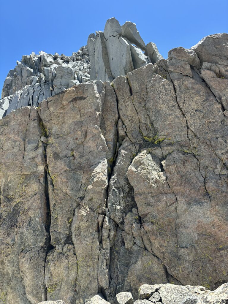
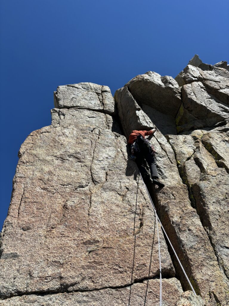
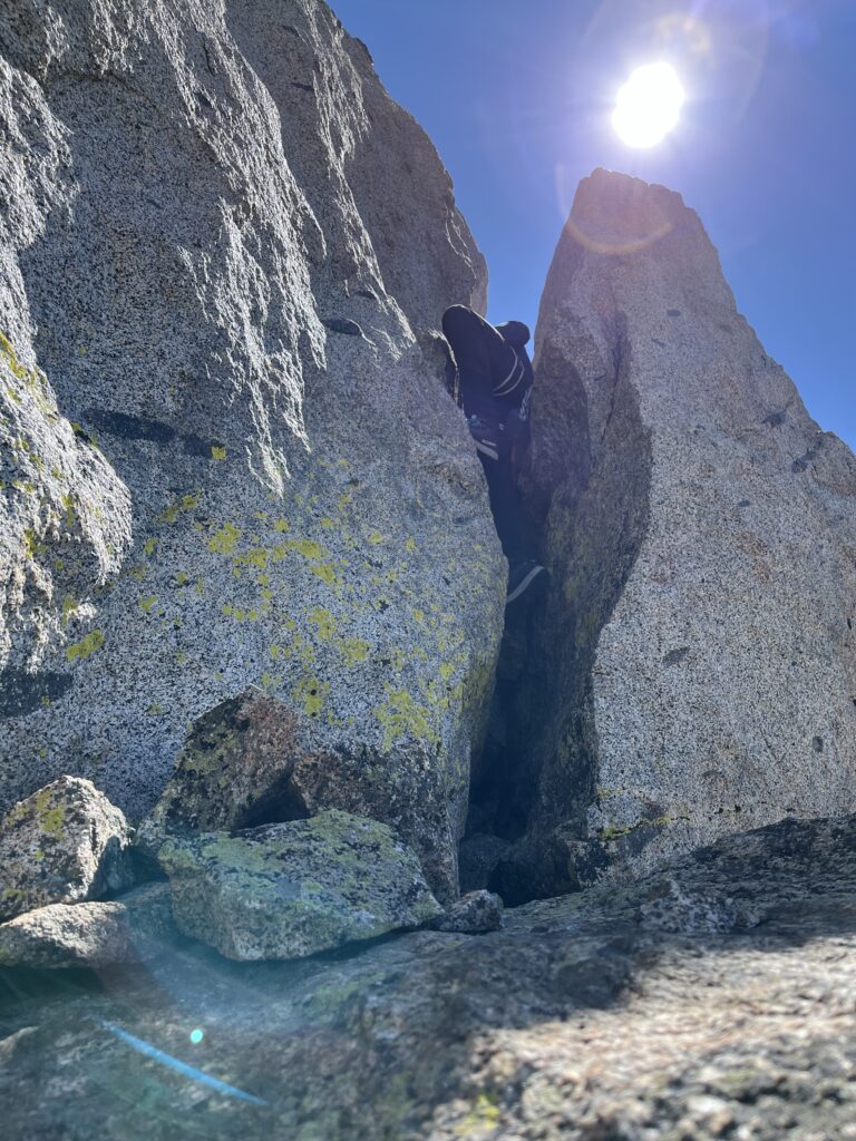
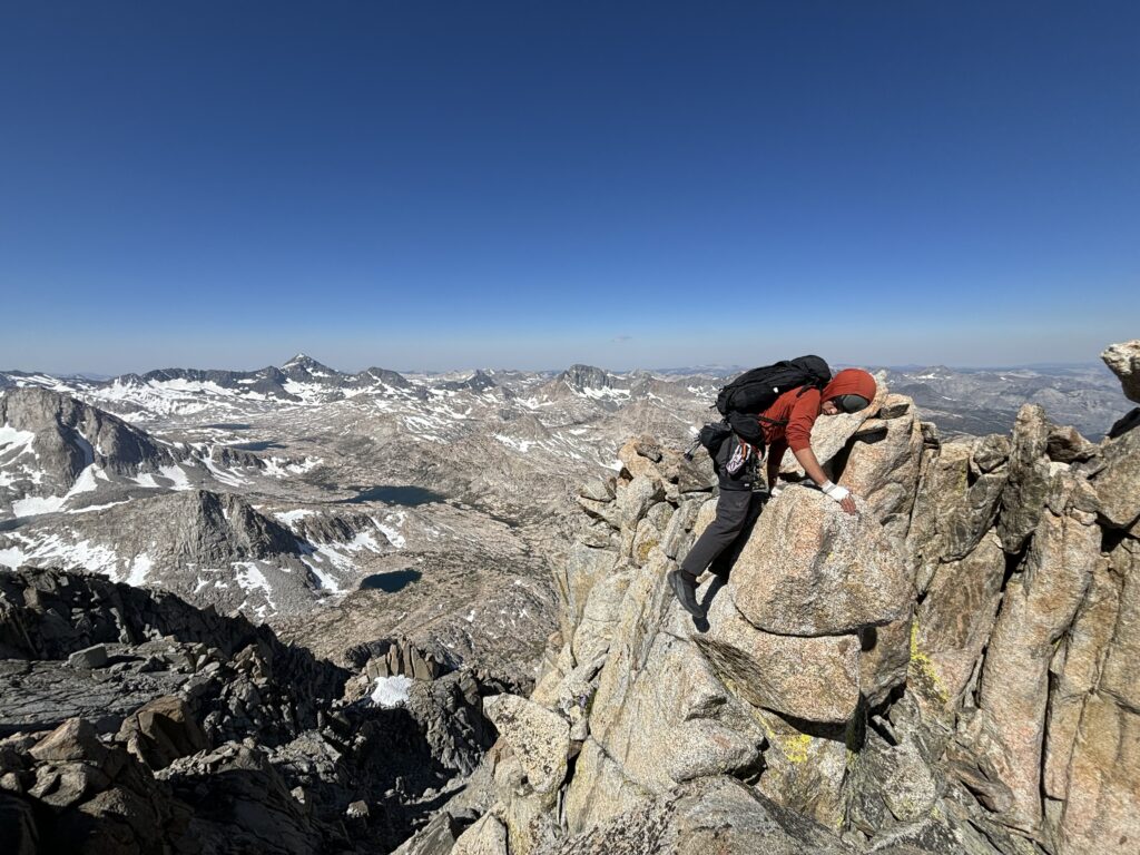
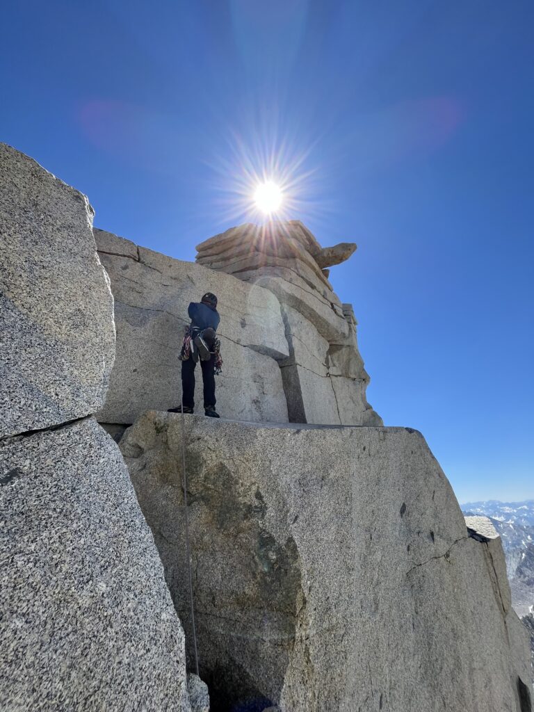
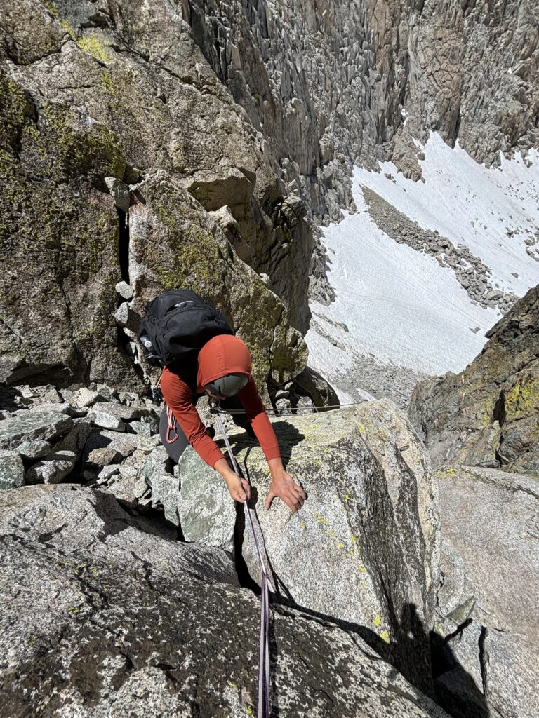
With the rope out, I climbed up and found relatively solid rock with great hand jams near the top. The 5.6 grade felt on point, which was a little unexpected for California. I then set out to haul our bags up, but they got stock near the top. Brayden seconded up and cleared the stuck cargo before joining me at my slung boulder. Now we scrambled up more 3rd class terrain before hitting yet another gendarme with a few options around. Brayden initially went for a wide hands corner, but backed off to see if we could find something easier/quicker. Around the east side a narrow ledge system gave way to a third rappel. From the base of the rappel a section of exposed scrambling took us to the base of the second pitch of climbing.
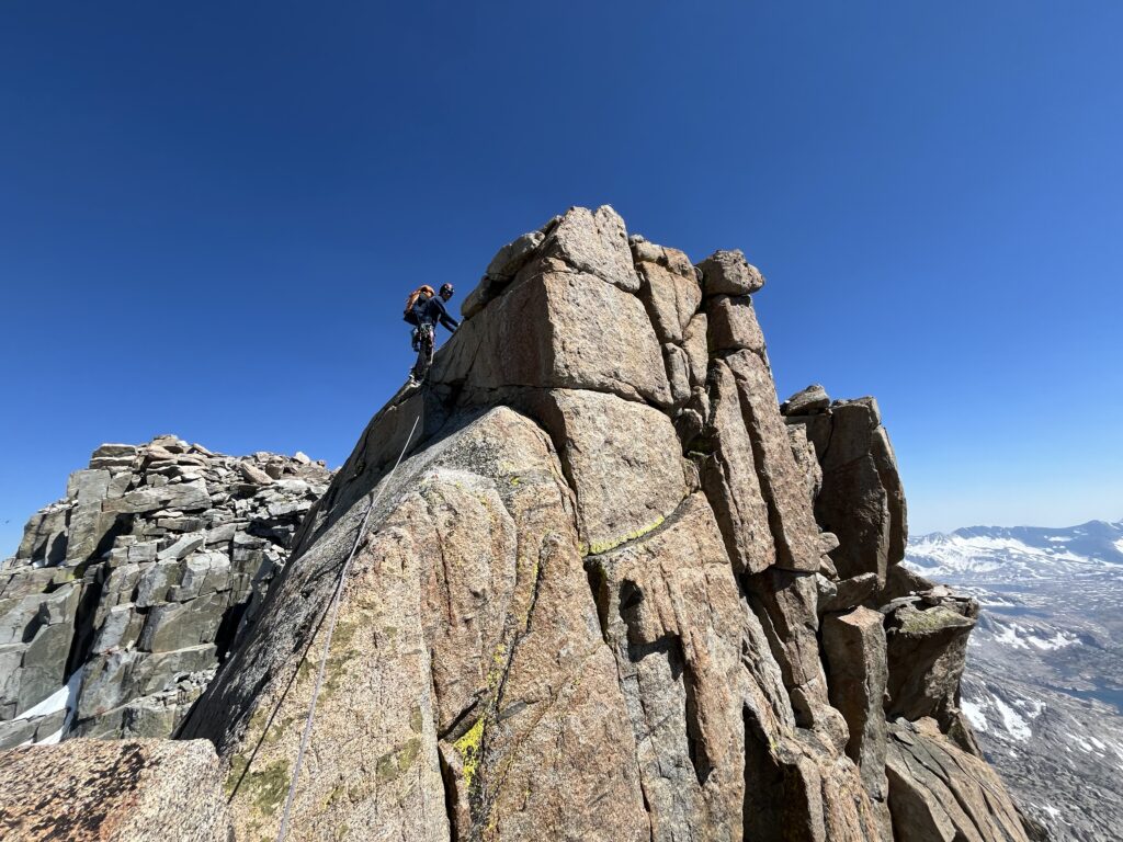
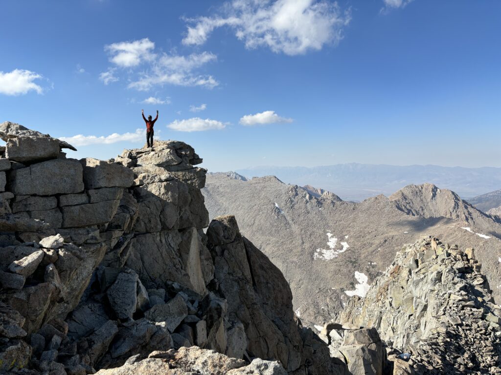
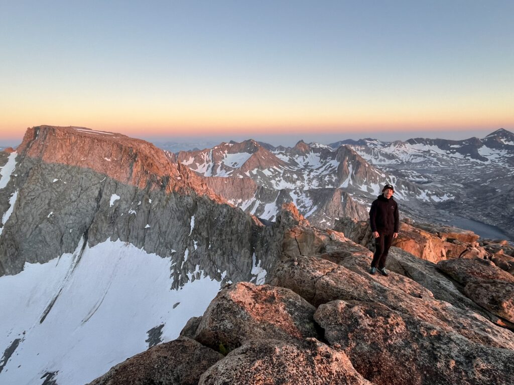
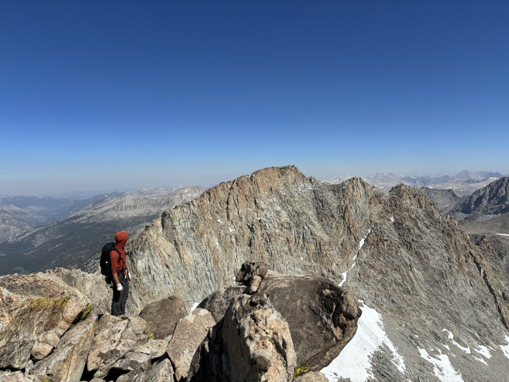
Brayden lead this up to the top and then we hauled bags while I seconded up to fix them. He lead one more small pitch around an exposed slab onto tamer blocks of granite and then we cleaned the rope up. The ridge was for from over at this point though. We regained the ridge crest and then had to a 5.4ish chimney down climb to the base of an ultra exposed slab. The climbing didn’t look all too hard, but we decided to rope up here and I lead a short pitch across. Now from the top of this slab we had to do another rappel into a deep notch which marked the last section of climbing to the summit. Here we saw another rappel station and briefly considered taking it to see if there was easier terrain further down. However, with the rope already out, we opted instead to lead a pitch across the steep face and regain the ridge. Brayden took this lead and climbed up to 5.7 on a mix of hand traverses, finger cracks and some interesting stemming. All in running shoes no less! At last we had gained the ridge crest and the technical difficulties were over! The Gould to Mendel section had been even more complex than we could have imagined. It was 5:20pm by the time we hit the summit and we both agreed there’s no way we’d reach Darwin in time.
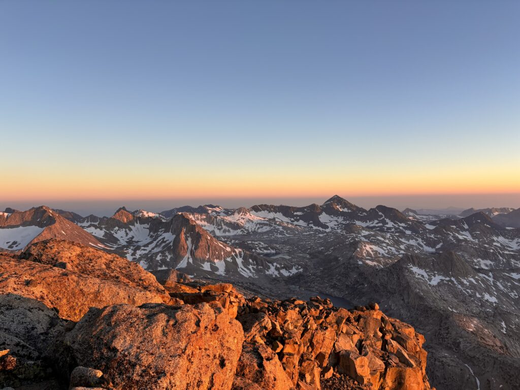
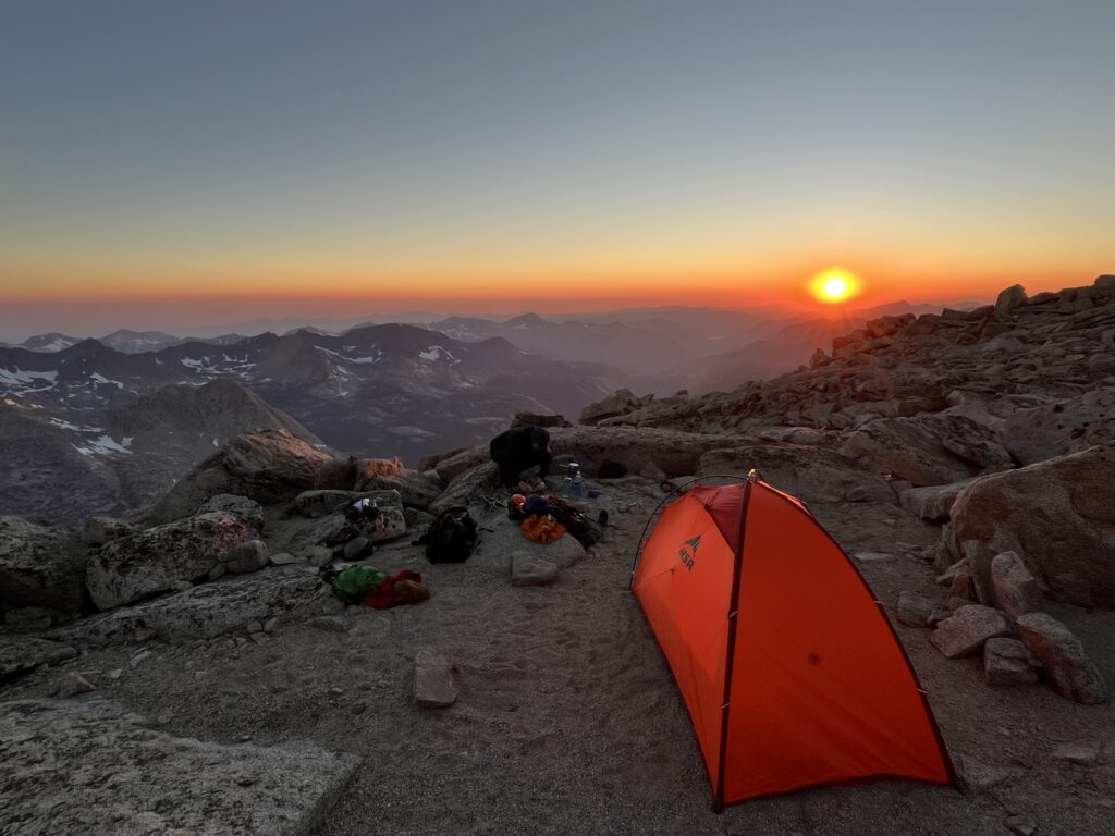
At this point, we had been having a few discussions about the rest of the traverse too. The complex route finding, loose rocks and large hanging death blocks had been anything but “classic” in our minds. In fact, it wasn’t all that fun and we were feeling our time could be better spent on other routes. The call was made then and there to bail on the traverse. Now however, came the dilemma of whether to stay the night and push out the following day or go to Darwin (the tallest of the group) and then bail. We both waffled over the idea and neither of us felt satisfied to go all day on the next day without doing a summit considering we’d spend one more day after just driving. With that, we settled on going for Darwin in the morning and catching an alpine sunset on the summit of Mendel.
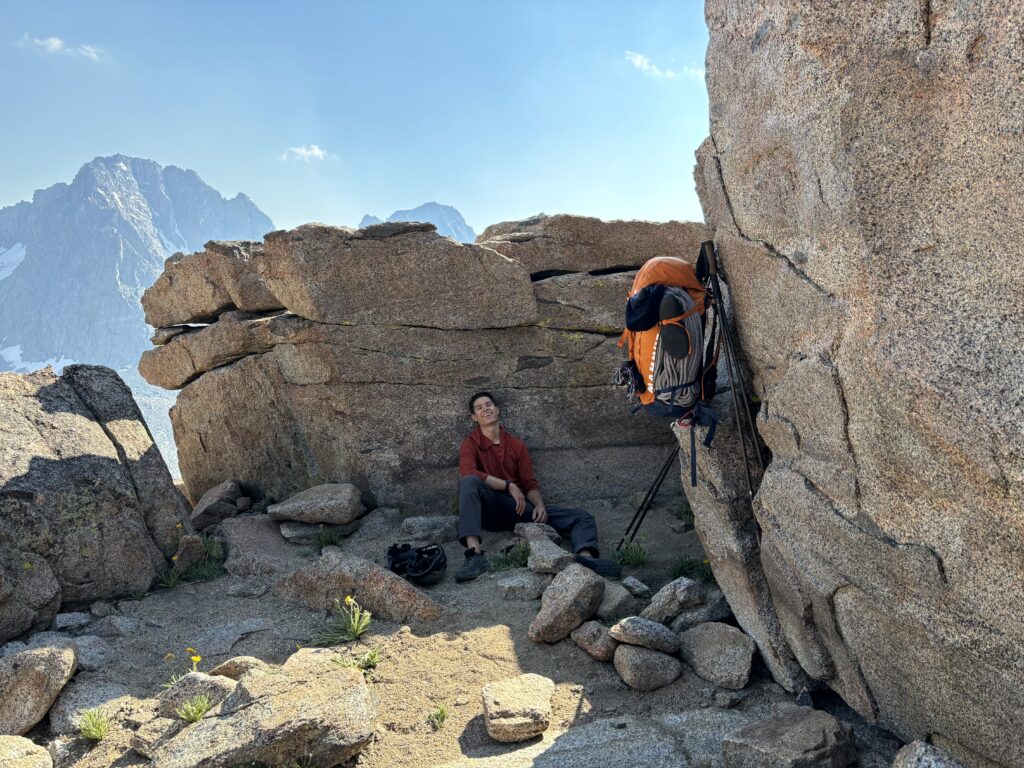
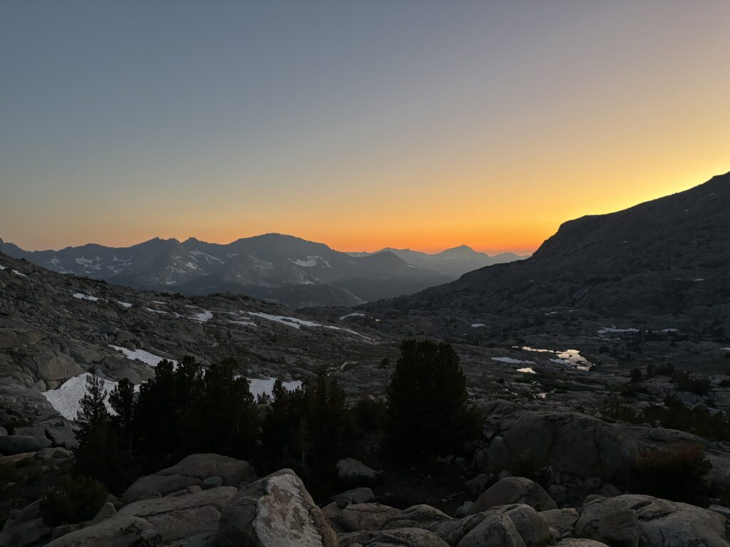
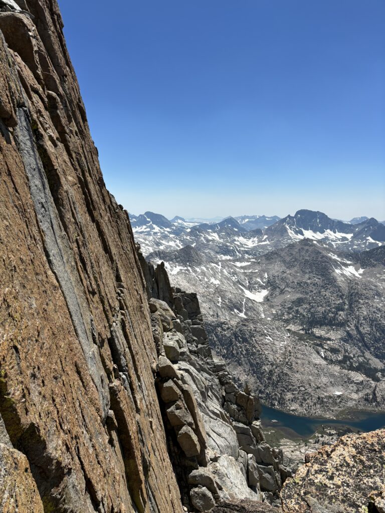
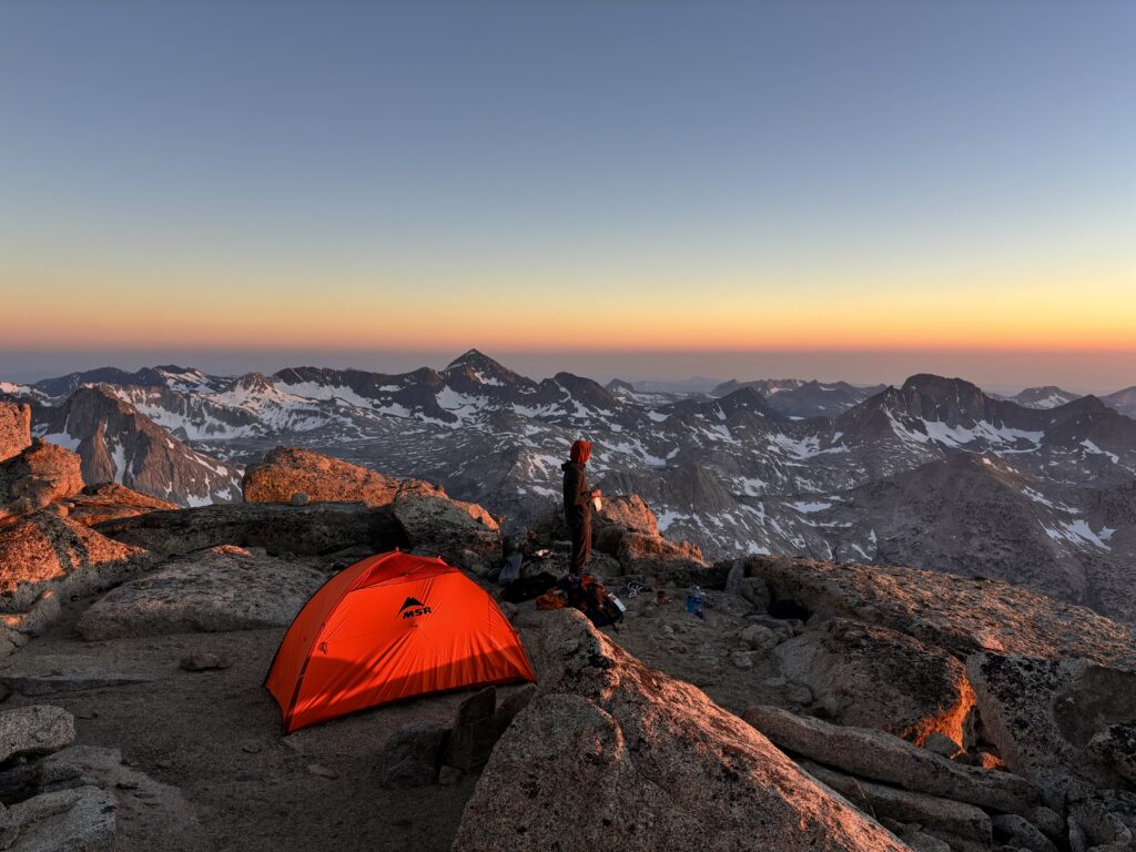
I got to work setting up our tent in a premium bivy spot (flat sand!) and Brayden started melting water from a nearby snow patch. The next few hours were spent just relaxing, watching the sun drift down the horizon and chatting. It was a truly exceptional place to be hanging out and we were both stoked to have opted for a night up there instead of the valley below. Alarms were set for 4:30am and after nightfall hit, we were off to bed.
When I woke up, the nights previous peace and relaxation were undone by a pounding headache and intense nausea. Ah. Yes. Altitude. I knew these feelings all too well from Aconcagua. They’re normally offset by an over prescription of water and rest, but here at 4100m with just snow to melt and a fast pace to set there were no such luxuries. Barry Blanshard says to be a good mountaineer/alpinist one has to have a bed memory and strong optimism. If I had remembered all my previous sufferings at elevation, rest assured we’d be on the north shore for most weekends. Nonetheless, I got about walking around and slowly trying to ease off the symptoms. I couldn’t really get any food down, but Brayden’s advil alleviated the headache after a bit. By 6:20am we were packed up and making our way down to the Darwin col.
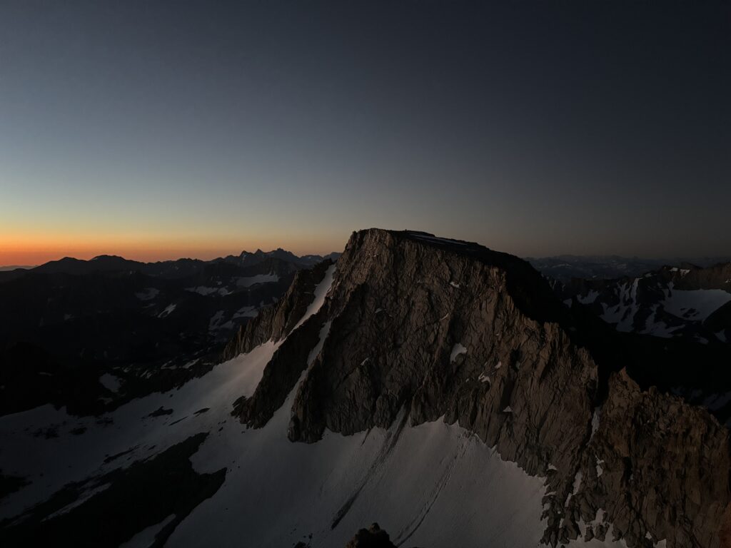
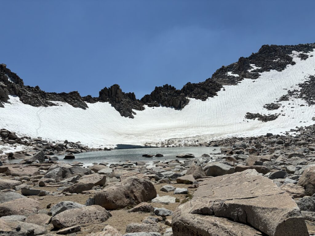
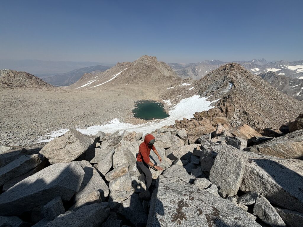
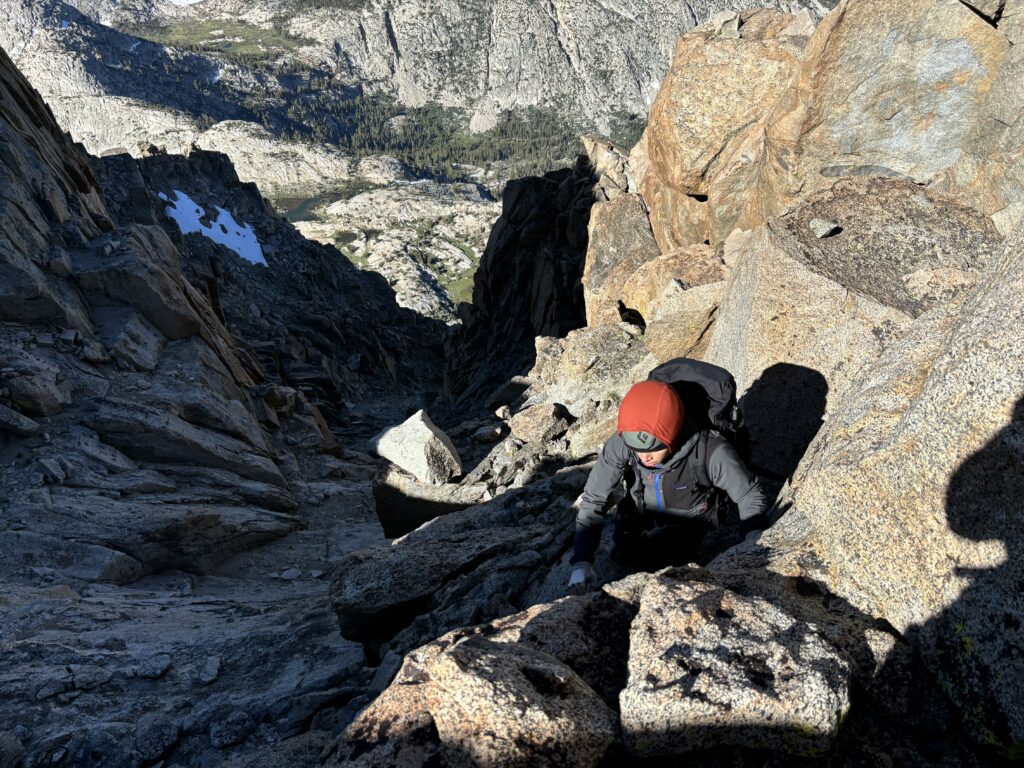
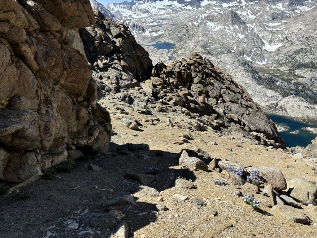
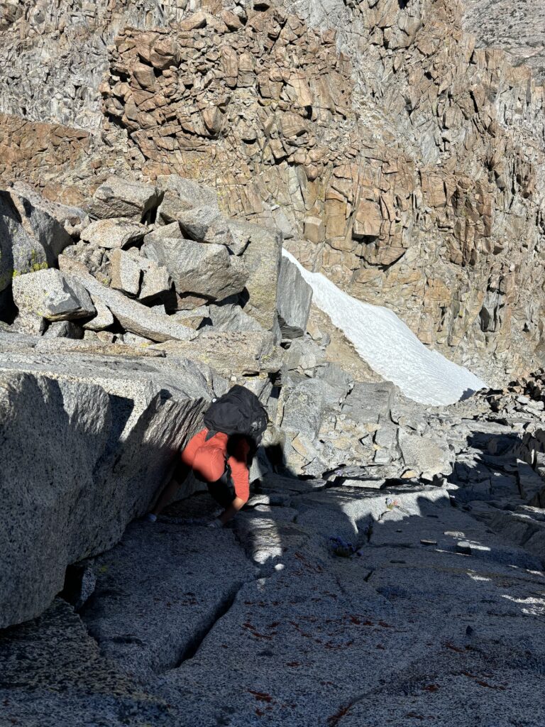
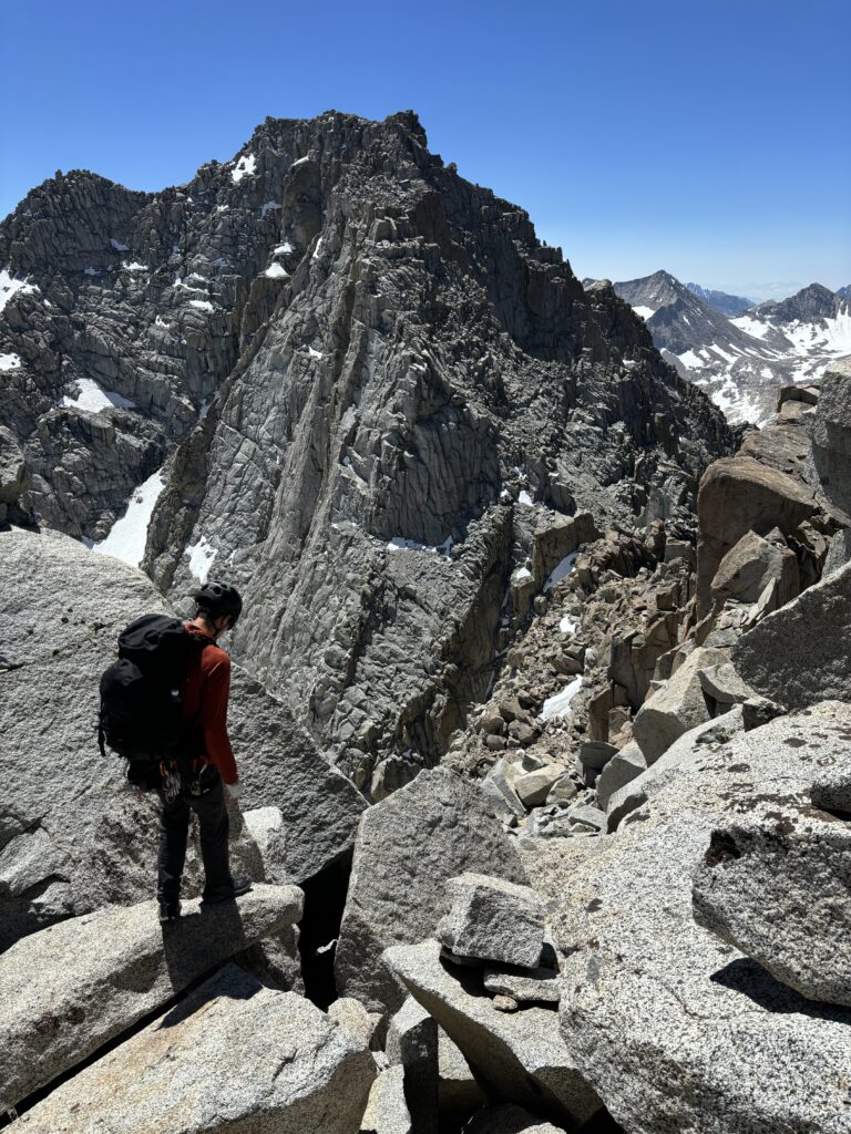
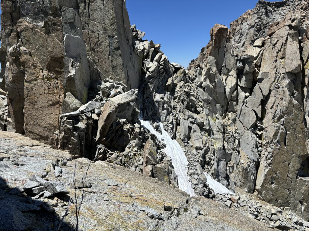
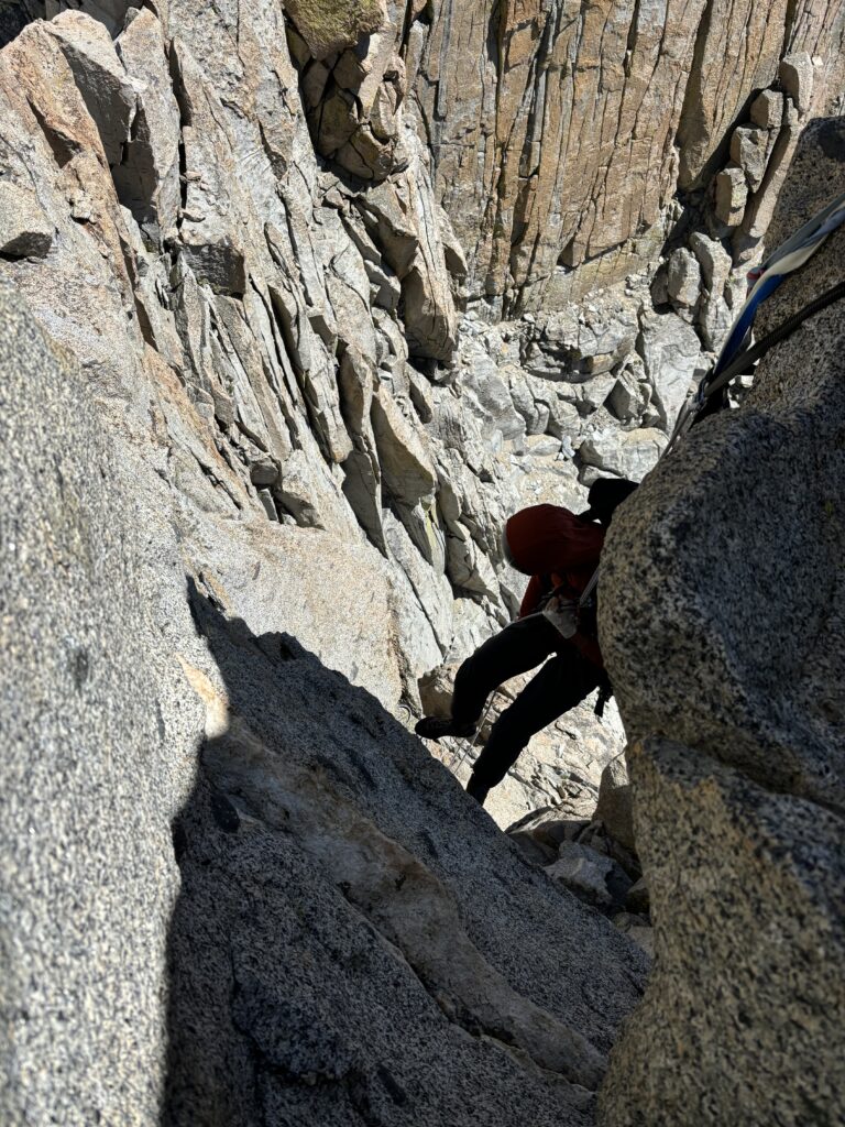
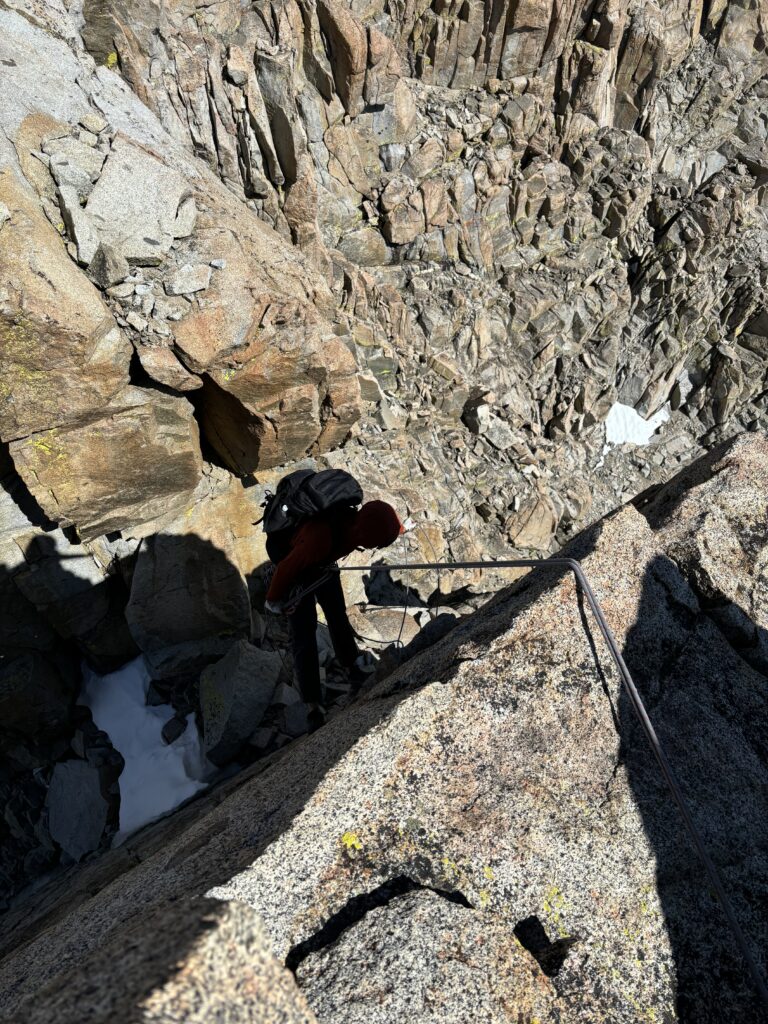
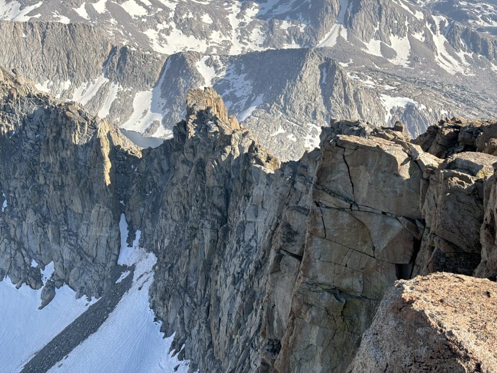
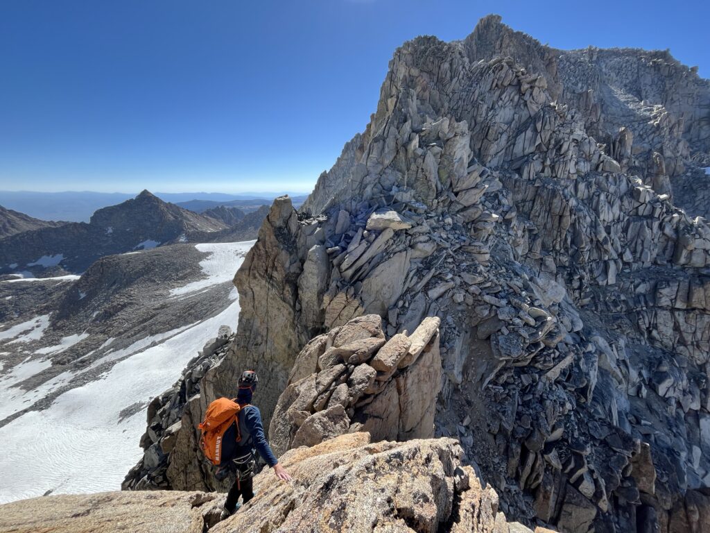
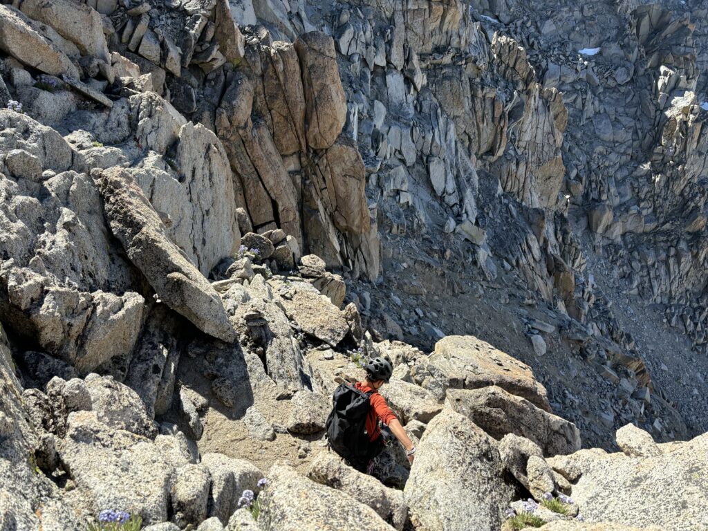
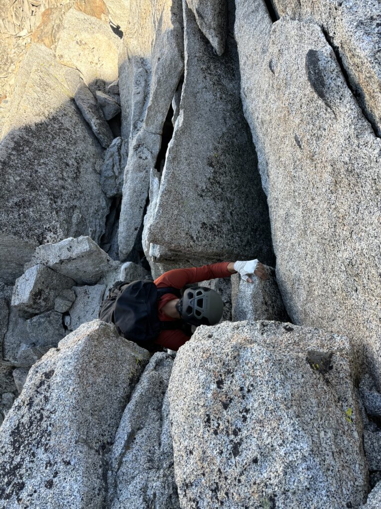
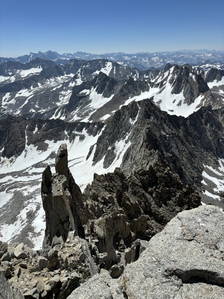
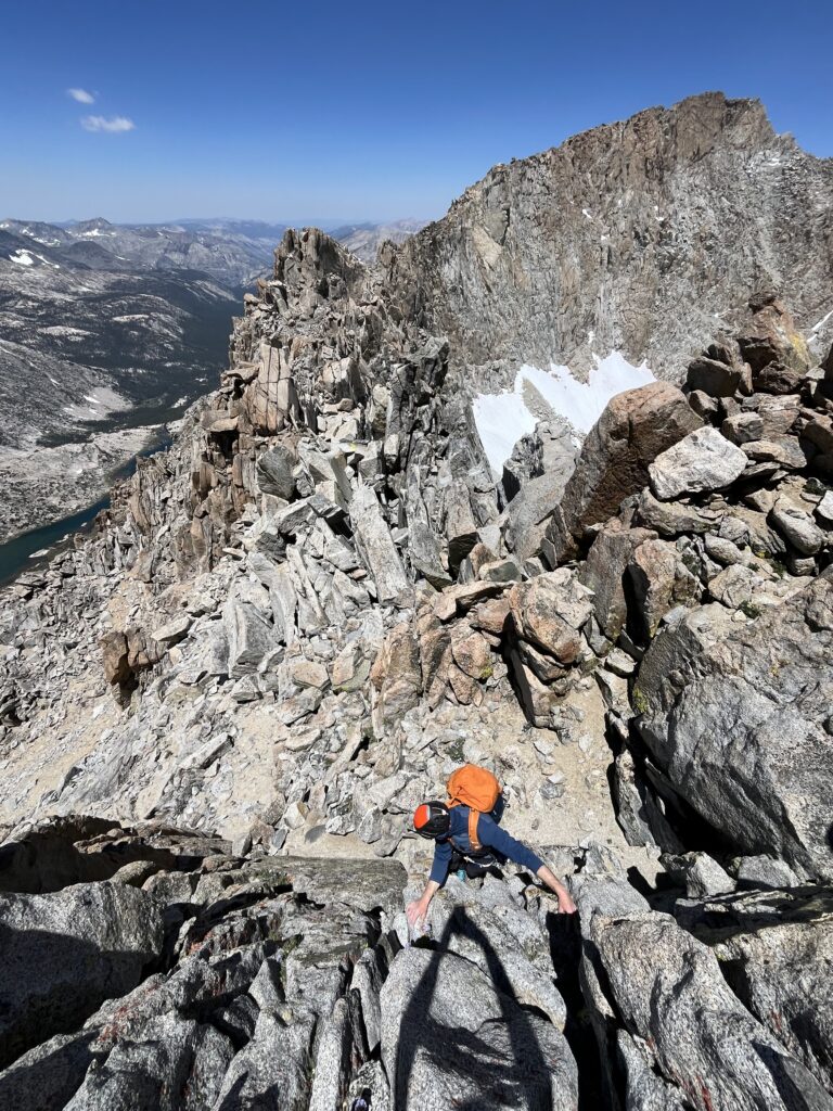
The first section of ridge wasn’t bad at all with just a few exposed 3rd/4th class down climbs to continue on the crest. Part way down we climbed to the top of the first gendarme and had to make a rappel onto the west side before regaining the ridge again. We climbed up another short gendarme and then had to do some low 5th down climbing on cracks onto the west side before climbing up yet another gendarme. This gendarme marked the 5.8 climbing section if you were going south to north or soloing. Thankfully for us, there’s an obvious rappel station. However, like all the other stations the tat was not to be trusted and we had to use more webbing to make it safe again. At the bottom of this rappel was the low point on the ridge and a gully that we planned to make our descent from after. This gully was chosen specifically because a finger of dry talus extended almost all the way up the glacier to the ridge. That would mean we could avoid any extended time on snow or steep snow down climbs. We had ditched our axes and micro spikes at the first camp on day 1, so rock was our only option really. Here too we decided to ditch all over night gear while we went for the summit of Darwin. There was some hesitation in case we couldn’t return the way we came, but the reality was that this was the best descent line so we should try at all costs to get back to this point.
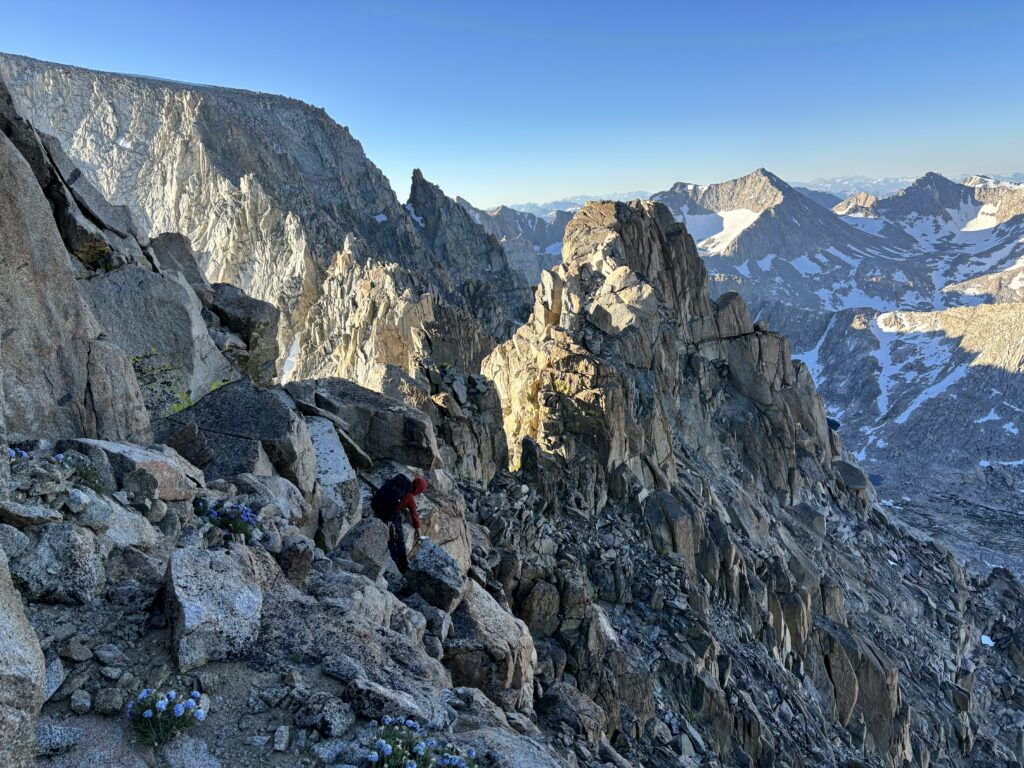
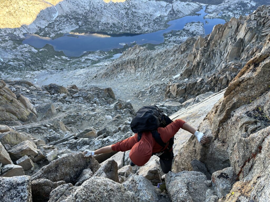
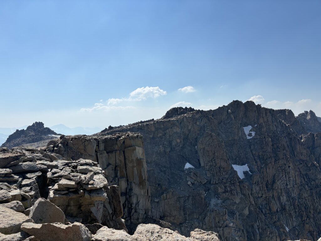
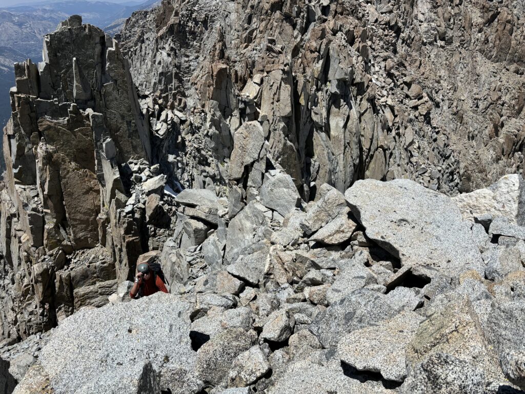
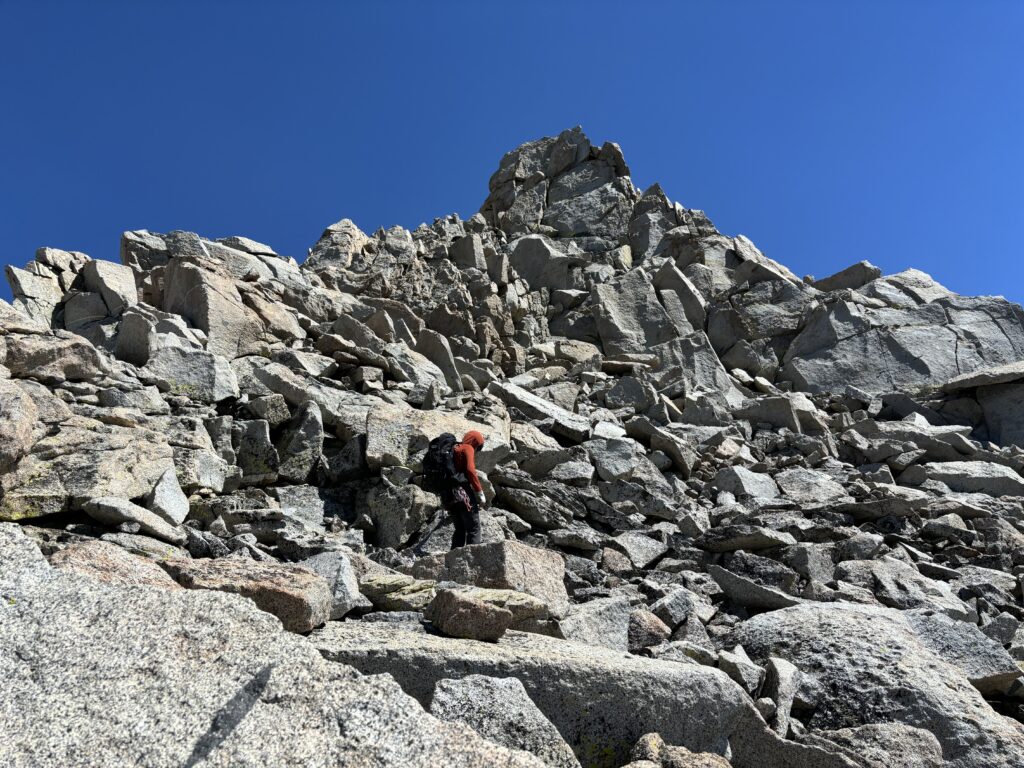
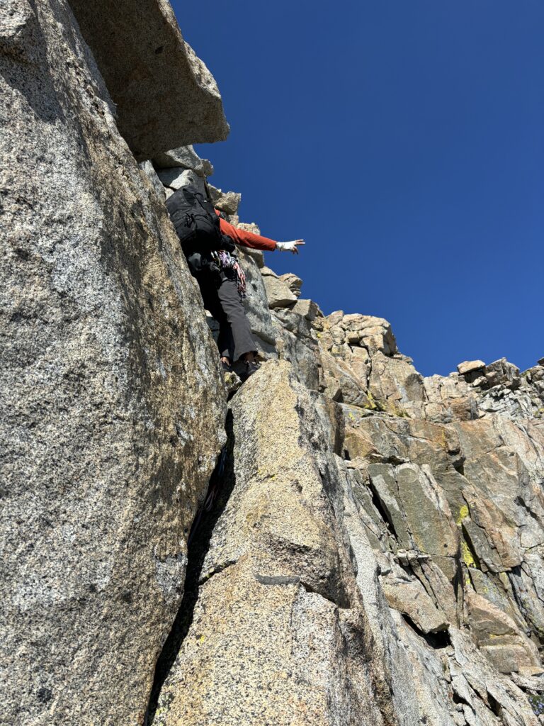
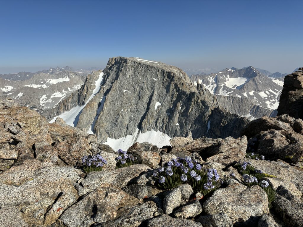
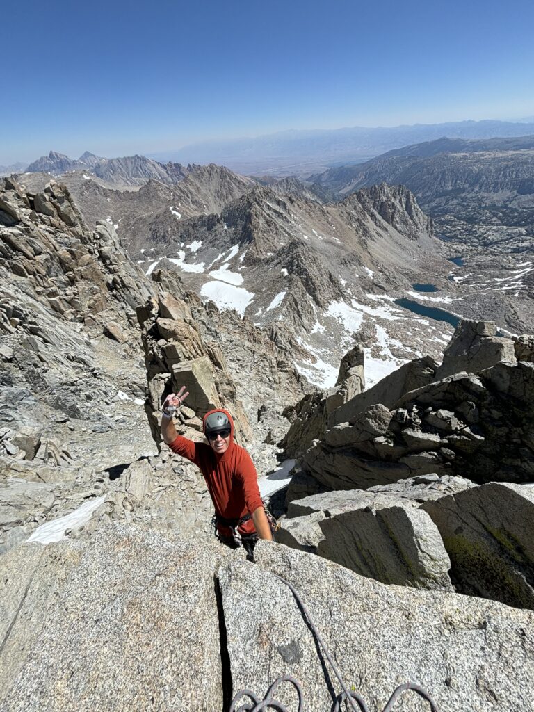
With the gear ditched we continued up the ridge climbing a section of slabs and then swapping from west to east to west again navigating around various notches and impasses. The last technical hurdle of the day was a deep notch that we did some low 5th class climbing partially down. Not spotting a reasonable way down the rest, we climbed back up and then dropped a ways down the west side onto a dirt gully before climbing back up to the base of the notch. The terrain had appeared improbable above that, but as we got closer reasonable lines appeared. From this point it was basic 3rd/4th class scrambling all the way to the broad summit shoulder of Darwin. Admittedly, this section had been quite fun and it’s too bad the route only really improved at this point as we were now committed to other goals.
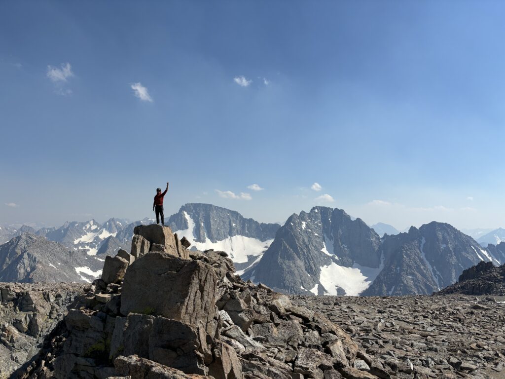
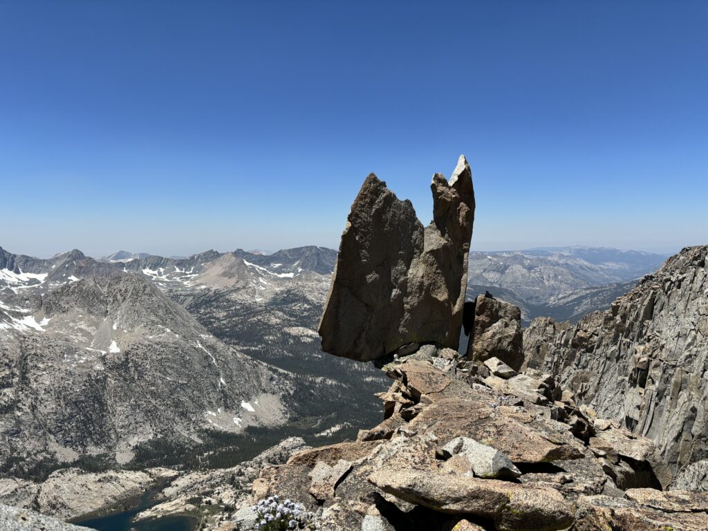
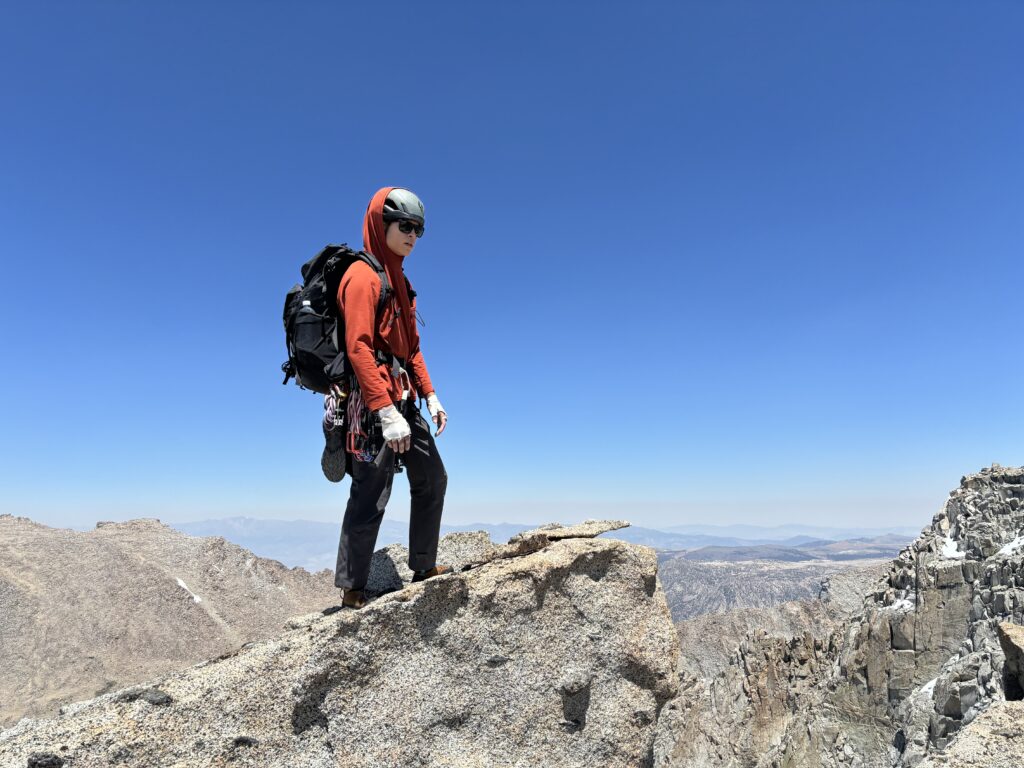
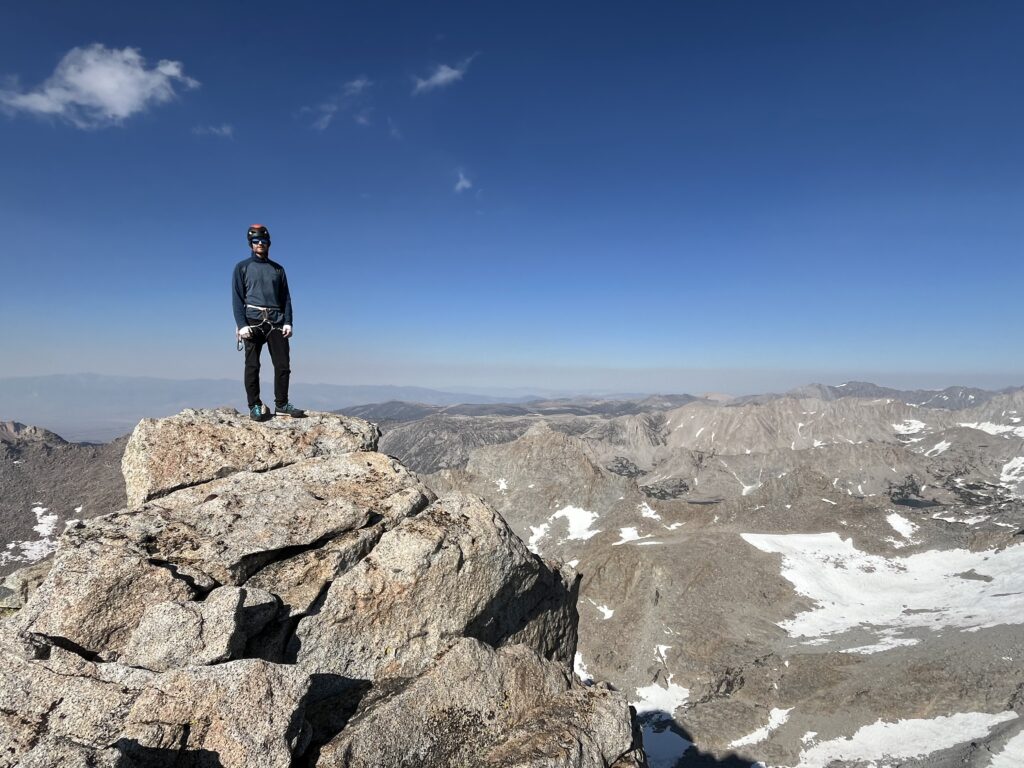
Once on the shoulder we hiked a ways to the true summit on the south side. An interesting monolith of stack granite marked the high point and involved a single 5.7 move to gain the top. We roped up and I took the lead, finding one reachy move to a solid hand hold and the rest was over. Brayden joined me on the summit and we spent some time going through the summit register and chilling out. It seems Darwin is done very frequently, but mostly through one of the many less technical options on the face itself. There were a surprising amount of entries for the evolution traverse as well. When it was time to rappel, the anchor had to replaced again and then we were on our way.
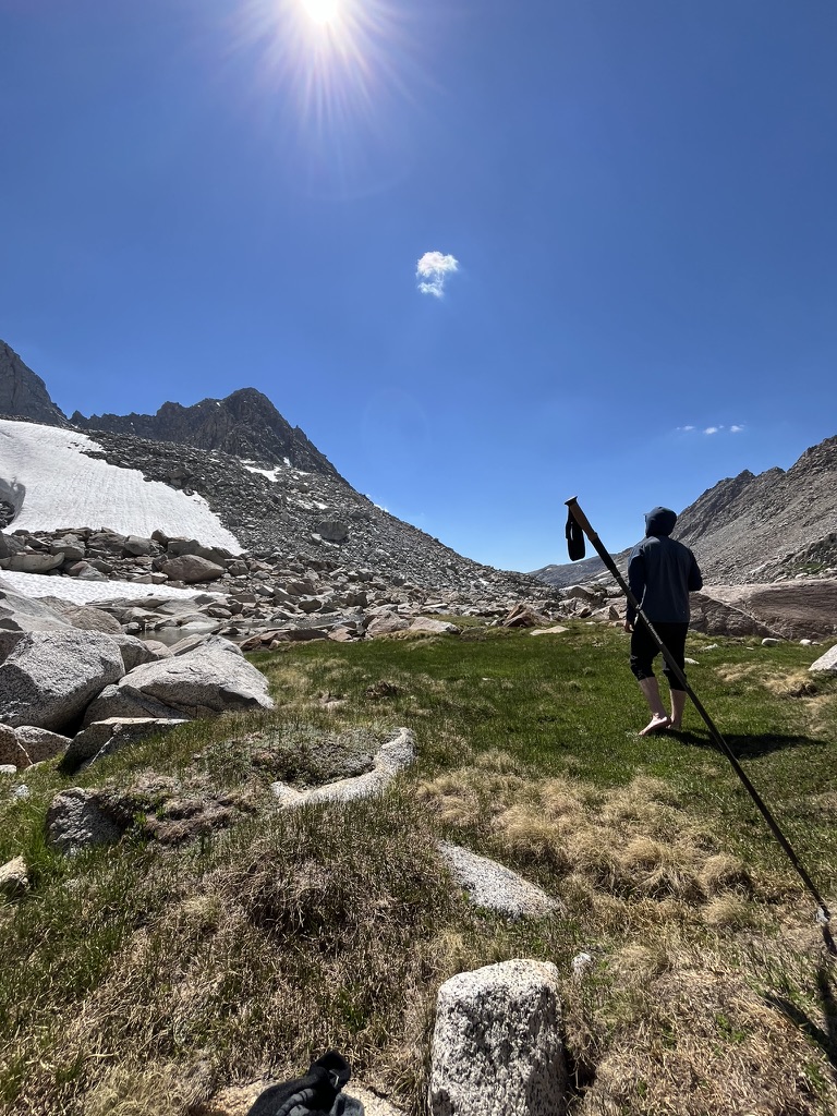
We made quick work across the long flat ridge of Darwin and then had a pretty easy time down the ridgeline until we reached the notch that we had originally bypassed. This time we opted to climb it directly and it was only a short section of perhaps 5.7 with a fun stemming move to regain the top. That marked the end of any technical difficulties and we scrambled down to our gear stash to get ready to bail. Here we spent some time relaxing in the shade for a bit. The heat of the day was slowing us down a bit, but I was finally feeling better overall and managed to get some snacks down by this point.
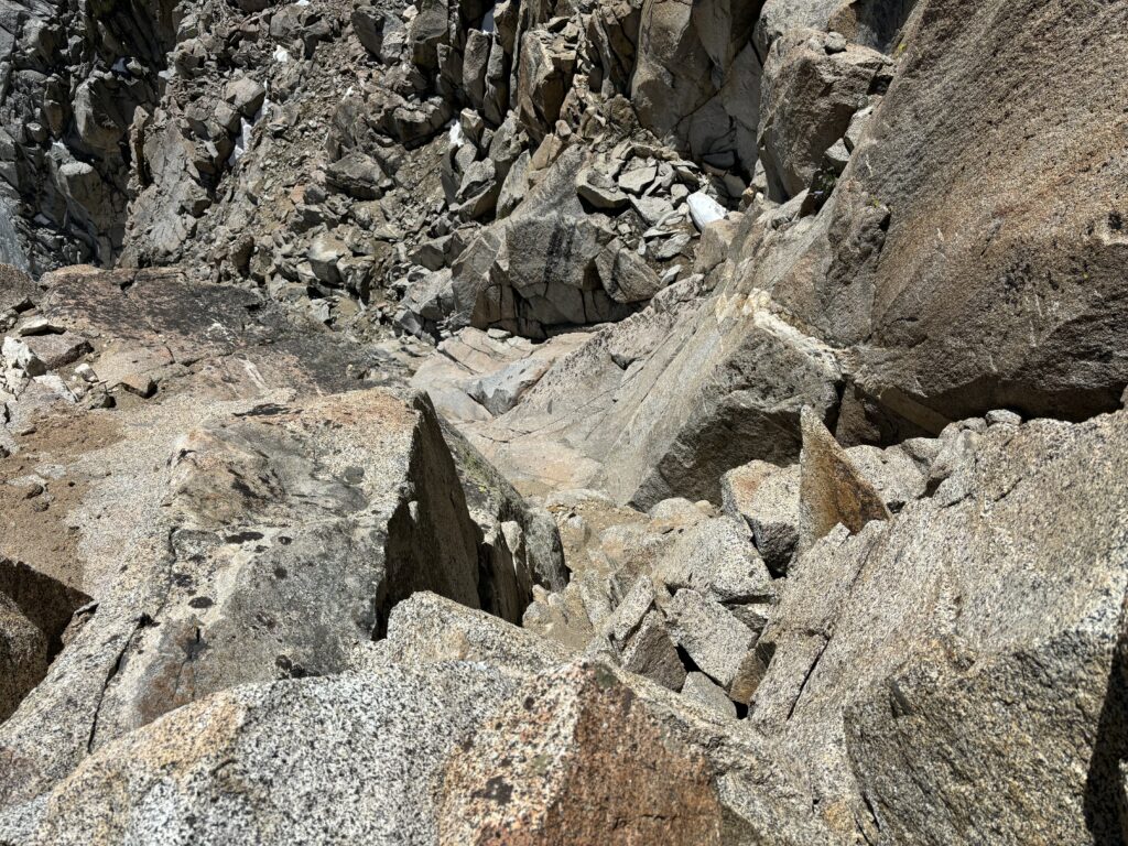
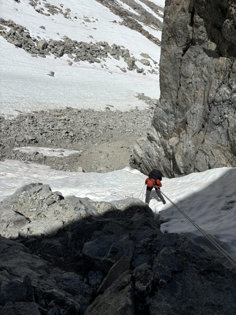
I packed up first and went ahead to scout out our descent options in the gully. There was easy scrambling for the first 30-40m and then an abrupt drop off to the steep snow below. When I peered down I could see snow through the huge perched blocks acting as chockstones in the gully. Brayden now joined up and we decided to rappel above this and skiers left where the rock was more solid. We had run out of webbing now from replacing all the stations so we left a dyneema sling around a block and then Brayden set off. To both our surprises he found a secondary station sheltered out of the way about one ropes length down and started prepping us for a second rappel. I joined him and then we made one final rappel to reach solid rock below. We probably could have down climbed the steep snow, but a slip would be highly consequential, so rappel it was.
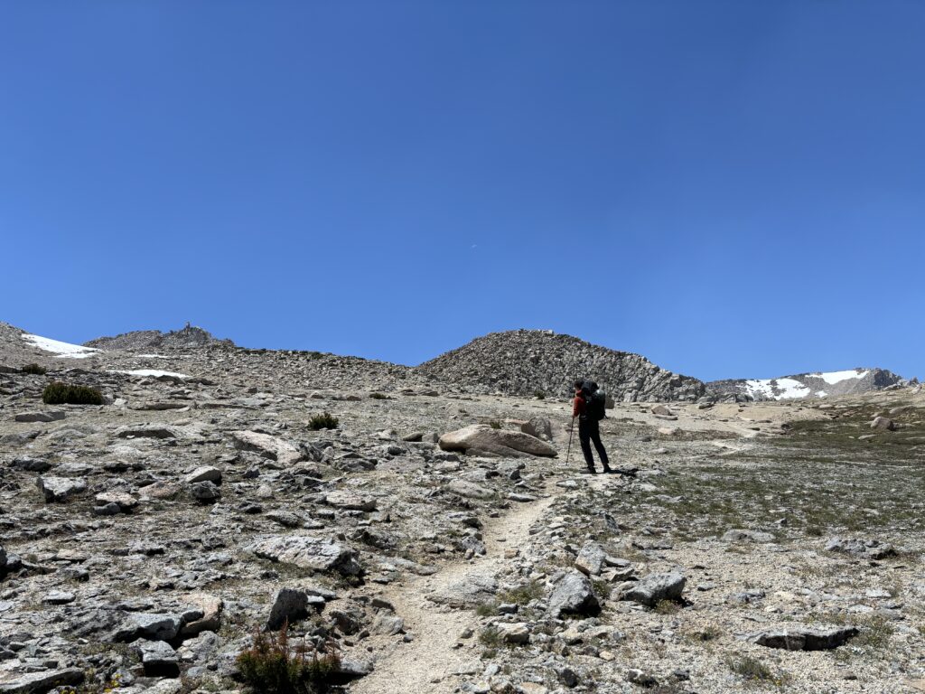
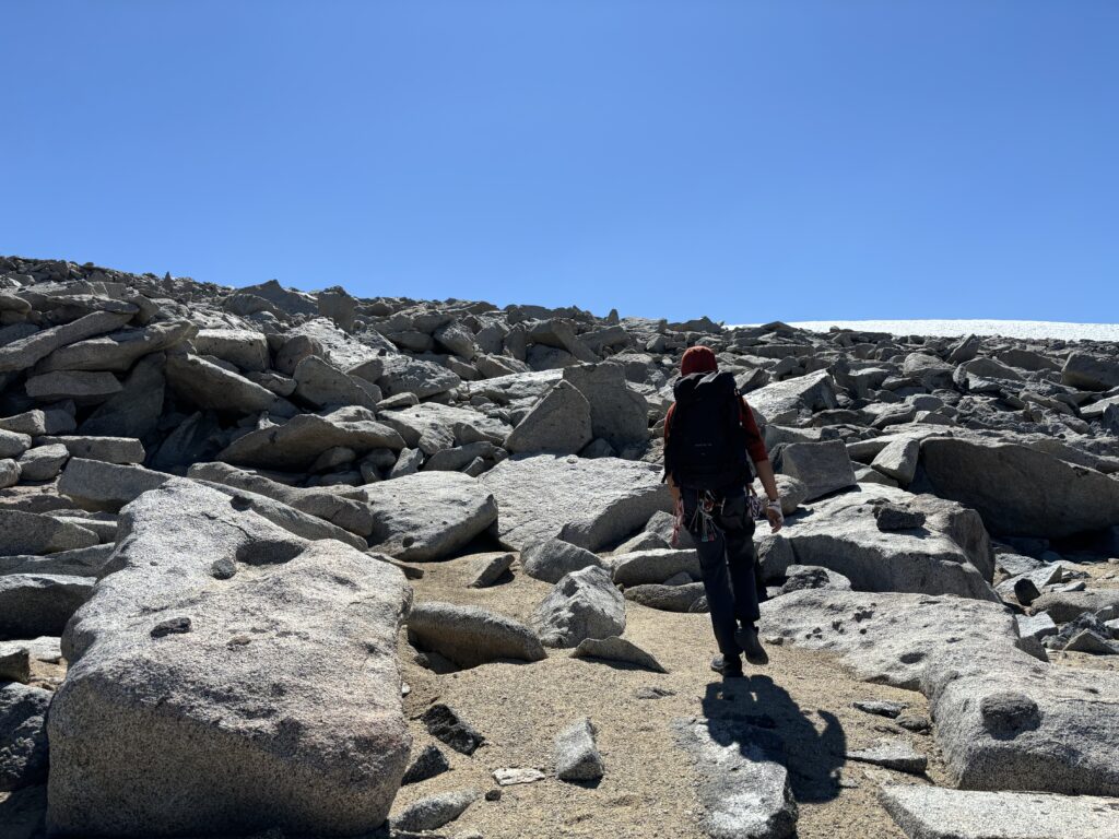
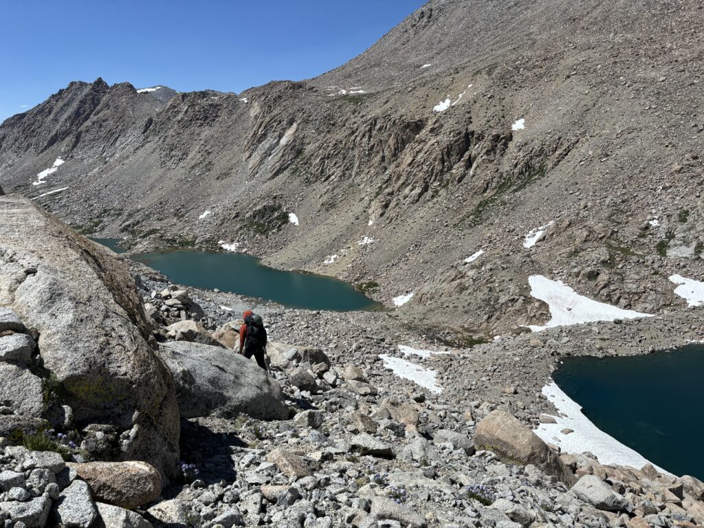
There was a shared sense of relief to be done with the complex ridge line terrain and now we could focus on a relatively tame return on snow. As we walked we discovered the massive sun cups would draw in our feet resulting in an awkward drunk-like stumble through the snow field. Thankfully, the post holing was minimal and we reached continuous rock after a kilometer or so. We rock hopped down to the first lake below Lamarck Col and planted ourselves in for another small break. There was a beautiful grassy patch right in the sun with a small stream to dip our sore legs. It was a slice of paradise to say the least.
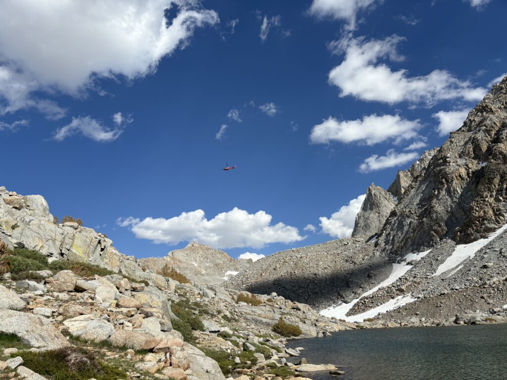
Slowly, we stashed all of our gear in preparation to hike all the way back down the chain of lakes. Unfortunately we still had to grab our first gear stash before returning to exit out of Lamarck col. With the day getting on, we headed for our stash spot and the beauty of the day helped pass the time. Before long we reached our gear and then started the trek back. Our return was delayed mid way when a SAR heli came into scoop up an injured hiker. We were forced to wait about 30 minutes while the helicopter occupied the trail, but I love helis so it was hardly an inconvenience. Shortly after it took off, we returned to our small grassy spot and packed our bags one final time.
Ahead of us was 400m of elevation gain to the col and there’s nothing left to do but put one foot in front of the other. I felt a bit of a second wind on the way up and we managed to finish up in relatively fast time. Now we descended the long ways back to the car, with all of the major elevation gain out of the way. About 3km from the end, the headlamps came out and we walked as quickly as we could to escape the mosquitoes. I’m not actually sure I’ve encountered a more aggressive variation. They were able to land on a moving hand like an F-18 to an aircraft carrier. Props to them.
While the traverse didn’t go exactly as planned, it was the full on adventure we were looking for. The extra elevation, heavy packs and new terrain made for a really physical and awesomely challenging trip. The route itself, was not all that great in my opinion, but maybe I’m just not used to this type of Sierras terrain. Steph Abegg’s report was as detailed as you could hope in this type of terrain, but we way under estimated how much time it would take route finding. She and her partner must have had some exceptional route finding skills or perhaps were familiar with some of the route already. Finally, a special thanks to Brayden for bringing the stoke and a willingness to drive ridiculously far distances for good weather. This trip would not have been the same without him that’s for sure.