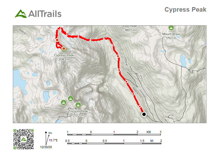
Distance: 15.85km
Elevation: 1,328m
Summit Date: August 28th, 2020
Total Time: 5 hours 57 minutes
Towards the end of August, I was looking for a scramble with a bit of technical challenge, but not too far from home. After doing some research online, I discovered a mountain, called Cypress peak, outside of Squamish. It had made many people’s top scrambling lists in BC and so I figured it would be a great choice. I sent out a message to a few friends to see if anyone would be interested in joining, but no luck. So on August 28th, I set out on a solo trip.
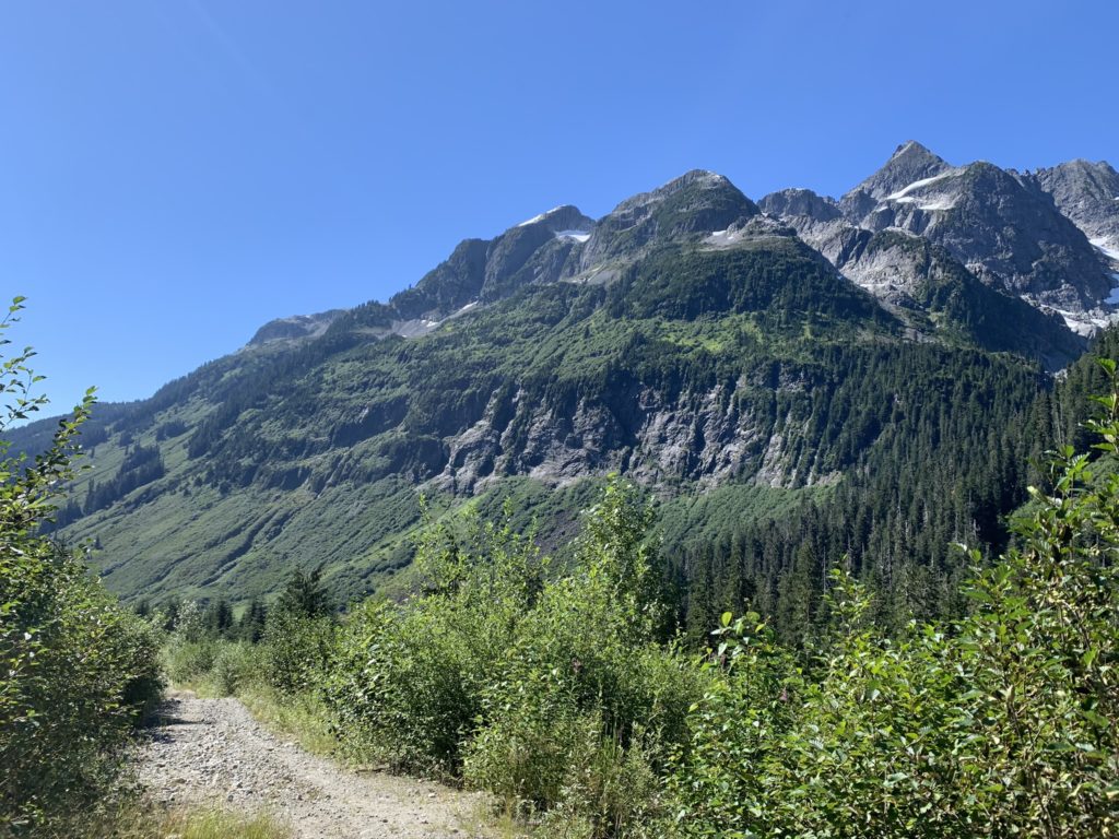
The trail began at the junction of R200 and Roe Creek Forest Service Road. The first ~4km of it followed the deactivated portion of the Roe Creek FSR. Once the road tapered off, there was a small flagged section through the forest. It quickly flowed out onto part of a creek and then continued along an overgrown trail through alpine meadows and brush. During this portion, I was little on edge as it’s definitely bear territory and I was alone. Thankfully the deep bush section was short and I reached the beginning of the first slope upwards in short order.
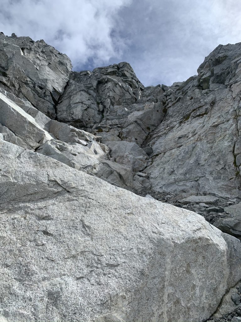
The first rocky slope rises up ~400 meters and is straightforward to climb up with an established path. There was one tricky section where I needed to cross the waterfall/creek as it was loose and steep riverbed type terrain, but nothing daunting, just needed to pick the right line.
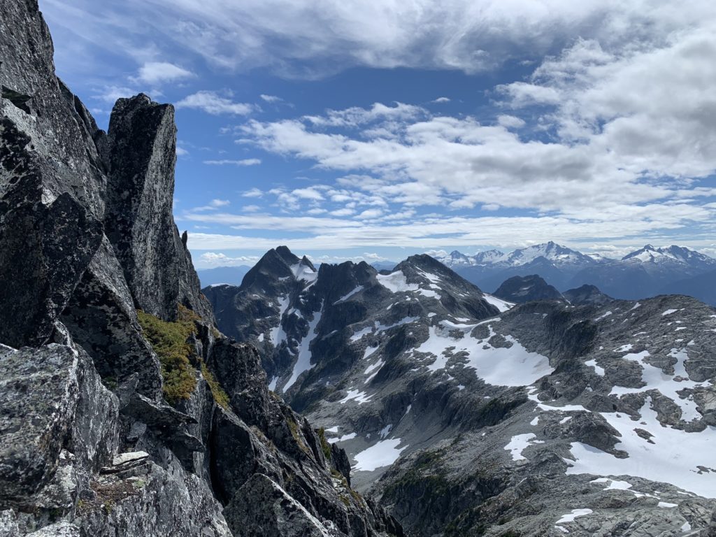
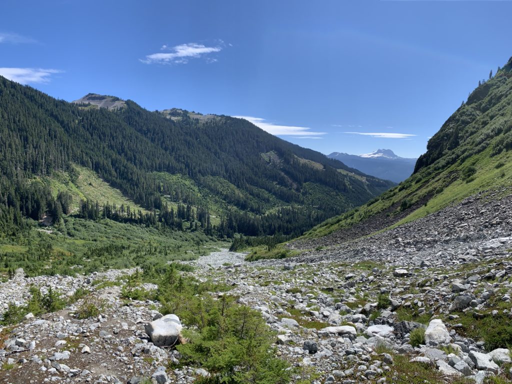
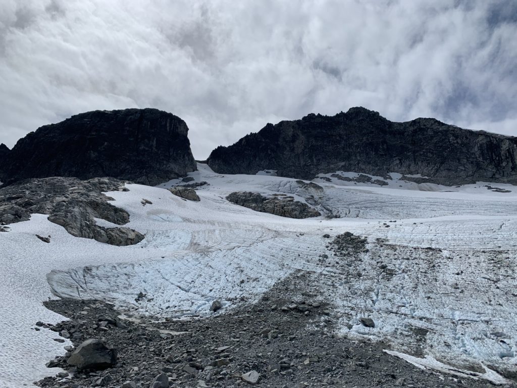
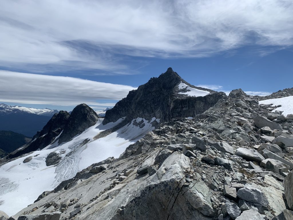
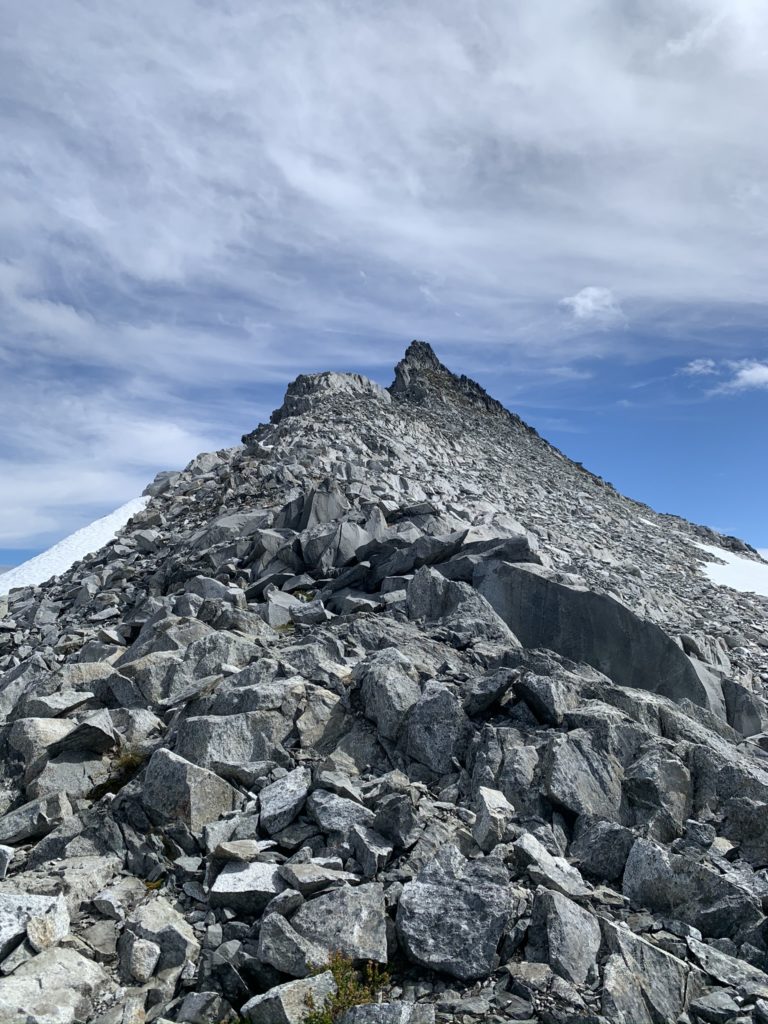
Once I reached the top of the first slope, it flattened out into a rocky meadow with a nice creek and views of the Black Tusk and of course, Cypress Peak summit. I continued across the meadow and then reached another ~150 meter talus slope before topping out at the foot of a small glacier that hangs at the base of Cypress Peak.
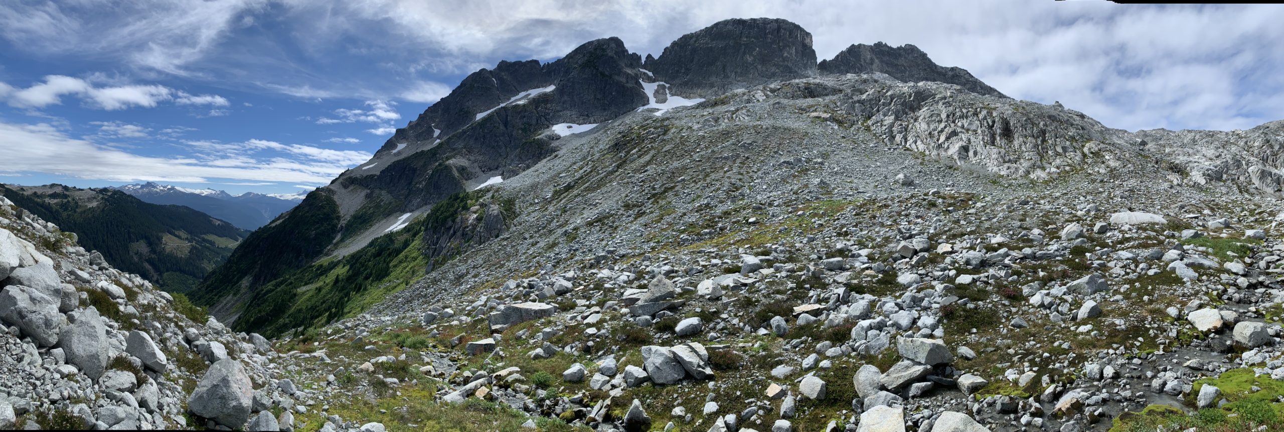
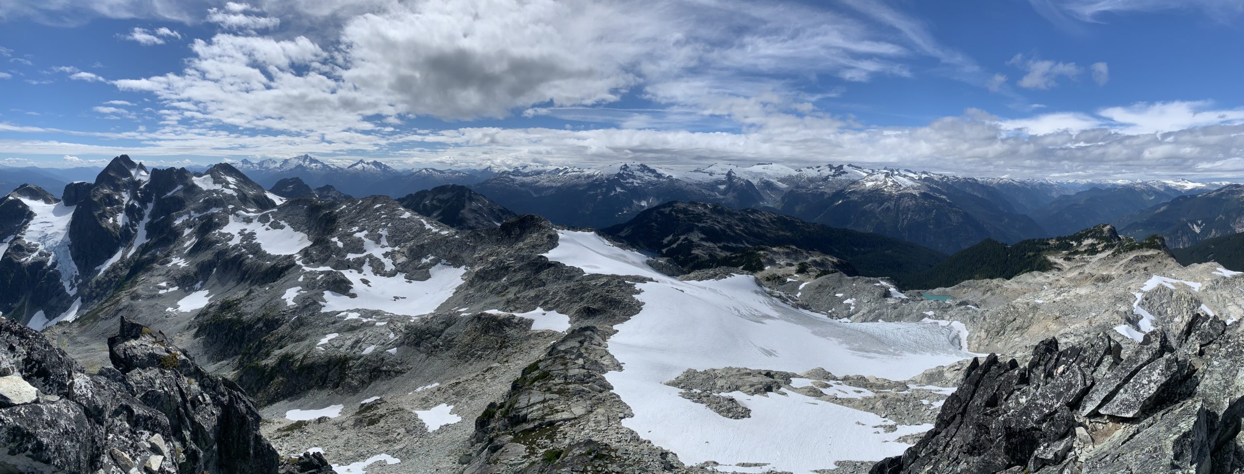
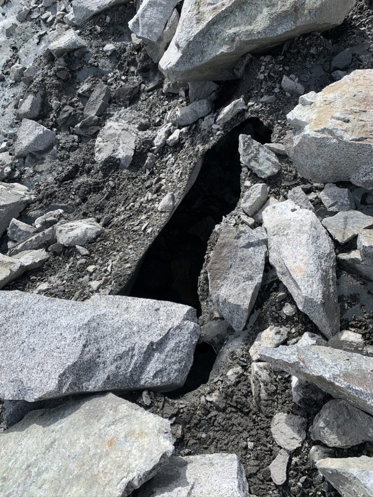
I recommend sticking to the right of the glacier and avoiding direct travel on it as there were sizeable crevasses and tunnels under the glacier. There are cairns placed at regular intervals, so keep your eye out for them. Beyond the glacier there’s not much to say besides more talus slopes.
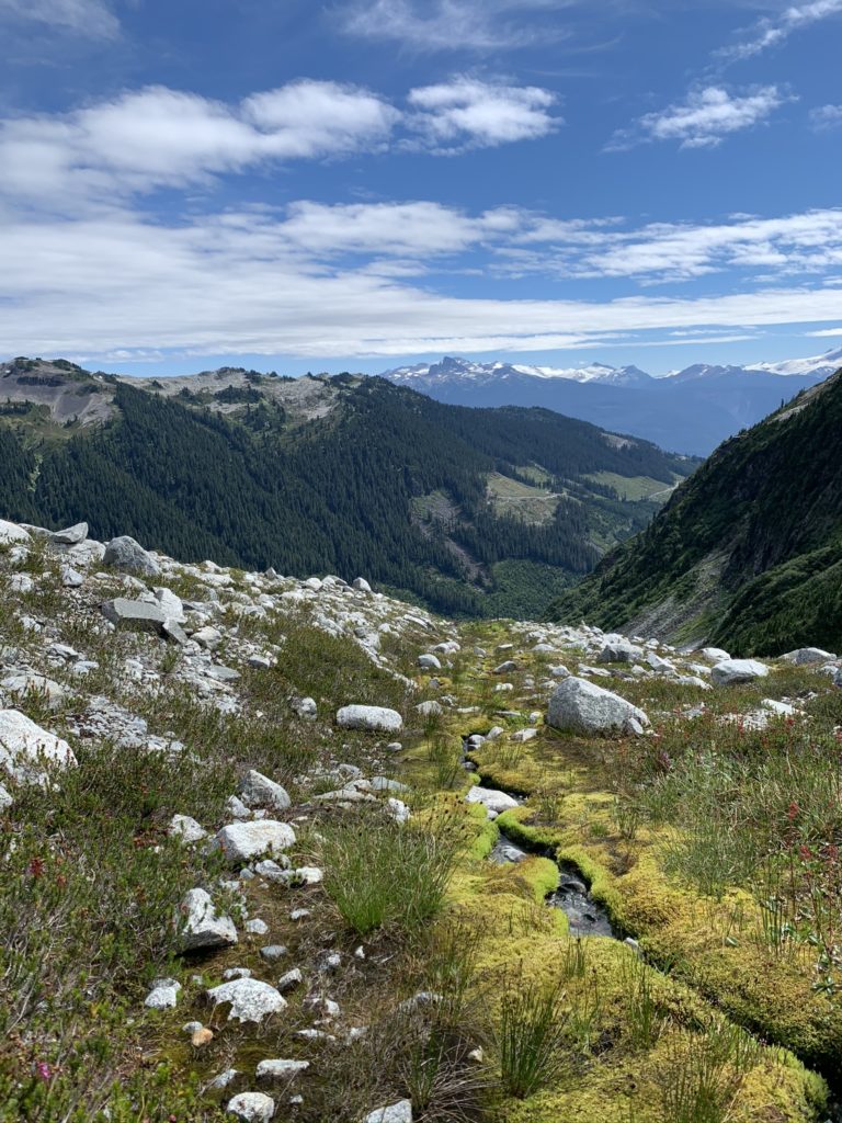
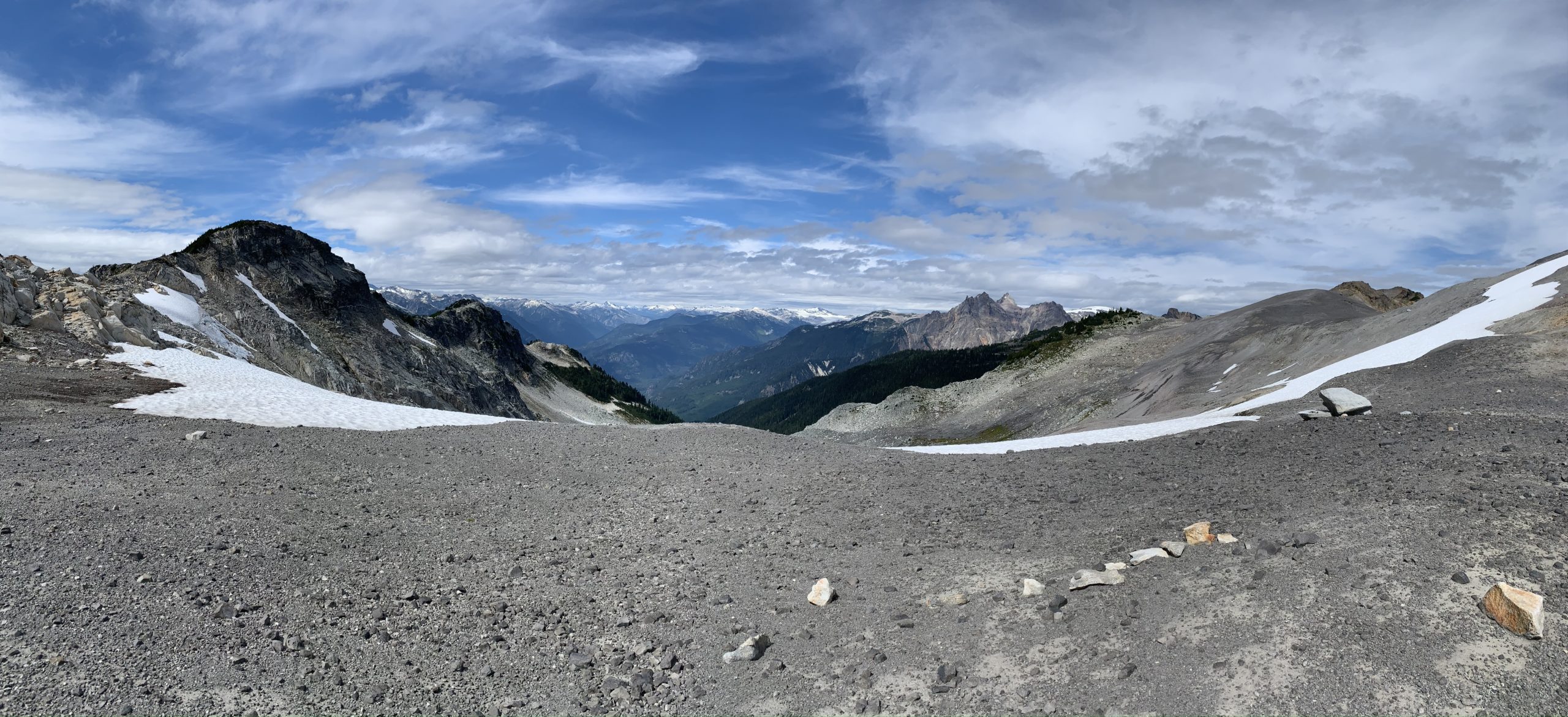
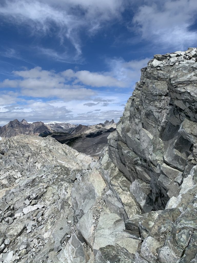
At around 1850 meters, I reached the final ridge line to Cypress Peak and continued to follow the cairns towards the summit. From this vantage there were superb views of Garabaldi, Mt. Cayley, Brandywine Mountain, Mt. Brew, Ice Cap peak and countless others.
Somewhere around 1920 meters I hit a cliff band that I could choose to scramble up or could hike down to the glacier on the west flank of Cypress Peak. The cliff had solid holds, but does have a fair bit of exposure. If you prefer a less exposed route, hiking down the glacier and following the cliff band around until it mellows out is my recommendation. I chose to climb up the cliff on the route up and take the less exposed route for the down climb.
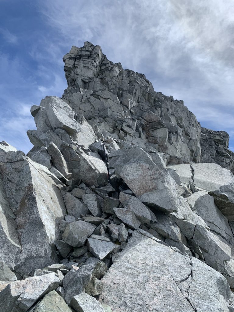
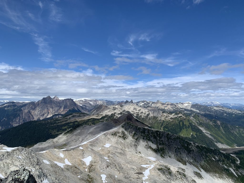
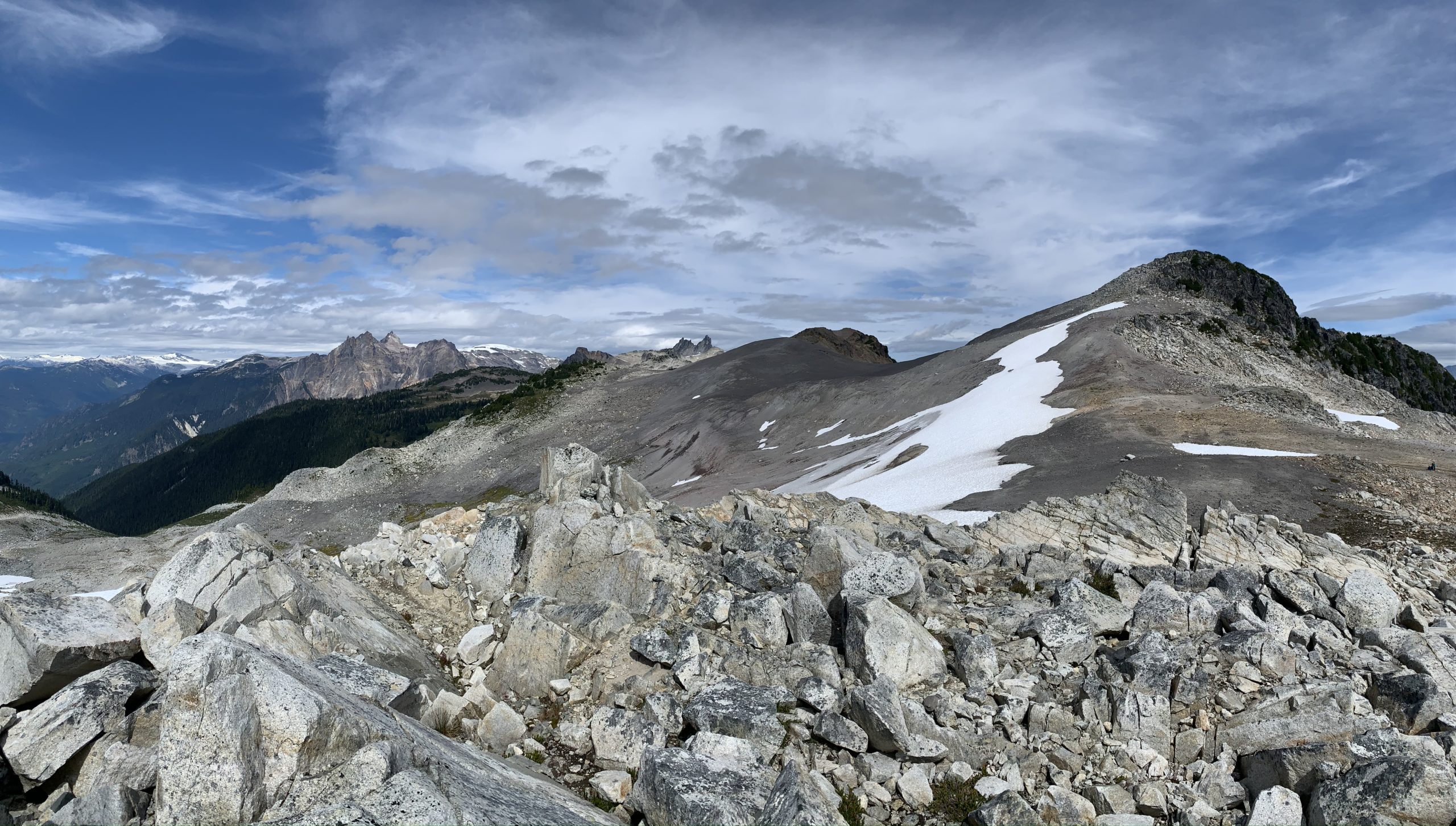
After the cliff band there was a moderately steep talus slope, but the hardest part was out of the way. Once I reached the summit, I found there was enough room for a small group and superb views of Tricouni Peak, the Tantalus range and more. The route down was straight forward, albeit a bit slow with all of the loose rock.
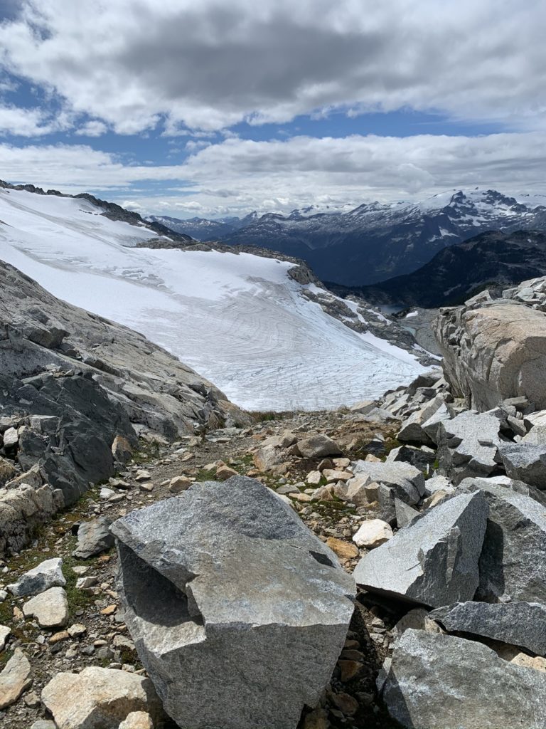
From the summit I headed straight east towards the glacier and found more gentle terrain down. I took the glacier back up to where the cliff band started and the followed my old line all the way back down to the car.