Elevation Gain: 1,358m
Distance: 19.63km
Total Time: 7 hours 56 minutes
Date: August 27th, 2023
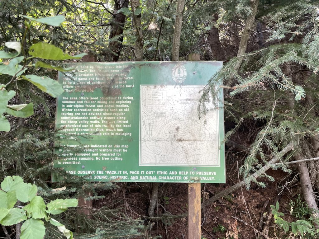
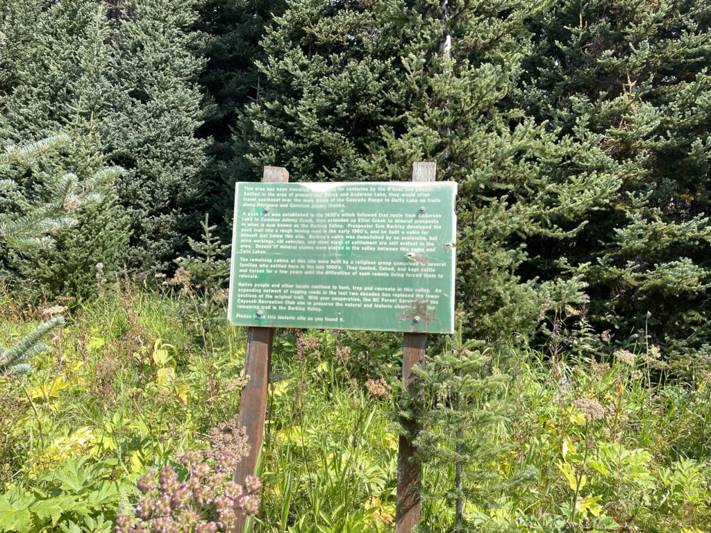
Andrea had been talking to me about hiking into a pristine alpine area known as the “Twin Lakes” for some time now. They’re located one valley to the west of Duffey Lake up the Haylmore Creek FSR. The whole area has some cool history with a long presence from the Nequatque people who apparently travelled this valley to reach neighbouring areas. A pack trail was created in the 1930’s and then in the 1960’s a miner by the name of Tom Barkley built a mining access road on top of the pack trail to access more mining claims. In a later part of the 60’s a religious group also settled in, but did not last long due to the challenges in living remotely. Ultimately, it seems the valley’s inhabitants all moved on and now in the year 2023 what remains is an ATV track and foot trail that follow the old mining road up to Twin Lakes.
Abutting onto the lakes are two 2400m+ peaks, one on each side. To the east is “Elliot Peak” and to the West “Crystal Peak”. I’m not sure of the origin of these names, but likely it’s a creation of Bivouac.com. In Matt Gunn’s book they’re labelled as Twin Lakes Southeast Peak and Twin Lakes Northwest Peak . Both peaks are about 100m prominence though, so it’s only fitting they should receive a name.
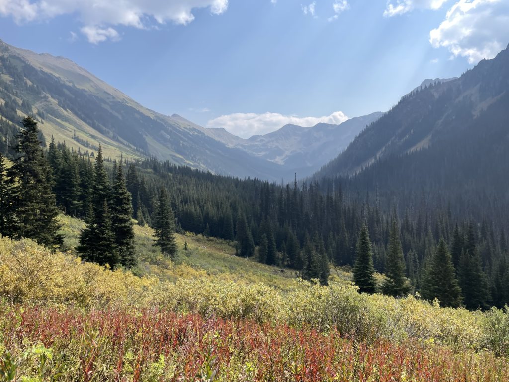
Now despite, this area being on Andrea’s list for so long we only found the opportunity to do them in the last weekend of August. A combination of fire smoke and work obligations pushed us towards the Cayoosh range in search of a shorter outing. Twin Lakes and Elliot Peak were a perfect match and the decision was made! We calculated around 20km and 1200m elevation gain, so a pretty easy day trip and that meant a leisurely start as well.
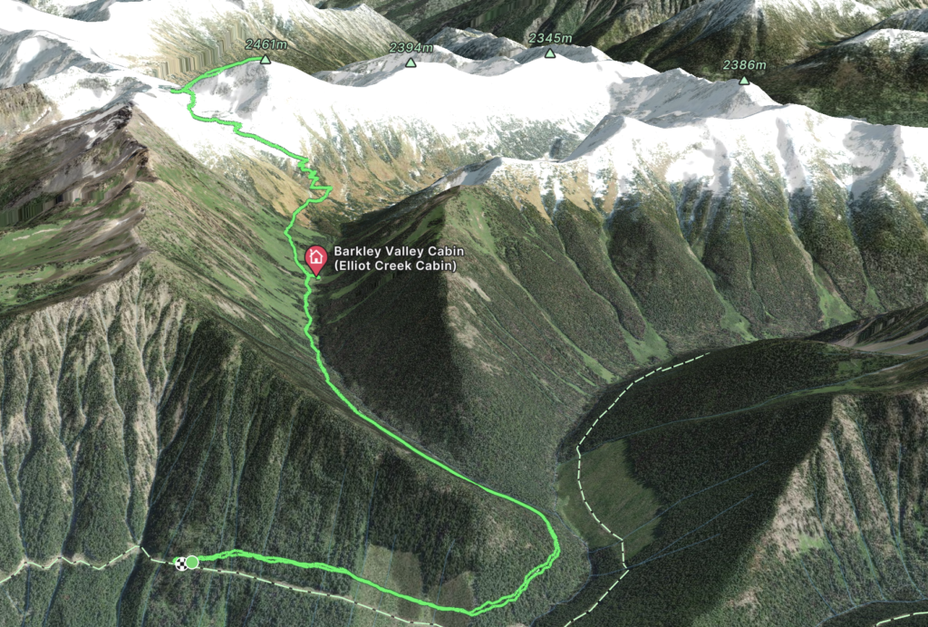
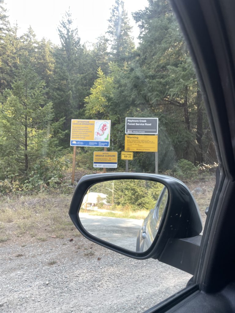
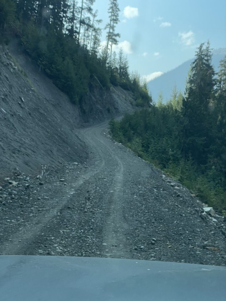
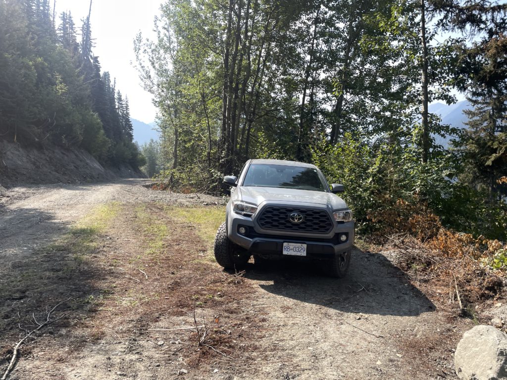
I drove us out towards D’arcy on the Saturday and we were heading down the Haylmore Creek FSR by 10:30am. A recent road report on Bivouac had stated that previously condemned bridge was now back up and running and we noted the new guard rails as well. The road had some recent grading work done and overall access was great. We located the Barkley Valley trail some 15km down the road and found a good pull out to park.
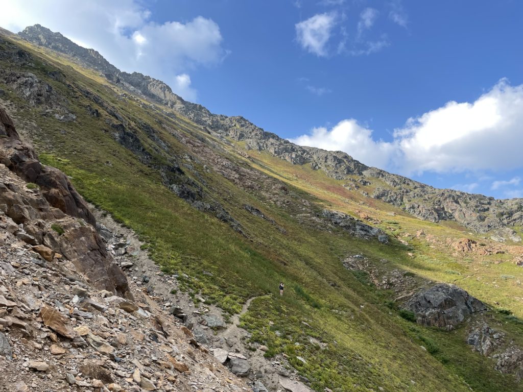
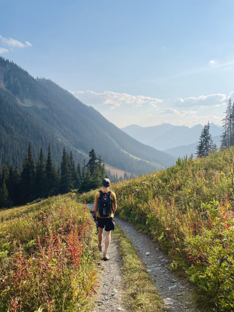
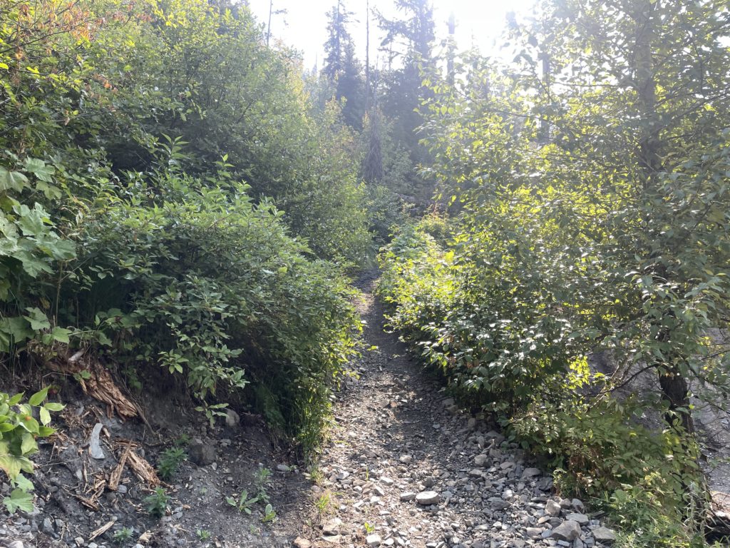
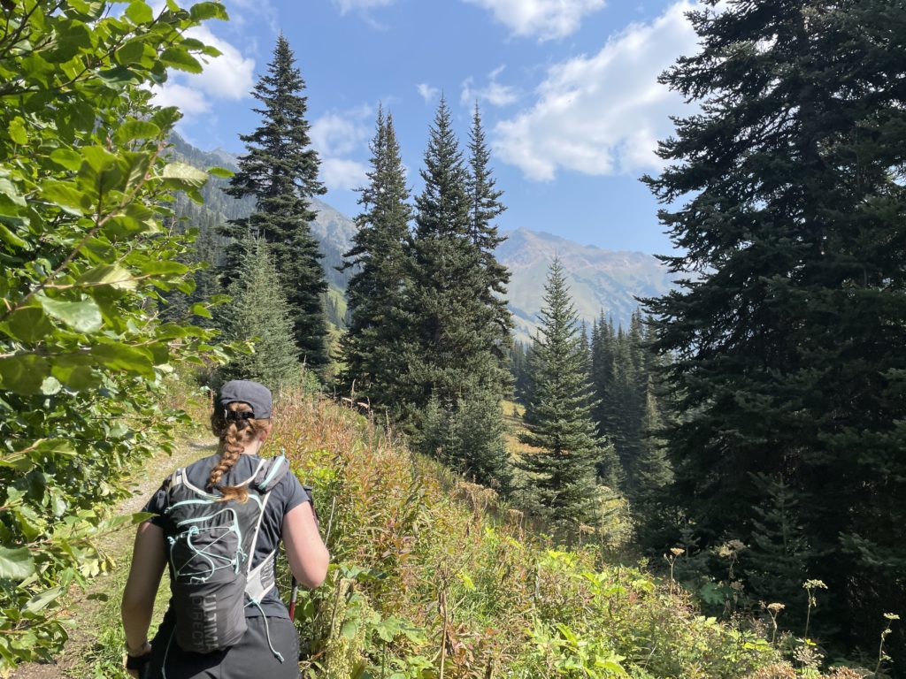
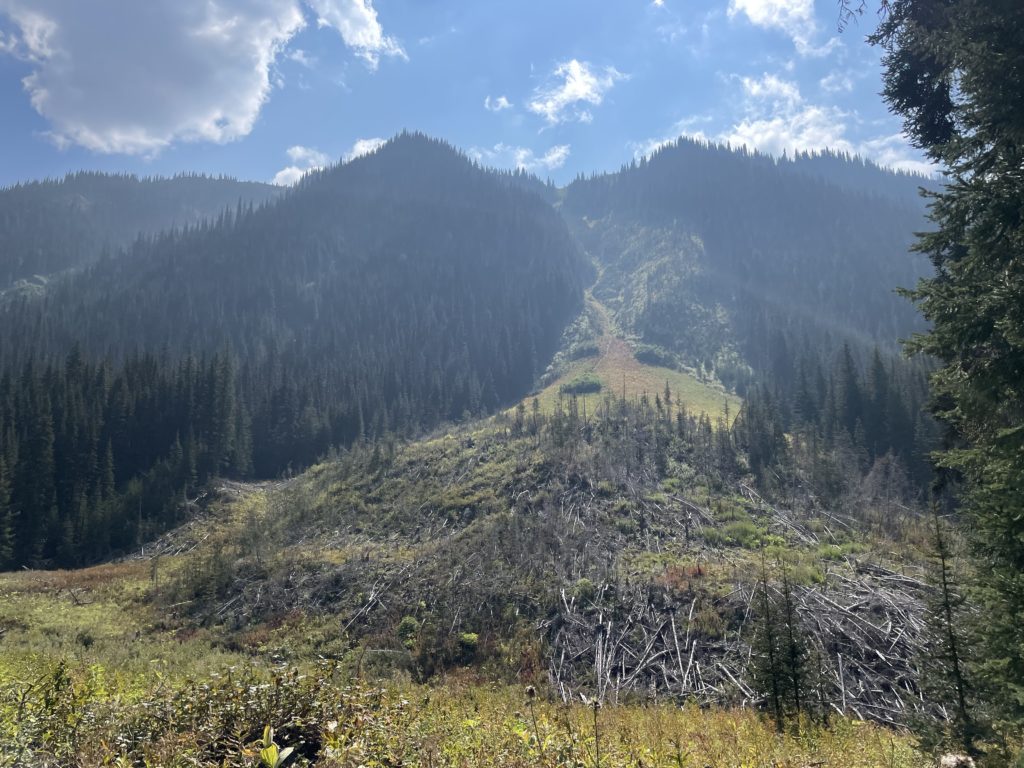
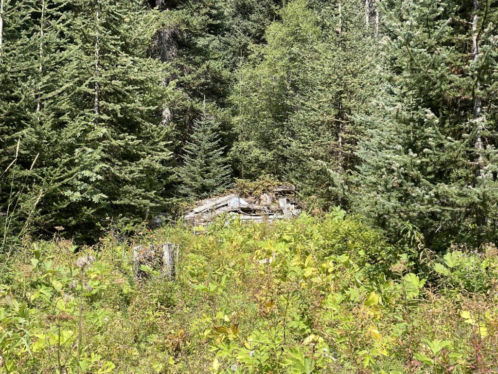
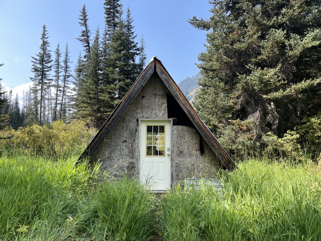
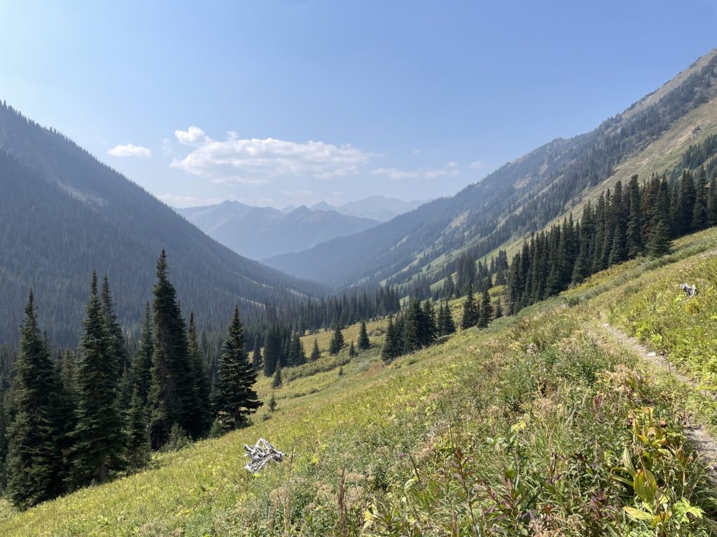
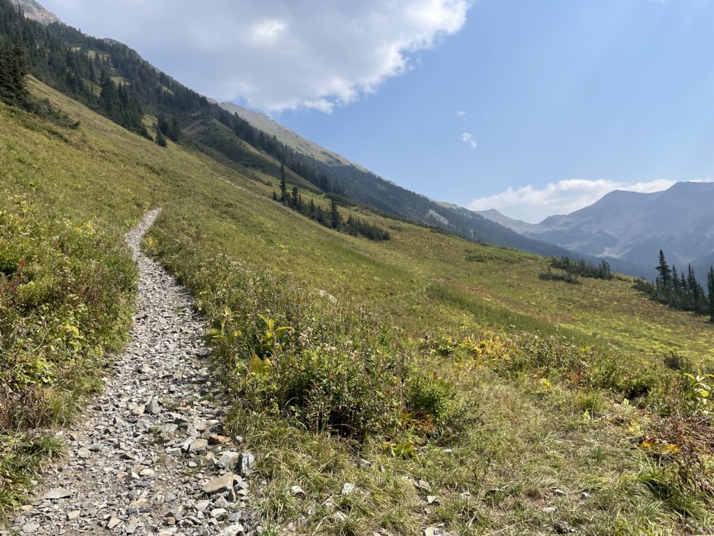
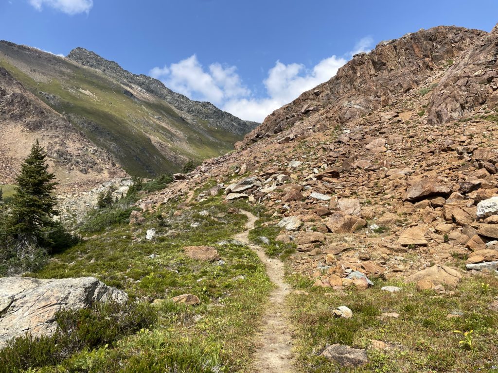
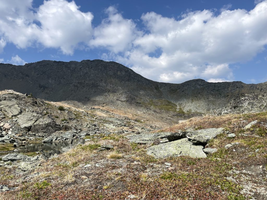
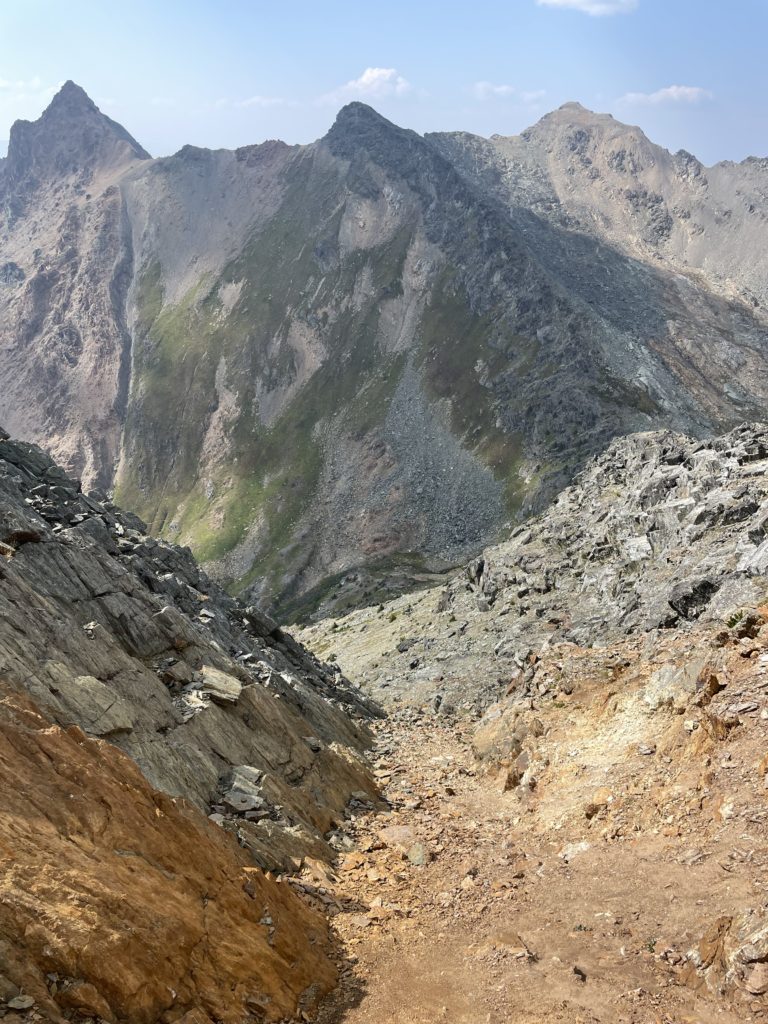
The first 100m of the trail was a steep grunt and then the grade levelled off with a very pleasant ATV track to follow. It looked like all recent deadfall had been cleared and there was lots of recent activity on the track. We followed this road for about 5km before reaching the campground and site of a number of historical cabins. Here we paused for some food and to check out the cabins before moving on. After another 2km the trail forked off the lower ATV track and zig-zagged up the valley between Crystal Peak and Elliot Peak. We gained elevation quickly going from 1800m to 2100m to the base of the first lake.
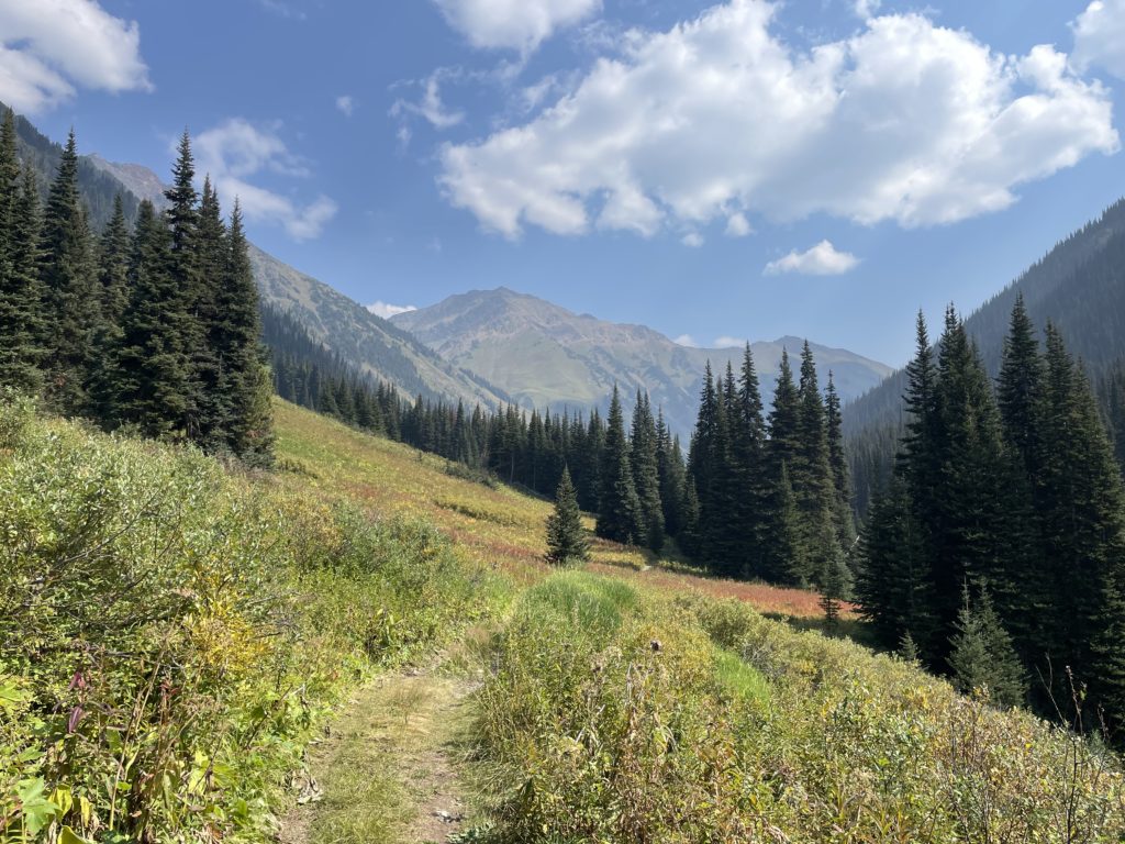
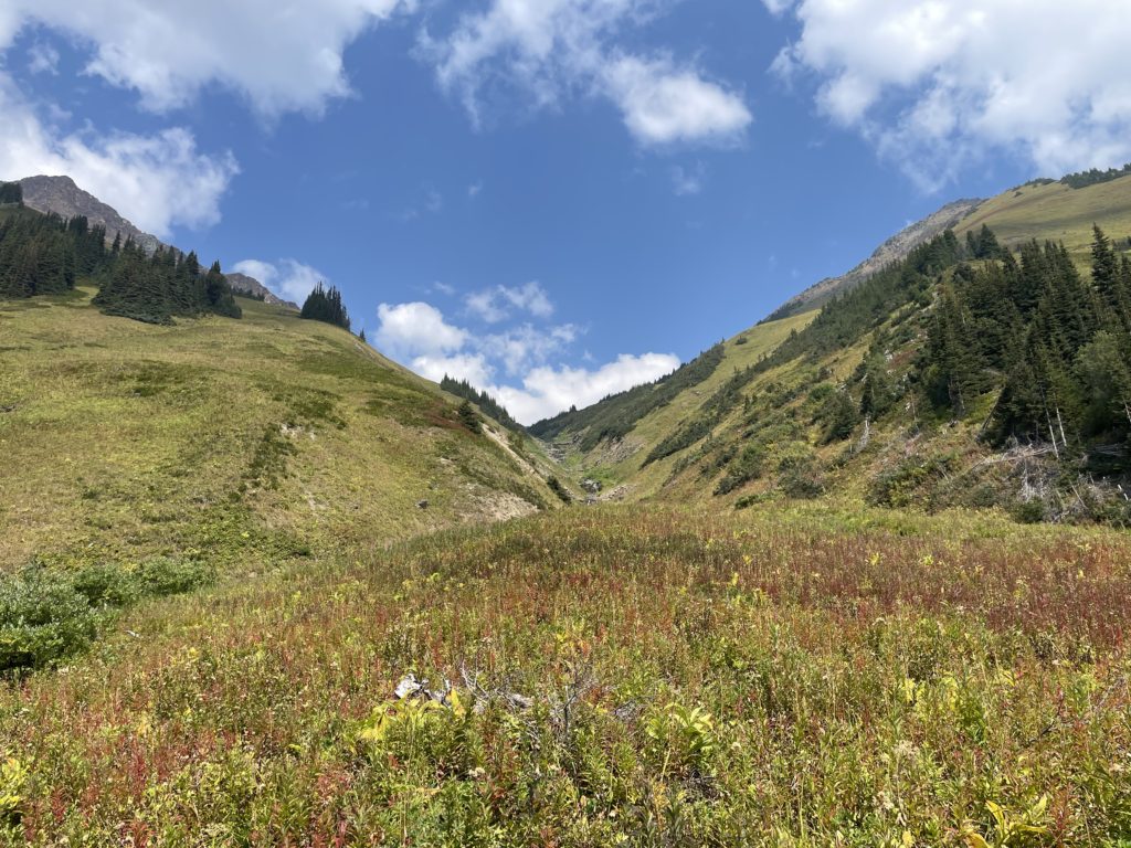
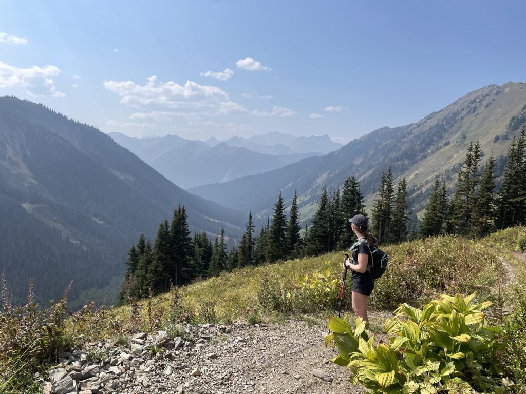
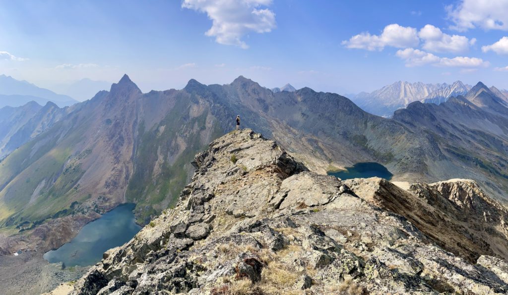
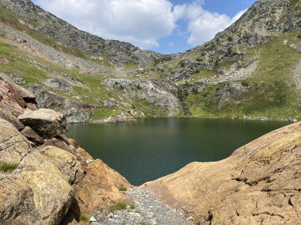
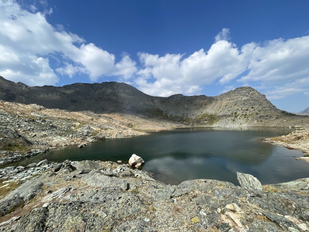
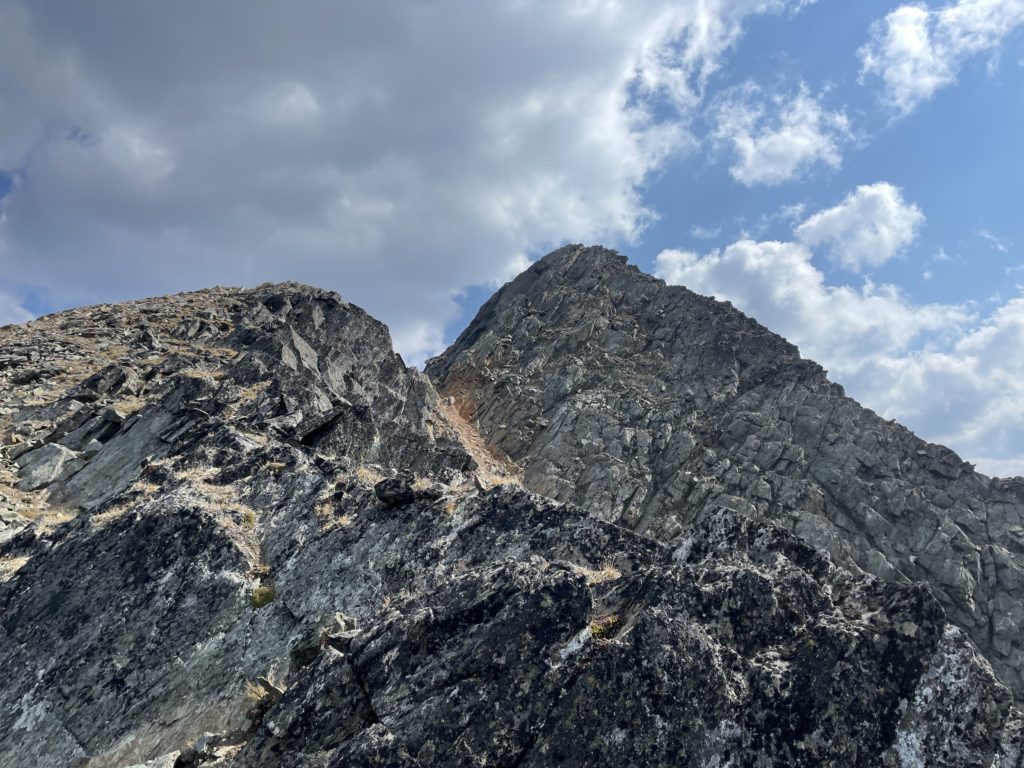
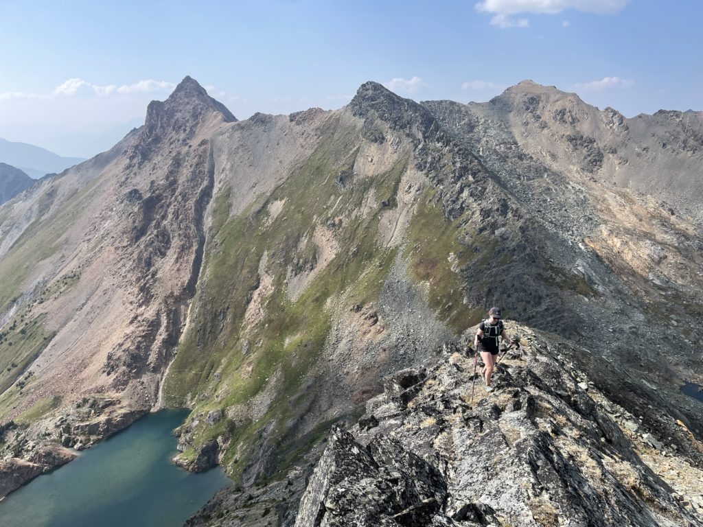
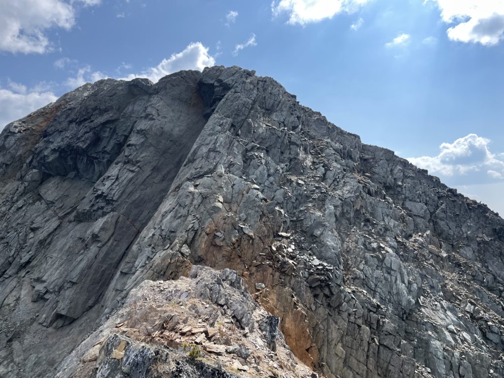
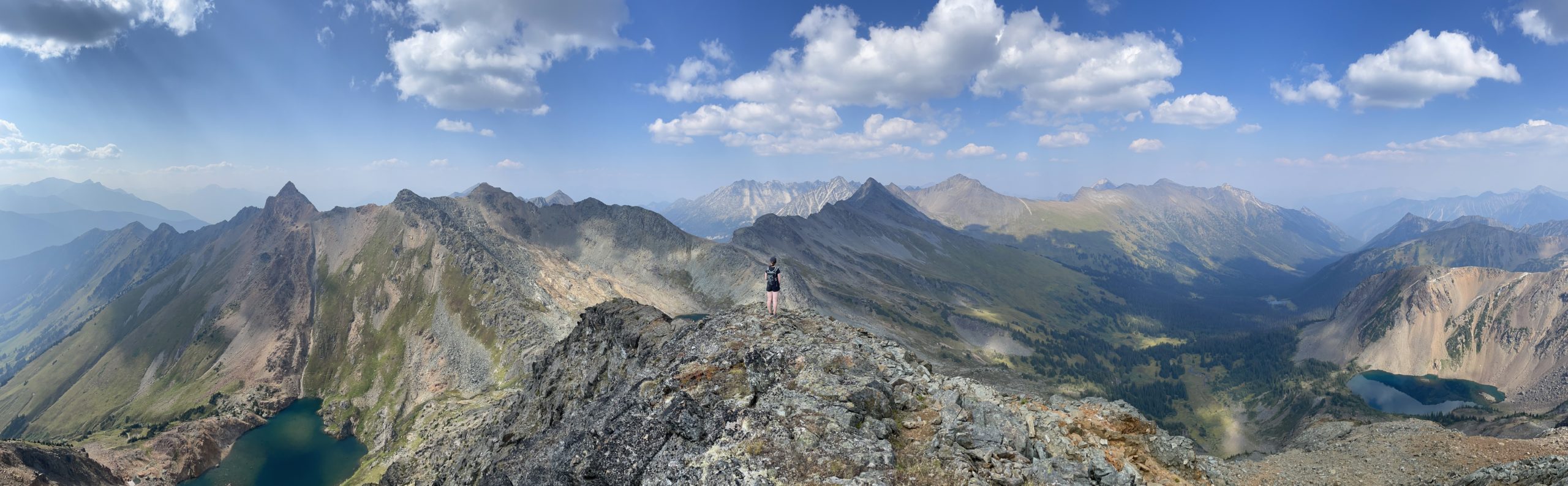
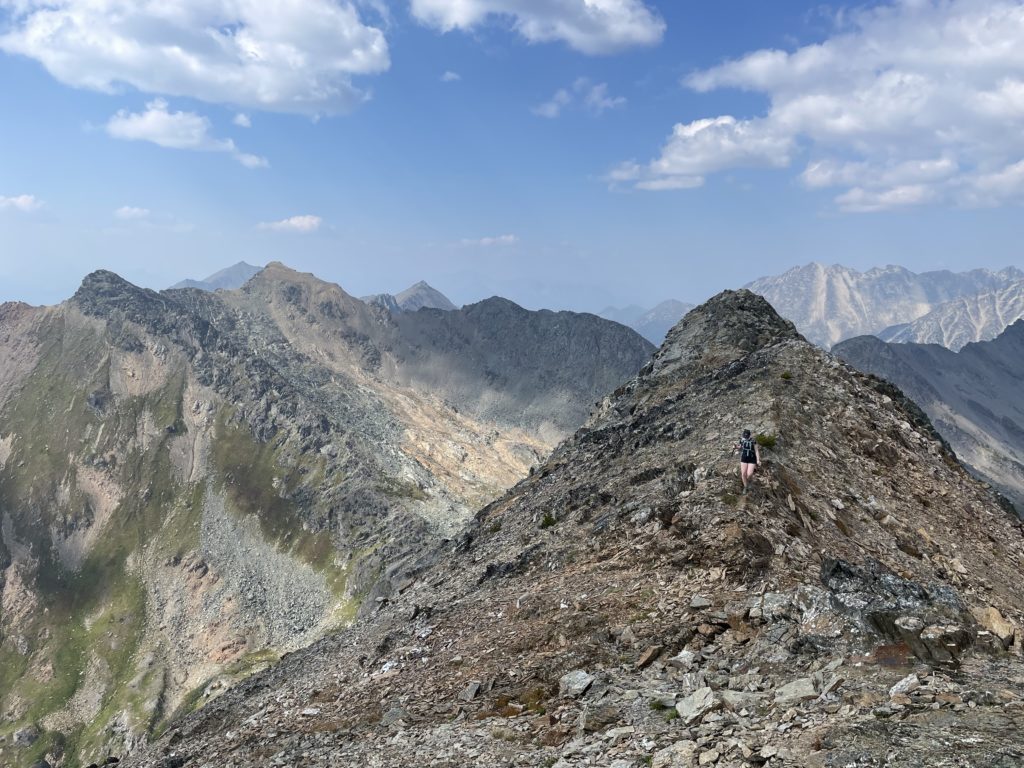
As we reached the shores of the first lake the rocky outcroppings began to appear; comprised of a gritty rust coloured form that was exceptionally grippy. Higher above verdant green fields ran straight up to the base of steep rocky bluffs where I’d normally expect to see barren scree fields. Once we arrived at the lake shores we laid eyes on a picturesque blue pool of water neatly framed by Elliot Peak rising a full 200m above us. It’s no wonder this area is popular!
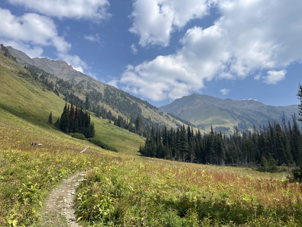
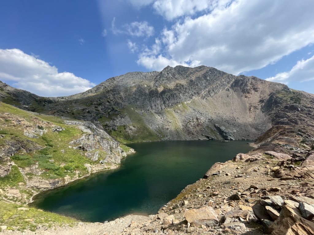
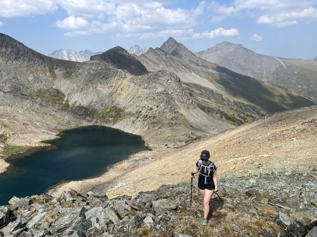
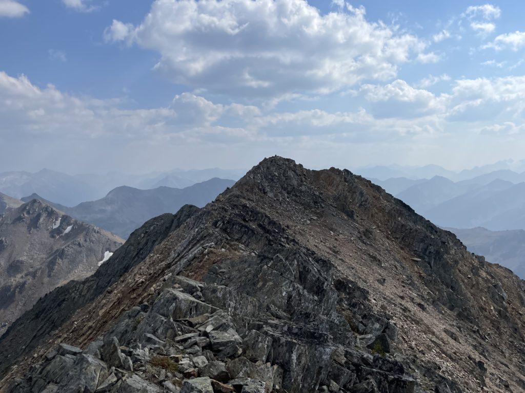
From the first lake we followed an obvious path around the west side and then up a short slope to the second lake. Here we had a very different set of a views. A much more glaciated alpine type of atmosphere. Now came decision time! Which peak to go for first? Elliot Peak was 7m shorter than Crystal but had more prominence and based on what we saw likely better views as it was much more isolated. So Elliot Peak it was.
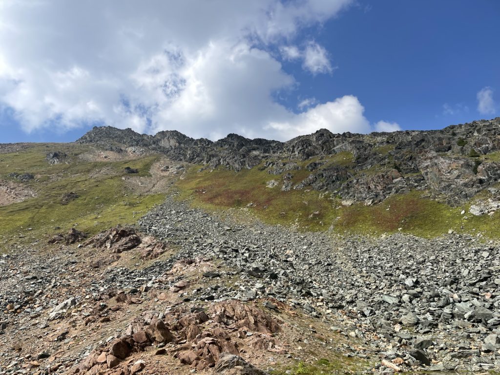
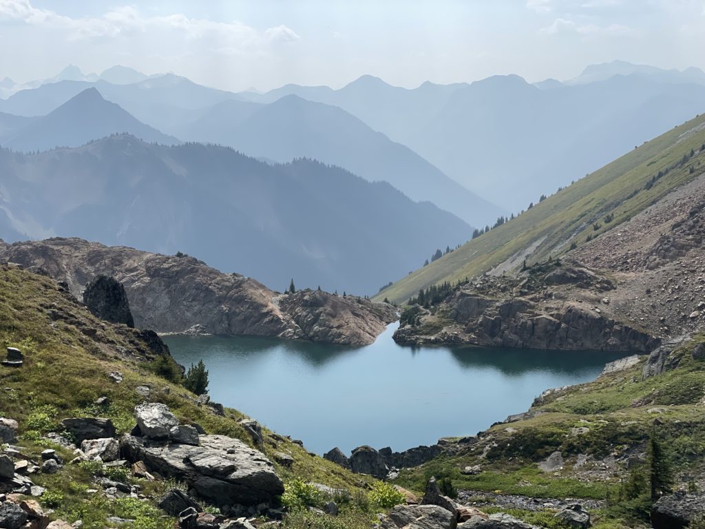
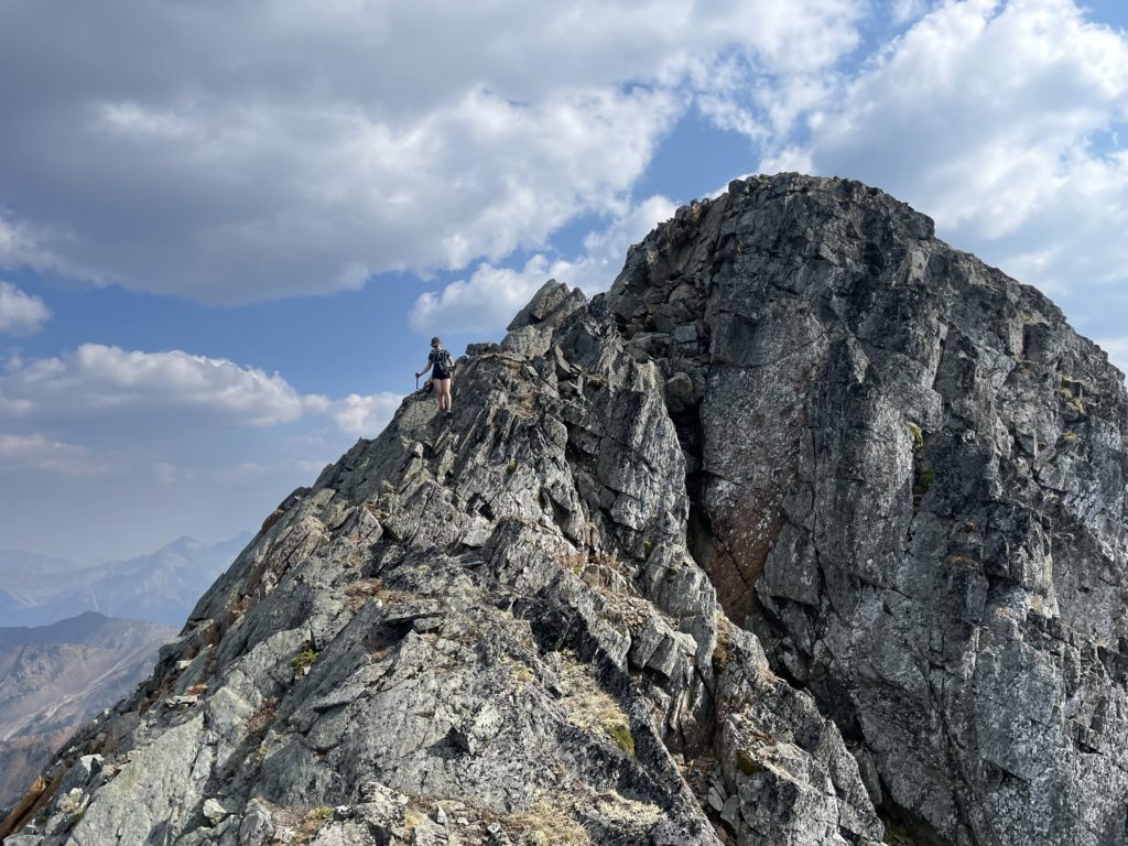
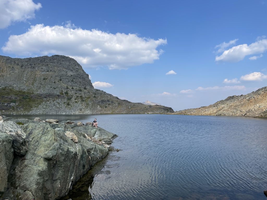
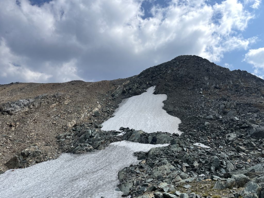
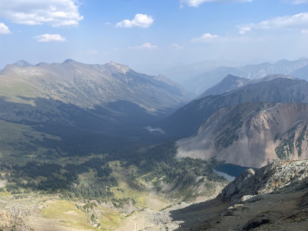
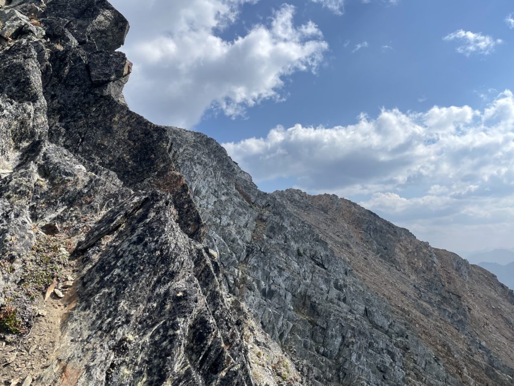
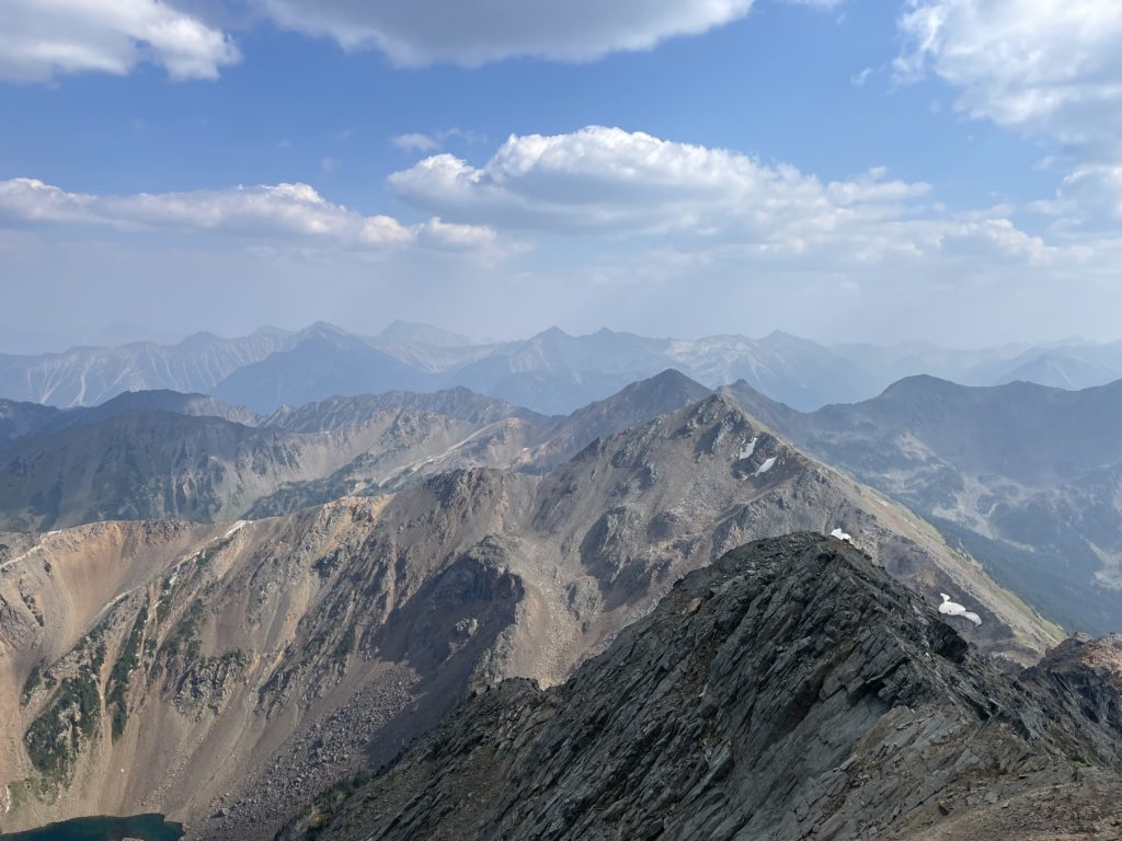
Andrea and I hiked up the tame scree/talus slopes trending towards the ridge line where we scrambled up to 2400m. Here a short notch with a bit of class 2 scrambling was required to regain the ridge above and then it was a short walk to the summit. As anticipated we had unfettered 360 views of the Cayoosh Range! The smoke was thickest to the north, but looking south we could see the majority of the summits you’d find on a clear day; if only a bit more obscured. We hung out at the top admiring the views and voting on which lake looked the most swimmable. The temperature on the upper lake was surprisingly the warmer of the two, so we selected that one as our must-swim spot.
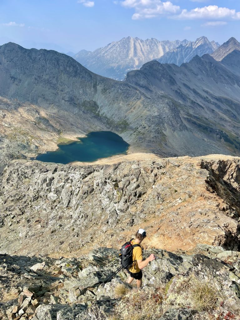
It was about 4PM now and Andrea rightly noted that it may be getting a bit late to add on a second peak if we wanted to be home early. We both were planning a big day of climbing the following morning so we didn’t want to squander the experience arriving already fatigued. With that, I made the call to skip Crystal Peak and save it for another time. In beautiful areas like this I really don’t mind having an excuse to come back. After a leisurely descent down to the lake we stopped for a short, but frigid swim and then let the sun warm us up in between cloud breaks. Once we were dry enough, we descended back down to the second lake and then followed the ATV track back down into the valley. From the valley trail, it took us about an hour and a half to return to the truck with a fresh set of spider webs to keep us occupied on the walk back.