
Elevation Gain: 860m
Distance: 7.84km
Total Time: 9 hours 49 minutes
Date: August 4th, 2024
Just a few days before a long planned BCMC camp in the Pantheons Range, we heard some dreaded, but somewhat expected news… all heli flights diverted to fires. This is not my first experience with fires cancelling helicopter flights, but it was surely one of the most disappointing ones. Myself and many others at the BCMC had set aside 10 days to explore the Pantheons, with the bulk of the group being based out of Nirvana Pass. Meanwhile, Andrea, Alessandro, Nicole and myself would head for the south western terminus of the range to try for some unclimbed peaks. Glenn Woodsworth, the current president of the BCMC and legendary explorer of the coast mountains, had revealed a set of possibly unclimbed peaks in the area and it had all four of us excited to take a shot at a truly unexplored corner of the mountains. So it was a big hit when the whole camp had to be cancelled and it left Andrea and I scrambling for alternatives. To add salt to the wounds, the next weeks forecast was calling for rain anywhere it mattered in BC. That’s when we made the call to try and postpone our 2 weeks off by an additional week. By some luck, both of our work places offered the flexibility and we were given some breathing room to re-work our trip.
I started researching some ideas in the Kitimat range, but in the week leading up to our re-scheduled departure time, we got wind that White Saddle Air was taking small parties again. I hastily wrote up an email and got tentative confirmation that we could fly in on the Sunday. Now to see if we could re-organize a smaller BCMC party to head out. I posted a trip, but unfortunately no luck on such short notice. No matter, Andrea and I were committed and I was more excited than ever to get into the area. So on Saturday morning, we heard official confirmation that White Saddle could take us and made the 9-ish hour drive out to Bluff Lake. We caught White Saddle Mountain in the evening sunset glow and knew from that point on we were in for an amazing trip.
Early on Sunday morning, we got ready as promptly as we could and set our bags beside the heli. Our supposed take off time was 7:30am, but now 20 minutes later there was still no sign of Mike. I was getting anxious that we might not be flying or that I had messed up some part of the booking. To my relief I heard the rumble of a side by side not long after and a few seconds later Mike swung around to the admin building and greeted us with a friendly hello. The anxiety washed away and it became apparent that this whole operation was casual and friendly, not like the usual crap at the airports. He did a few administrative tasks with us and then we were on our way, flying a hundred feet over steep ridge lines and glaciers. In the distance I could see the Culbert Crag group we were headed for. I had looked at it on the map a hundred times, but there’s always something special about seeing the topographic lines manifest into the steep rock, ice and pointed peaks of your imagination. Mike set us down at the col between the Culbert Crag group and the Nemesis group and then flew out of sight.
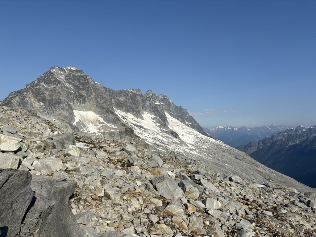
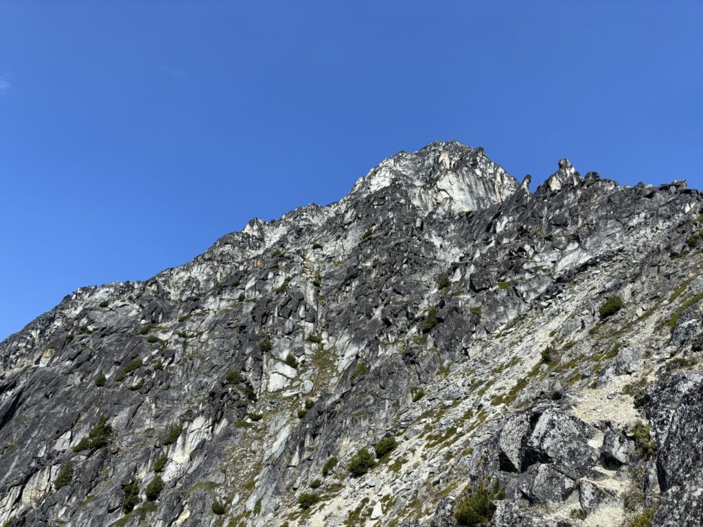
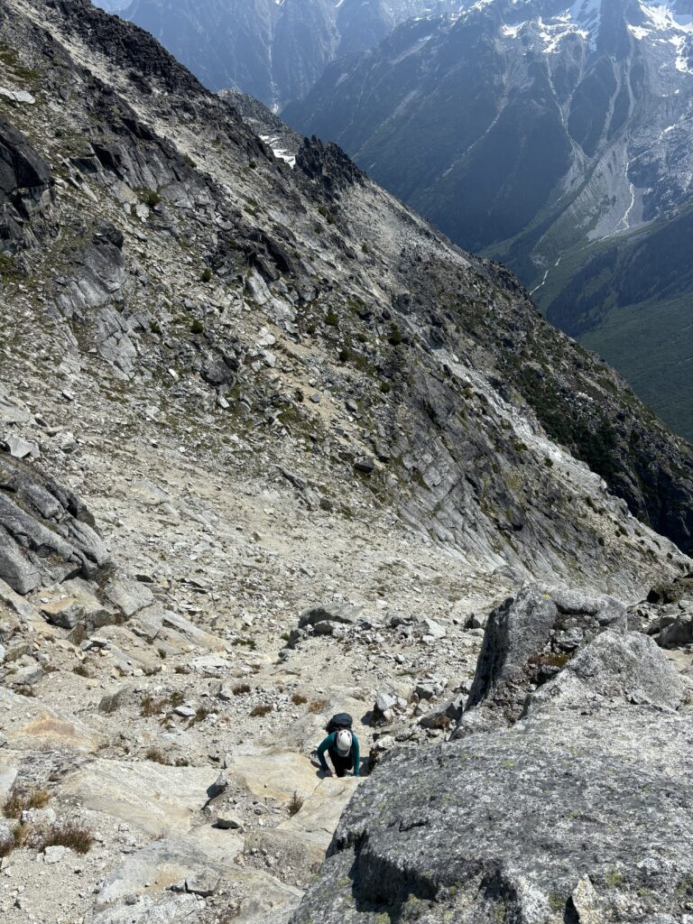
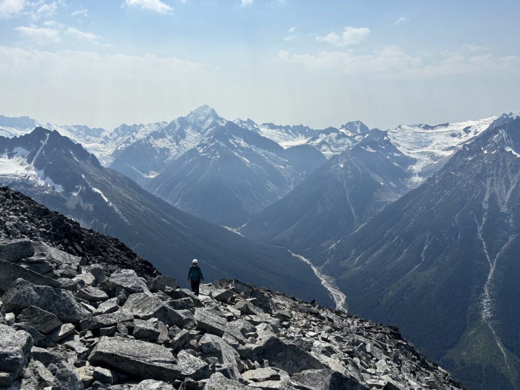
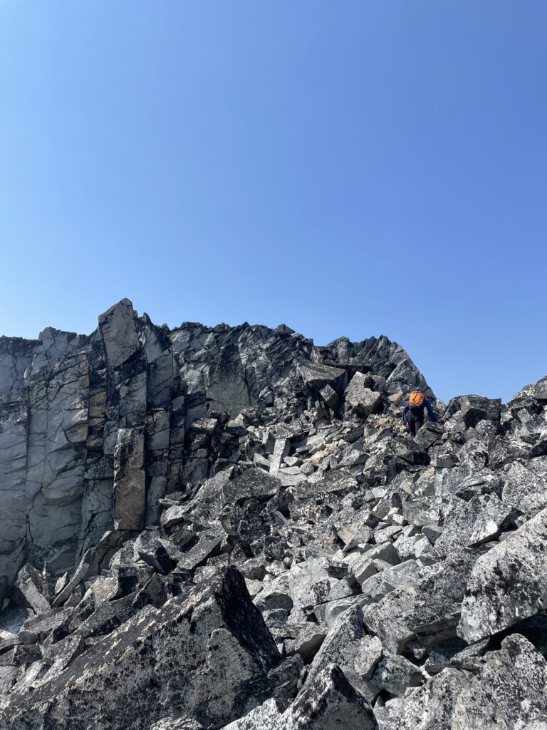
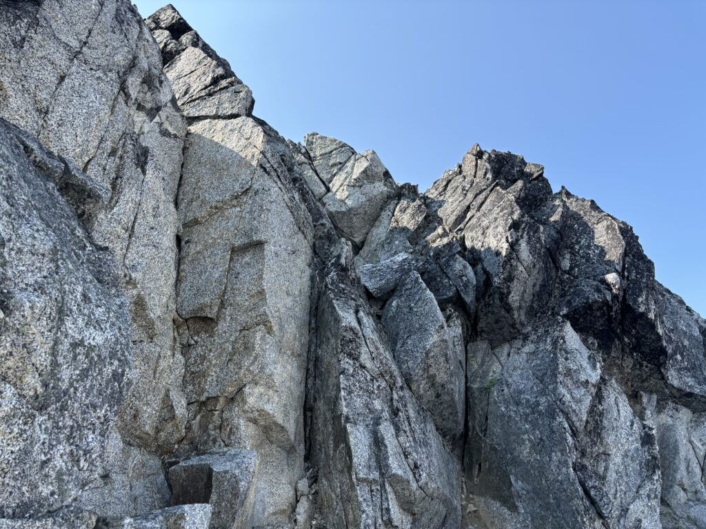
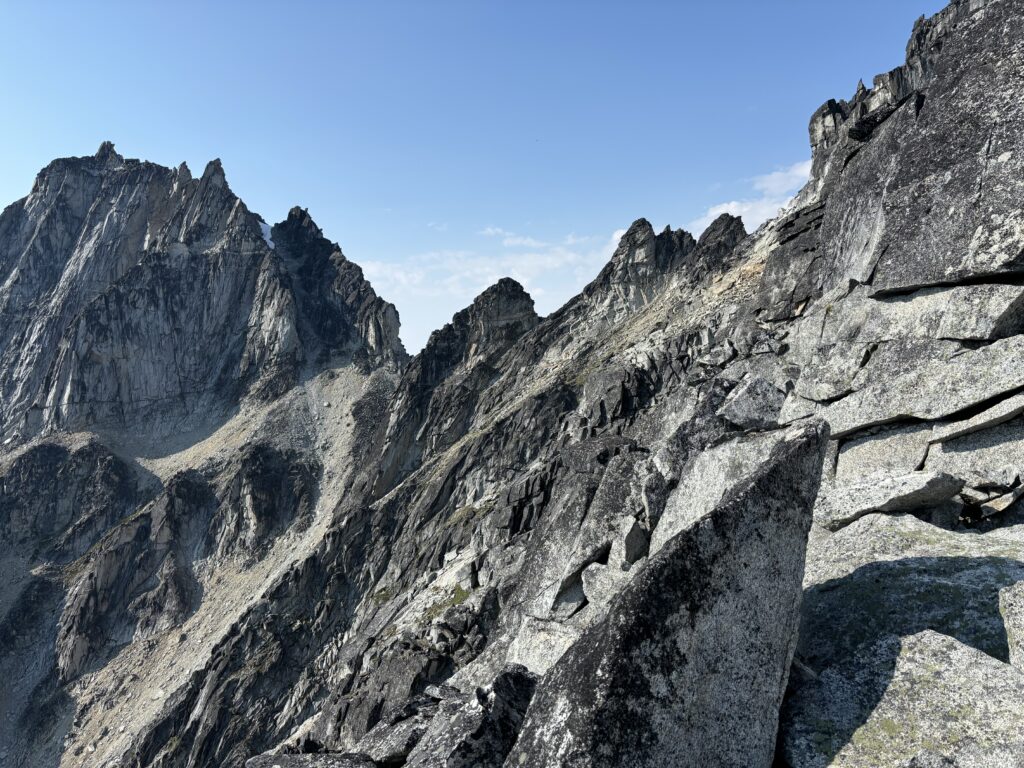
We were here at last! Our first goal of the day was an exploratory mission up the unnamed peak that marked the south eastern commencement of the Culbert Crag group. Andrea and I quickly set up camp and then packed our bags and headed down the ridge line. To our left was the massive north face of Outpost Peak and off in the distance the awe-inspring north face of Mount Bell. The terrain around here was off the scale. Nothing in south west BC compares. The first 1.5km of ridge was straight forward and we were keeping an eye on the ridgeline to our first peak. As we got closer, it became clear that everything in front of us would require technical climbing to ascend. We had brought ropes and a rack just in case, but the hope was to find some easier terrain to start.
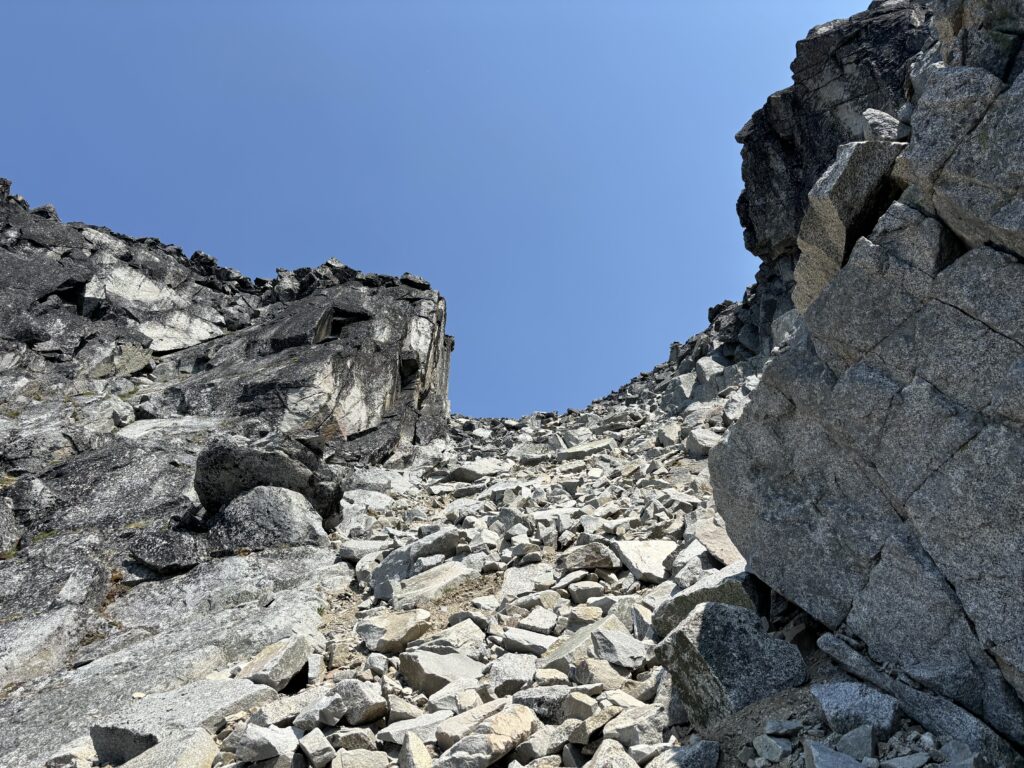
At the end of the ridge line a massive gendarme forced us climber’s left off the ridge crest and there Andrea spotted a steep bench that ran across the east face. We decided to explore this route and traversed across steep heather, descending a short ways until we were on the bench. From there I kept moving across until a long running gully revealed itself. Perfect! The terrain looked relatively easy and a ramp around 200m up seemed to divert on the ridge at climbers left. This looked like the best option, so we scrambled up 2nd class slabs and steep heather until we reached the ramp/channel to the ridge. Again, this looked better than continuing up the gully and we managed to keep it mostly 3rd class with a few 4th class moves on sand covered rock to gain the ridge.

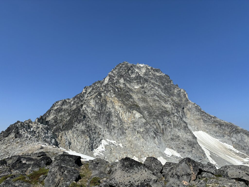
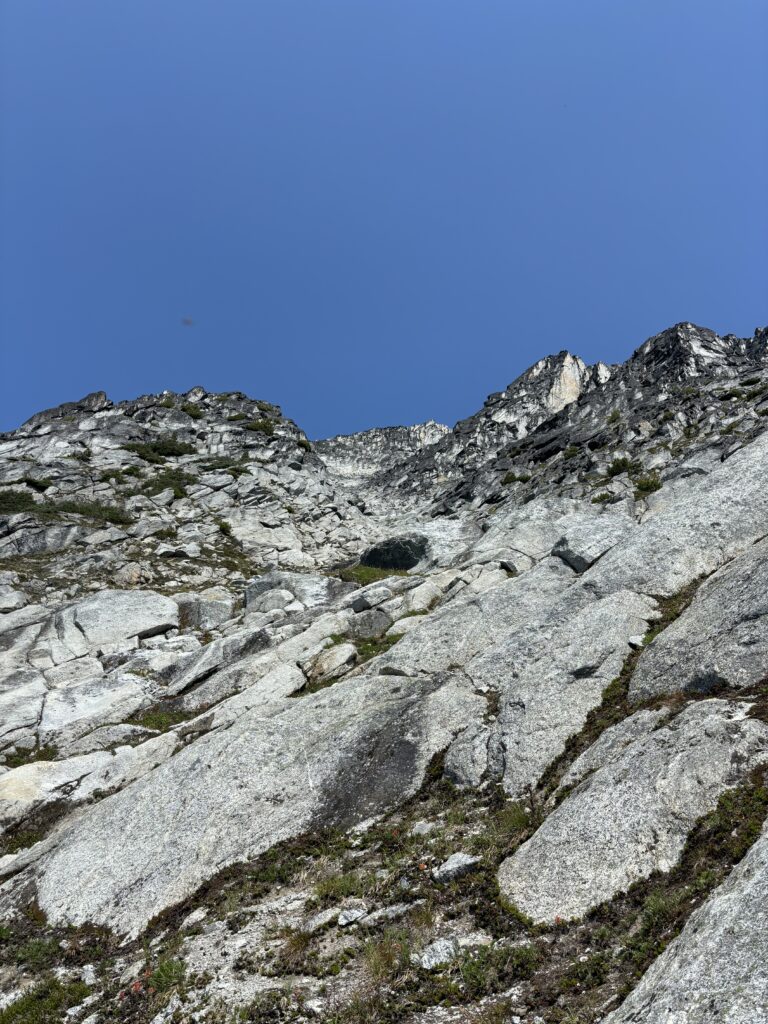
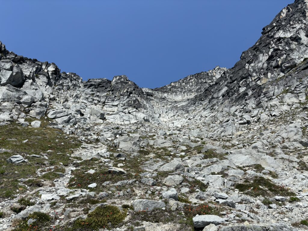
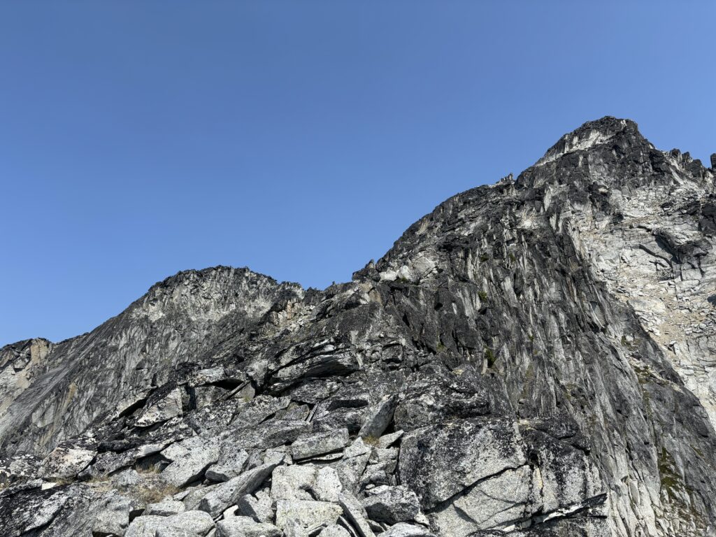
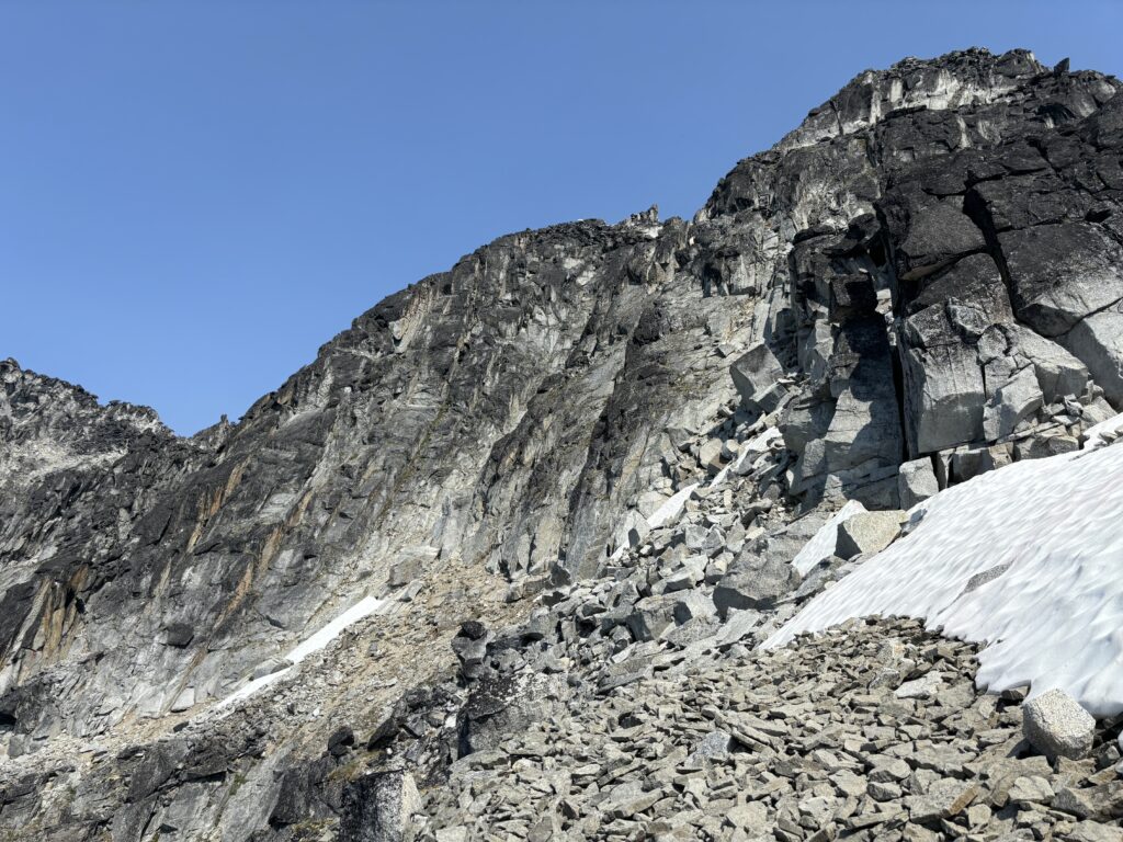
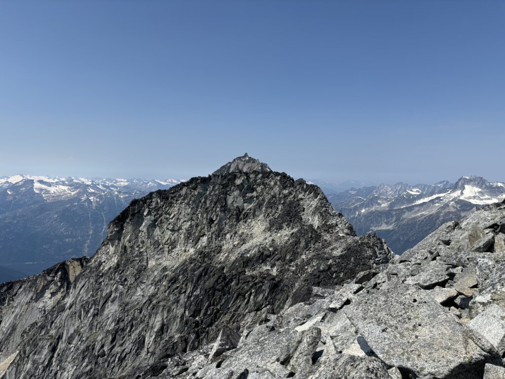
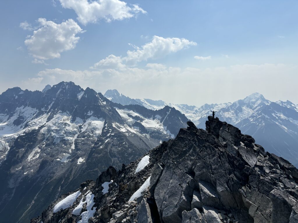
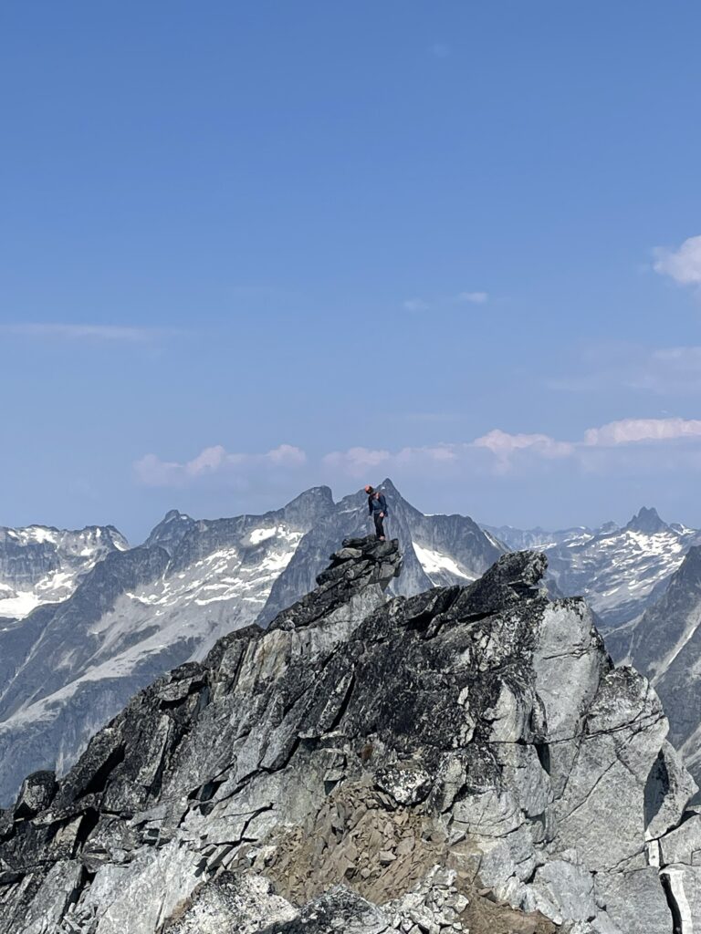
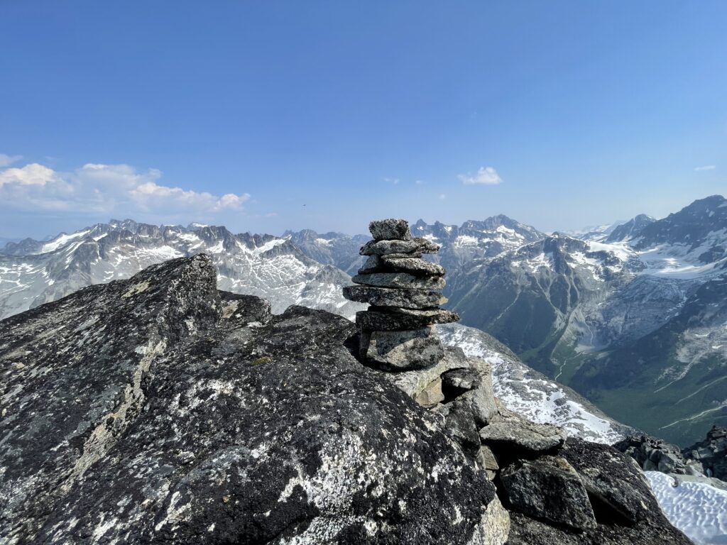
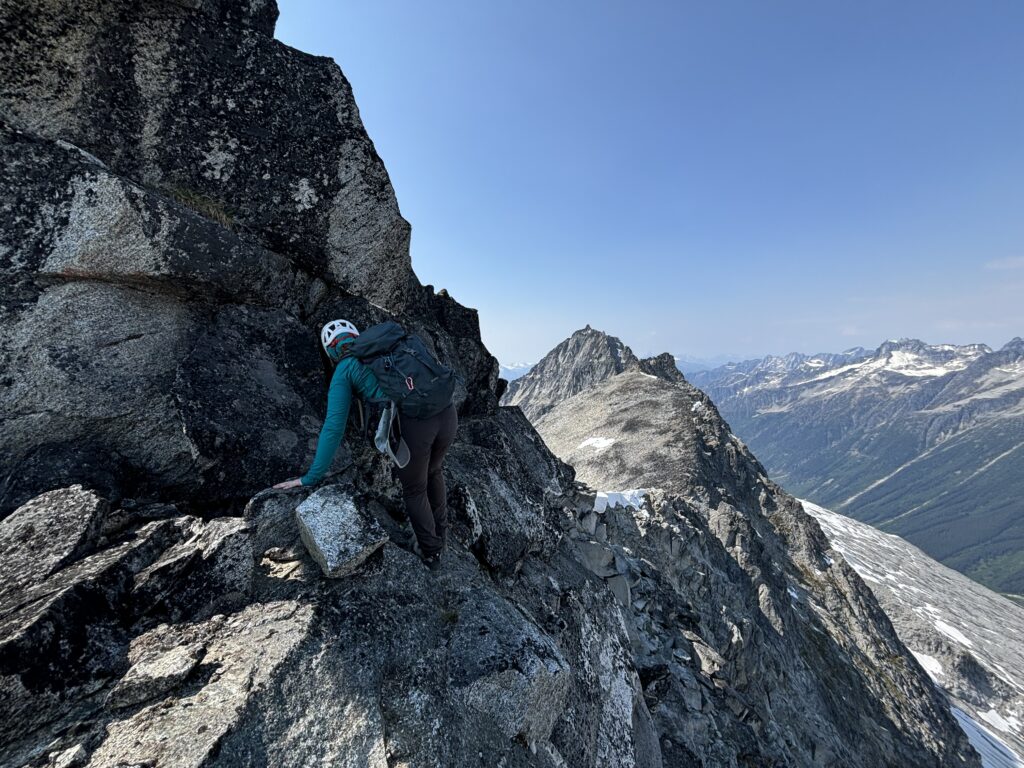
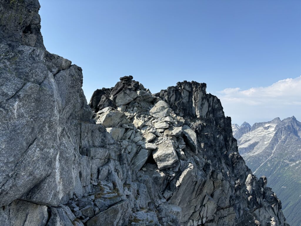
The ridge angle eased off here and so we continued up more third class terrain until the ridge morphed into a head wall of sorts. By some luck another bench system revealed itself and a short traverse climber’s left brought us to the base of yet another reasonable gully. I was curious about alternatives though and so I quickly traversed passed the gully and another spur to poke my head around the corner. Another gully was present, albeit sandier, so we opted for the more rock filled first option. Andrea and I made our way up more loose talus and 3rd class terrain and lo and behold we were on the summit crest! Three small rock formations marked the potential high points and I walked to the northern most point while Andrea took the southern most. With some basic visual confirmation the northern rock point looked to be the tallest and so we set up shop on top. There was no cairn or signs of climbing and I felt some relief knowing that we hadn’t been swooped on by an unknown climbing party. We excitedly placed our first cairn on an unclimbed peak and started to survey our surroundings.
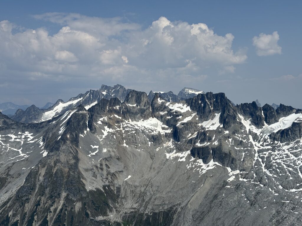
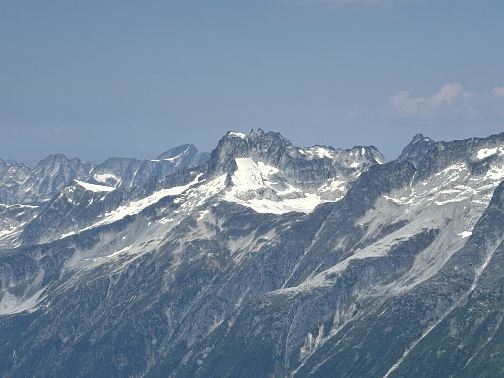
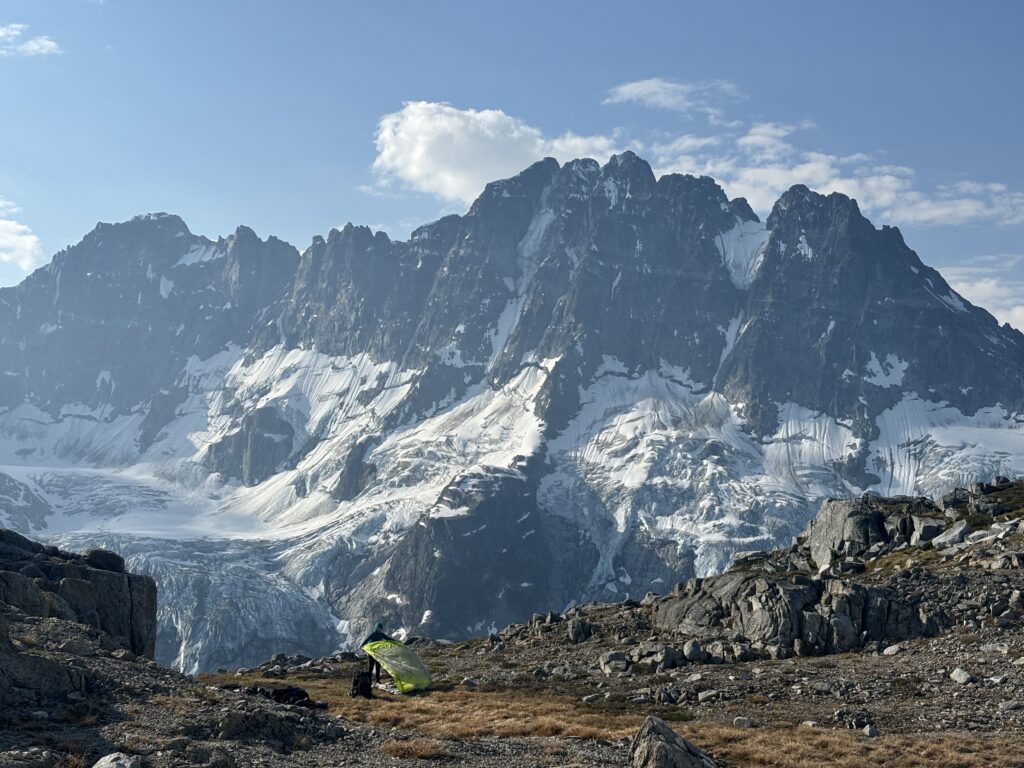
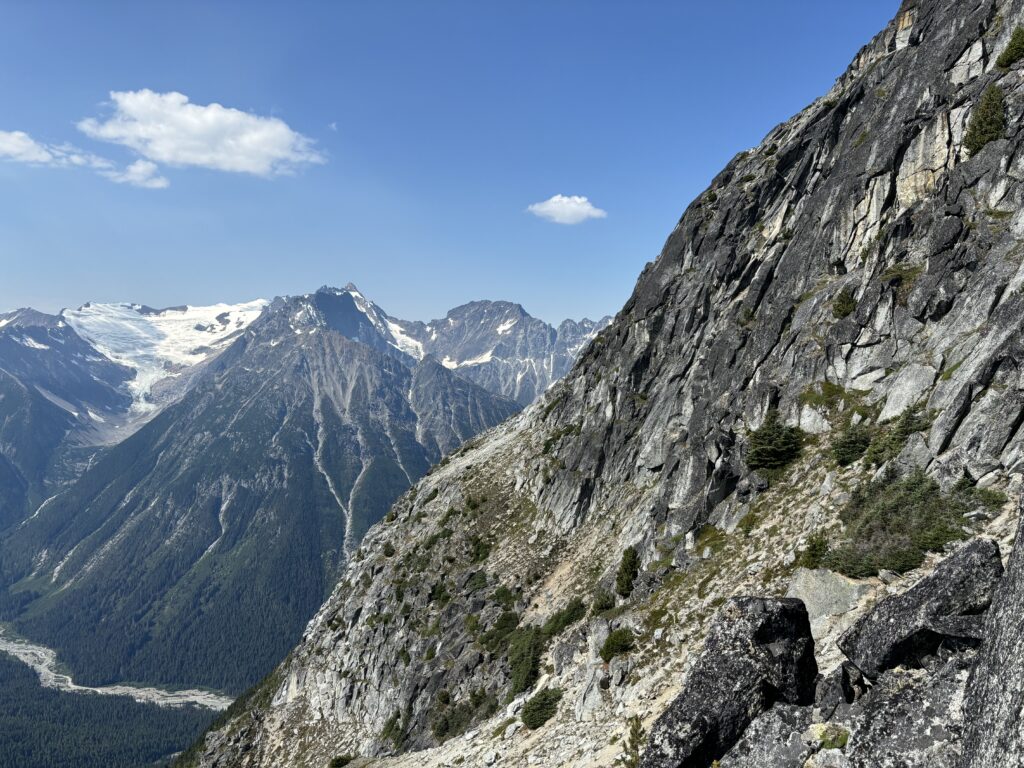
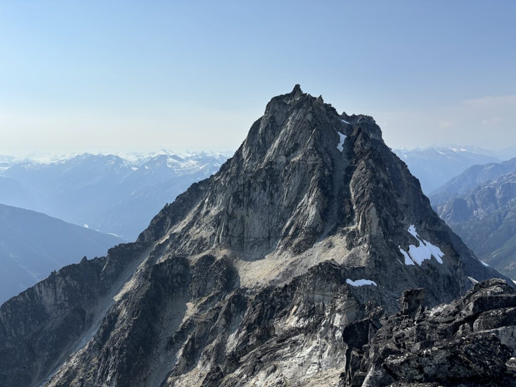
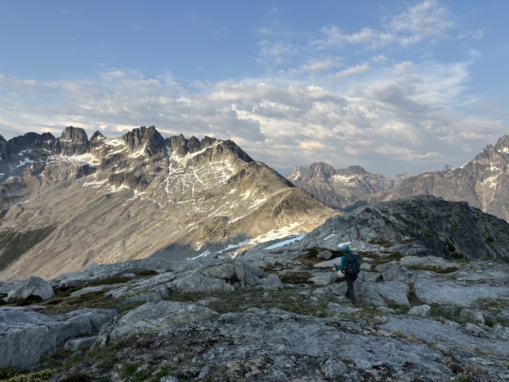
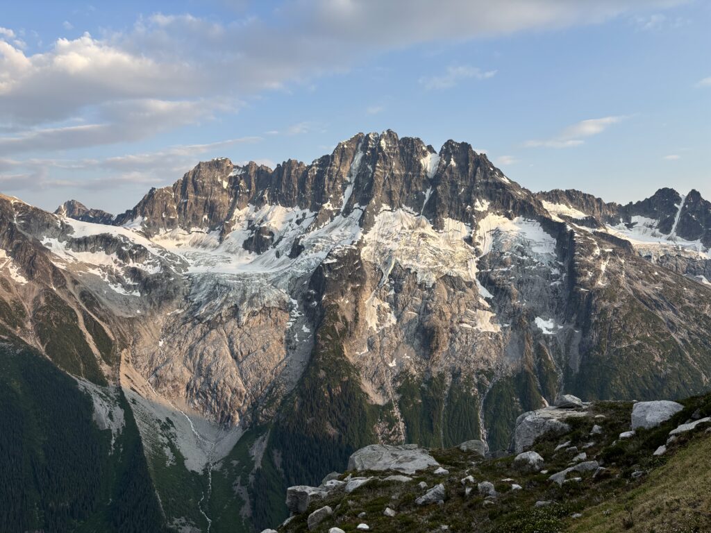
About 1.5km north west was the secondary high point of this “twin” summit and while the one we were standing on had been surveyed as higher, we wanted to rule that out. True summit aside, the primary objective of getting this summit was in fact to scope out our ultimate goal for the trip: Culbert Crag. The tallest summit on the Frontier Creek ridge line and a complex formation of rock with massive planes of vertical granite forming several steep buttresses and impassible looking gendarmes. Glenn had graciously provided us with a few fly by photos of Culbert Crag when we he revealed the unclimbed area to the BCMC group. However, we needed to do reconnaissance in person to truly understand the terrain.
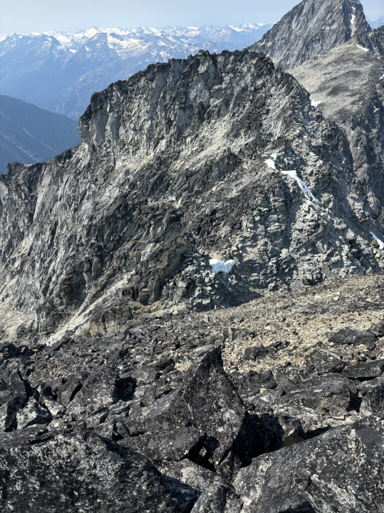
With our primary mission still unattained, we pressed on and looked for way a way off the west side of the summit. A short 4th class down climbed got us into the gully that I had scoped out earlier and that required a bit more descending to bypass a gendarme. From there we ascended back up the other side and then scrambled through some 3rd class terrain to a notch up the sub summit directly west of us. The notch took us onto a very exposed but easy 3rd class move around the face and then we reached the massive and broad ridgeline to the secondary summit. Now we had an easy ridge ramble up towards the secondary summit.
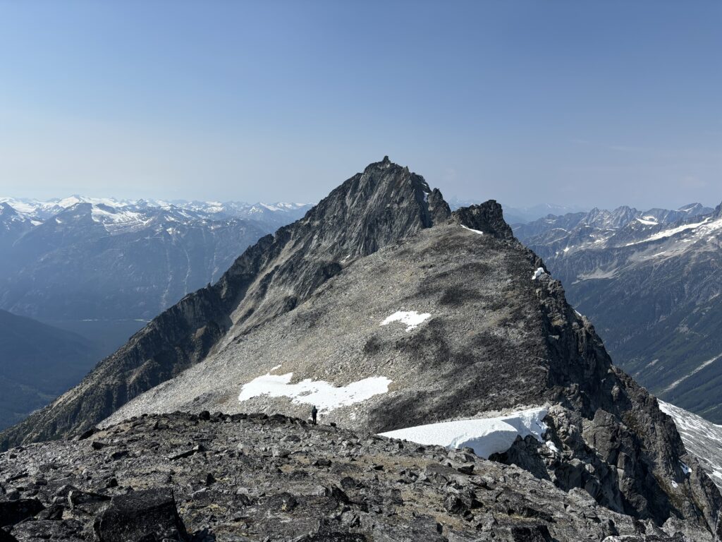
Naturally, the summit block was guarded by some 5th class looking moves. We diverted climbers right onto a ledge system and followed that to an exposed 4th class move on the east side and gained the summit from there. I quickly checked my GPS and confirmed this summit was in fact lower, but the margin for error on a phone GPS was enough that I was happy to have tagged this summit too. Our attention now turned to Culbert Crag. The one feasible route we had identified from Glenn’s photos looked unruly in person. Our original thoughts were to take the east ridge and bypass several of the huge gendarmes on the ridge wherever it made sense. Now looking at it face to face, there was no featured ridgeline to climb but rather exceptionally steep rock and no easy way to reach it. Two massive pinnacles blocked ridge access to the base and we would have to climb up a very steep gully just to reach the ridge. We ruled it out and looked around. A long running gully system on the south face looked promising, but we wouldn’t know for sure without checking it out in person.
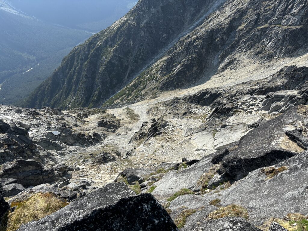
That’s a mission for another day though, so with some photos of the route we returned back along the ridge to think about the mysteries of the south face. Rather than climb back up the summit we continued down the secondary sandy gully and reached the east ridge without issue. From there we had a scrappy down climb on sandy slabs to reach more civilized terrain below. The rest of the route back to camp was one of pondering, excitement and nerves thinking about the exploration ahead. Meanwhile we decided to call this summit Sedna Peak for the Inuit Goddess of the sea.
Summit Cairns. Well done.