
Elevation Gain: 1,336m
Distance: 28.74km
Total Time: 9 hours 56 minutes
Date: July 13th, 2024
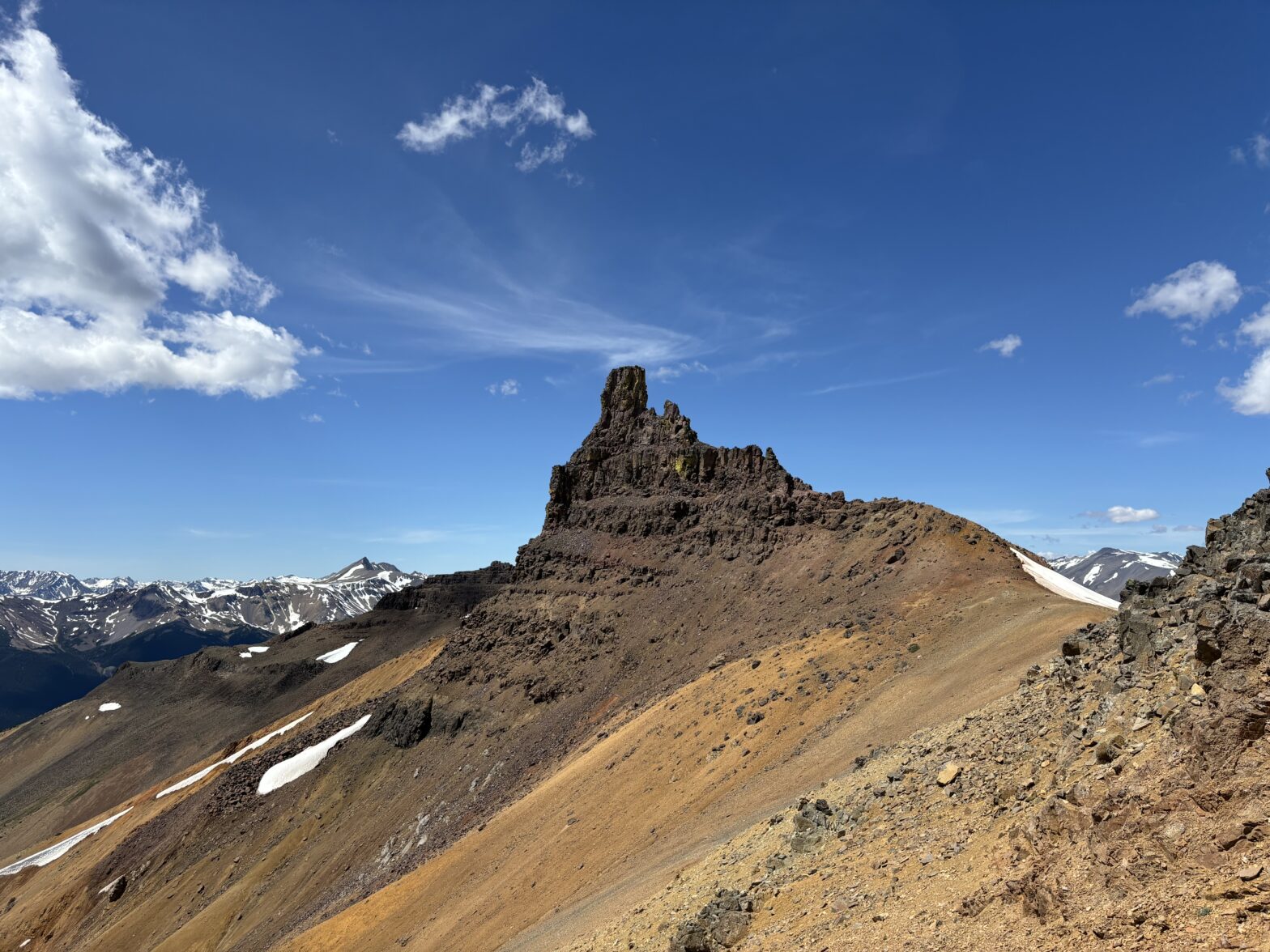
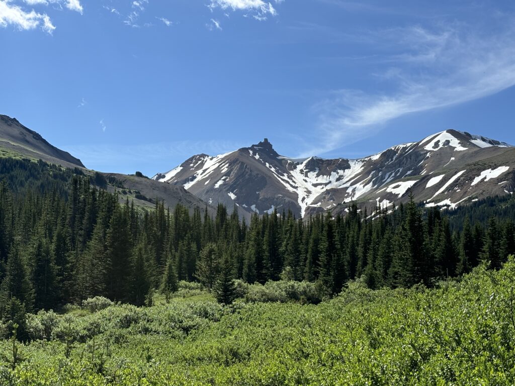
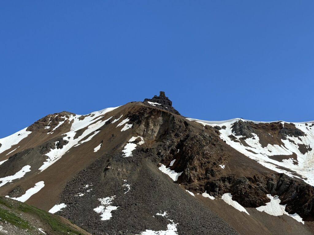
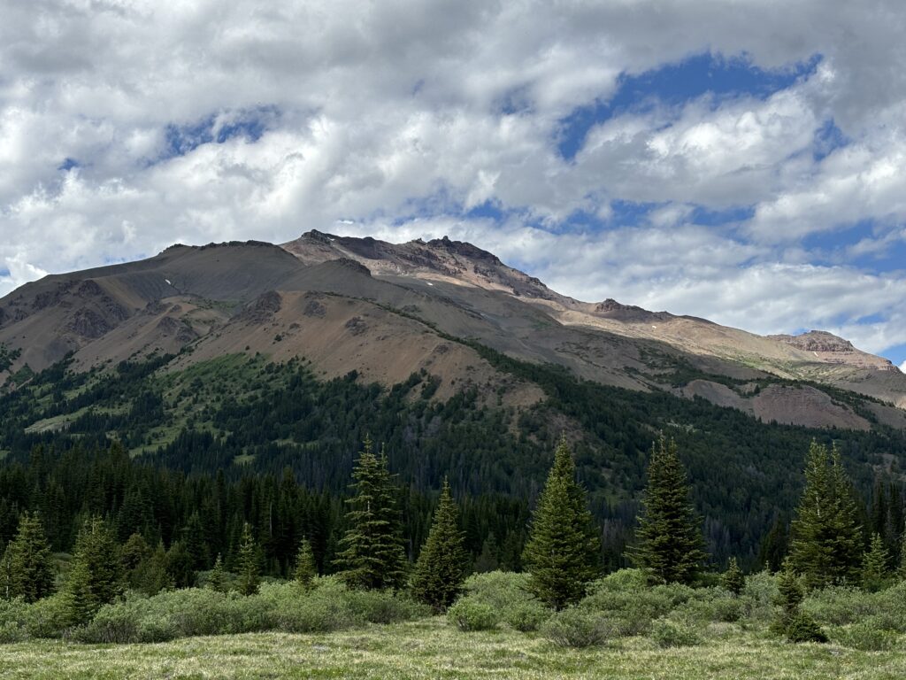
Castle Peak is an iconic summit around the Chilcotin’s with a very distinguished multi-tiered tower. Its formation is volcanic in nature and the summit is flanked by steep loose rock on all sides. Andrea and I saw it together during our 7 day Chilcotin traverse, but we never entertained climbing it. Even from afar it looked to be much more than a scramble. A couple of years would go on since that trip and I’d make a few more forays into the area, but I only started seriously thinking about Castle Peak after my trip with Andrea to Leckie Peak. Post-trip I got home and picked up my usual sources of research. To my surprise nothing appeared. There was no mention in either of Culbert’s guide books nor Bruce Fairley’s and Bivouac showed no reports or recorded ascents. Online searches revealed nothing as well. I was skeptical that such an obvious summit was still unclimbed in 2024. However, my optimism was bolstered by the fact that the easiest approach in is still 14km each way and that the area is almost exclusively frequented by multi-day hikers and mountain bikers. If (and that’s a big if) the summit required technical climbing, it’s pretty unlikely that either of those demographics would be making an attempt to the top.
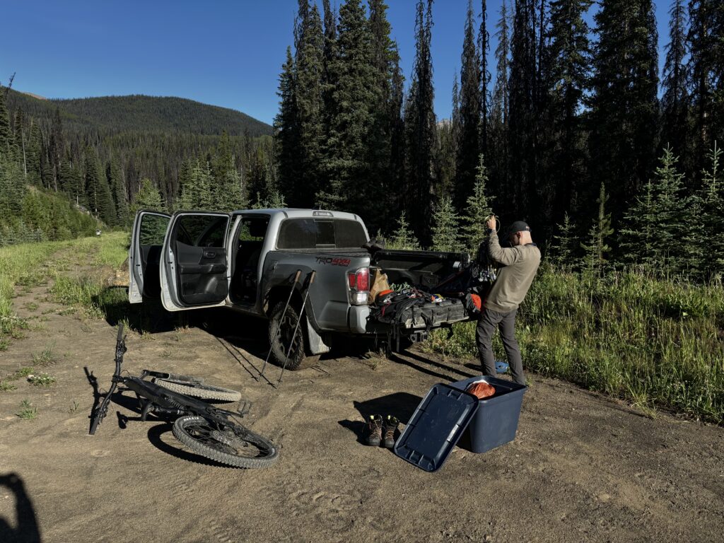
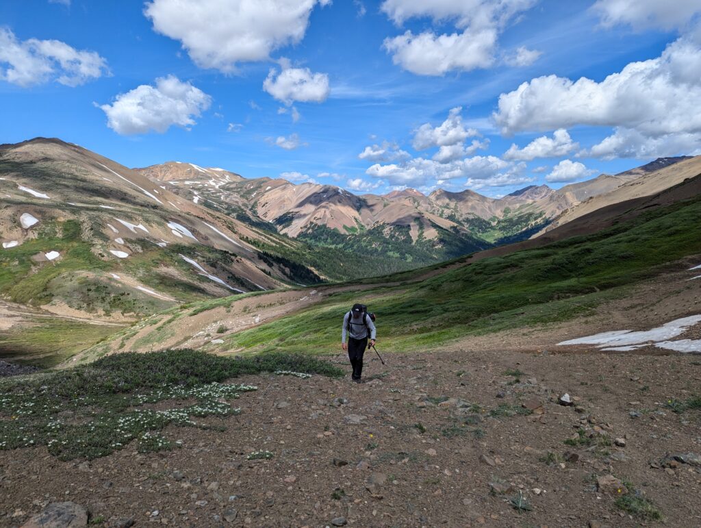
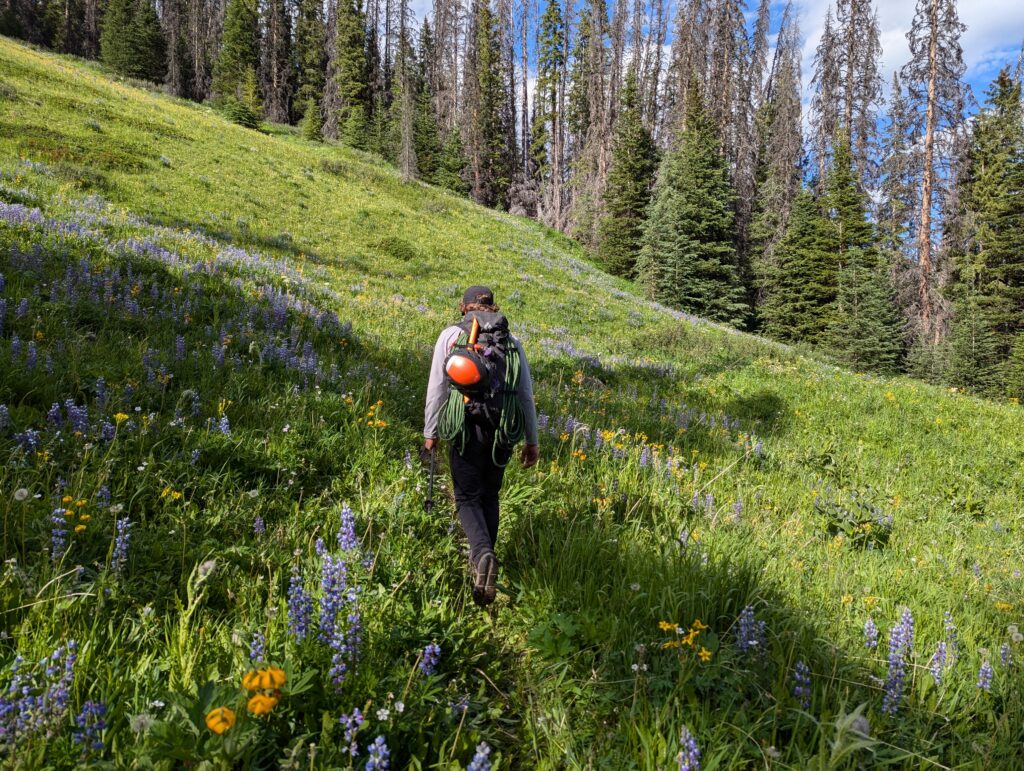
The approach is doable in a day, but made even easier if you could bike some part of it. Especially with e-bikes. By some fortune my friend Alex acquired an e-bike just a few weeks ago and we had decided to take advantage of that. We set aside one weekend to do e-bike exclusive type trips and our plan was to do Grainger Peak one day and a yet to be determined peak the other. Initially we thought about Welch Peak, but with the weather and the timing everything was looking perfect to do Castle Peak instead. I threw the idea out there and Alex was right on board. From that point on the contract was signed for a ridiculous amount of driving down service roads and two back to back massive approach days. Both we’d later find out that we heavily underestimated.
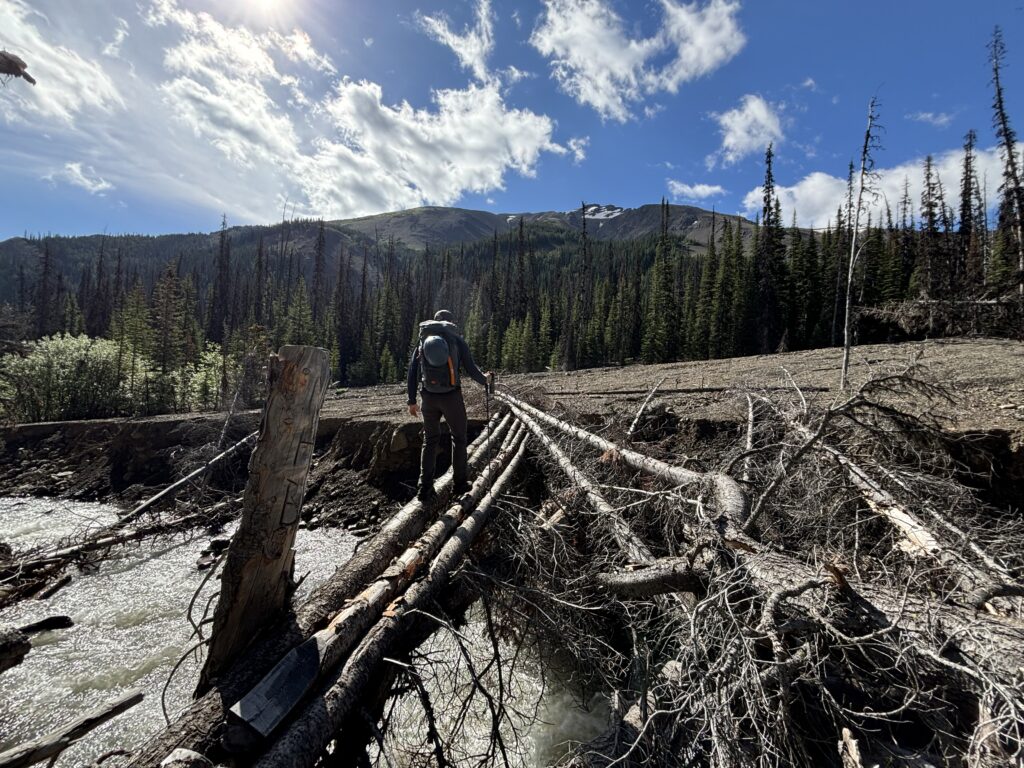
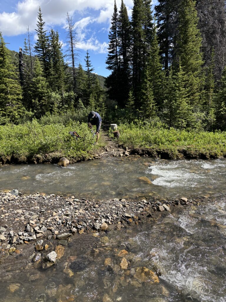
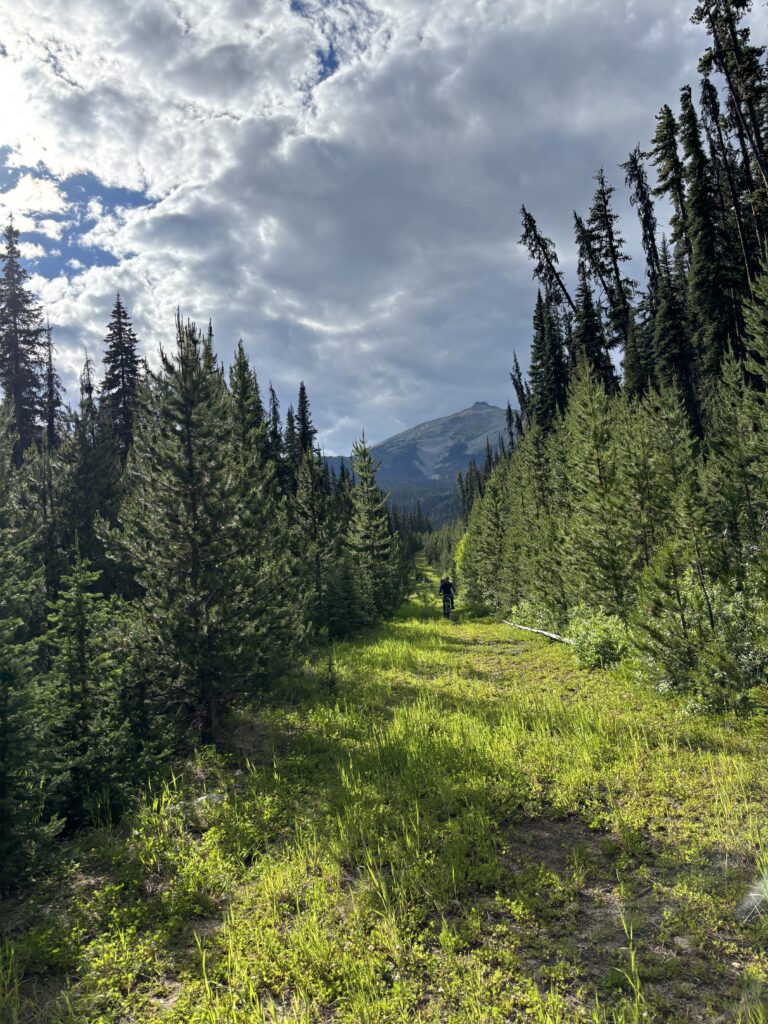
We left Friday night to camp at Gun Creek campground and pulled up around 11PM. Alarms were set for a casual 6am and the following morning we found ourselves driving an additional hour to get to the Paradise Creek trail head. This section of road was much more worn down than I expected and I was a little worried the Paradise Creek trail might be in bad shape. Nothing left to do but find out! We carried our bikes across the small foot bridge over Lindsey Creek and then started biking in earnest down the road. About 750m later we hit another creek crossing only this time we had to ford it on foot. Unlike a regular bike, e-bikes aren’t keen on getting submerged and that meant we’d have to heave the 50lb bikes above water while making the crossing. Not an easy proposition, but we made it happen.

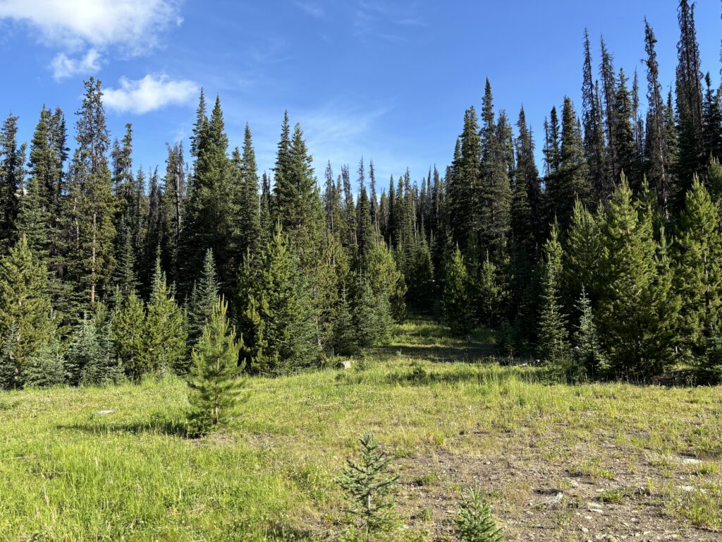
That was the last of the faff thankfully and we had easy riding conditions to the road terminus. We made a brief push into the forest on the trail but gave up quickly as multiple bogs and deadfall slowed us down. With that, we ditched the bikes and continued on foot. In total we probably spared ourselves around 7km of road walking so that was still a win in our books.
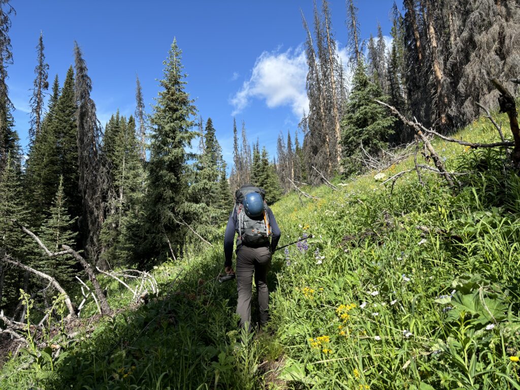
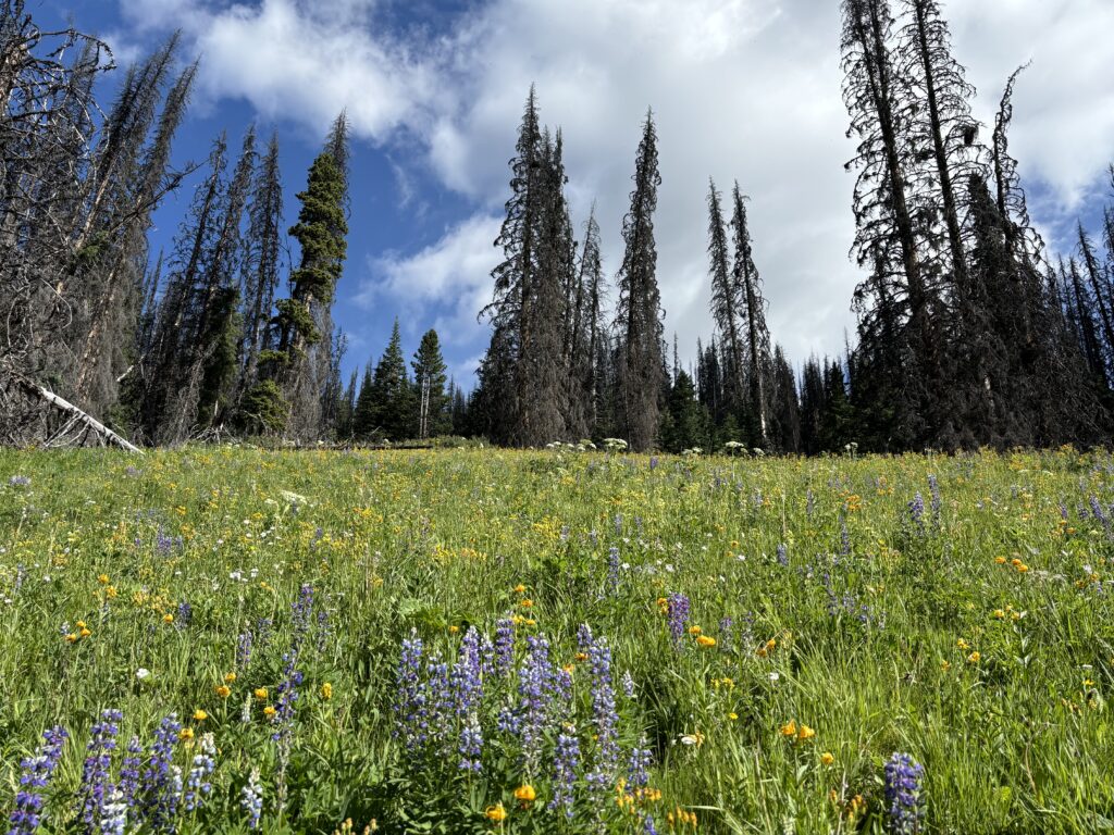
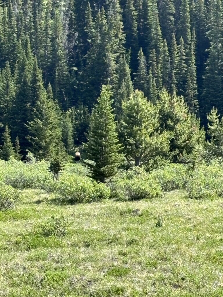
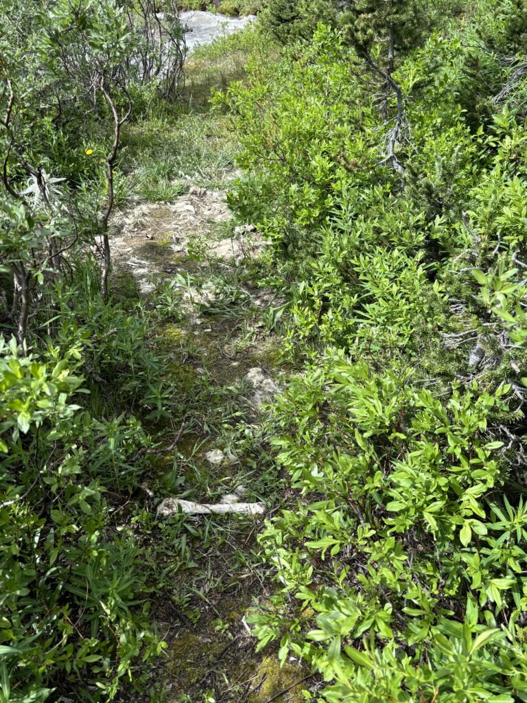
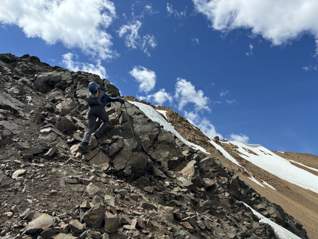
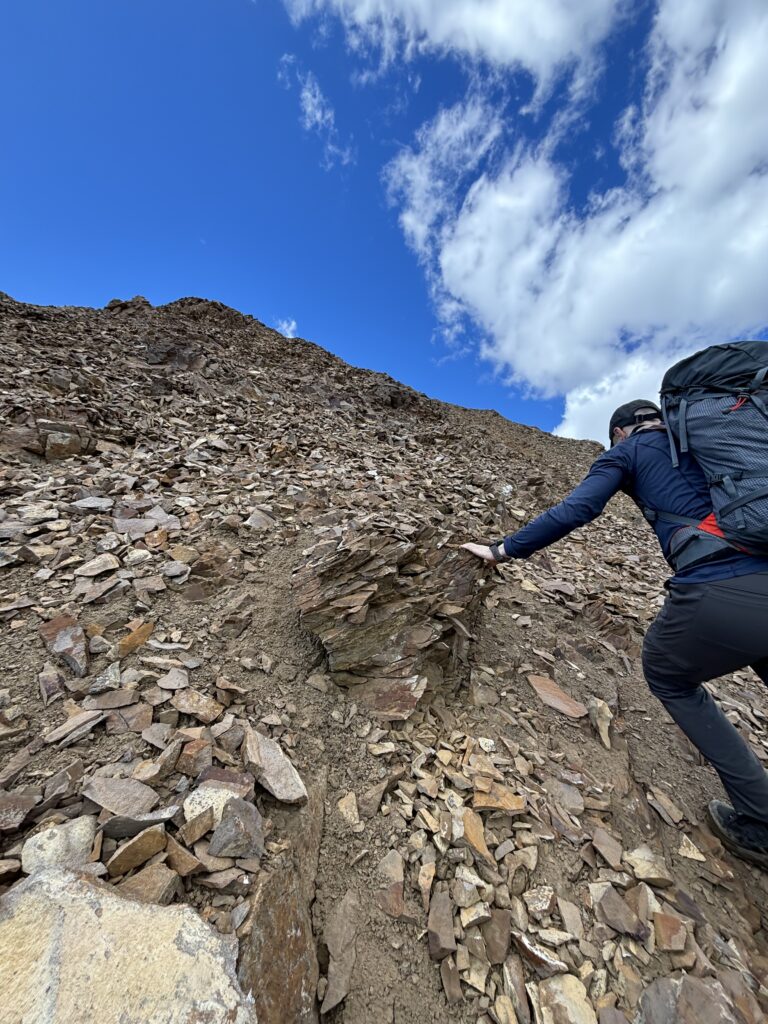
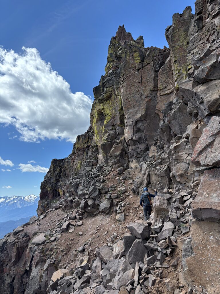
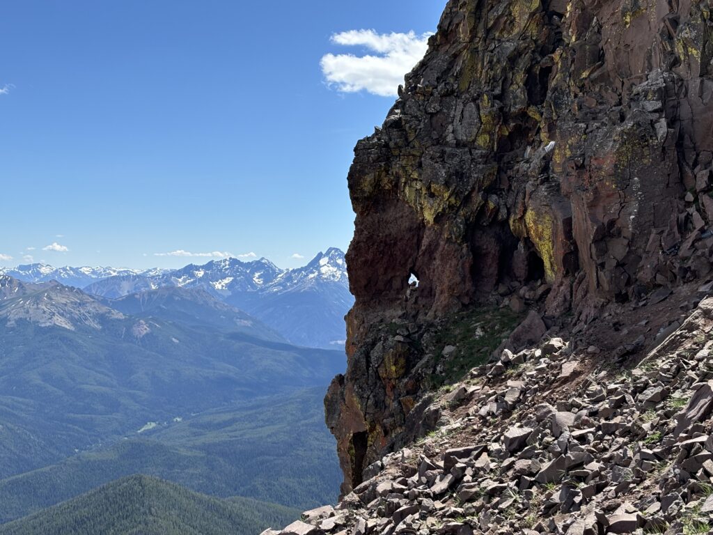
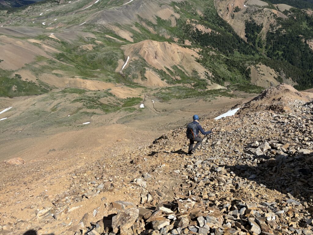
The trail continued to be muddy and boggy in spots but slowly improved as we gained elevation. It was straightforward to follow and we soon reached the lush green alpine meadows near the head of Paradise Creek. This area was proper bear country and the Chilcotin’s has no shortage of Grizzlys around. We kept our eyes peeled and as dropped down and back up from a creek we ran into a group of 3 Grizzly Bears only 60m away. To our good fortune, they quickly dispersed after we notified them of our presence. We made a wide berth around the bushes they were foraging in and then walked along Paradise Creek a bit further south. Just in time we walked through an old goat carcass alongside the creek. Alex and I resolved to exit the area as quickly as possible and thankfully the foreshortened trail up to Castle Pass appeared just in time. It took us along scree slopes high above the bushy terrain and put us at ease. Of course we’d have to run the gauntlet again on the way back, but that’s a later problem.
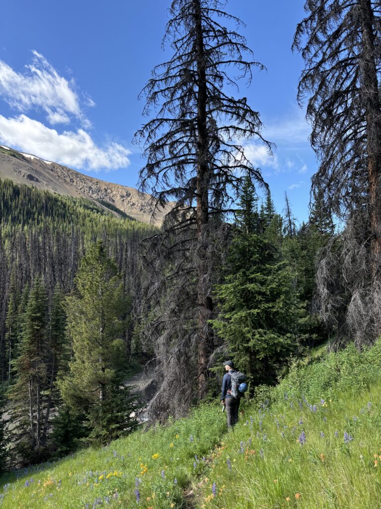
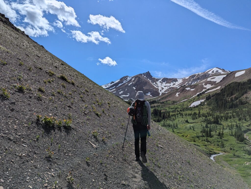

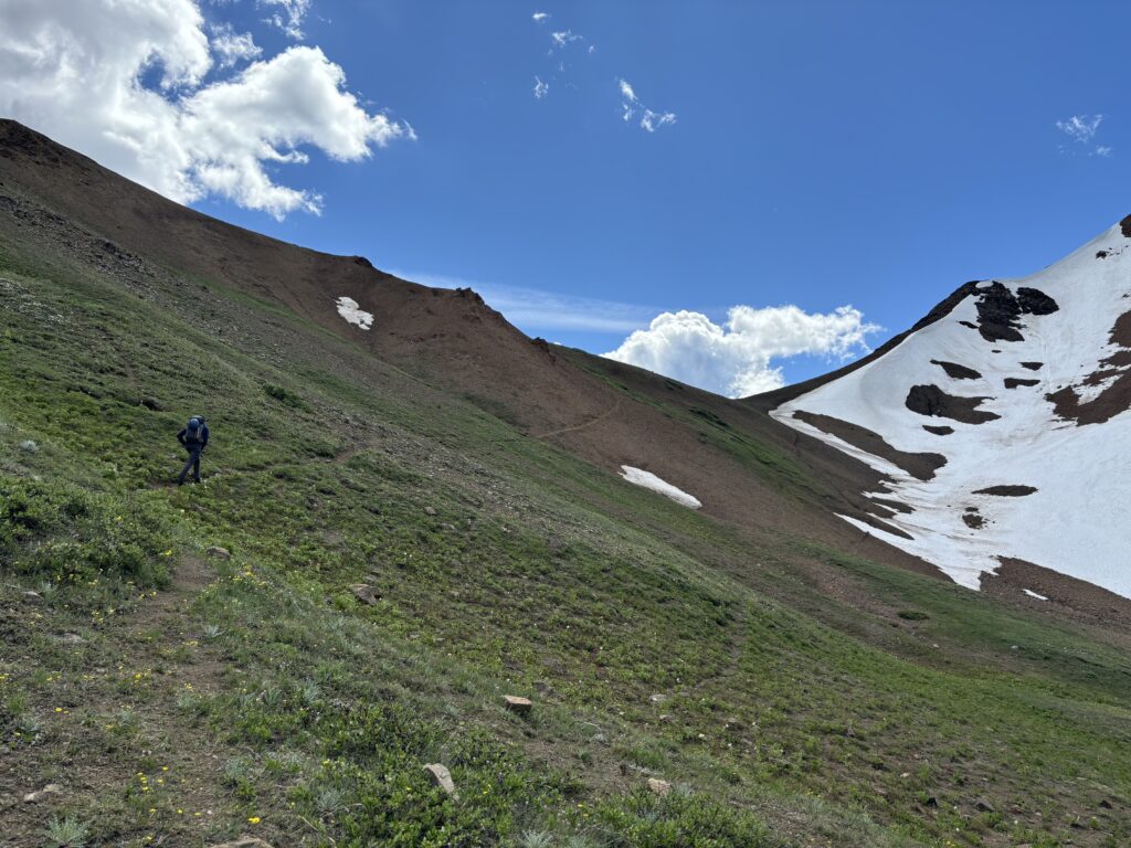
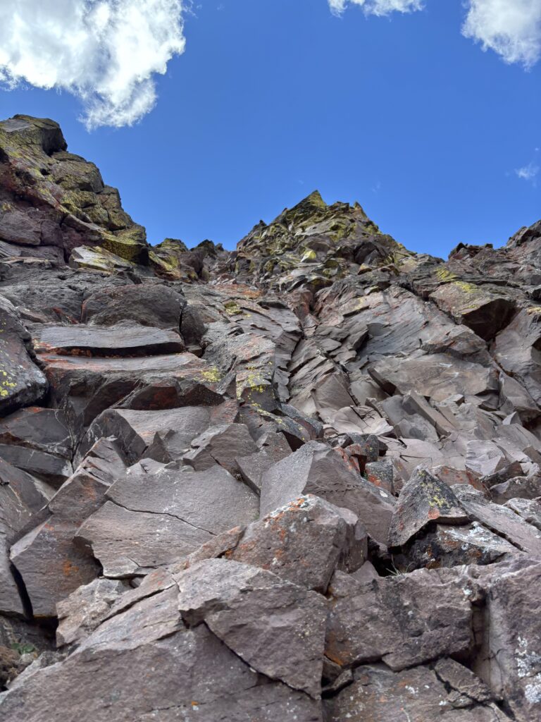
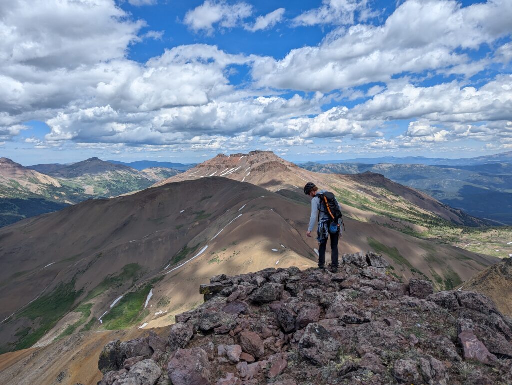
By the time we hit Castle Pass we were both feeling more exhausted than expected. Our approach had now hit around 14km, which was much farther than we originally anticipated. We were in striking distance now though and so we started the loose scramble up scree covered dinner plates to gain the shoulder of Castle Peak. Once we cleared the loose terrain we had our first good eyes on route options. The shortest and most solid looking option was a wide crack on the north side, but we had left all wide cams at home. The next best options looked to be around the east side, but we had to get up close to see for sure. One things for certain, there really did not appear to be any scrambling terrain to the summit.

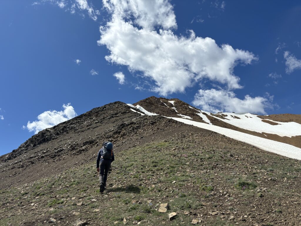
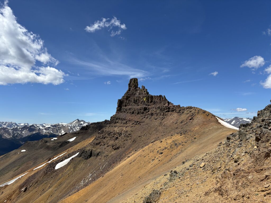
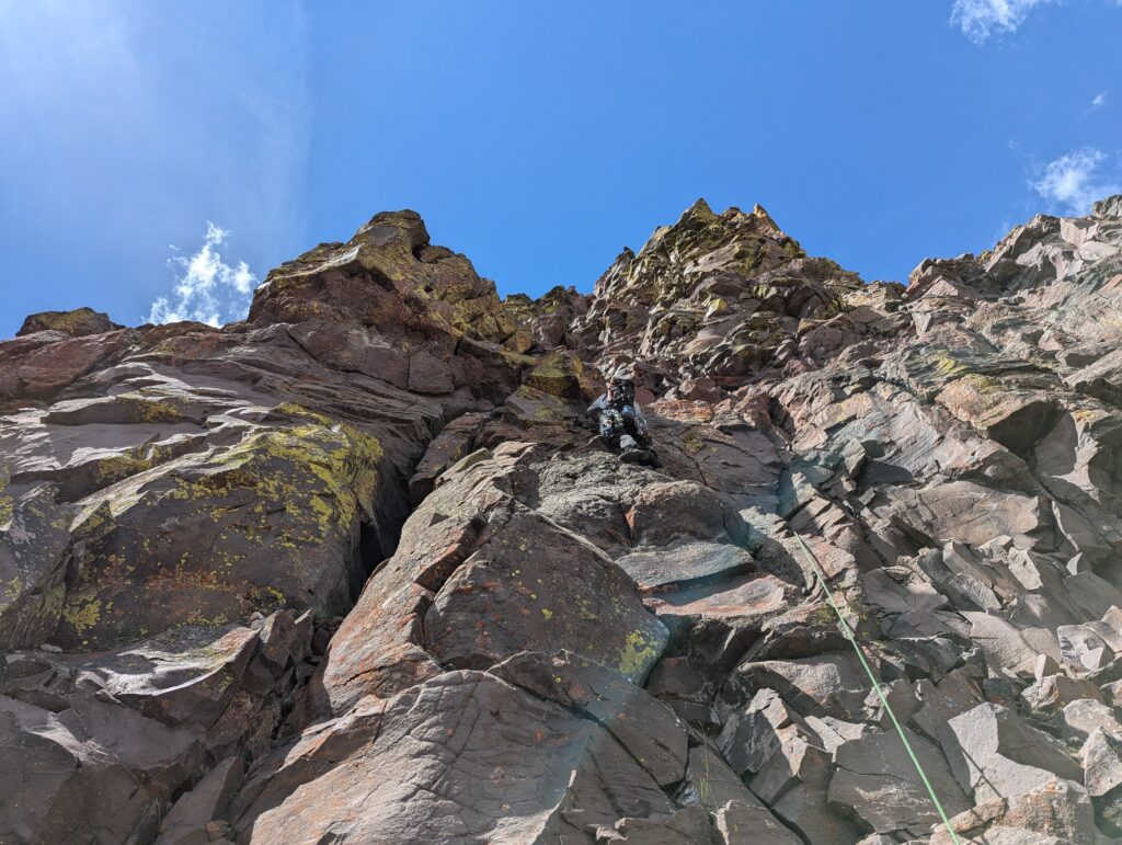
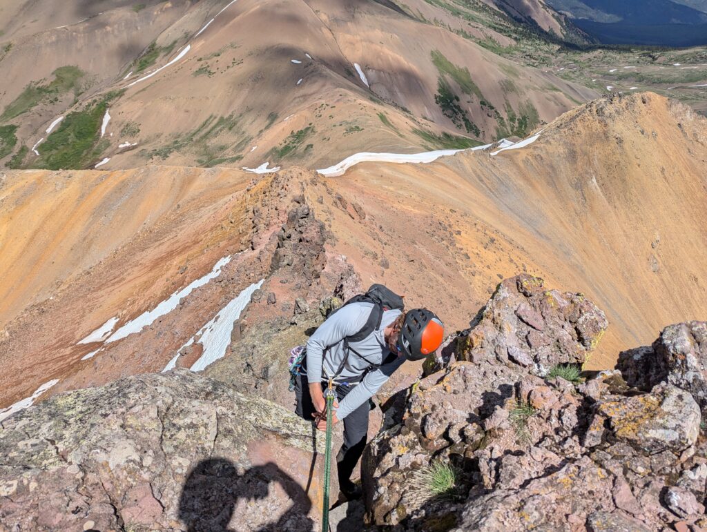
Alex lead the way scrambling up the north ridge and then traversing along a loose scree bench underneath the east face. Here we had a good look and found a 5.6/7 looking route up the face and then a corner system. From below the holds looked deceptively good, but looking at the profile of the face from the side one could see the terrain was not going to be so blocky on ascent. I asked for the lead in return for Alex taking the best leads on Grainger Peak and he graciously accepted. We had brought a single rack, 60m rope and a tagline, but it looked like maybe one pitch at most to gain the summit.
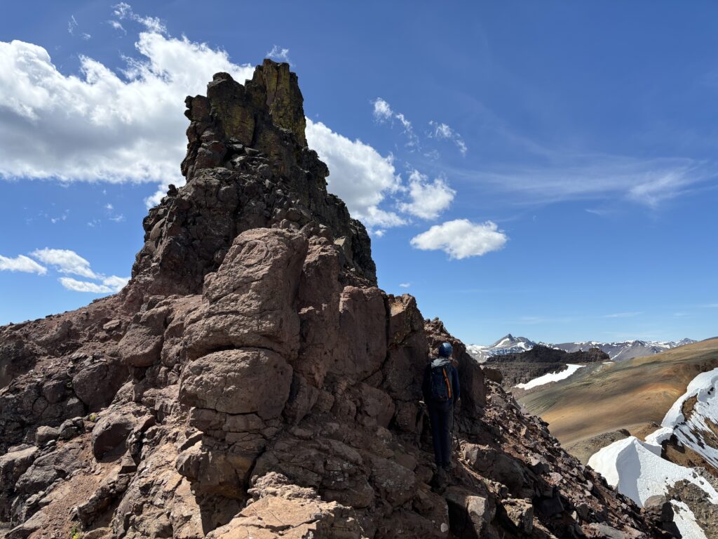
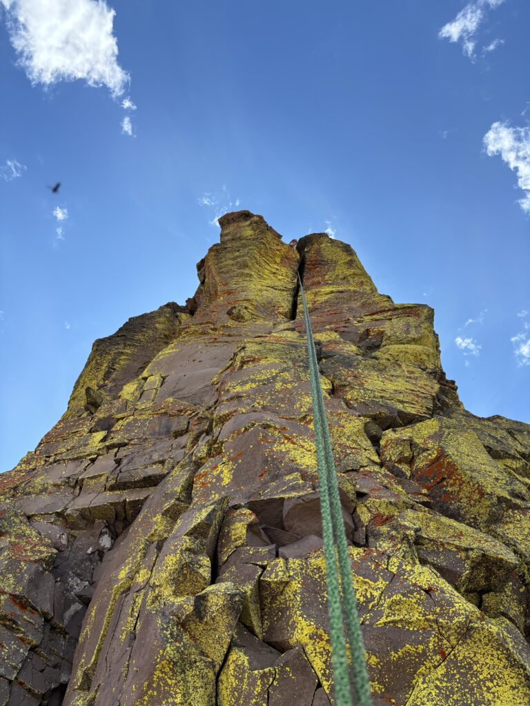
I racked up and started the lead. The lower section was blocky, but loose and protection was somewhat limited. Above this section was the tapered end of the last scree slope/tier before the face became vertically sustained. I kept to the left side of the face climbing just right of an arete picking my way as carefully as I could through the large death blocks plaguing the route. Mid way up, cracks and blocks gave way to gritty face climbing that was not protectable, but looked quite grippy. Unfortunately, it proved to hard mud and required some care to tip toe through. Finally I reached an upper corner system where better cracks and protection revealed themselves. I plugged a #4 into a perfect fist sized crack on my right and pulled myself up onto the summit.
My eyes immediately went on the hunt for a cairn. To my left a pile of loose rocks somewhat matched the description and so I called to Alex that we did not appear to be the first up here. Oh well! Now I turned my attention to find an anchor to get Alex up. On a loose summit like this the options were pretty limited. I resorted to slinging 3 large blocks, which collectively felt solid enough to bring someone up on. Alex then seconded up and dispatched with several huge blocks as he climbed. I dared not do that while above Alex, but now the route was getting a bit of much needed cleaning.
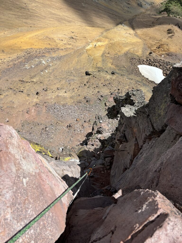
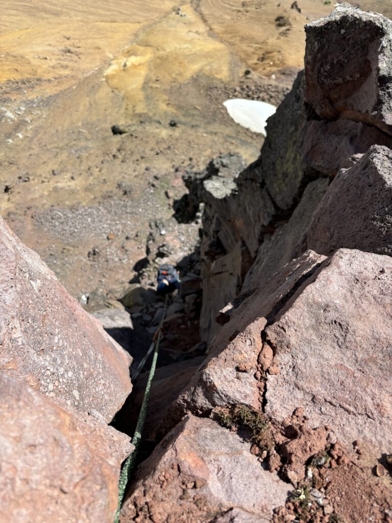
Once Alex came up he too turned his eyes to the suspect cairn. Only, he disagreed with my assessment. It looked too much like a loose pile of rocks. I snapped a photo for proof and then we got to work figuring out how to descend this thing. My slung block of boulders seemed a bit precarious for a rappel, but we managed to build a chock stone anchor on the north side and rappelled off that. I initially rappelled to the ropes end but was about 2m shy of the ground and had to re-ascend to the ridge. We pulled the rope on the ridge instead and then I found a 4th class route off the ridge below the summit and regained the tamer terrain below. Alex headed for the shoulder while I recovered our gear and then we took a break to look over the tower.


After we rested up we headed back down to Castle Pass and then passed through the bear laden meadows unobstructed. Now it was an easy descent through the trail where we recovered our bikes and had a fast return to the truck.
It was a much bigger day than expected, but a very worthwhile adventure. I spent a few days after the trip asking around about attempts. A search through the Canadian Alpine Journals from 1907 to 2007 revealed nothing. Nor did a canvas of the south coast alpine climbing group. I eventually reached out to Glenn Woodsworth, one of the foremost Coast Mountain experts, and too had not heard of an ascent. Everyone I’ve shown a photo of the suspect cairn too has stated it looks like a random pile of rocks. However, I’m reluctant to claim a first ascent as the area was frequented by bold prospectors and I feel it’s unlikely such an iconic peak would have gone unclimbed. With that, we’ll settle on first recorded ascent unless some other proof comes out to say otherwise. A first of firsts for me!