(Stats include all 7 days)
Elevation Gain: 4,388m
Distance: 104.8km
Total Time: 7 days
Dates: Sept 3rd to 10th
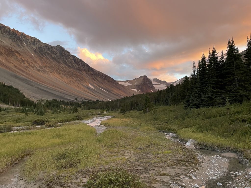
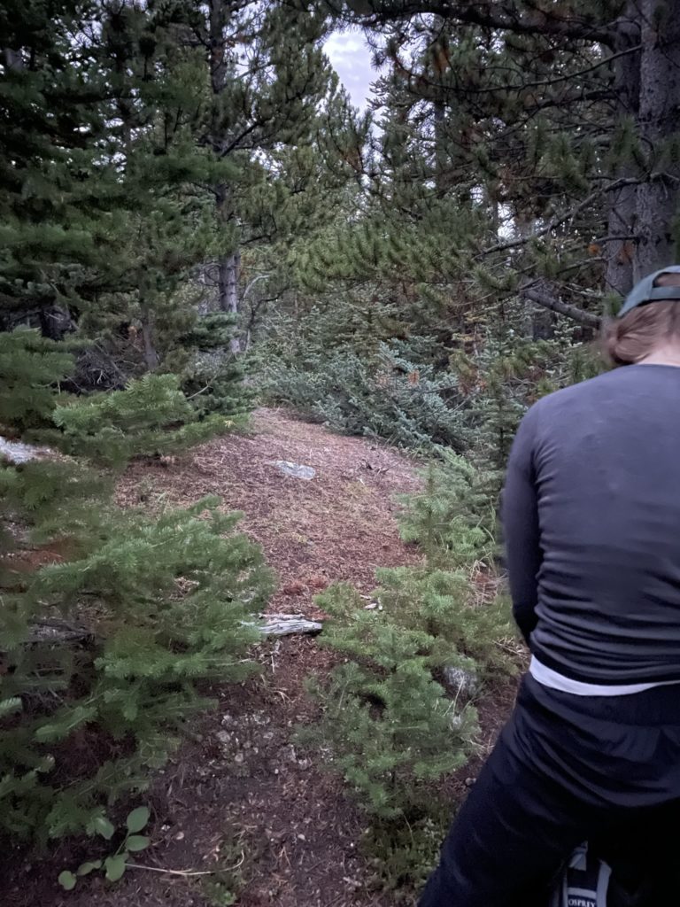
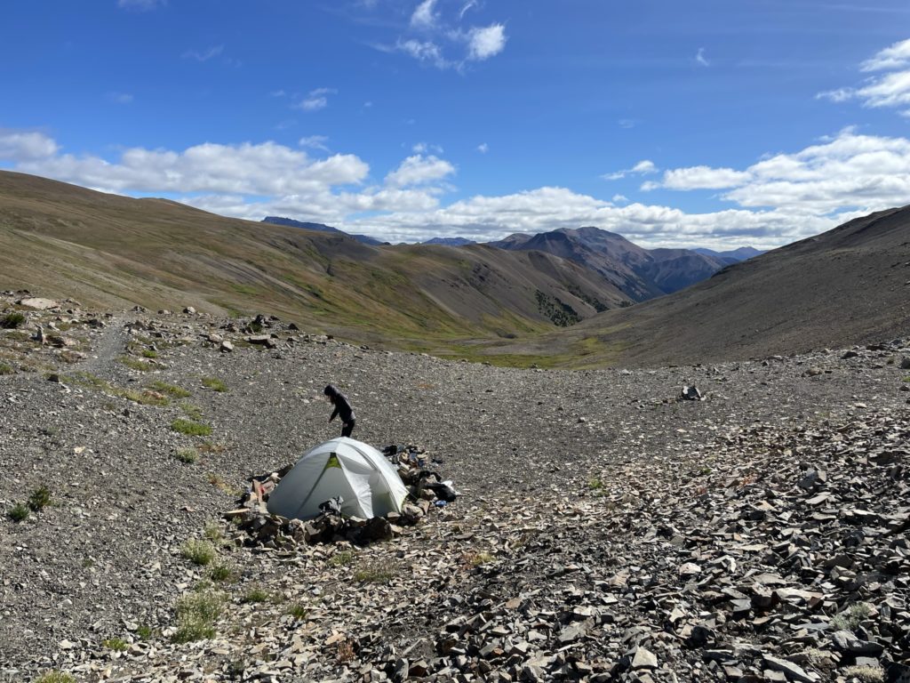
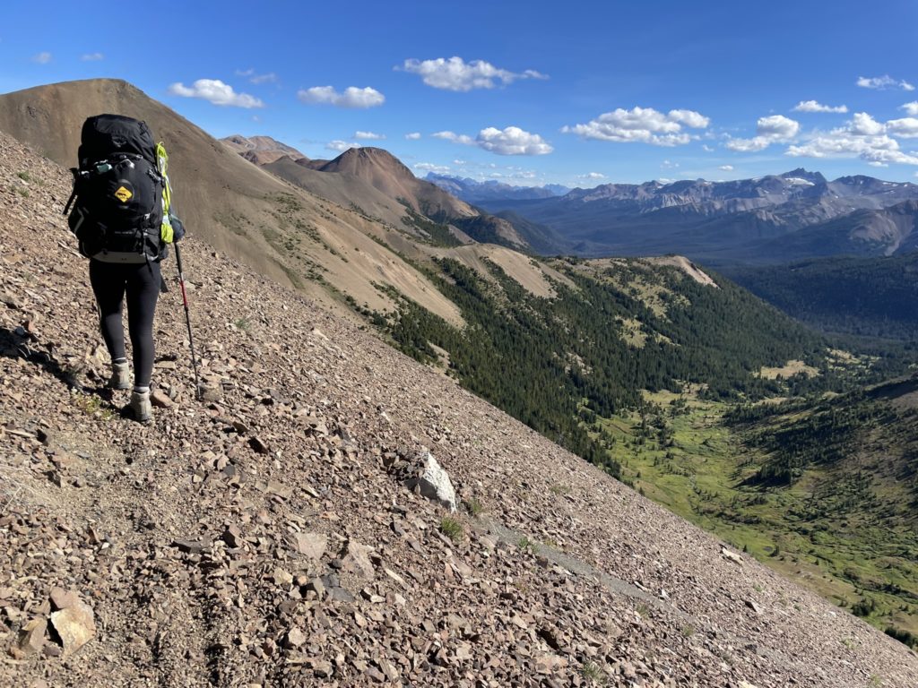
Andrea and I were now on day 4 of our 7 day Chilcotin traverse and we had just finished reaching Mount Solomon the previous day and were now resting around Lizard Lake for the morning. Our plan was to reach Lorna Lake in the morning and then climb up to Mount Davidson on the following day. When we both woke up we were exhausted after 3 days of hauling 50+ pound backpacks and a rest day was in order. I spent all morning doing a few camp site errands and then taking photos, napping and doing a bit of reading. We both still wanted to see Lorna Lake and part of the reason we’d gone this deep into the park was to spend at least a few hours there. So by the time lunch rolled around we agreed to head over in the afternoon and get a few hours to hang out before pushing on the next day.
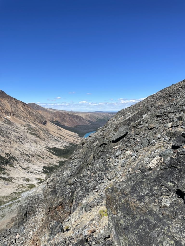
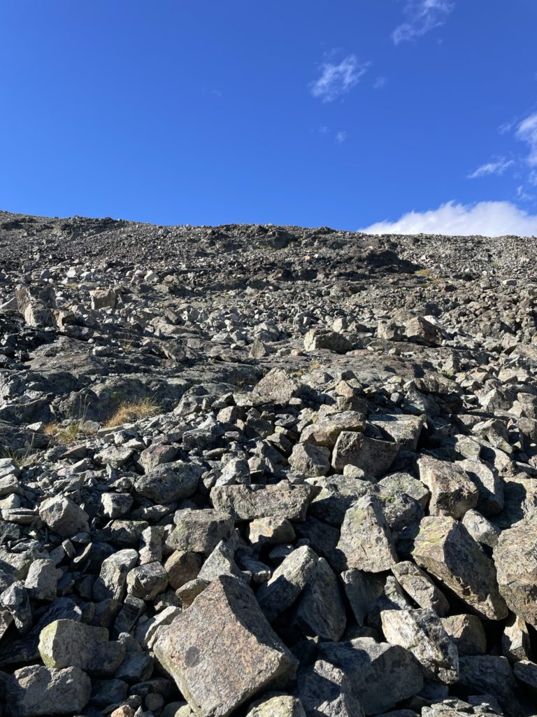
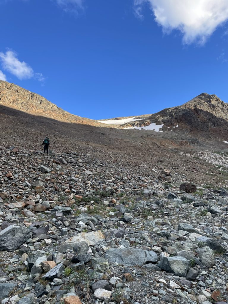
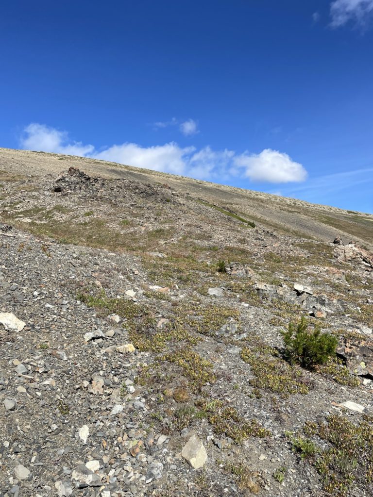
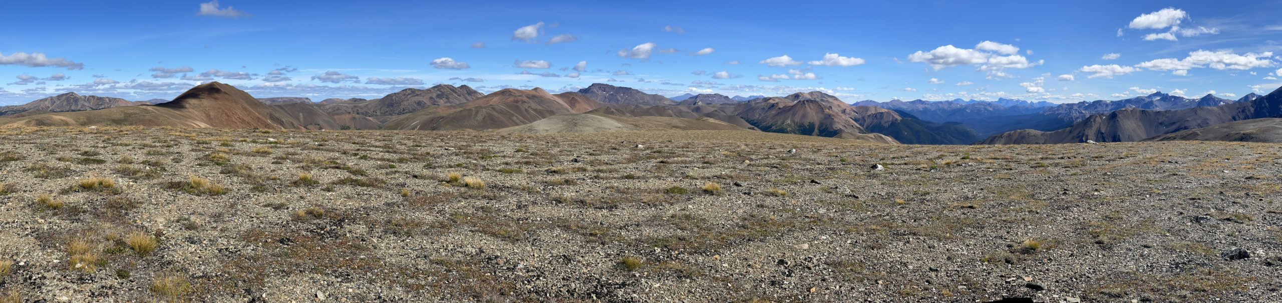
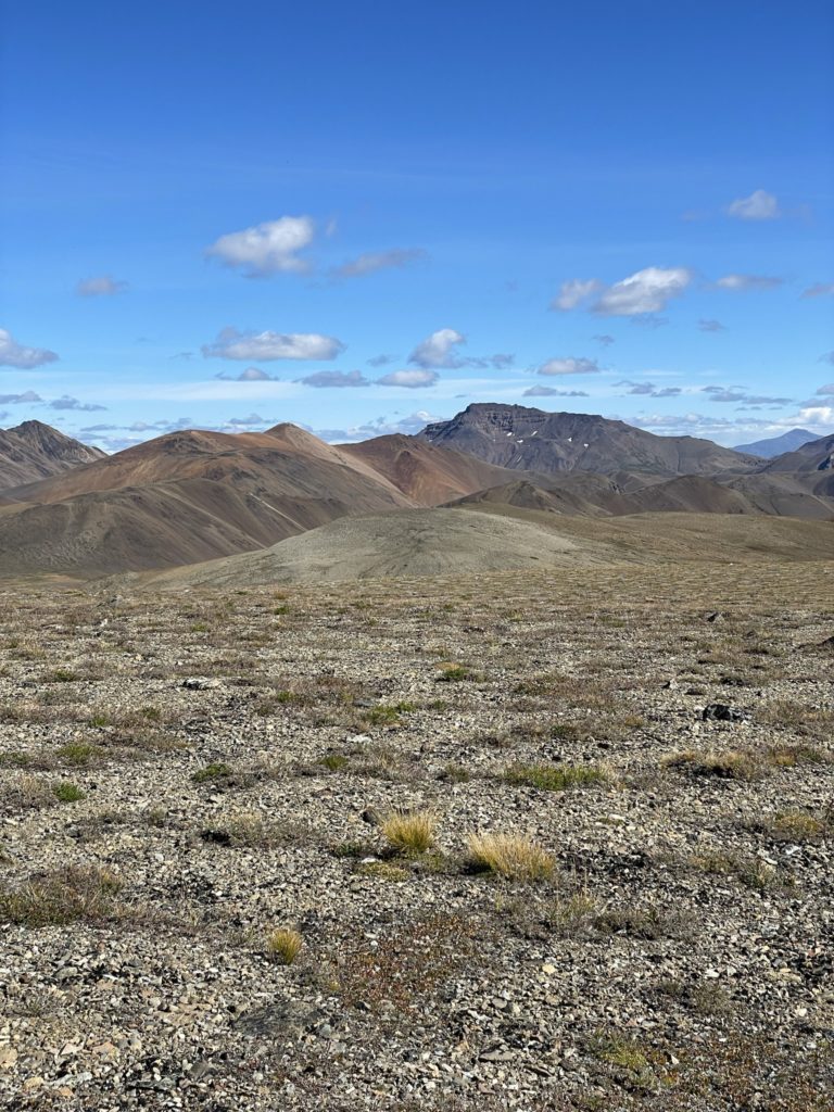
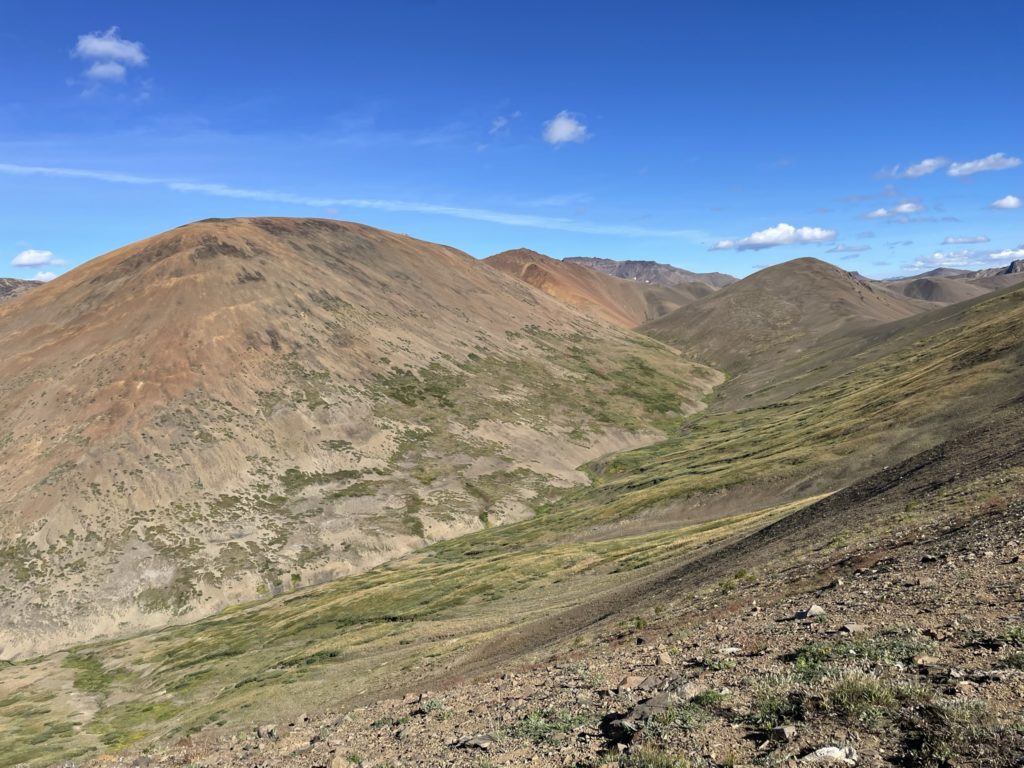
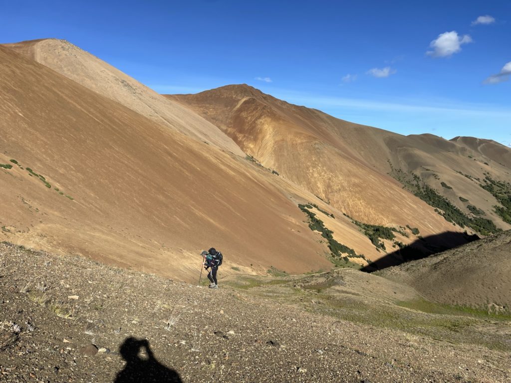
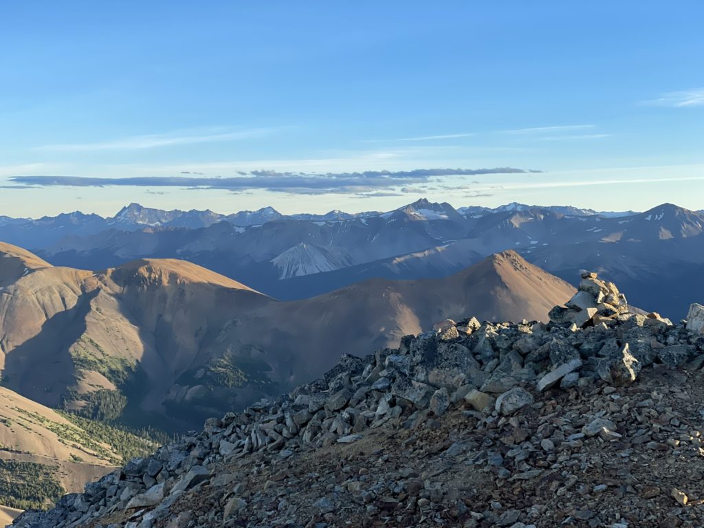
The first problem was actually getting to the lake. There’s a mountaineers route that involves 500m of scree bashing up to Tyaughton and then 800m of descent on the other side to reach the lake. Neither of us was super keen on lugging our heavy packs all the way up and over though. The next option was a lower pass from Lizard Lake that descended down just north of the Warner glacier. We could then follow the valley all the way to Lorna Lake. Neither Gaia GPS nor our paper map showed any indication this route went though and there was a big question mark of whether it was doable. Looking at the topo the terrain wasn’t too steep, but you never know with micro terrain.
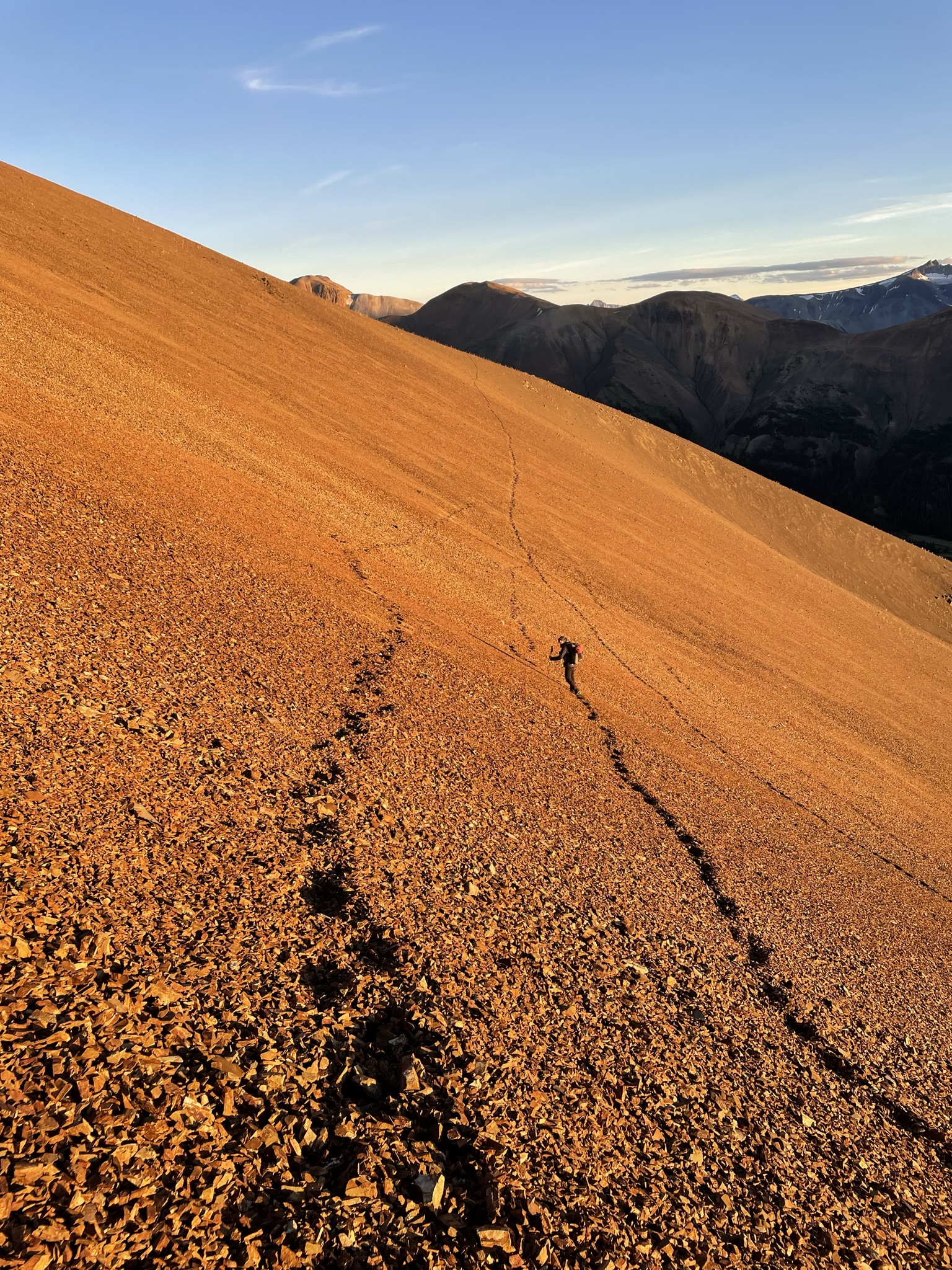
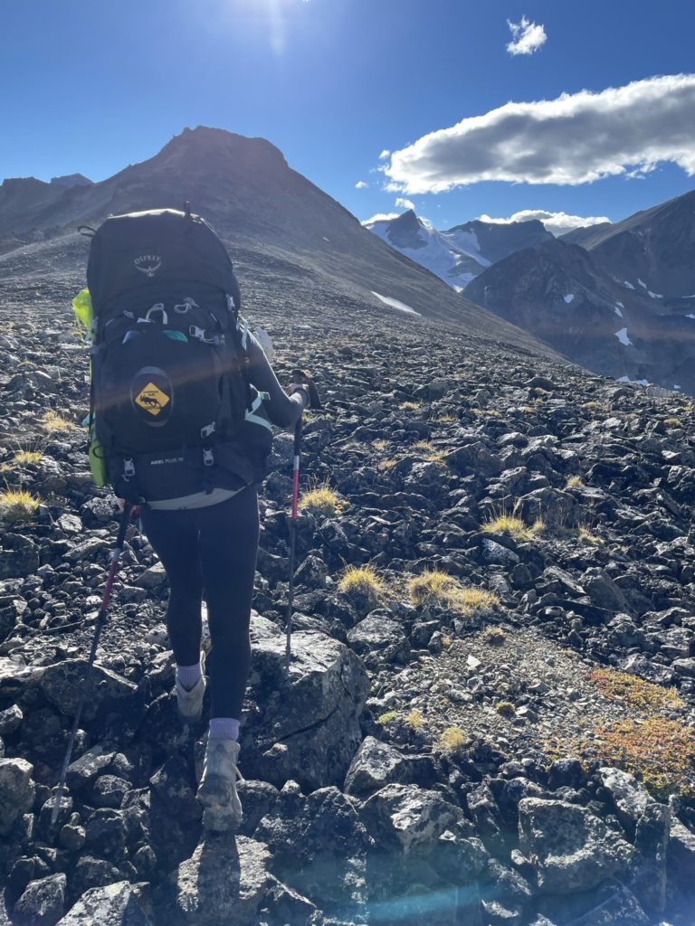
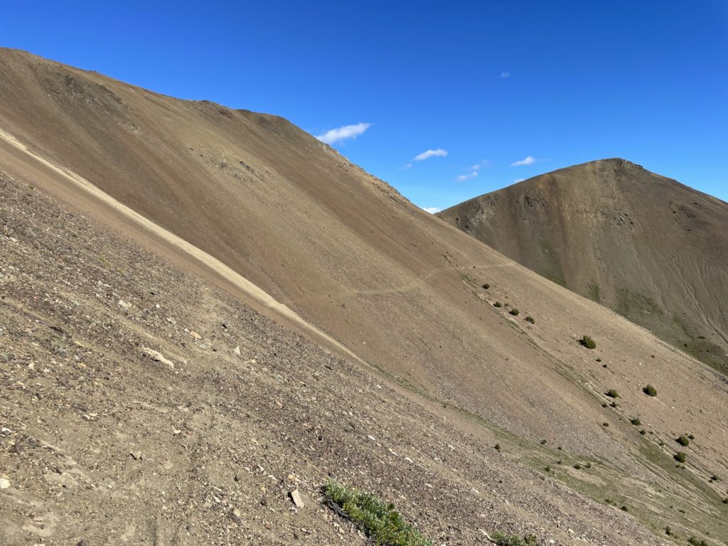
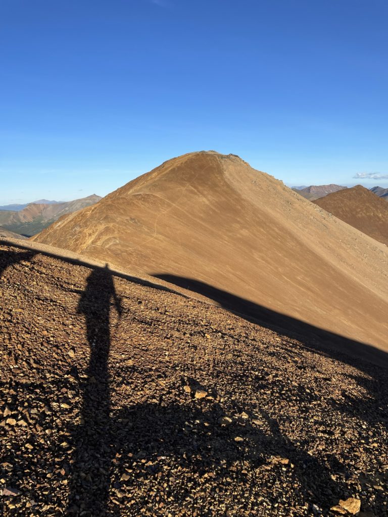
Rather than haul our packs up there just to find it doesn’t go, I made the call to do a short run to the top with just a pole and extra layer and see if I could spot a way down. Meanwhile Andrea would start packing up camp and we could get going as soon as I was back. To reach the top of this pass was just a short 200m elevation gain and then maybe 3-400m of walking across to check the other side out. I set off at a slow jogging pace and bashed my way up the scree slope to gain the top. I crested the ridge in about 17 minutes from our tent and then walked over to the other side.
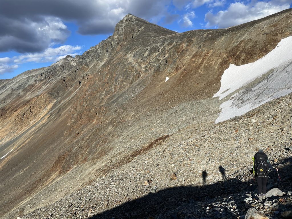
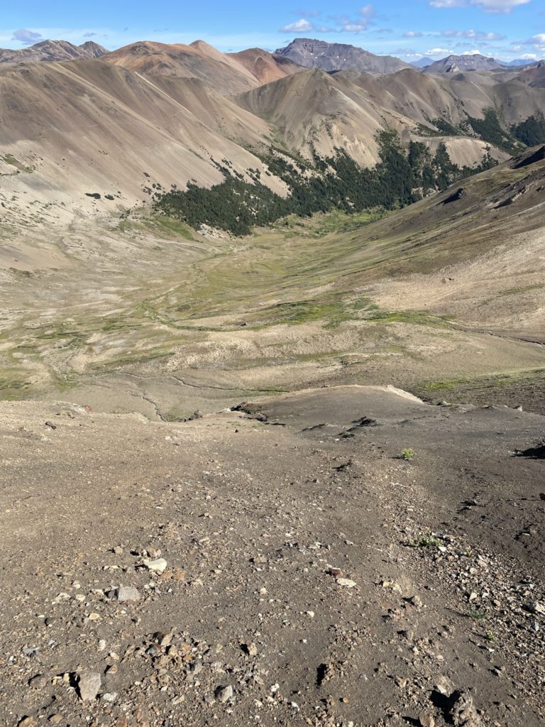
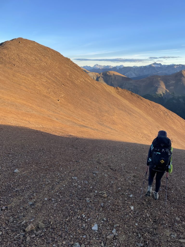
By some luck, there was a narrow ramp system that ran through a gap in a receding snow patch and ran to the valley floor below. This would be our ticket down, but I imagine in previous years that such an access never existed and without crampons would be a closed deal. I surmise this is why it never appeared on any maps, but with glacial recession occurring globally, this route was now available and we were certainly going to take advantage. With confirmation, I made the short run back to camp with an ~40 minute round trip time.
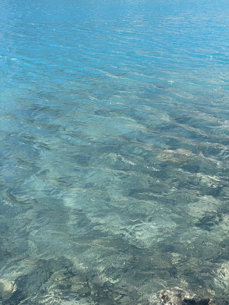
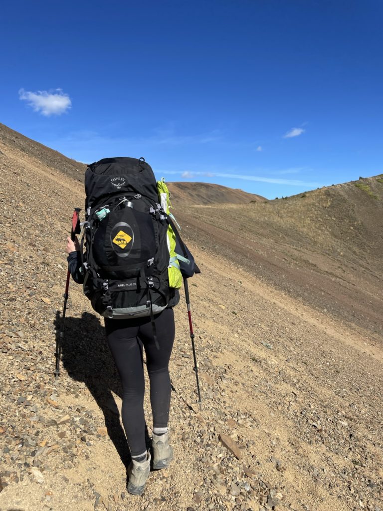
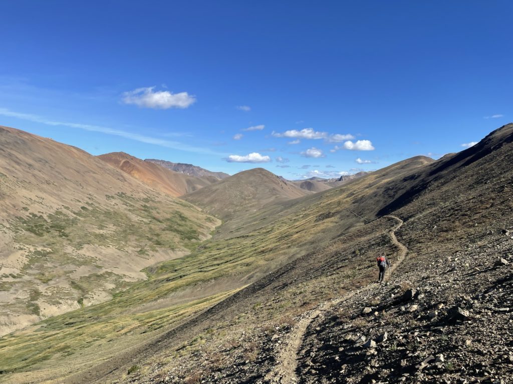
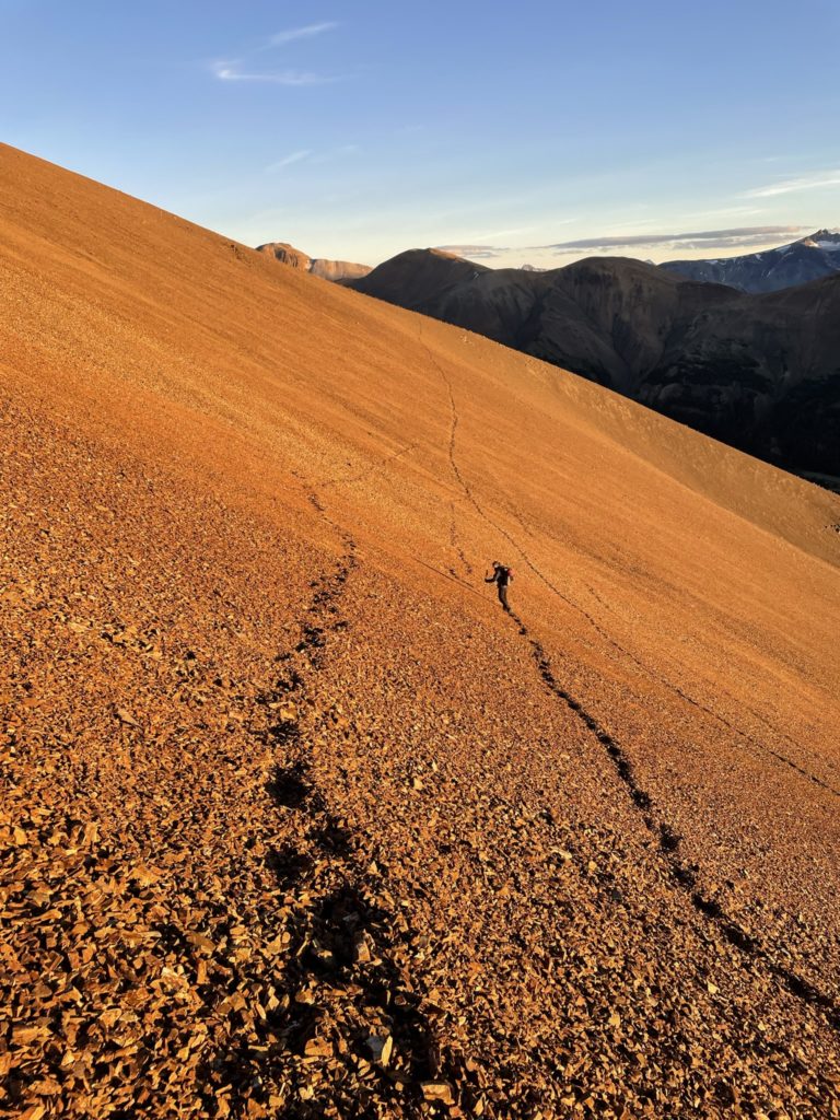
The day was still nice and we had ample time, so before fully packing up we did a quick swim in Lizard Lake which proved to be a nice highlight on our rest day. Unfortunately, we lost track of time a bit and by the time we packed up to go it was already 4:30pm. We’d have about 3 hours to do 7km and that seemed reasonable so we weren’t too concerned. I lead us through the steep scree slope up the pass following the same route I’d discovered a few hours earlier. Then we walked towards the south side of the pass and down through the access ramp in between the steep snow patches.
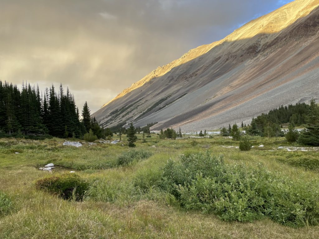
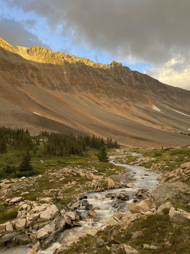
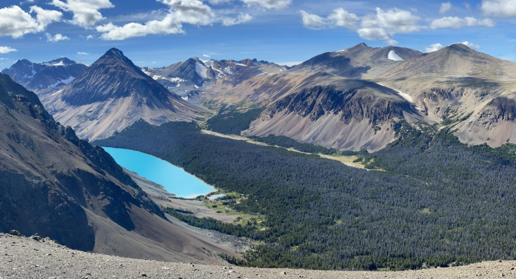
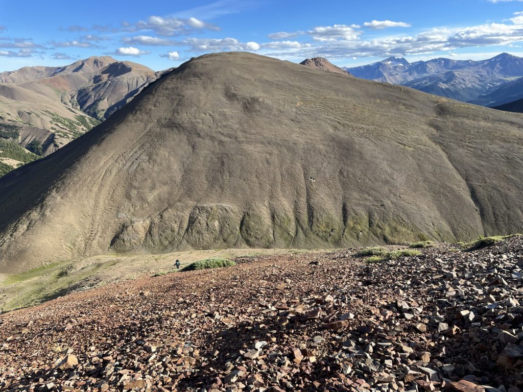
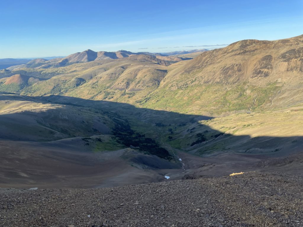
From here it was a long and tedious descent to the valley floor. There was a lot of micro terrain to negotiate and the scree slopes were highly variable making a fast descent tricky. We didn’t reach the valley floor until 6:30PM, way behind schedule. High above on the west side of the valley ominous clouds were starting to roll in and it was looking like we’d have to weather some rain and night time trail travel to reach the camp site. There’s also no official trail from the valley to Lorna Lake, but it’s quite open and wide so we weren’t concerned. On the maps there was a proper trail marked around both sides of Lorna Lake so if we had to do that in the dark it wasn’t going to be a big deal… or so we thought.

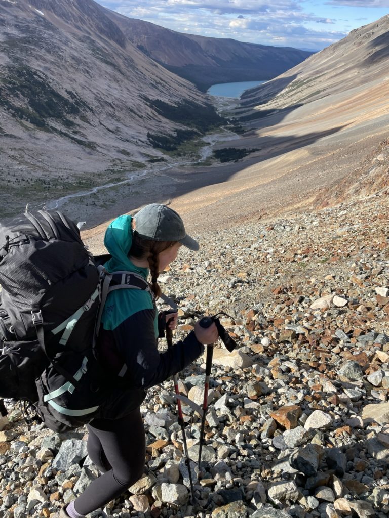
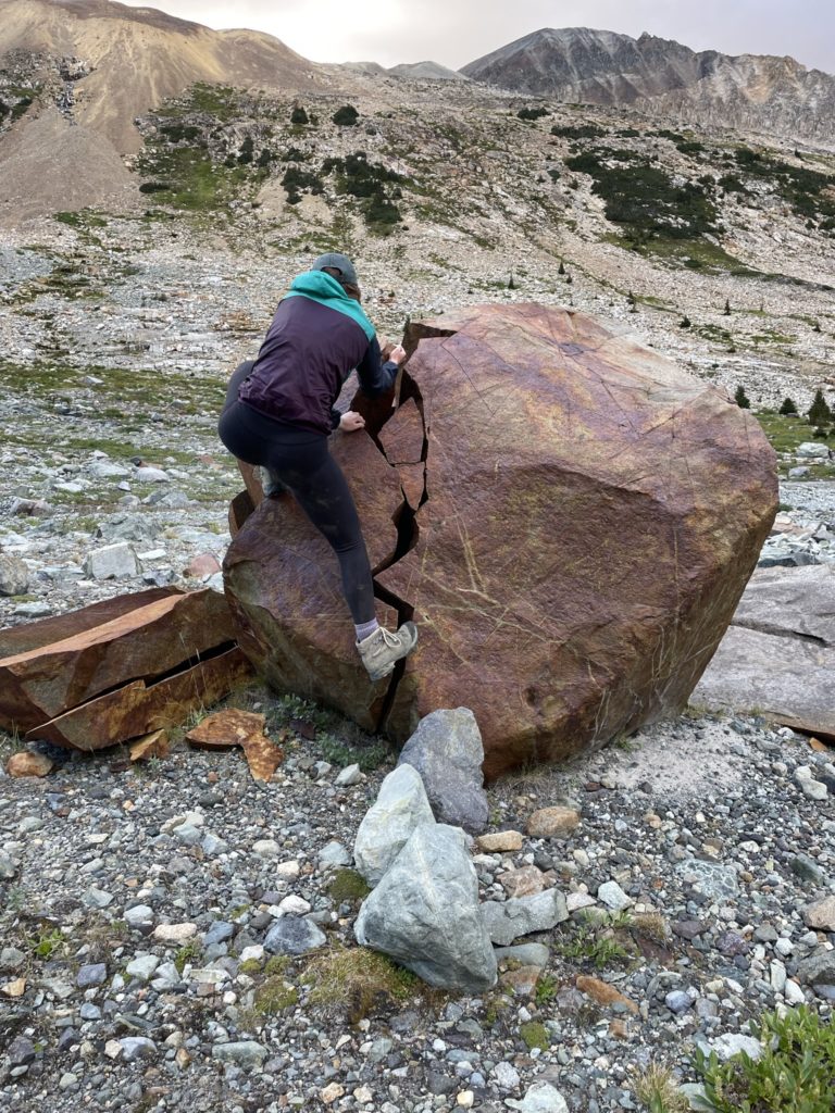
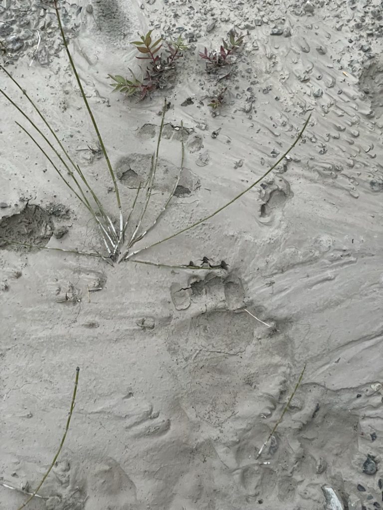
At the base of the valley, we took a small break climbing a cool boulder problem and then headed down to the lake at last. We didn’t make it more than 60m before running into fresh bear scat. At this point we were quite high in the valley and I really didn’t expect to see bear signs so high up. This immediately put me on edge as it’s getting dark and more or less ruled out our back up plan of camping higher in the valley and hitting Lorna Lake in the morning. Further down towards the lake was a generous amount of bear terrain and I just had a bad feeling about all of it.
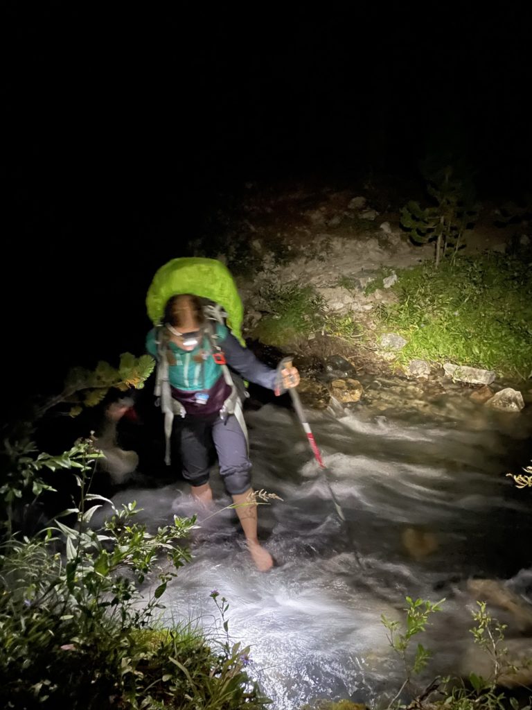
We had to reach the camp site one way or another though, so Andrea lead us down the valley and we did our best to make our presence known. Andrea did her best to keep us out of the chest high brush sections and followed close the river where visibility was better and the rest of the way to the base of Lorna Lake was uneventful. At the small delta before Lorna Lake we spotted more bear signs. This time a fresh bear track heading into the forest. I didn’t like seeing that either as the Lorna Lake route feeds into a narrow choke point between a small ridge and the lake shore and that can only increase the chance of an encounter.
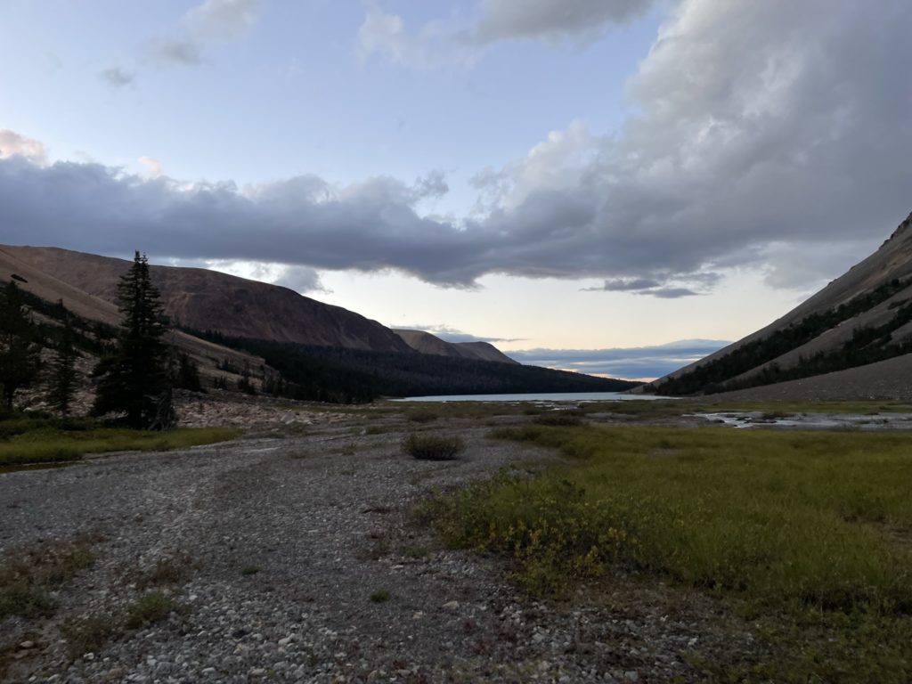
Our mood did lighten a bit though when we also spotted a fresh boot print. That must mean someone took the Lorna Lake trail recently and we would at least be an official path in the dark. We finished crossing the delta and reached the base of the forest on the east end of the lake. To our surprise there were no cairns or obvious openings into the forest. It’s also just about dark now and I was getting a bit worried we wouldn’t be able to find the trail. Andrea finally spotted something near the shore and we walked along a brief section of trail. It opened out to some seemingly long abandoned camp with one man made stake post as the last remnant. Then the trail disappeared to nothing… it’s now basically dark and we had to get the head lamps out. The decision was made to follow the shore line where a game trail appeared to exist and then we would do a zig zag up and down the supposed elevation of the trail until we found it. This way we’d still make progress to the camp site and have a good chance of catching the trail.
The trail along the shore soon lead into the forest and then disappeared altogether. We continued on past the end of this trail and just bushwhacked through the forest. There were a few tight sections of dead fall, but it was otherwise fairly open forest to travel through. Occasionally we’d spot what we thought was a trail but then it’d soon disappear after and we’d continue just bushwhacking along. This part was honestly quite eerie with the dead trees in the darkness and one of the most remote areas of the park. Around 500m around the Lake we gave up on finding the official trail as it’s clear it was either entirely over grown or non-existent anymore. The plan now was to stick close to the shore line and just follow game trails wherever they cropped up. As the bushwhack continued on, I began to ease up and realized we’ll reach the camp site sooner or later as it’s fast enough travel through the forest.
Somewhere around 400m before the end of the lake that all changed. I was now in front, pushing through a tighter section of trees when I looked to my left and my light glanced off a set of large eyes lurking deeper in the forest. I stopped dead in my tracks and a ducked down to get my head lamp a more direct line of sight on what I just saw. My heart dropped when I made out the unnerving silhouette of a bear not more than 15m away. The subject of nightmares was now our reality. I shouted to Andrea to get close and pulled out the bear spray immediately. I was honestly scared as all hell, but there’s only one thing to do and that’s make as much noise as possible to see if we could scare it away.
As we yelled, I could make out its head turning and fading back into the forest. Andrea and I then moved slowly right towards the shore line to see if we could get past it. We both scanned the tree line constantly and after moving another 20m I spotted the eyes again further down the forest still ahead of us. Great it’s not going away. I pushed down all the way to the shore line to get some space while we sorted out a plan. There’s no time to panic, so I quickly gathered the best idea was to keep yelling, and traverse along the shore line and get towards the camp site with the bear behind us.
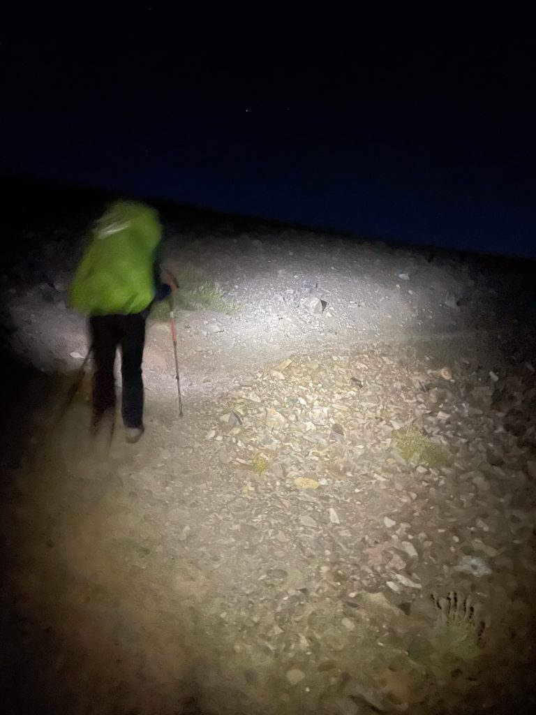
Unfortunately, the shore line tapered off into a marsh and we had no choice to ascend a bit higher into the forest where the bear was. This time as we pushed up, I didn’t spot any eyes. Andrea kept scanning behind us, while I lead the most direct line to the camp site as I could. A few hundred meters later and we finally reached the camp site and an official trail at long last. Still no sighting of the bear. However, we’re both spooked at this point and the idea of camping deep in the forest with no bear cache this close to the bear was totally off the table. We pushed past the camp site and decided we’d hike all night to reach the safety of the alpine if we needed to.
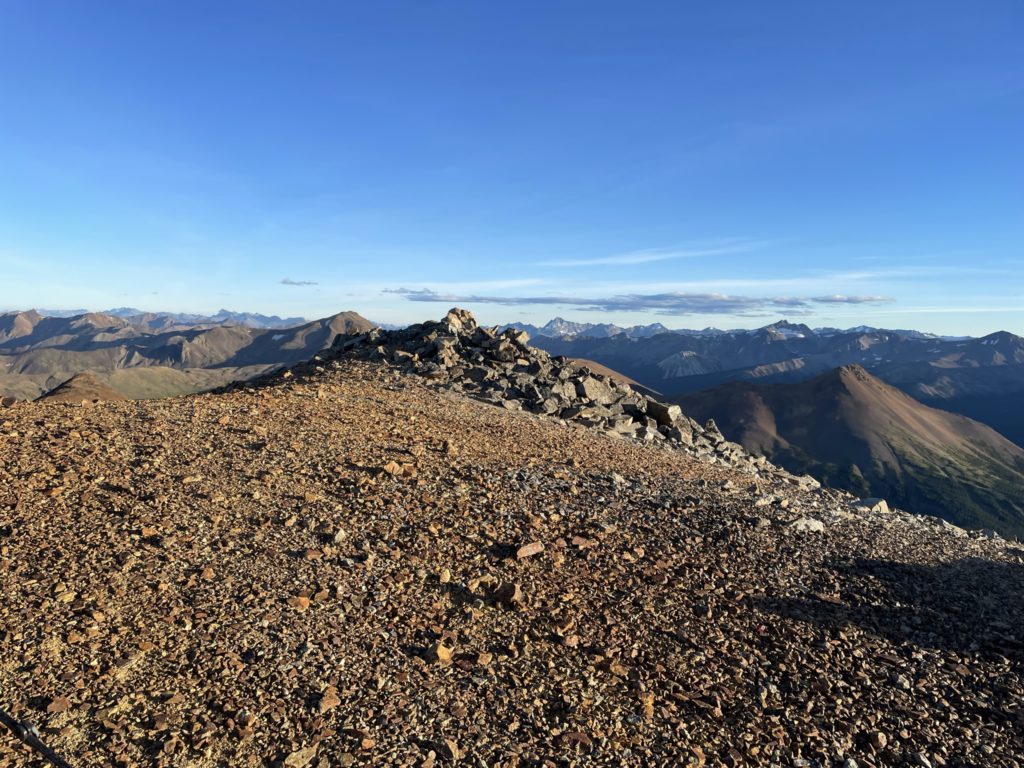
Thankfully, the official trail we’re on lead to an area called Lorna Pass at around 2300m and it’s only an extra 3km to get there. That’s the new plan and we hiked quickly along the trail, constantly looking behind us for any sign of a lurker. Perhaps 1.5km beyond the camp site we finally eased up a bit as there’s no more sign of the bear. I was still very much on edge though, so we didn’t linger for long in the forest and made it to the safety of Lorna Pass somewhere around 11 at night. The encounter was finally over in my mind and we setup camp for the night and some much needed rest.
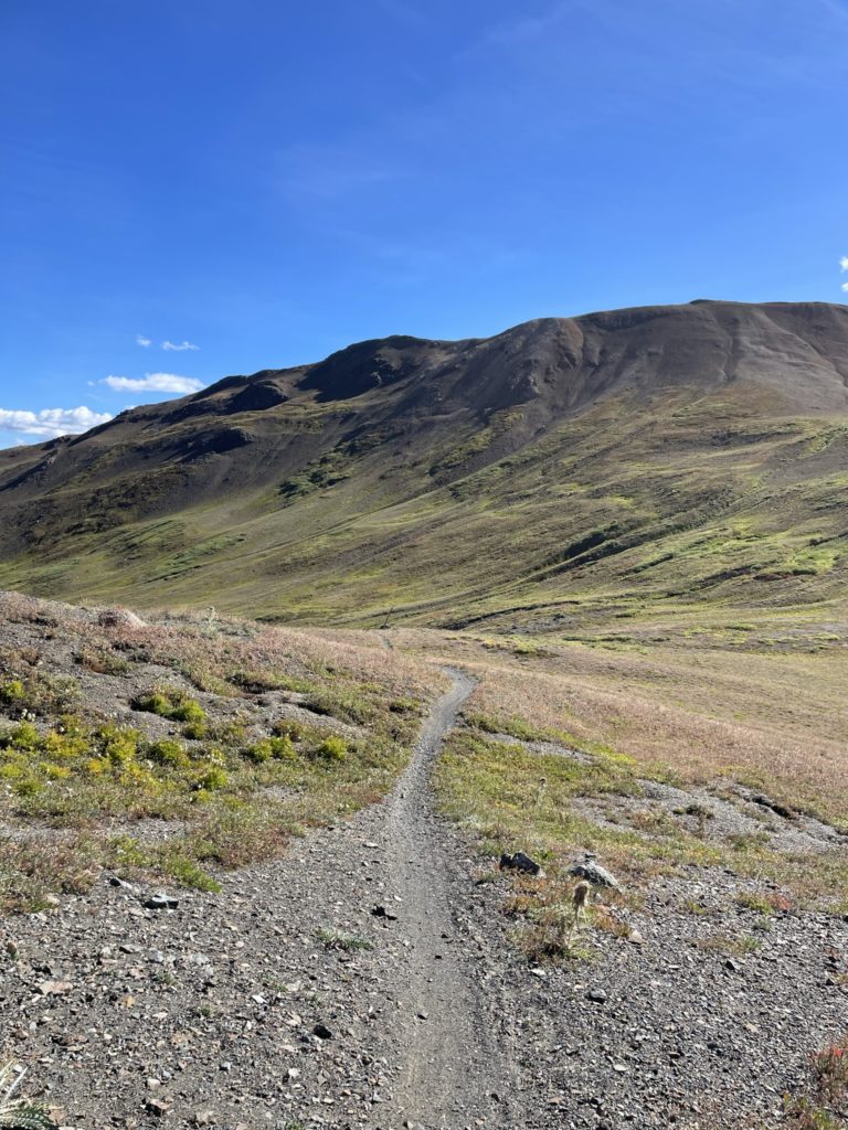
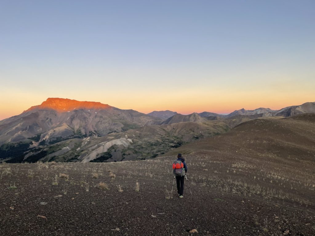
I slept surprisingly well and woke up feeling at peace with the nights horror now behind us. Thanks to our all night push, we’re also much further along than planned and that meant an easy day of ascending up Mount Davidson and camping near the base of Mount Cunningham for the following day. We took our time in the morning generally running over the nights events and just feeling happy to have it all over. It wasn’t until 1:30 that we got going up the ridge above Lorna Pass.
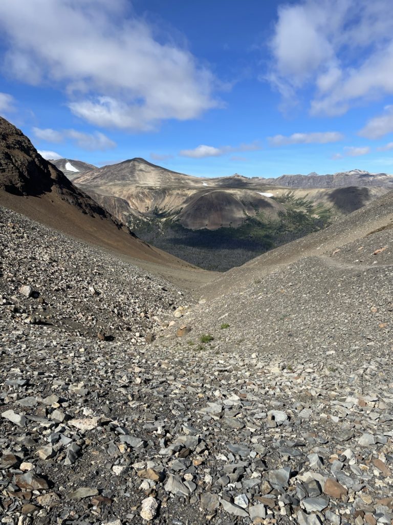
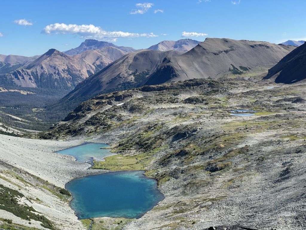
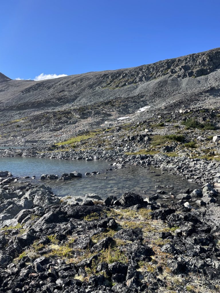
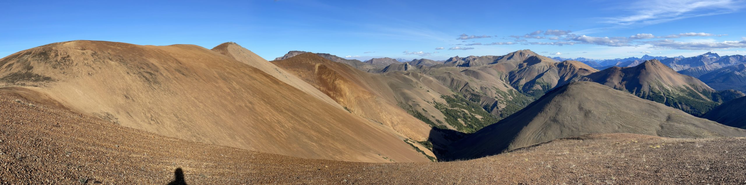
We made a small detour and walked to the northern edge of the ridge to get a view of Lorna Lake and the ranges towards Big Creek Provincial Park. Then we followed the ridge east and dropped down into Elbow Pass. We briefly considered going up Elbow Mountain, but it’s not more enticing than Mount Davidson and out of the way, so we decided to skip it. From Elbow pass we skirted along a trail carved through the southern aspect of “Davidson W3” and reached Tyoax pass. Then we followed a beautiful trail through the tranquil valley to reach the base of Mount Davidson.

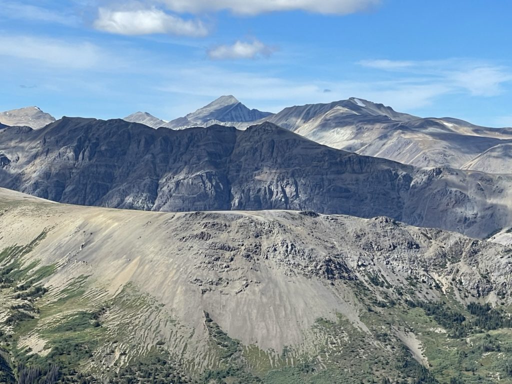
At this point we were out of water so had to make a small detour down to a creek to refill and then we started the charge up the western sub summit of Davidson. From afar, Mount Davidson appears as 4 prominent mounds of striated red rock piled high above the ground. It’s shape is reminiscent of sand trickling down from an hour glass into neat piles or ornate colours that form the 4 distinct peaks. Gaia marks the western sub-summit as the true summit, but in fact the third peak from the west is the tallest. The slog up this scree slope was the toughest yet now 5 days into the trip. We crested the ridge after our hard push and then it was a straight forward ramble up to the true summit just a few hundred meters down the ridge.
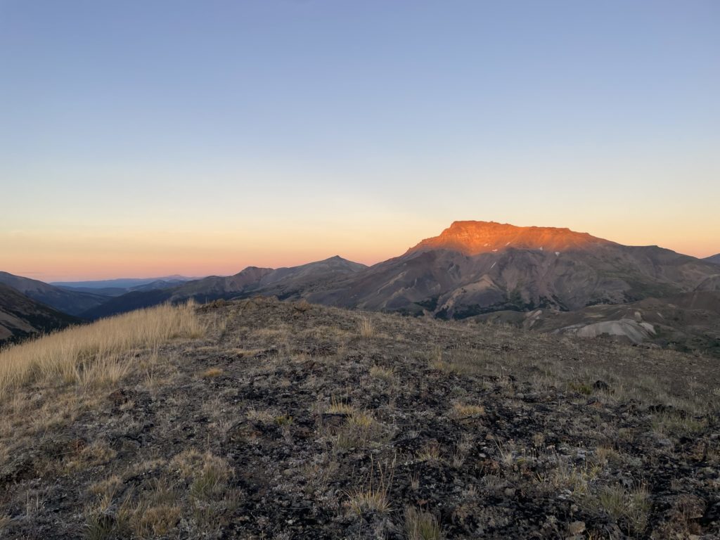
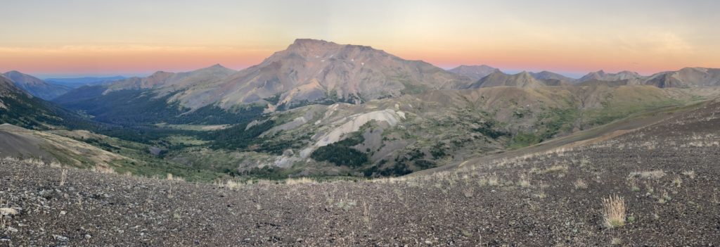
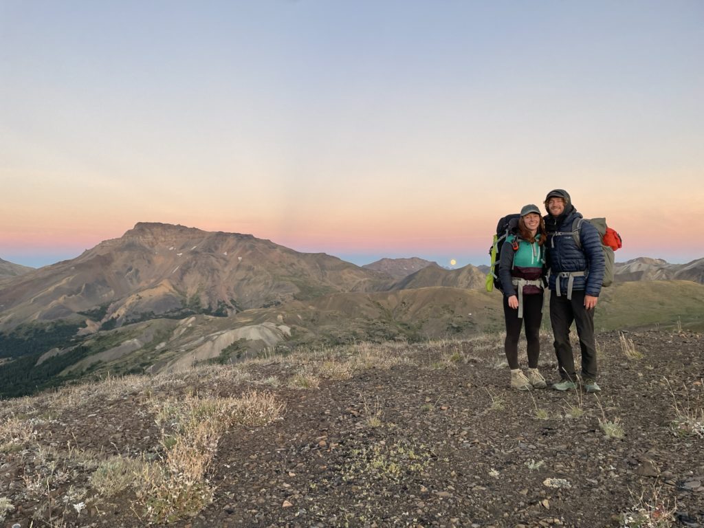
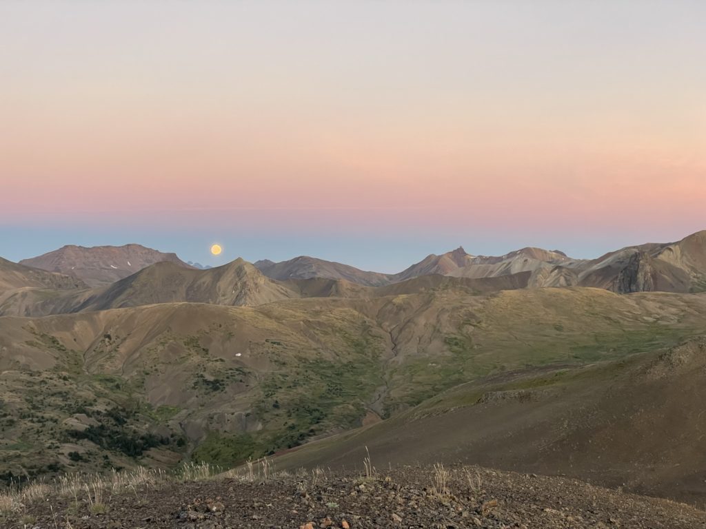
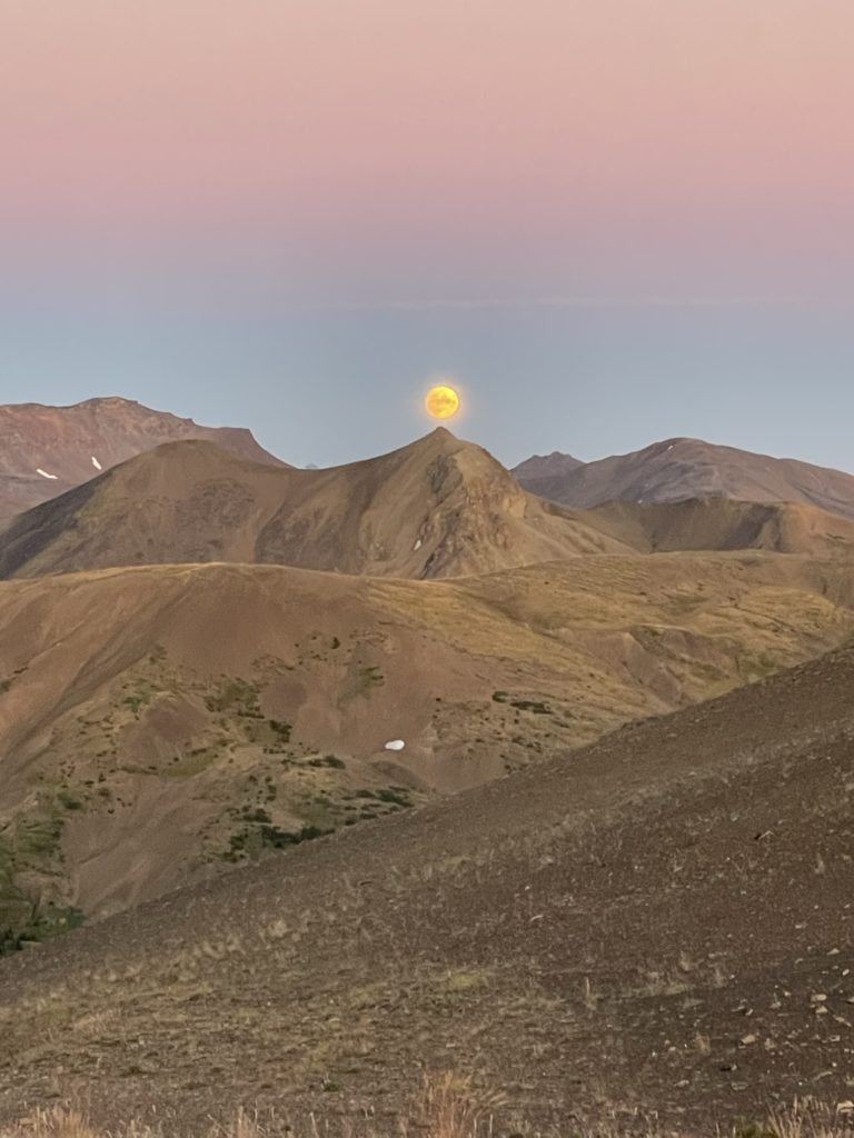
After a brief snack break on the summit we descended to the 4th peak and then skirted around the loose scree field on its southern flank to avoid unnecessary elevation gain. As we traversed along the ridge we caught an amazing sunset and moon rise above castle peak and this became one of the big highlights of the trip.
We continued along ridge at the eastern end until finding a satisfactory camp site about 1km from the base of Mount Cunningham and settled in for the next days adventures.
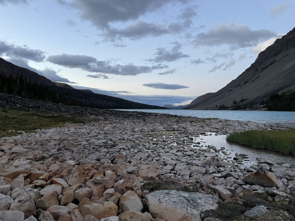
More fantastic photos bring back good memories of Lorna Lake.