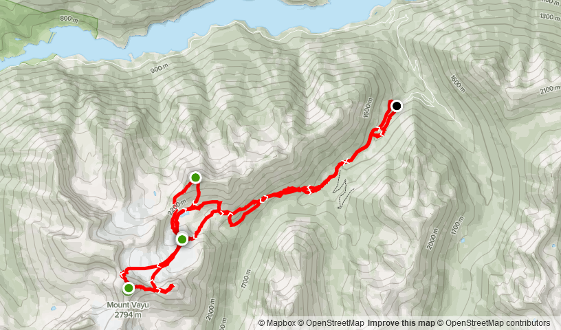
Elevation Gain: 2,186m
Distance: 25.42km
Total Time: 3 days
Date: July 31st, 2022
Stats include all days in the Vayu Massif area
One of my favourite past times is scanning through maps of BC looking at remote or obscure areas in the hopes of coming across an interesting mountain. Then, figuring out how to get there and if it’s even possible. Mount Vayu is one such mountain I discovered back in 2020 while peeking around the Downton Lake area. My online research only really netted one trip report from 2011 and it revealed an aesthetic NW Ridge ascent that went up to 5th class. It looked like a really cool alpine route in a rugged and remote part of BC and caught my attention immediately. However, at the time I was only just dabbling into scrambles and so I tucked the idea away into a dark corner of my mind…
Coming into the long weekend, Elise, her boyfriend Derek and myself had been deep into the planning phase of an obscure objective in the Skihist area. We were satisfied with the plan and now all that had to be done was the execution. Elise was only free starting Saturday afternoon, so we planned to leave Vancouver around 4PM in Derek’s truck and stage ourselves near the Skihist trail head for the following days full on bushwhack. In the 11th hour, we had hiccup when a part for Derek’s truck didn’t arrive in time and my truck would not be sufficient for reaching the trail head. Derek applied some ingenuity and came up with a hybrid approach where we’d load his dirt bike into my truck, drive as far as I could and then ferry us the rest of the way. With a new plan in place I woke up on Saturday as stoked as ever.
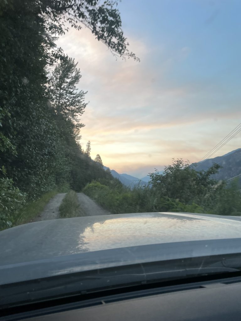
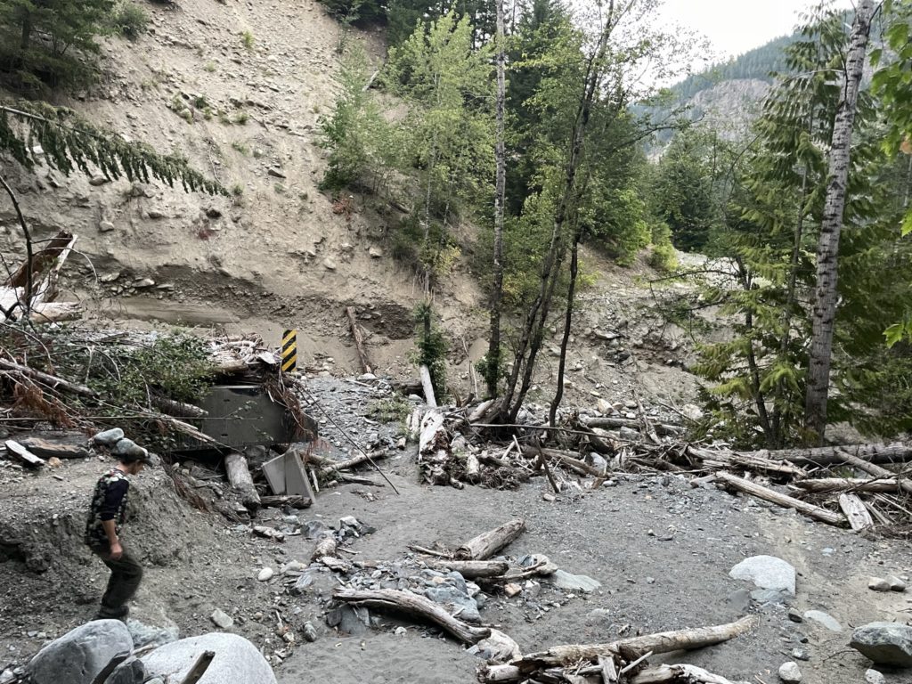
By 4:15PM I was rolling up to Elise’s and we started sorting out some last minute group gear and dirt bike loading. Then we’re off towards the Skihist area. It was about a 2.5 hours to the turn off at Boston Bar and then we drove down a variety of service roads for close to 1.5 hour. At about 15km down Keefers road, we drove around a bend and came to a halt before a very disheartening scene. One of the permanent bridge structures had been completely destroyed from flooding. There was at least 20-30m section of the road washed out with no way for the truck to cross. Everyone hopped out to survey the scene and Derek immediately got to work assessing a dirt bike work around. We spent at least an hour trying to see if we could get his bike across, but the eroded embankment on the other side was nearly vertical hard packed earth. With the fading light it was looking like our objective was a complete impossibility.
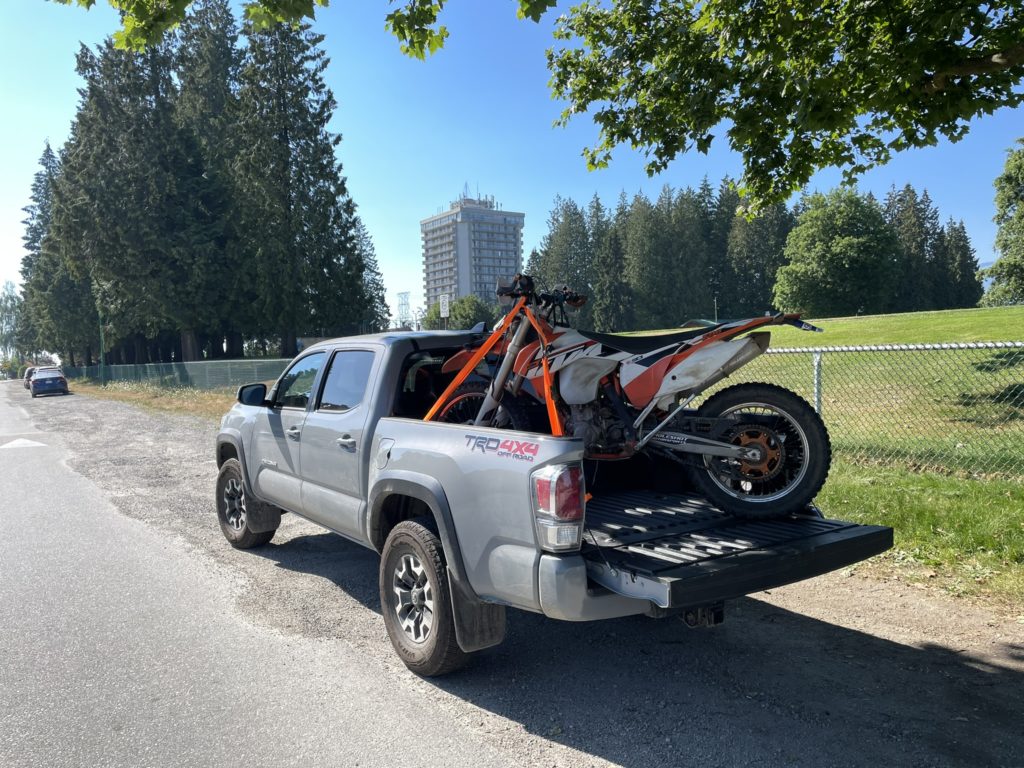
Not sure of what to do next, Elise started searching her phone for some back up plans and few ideas came around: Mount Severide near Vernon, Mount Begbie in Revelstoke and a few others. However, we had all set aside 3 days to tackle something remote and technical and we held our hopes that we could find something similar. That’s when Elise mentioned a once familiar name…. Mount Vayu. I’m not sure what she searched that caused it to pop up, but I lit up inside when she mentioned it. That NW Ridge matched exactly what we were looking for and while we could do it in a single day, if we spent a few days out there we could explore more of the area in a relaxed pace. We’d have to drive 1.5 hours back to Boston Bar and then another ~4 hours to Gold Bridge to reach the Mount Vayu area, but we didn’t have any better options. Some recent road beta also revealed that the old starting point was no longer accessible due to a permanently locked gate at the base of the Jamie Creek FSR. Thanks to already having a dirt bike on board, this actually presented a nice opportunity to skip a bunch of boring road walking. Now everyone was excited about the new plan and so I started reversing course back to Boston Bar.
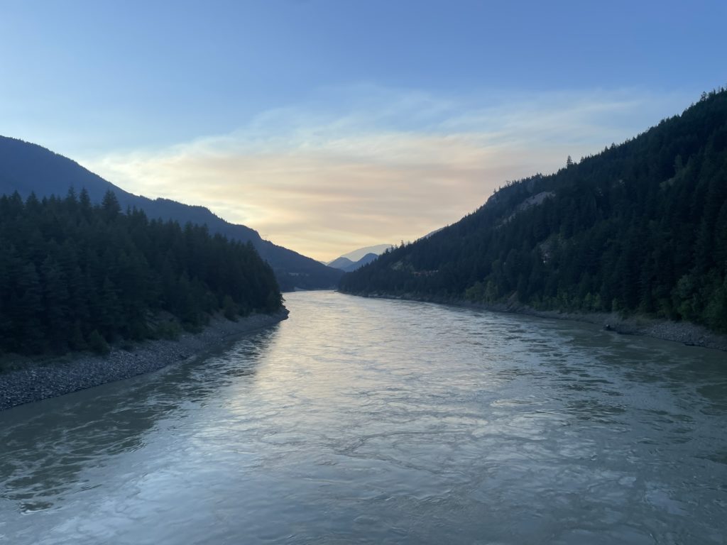
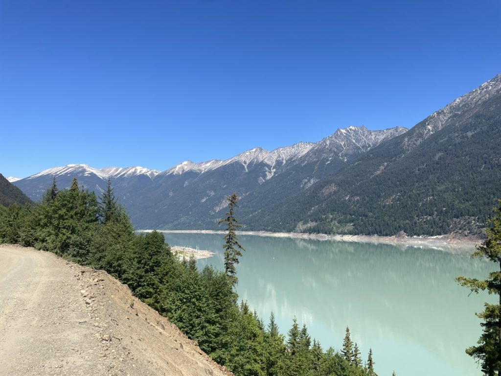
From Boston Bar, I drove all the way to Lillooet, which by this point it was now past 1AM and I decided we should just finish the drive up in the morning. Derek found an empty asphalt road off the highway and we set up cam for the night in an undeveloped cul-de-sac. I slept amazingly and didn’t wake up until 8:30am or so. We tore our tents down, made a pit stop at the A&W and then drove out towards Gold Bridge. I took us past the turn off for Gold Bridge and then down the Bridge River Main FSR for a ways until reaching the base of the Jamie Creek FSR. As anticipated there was indeed a locked gate at the beginning.
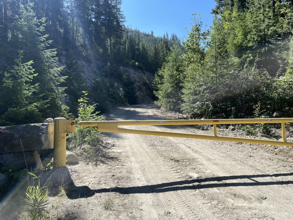
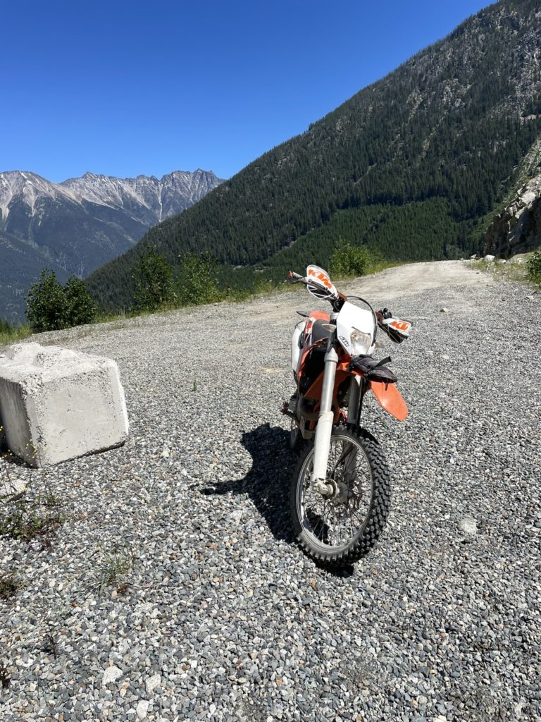
Derek got to work unloading the dirt bike while Elise and I sorted out some gear. I helped Derek slip the bike under the gate and then he went for an exploratory ride to see how far up the road went. Perhaps 15 minutes later he returned, with good news that we could get at least as far as the pump station at KM 4.9. Then we started ferrying the gear up to the pump station, with Elise going first and then myself last.
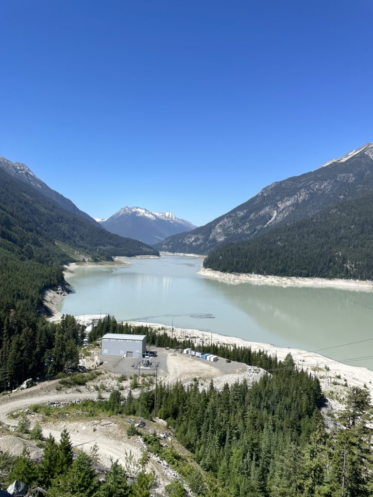
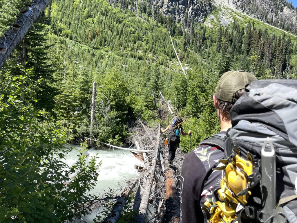
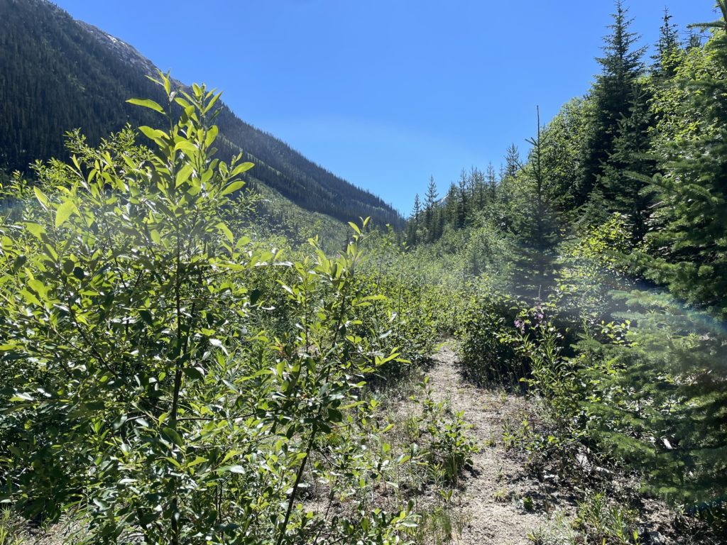
At the pump station we discovered that the bridge to Jamie Creek FSR was now out and replaced by the pump station infrastructure itself. There was no easy way to cross with the wild torrent of Jamie Creek, although we briefly considered crossing the concrete divider across the river. For some reason, we all figured a log crossing would present itself not far up a head and so the decision was made to just start bushwhacking through the cut block on the east side of Jamie Creek instead.
I lead the way through initially pleasant terrain continuing on for a few hundred meters until the cut block ended. Then it’s a bit of old growth forest before descending into complete madness. Just beyond the old growth section was a several hundred meter wide slide path. The entirety of which was filled with dense slide alder and a menagerie of chest high vegetation. We pushed through the densest section, struggling to make much progress, but eventually popped out into an opening. Directly above appeared to be a clearing with justvegetation to deal with so I lead us further away from the alders. I barely made it 20m before getting sharp stings with each step. I took a moment and then I looked around to discover that we were now bushwhacking through a field of stinging nettle.
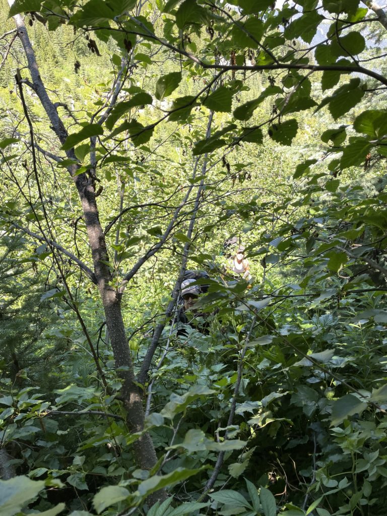
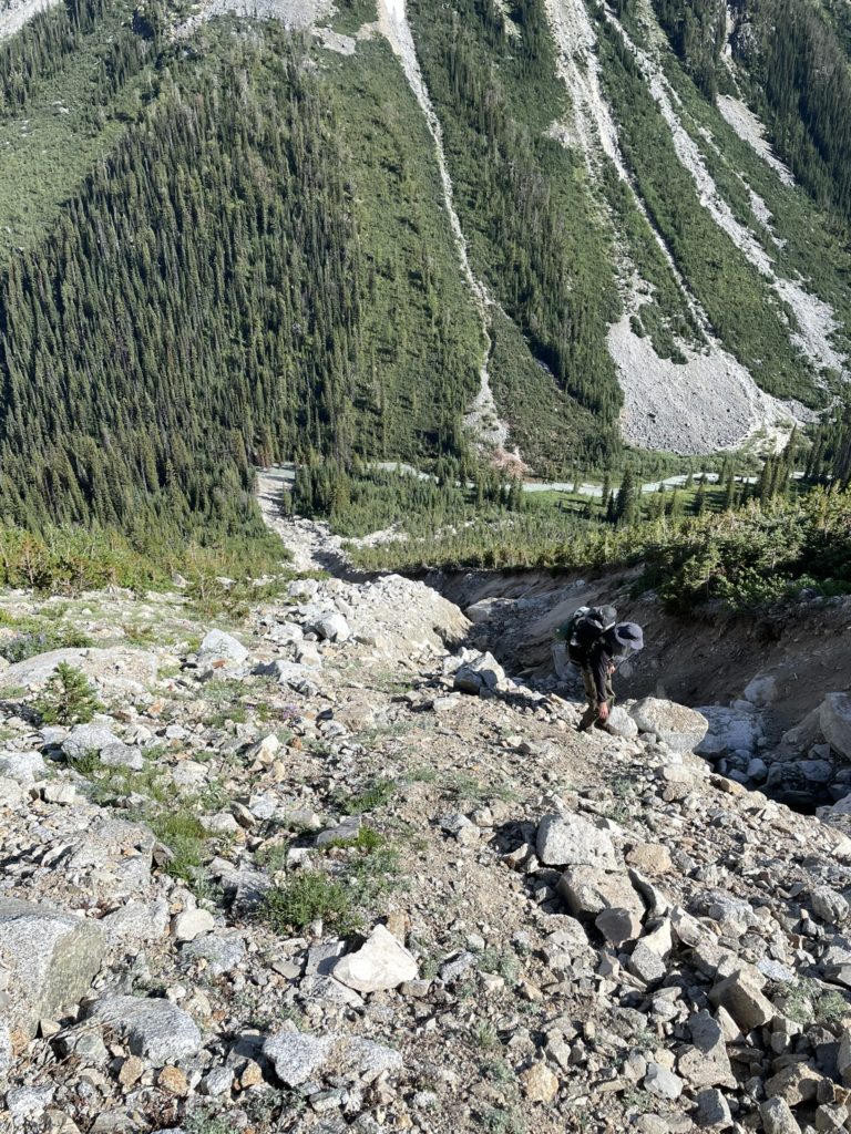
We quickly retreated back into the alders and then formulated a new plan. All of us were getting drained by the horrendous bushwhacking so we decided to cut diagonally towards Jamie Creek to see if we could locate a crossing. Even from afar, the Jamie Creek FSR looked much less overgrown. I lead us down to the water through a sea of alders and to our disappointment no crossing presented itself. We pushed further south by another 60m or so and that’s when Elise discovered a crossing at last. Relieved, we rushed across and found, almost disappointingly, that the west side of Jamie Creek was completely free of dense bush. In fact it was a breeze to walk through. By now we’d spent over an hour barely getting a kilometer, but we were happy be out of the worst of it at least.
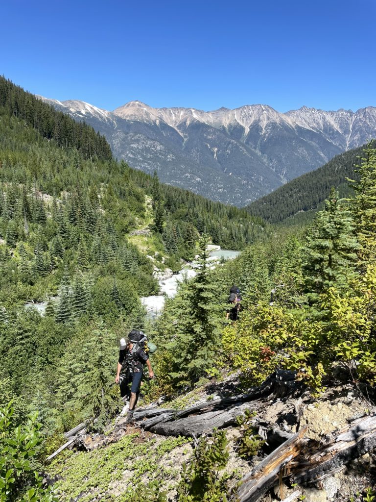
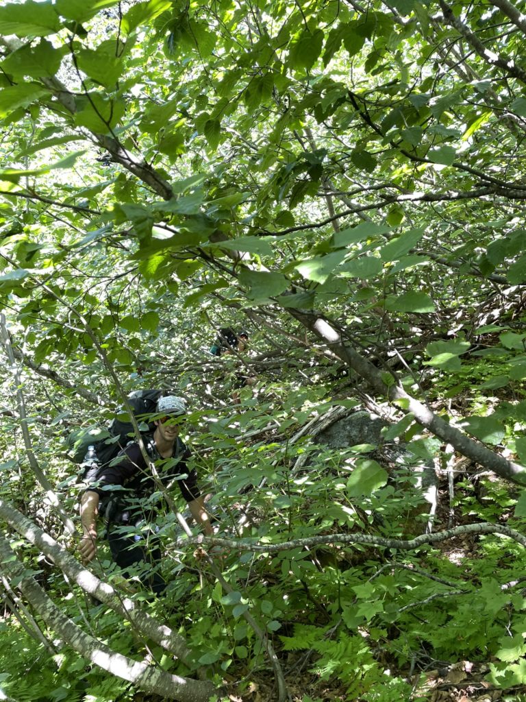
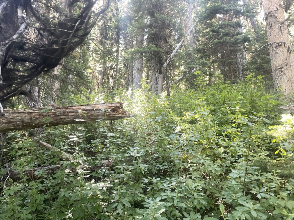
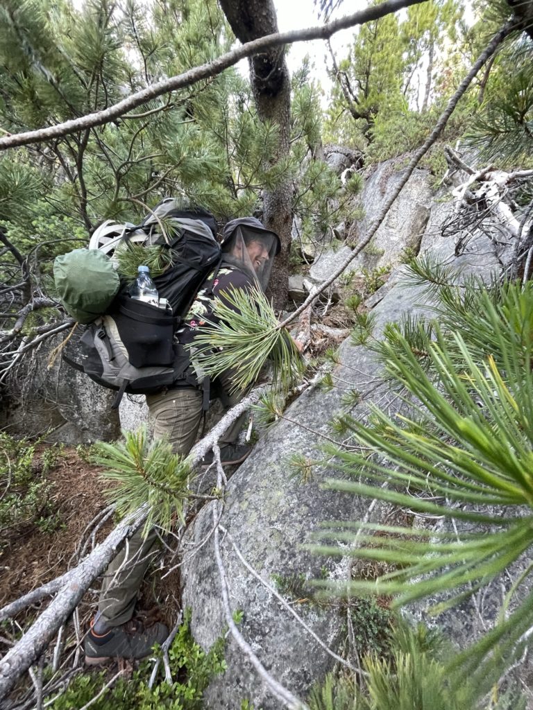
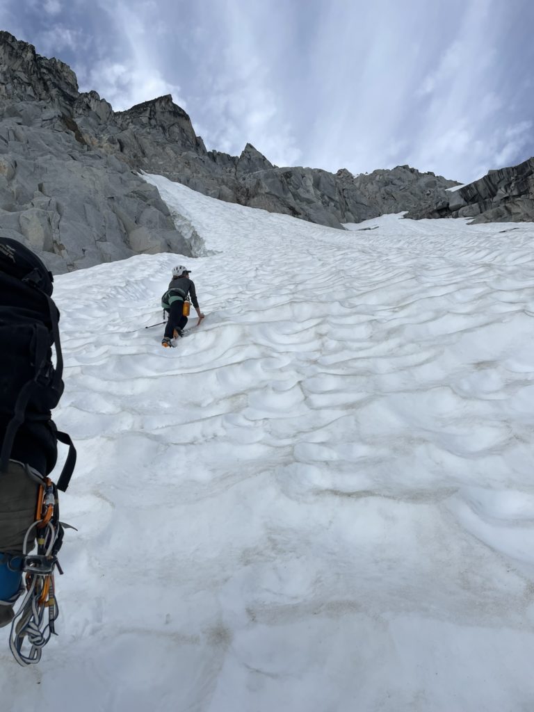
Using that same trip report beta I had found in 2020, Elise lead us down the Jamie Creek FSR and then up an unmarked (on maps at least) spur road for another 500m. We reached a swampy section of cut block and that marked the beginning of the prolonged bushwhack up to the Vayu area. The goal was cut diagonally up the slopes for about 2.5 km to reach the outflow of Pancake Glacier at the base of Mount Vayu. Where the worst of the bush ended, the worst of the mosquitos now began. After the cut block we started getting swarmed and while we weren’t in that slide alder hell anymore, the bush here was still defeating with swathes of dead fall, dense clusters of stunted pine trees and even the odd batch of alders as well. Add the mosquitos in the mix and it was turning into a quintessential BC bushwhack experience.
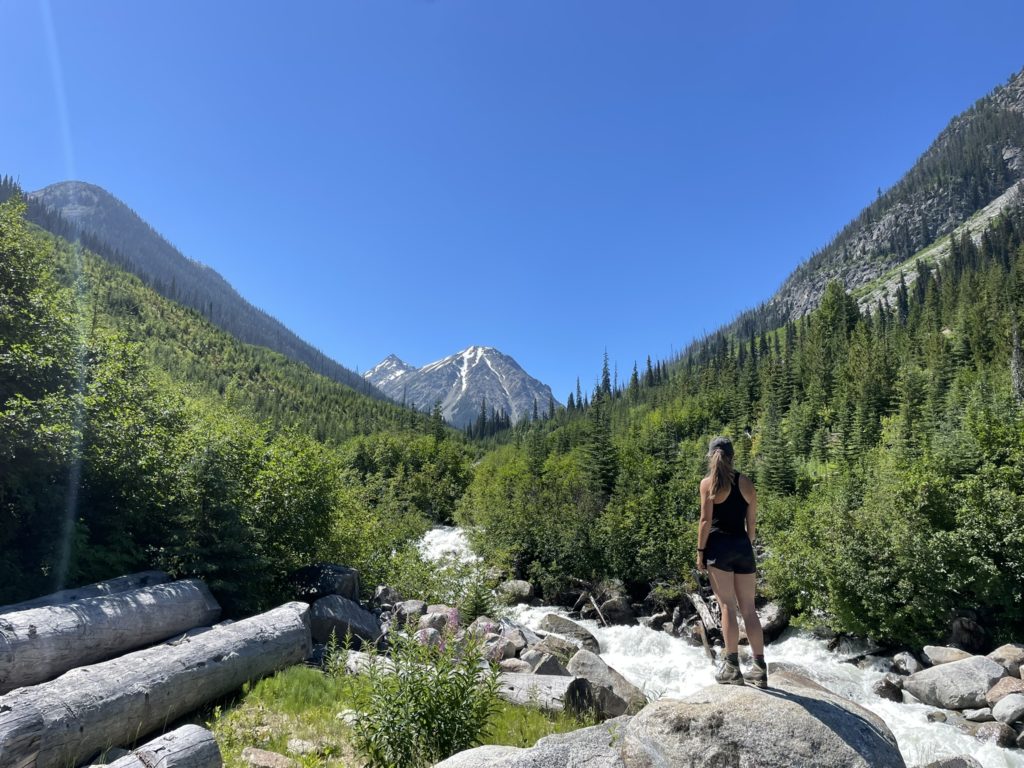
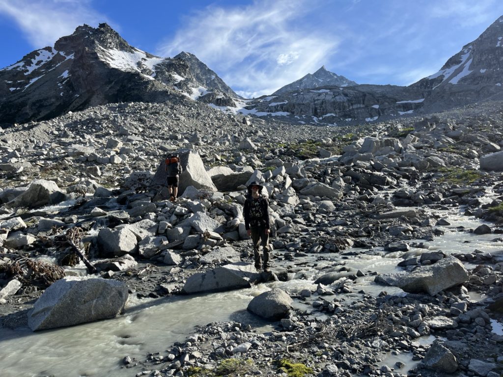
We took turns leading through the forest and it was slow going with lots of pockets of dead fall to circumnavigate, a few bluffs and at one point a major wash out gully to cross. Still, we made consistent progress and by 6PM we were finally reaching the glacial terminus. However a new challenge presented itself. The water feeding into Jamie Creek from the glacier was running at a raging pace and there was no good way to cross it lower down. As a result, we had to ascend further north up through the forest and onto a boulder field. At the top of the boulder field we started traversing towards the weaker outflow higher up and finally found a crossing at around 2000m.
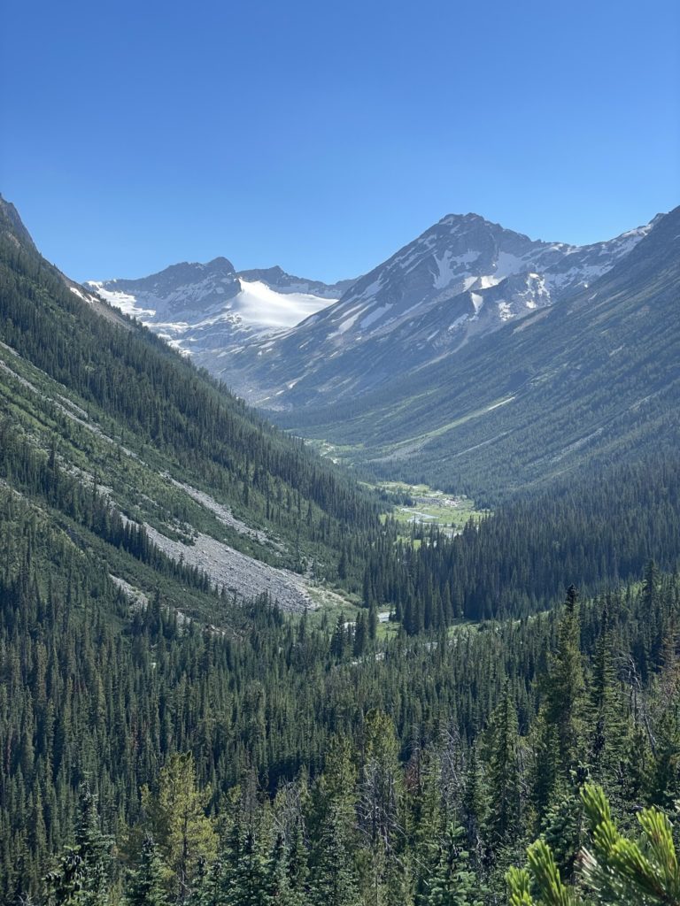
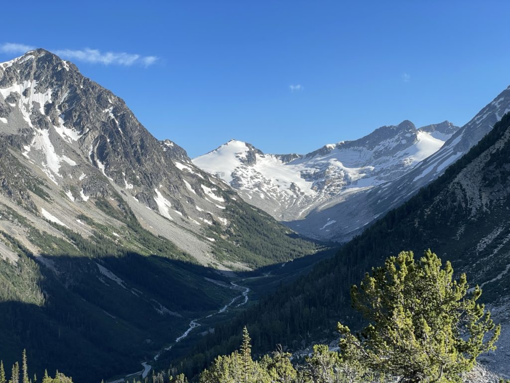
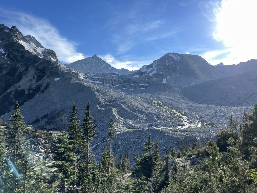
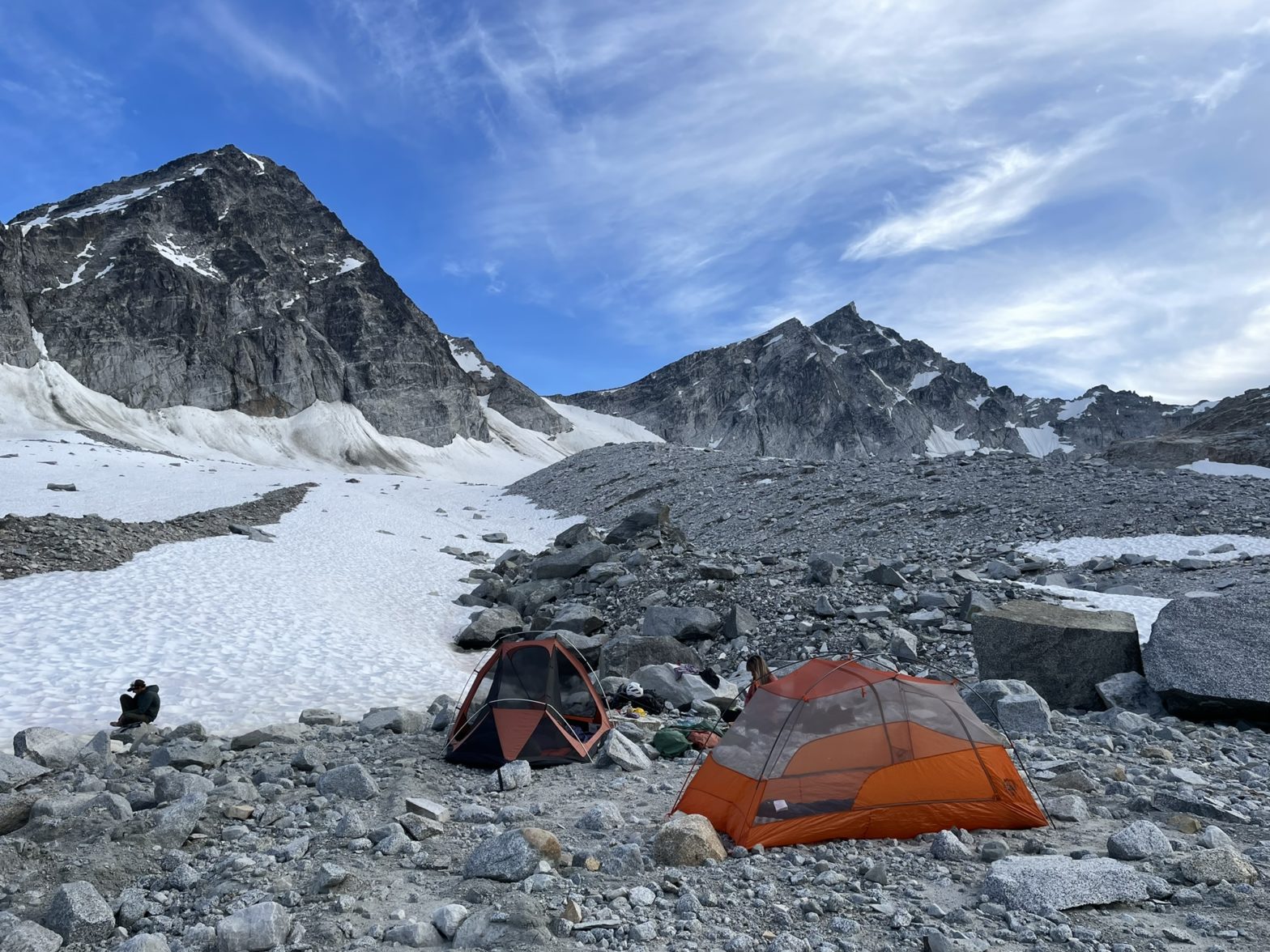
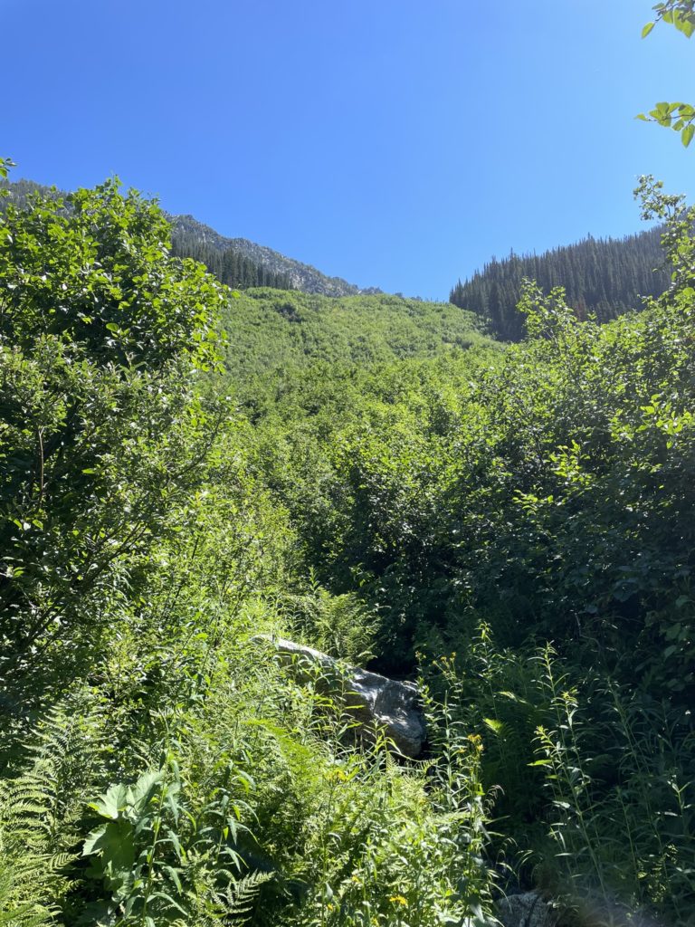
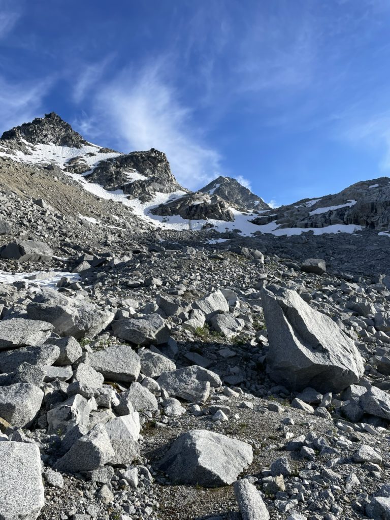
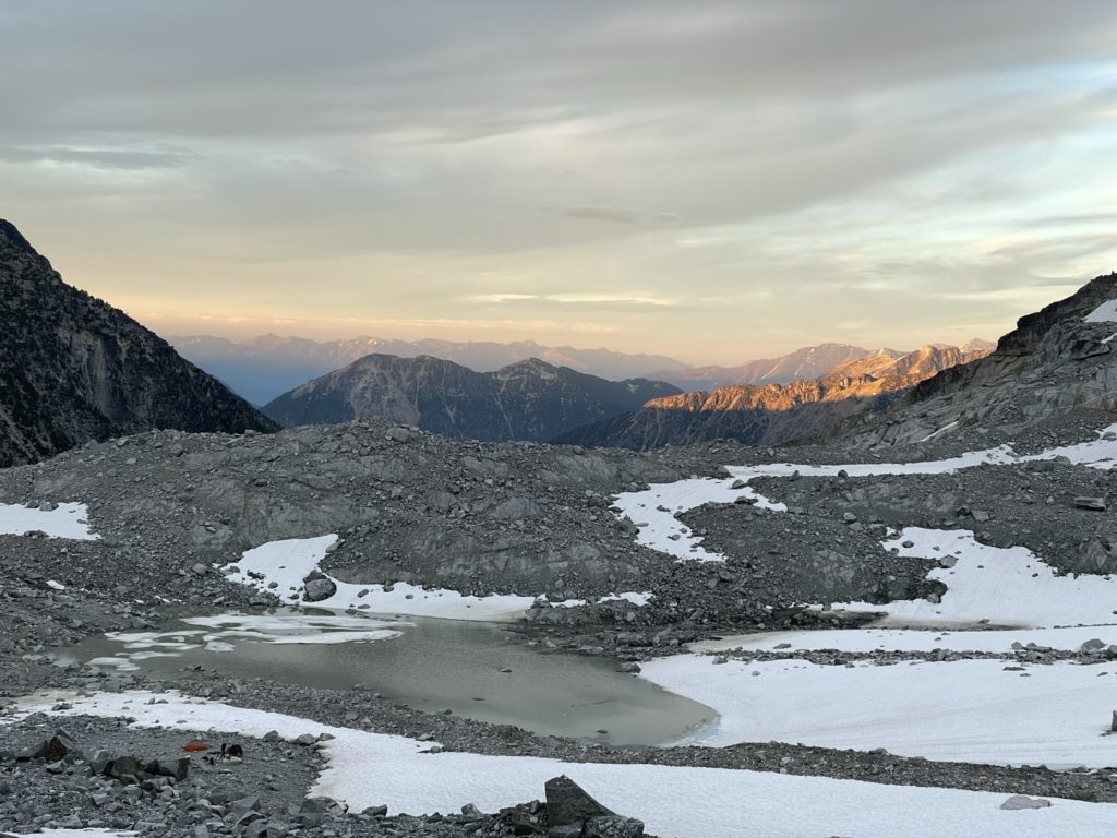
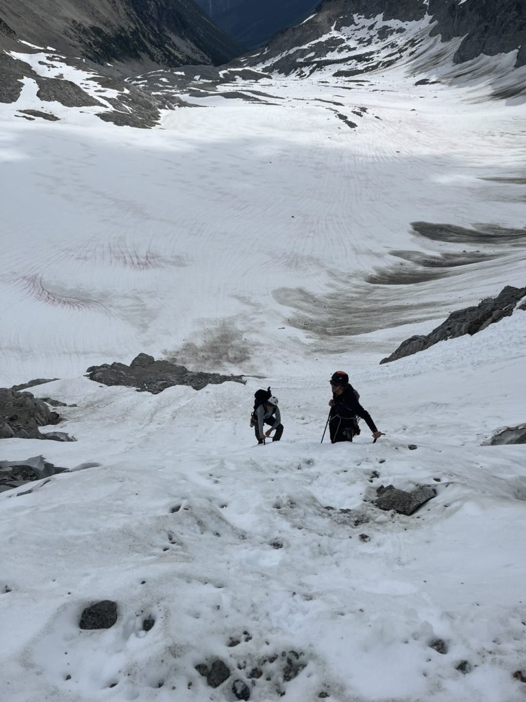
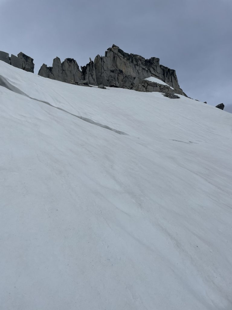
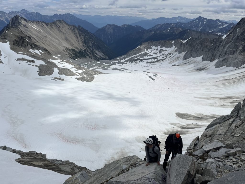
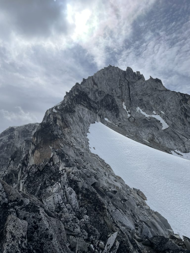
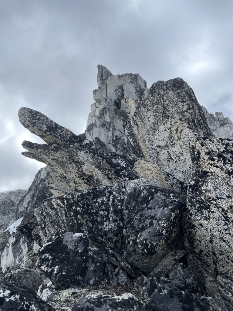
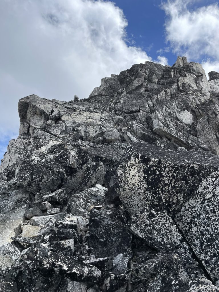
At last the terrain opened up and were in the alpine for good. Here to we had our first good look at Mount Vayu and words can’t really do it justice. A steep jagged ridge line ran down both flanks of the summit and the top was comprised of a beautiful pinnacle carved out of granite that jutted out into the air like a sail. It honestly reminded me Himalayan peaks in Nepal and the name Vayu (the hindu deity of wind) seemed only fitting. While taking in the views, we continued up the terminal moraine until reaching the permanent snow and base of Pancake Glacier. Sadly it looked like a shadow of what it once was, but that meant an easier crossing for us at least. Derek and I spotted a flat patch of scree near the base and decided on that as our camp site. By now it was 7:30PM and so there’s no way we’re going for the summit.
Everyone set up camp and settled in for the evening by making some dinner, chatting and enjoying the views. We hatched a plan to do an alpine start to catch sunrise on the ridge line and so set our alarms for 3AM. Then with the last of the light expiring, we all went to bed.

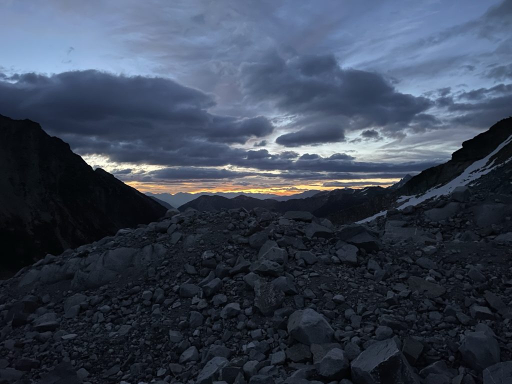
3AM came around and I hit snooze a few times before relenting and finally getting out of bed. The air wasn’t too cold so I started getting my gear ready. As sky started lighting up, I could see an obstructive layer of cloud over our sunrise and it seemed we might not get a good view after all. Elise came to shortly after and seeing the same thing decided we might as well sleep in and have a leisurely start up the NW ridge. I agreed, but stayed up for a bit to see if I could catch any interesting light as the sun rose. Unfortunately, it was pretty lackluster so I walked back to the tent and fell asleep until 8:30am or so.
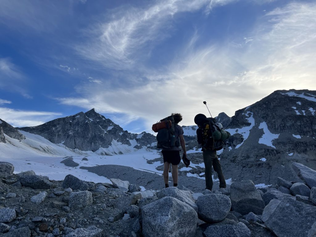
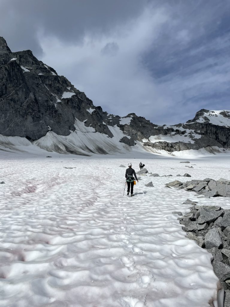
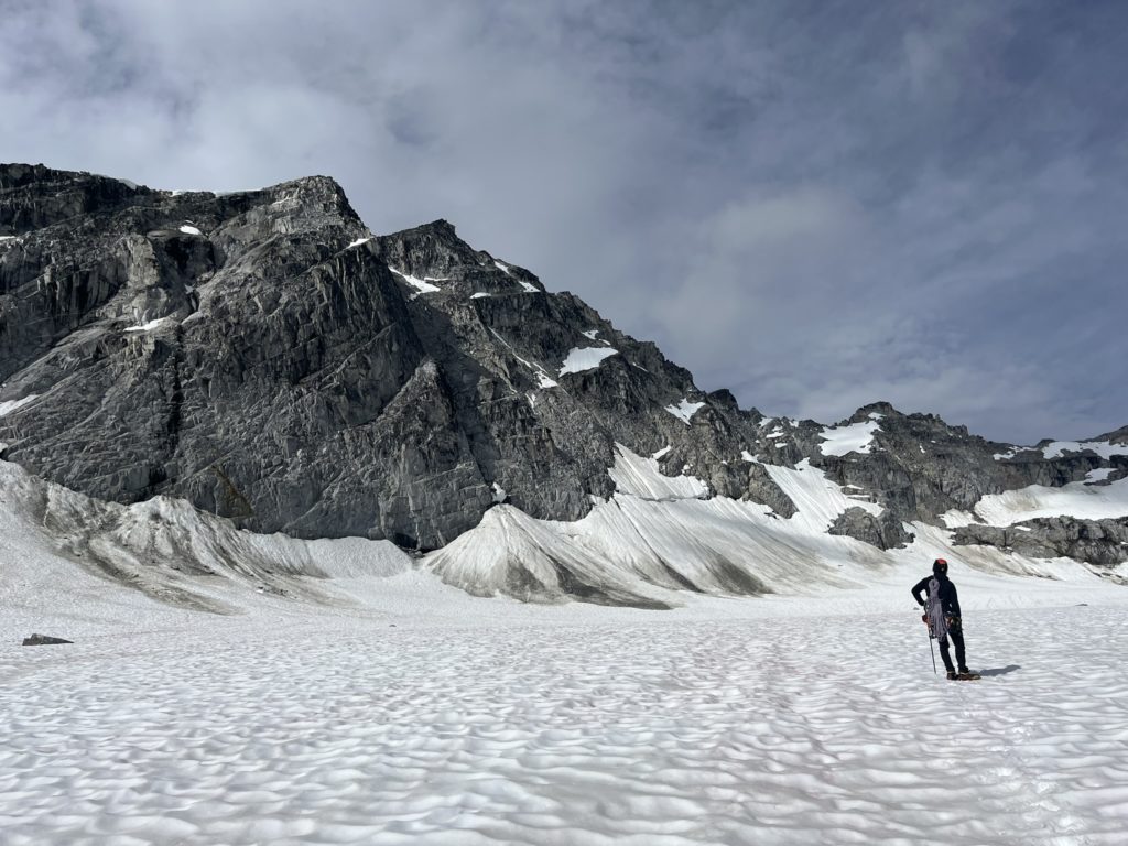
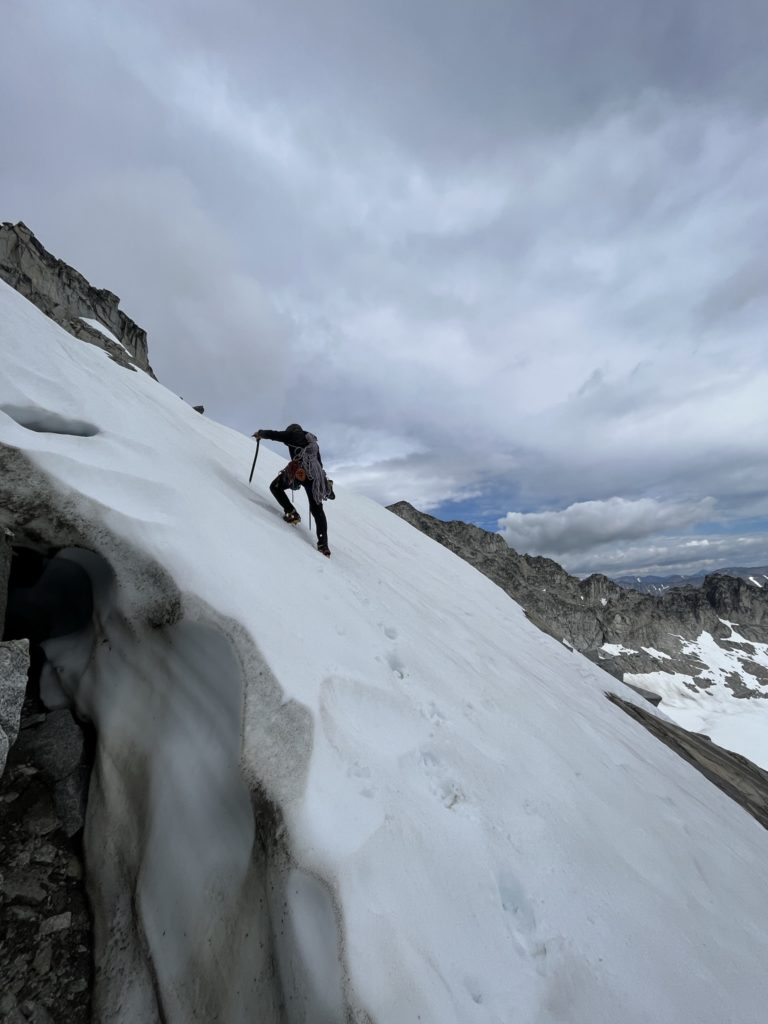
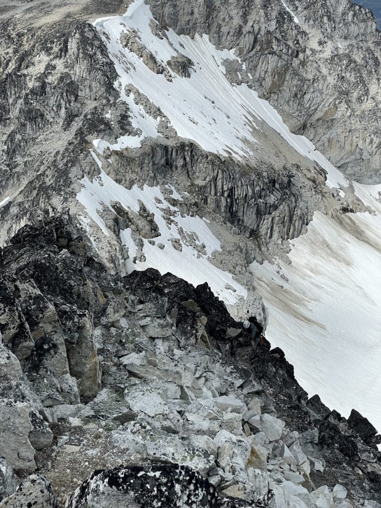
Derek and Elise were already up, so I quickly got to work making some breakfast and packing my bag. By 9am we were starting the plod across the Pancake Glacier. From the glacier I had spotted a few options to gain the ridge. The most obvious one to me was a steeper looking snow line that took us directly at the mid point between Mount Vayu and Hanuman. Another line that piqued Dereks’ interest was a longer traverse on a horizontal line of snow. It was less steep, but a longer route and above an exposed rock slab. We aimed for the steeper line first and as we reached the base see-sawed a bit on which route to take out of concern for how steep it was. After a quick group vote we decided on the steeper, but shorter line and Elise lead us up kicking nice steps into the snow.
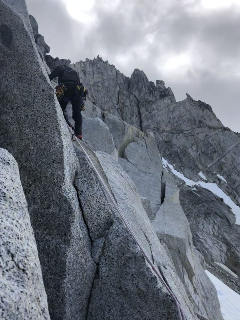
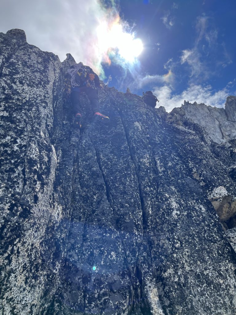
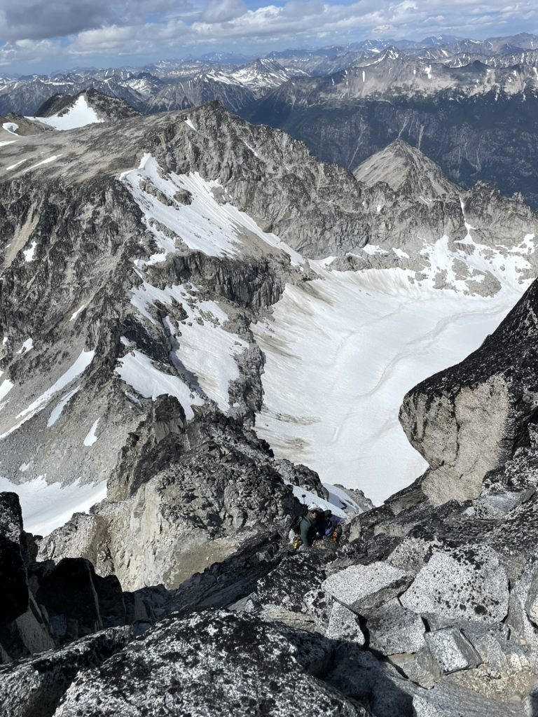
It never got too steep, maybe up to 40 degrees in a spot and we soon reached the top of broken snow line where an intermediary rock traverse was required to gain the upper snow pitch and finally the ridge. I lead the way on the upper snow pitch, but didn’t make it far before discovering a huge moat running the length of the face. I looked climber’s left and found a reasonable route on rock so called out Derek and Elise to aim for this rock section. I paused above them when I found the whole rock pitch was exceptionally loose. Once everyone was caught up, I climbed up a short section of low fifth to finally gain the ridge. Elise followed up after and then Derek, carrying everyone’s gear in his backpack paused at the crux and Elise offered that we belay him. I quickly set about creating an anchor and then belayed Derek up the final section.
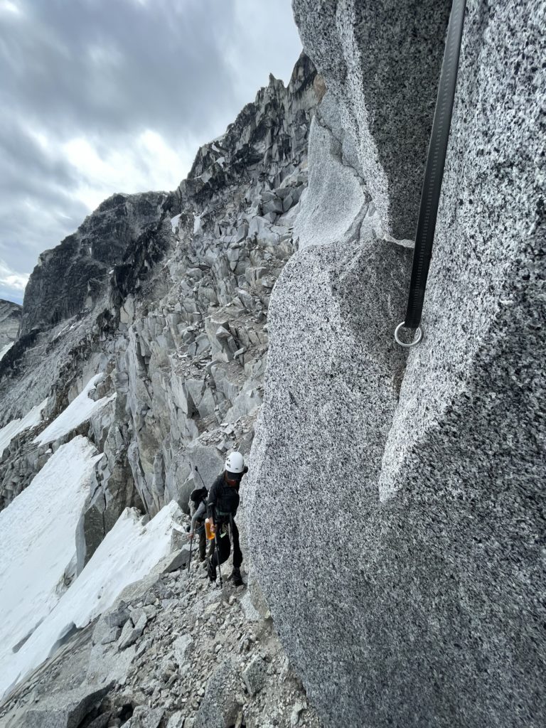
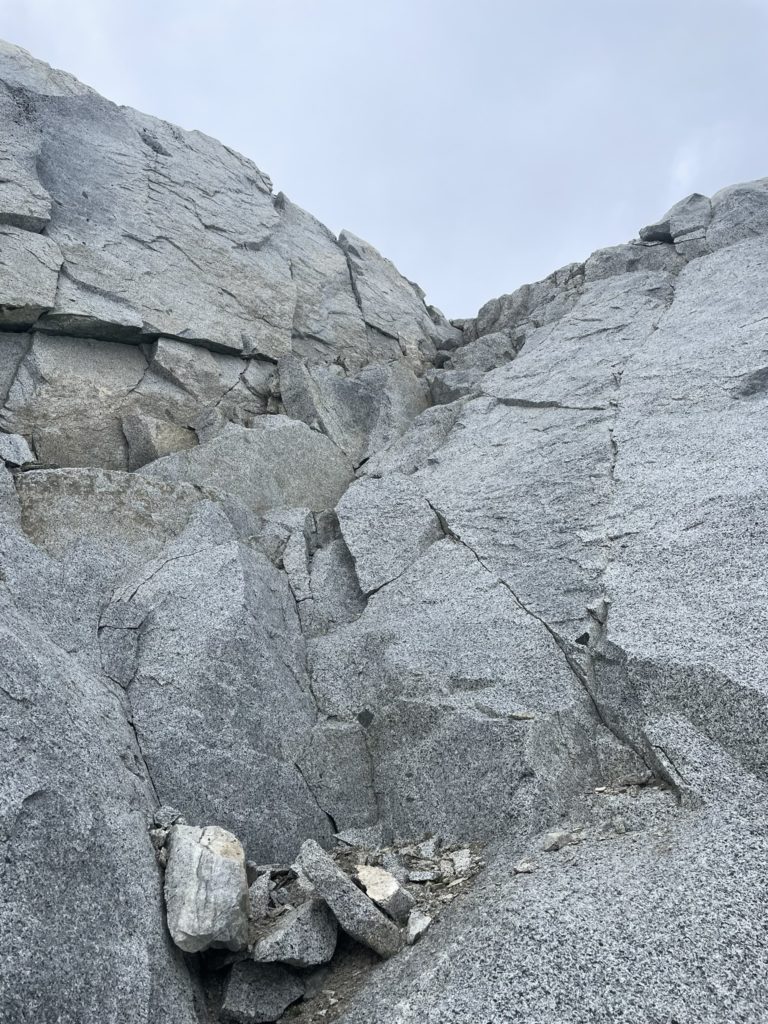
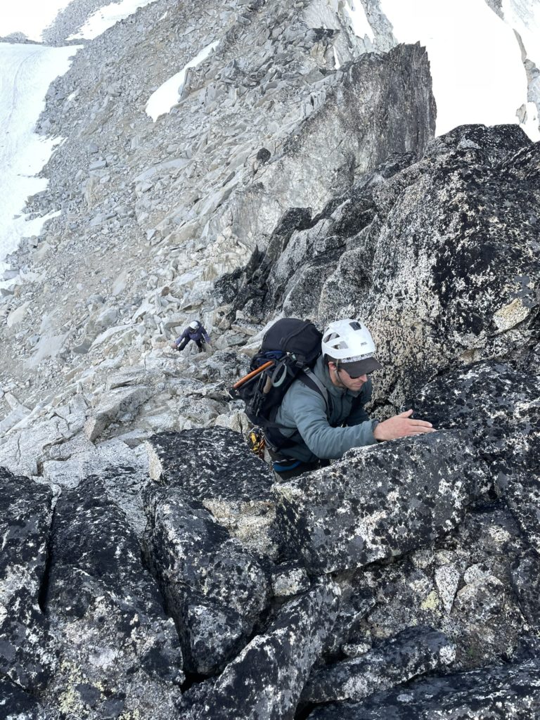
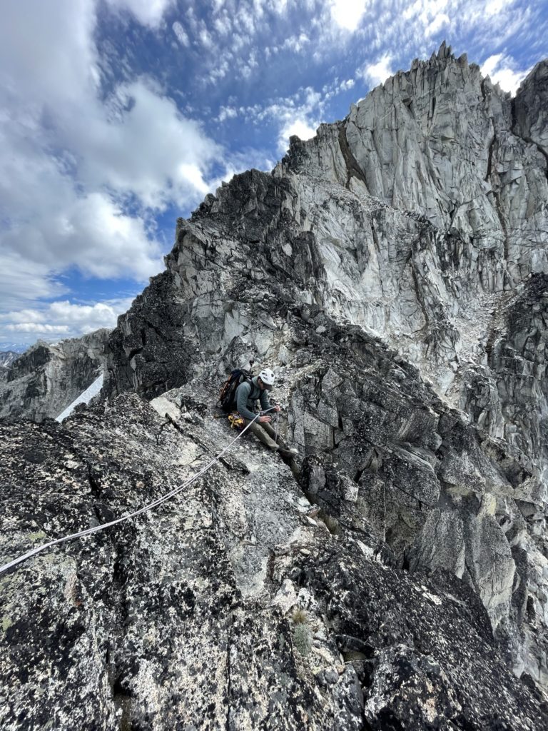
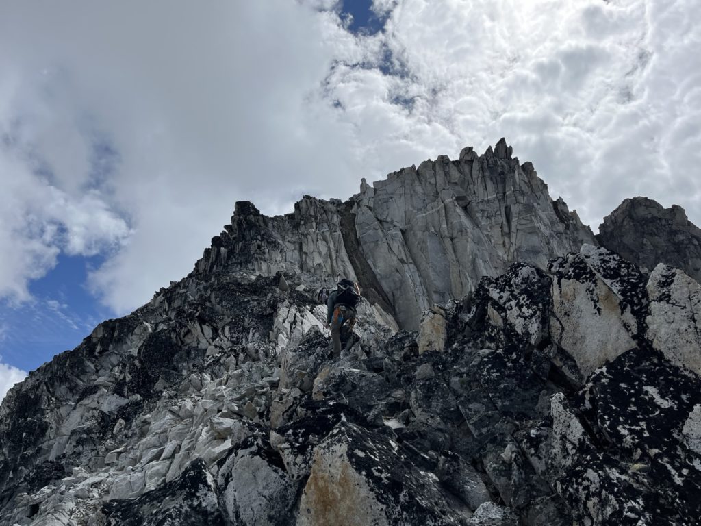
After tearing everything down, we started up the ridge at last. The scrambling was super fun with a mix of 3rd and 4th class moves on solid rock. Eventually we got kicked over onto the climber’s right side of the ridge and came across an exposed slab section. I started scrambling up it but discovered some stiffer moves ahead so backed down and decided to pitch it out. Once on belay, I took lead through the slabs and found a few tricky moves, but nothing that really warranted a belay in the end. I setup an anchor at the top and belayed Elise and Derek up anyways.
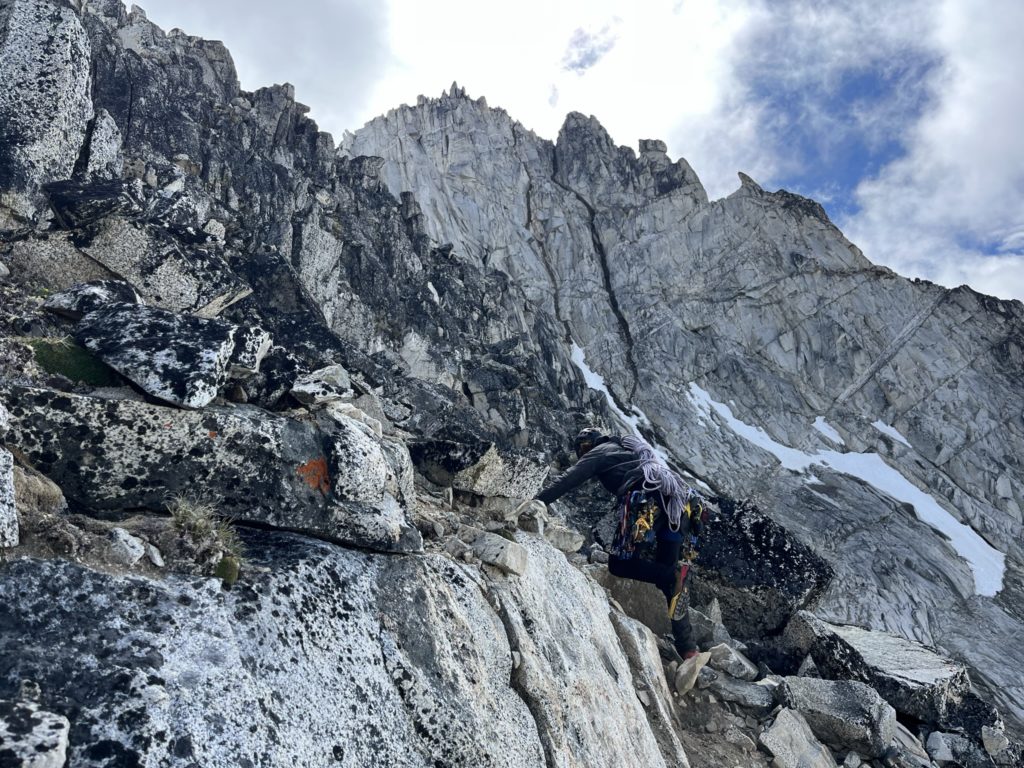
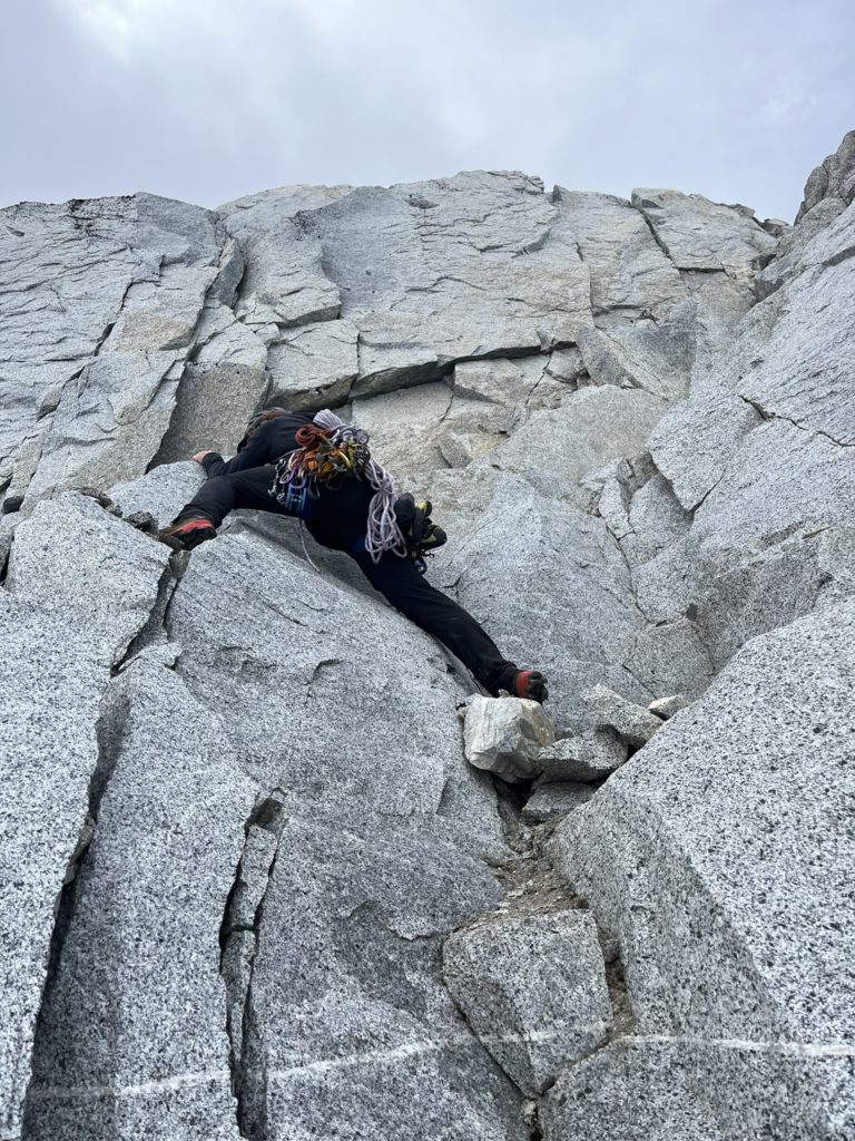
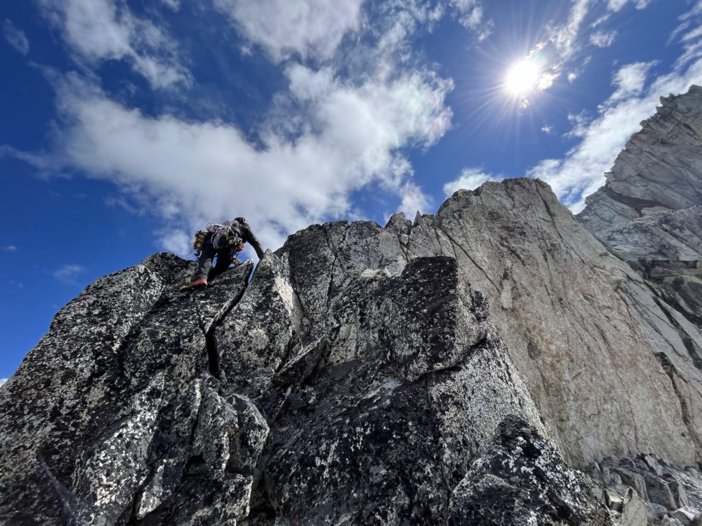
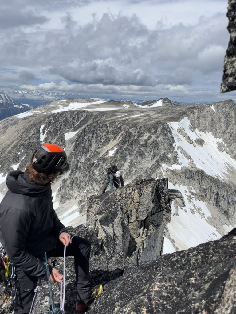
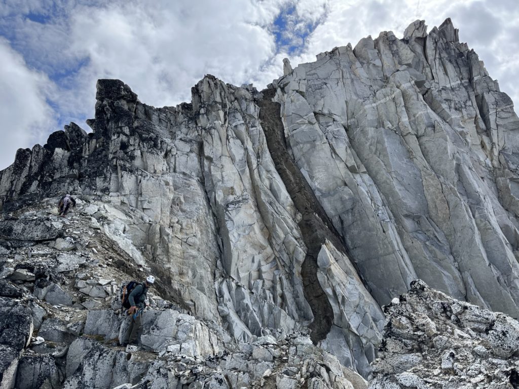
Now we scrambled a bit further and I found a beautiful hand crack to regain the ridge top, so I took the optionally harder route. It was only 6m or so, but amazingly fun. Now on the top of the ridge again, we were met with a junction of sorts. At climber’s right we could descend below the ridge and traverse across some loose ramps into unknown terrain or at climber’s left stay on the ridge proper and climb up an exceptionally exposed section. Elise recalled that the trip report made no mention of any ramps so it seemed like the ridge route was the way to go. I scrambled up some exposed 4th class stuff and then reached the base of an interesting mantle move.
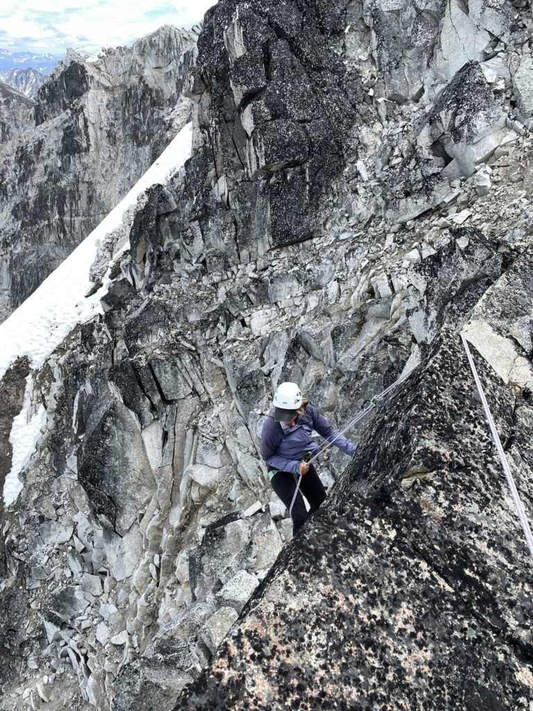
From here I had a good vantage of the ramps and it looked mediocre compared the ridge, however both routes were unknown. Still I was keen on trying to lead this section and so set up an anchor with Elise and Derek scrambling up to it shortly after. Elise then belayed me while I lead the exposed pitch up the ridge’s back. I found a good piece to place pro before the mantle move and then committed to the climb up. It was straight forward and directly a head was narrow ridge with more good places to put pro. Finally, a short knife edge section presented itself and with the wind gusting it made for an exhilarating sequence of moves. Once across the knife edge, the ridge broadened out again and I found great spot to setup an anchor.
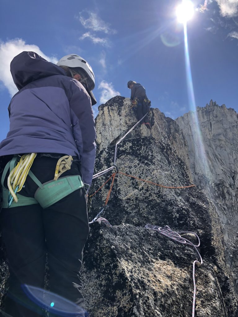
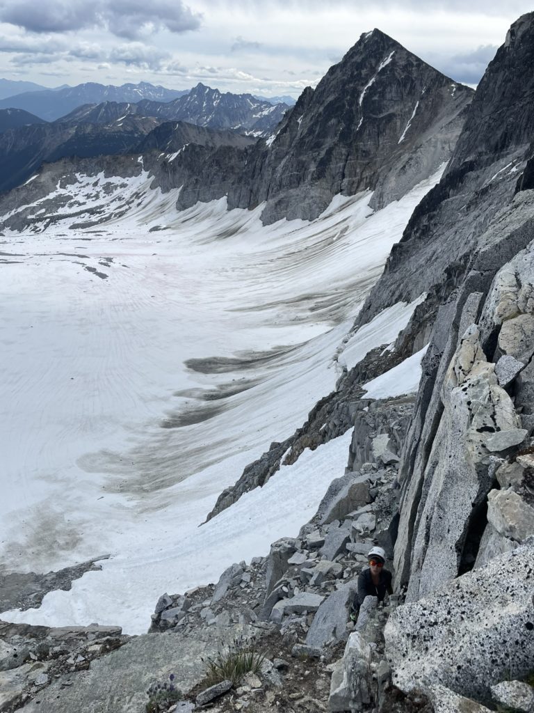
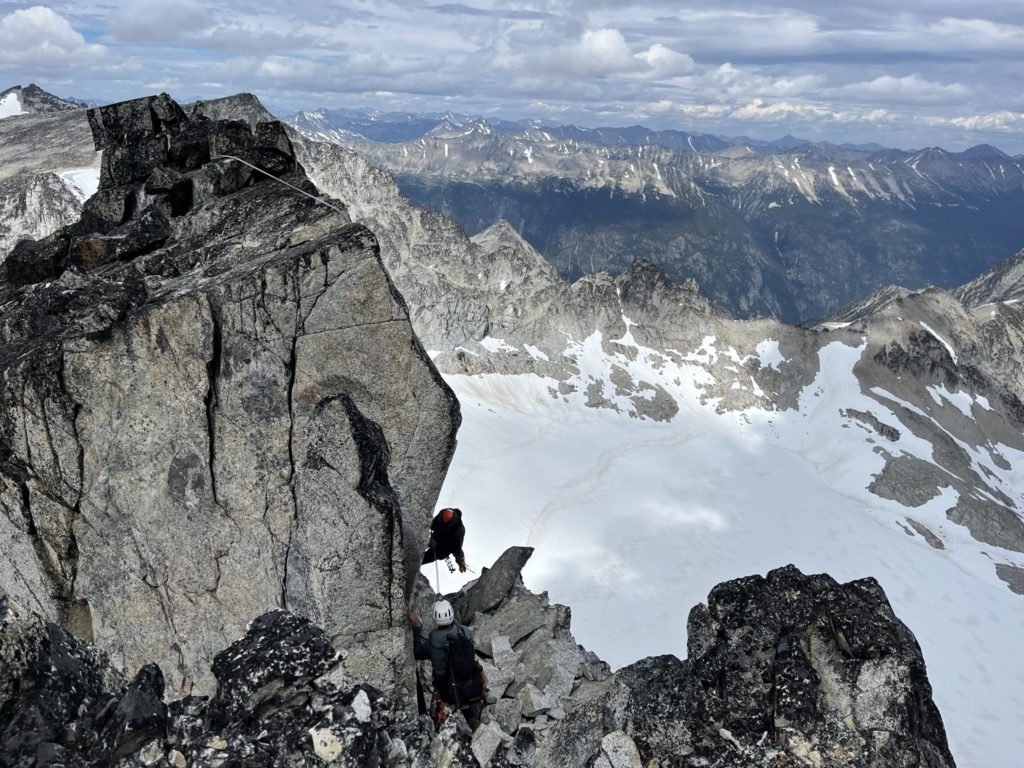
I put everyone on belay and then Elise climbed up first with Derek shortly after. All of us were stoked on this pitch, even though it probably didn’t exceed 5 easy. The wind and exposure got us all hyped up for sure. Now ahead of us appeared to be a notch we needed to down climb. I eased towards the edge and discovered there’s no way to down climb and this must be the rappel section the trip report mentioned. I searched around and found a good boulder to sling some webbing around and then used Derek’s quick link to setup our rappel anchor. Then Derek took the lead starting the rappel directly into the notch. It turned out to be really awkward with big potential for a swing out into empty space, but he did eventually manage to get down alright.
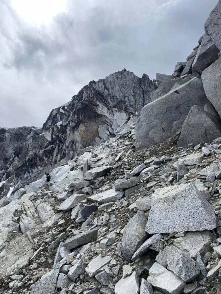
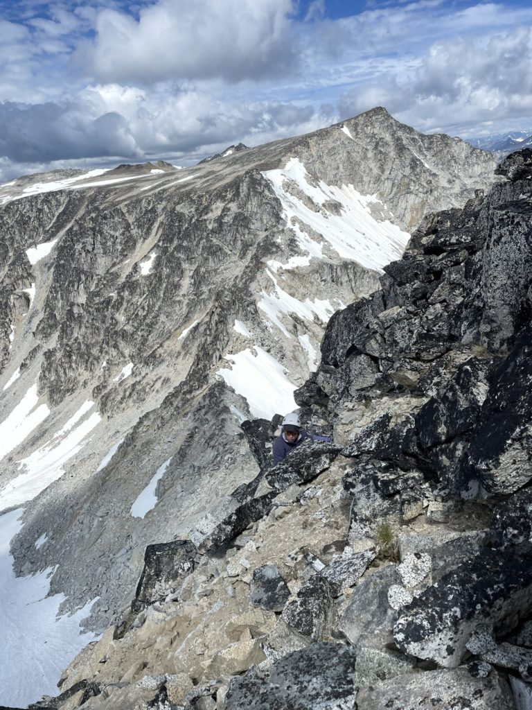
Elise followed next and we both agreed a rappel down onto a ramp on the north side of the ridge looked more promising. Sure enough it proved to be the better option and I followed suit with the short 7-8m drop down to the ramp. The rest of the ridge looked like a scramble so I packed up the rope again and started the lead up. There were a few sections of 4th class, but it was mostly 3rd class terrain and a few sections of exceptionally loose rock. Now just below the summit, I tried going climber’s left but discovered more 5th class terrain, so back tracked a bit and found an easier 4th class ramp up the summit. Once I topped out from the ridge, I found a short section of class 2 scrambling to gain the summit.
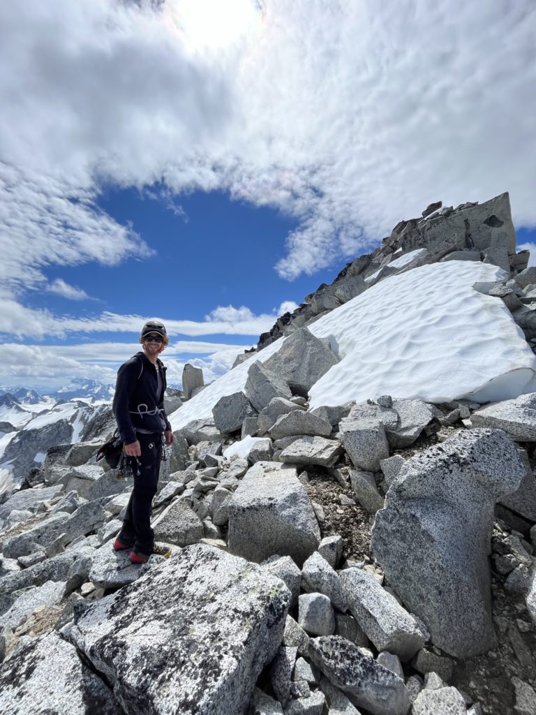
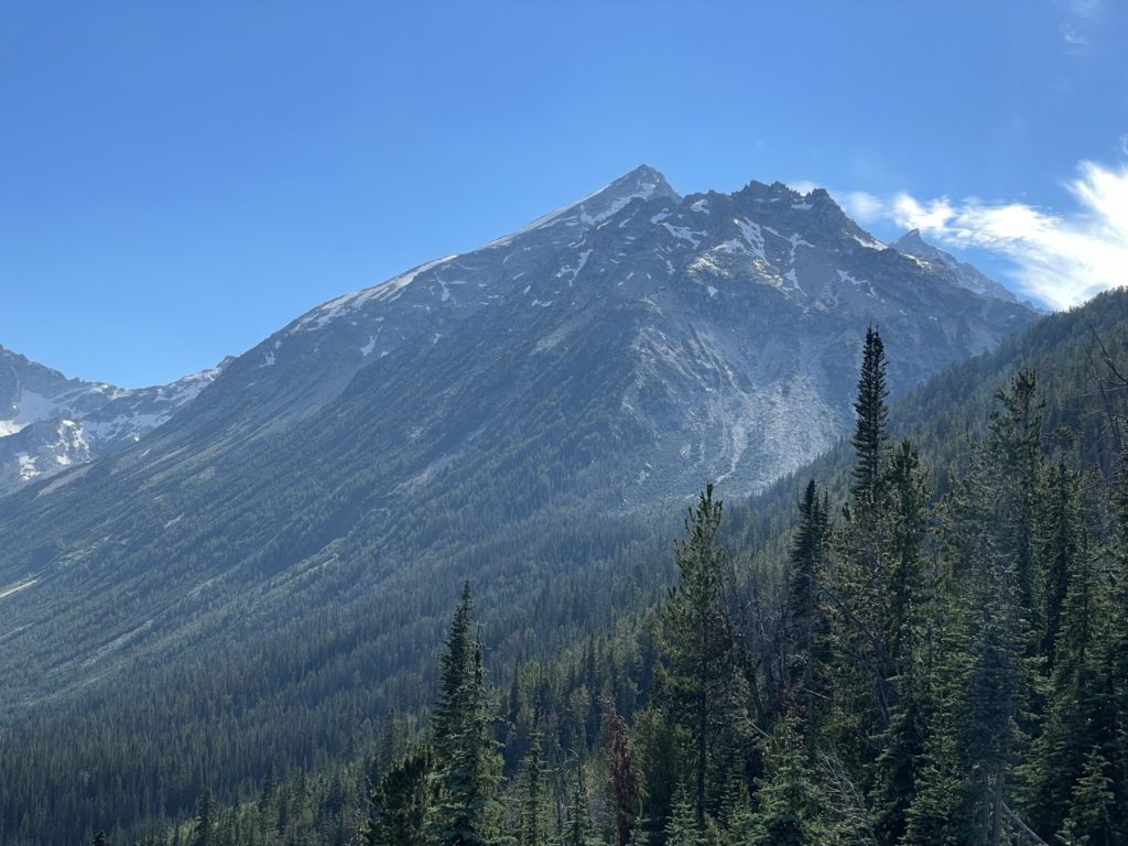
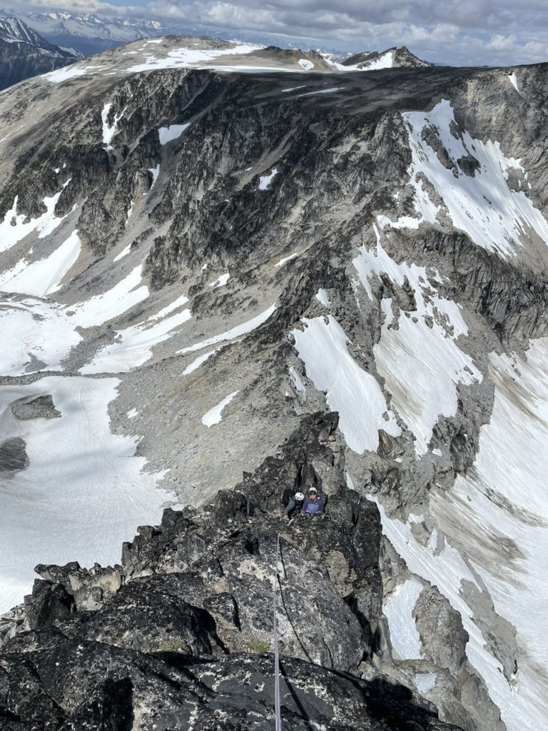
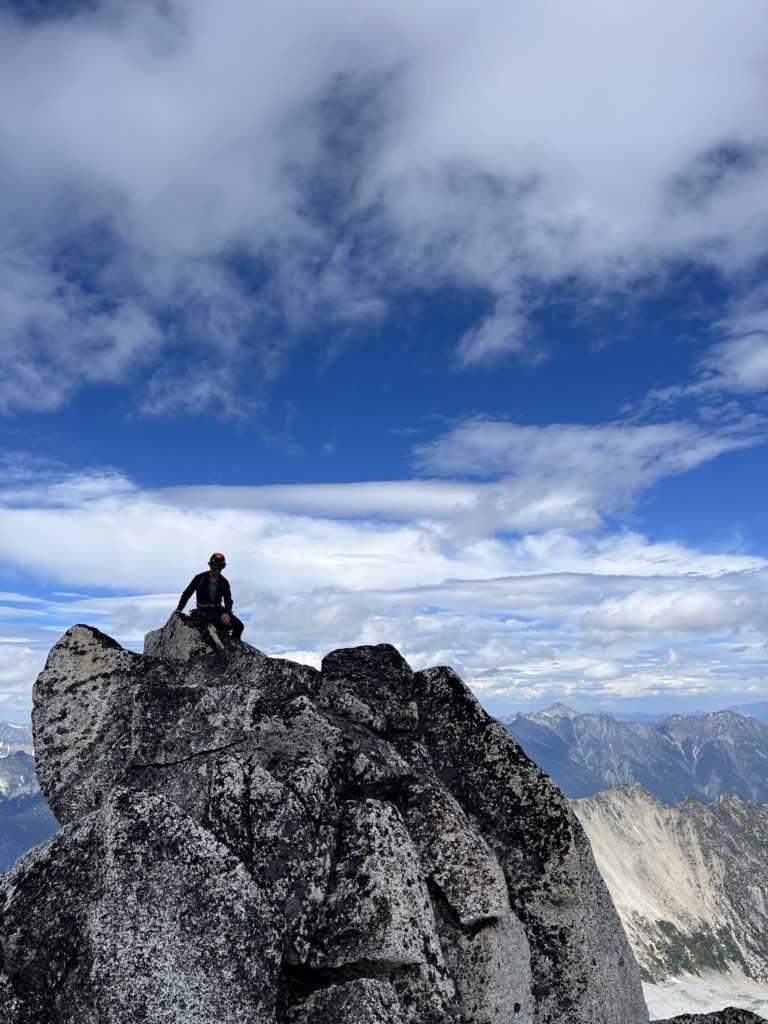
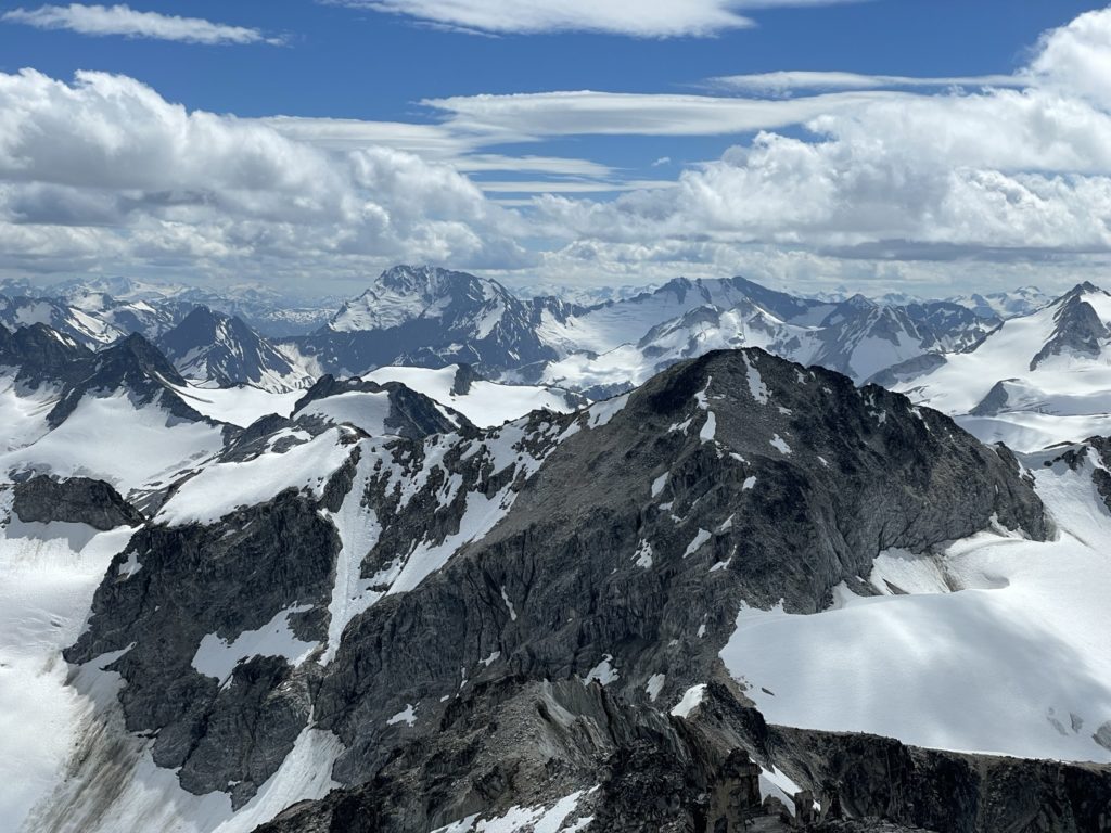
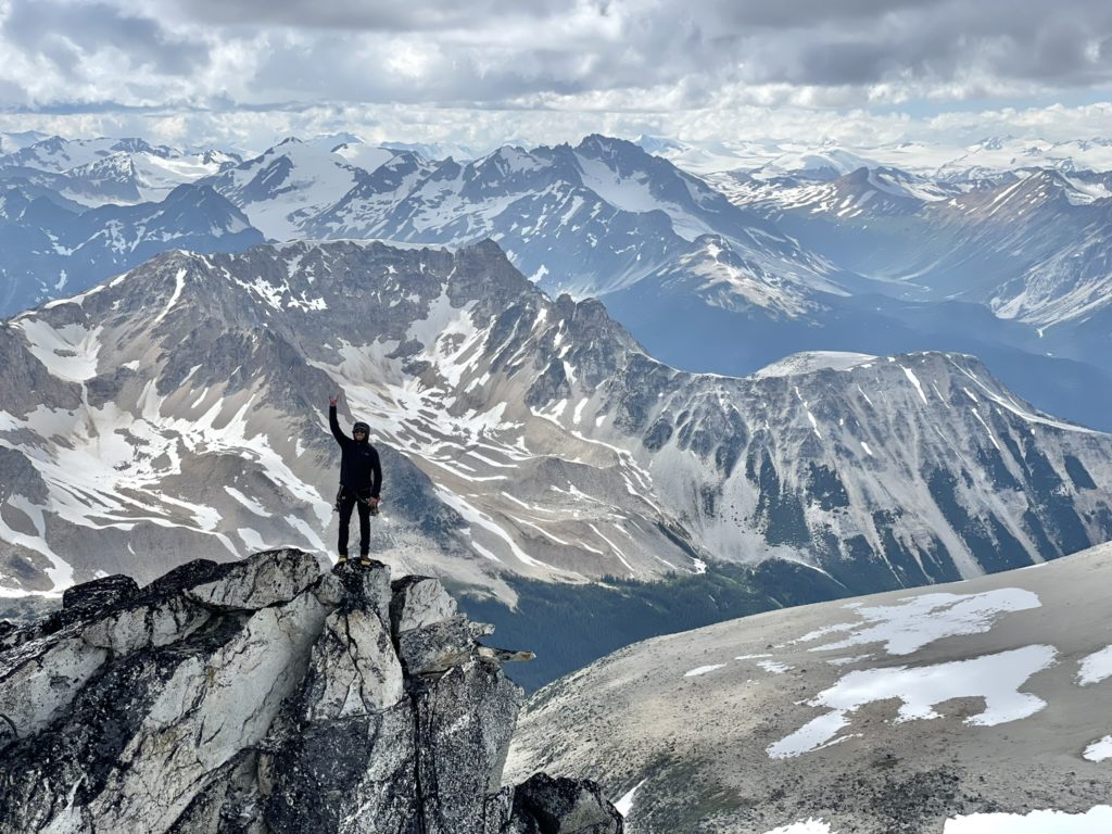
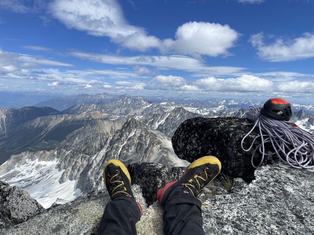
I waited for Derek and Elise to catch up and then we all climbed the remainder of the way on to the summit. Finally at the top, the stoke kicked up a notch as we now had 360 views over some exceptionally remote and rugged areas. Far off in the distance we could see some of the huge bulky summits above the Lillooet ice field, to the north the beautiful Chilcotins and to the south the train glacier area. The sun was out now too, so we ended up napping and basking on the summit for at least an hour.
When the clouds finally cut of the steady stream of sunshine, we reluctantly started our descent down the class 2 eastern slopes of Vayu. The plan now was take on Vayu E1 directly across the way and so of we went…