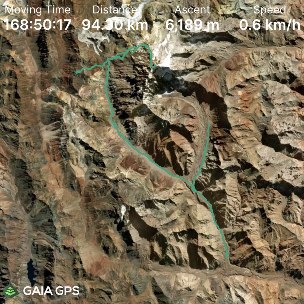
Elevation Gain: 6189m
Distance: 94.3km
Total Time: 16 days
Date: January 2nd – January 17th, 2022
In early October I was starting to organize a long since planned sabbatical from work. I’d be officially away for 3 and a half months to take time to travel and decompress after 2 years of working through the pandemic. My leave would start mid December and run through to the end of March. That meant winter time in the northern hemisphere, so I had my eyes set on the south to take advantage of their summer. I was originally inspired to follow in the foot steps of my dad, who had done a 3 month trip trekking through Chile, Argentina and Peru. I was especially interested in his time in Patagonia and had my eyes set on the W/O treks.
The trekking idea was short lived though, as the mountain high points began to call. I realized I could turn this into an opportunity to summit and climb as many peaks as my heart desired. Now that my perspective shifted, I saw the capacity for taking on some loftier objectives. Almost immediately, I recalled a list of such goals tucked away in the back of my memory. They were: Aconcagua, Ojos del Salado and Nevado Sajama. All 3 were high altitude objectives that would require a non insignificant quantity of time to accomplish.
Generating lists of goals is easy enough, but now came the hard part of figuring out how to get them done. Step one was seeing who would be on board to take on a big summit on short notice. I asked around to friends and of course the SWBC Peak Baggers group, but in the midst of the pandemic, no one was able to commit. I also received additional beta that Nevado Sajama was not in season for my dates and Ojos would be too challenging with PCR tests, border crossings and a lack of Spanish speaking skills.
That effectively narrowed my choices down to Aconcagua, the tallest of them all. Faced with the prospect of going alone, I started researching the feasibility of a solo expedition. I found a few articles online documenting such a process and the information revealed many hidden challenges and complexities. Most had completed the journey with others previously or had 6000m+ experience already (I had none) and were now finally making the trip solo. At this point I made the decision to take the plunge on a guided expedition. It might eliminate some of the sense of adventure, but I would save me from hauling loads of gear down, logistics, etc. I was planning to continue travelling onwards after and the idea of showing up with just personal climbing gear was very enticing.
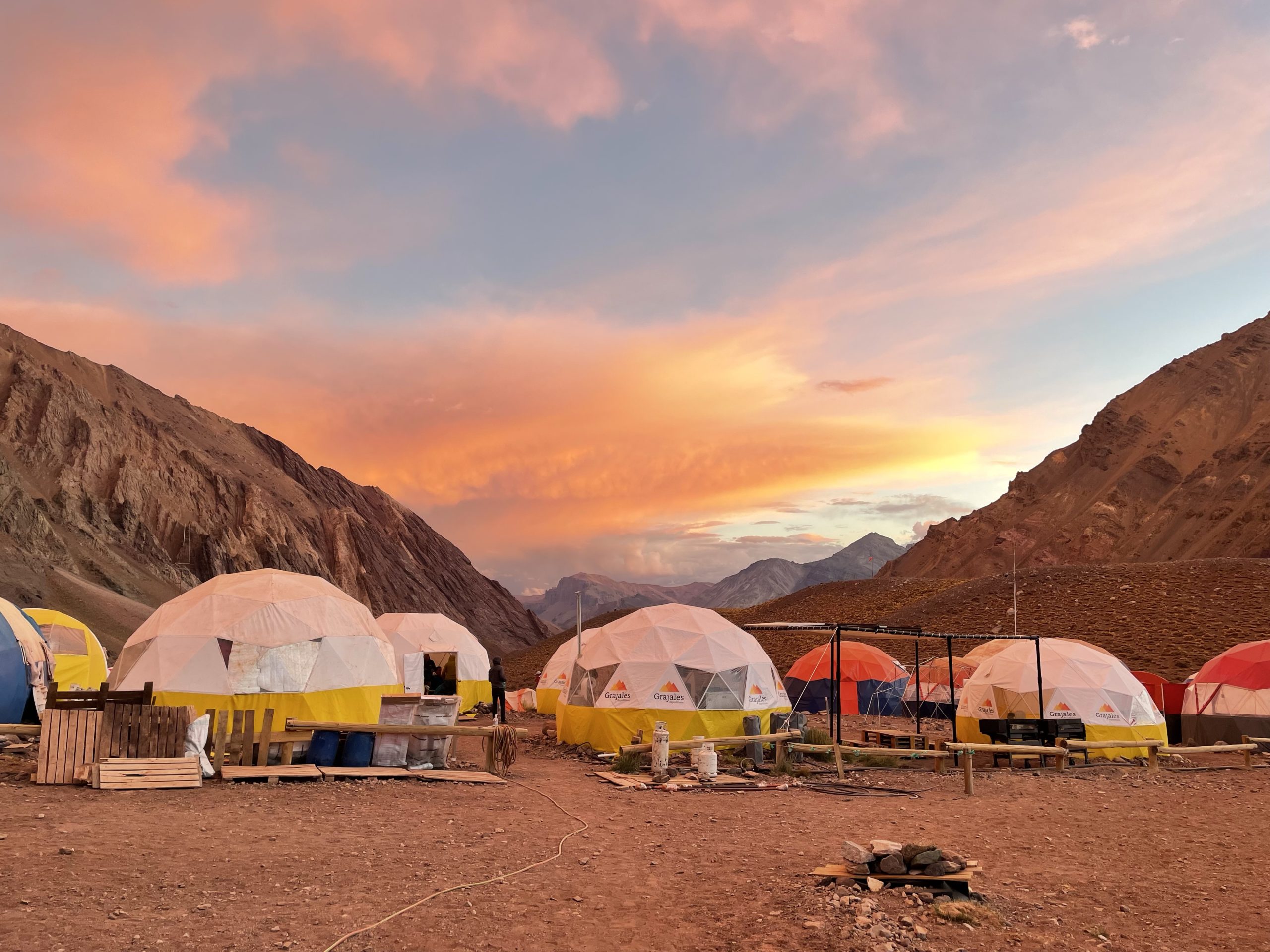
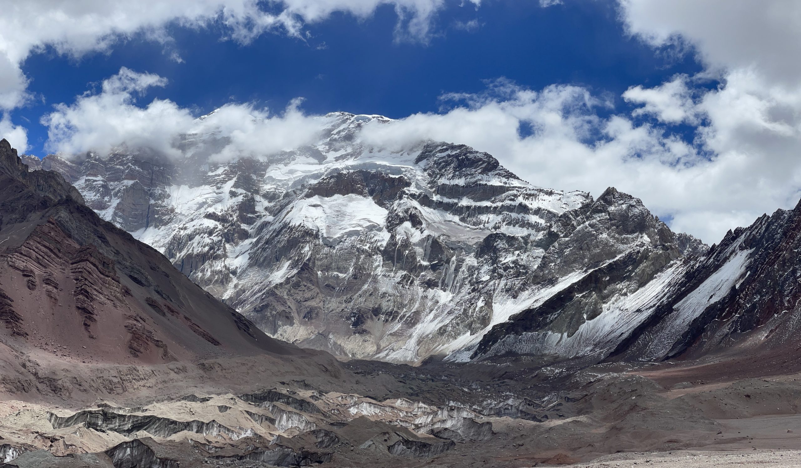
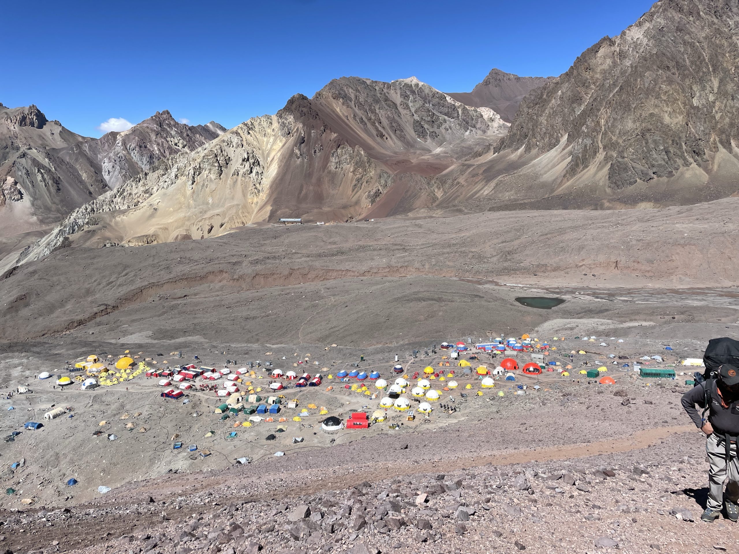
I looked around at a few operators and finally picked Grajales Expeditions. They had a great track record and had been running expeditions since the 70’s. There were no shortage of options to pick from though. At 6961(±1)m tall, Aconcagua is the tallest mountain in the Americas and the tallest outside of the Himalayas. Thanks to this stat, it’s part of the popular (among those with the means) seven summits list and is heavily commercialized as a result. Apparently Aconcagua has the second largest base camp in the world, after Everest, to give some perspective. Due to COVID all routes on the mountain except for the normal route were open. The normal route is essentially just a a trek up via the tame north slopes, but the altitude and weather pose the greatest challenge.
Grajales uses a climb high, sleep low strategy that’s very popular in high altitude ascents. In total the plan called for 12 days of acclimatization before a summit push would be attempted. It allowed for a three day buffer as well in case the weather posed an issue. It’s apparently not uncommon for summit attempts fail solely because of weather on Aconcagua. I’ve seen many stats that place the success rate including weather, altitude and other considerations at around 30%. For just a hike up, that’s an exceptionally low success rate, so I was curious to see how this would all play out.
Despite all that, I was excited as ever to take this summit on. I planned to continue on to Patagonia after to take on more summits (unguided this time) and that helped me feel a bit better about going with a guide this time around.
I flew into Mendoza, the expedition starting point, on the 31st of December and spent a few days relaxing and catching up on the jet lag. This had been the most stressful start to a trip I had done yet. All of the additional Covid restrictions and testing had me on my toes for weeks leading up to my departure. I was constantly stressed about catching Covid in the midst of a highly contagious new variant wave. I was relieved to finally touch down in Mendoza, but there was more testing ahead before setting foot on a trail.
The first part of the trip would begin in hotels, with one night in Mendoza and a second in Uspallata to acclimatize. Normally operators use the village of Penitentes to acclimatize, but a Chilean construction company had rented out all hotel rooms in the area for the next 3 years to facilitate some tunnel construction.
Days 1-2
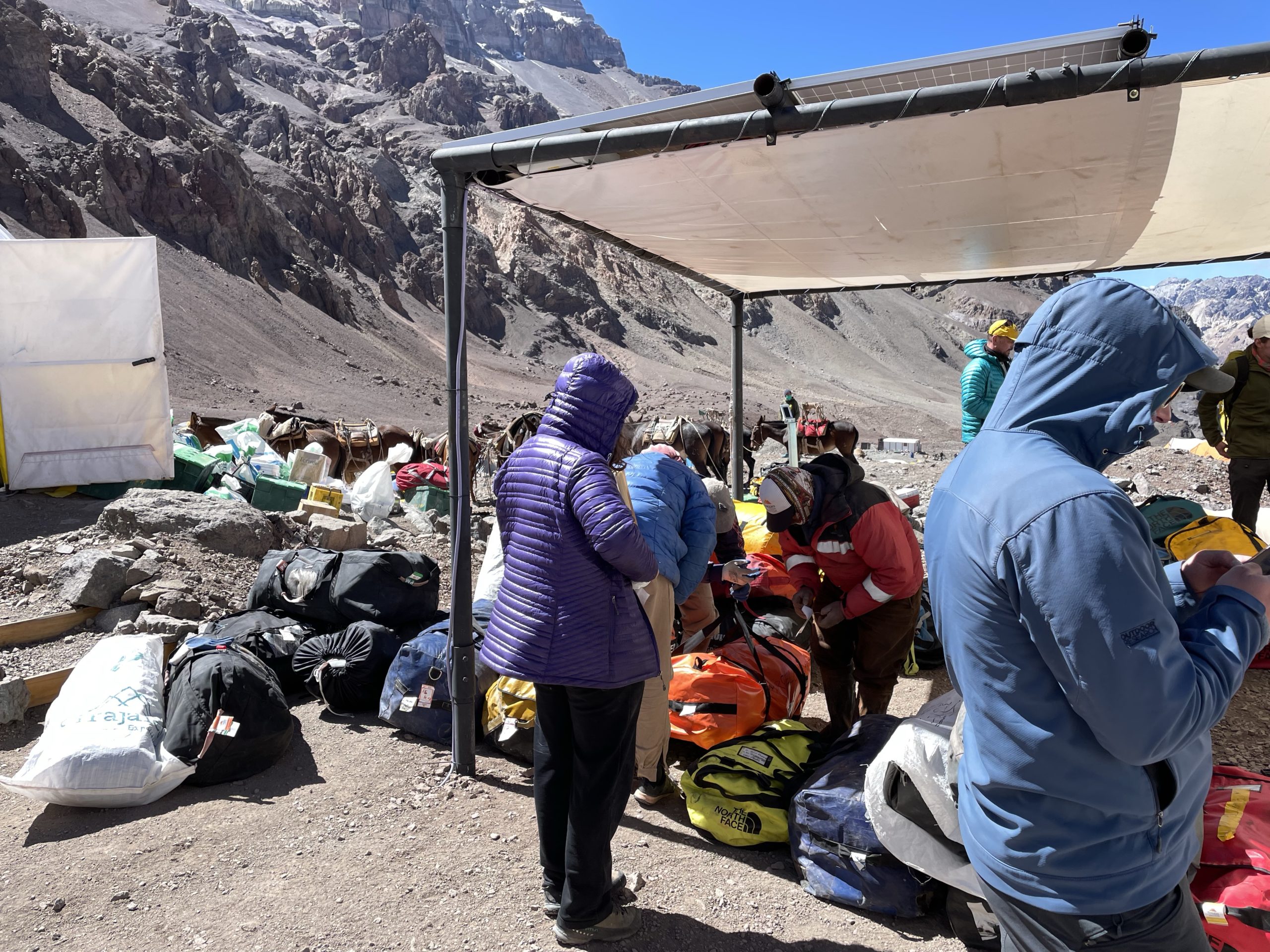
On the second I checked into the first hotel and thus began the start of the journey. We had a briefing, gear check and Covid test that day and the following day we dropped by the rental store to grab anything that was missing. To save buying and carrying extraneous gear down, I had planned to rent a larger backpack, duffel bag and few other items. This ended up being a huge mistake, as the exorbitant cost of the rentals would have been saved by simply buying and bringing the gear down myself. I was initially bitter, but I put my mind at ease focusing on the fun still ahead.
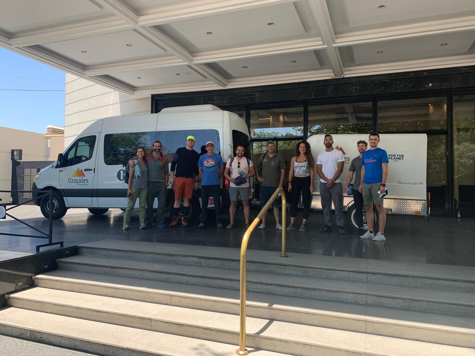
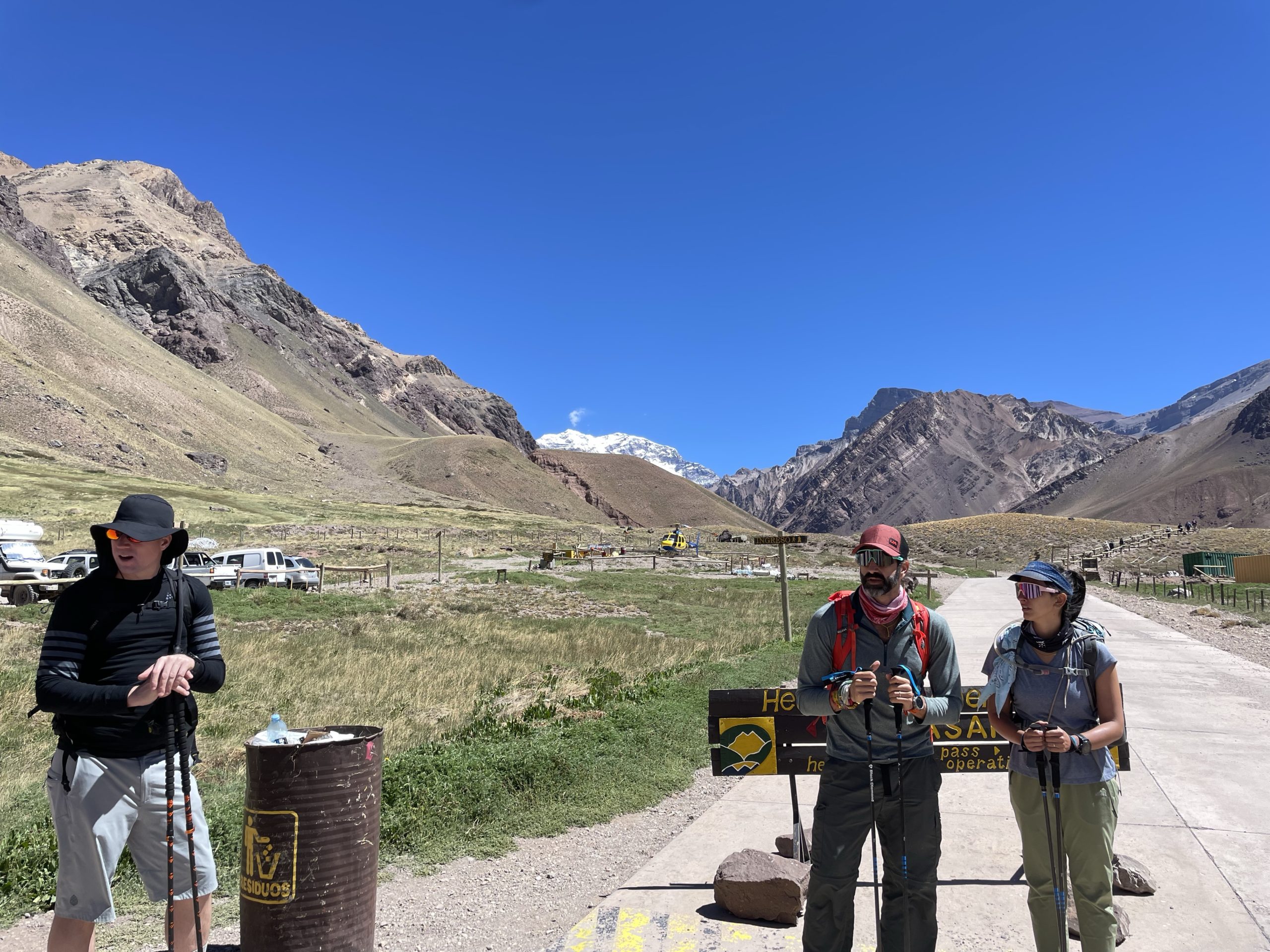
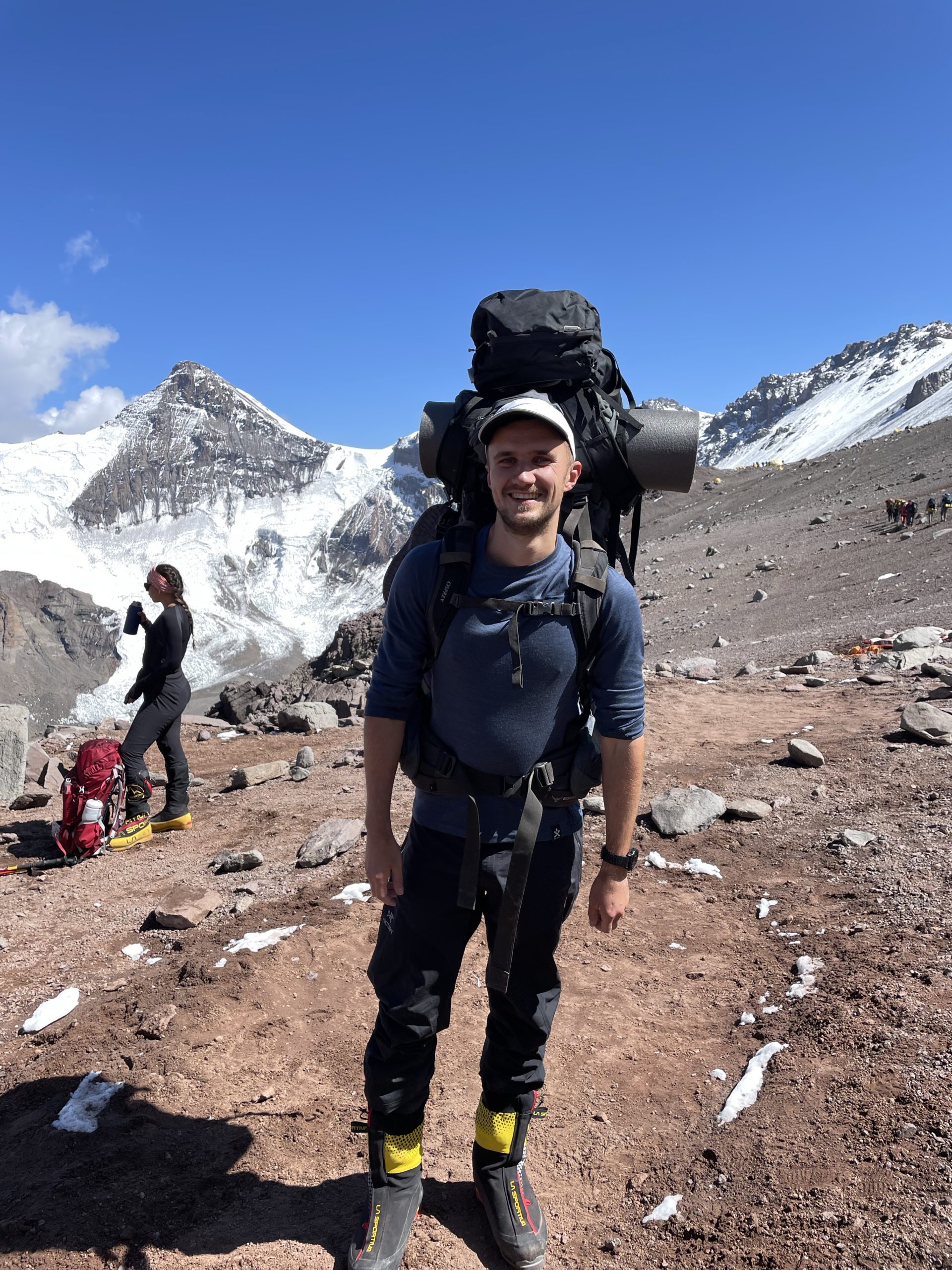
 , Mark, Craig, Lucas (lead guide), Diana, Mosin (trekking only), myself and my tent mate Christopher
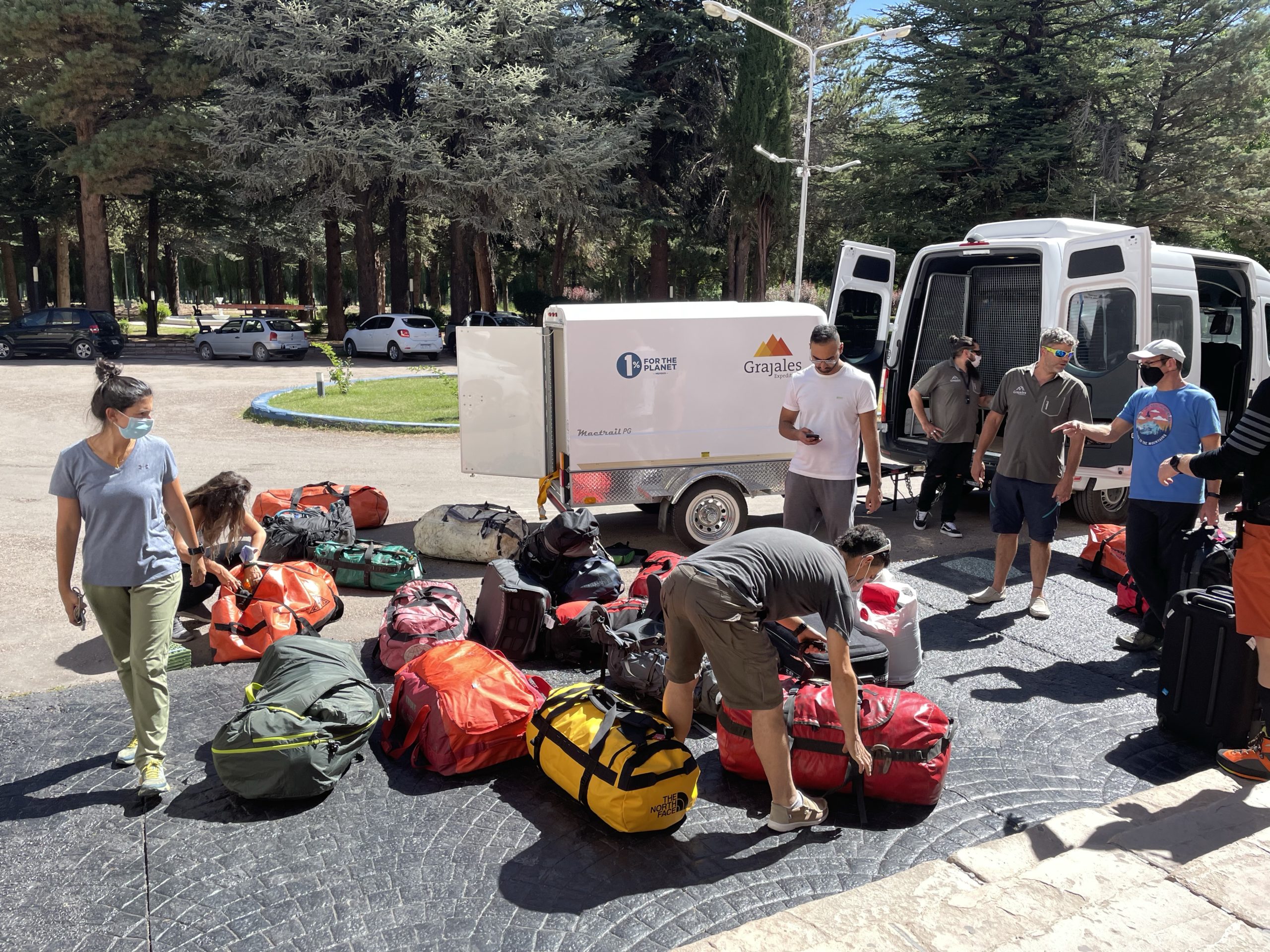
After the gear rental we hopped into our transfer and made the 3 hour drive out to Uspallata. We spent the night there in a hotel at ~1900m to acclimatize.
Days 3-5
- GPS recording for days 3-5: https://www.alltrails.com/explore/recording/las-heras-hiking-154f596
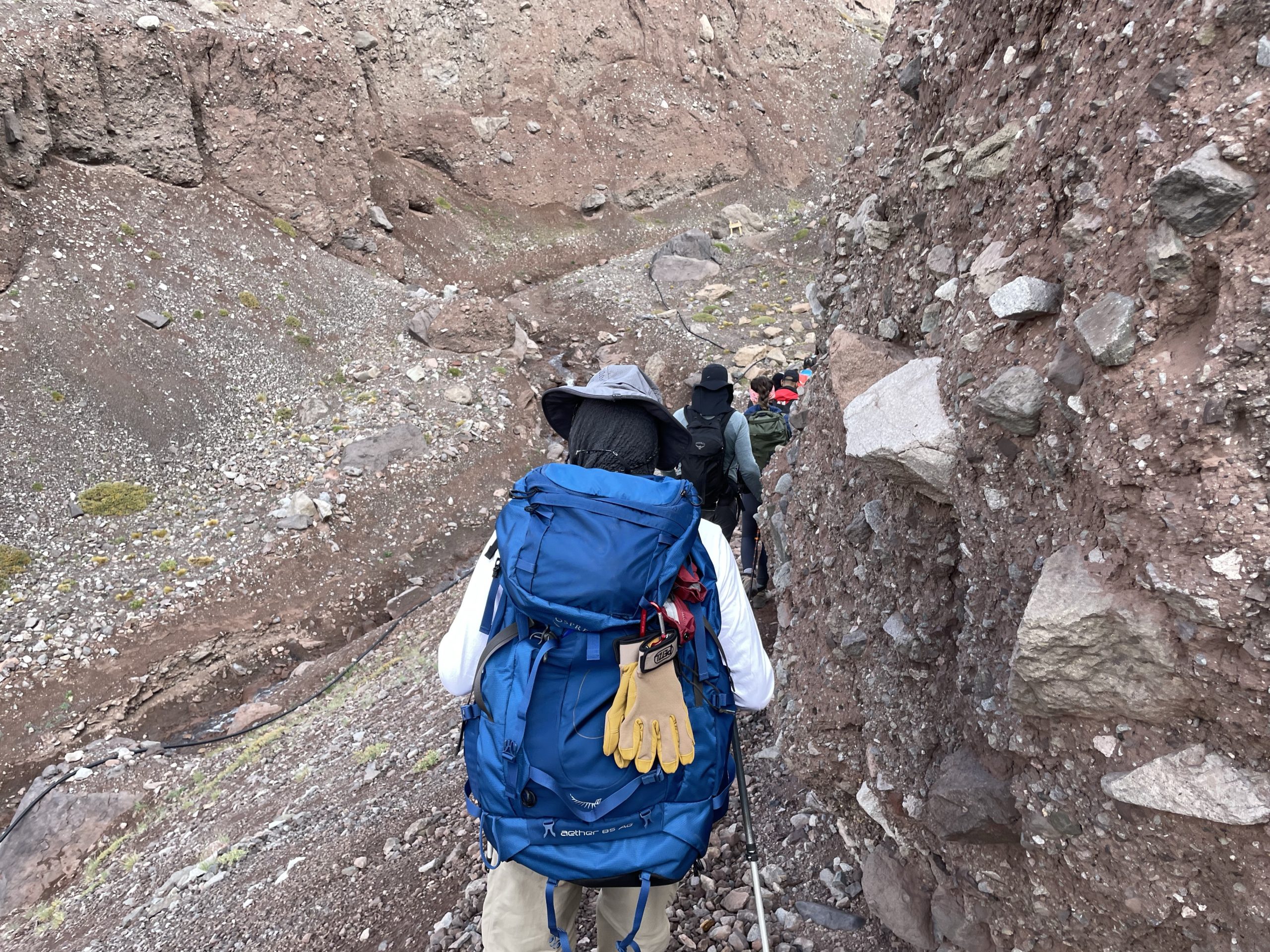
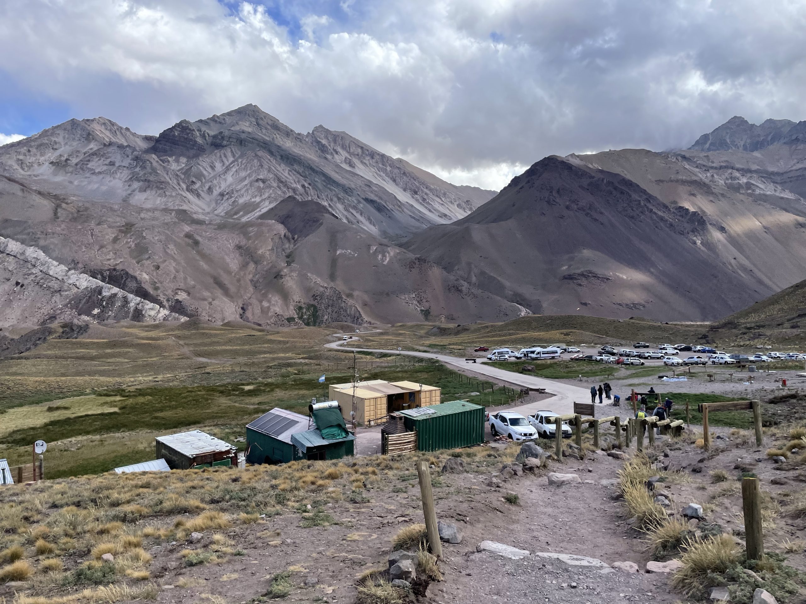
On the following morning, the expedition finally started (in my mind) when we first stepped foot onto the trail head. Of course there was some extra gear organization and permit issuances, but those were handled by Grajales so I’ll skip on the details.
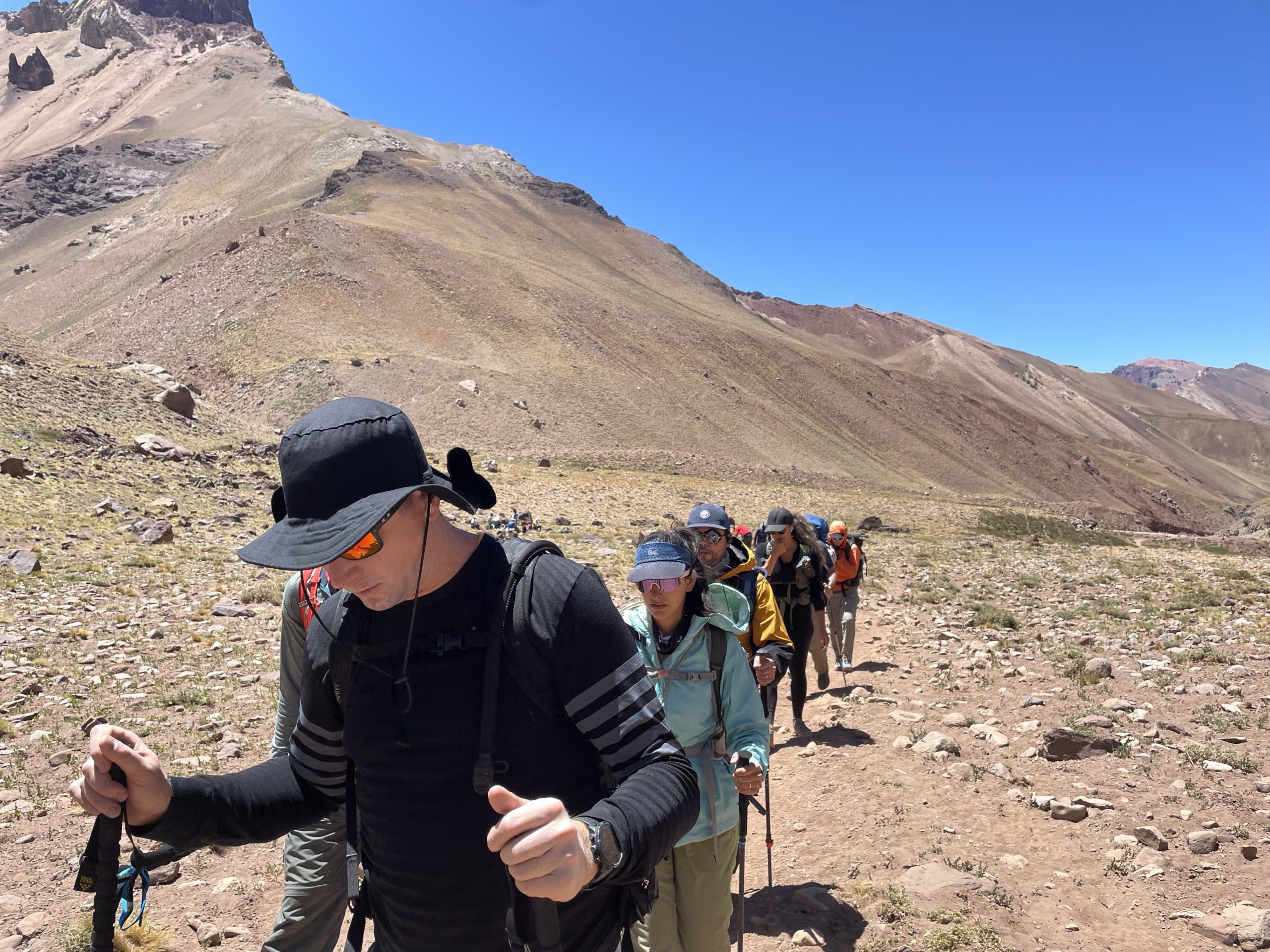
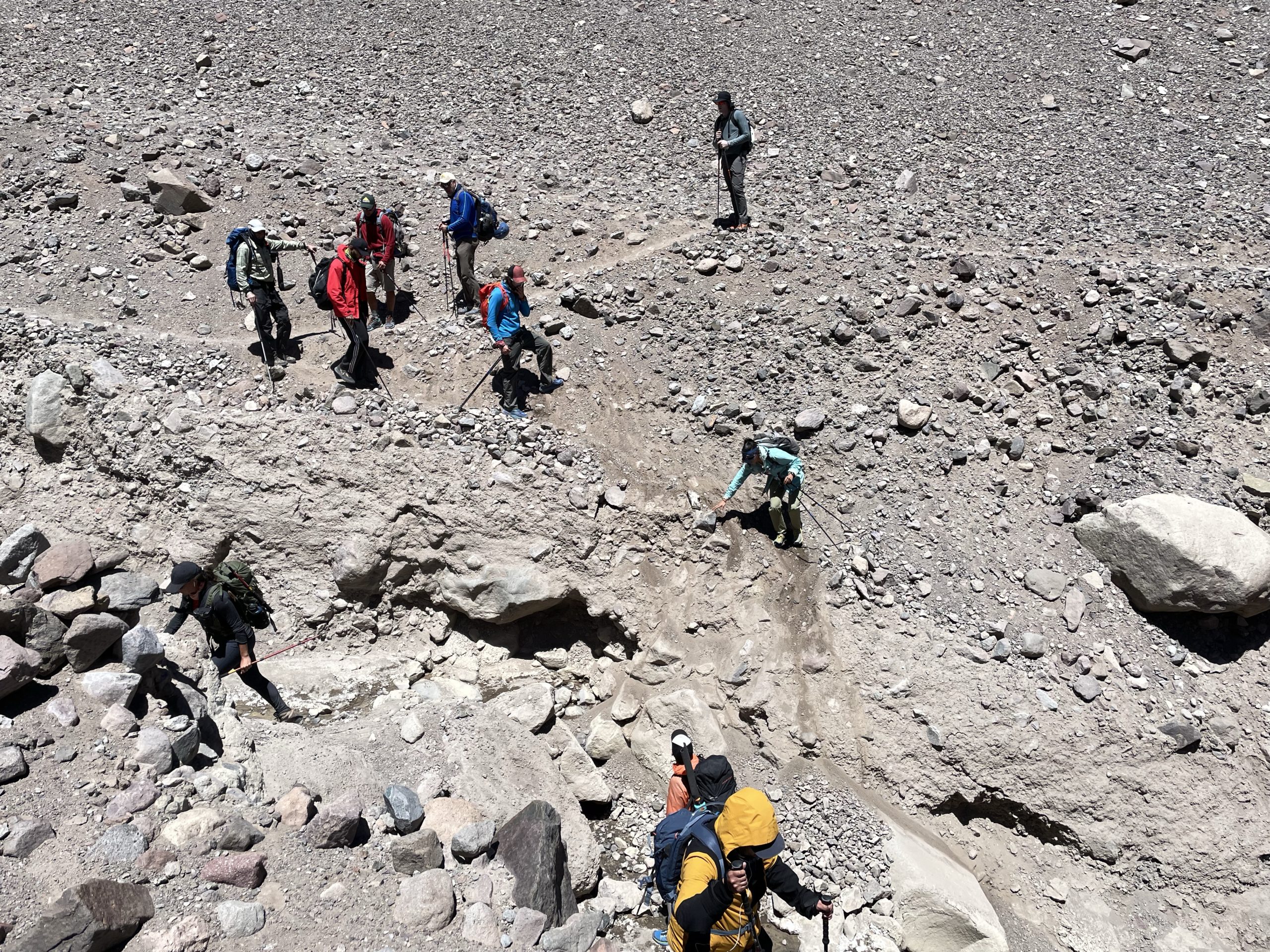
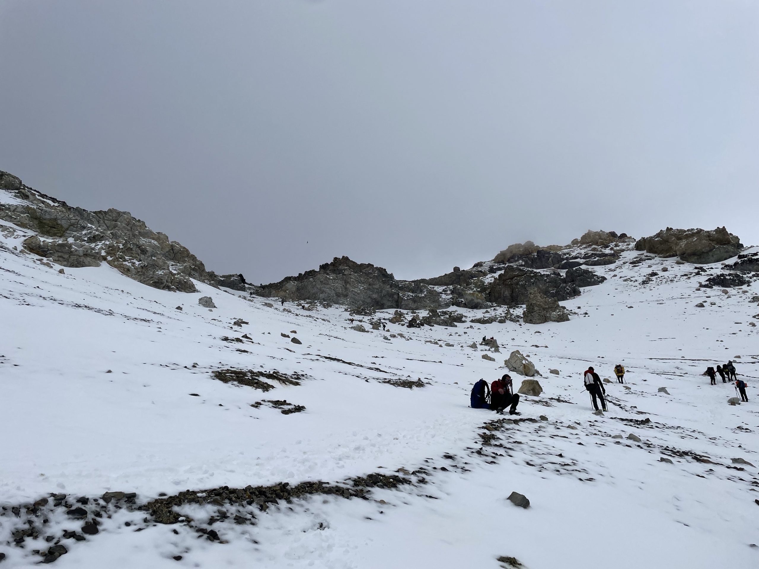
The first day on the trail involved an exceptionally slow approach to an intermediary base camp called Confluencia. Keeping the pace slow was deliberate by the guides, but it took some adjusting to realize this would be the new way of things at high altitude. We arrived about 3-4 hours later at an elevation around 3400m.
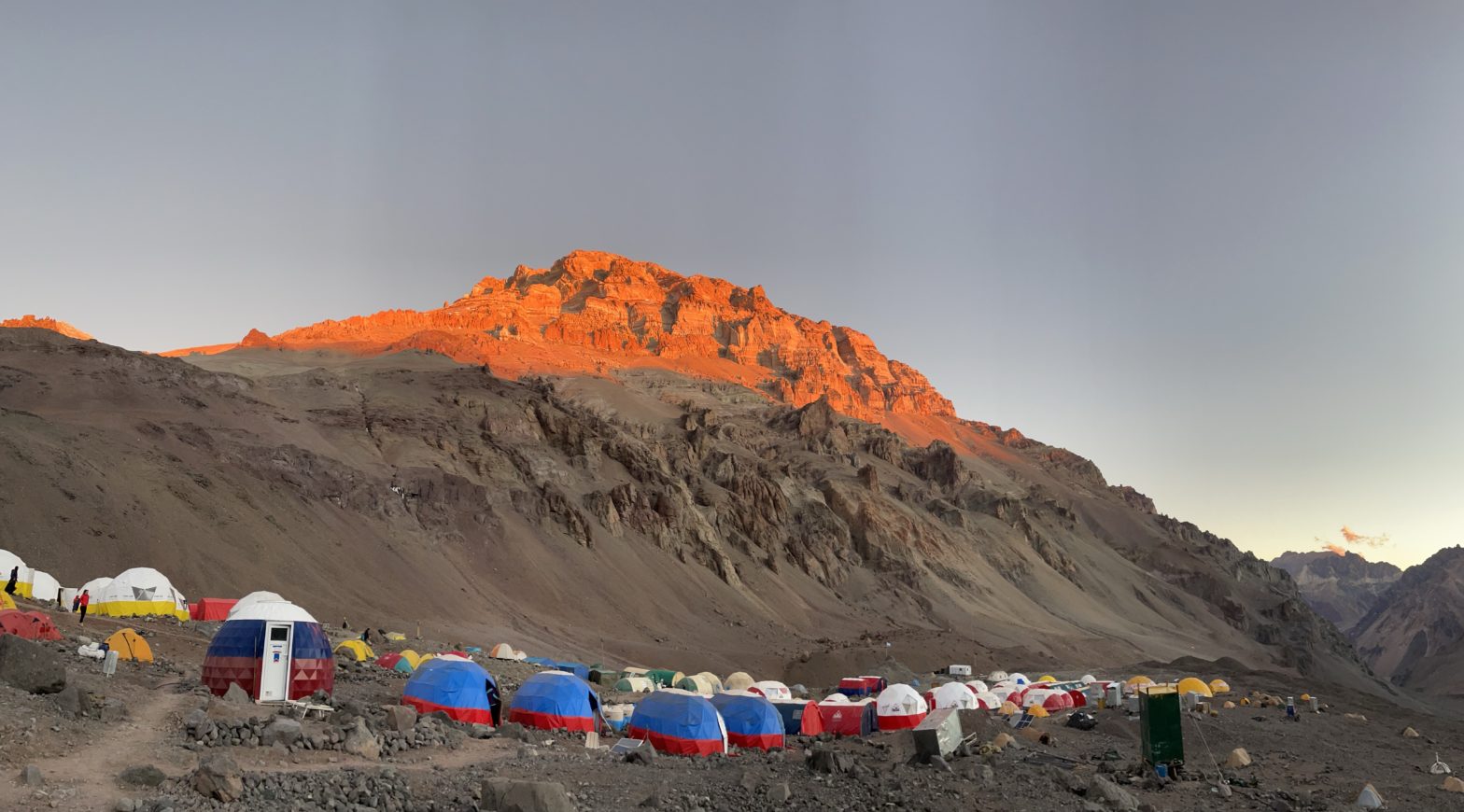
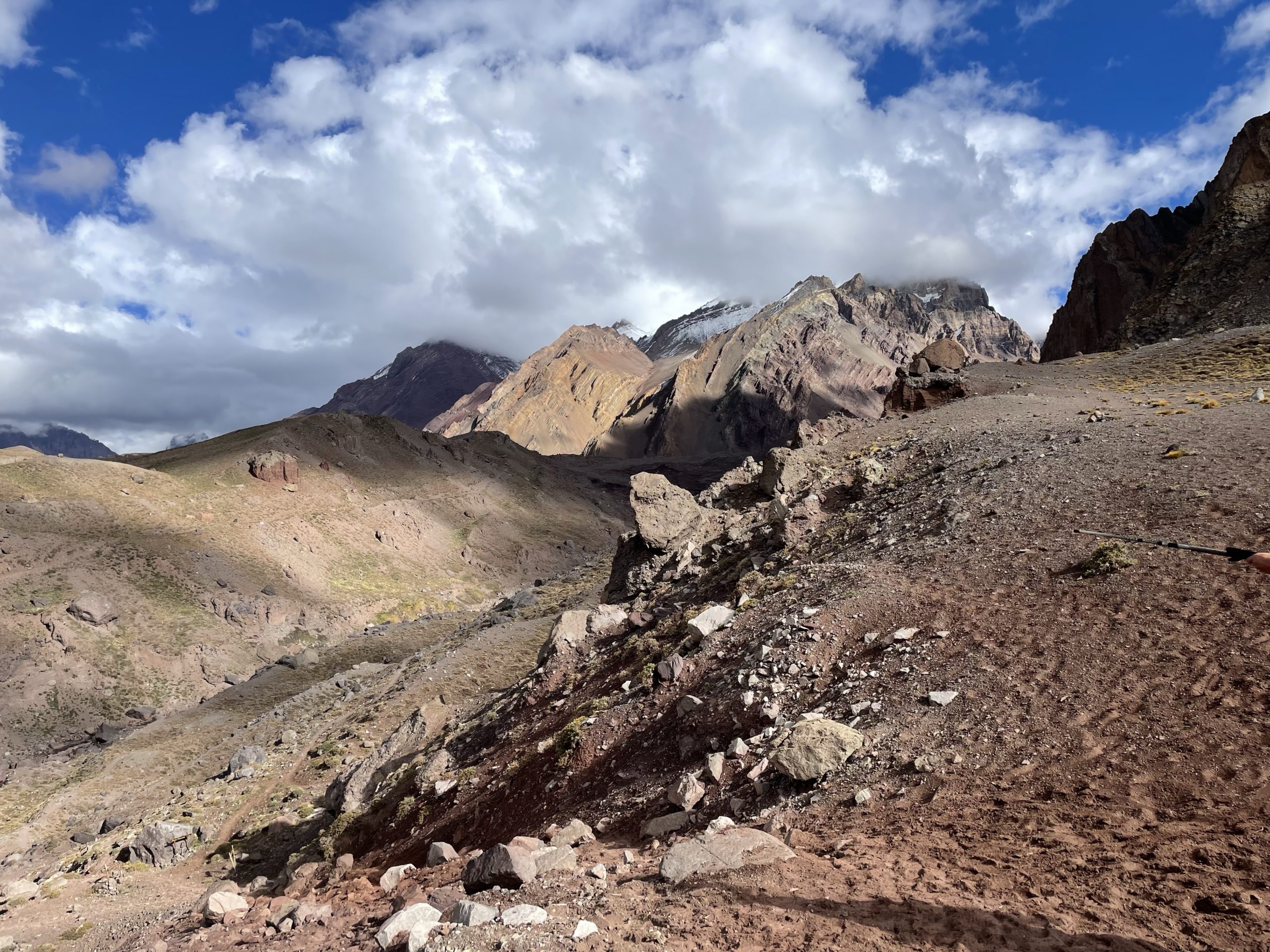
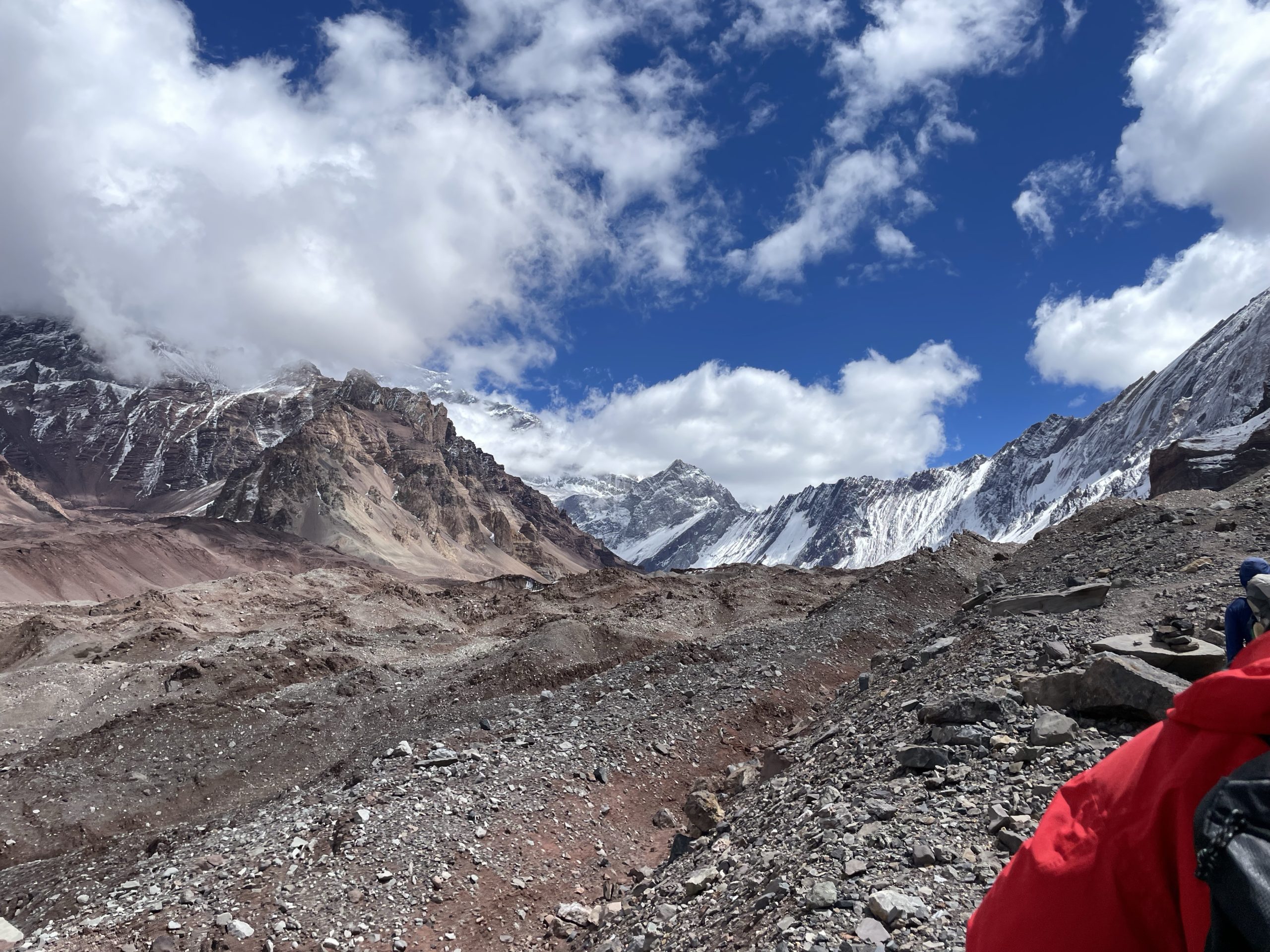
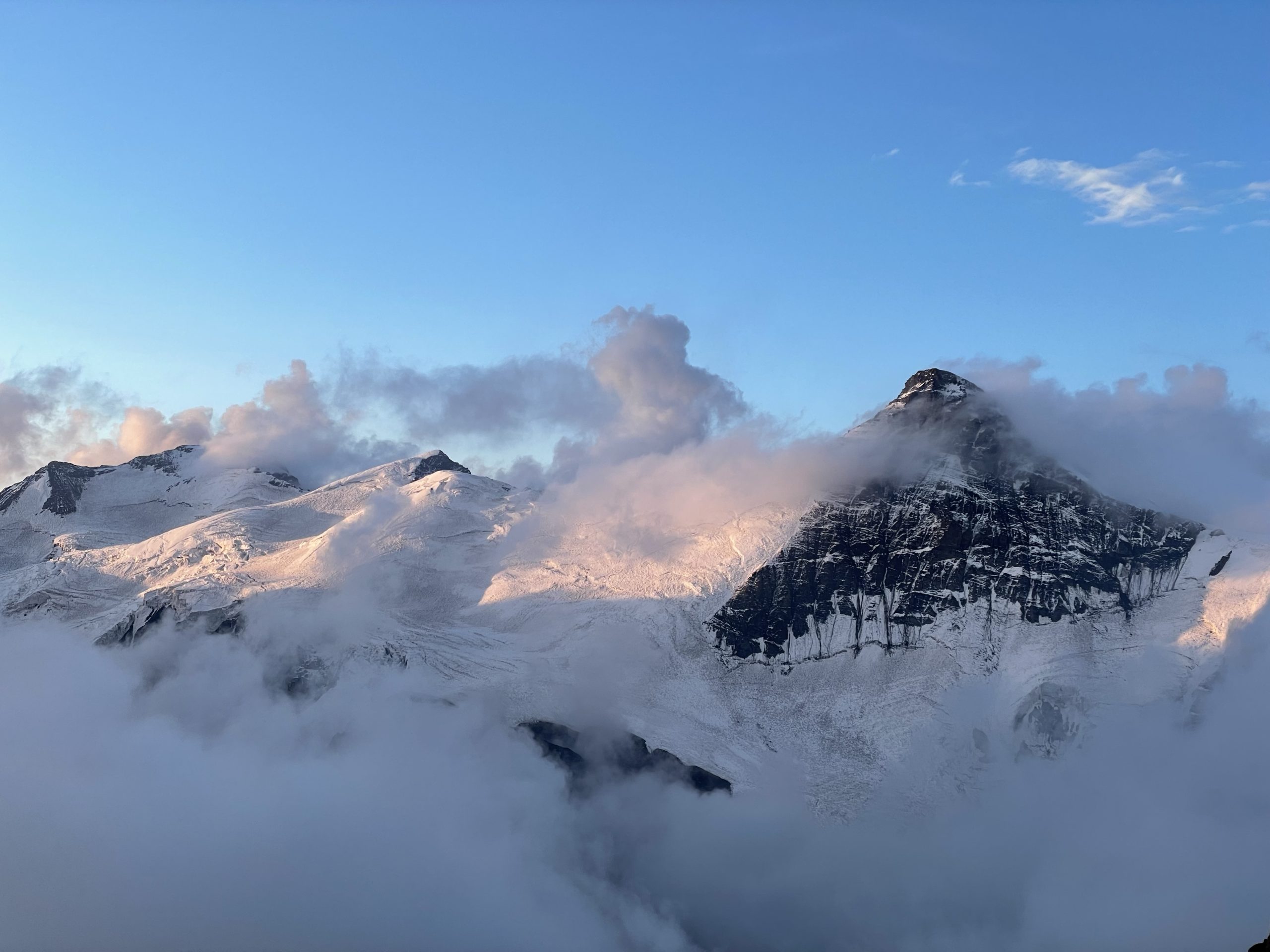
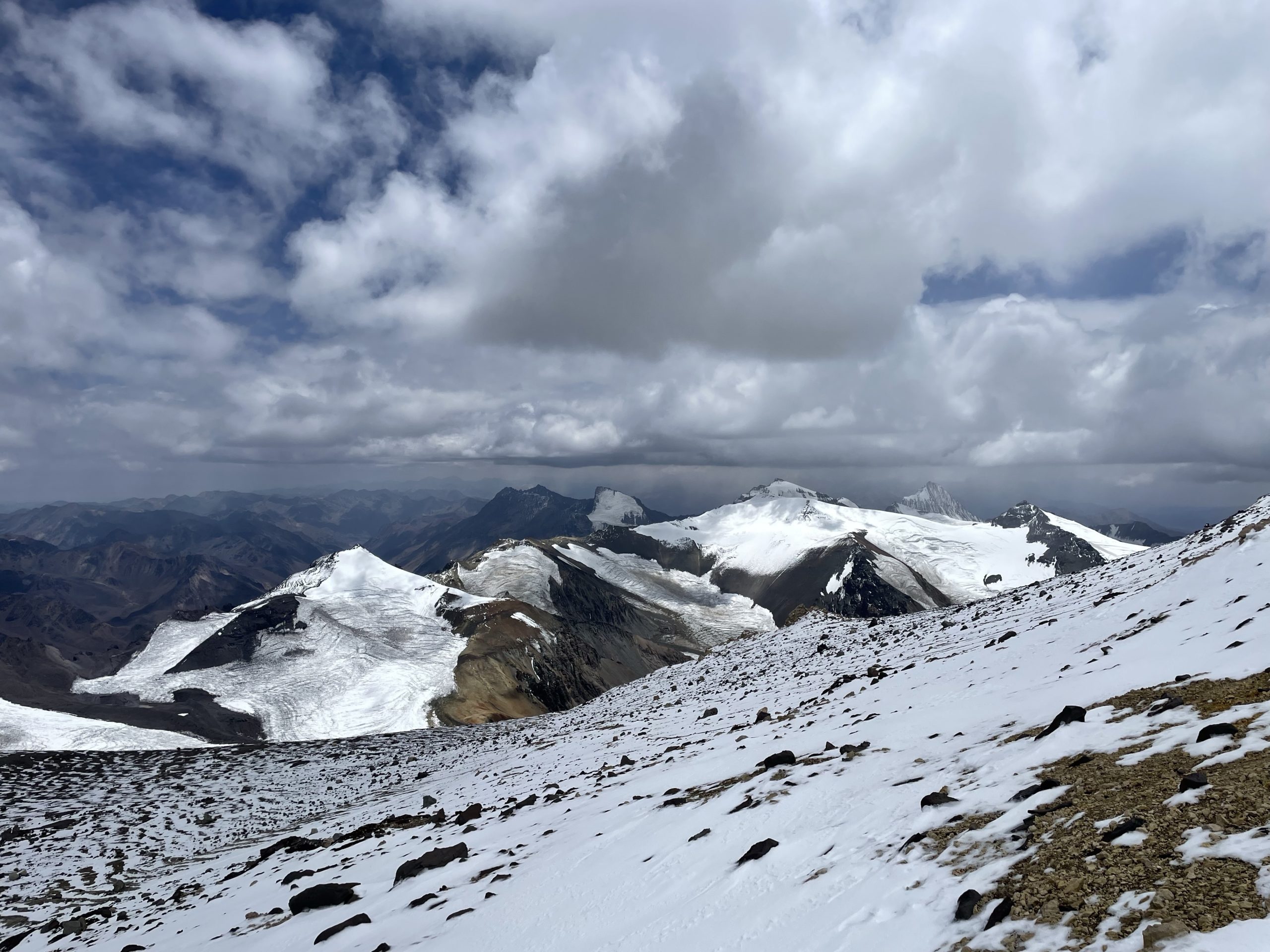
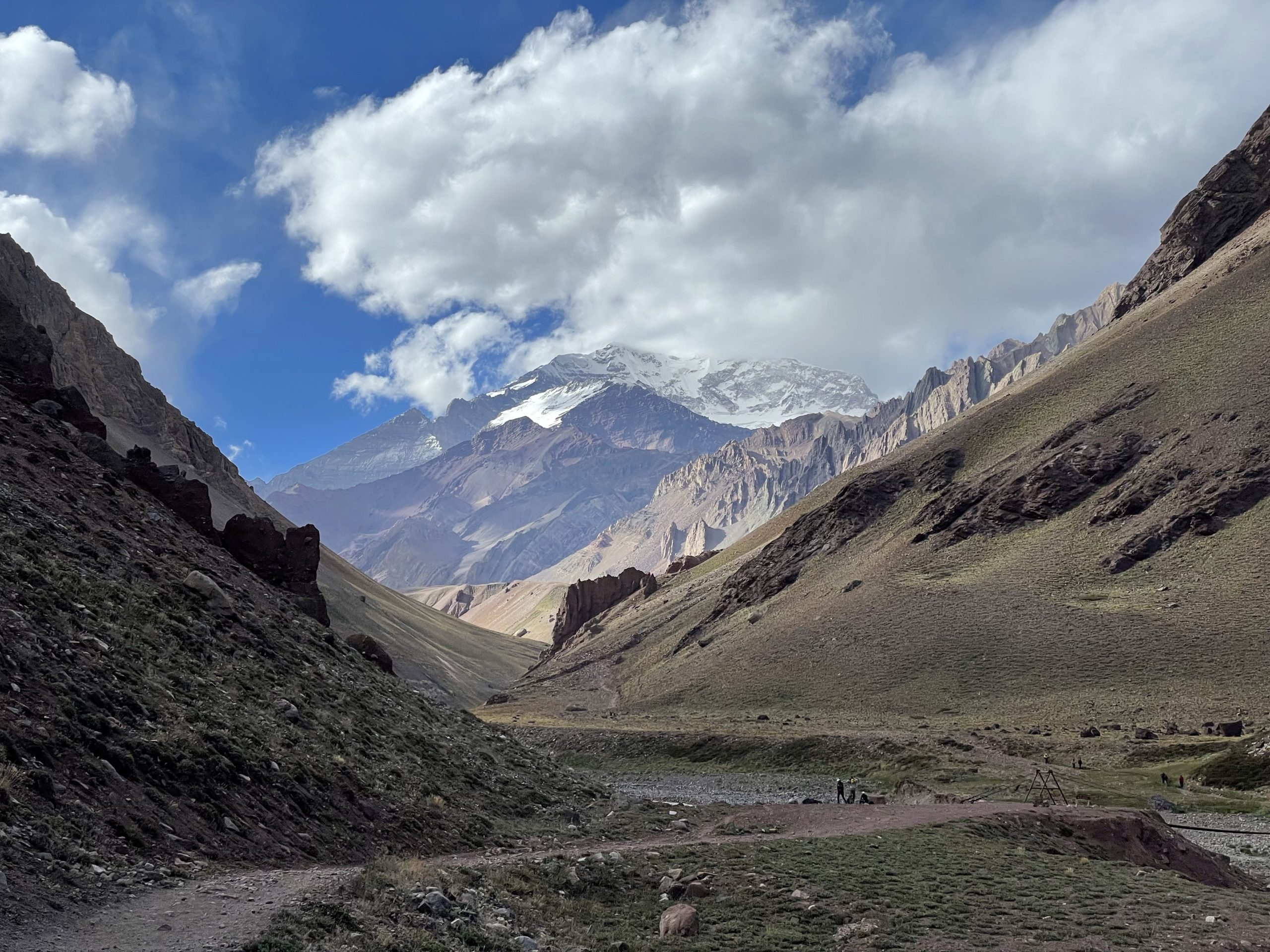
We slept one night here and the following morning made an acclimatization hike towards Plaza Francia. Here we bared witness to the almost insurmountable and imposing south face of Aconcagua. Despite the massive hanging glaciers and séracs, many teams have actually summitted from this side successfully. Many have also failed or perished attempting it. We spent an hour or so having lunch there and then headed back to Confluencia for a final night. I’ll add that on the way in we only carried day packs as the mules handled our items to both Confluence and the main base camp: Plaza de Mulas.
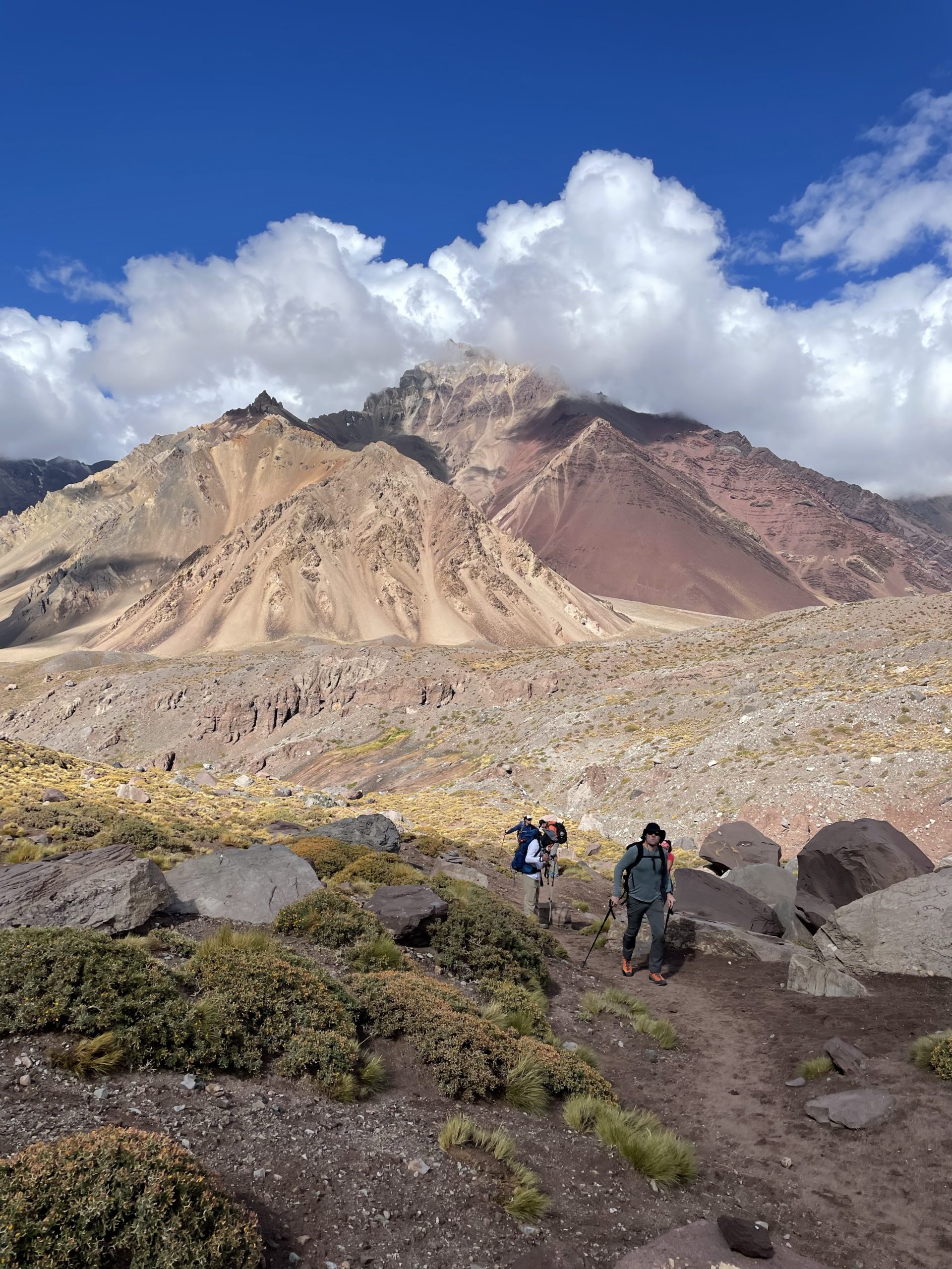
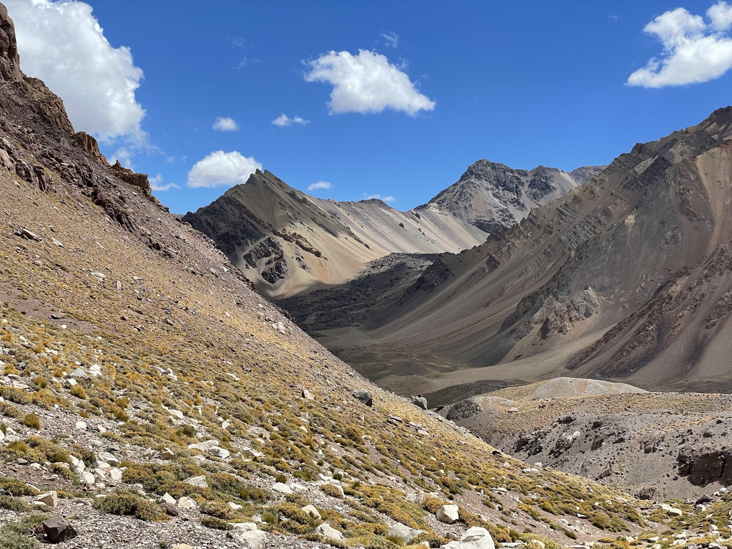
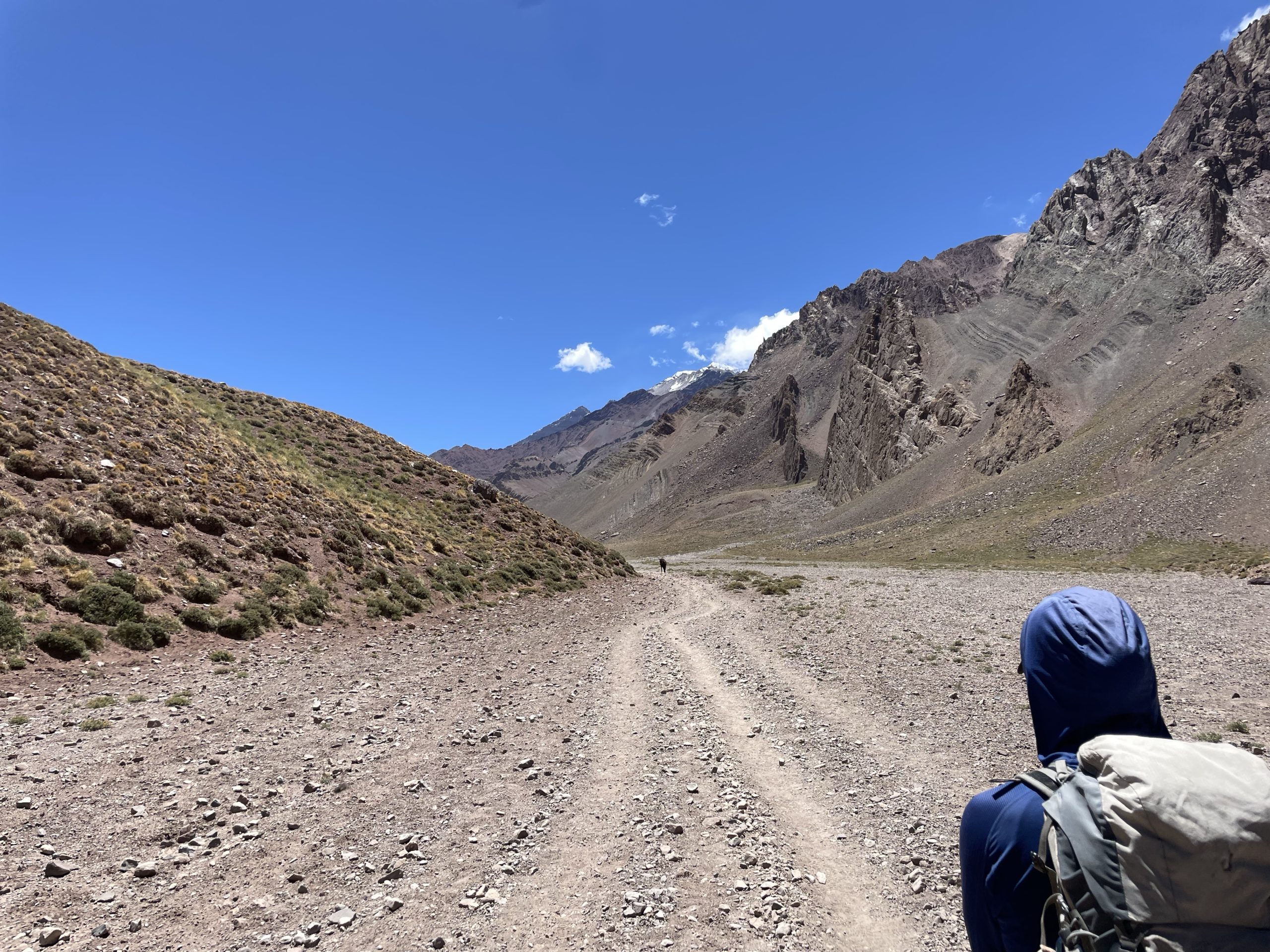
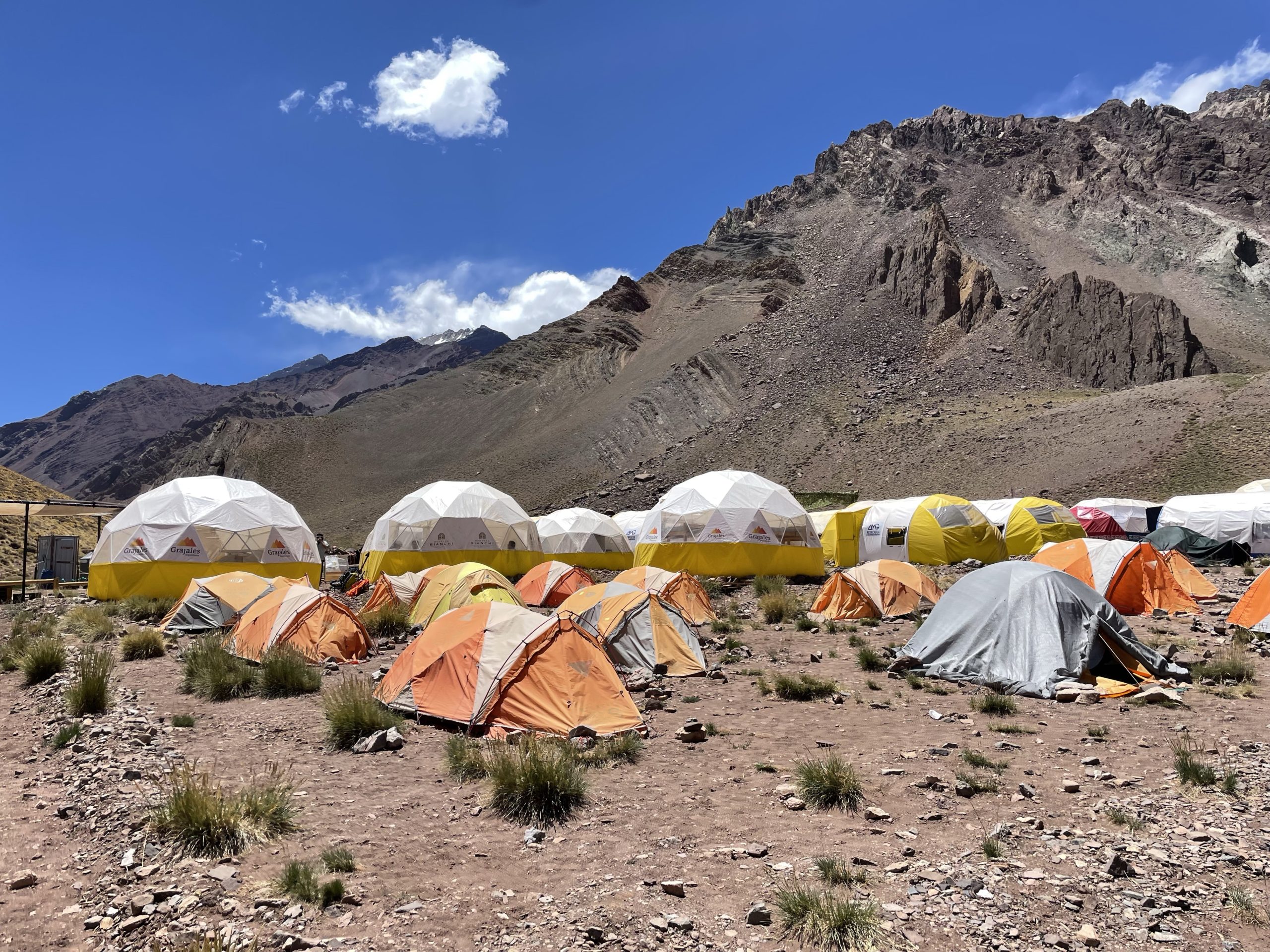
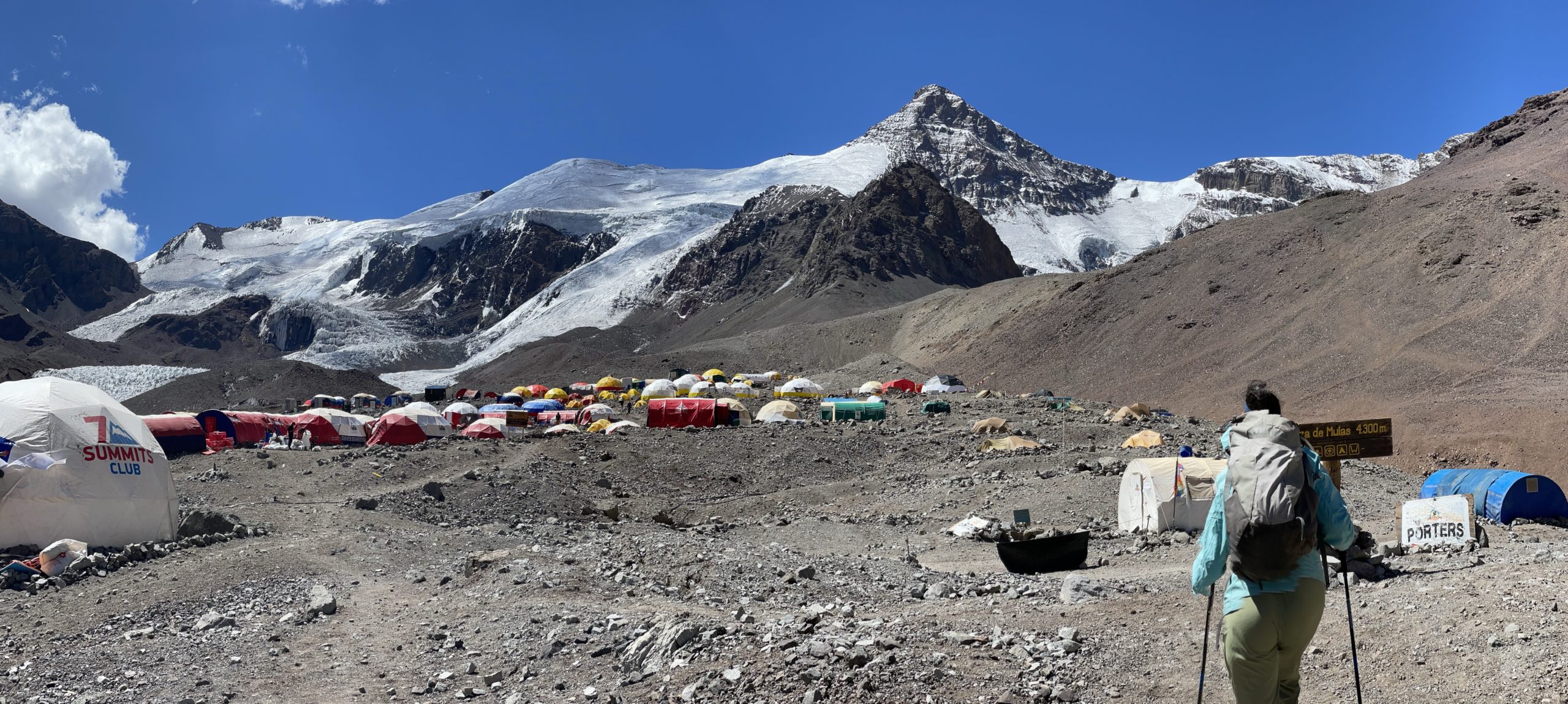
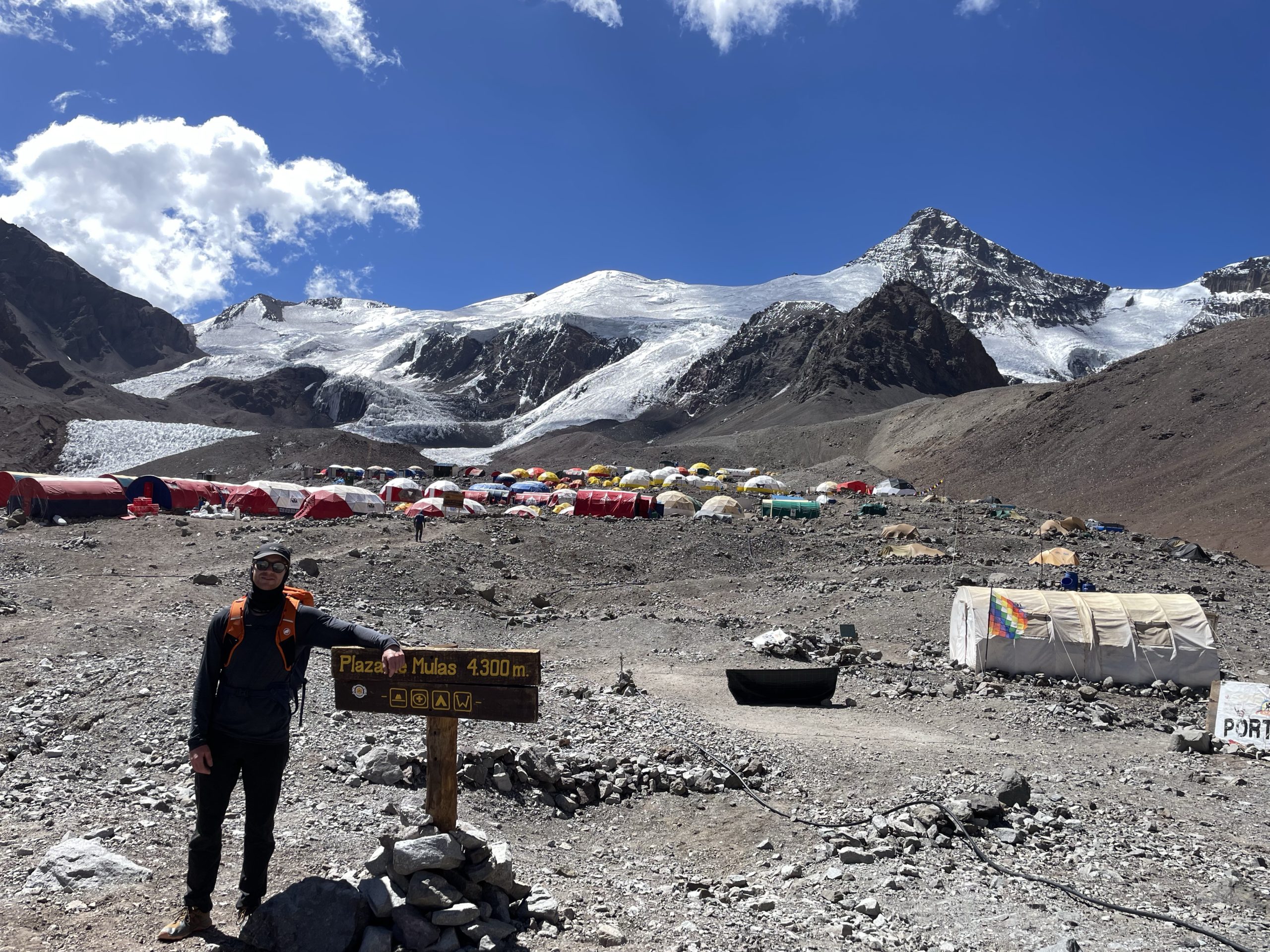
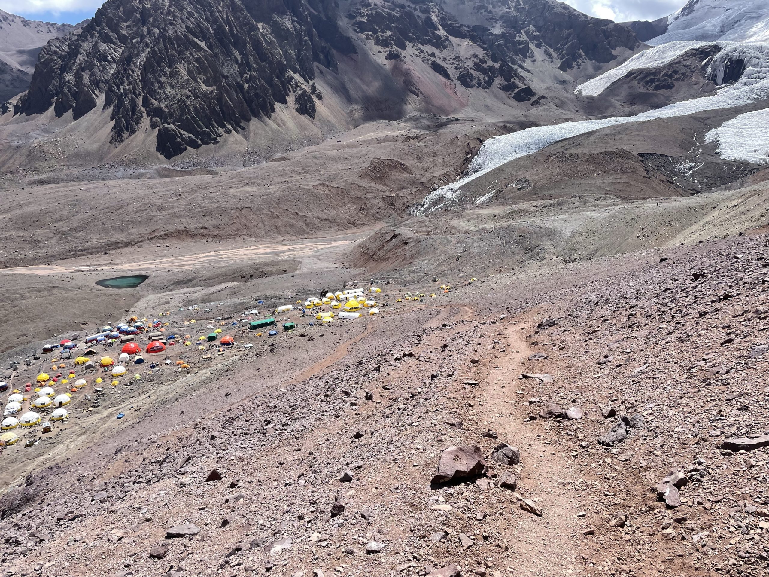
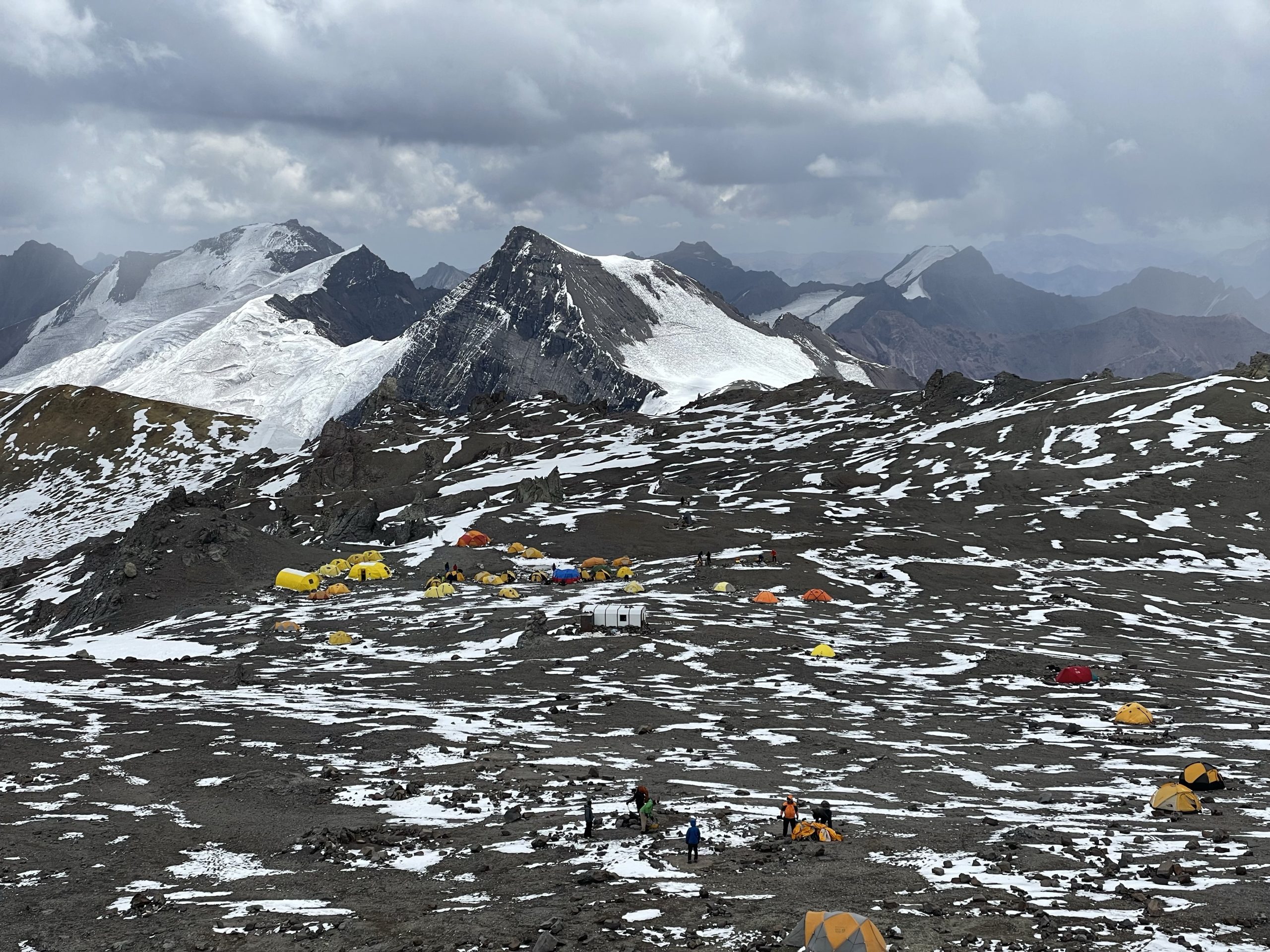
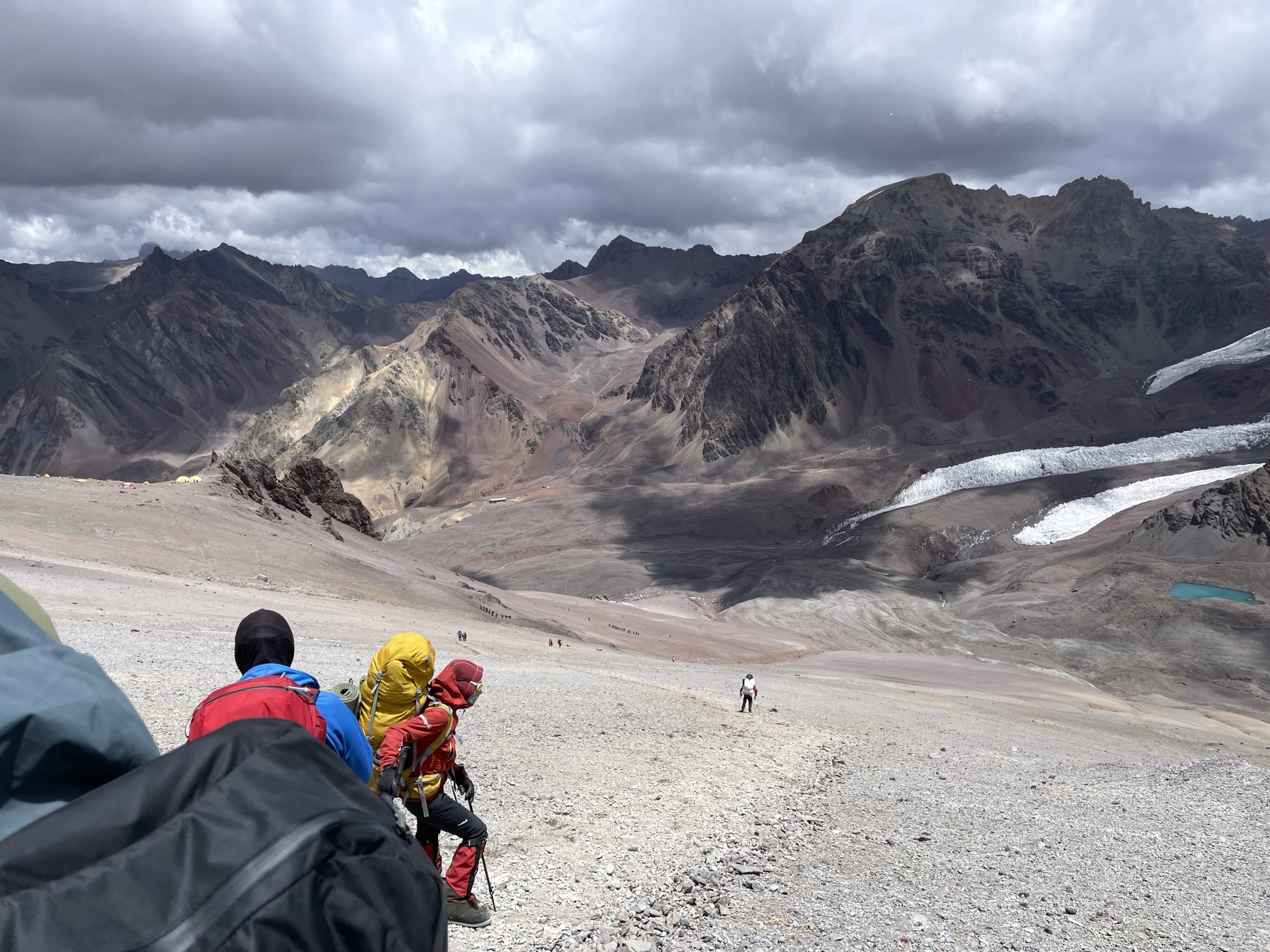
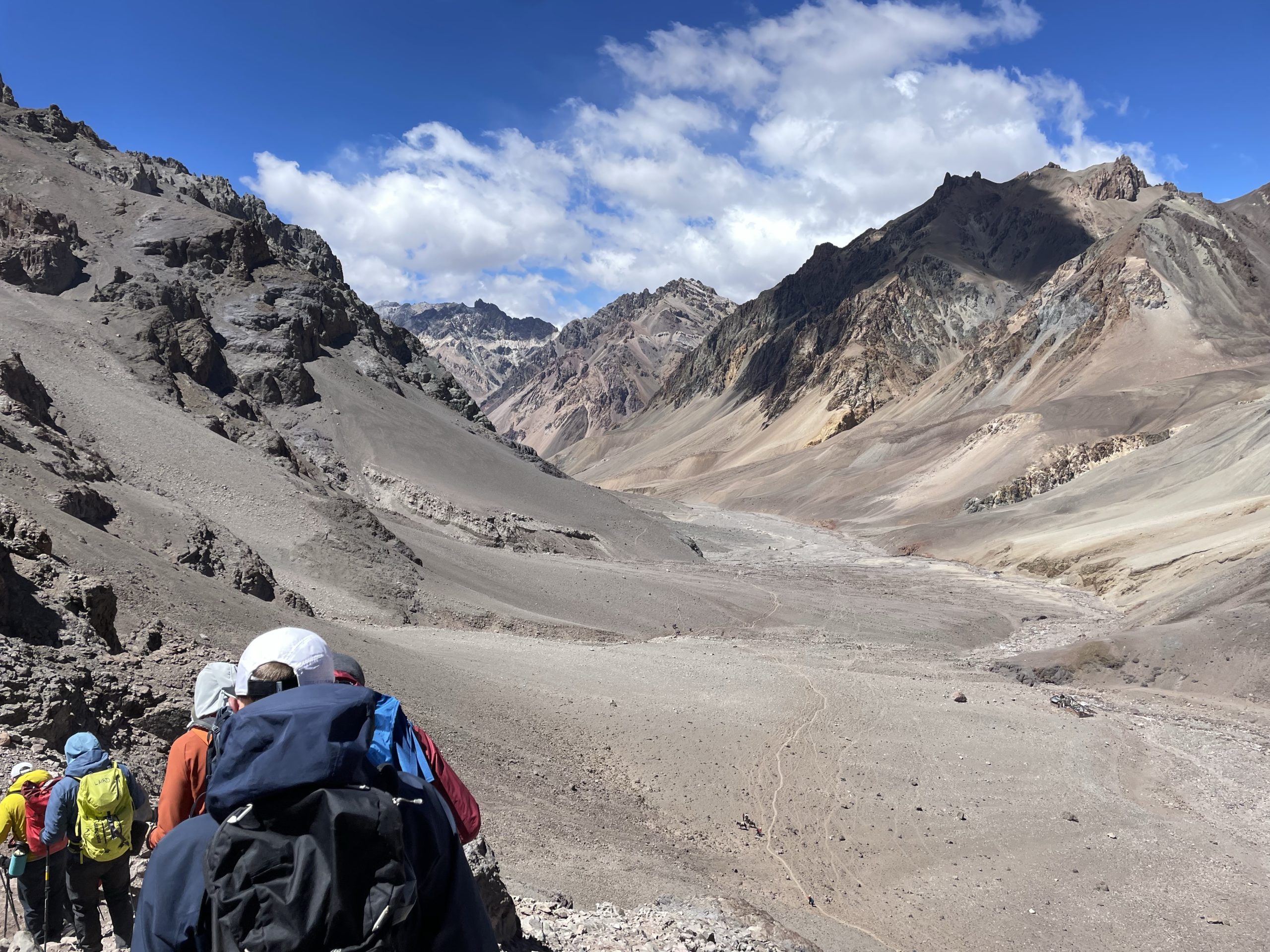
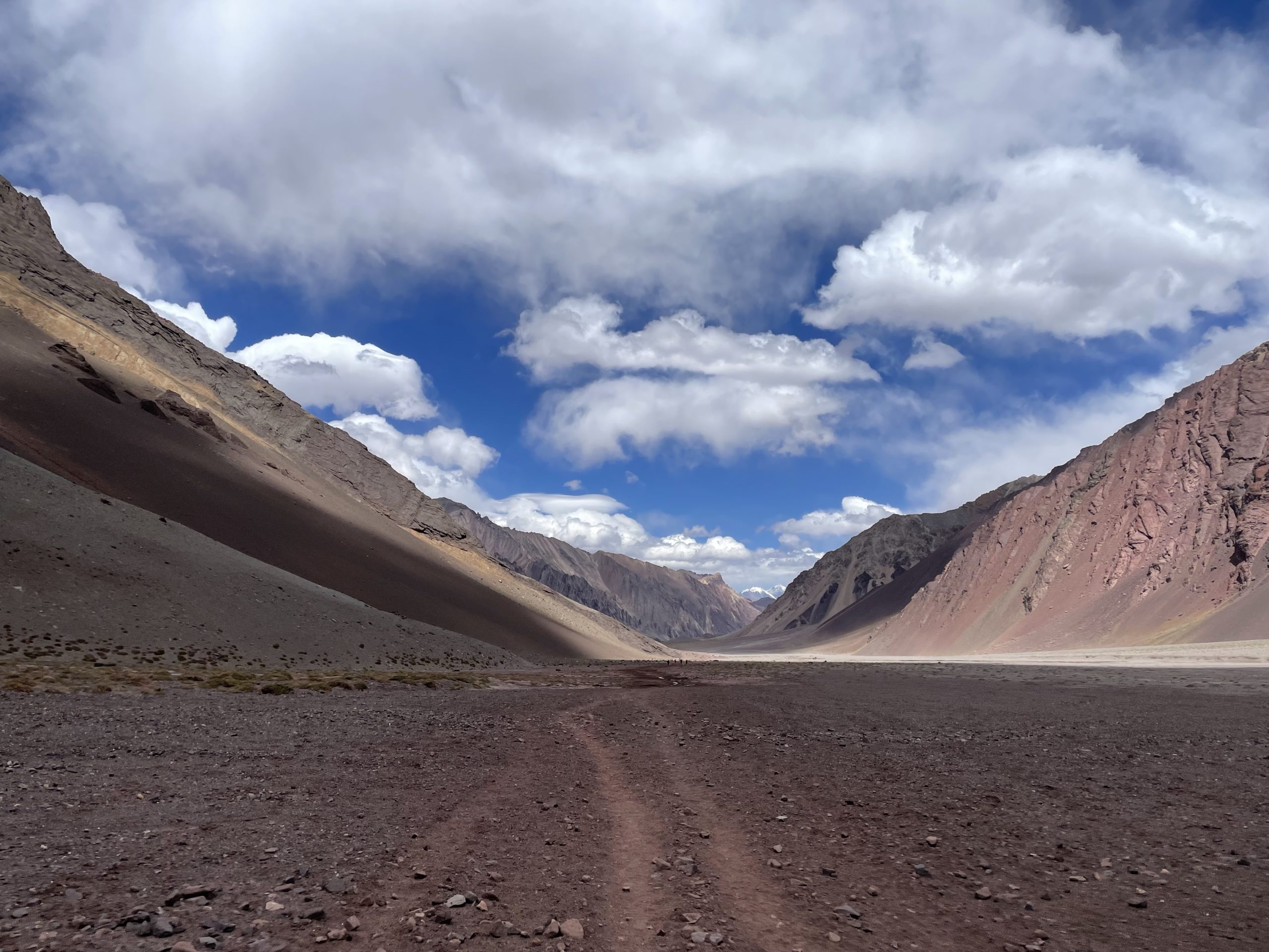
On the following morning we started the ~20km approach to Plaza de Mulas. The route followed through Horcones Valley along a long flat river bed. Only in the last 3km did we finally encounter a steeper rise up an old moraine slope before arriving at base camp. In total the journey took about 7 hours and we climbed from ~3400m to ~4300m. When I arrived at base camp I actually felt quite good with no symptoms from the altitude… yet.

Days 6-9
- GPS recording for day 7: https://www.alltrails.com/explore/recording/las-heras-hiking-6a5dfac
- GPS recording for day 8: https://www.alltrails.com/explore/recording/las-heras-hiking-7b7a53e
The first full day in base camp was slated to be a rest day. When I woke up, I was most thankful for that, because I had a major headache along with some fatigue and general altitude symptoms. It took all day to recover with drinking the recommended 6 litres of water per day and resting.
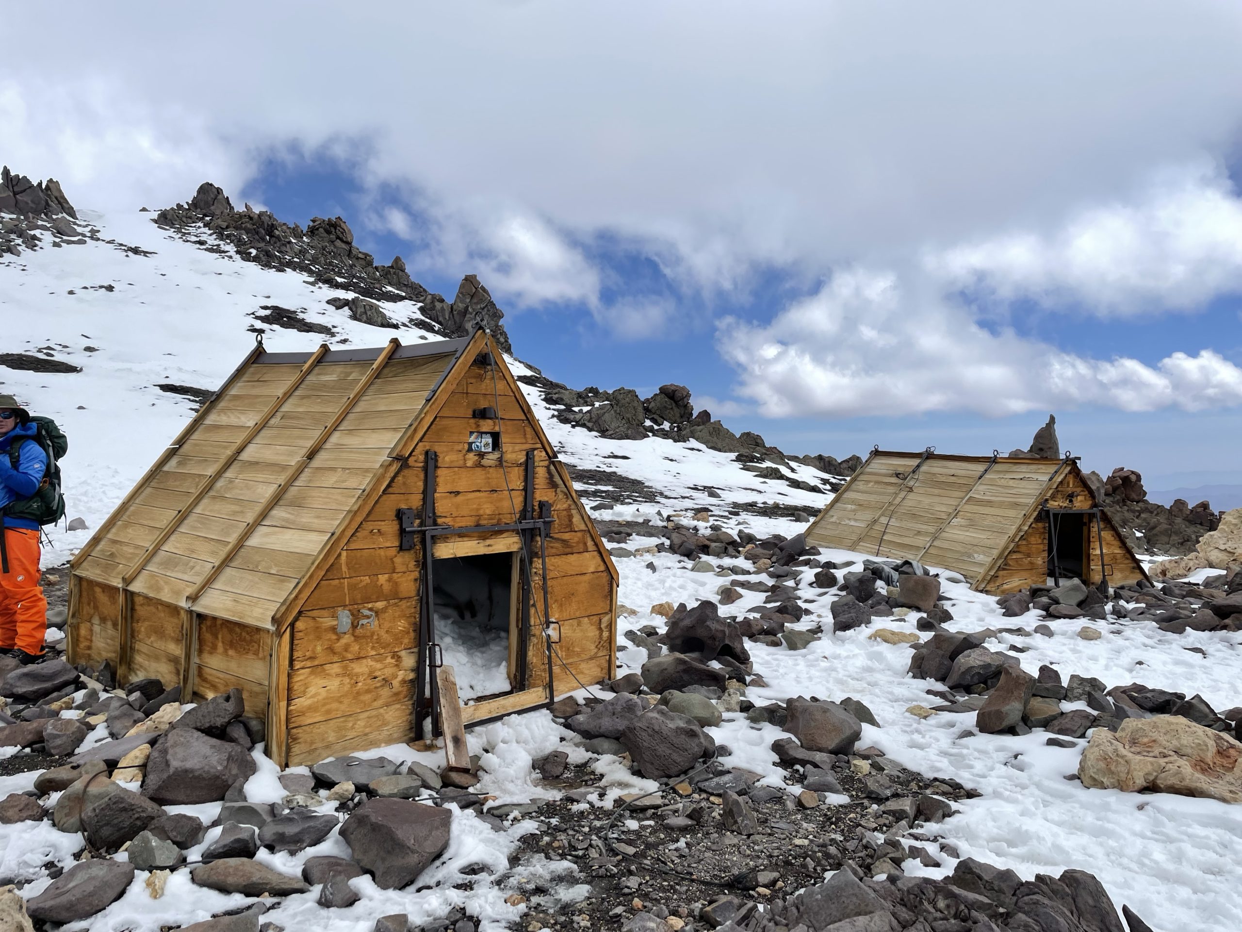
Thankfully, the following morning I was feeling good again. The second day in base camp was originally meant for an acclimatization hike up to the summit of Cerro Bonete. At the last moment the guides decided we should do a gear haul up to camp 1 instead. It was never stated why exactly, but I suspect it’s because the second group, run by Grajales, had a member contract a “mountain cough” and they wanted better separation of the groups. This first case of “mountain cough” in base camp was just a sign of things to come as well.
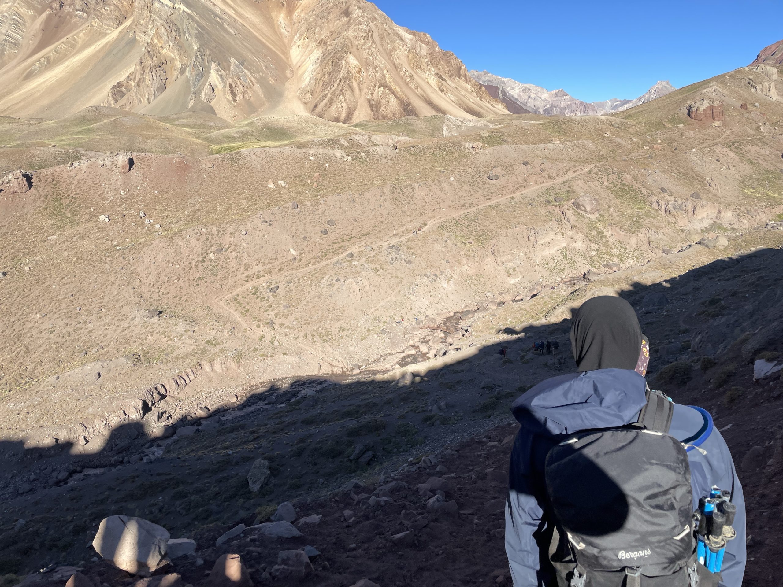
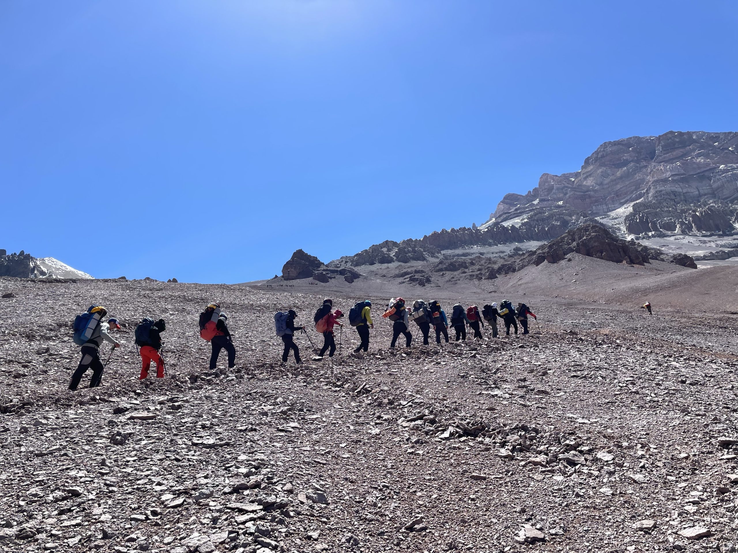
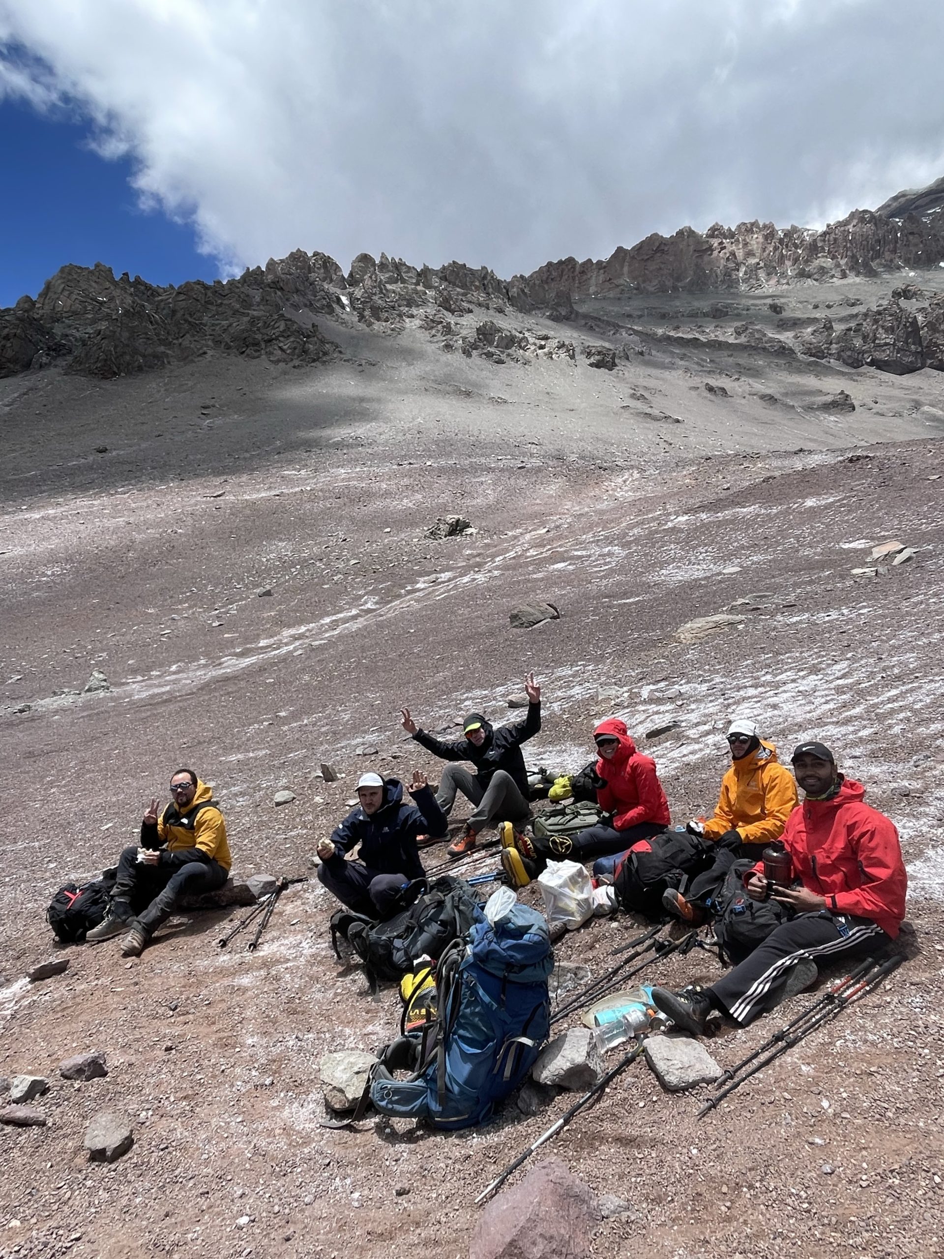
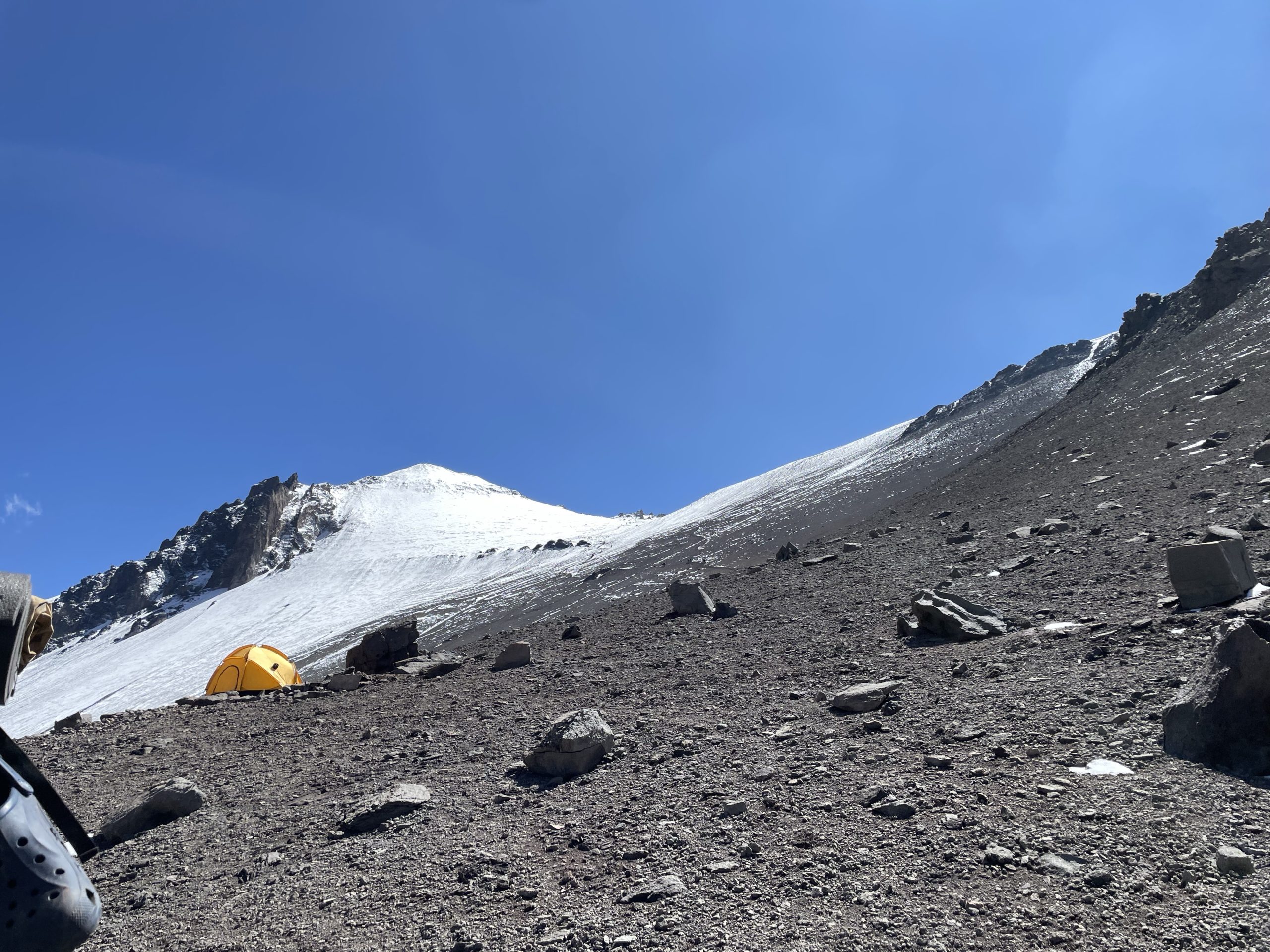
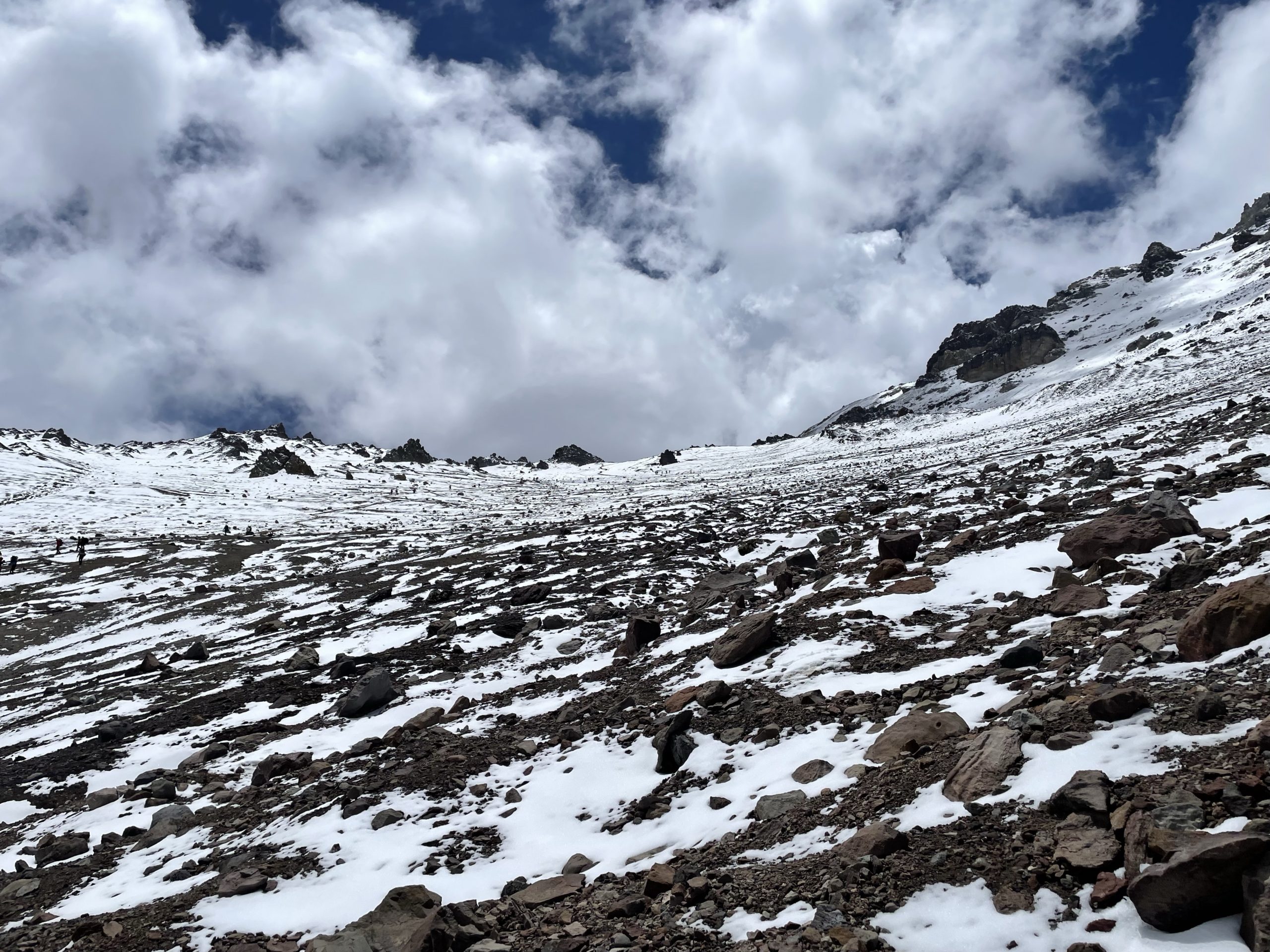
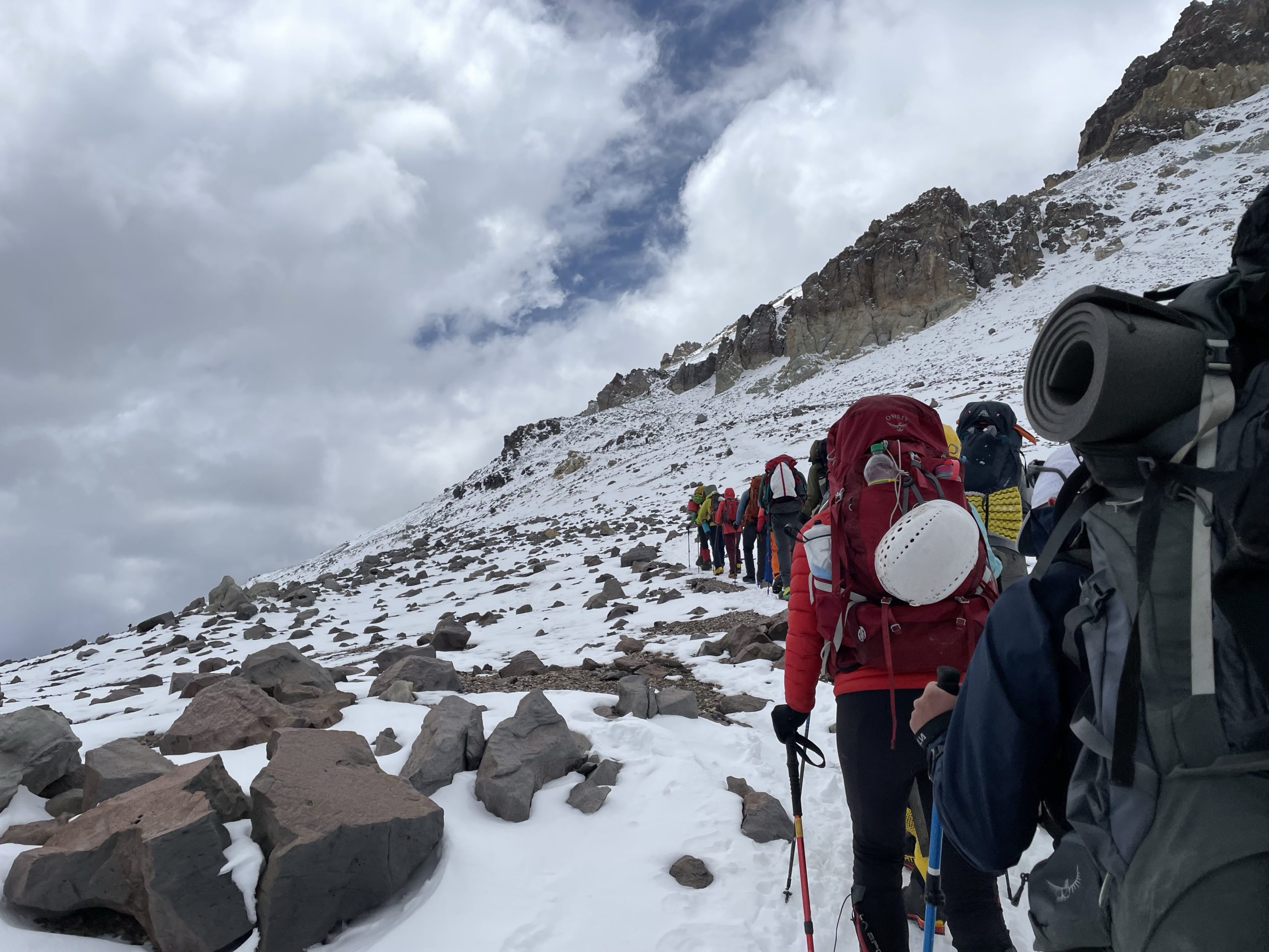
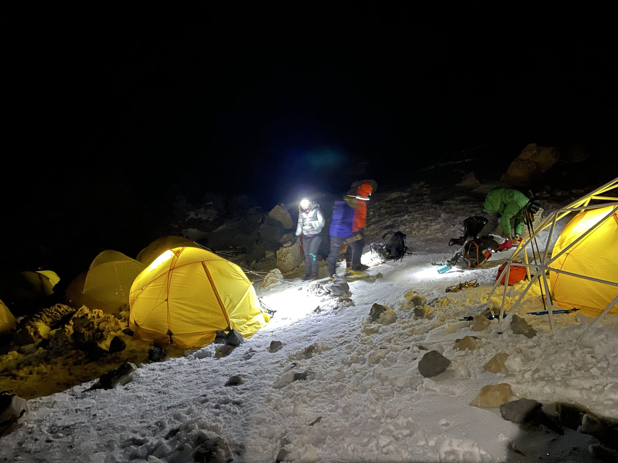
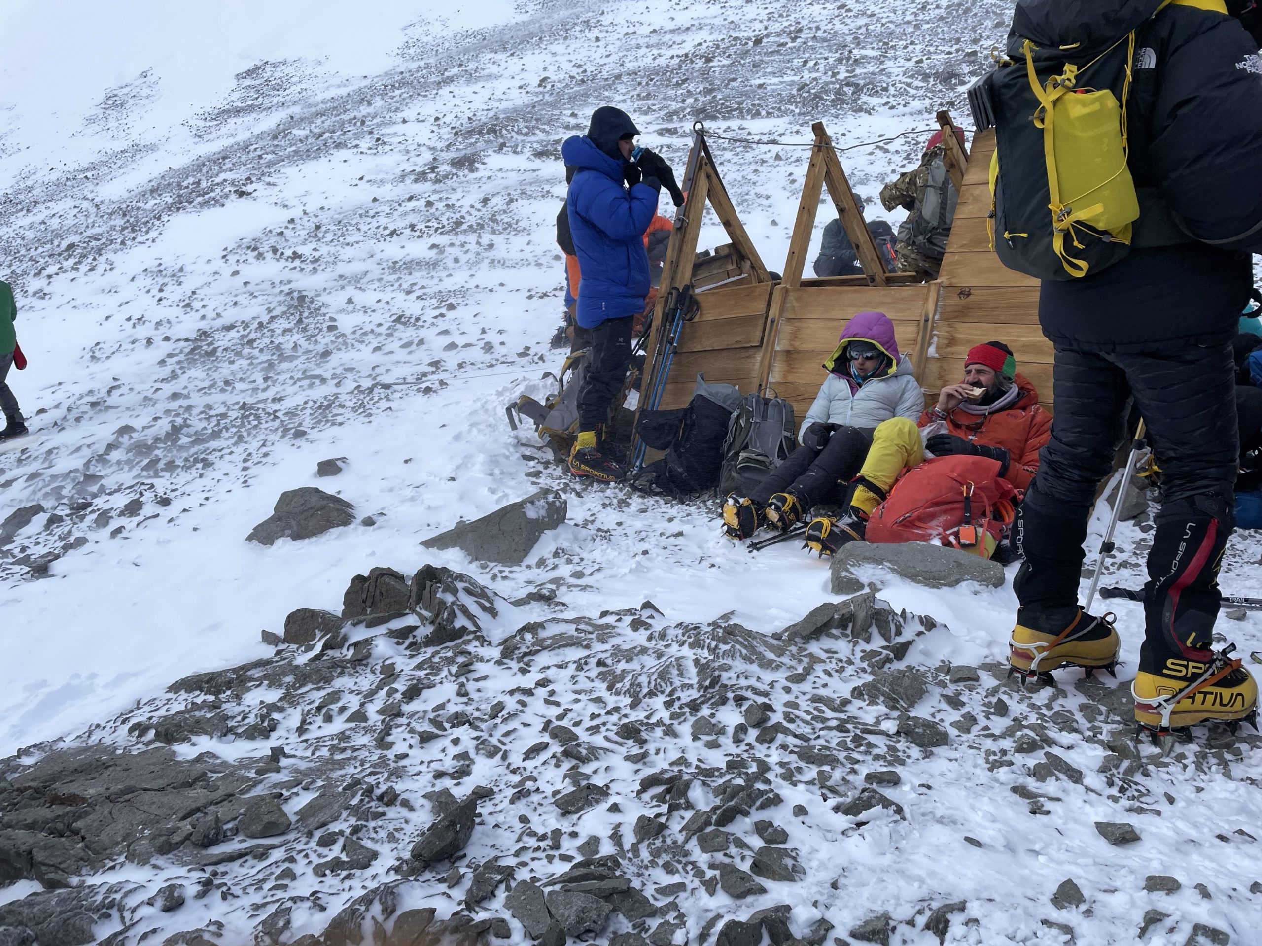
Camp 1 was situated at about 5000m in elevation along the tamer western slopes of Aconcagua. It was located about 500m south of Plaza Canada in its own area designated solely for Grajales. To get there we’d have to ascend up a steep, but manageable scree slope. This was my first day with a full pack, as the mules operated no higher than base camp. It weighed in at around 18kg with the shared group gear and so wasn’t as bad as I expected. Only one other member in my group: Christopher, was carrying their own gear as well. His pack was laden with 23-24kg and so I was thankful to have some lighter weight gear on me to keep the pack manageable. I opted to carry all the gear I planned to use in the high camps including double boots, helmet, thicker layers and so on.
We started up the slopes at around 10:45am. It didn’t take long for me to start feeling the altitude heading up. I have to admit the pack made breathing a challenge. I did virtually no training with a heavy pack leading up to the expedition and I was beginning to wonder if I’d regret that. Soon enough I did finally manage to settle into a rhythm and the doubts subsided as I made easier strides upwards. The guides set a reasonable pace, so it was just an exercise in putting one foot after the other.
After about 3.5 hours we reached the base camp and dropped our gear off. We then spent 30-40 minutes having some lunch before starting our descent. Heading down was a dream thanks to the mostly soft scree slopes. I was practically able to run down and the guides were content to have us do our own thing all the way back to camp. Perhaps 30 minutes after leaving I completed the descent and settled in for an evening of rest.

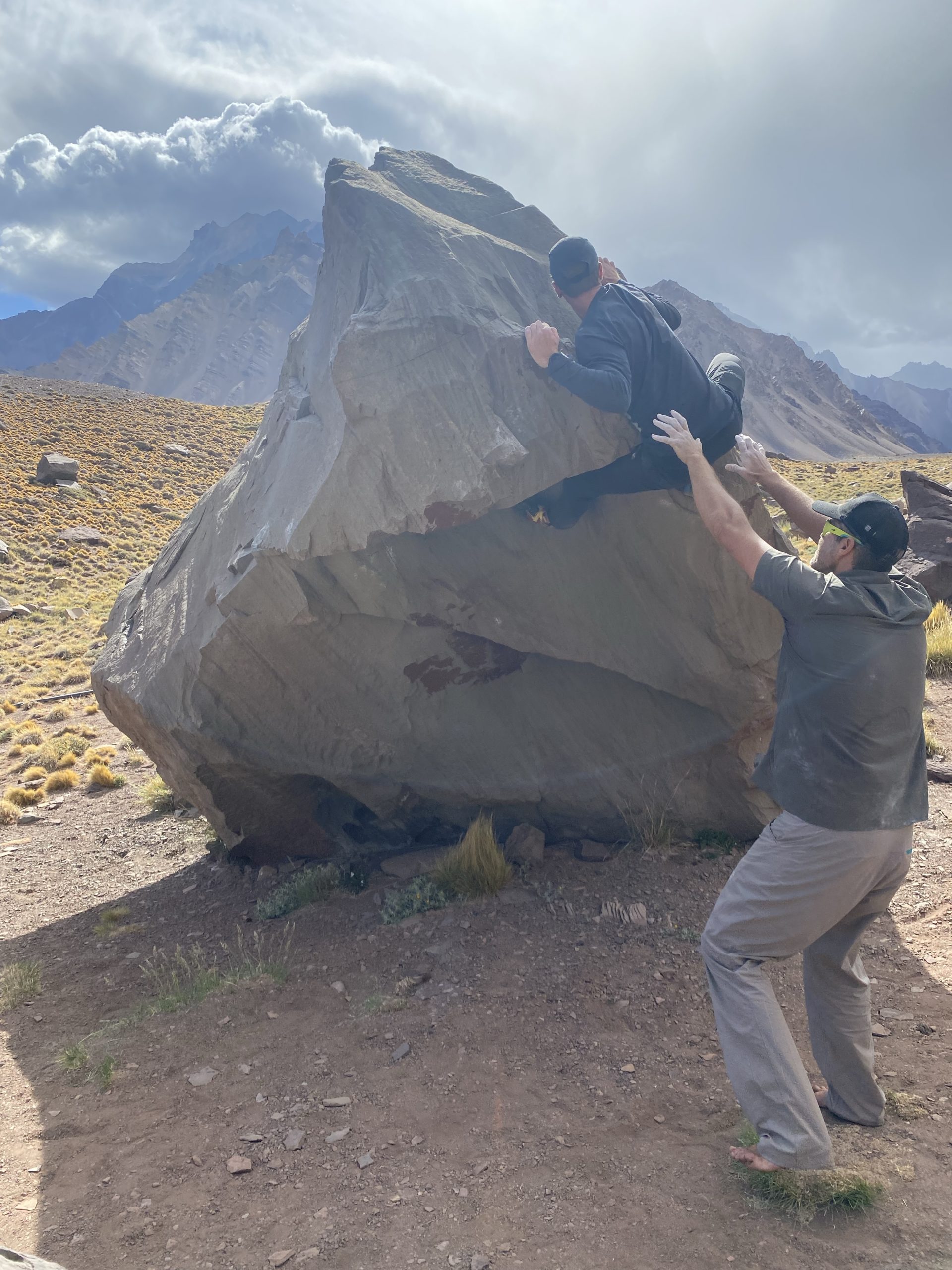
On the third day in base camp we made an ascent up to Cerro Bonete which is covered in a separate post. The fourth day was just a rest day and for some reason it dragged on a bit. We did learn more about the plan for the high camps however. The original itinerary called for a move to camp 1, then camp 2 the following day and finally a move to camp 3, if there was a summit window. Otherwise, we’d wait in camp 2 for the first window and then move up to camp 3. A new plan came to light, which was to add a rest day at camp 2. This left two days instead of 3 for a summit attempt, but we’d be better rested as a result. There was certainly some hesitations about a rest day at a high camp, but the weather looked promising either way so it seemed to make the most sense. Personally, I wanted to get the trip done in the quickest possible way, as the tent life was tiring, but I trusted our guides’ decisions.
Days 10-13
- GPS recording for day 10: https://www.alltrails.com/explore/recording/las-heras-hiking-9b91d24
- GPS recording for day 11: https://www.alltrails.com/explore/recording/las-heras-hiking-17326d1
- GPS recording for day 13: https://www.alltrails.com/explore/recording/las-heras-hiking-975e610
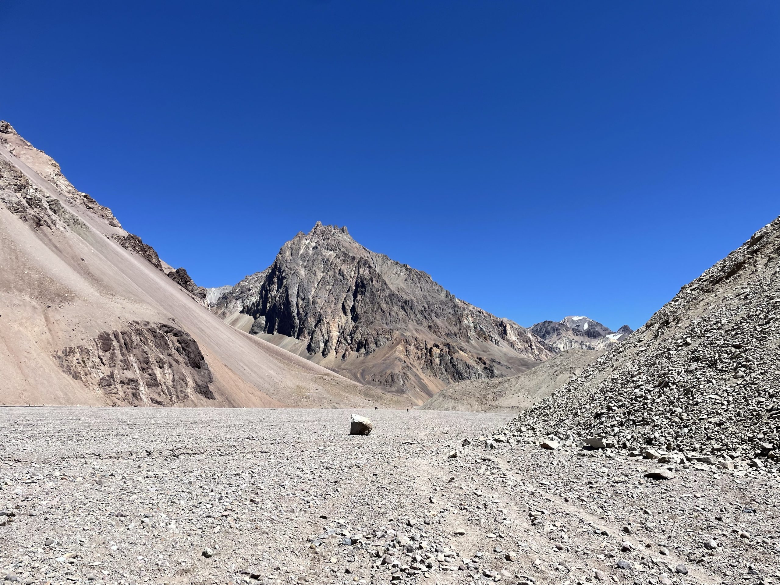
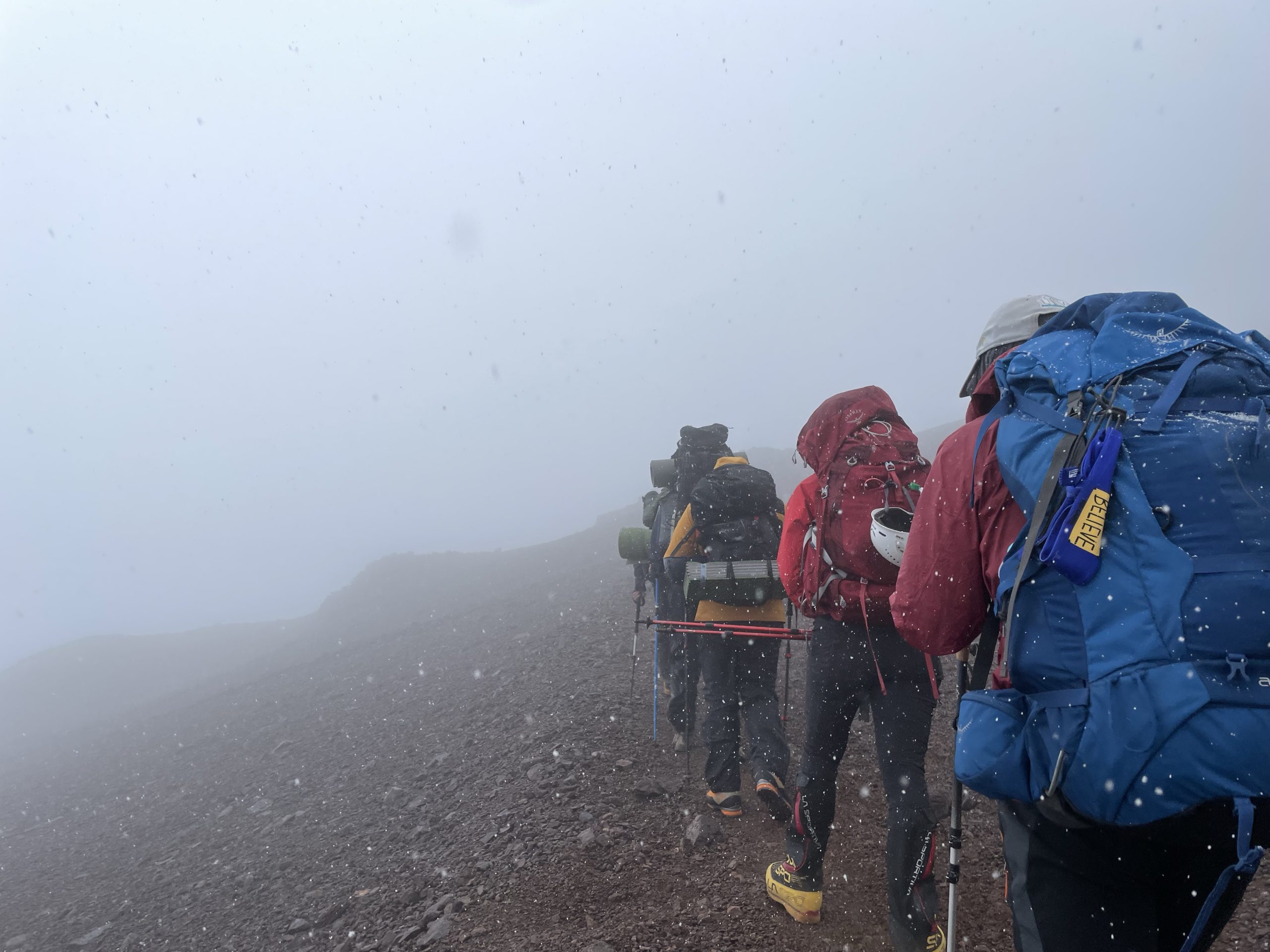
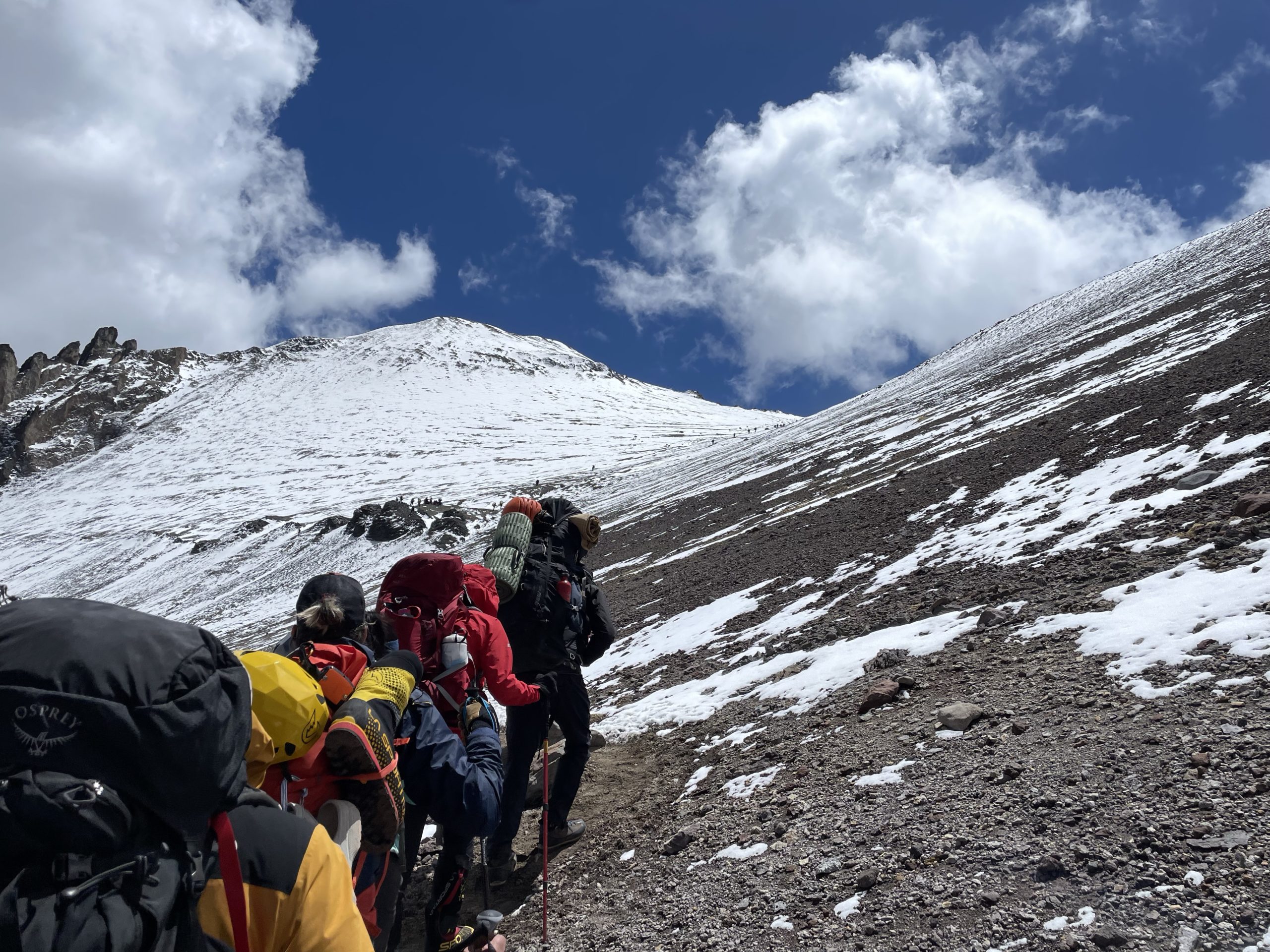
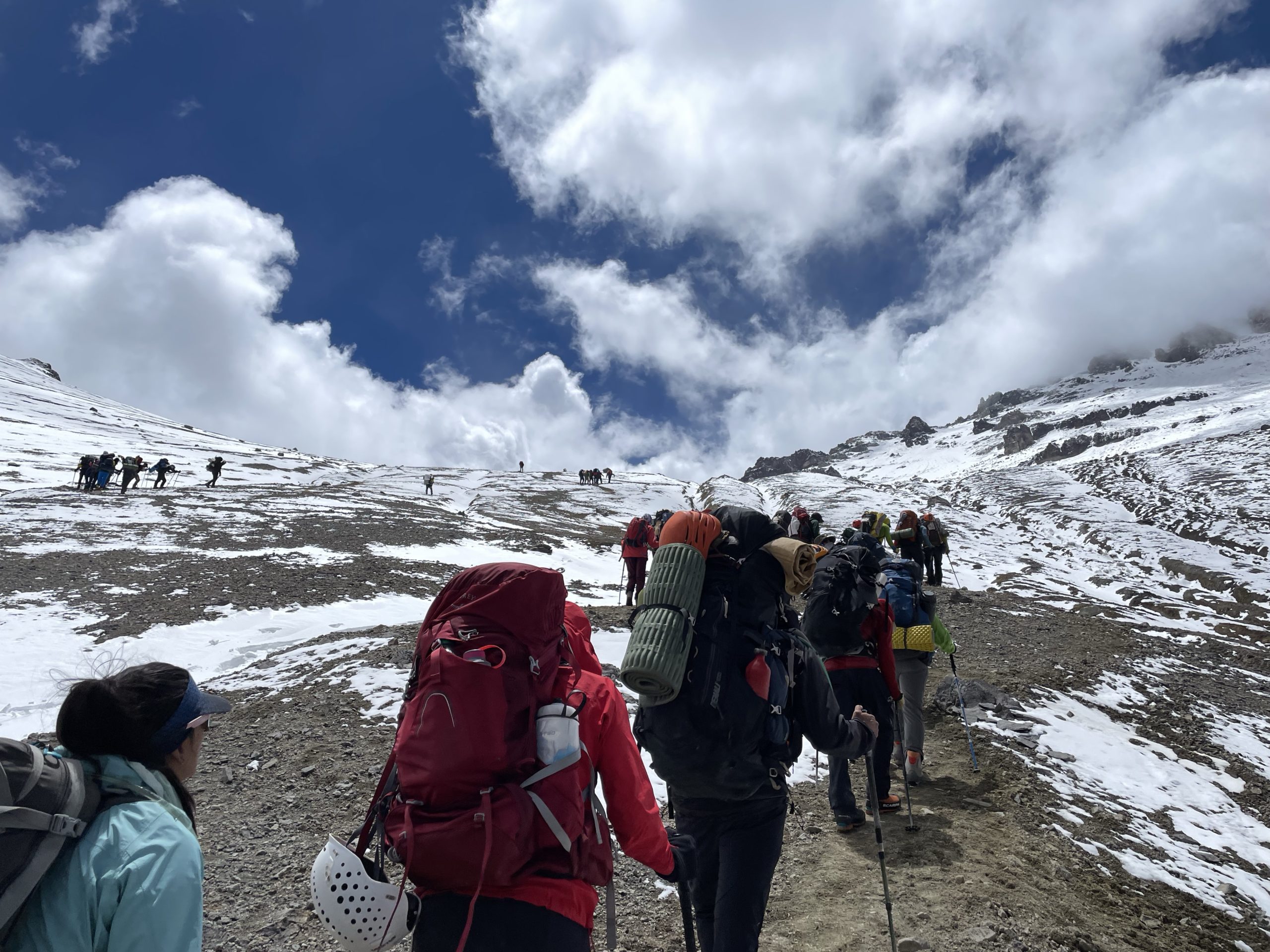
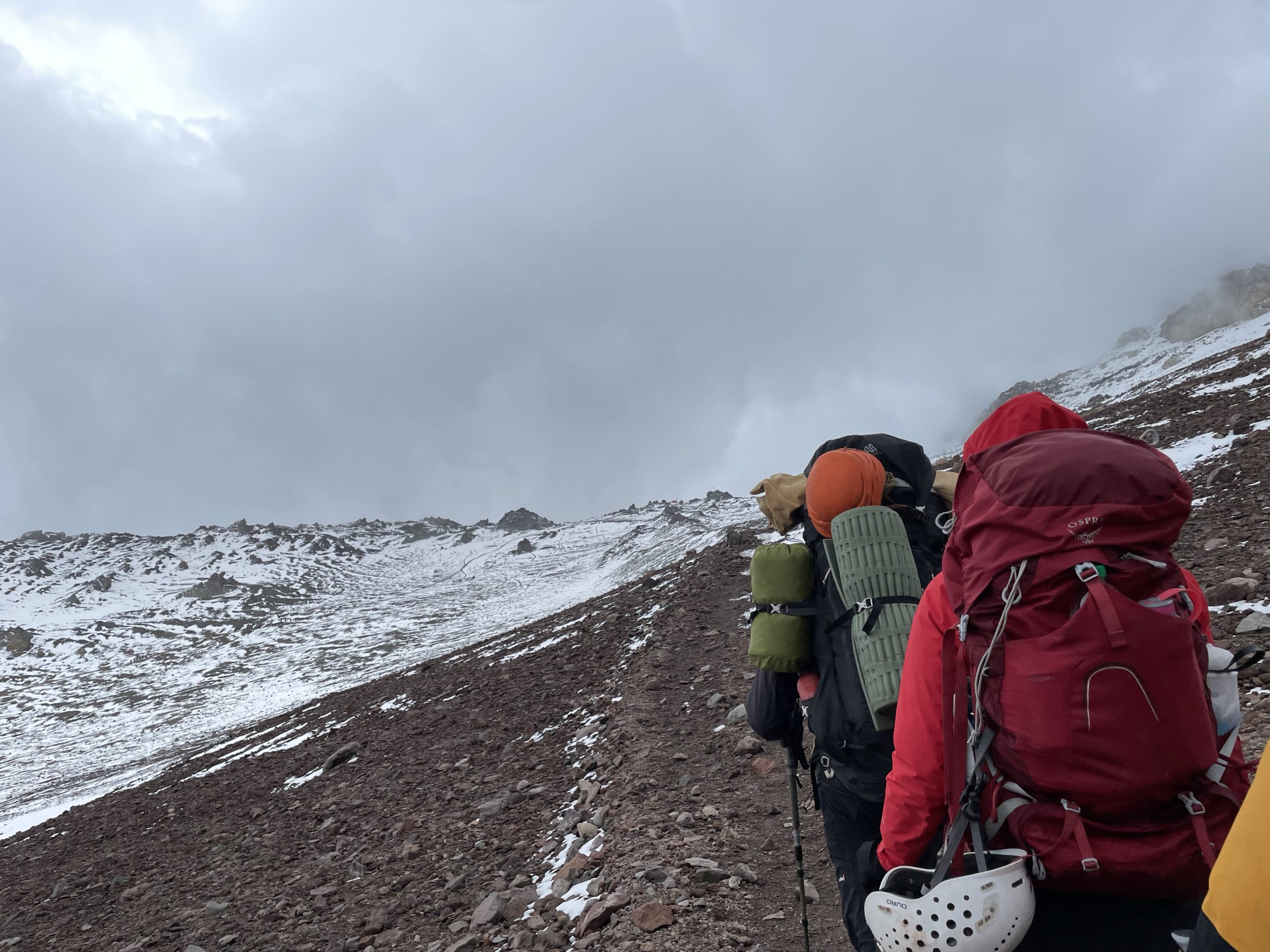
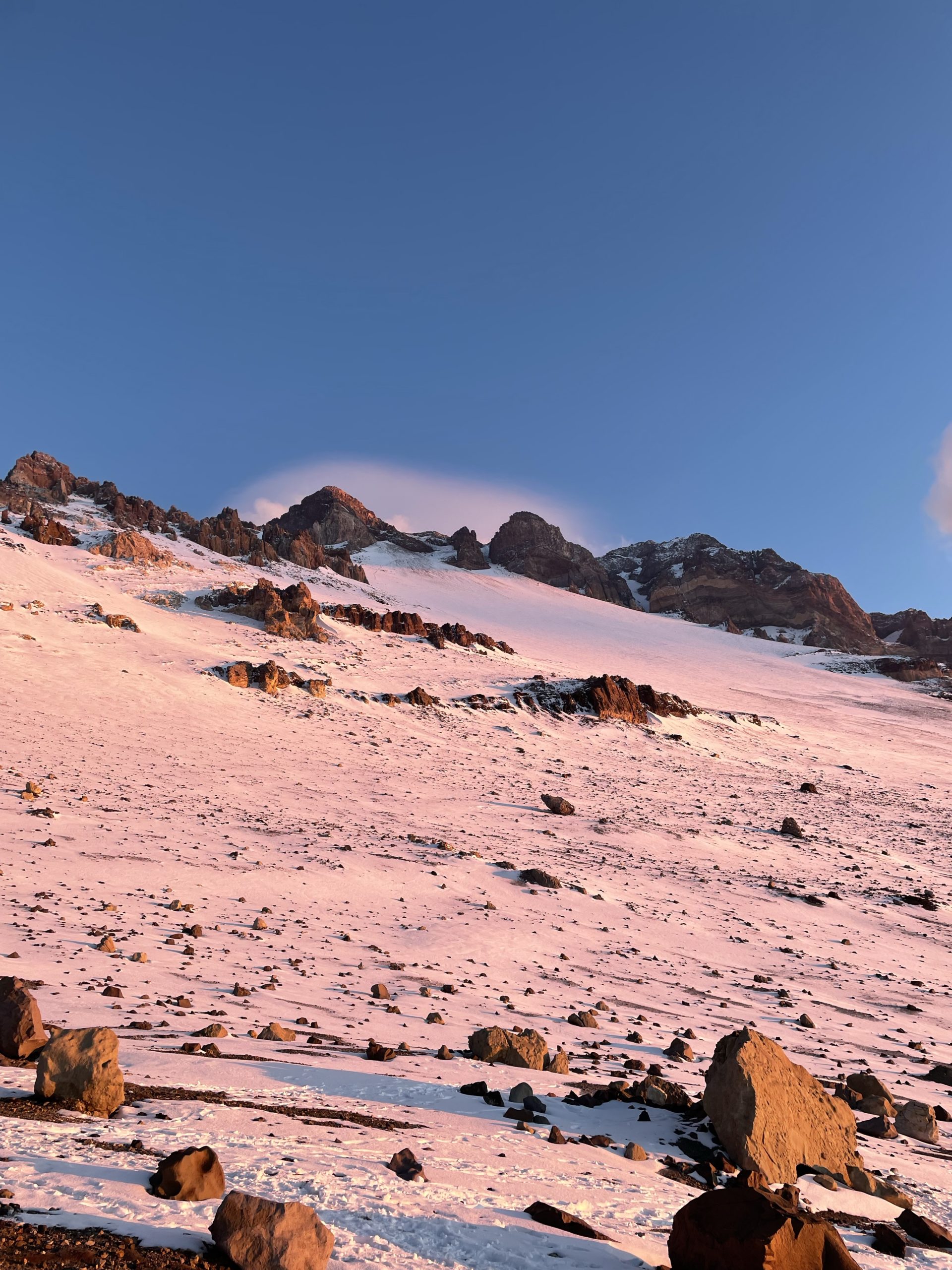
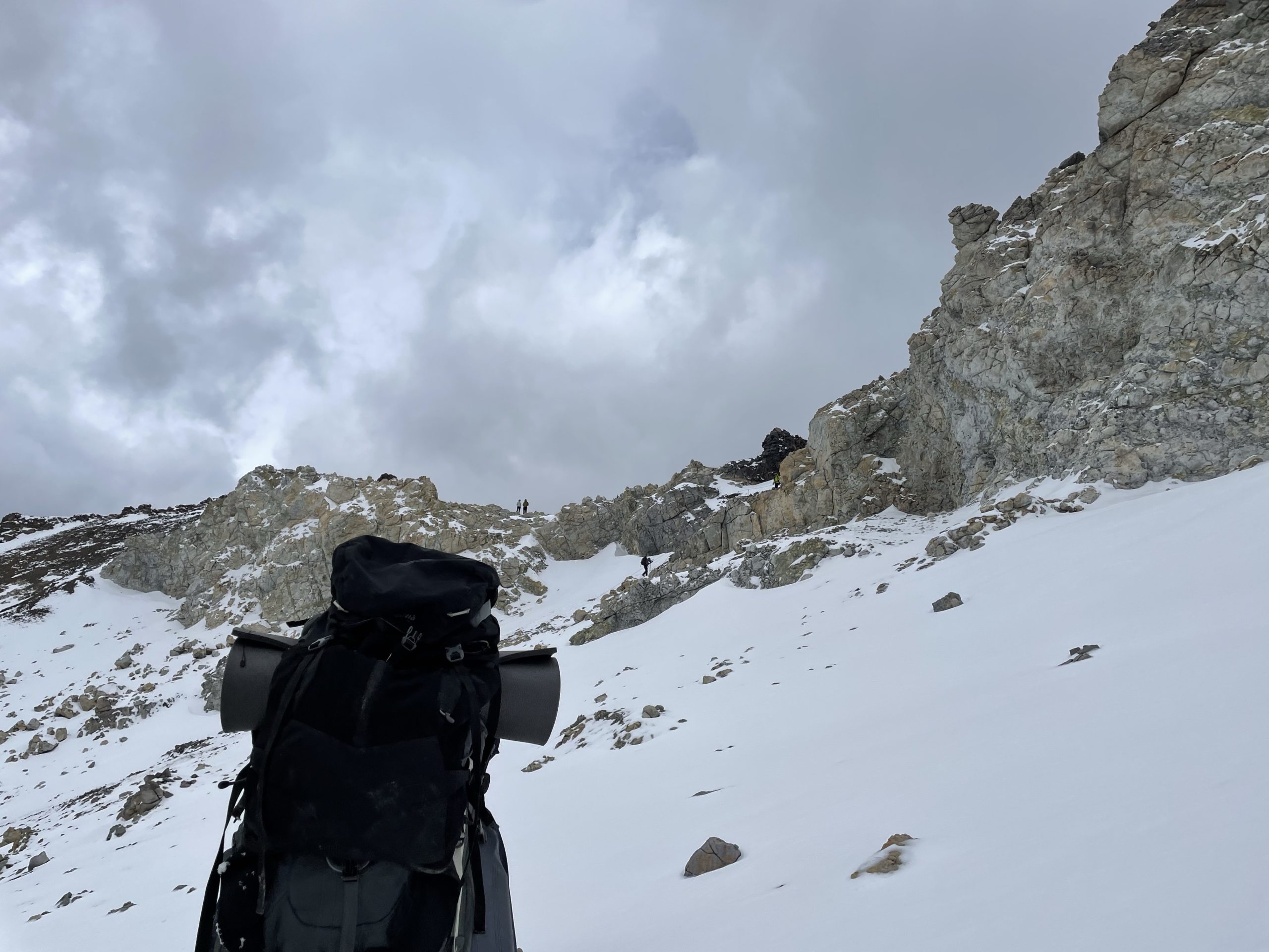
On the morning following our final rest day, we started preparations for the push to the higher camps. I needed to haul all my remaining gear up plus another round of shared equipment, but my pack came in at a more reasonable 15kg this time. We left from camp at around 11:40am and said good bye to the luxuries of base camp for the next 5-7 days. As we made our way up the now familiar slopes to camp 1, I felt surprisingly good. I was dreading the higher camps a bit because I knew that inevitable high altitude headache would creep it’s way back in.
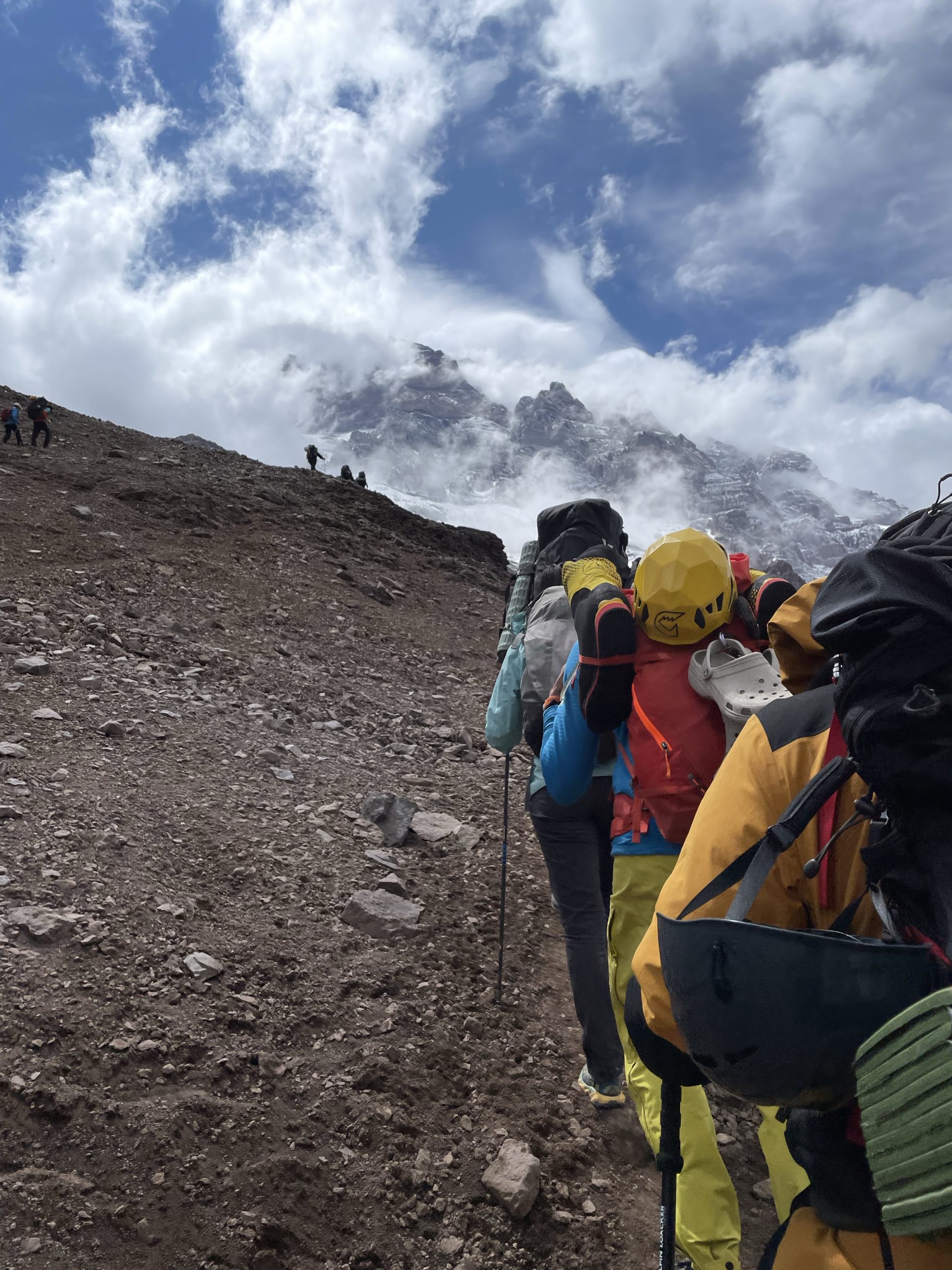
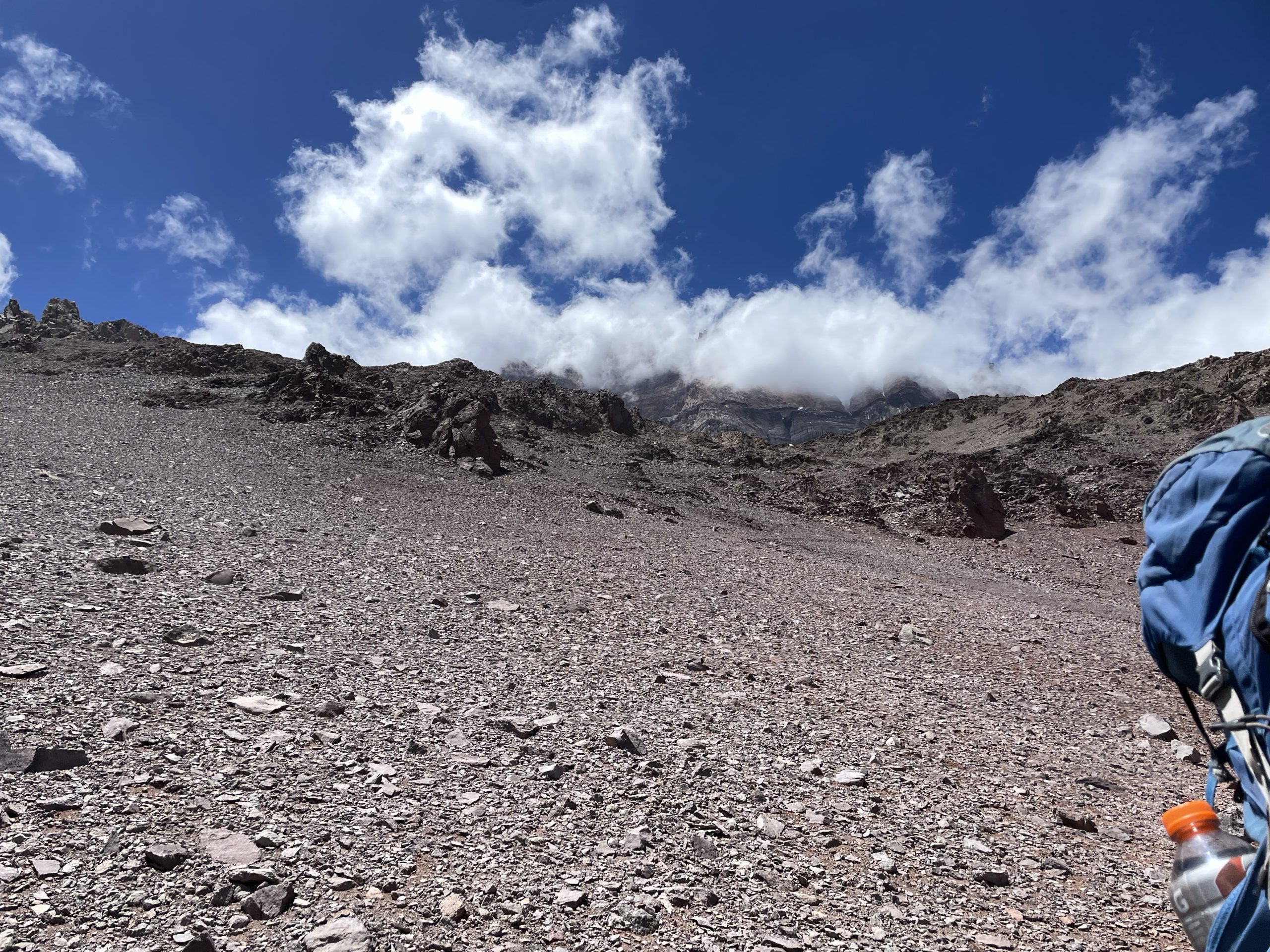
As we climbed higher, the weather started to close in and we began to experience some moderate snowfall. Up until this point the weather had been immaculate. In fact, our guides could only recall a handful of times that we had such warm and clear weather in their 20 years of guiding Aconcagua. The snow never worsened though and we arrived at camp 1 in about 3 hours. By evening the weather had cleared and we were back on our hot weather streak.
At some point we were introduced to our toilet for the high camps. A tent called marianita with no floor that covered a bucket and a makeshift toilet seat. At base camp we had outhouses, but this setup was almost more pleasant because the smell was contained within plastic bags that we would remove after each use of the toilet. Besides that, the higher camp was nice enough. We were already sleeping in tents since Confluencia so the only major adjustment was the altitude and the temperatures.
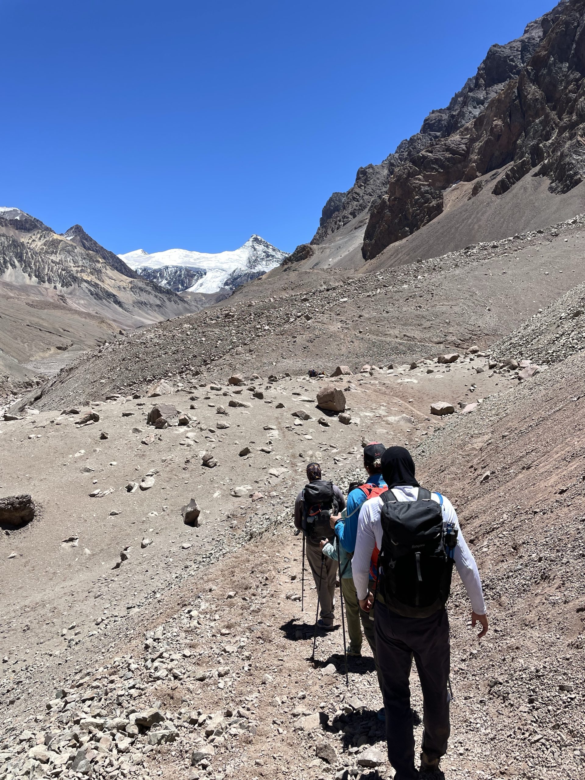
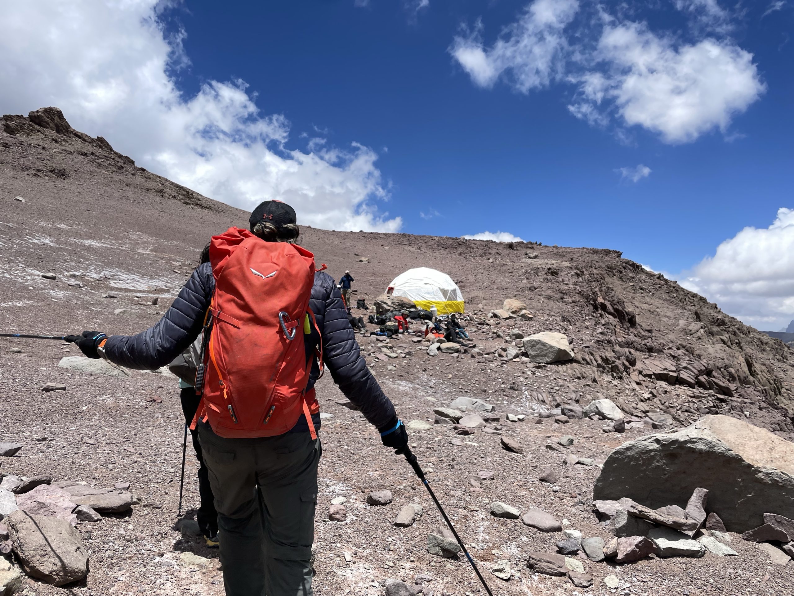
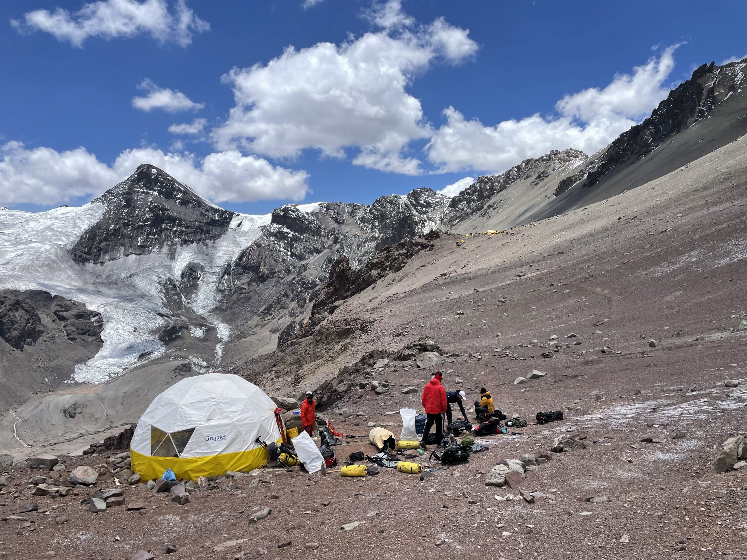
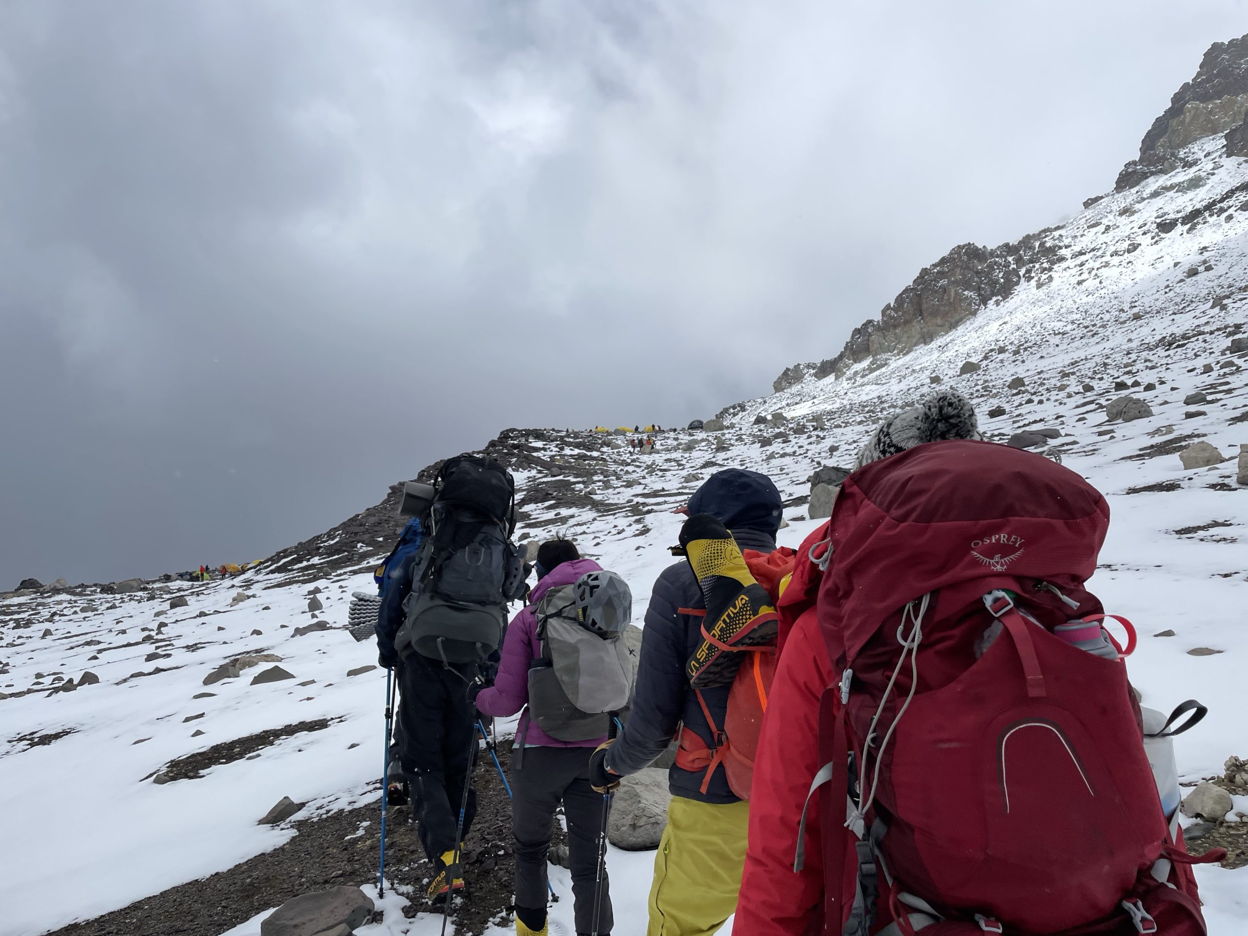
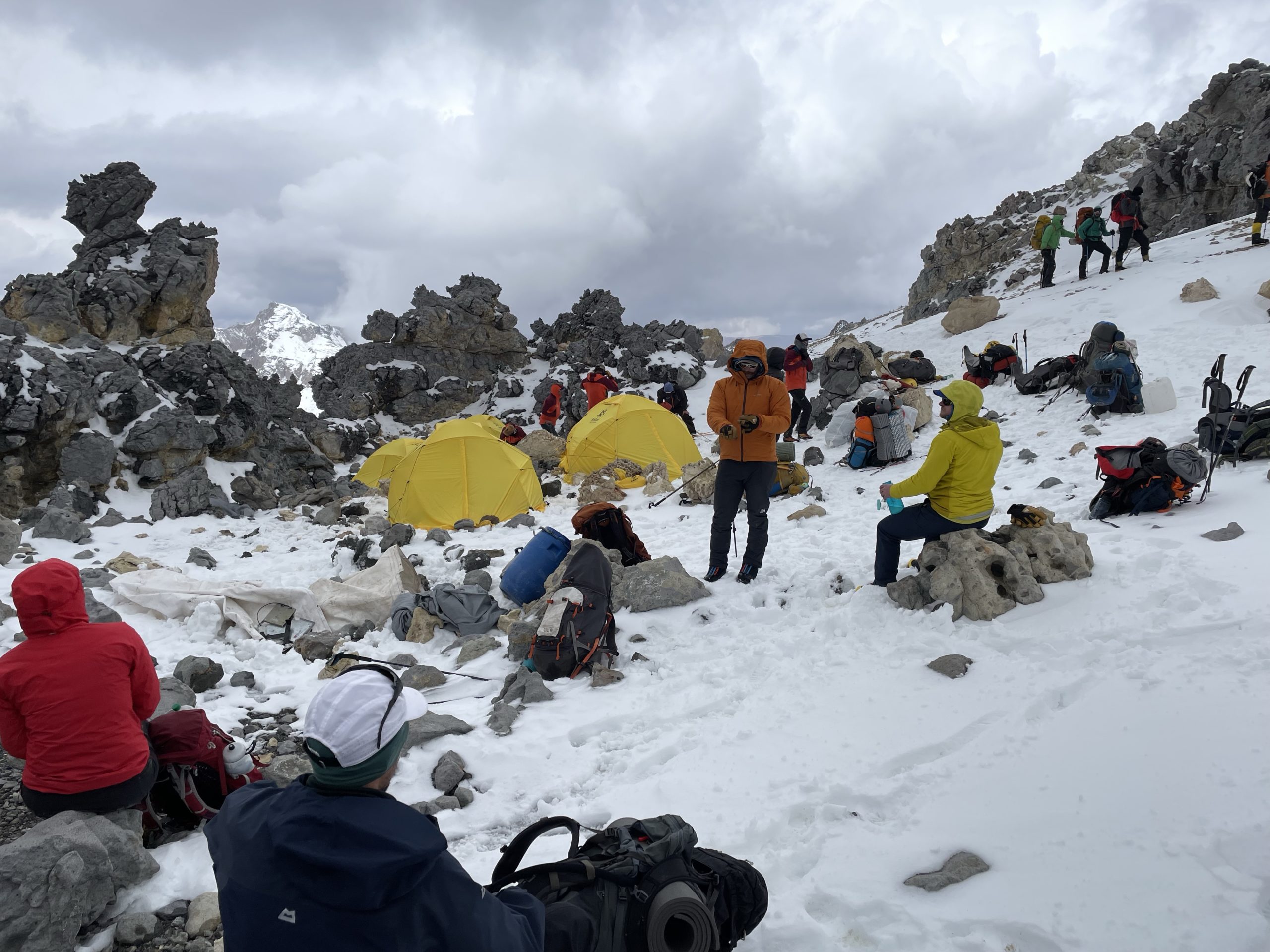
I slept well that night and the next morning I still didn’t feel symptoms of altitude sickness. At 10am we started breaking down the tents and packing our gear again. This time I had all the gear from the first equipment haul + yesterdays haul and so my pack weighed in at around 20-21kg. Still reasonable considering the team gear and I wasn’t too worried about the next leg of the trip. The plan now was to make the journey up to camp 2 and take a rest day after that.
We got going around 11:11am under clear skies. The guides maintained a slow but methodical pace and our ~1.14km route took around 3 hours and 40 minutes to complete. By now, I could feel my breathing was becoming more laboured, but I was feeling strong still.
Camp 2’s toilet situation was a bit more exposed with nothing more than an open air toilet seat to set a bag up underneath. No problem, I thought, as I’d likely only use it a handful of times. Unfortunately, that wouldn’t be so. The next day, during our rest day, 10 people including myself came down with diarrhea. Possibly from a contaminated water source, but we’ll never really know. I was now very thankful for the rest day, as the last thing I wanted was stomach issues for a summit push. I started on Imodium and that helped keep things at bay.
The stomach problems were really only the start of the issues though, as the rest day and following morning unfolded into a bit of a disaster. 3 guides and a member of the secondary group developed “mountain cough” and had to retreat to base camp. Everyone was on edge and I was also feeling symptomatic on top of the diarrhea. The major problem was discerning symptoms of “mountain cough” with normal altitude sickness. I took a test just in case, but came back negative thankfully. I spent the remainder of the rest day feeling anxious about the continuity of the expedition.
When the morning came around, I was feeling no better, but I think a good part of it was the doom and gloom atmosphere permeating through the camp. One of my teammates, Diana, gave some encouraging words that shifted my mindset back onto the summit again. Unfortunately two members from our group didn’t feel comfortable proceeding higher and opted to head down.
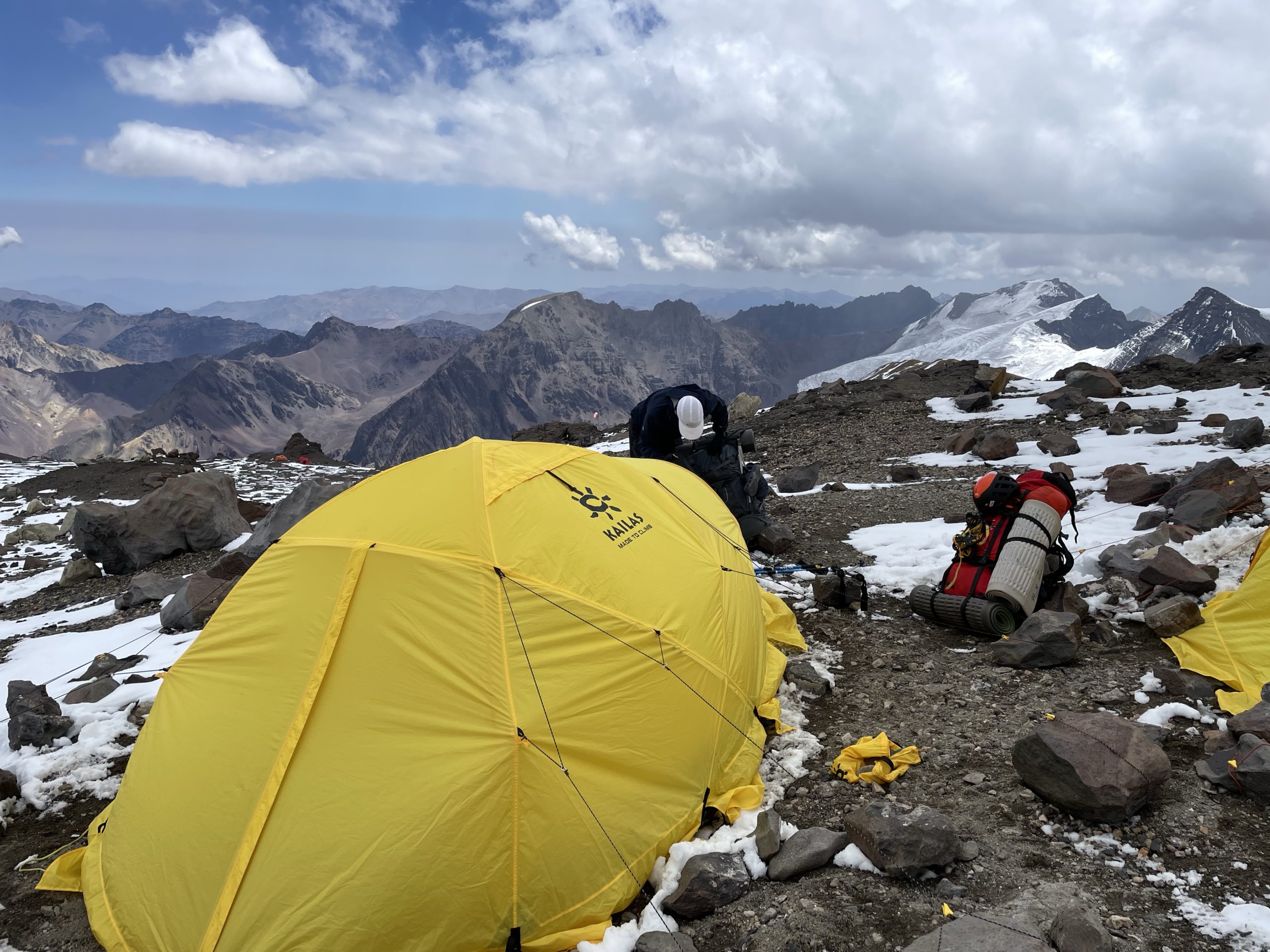
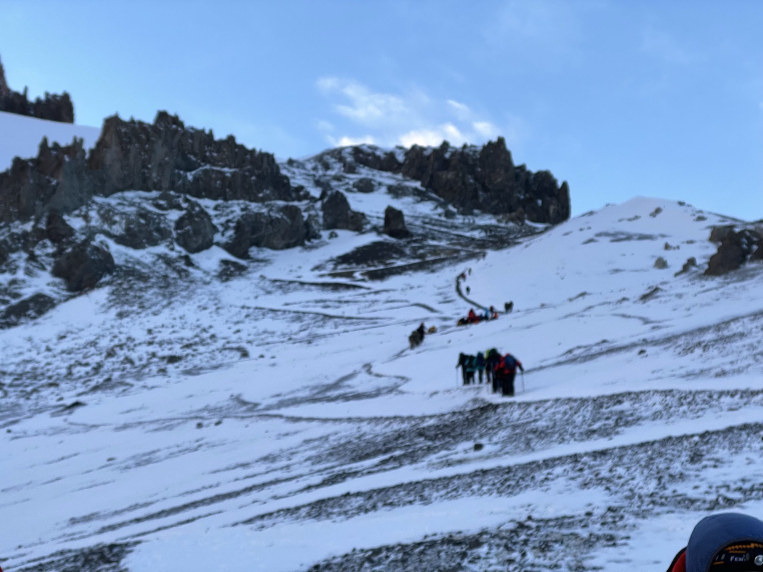
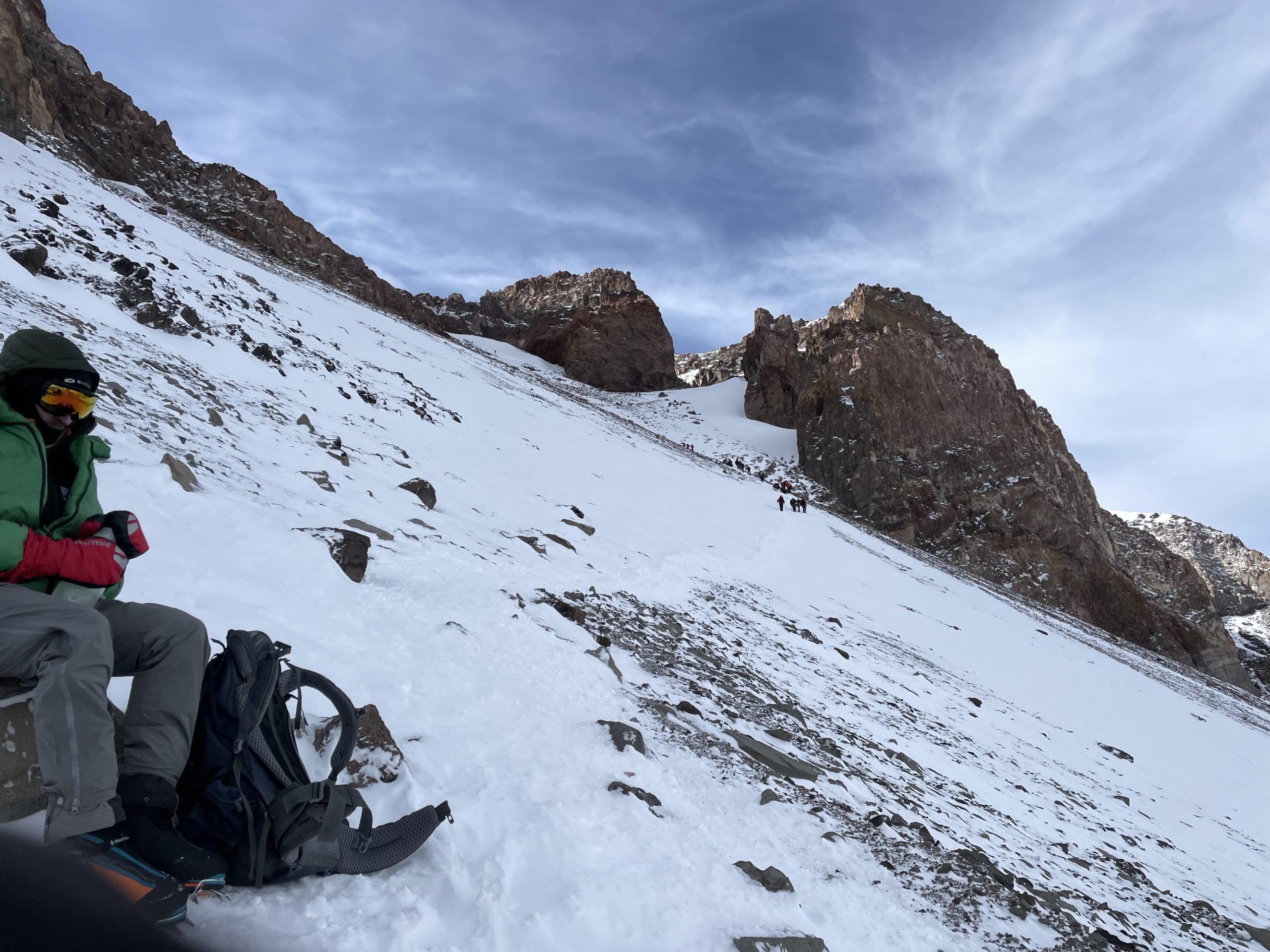
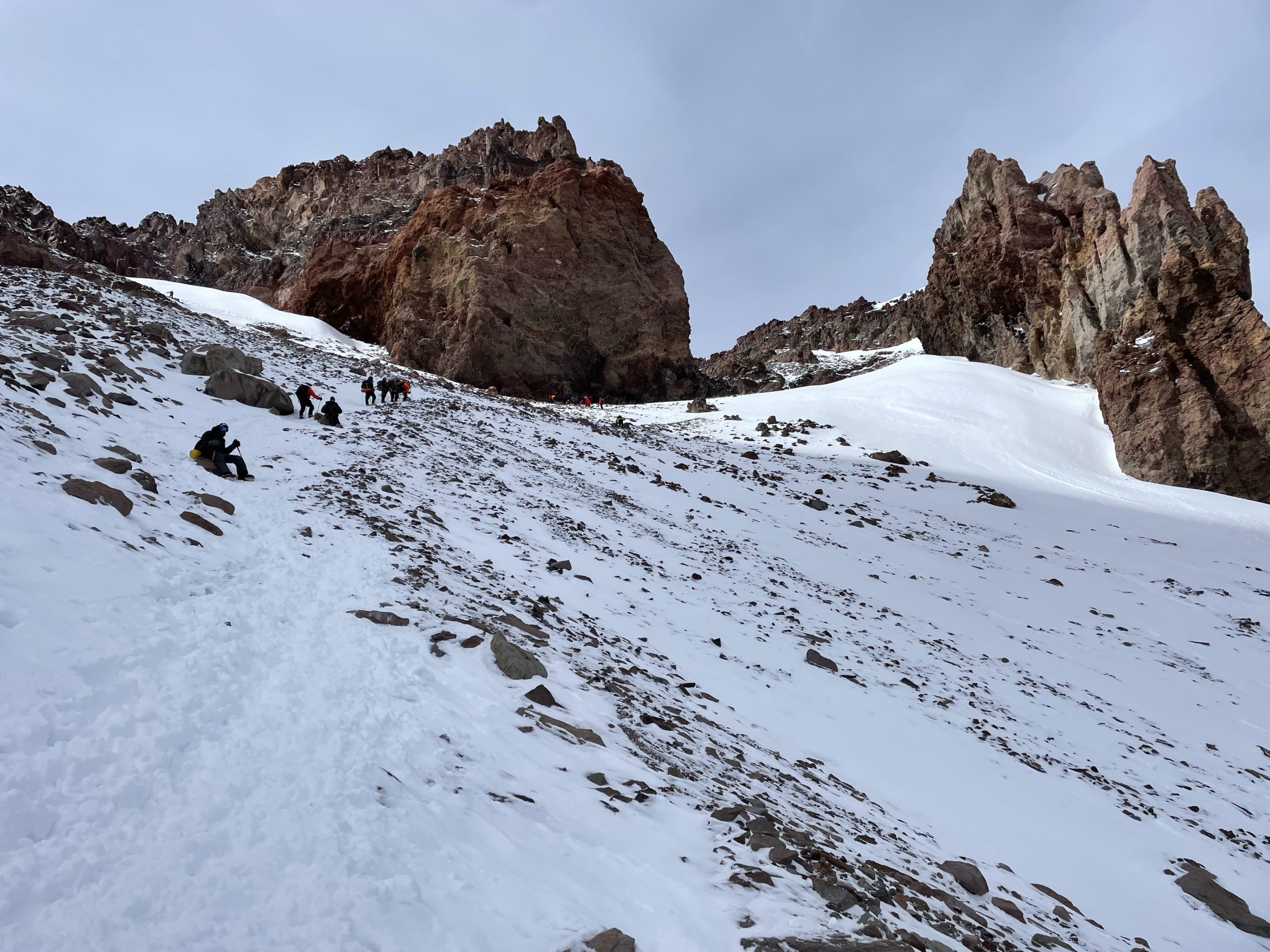
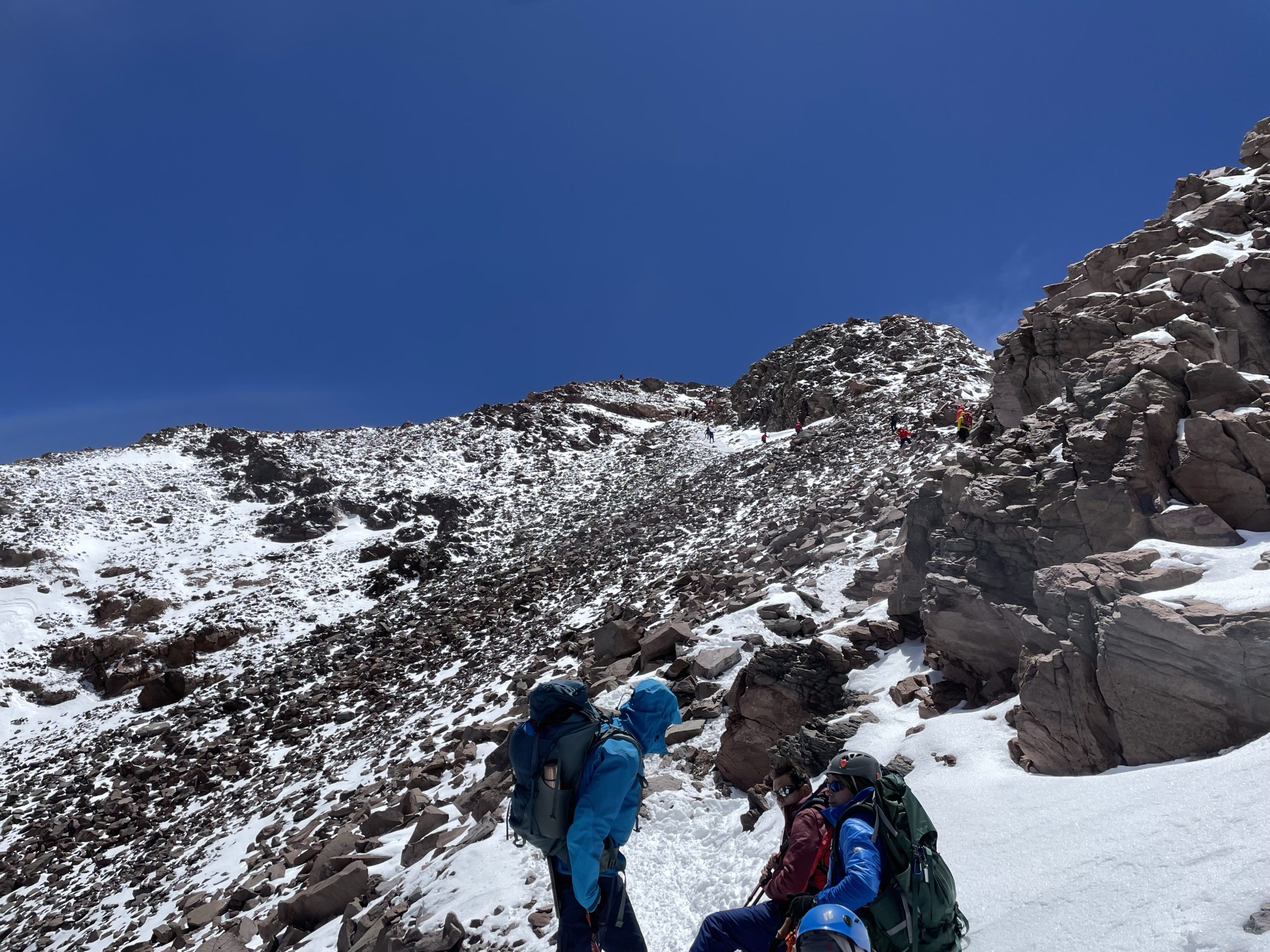
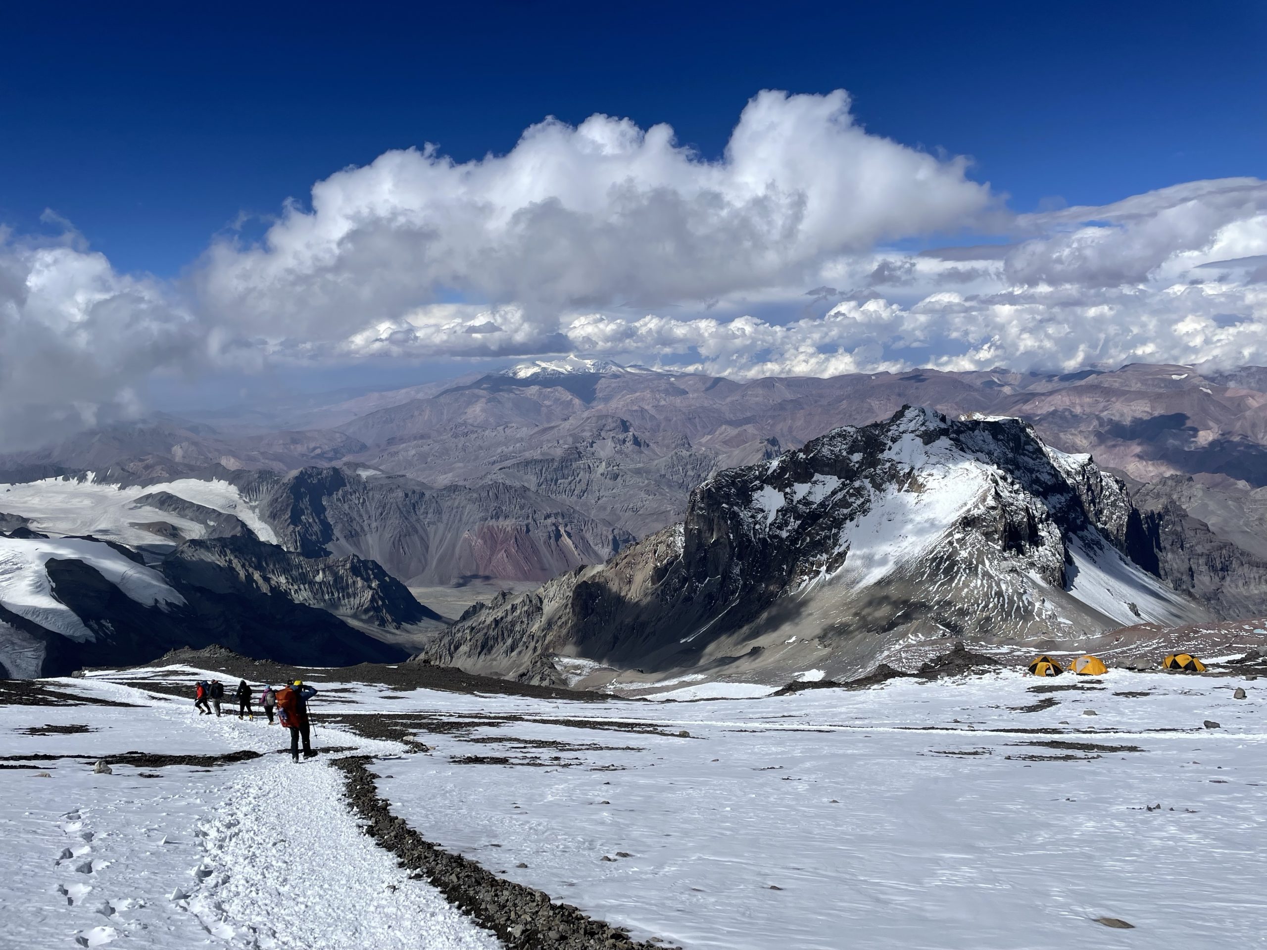
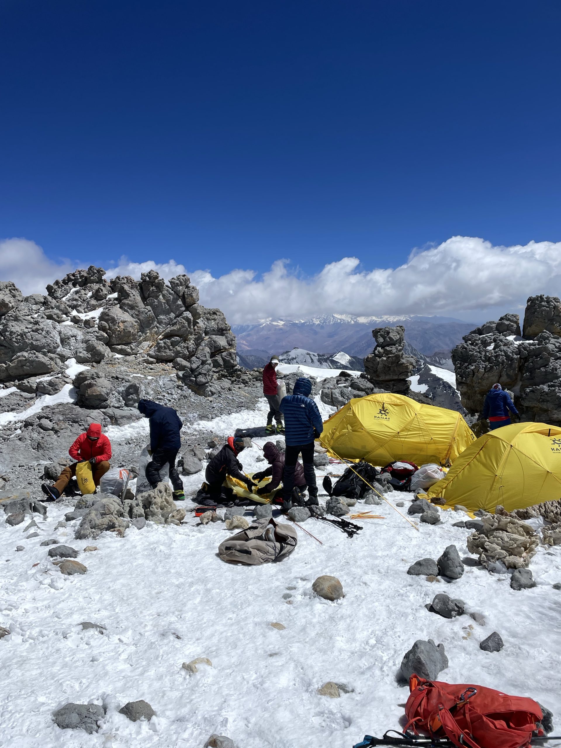
With all of the “mountain cough” business there were some last minute changes to the plan. The two groups running in parallel would now be merged together and the remaining guides would team up to take us to the top. This also meant a later than anticipated start. We only got going around 1pm, but it was a short haul of 0.64km to the 6000m high camp 3. Camp 3 was going to be my new elevation record, so I was very curious to see how I’d do.
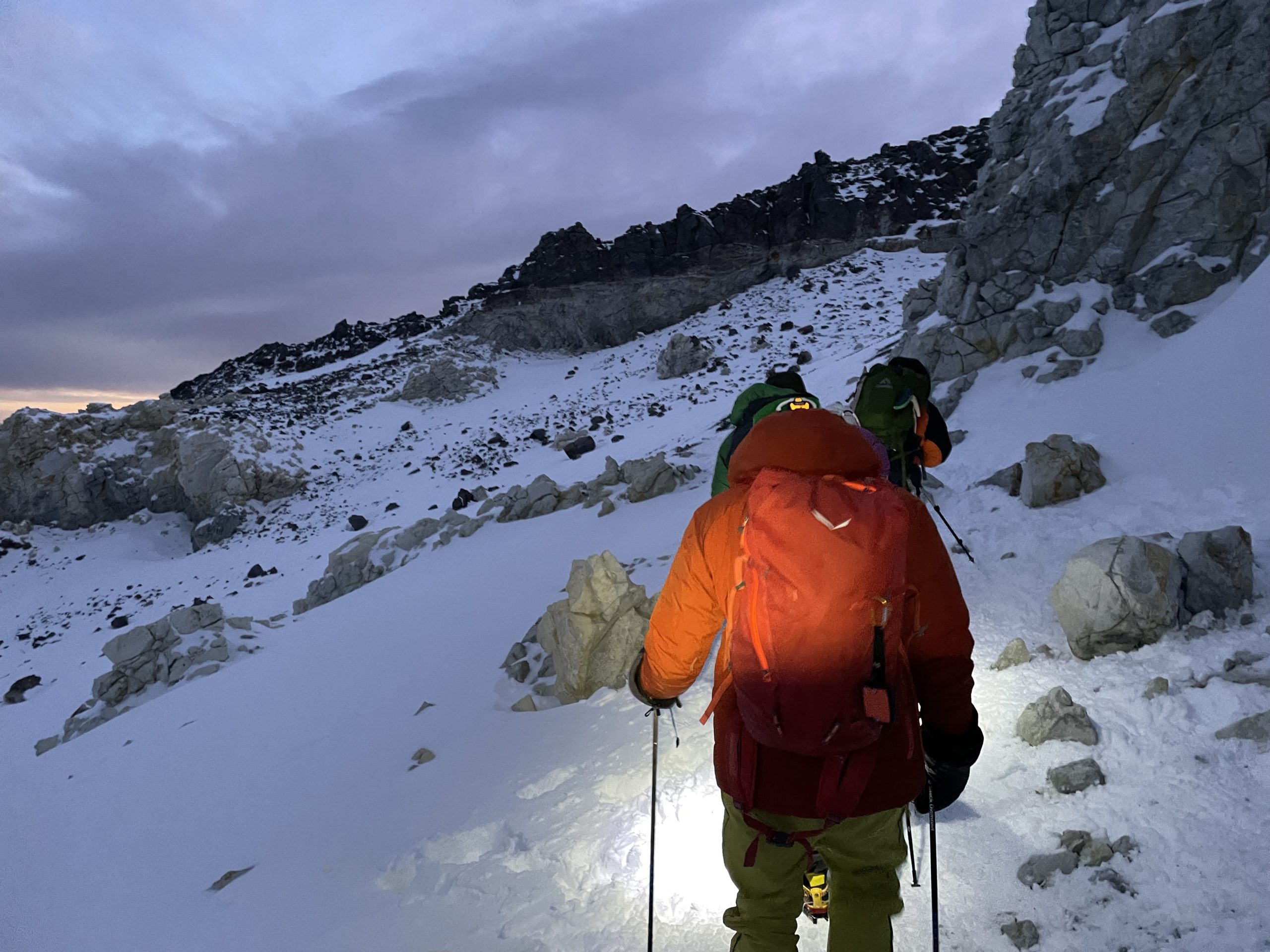
About 3 hours after leaving we arrived at camp 3. By now we had a thin, but permanent layer of snow and the temperatures and altitude were well noticed. On the way up there was one short scrambly section just below the camp, that was fixed with cables. Otherwise, the journey was uneventful.
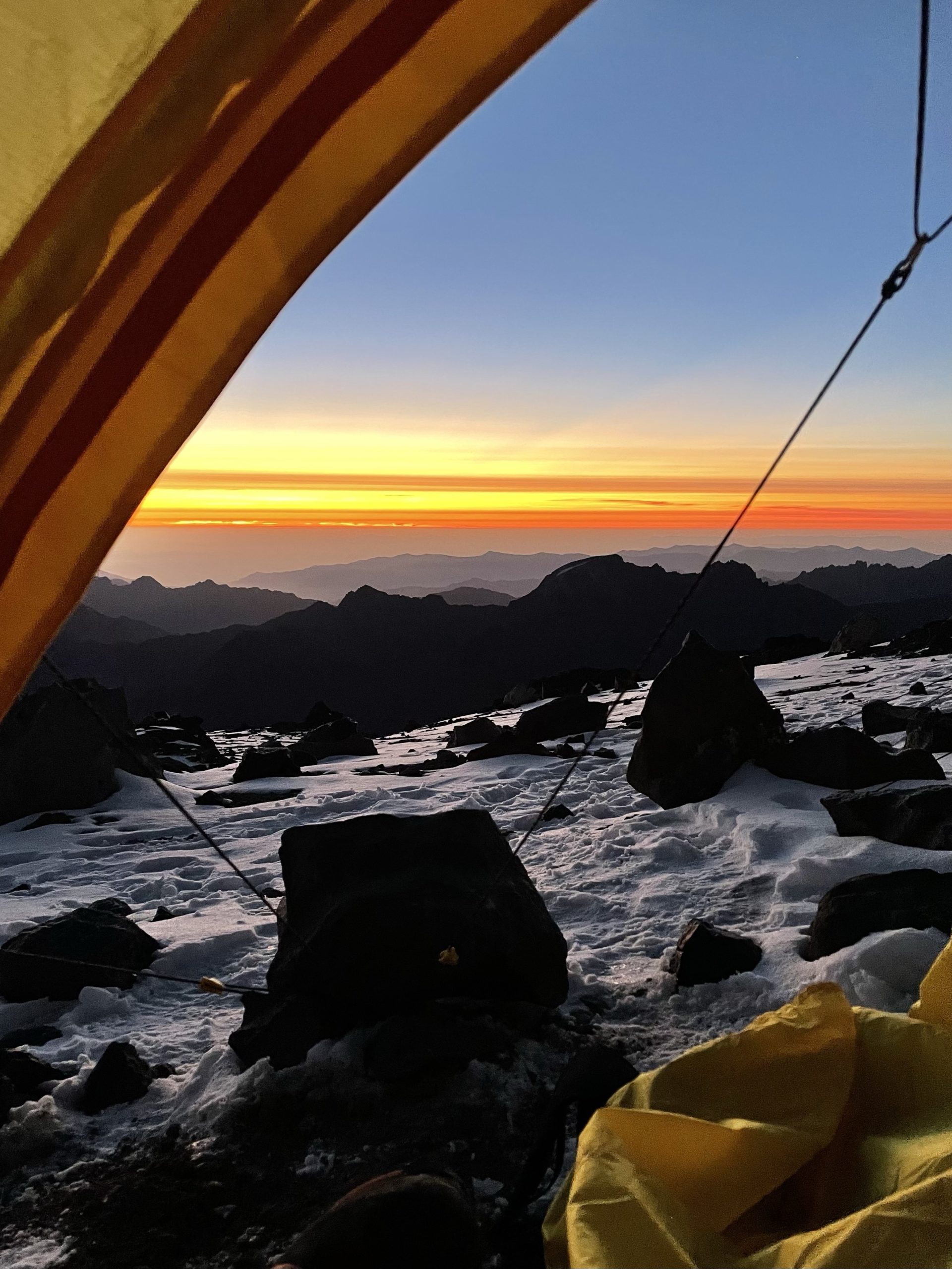
I was still dealing with stomach issues at this point and went for an unbounded regimen of Imodium despite the warning labels. I would rather deal with side effects after the fact than have a problematic summit day. All of that aside, the summit finally felt within closing distance. The plan was to wake up at 3:30am for breakfast and preparations and leave at 5:00am sharp for the summit. The weather looked perfect and this would be our only shot as the following day called for 100km/h winds. I fell asleep rather easily, but was in for a mediocre sleep throughout the night.
Day 14
- GPS recording for day 14: https://www.alltrails.com/explore/recording/las-heras-hiking-21186d7
My alarm went off at 3:30am and I woke up ready to start the day. About 30 minutes later guides came around with hot water and a light breakfast and we started getting ready. I was trying to time things down to a science to avoid getting out in the bitter cold too early, but not so late the group would leave without us. We were told if we’re not ready by 5am we’d be forced to wait at camp and miss the summit.
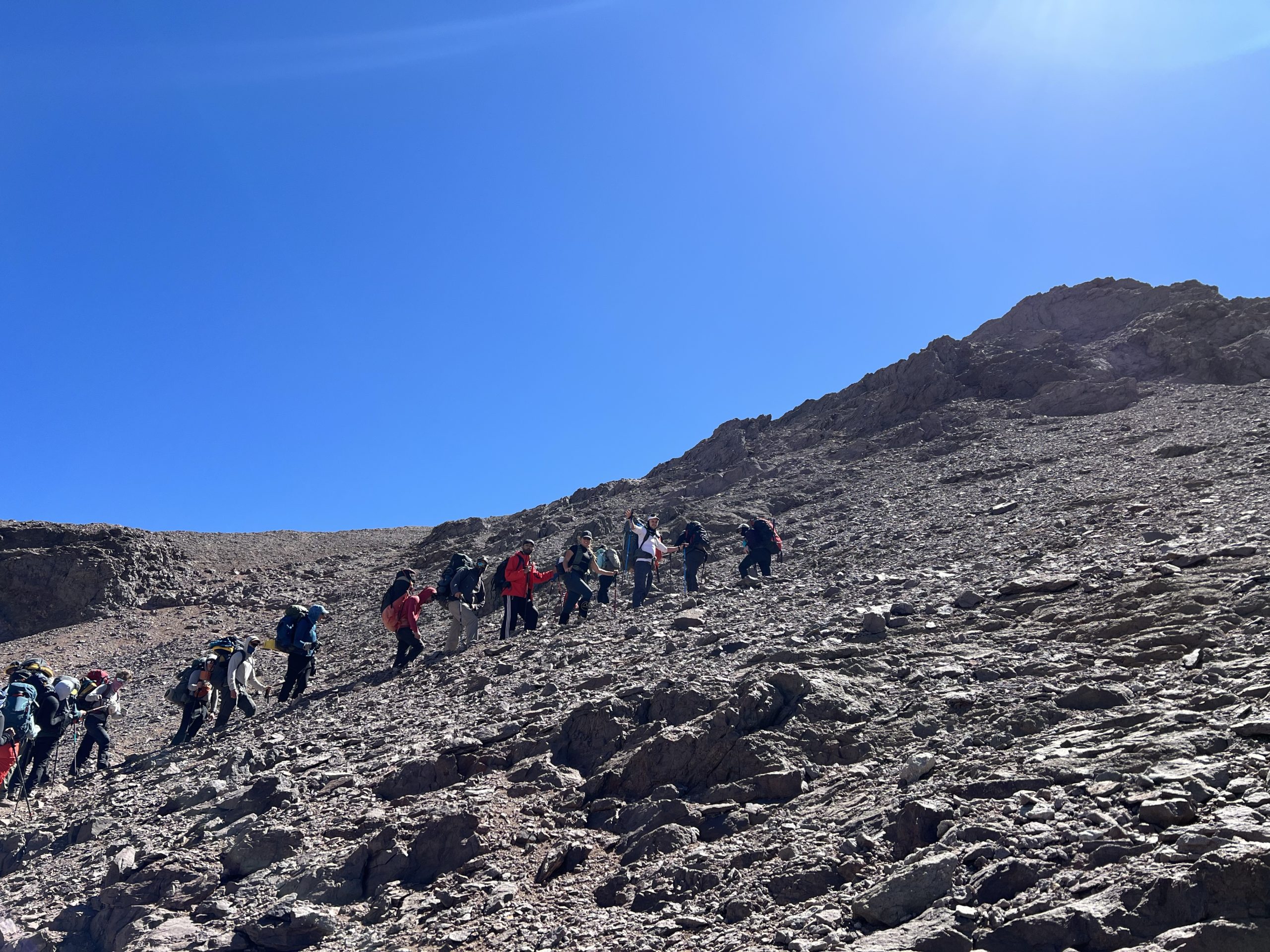
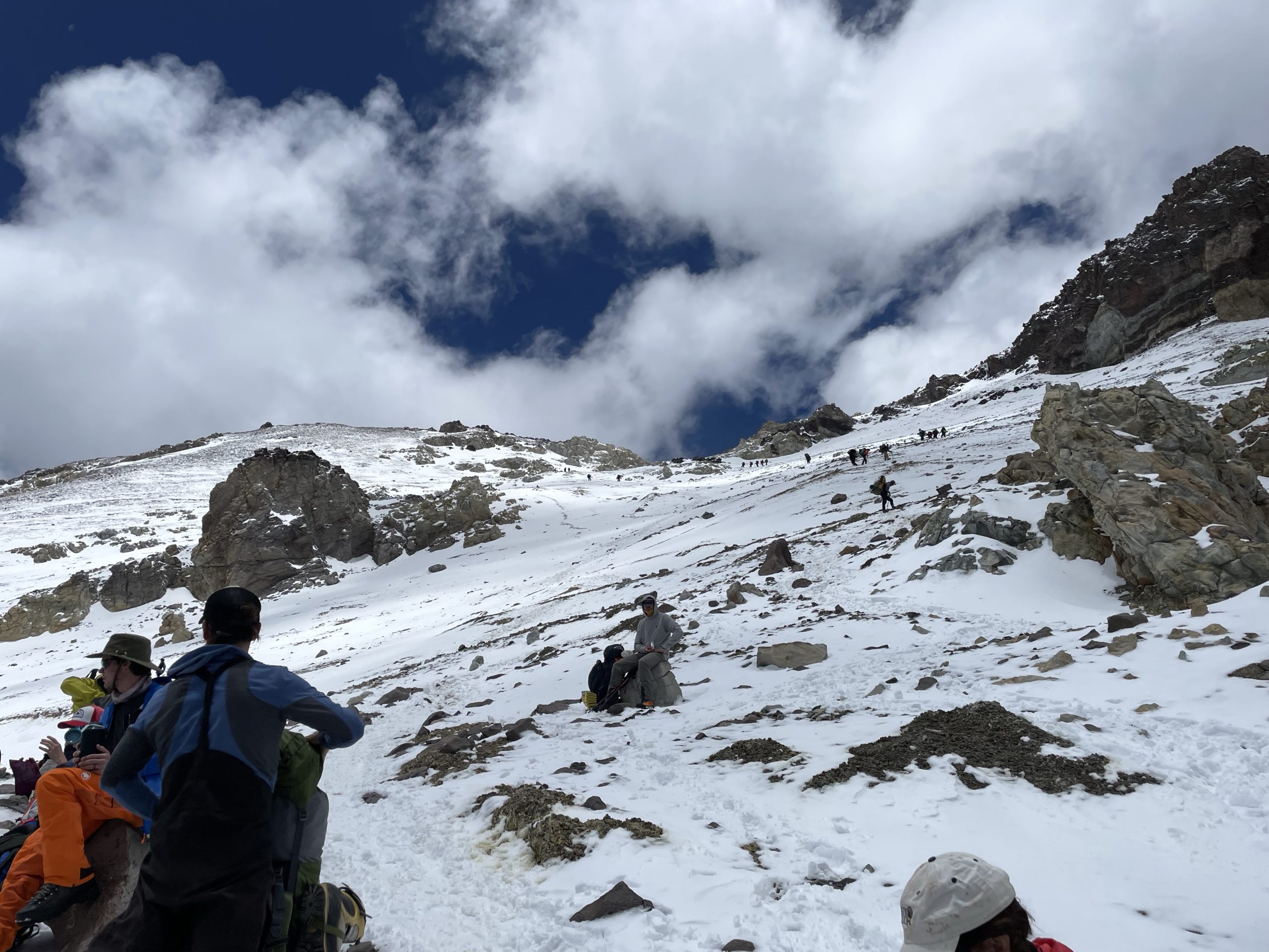
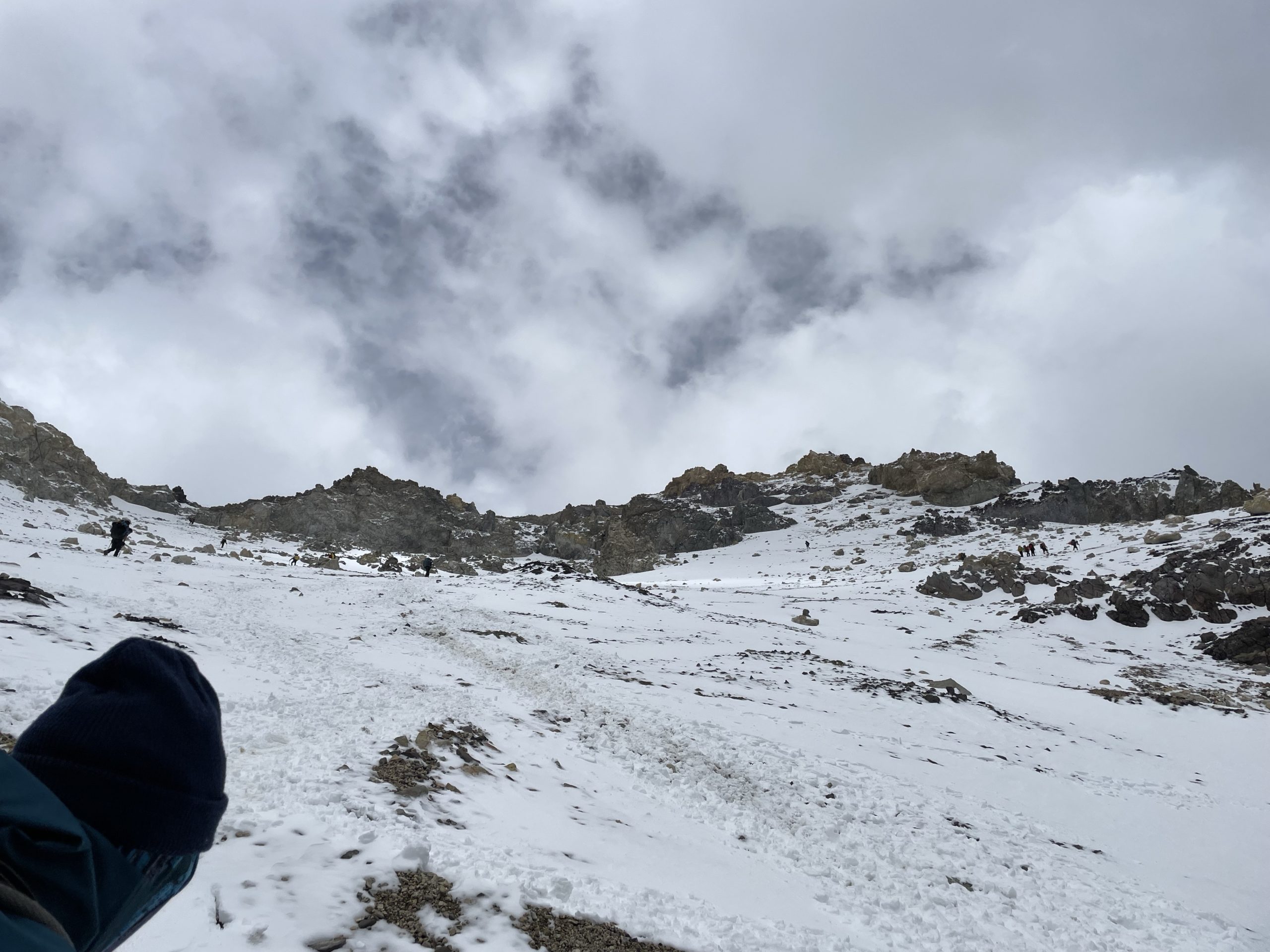
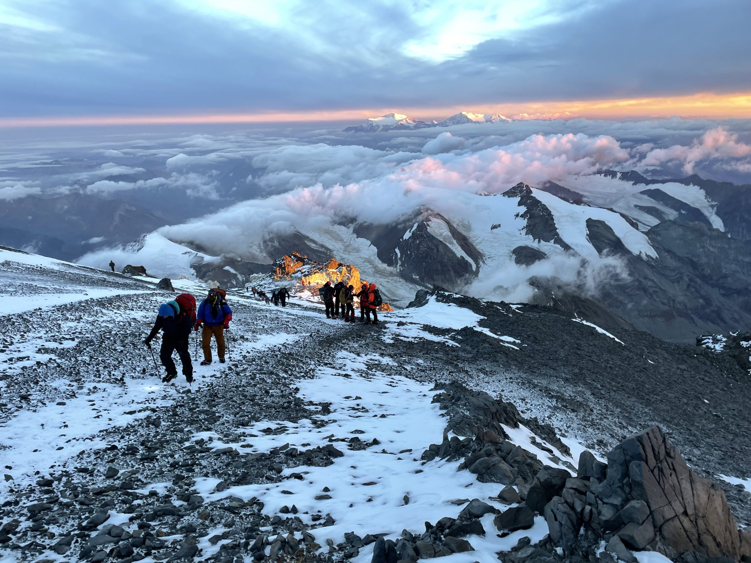
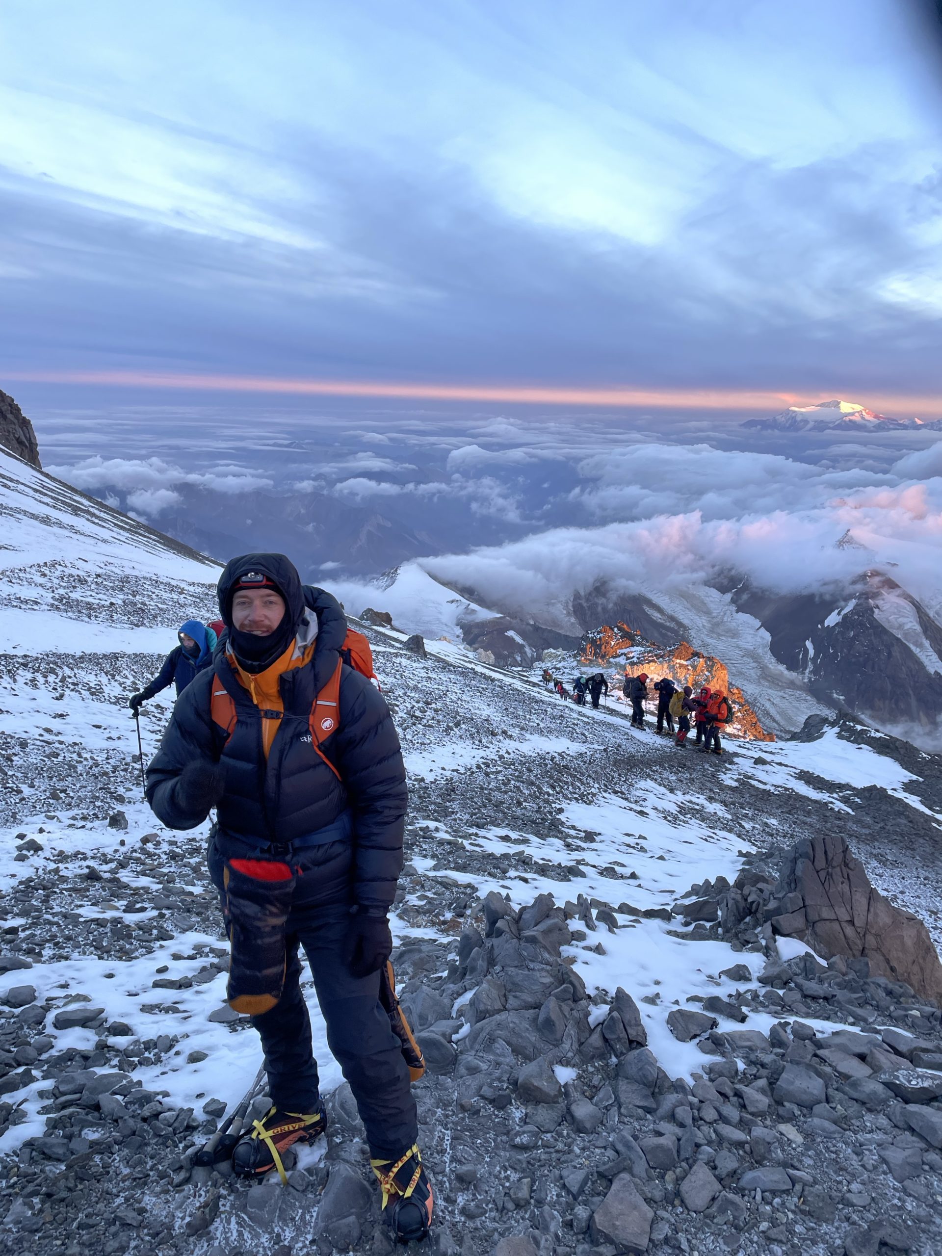
5am came around soon enough and I was ready as ever. We were told to wear crampons from the outset and they’d remain on until our return. With everyone now ready just in time, we departed under darkness with a row of head lamps to illuminate the way. As we climbed out of camp, I could see the slopes were littered with strings of light as various parties started their way up. I’d estimate at least 50 people directly in our view making an attempt and who knows how many more started before or after us.
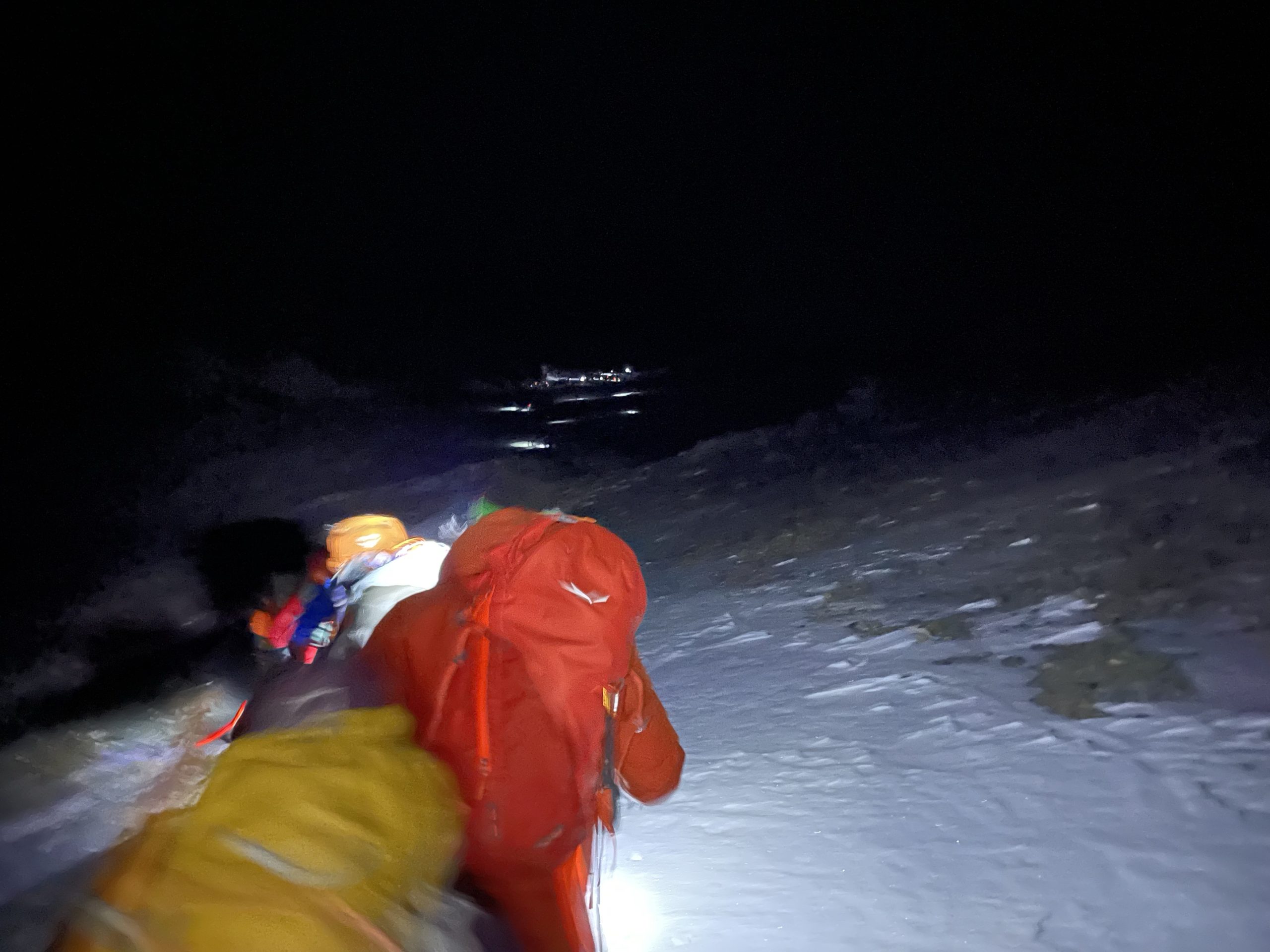
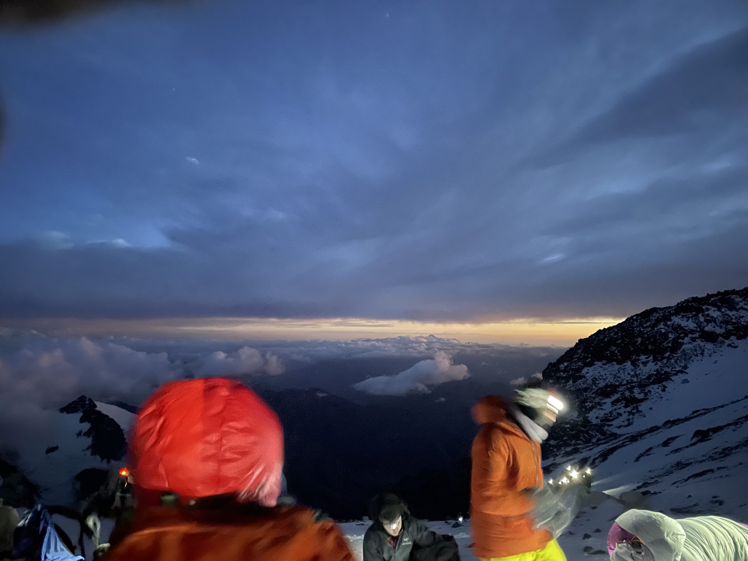
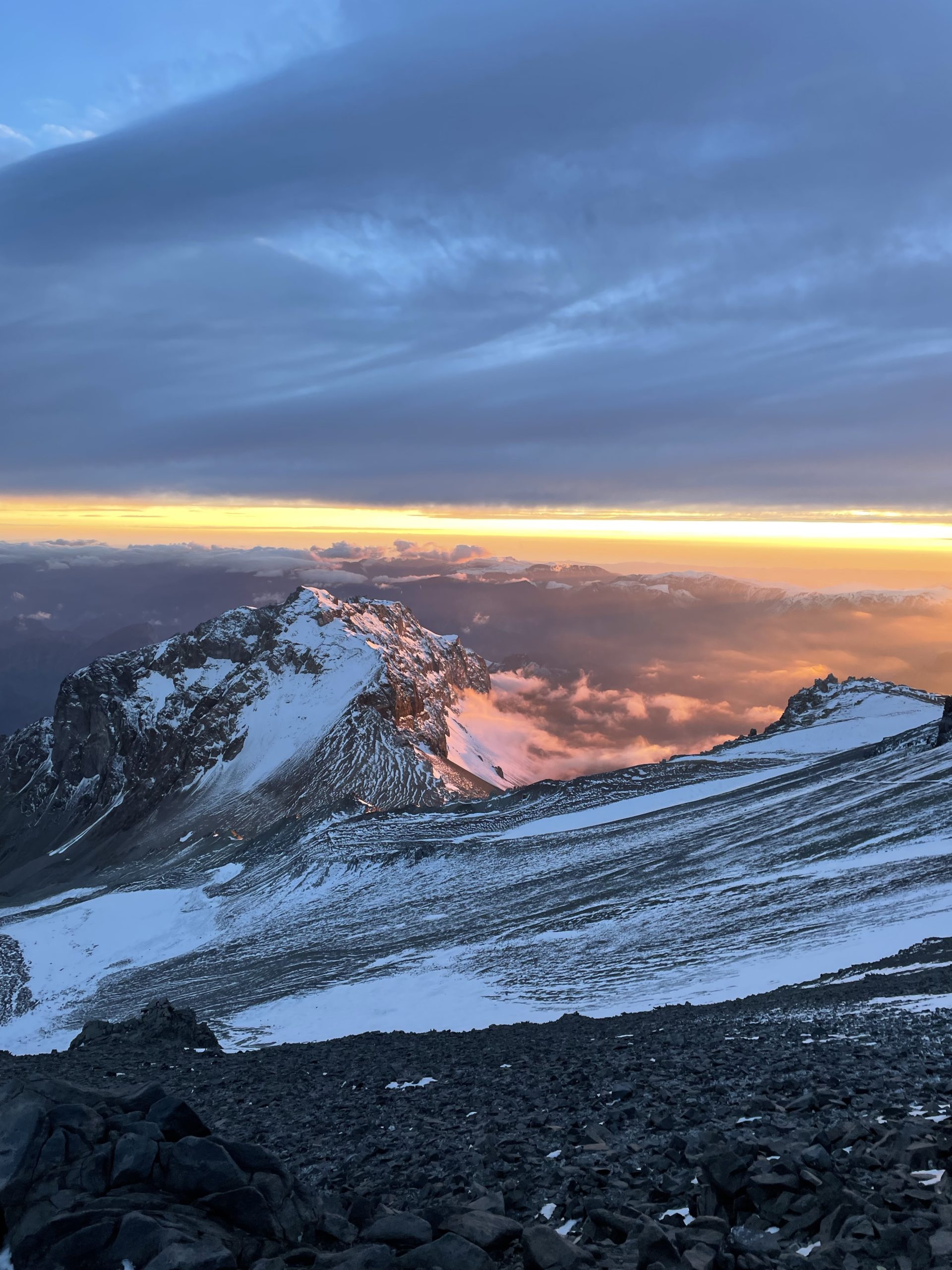
For summit day, I had my lightest pack yet, with just water, food and layers. As a result I felt strong and the pace being set was well within my capacity. Climbing the slopes felt easy as long as I didn’t deviate too far from a simple march. On a few occasions I tried to multitask by taking photos and walking and it always resulted in loss of breath. I made a quick call to save the photo taking for the hourly breaks we planned for. The climbing continued until we took our first break at a point called Piedras Blancas. Here the veil of darkness gave way to the early tells of a rising sun and the headlamps were put to rest.
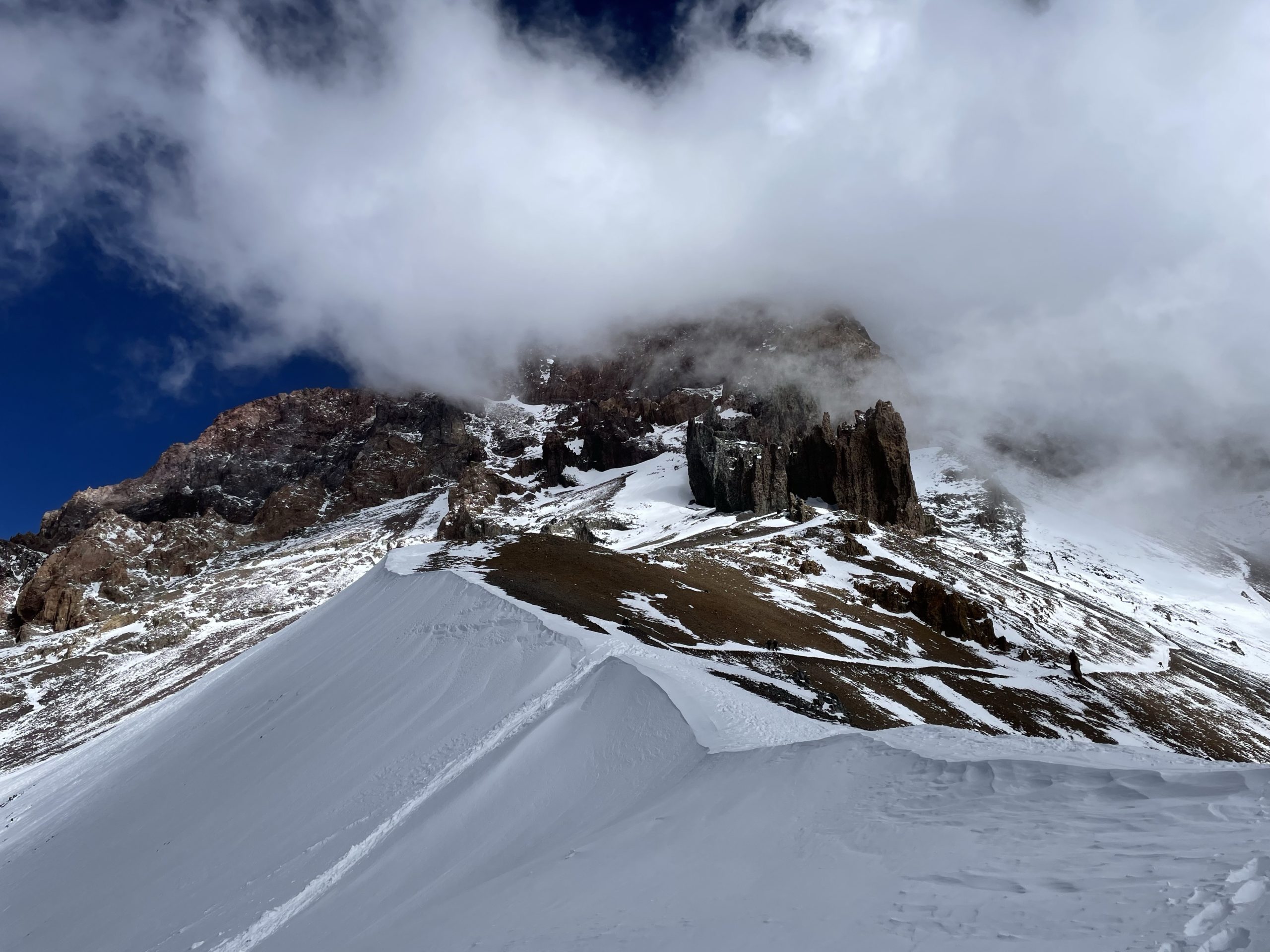
We rested around 15 minutes and then set off again for the next break point. At around 6200m we crested around a slope and came face to face with a fiery sunrise over the horizon. This raised the stoke levels even higher and I was feeling stronger as we went. We paused again at the base of slope below an area called Idependencia. One group had evidentially setup camp here to make the summit push shorter. An interesting trade off, but I can’t speak to its pros/cons.
Again 15 minutes passed and we were off again. The distances we travelled would be comically short at low elevation, but at 6200m, every move necessitated a slow and steady pace to have a chance of success. One foot after the other and we topped out at Independencia. A small wind torn shelter was the only major feature of note. It was now significantly colder as well, with strong gusts of wind and low temperatures testing out my layering as best it could.
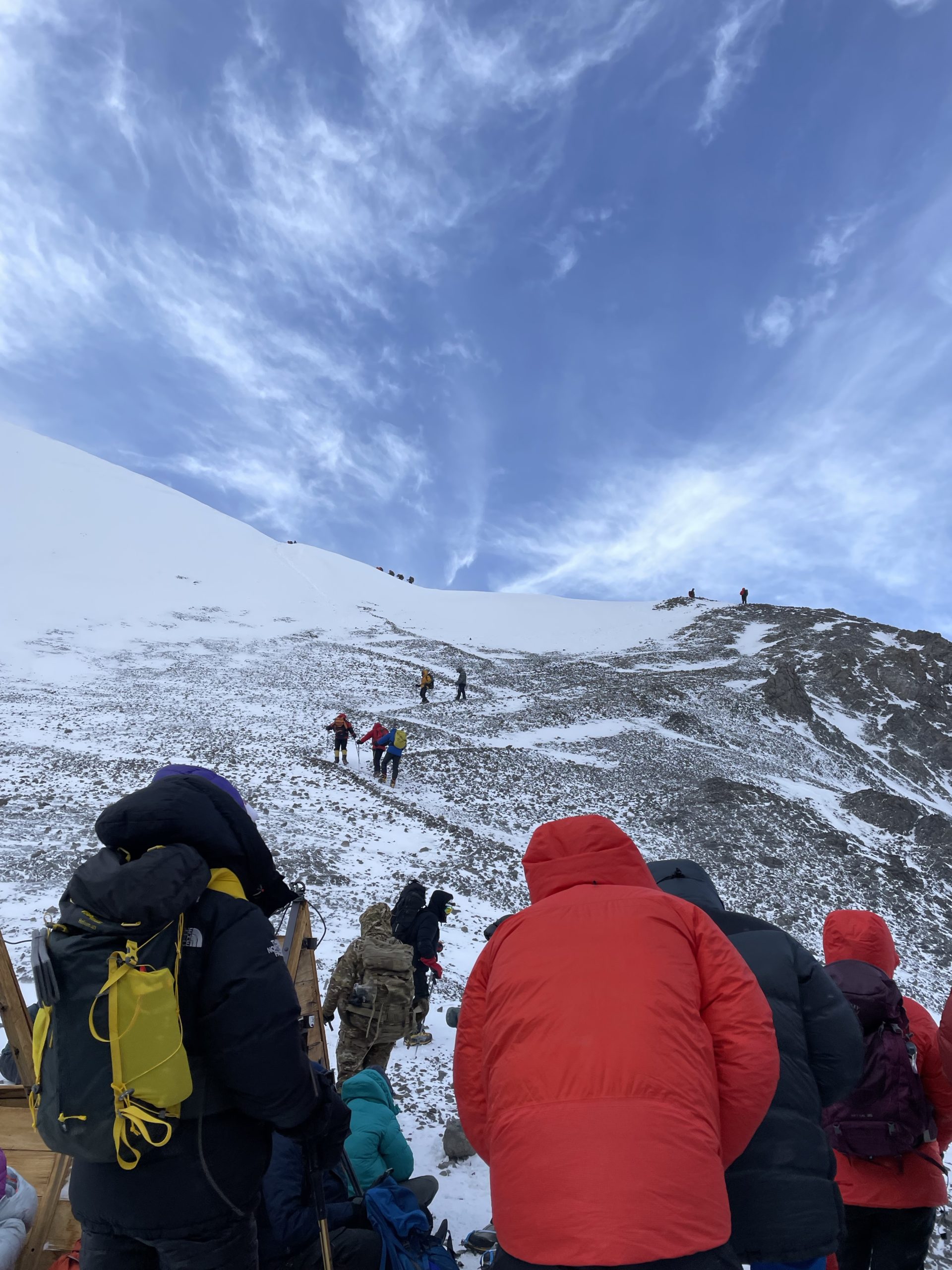
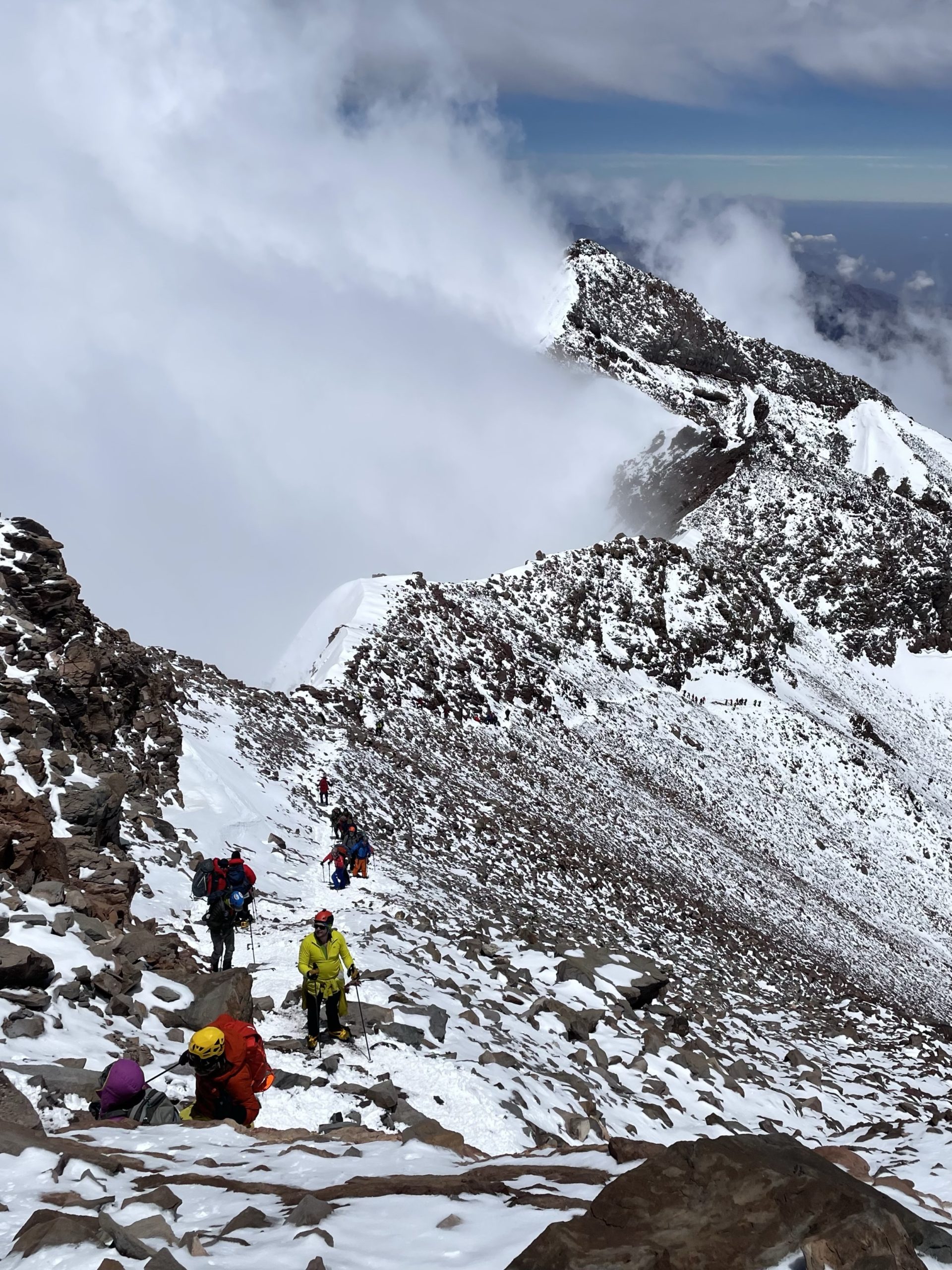
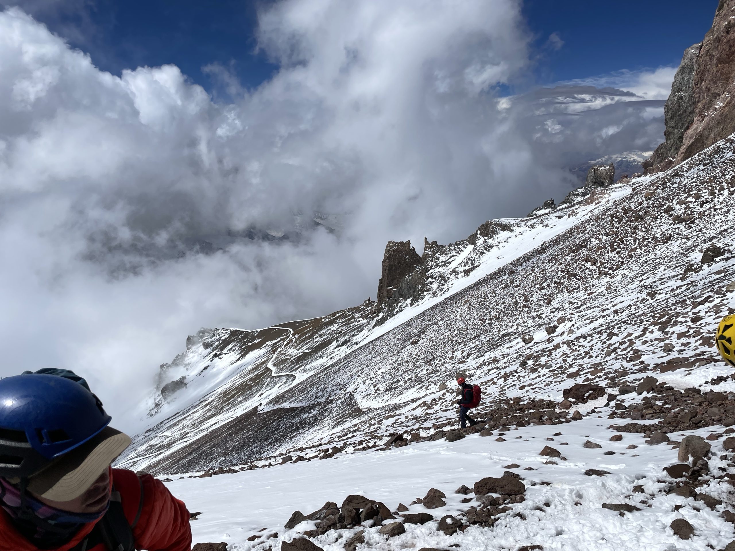
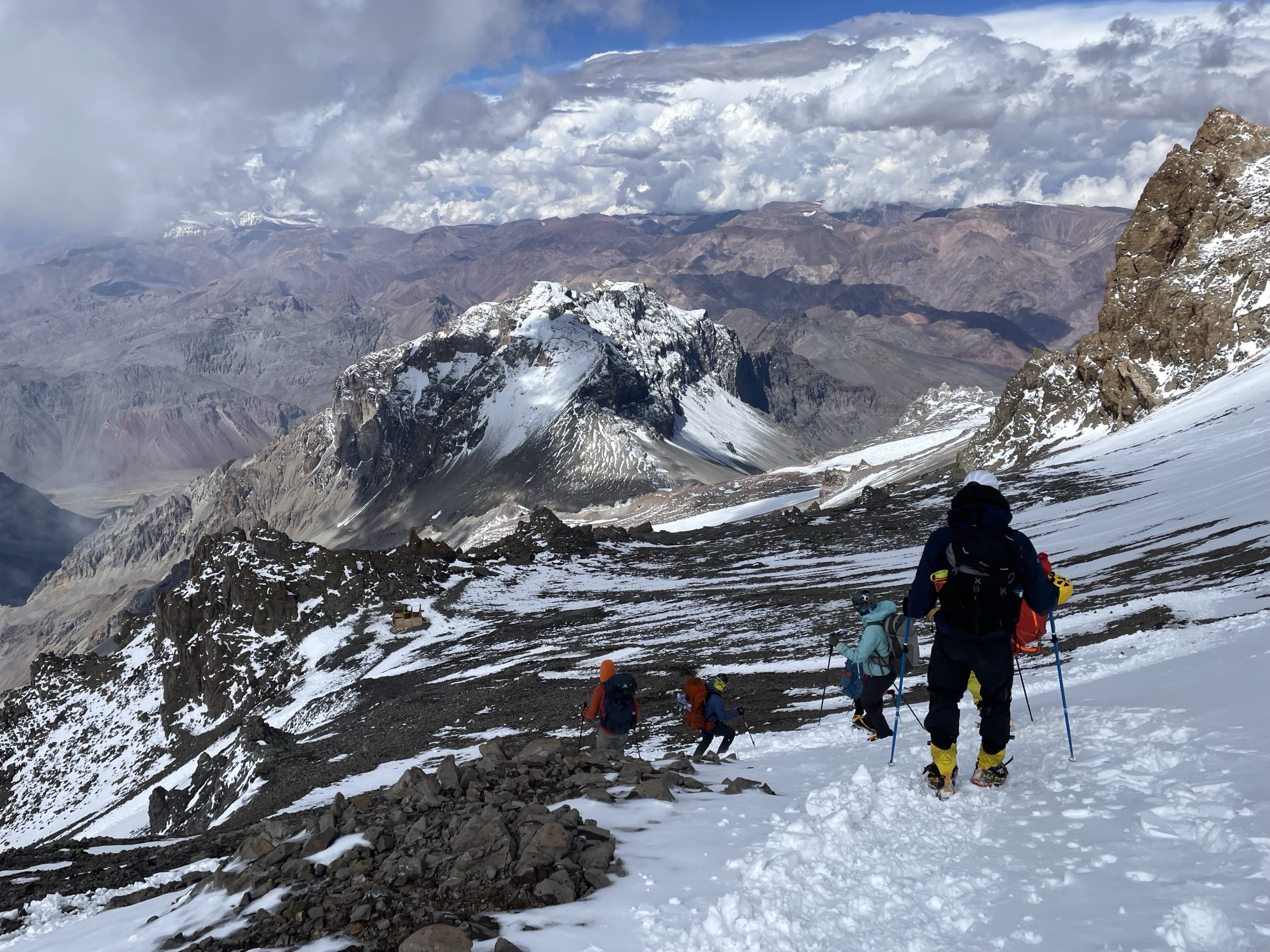
Independencia ended up being a high point for a few of our members as they were unable to push on for various reasons. In total 3 or 4 team mates made the difficult call to head down. The rest of us pushed on to start a famously visible part of the ascent called The Traverse. One can view it from camp 2 and it looks rather tame from below. Now at its start I could see it was rather steep and flanked on the right by a steep snow slope.
Nonetheless I continued to feel good and kept behind our guide Mariano with relative ease. We stopped about halfway up the traverse with an interesting problem. We were down to two guides after another member had to retreat to camp. This meant any other member going down would result in the summit being called off. One guide would need to take said member down and as a general rule the lone remaining guide simply couldn’t manage a group of our size on their own. A quick pep talk was given, encouraging those who were nearing the limits of being too slow to head down. No one gave way to the quitting bell and so off we went again. Surely we all hoped that any stragglers could gather the strength to push on. I was too focused on my own push to really make note of who was who, but everyone seemed to be keeping up well enough. My confidence remained high.
At the end of The Traverse we reached La Cueva. A slightly over hanging wall that provided some protection from the elements. Albeit, with some unstable looking components of its own. Here we stopped for an hour long break to recharge, eat lunch and of course soak in the views. The cold had subsided and the sun now rose directly above us. The temperatures rocketed upwards and I disposed of the majority of my layers in preparation for the next push.
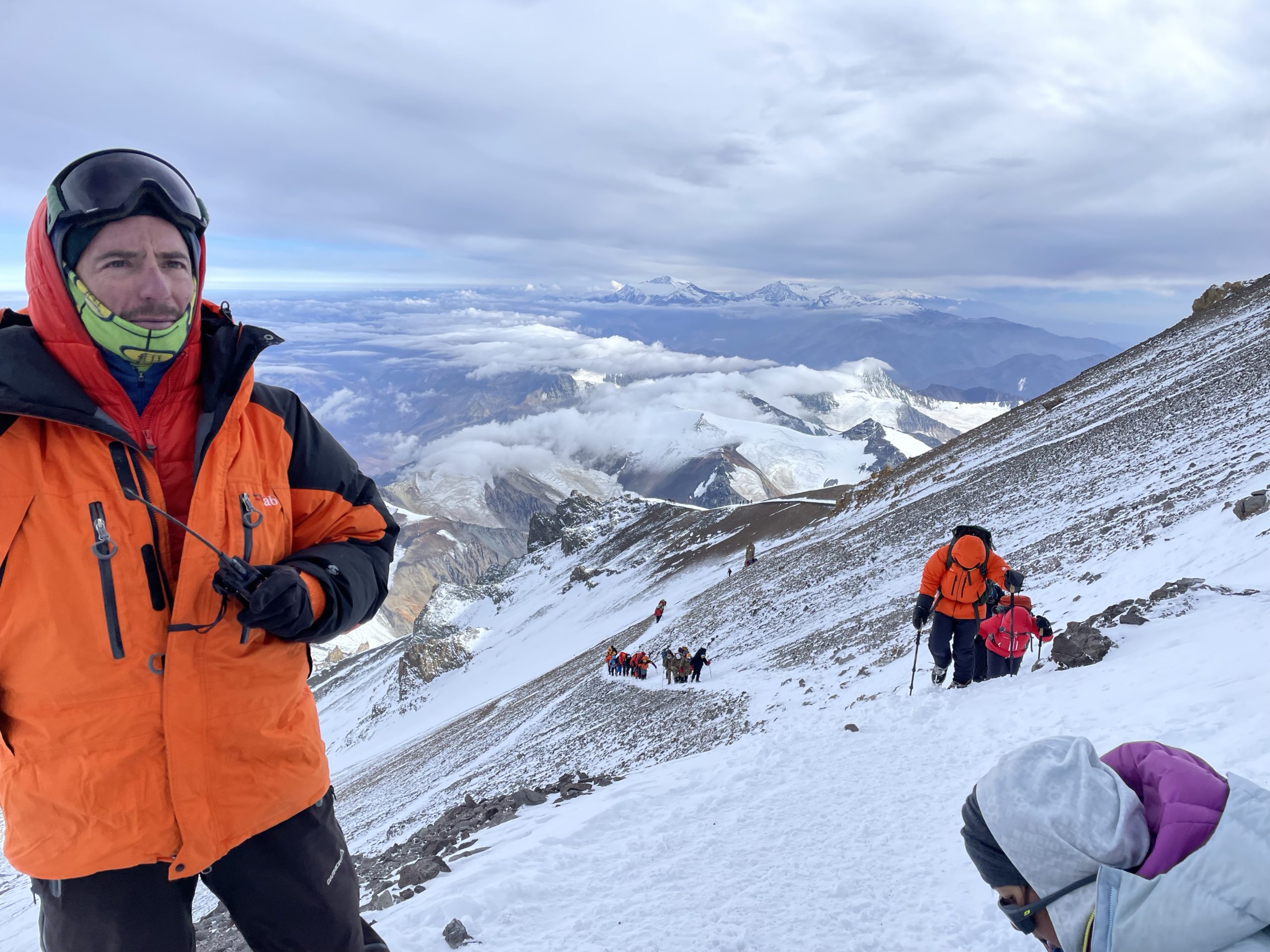
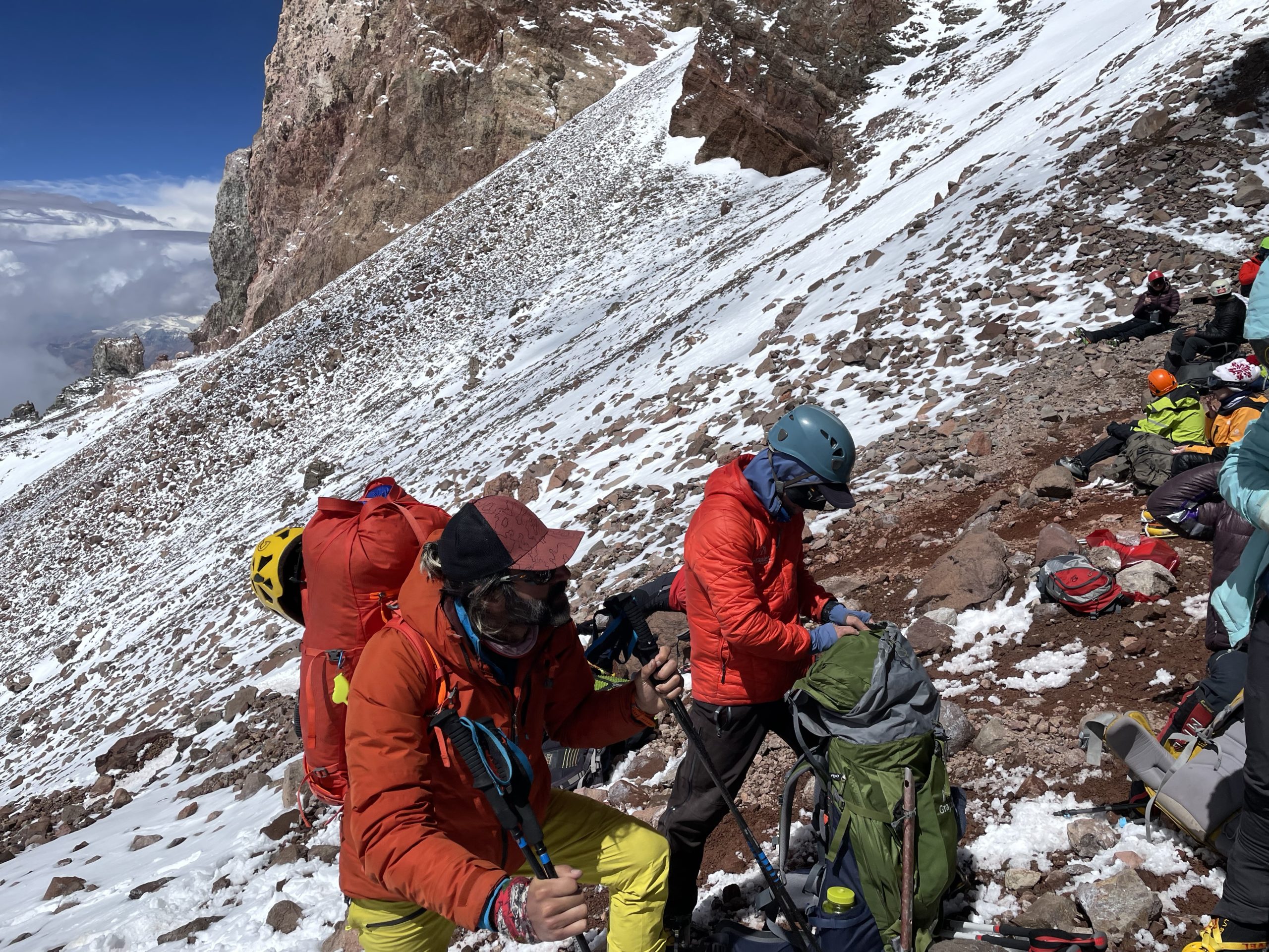
Now came the hardest part of the day. The ascent up a steep section of rock and snow called The Canaleta. As we began our push up I struggled to gain a rhythm again. Counter intuitively, our one hour rest effectively meant a “cold start” up the remaining segment and I suffered for it. The heat was punishing as well and I had to stop not long after to ditch even more layers.
Perhaps 50m up, I regained my composure enough to restore confidence, but this was going to be a laborious final push to say the least. Shortly after getting into the rhythm again we were forced to step aside from the ascent track to make way for a descending group. To my surprise a Congo line of lethargic climbers adorned in 8000m down suits half stepped, half fell their way down the slope. They looked totally besides themselves and in poor shape. Lagging not far behind with another beleaguered climber on short rope the leader of that group made an appearance. I won’t name names, but I was shocked to find a very prominent high altitude mountaineer leading a group so close to the margins of failure.
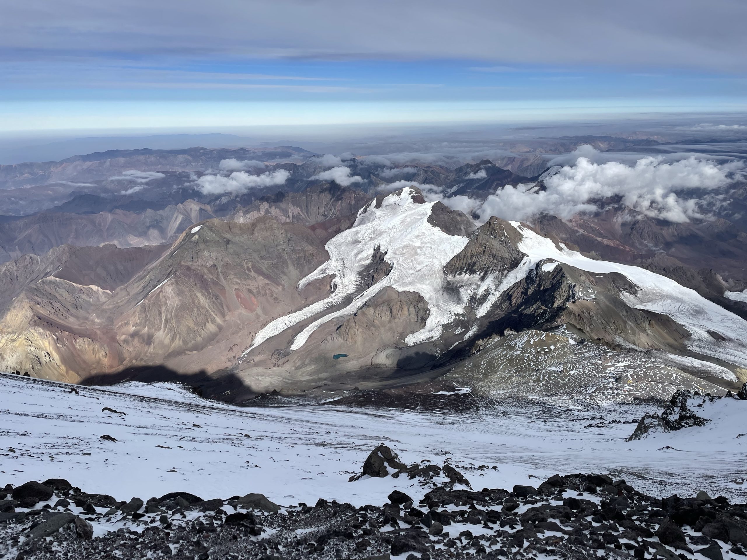
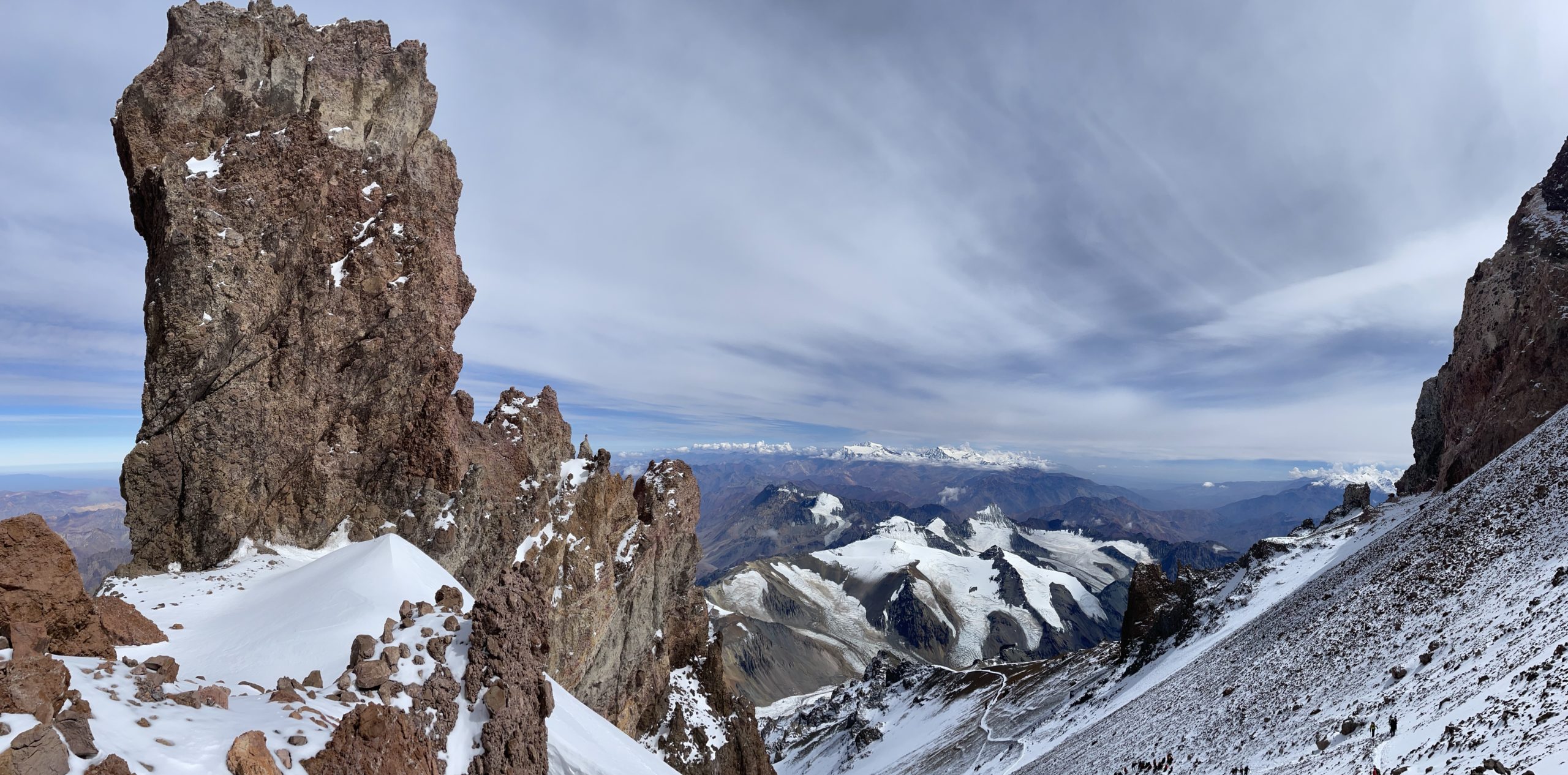
We moved on quickly though. There was still a mission ahead and I could sense I was going to make it! From La Cueva there’s less than 300m to the summit, but it was going to take the better part of 3 hours to climb it. This section is also notorious for rock fall and we kept helmets on starting from the bottom to hopefully avoid any fatal head blows from above. The route climbed to about 6800m before traversing climbers left along the ridge leading up to the summit.
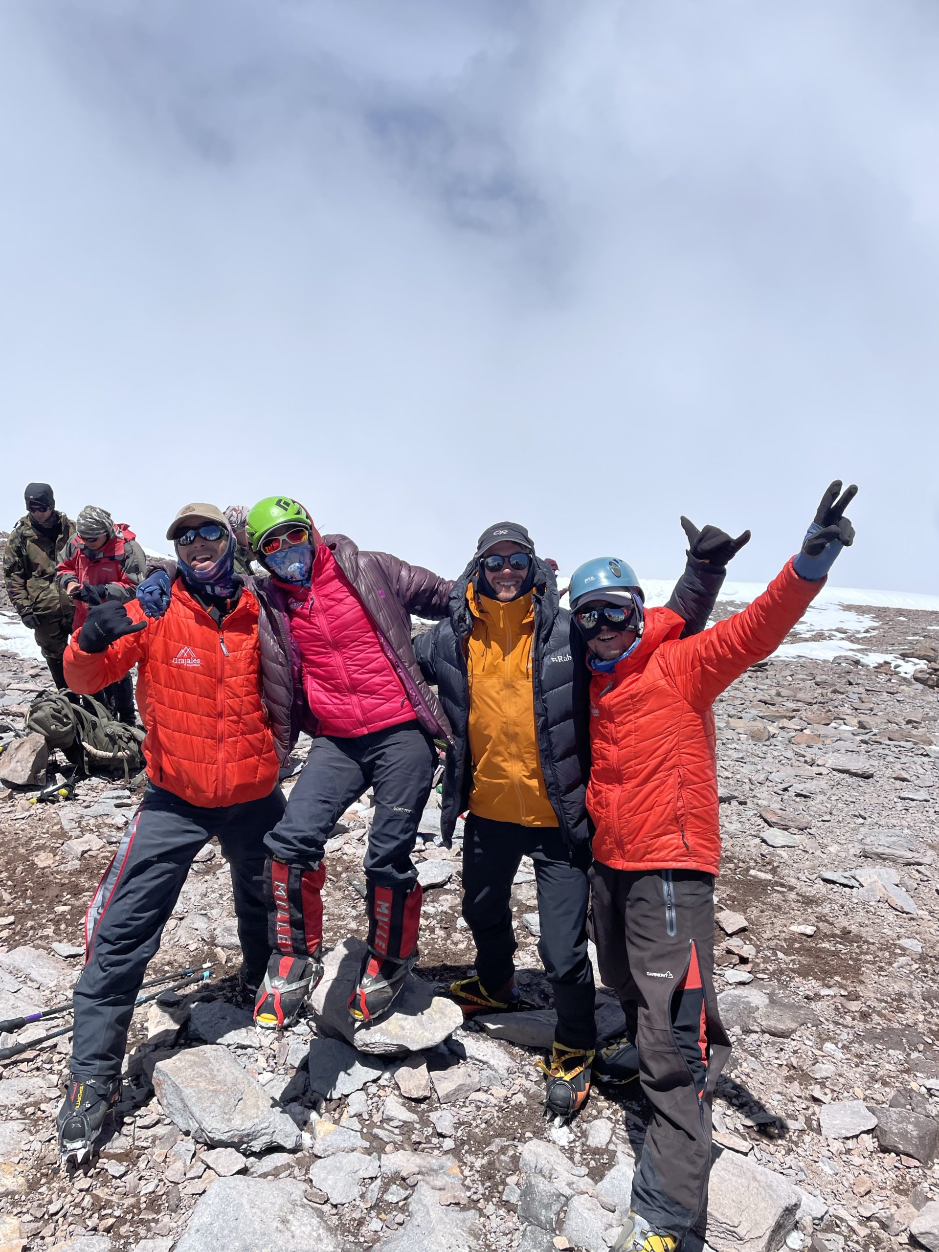
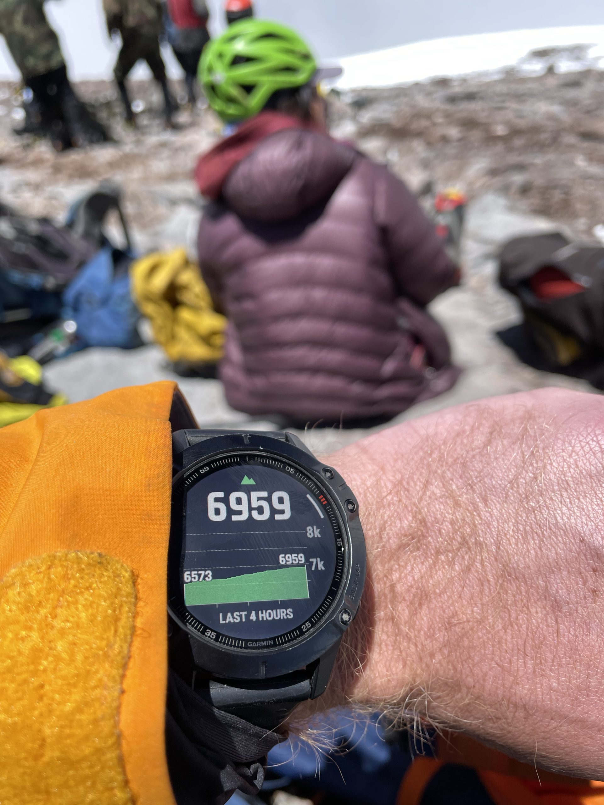
I was feeling slower with each step, but kept pushing on and stayed in pace with the lead guide. Eventually we reached a short rocky set of steps that wrapped around to the summit. I climbed slowly but steadily up them and before long reached nothing other than the summit! It was a good feeling, but it didn’t last very long. I was light headed and lost balance on two occasions near the summit. I had this dreadful feeling that I was just beyond the oxygen limits for my body. It was responding in kind and my focus for the next half hour was just resting and aiming for a quick descent.
Our group slowly piled on to the spacious summit plateau and there was a full body of emotions from the team. Personally, I didn’t feel particularly overwhelmed with emotion, just content that I was able to reach the summit and of course that strange “I don’t belong here” feeling from the lack of oxygen.
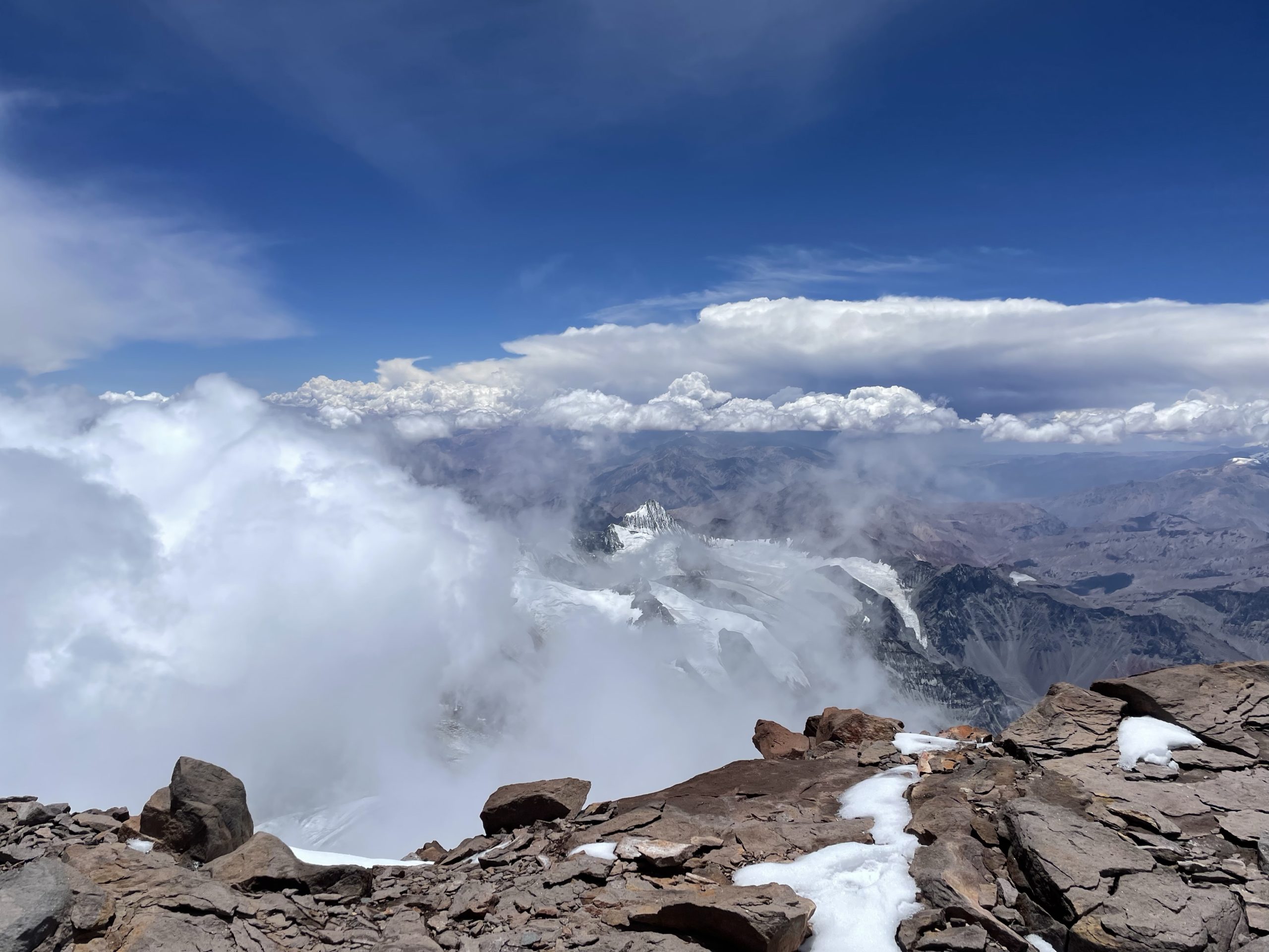
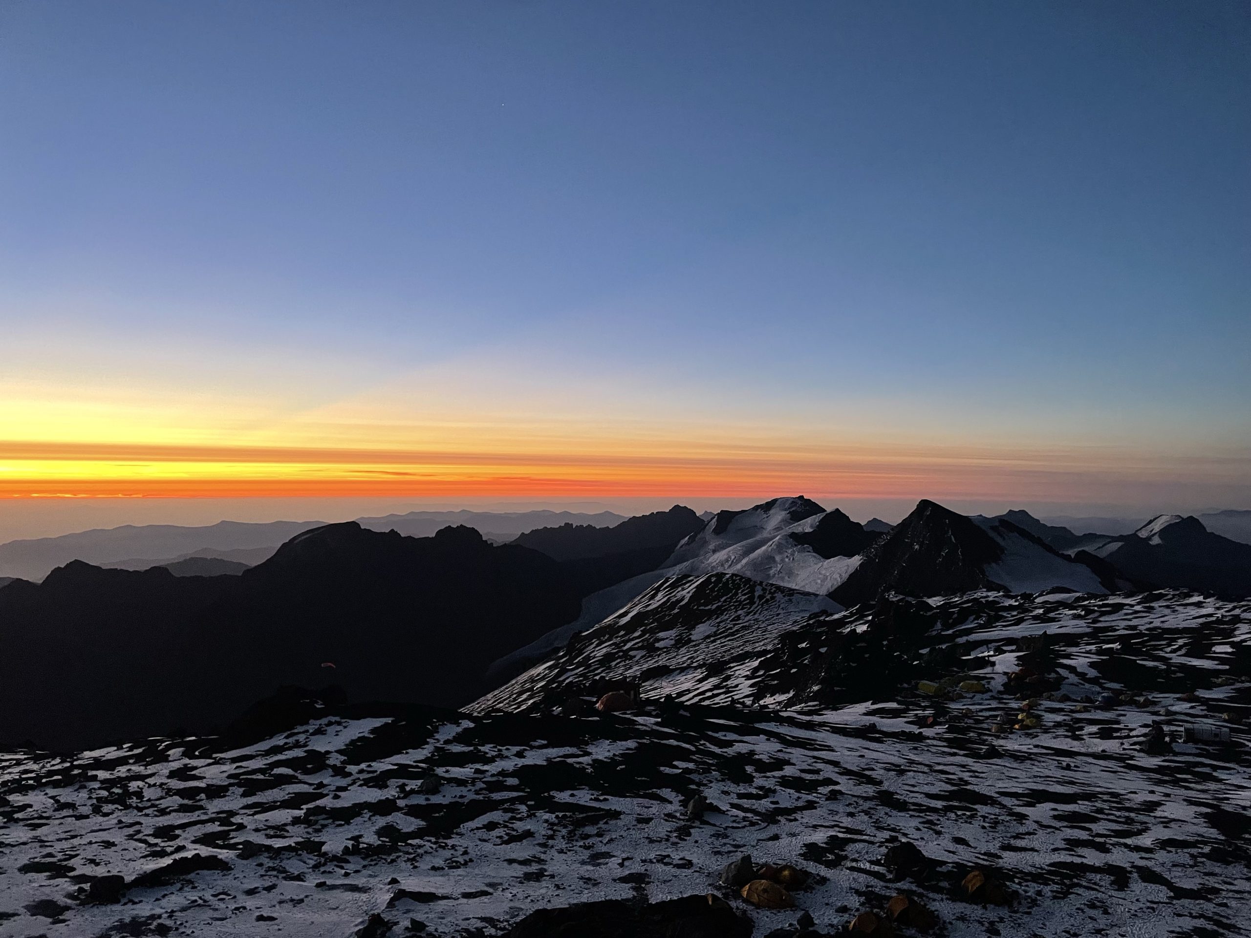
Perhaps 30-40 minutes after the last member arrived we grouped up for our descent and started down the way we came. I continued to feel the lack of oxygen and welcomed each step to lower elevation. We arrived back at La Cueva before long and I still didn’t feel much better. Thankfully, one of our guides Cabeza had an “emergency” can of coke that oddly brought me back to life.
We gathered some gear we ditched at La Cueva and then continued on as separate groups now with a faster team at the front. Our descent simply reversed our up track and we passed The Traverse and Independencia with ease. The final segment to camp was when the tiredness finally hit me. I felt totally bagged and had to push hard to keep up with the group. When we finally reached our tents I stayed up for an hour or so to have food and then passed out from exhaustion in the tent. In total the summit day took 12.5 hours to complete.
Days 15 – 16
- GPS recording for day 15: https://www.alltrails.com/explore/recording/las-heras-hiking-953ecc4
- GPS recording for day 16: https://www.alltrails.com/explore/recording/las-heras-hiking-a869dd9
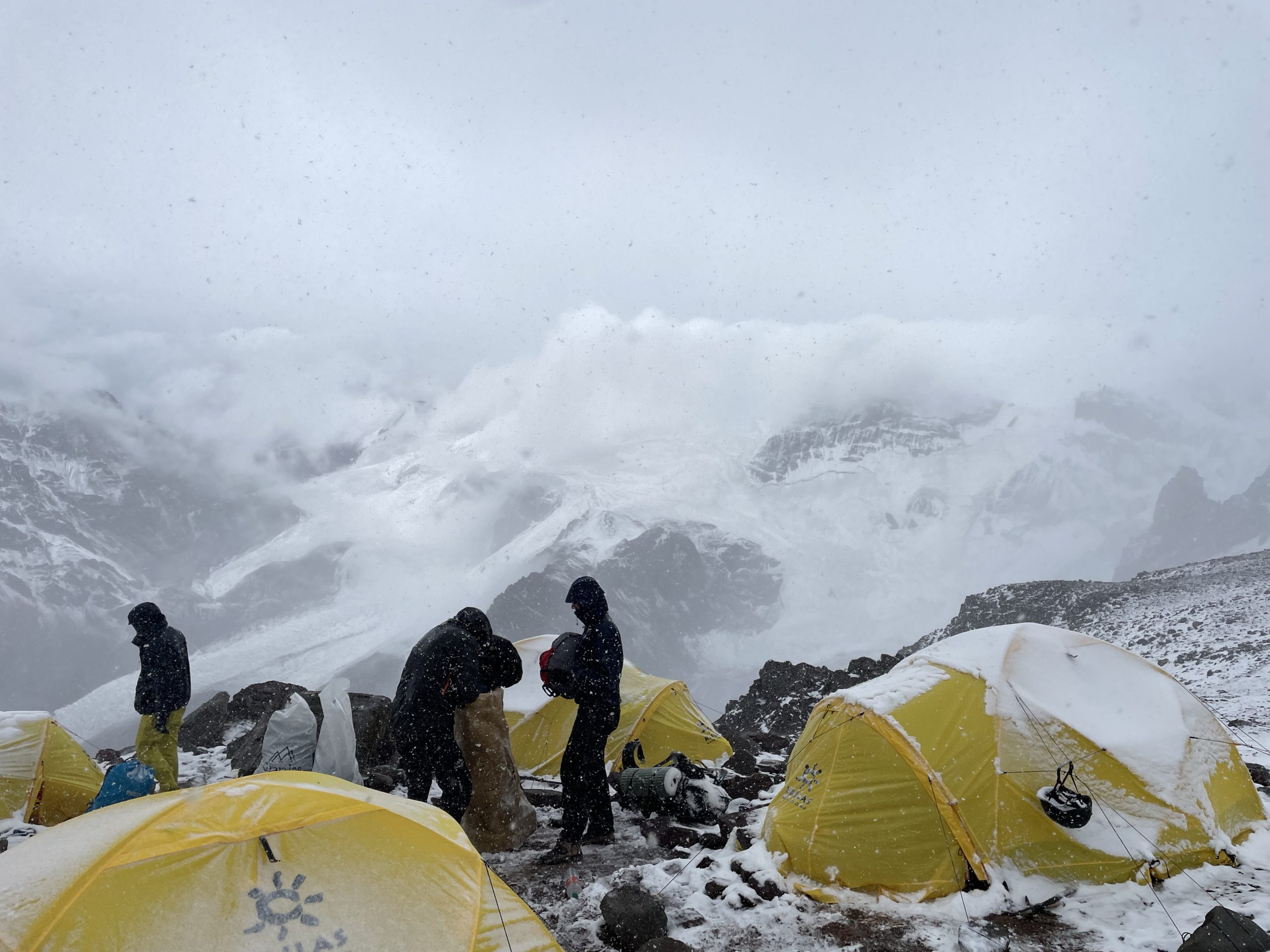
At some point around midnight I woke up to the tent walls shaking in a violent symphony as an incoming wind storm rolled into our camp site. I was absolutely exhausted and feeling unwell from the altitude but Aconcagua was not going to let me rest on this night. I managed to pass out perhaps an hour later, but was soon woken again as the tent walls bounced around off my head and sleeping bag. This little dance continued all night long and I finally gave up on sleep around 6am. Christopher woke up next me having experienced the same and we both lacked any energy to do much.
Unfortunately, we had no choice but to get packing in order to head down to base camp. It was an exhausting affair but we did finally manage to get packed up after a late breakfast came around. Then came the final step of tearing the tents down. Under these conditions it took a 4 person team to ensure nothing flew away, but after half an hour the site was down and we were ready to roll.
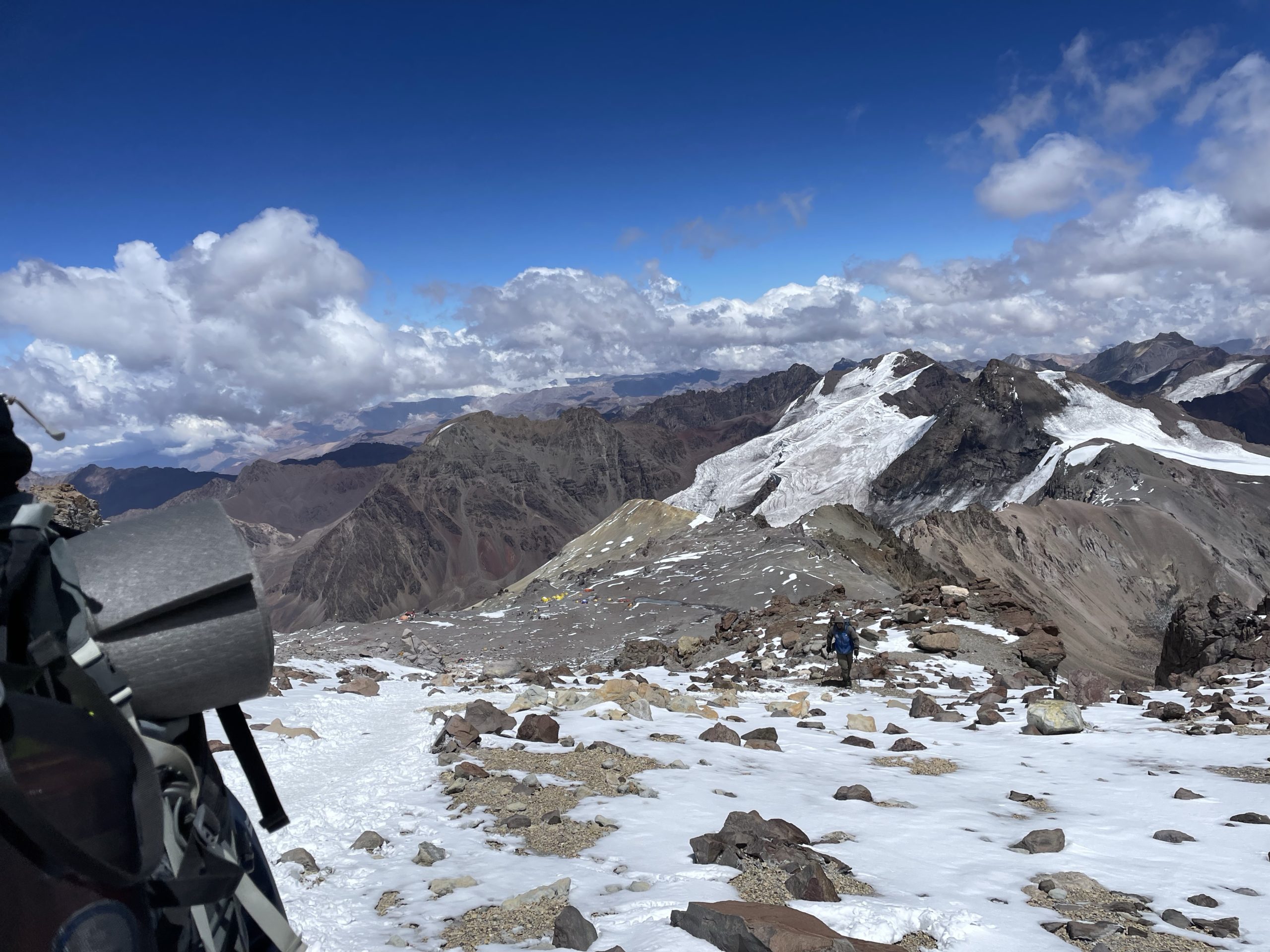
Around 12pm we began our descent to base camp. I was still feeling that ever present hang over from the altitude, but my mood improved greatly as we descended past camp 2 and eventually made our way onto the soft scree slopes around camp 1. From there we could make fast plunges down towards base camp and we arrived in about 3 hours and 10 minutes from camp 3.
I slept much better that night and the following day we started the ~26km trek back to the trail head. Retracing our steps through the Horcones Valley was uneventful and we paused for some snacks in Confluencia before continuing on. In total it took us 7 hours and 6 minutes to the trail head. Then it’s about 3 hours back to Mendoza for a long awaited night in a regular bed.
Aconcagua certainly opened my eyes to the realities of high altitude ascents. For one, it’s a huge commitment for a single peak. There’s no shortcuts to acclimatization and the process is often wrought with elements of suffering. Personally, I think I much more enjoy heading out into my own backyard for a day of adventuring on a local peak. That’s not to say I won’t try something like Aconcagua in the future, but I’ll be keeping my eyes set on more technical challenges than the logistical ones that a high altitude peak poses.
In final, I’m still stoked to have reached the summit and gain more insight on what I’m capable of. I’m also stoked on getting to do such an adventure with a great group of people and a great set of guides. I probably won’t go guided again, but the experience was great nonetheless.