
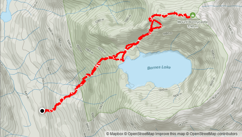
Elevation Gain: 1,196m
Distance: 8.98km
Total Time: 7 hours 51 minutes
Date: October 8th, 2021
Mount Bonnycastle is a summit that has captured my imagination for some time. I would even credit it to the genesis of my peak bagging interests. It’s one of those summits that I came across while perusing more remote areas of an online map. After happening across Bonnycastle’s map marker, I did a quick google search and that’s how I came across Steven Song’s site for the first time. He had the last documented ascent from 2016, which further added to the allure of making a trip up there. For me this peak checks a lot of boxes: it’s remote, has unique views thanks to its ampitheatre like structure and is rarely ascended. Despite coming into my purview over 2 years ago, it wouldn’t be until early October of 2021 that I would finally consider an ascent.
My friend Kyle and I decided to take the Friday off to make use of the short weather window before a weekend of rain. I had wanted to do Mount Bonnycastle as a 2021 goal, so I threw it out to Kyle and he was onboard. The one major concern was that snow had arrived in the alpine in the previous days and I wasn’t 100% sure if the route was still in or not. I heard from other trip reports that even lower elevation summits like Mount Coliseum were covered in snow as well. Nonetheless, the route to the summit is South facing and we had a full day of sun prior, so I figured we should take a chance. The plan was to leave Vancouver by 7am and arrive at the trail head around 9:30am.
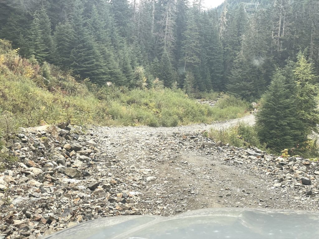
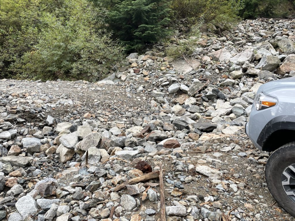
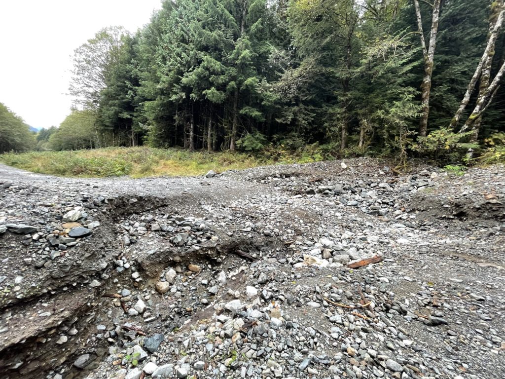
By the time Friday morning came around, I was running late and didn’t pick Kyle up until 7:30am. We made a quick breakfast stop at Starbucks and then were on our way. As we turned on to Mamquam FSR we were held up briefly by a film crew, but made it through about 15 minutes later. Then it’s down the Indian River FSR. I was expecting conditions similar to those on the way to Seed Peak, but in fact the road was in much worse condition. There were numerous wash out sections, narrow rocky tracks, pot holes and more. The road conditions slowed us down considerably and our new arrival time was looking closer to 11am.
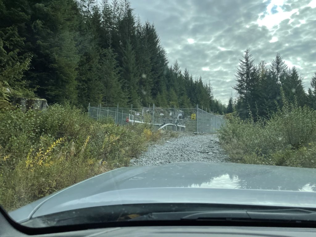
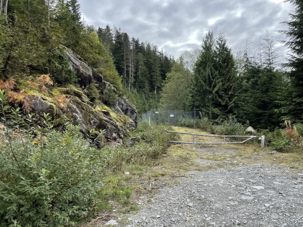
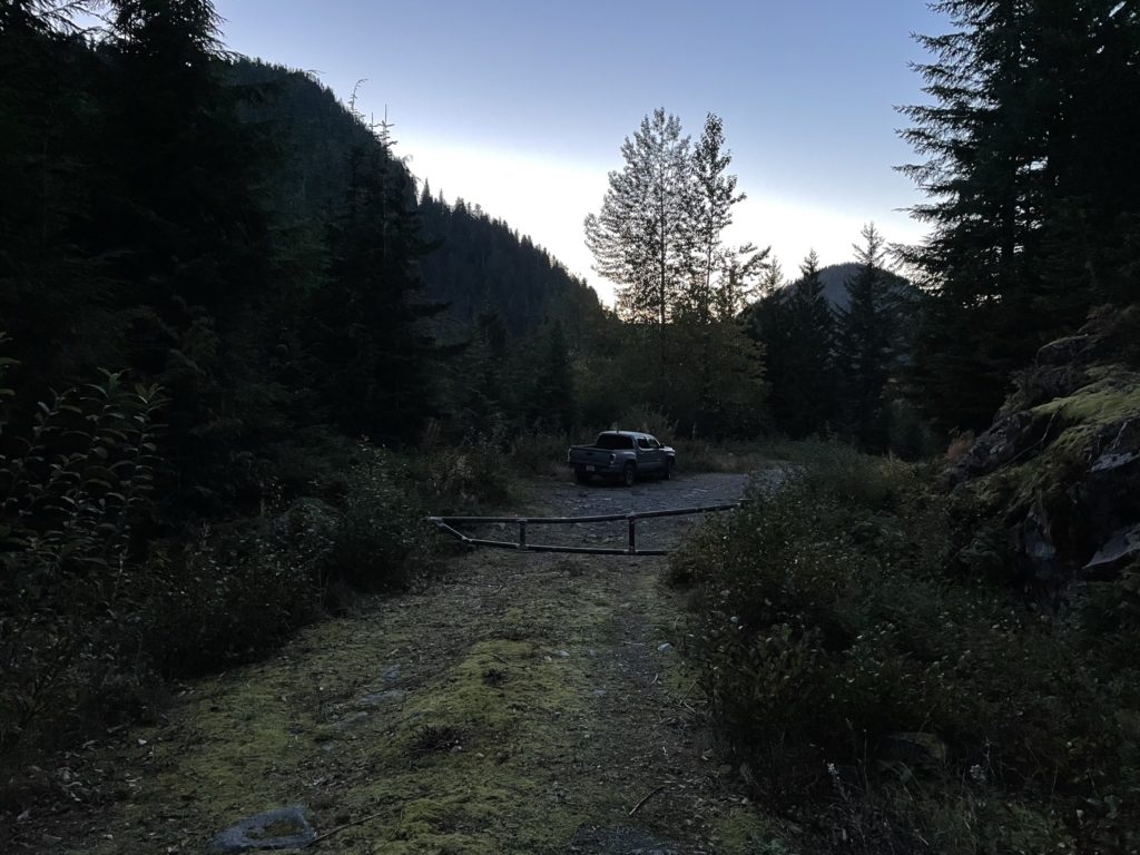
Nearing the Hixon Creek turn off, my tire pressure warning suddenly went off. I pulled over to check it out and could hear a small amount of air leaving the tire. I searched around and soon enough found a small puncture area. The leak was slow however and we’d already made it most of the way, so I made the decision to continue on. Shortly after we turned onto Hixon Creek FSR and the road conditions improved drastically. It’s unfortunate, because many cars could drive this FSR but they’d have to get their first via Indian Creek FSR. As we drove higher up to the road, I watched as my tire pressure lost one PSI every 5 minutes or so. I had a feeling the tire would be fully flat on our return, but I had a spare so I wasn’t too worried. We continued on past Steven’s stopping point and eventually reach a locked gate to the Coquitlam Watershed. I parked the truck here and Kyle and I got our gear ready by 11am.
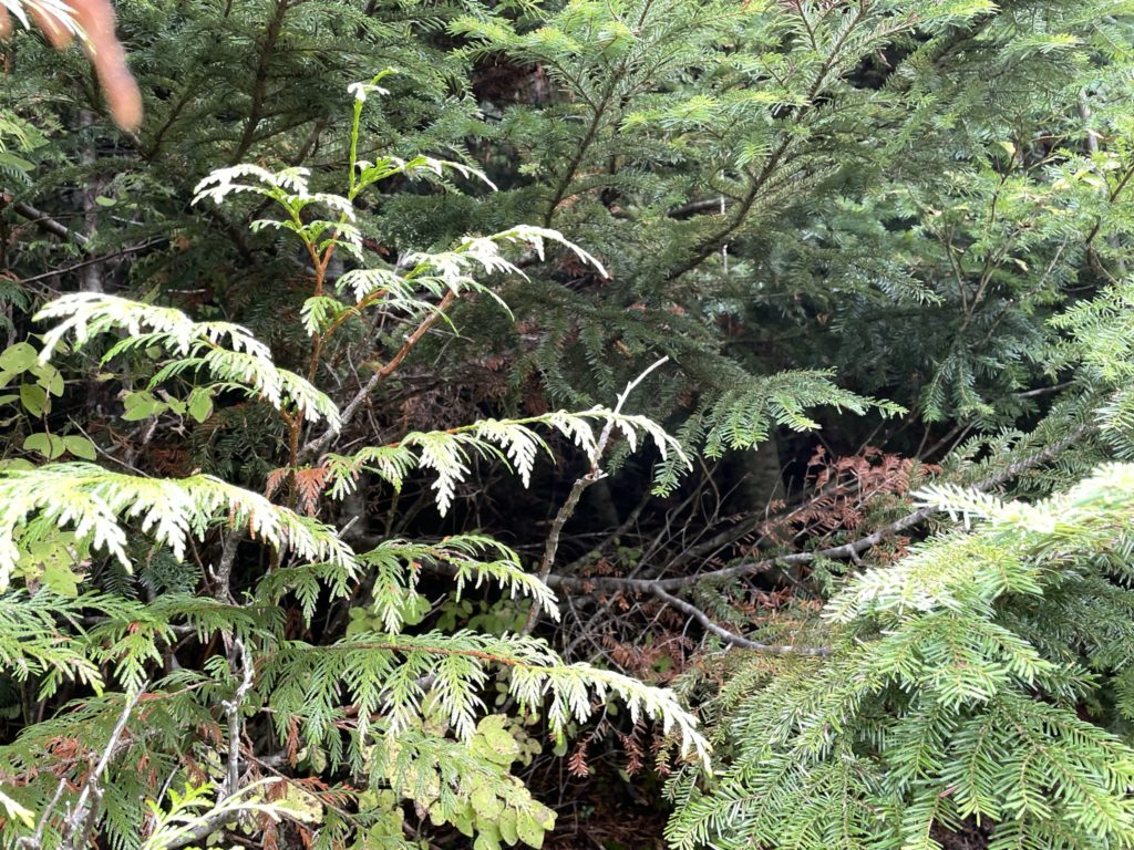
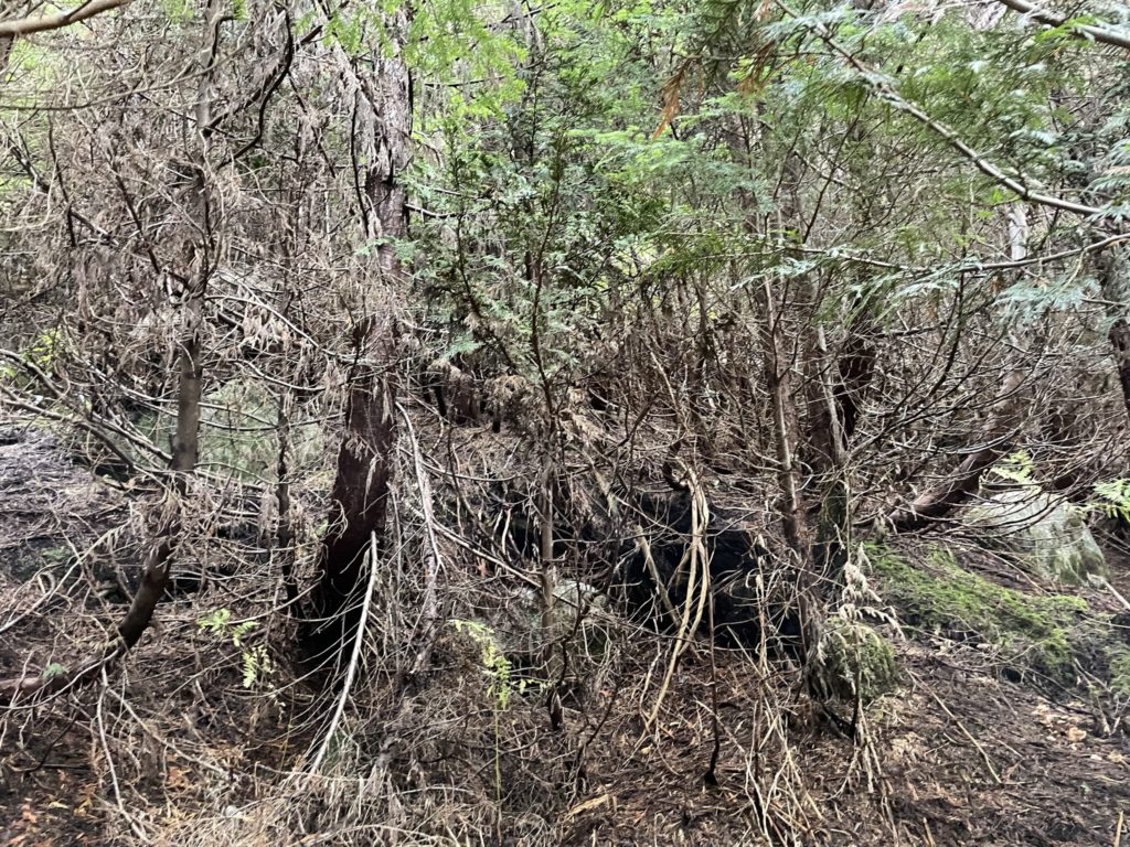
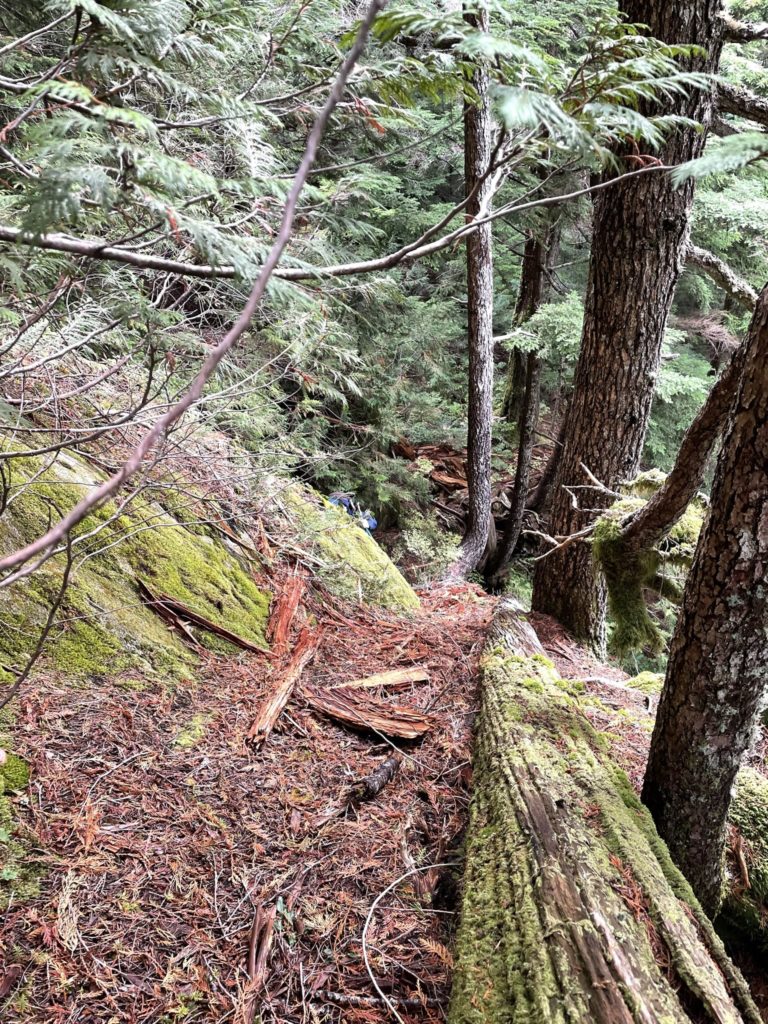
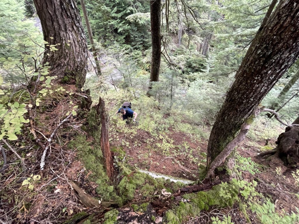
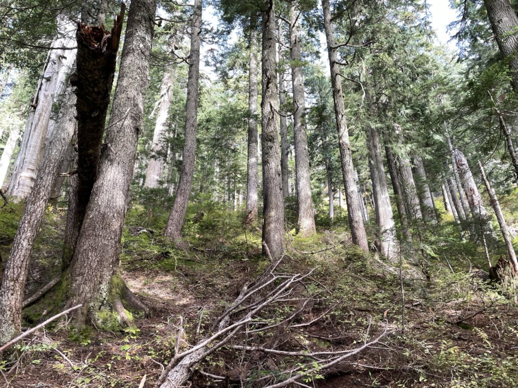
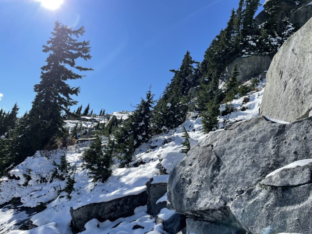
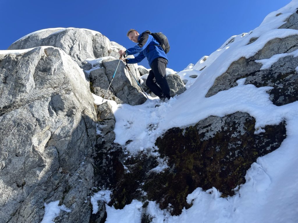
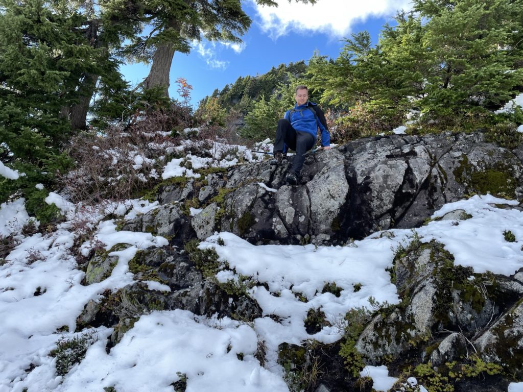
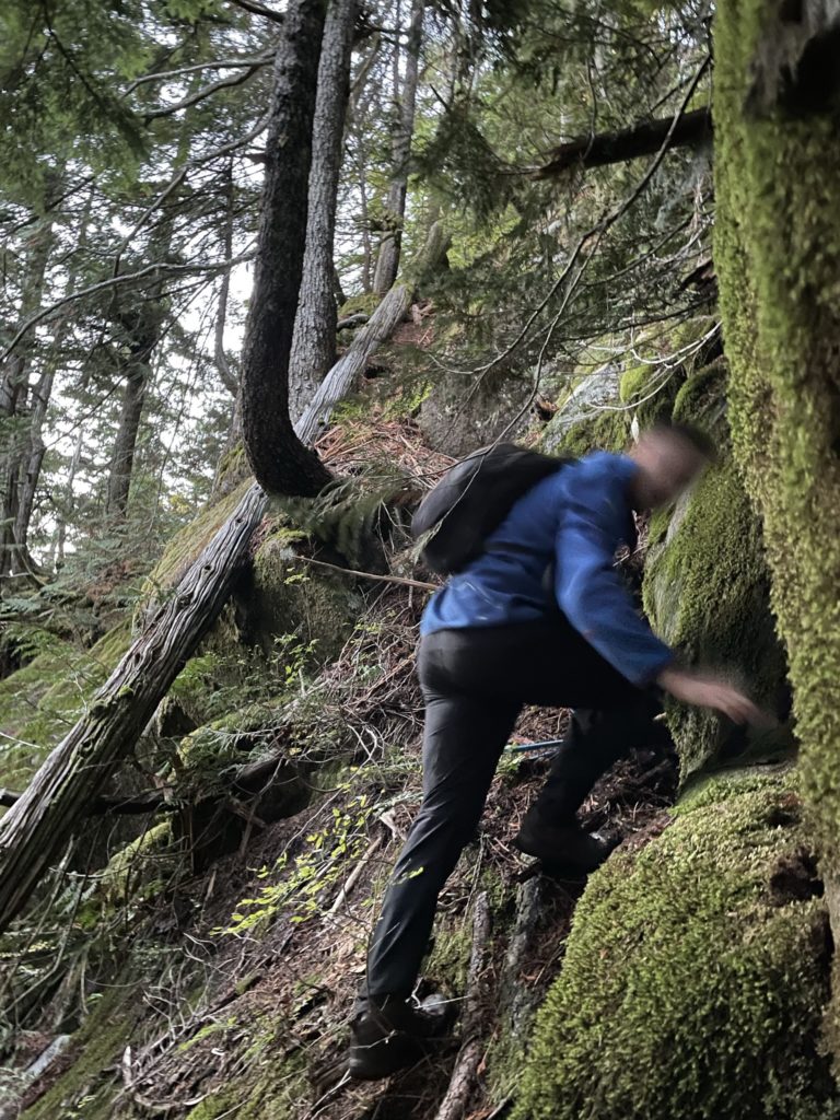
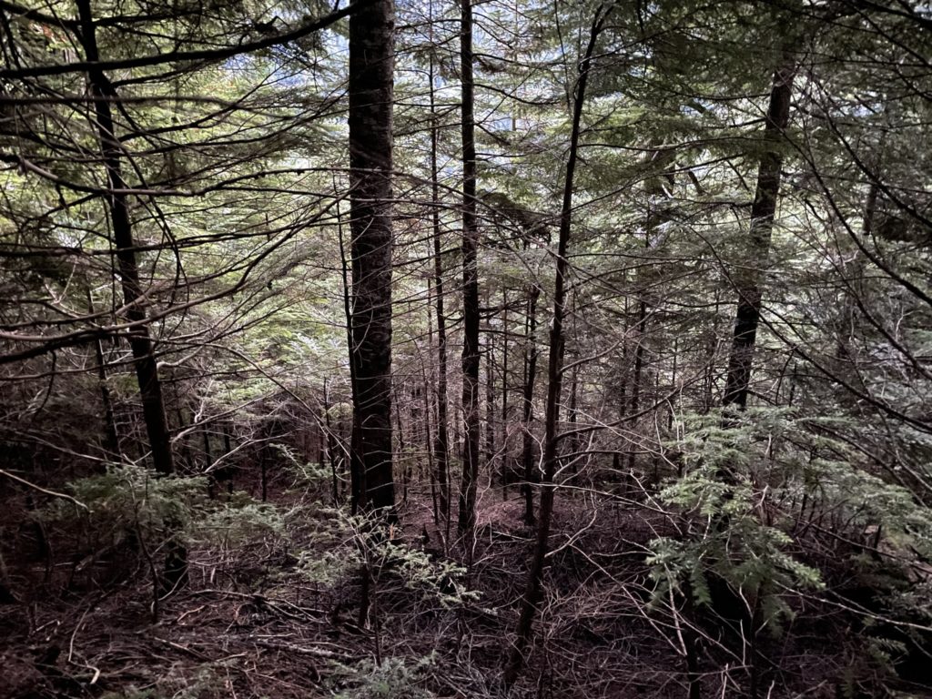
I loaded up Steven’s GPS track and we started our way into the bush. Not much, if anything, had changed since Steven’s report and we faced a similar full-on bush whack through dense branches and brush. We pushed until we were about 100m from the road reached a large bluffy section. Thankfully, where we popped out I was able to spot a steep ramp that traversed up a section of the cliffs. I started my way up and it proved to be a bit more sketchy than it initially looked. There was little to hold onto and the ramp was steep and slippery. A fall here would take you a good ways down the cliff. Kyle and I had to climb carefully, but thanks to a fallen log, we had better hand holds higher up.
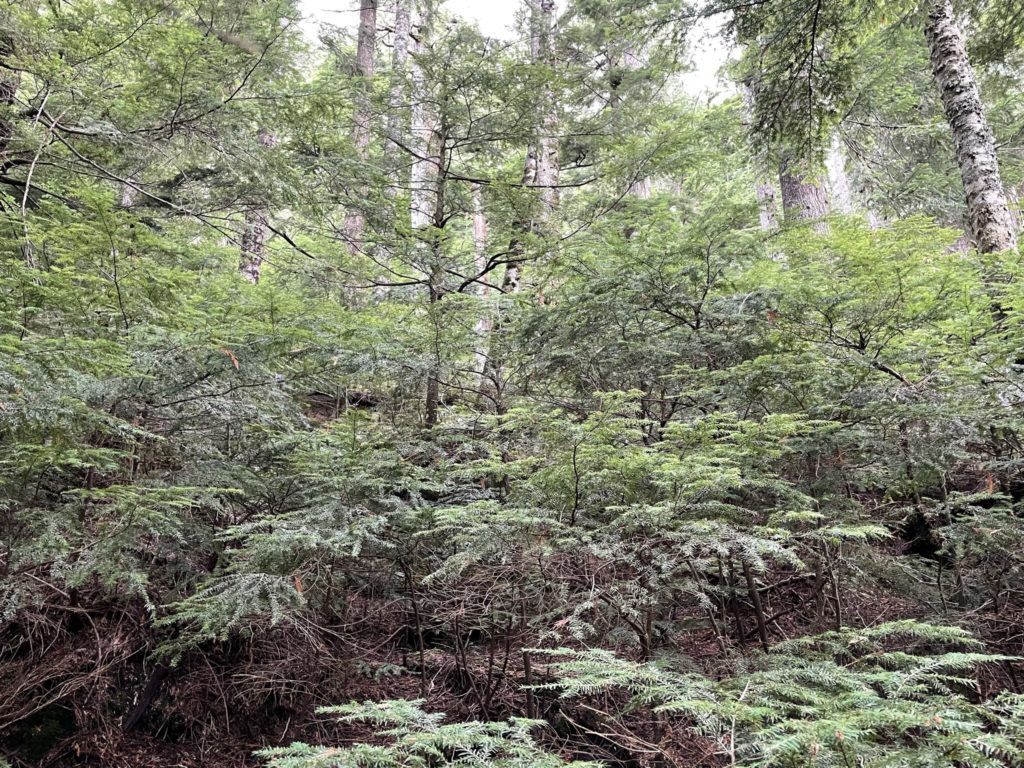

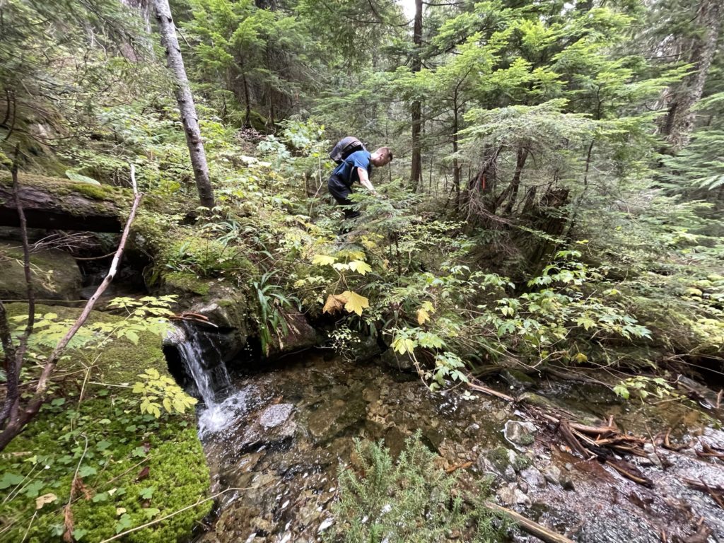
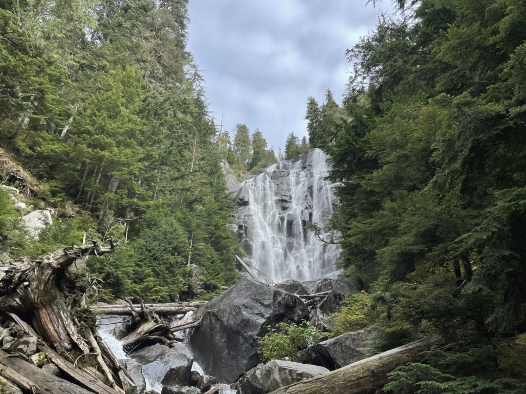
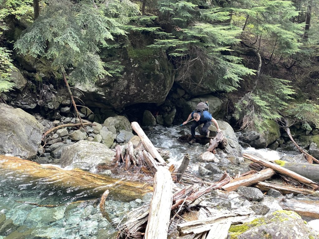
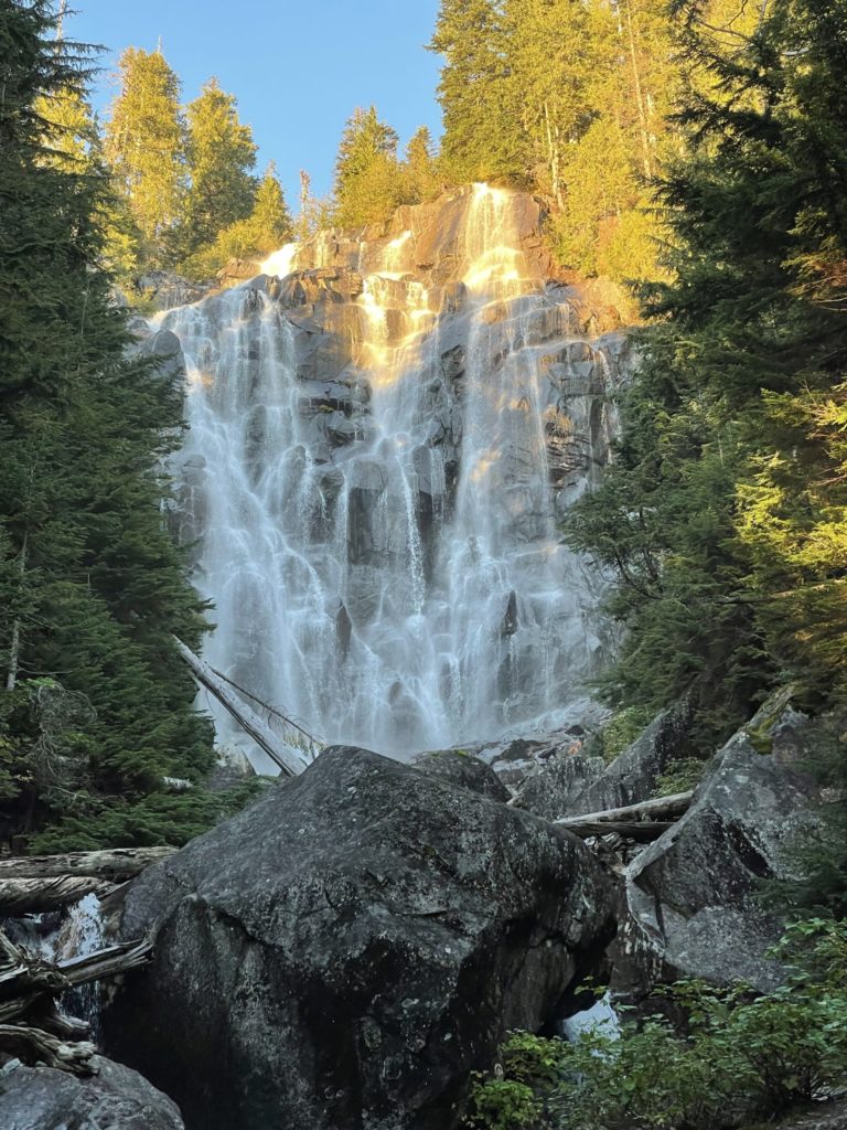
After we topped out, I continued along Steven’s track aiming for the creek crossing near a big waterfall. The route was still chocked with dense bush that made route finding and travel slow going. It had opened up more than the first 100m section, but it was by no means clear. Soon enough, we reached the creek crossing the Steven had documented and it still looked identical to his original picture. Above the crossing was a striking water fall that was stopped to take a few photos of. The crossing itself was straightforward, although I wonder how much spring melt off in the early season would affect it.
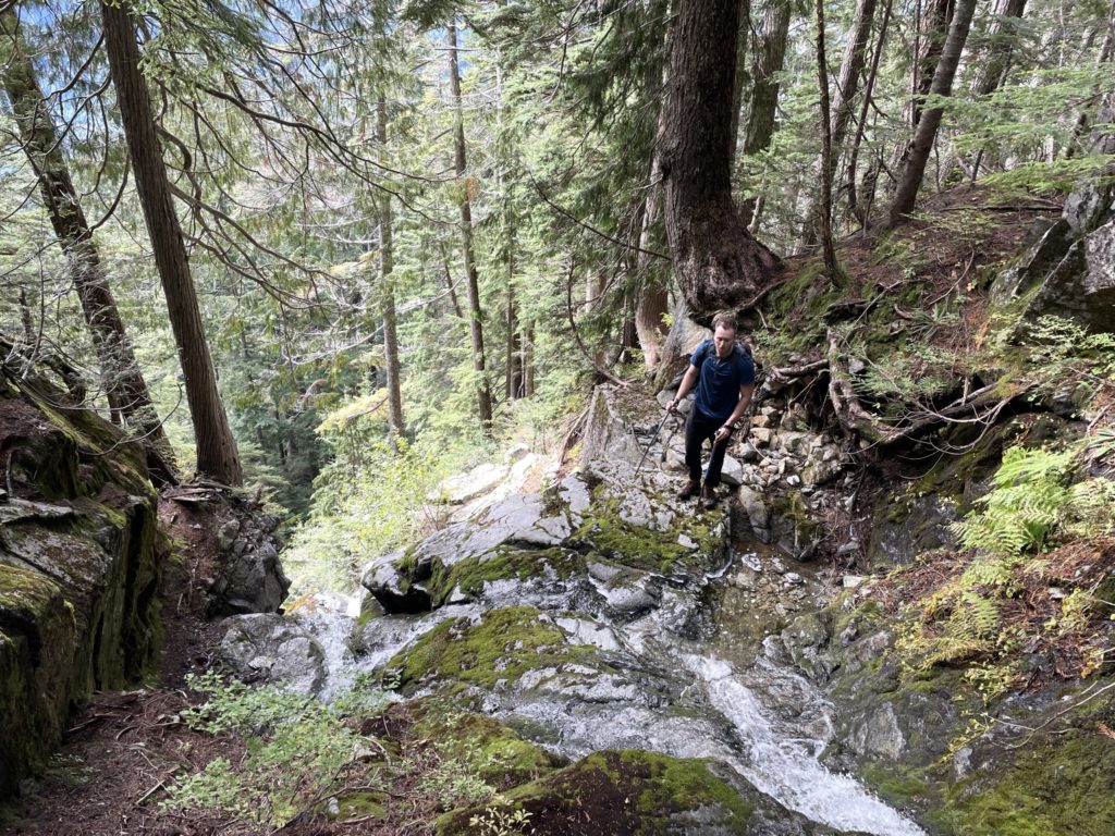
On the other side of the creek was a steep forested slope that we ascended and then cut climber’s left to a less steep ramp. Then we continued up through the forest above the water fall. At around parallel to the top of the water fall, we had to make a small creek crossing over a slippery slab section. After we crossed we spotted an easy safe spot just 10m above and made note for the descent. When we reached the 1120m mark, we stopped for some snacks and that’s when Kyle discovered his phone had fallen out of his pocket. We ditched our gears and dropped down about 80m in search of it, but never found it. Time was running on now with limited day light left, so Kyle called off the search and we pushed on.
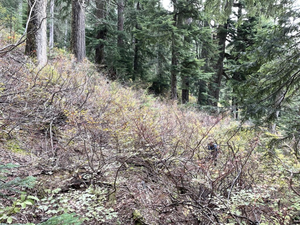

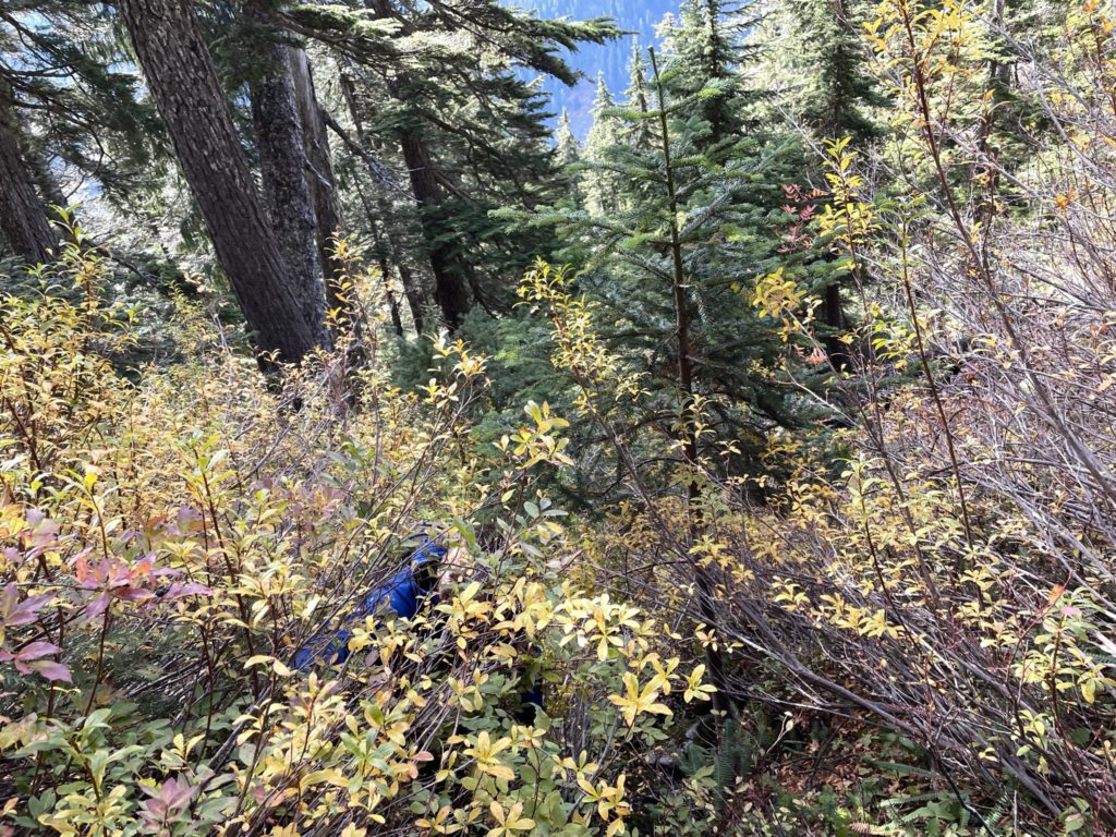
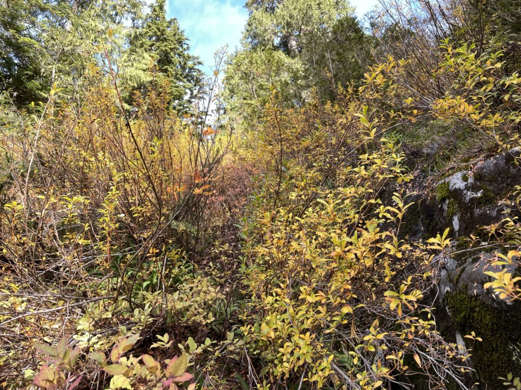
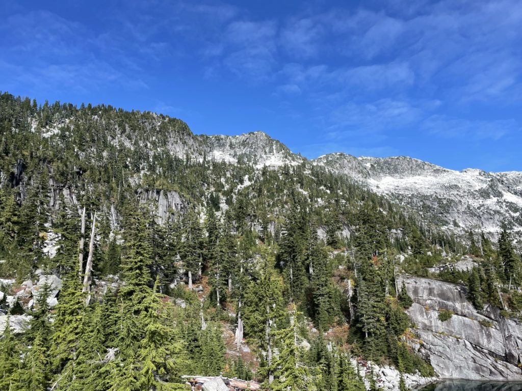
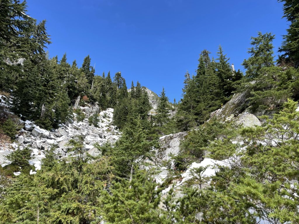
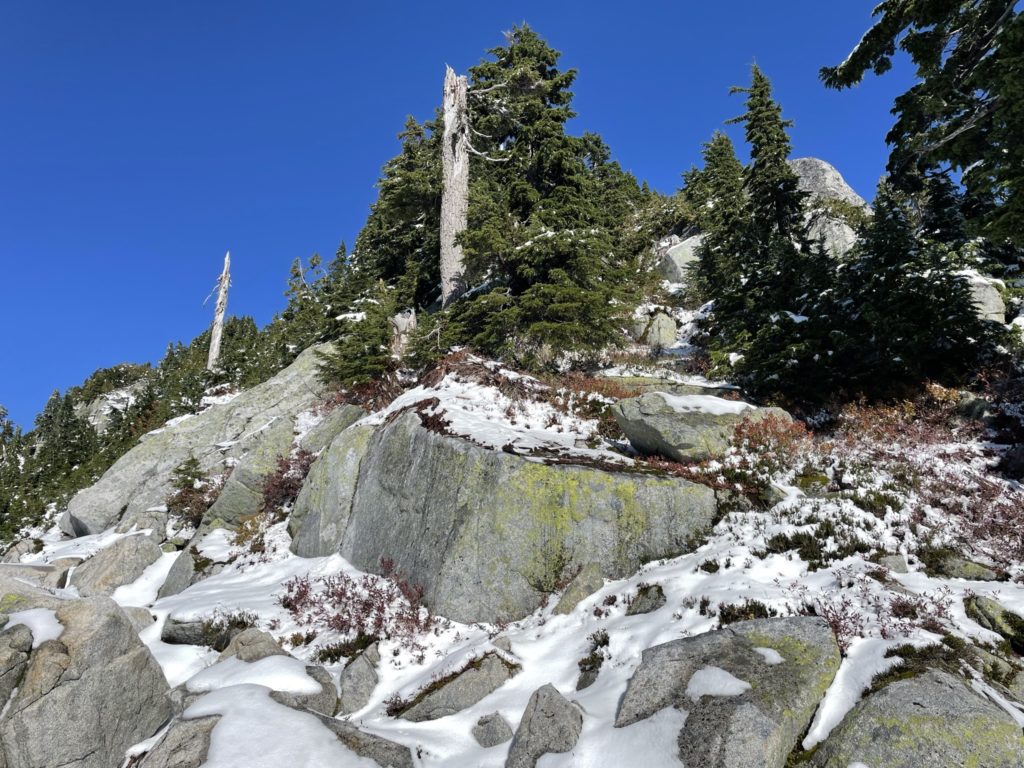
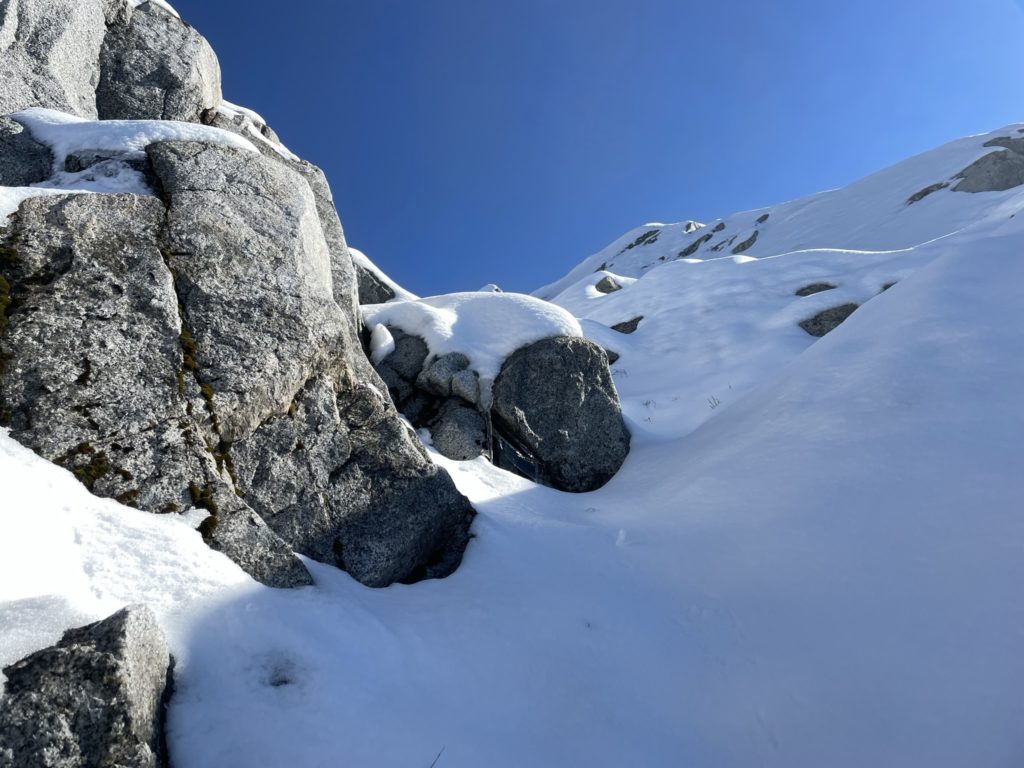
Perhaps 30m up from our stopping point we encountered incredibly dense brush again, making the route finding especially hard. I was now off track from Steven’s GPS route, but we were near the lake and so opted to push our own course. We had to traverse a steep brush slope above a creek and then up a narrow stream until we reached a section of wet slabs. I found us a line through the slabs up two 3rd class sections and then we were back on more moderate terrain. From there it was continuous bushwhacking until we finally reached some rocky outcroppings above the lake.
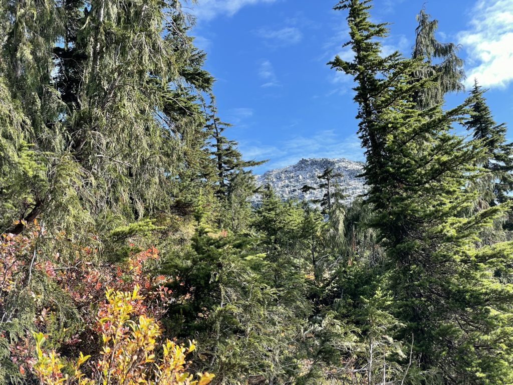
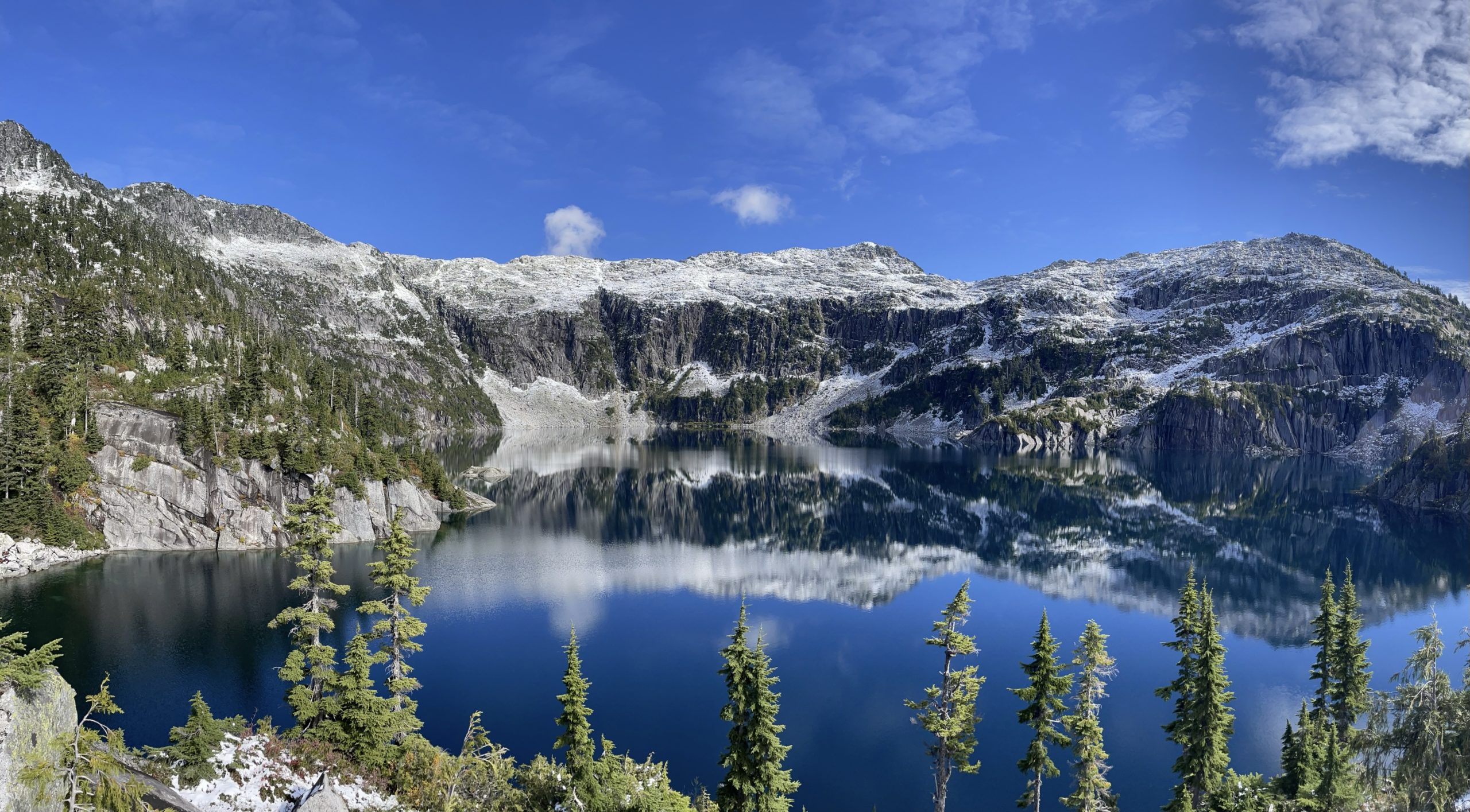
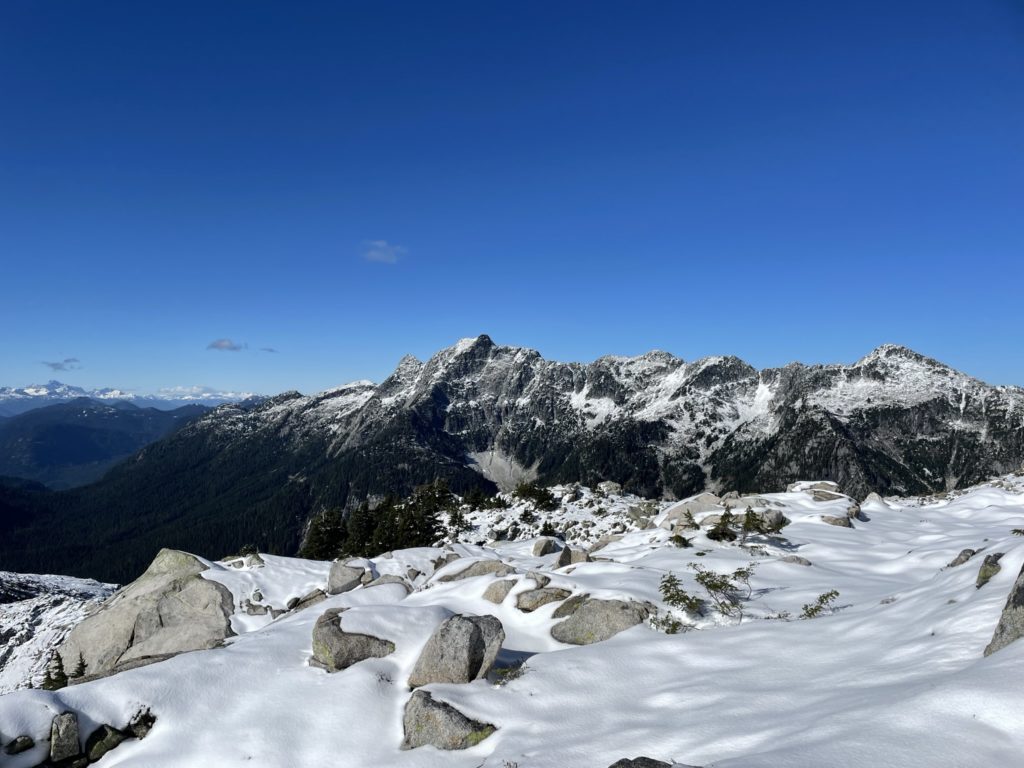
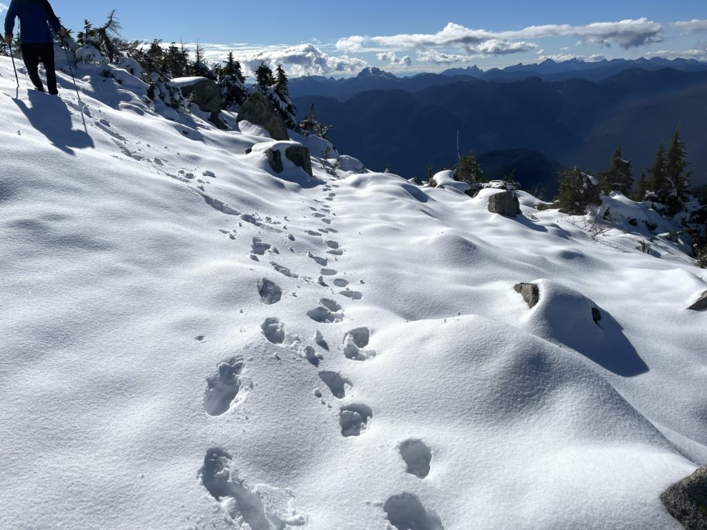
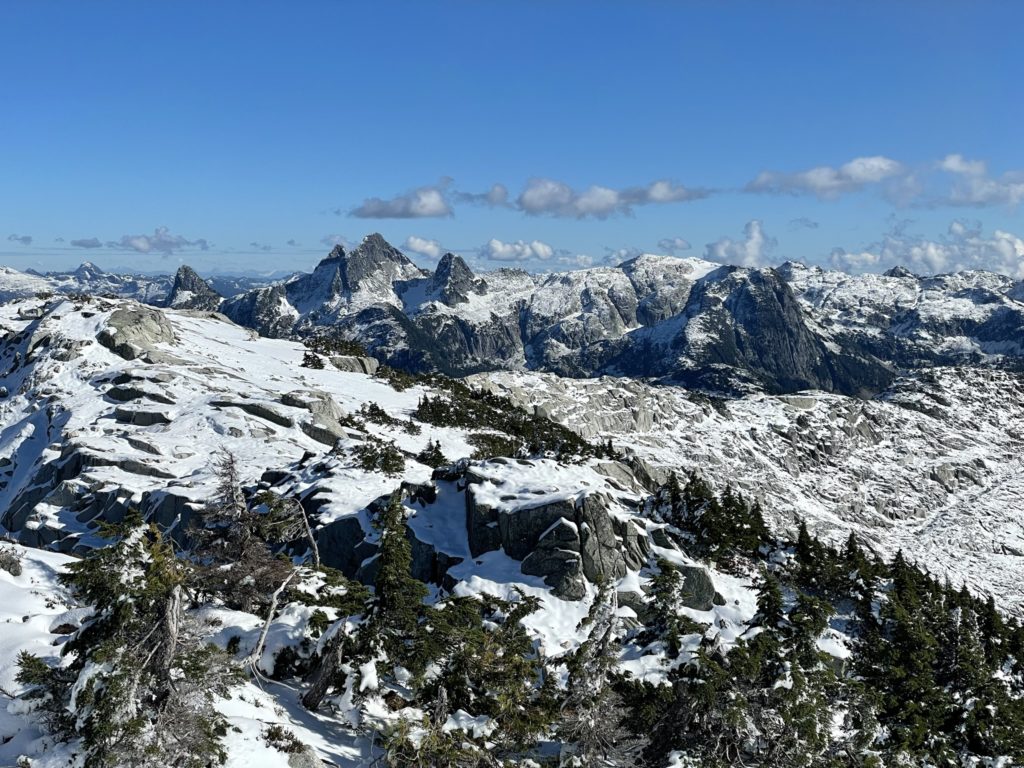
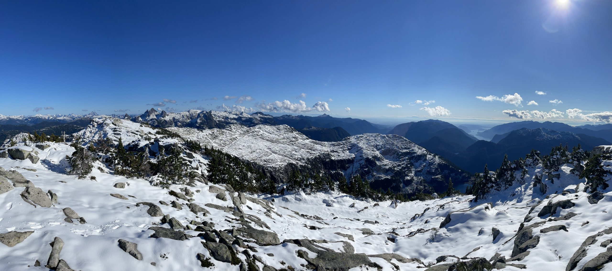
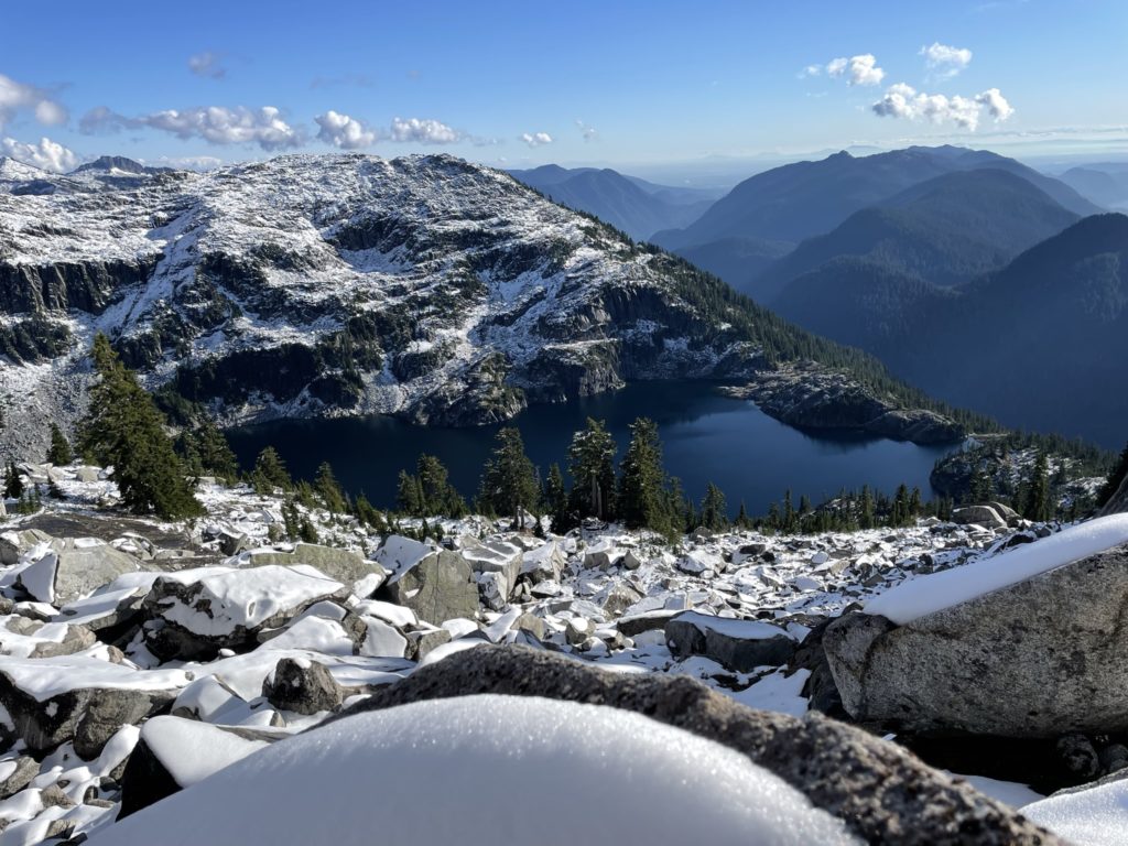
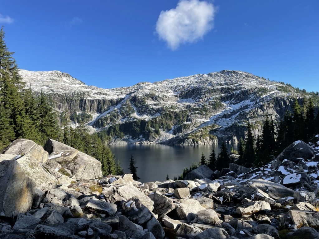
Once we popped out of the brush, I could see the entire alpine section of Mount Bonnycastle was covered in a layer of snow. I knew now, that our chance of summitting might be greatly diminished depending on the terrain we’d have to cross above. Nonetheless, we pushed on tot he the lake where Kyle and I stopped for food and absorbed the full ampitheatre views around Barnes Lake. The bushwhacking was almost worth it for that view alone.
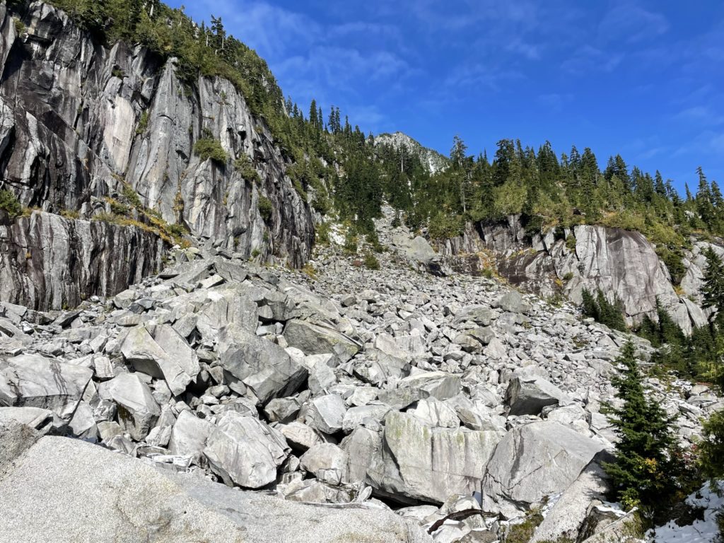
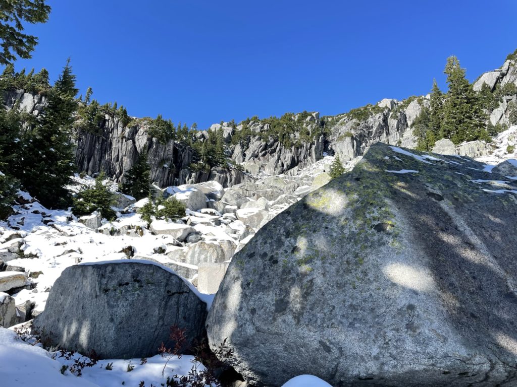
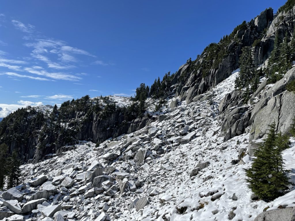
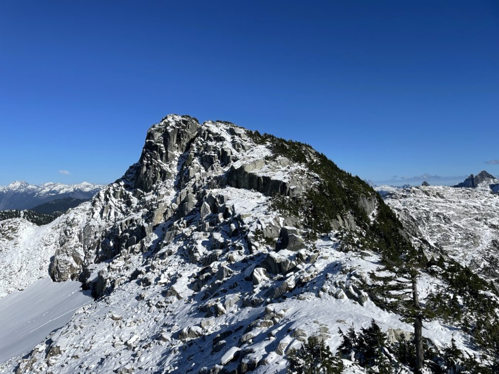
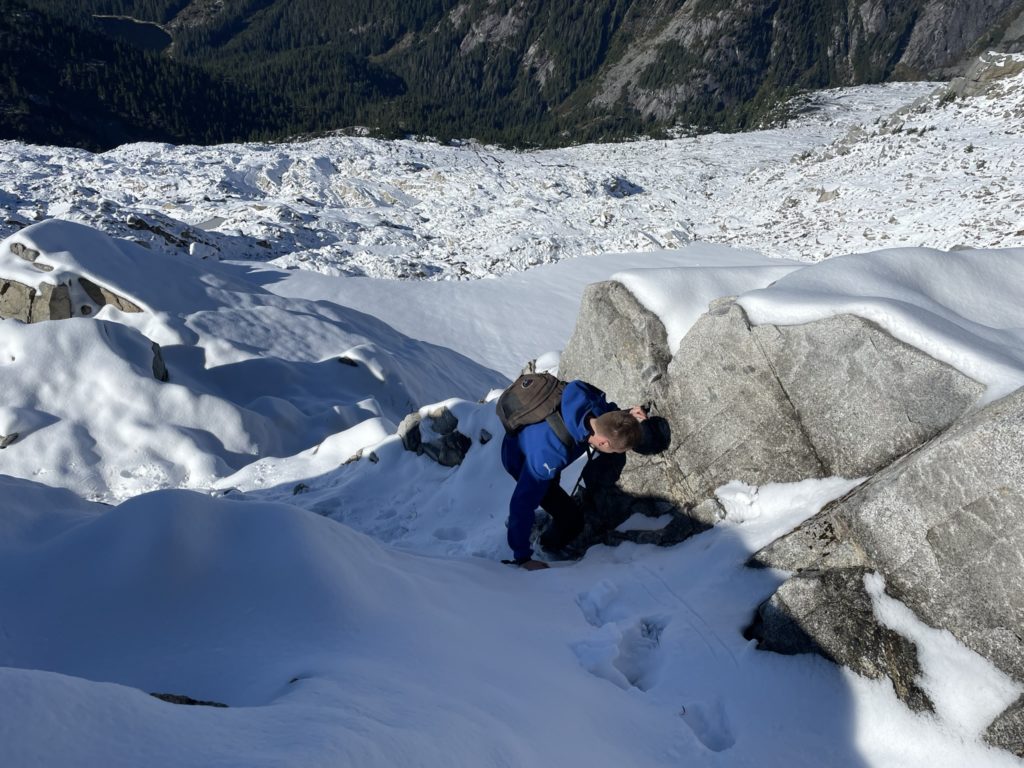
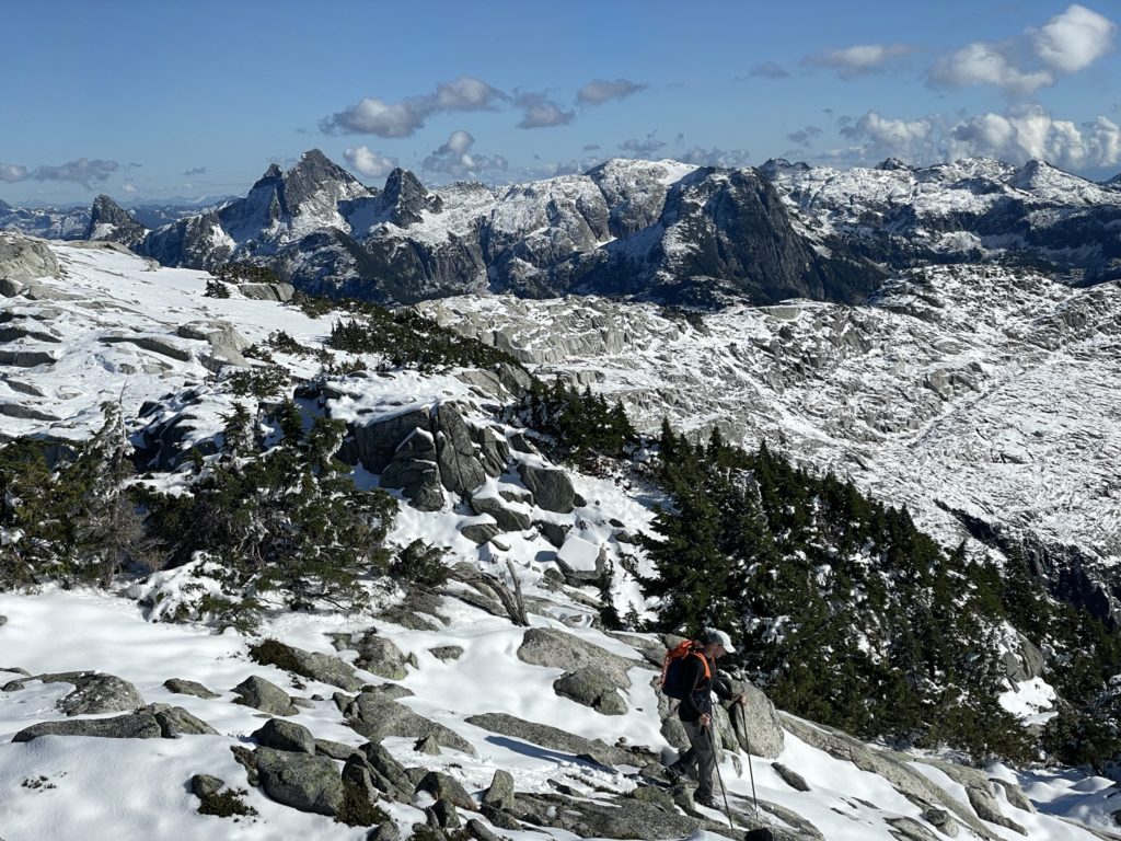
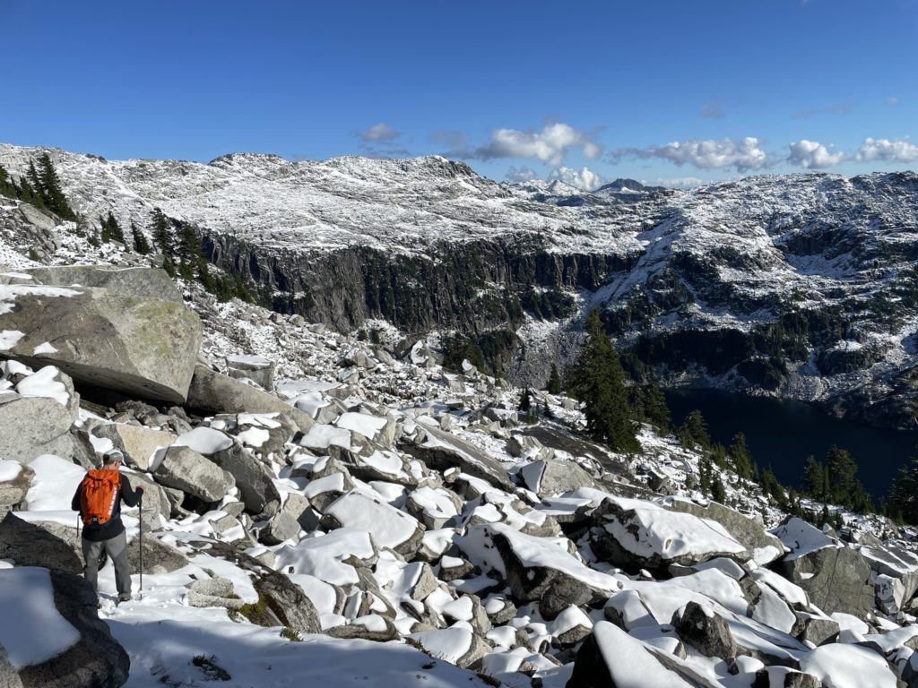
It had taken us almost 3 hours to get to the lake though, and we only had around 4 hours of day light left. So, with that, we took off almost as soon as we arrived. Instead of taking Steven’s traversing route around the entire perimeter or Barnes Lake, we headed straight for the summit. We spotted a boulder field gully that Steven had descended and marched our way over. The lower section of the gully was straight forward, but the terrain soon funneled us into a narrow slippery and steep forested section. We had to scramble up a few 3rd class steps, but eventually topped out on to a flatter section of boulders below the summit ridge. At this elevation, everything was now covered in snow and I was getting concerned we wouldn’t be able to make a fast enough descent to beat sunset.
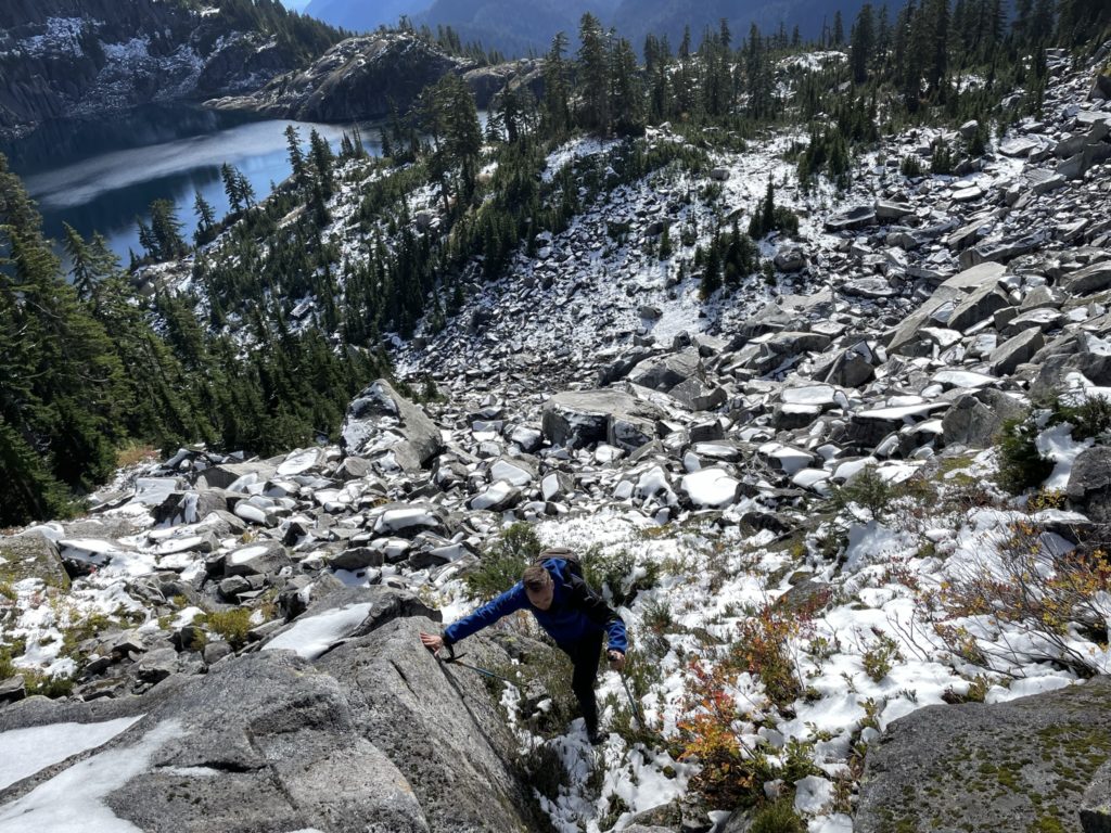
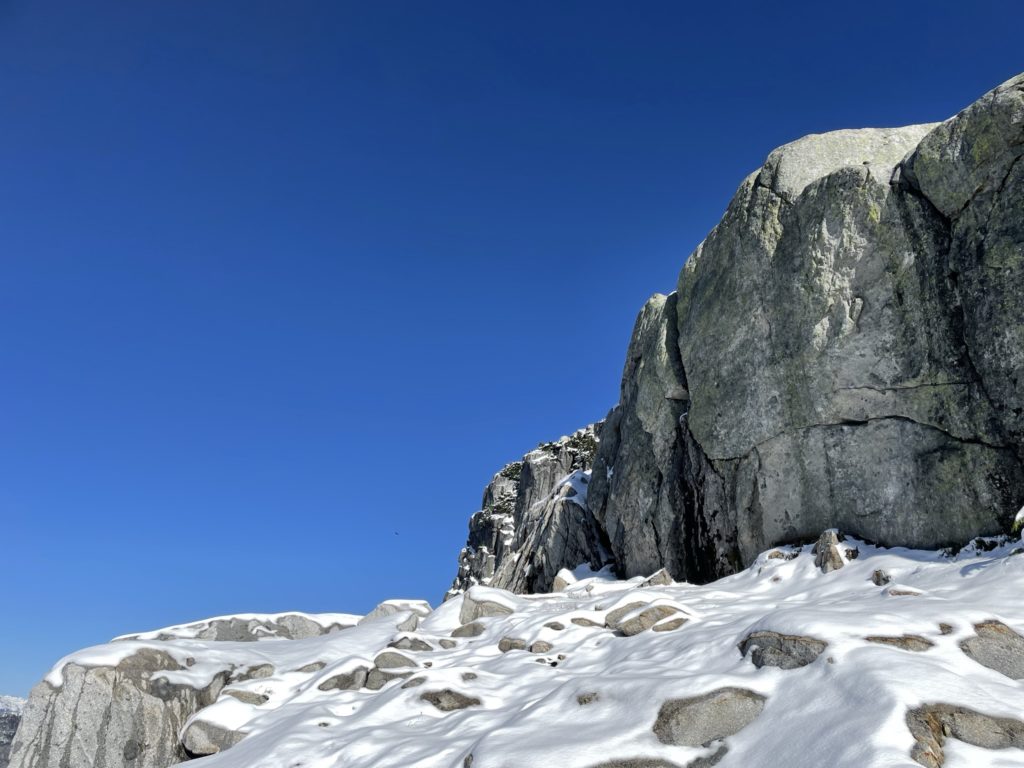
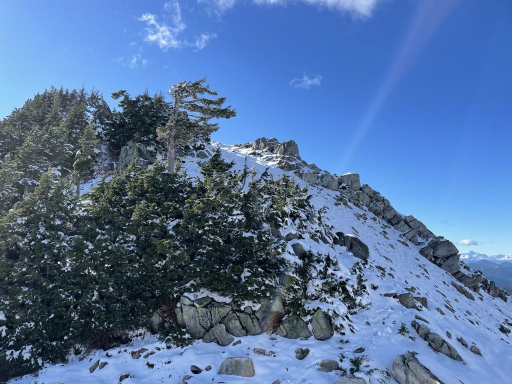
To expedite our ascent, I made an exploratory probe towards the eastern side of the boulder field to see if we could bypass part of the summit ridge. We made it up to about 1570m and still couldn’t spot a line up, so made the time consuming traverse towards a bench that would lead us back on to Steven’s route. From the bench it was quite easy to gain the ridge where the snow was about 5-6 inches deep in places. We continued up to a high point on the ridge and then descended down to the base of the summit block. At the base, we traversed on the north side until we found a snowy chute that we could scramble up. Then it’s a bit of bootpacking to mellower terrain. From there it was a short walk to the summit.
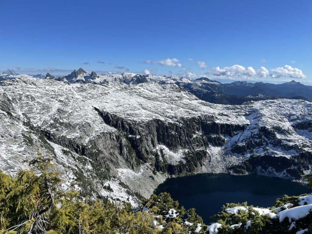
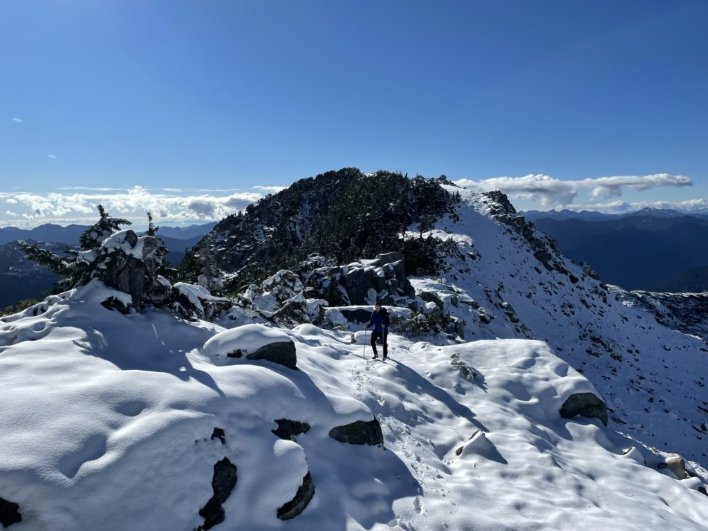

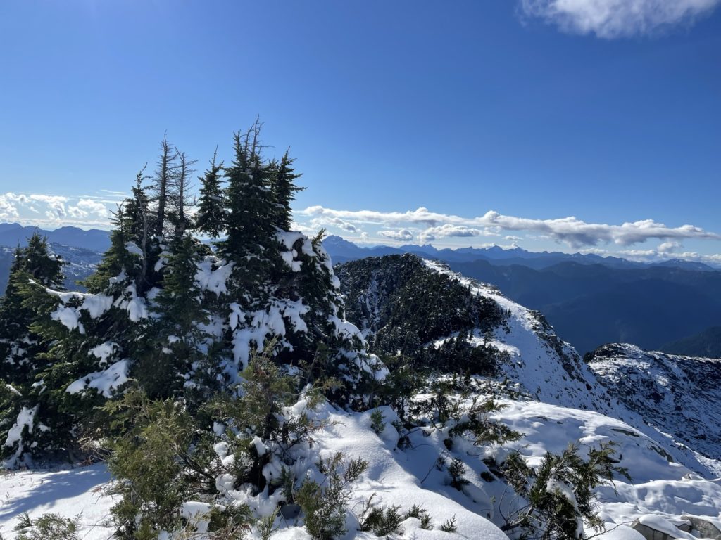
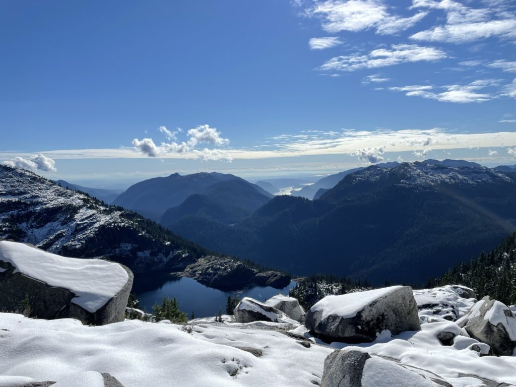
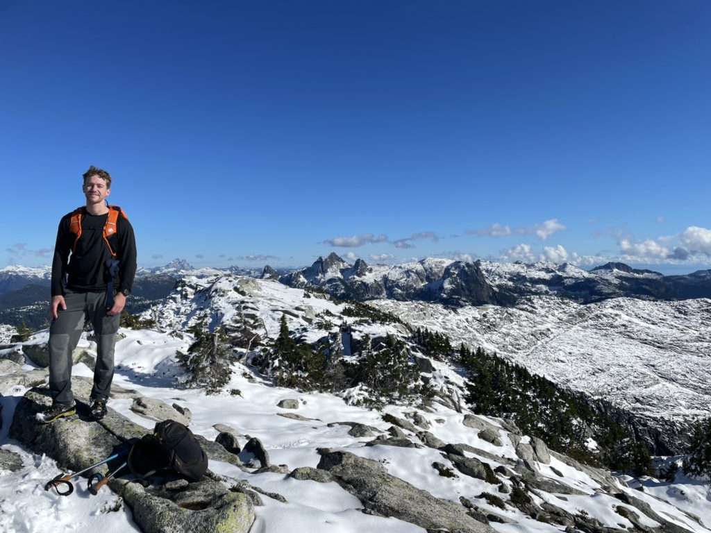
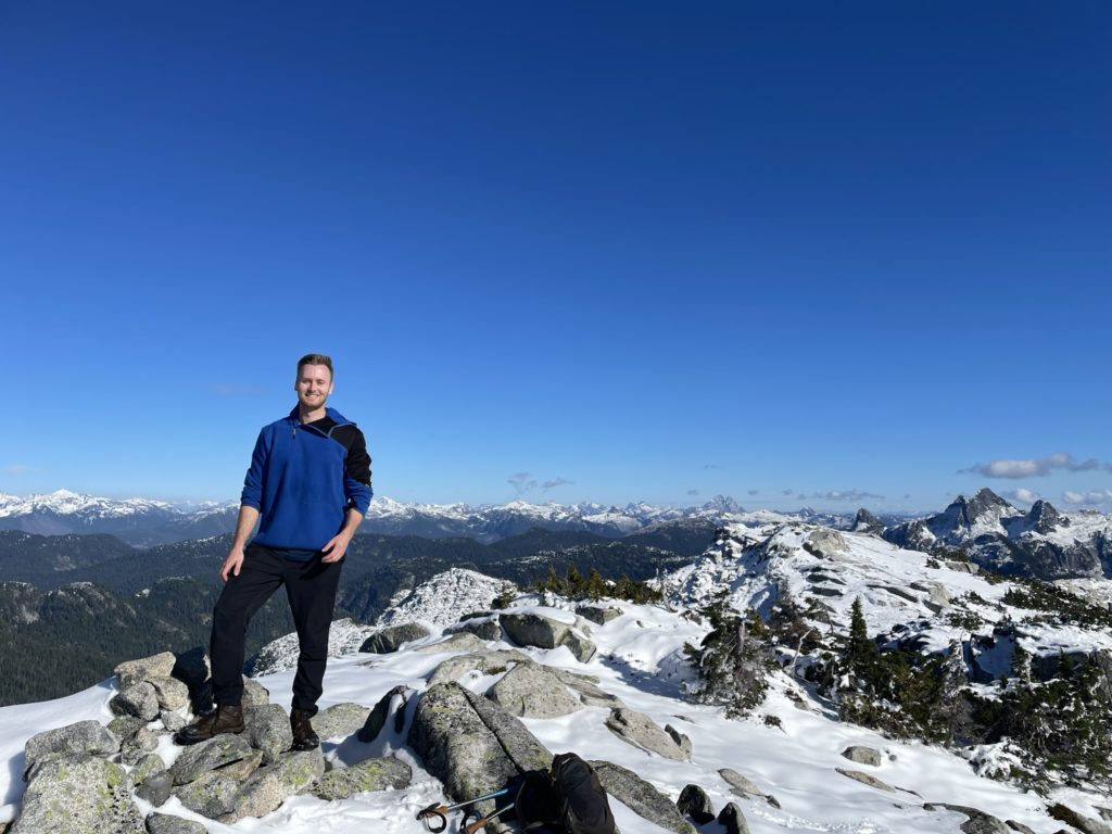
The views at the summit were phenomenal, but we couldn’t linger for long. We now had 3 hours until summit and it had taken us almost 4 to reach the top. We reversed our tracks down the summit block and chute and then continued over the ridge. Then we descended down the upper boulder field and changed course in the narrow forested section to see if we could bypass the crappier terrain. Unfortunately, we had no such luck and had to descend a wet 3rd class slab section and incredibly slippery brush and grass. Finally, we made it to the lower boulder section and picked our way down.
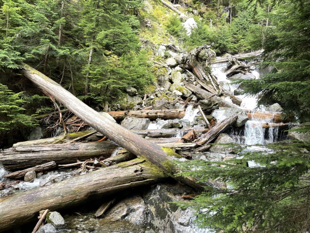
Instead of going to the lake, we bee-lined for our ascent track lower down and rejoined with it. I had to consult my GPS regularly to get us back through our safe ascent line. The brush was just as terrible on the way up as down, but we eventually reached the more open section in the forest above the waterfall. The descent to the creek crossing was uneventful, but at the waterfall we were met with a golden hour view of water cascading down the rocky terrain. No time to pause though, as we wanted to be out of the forest before dark.
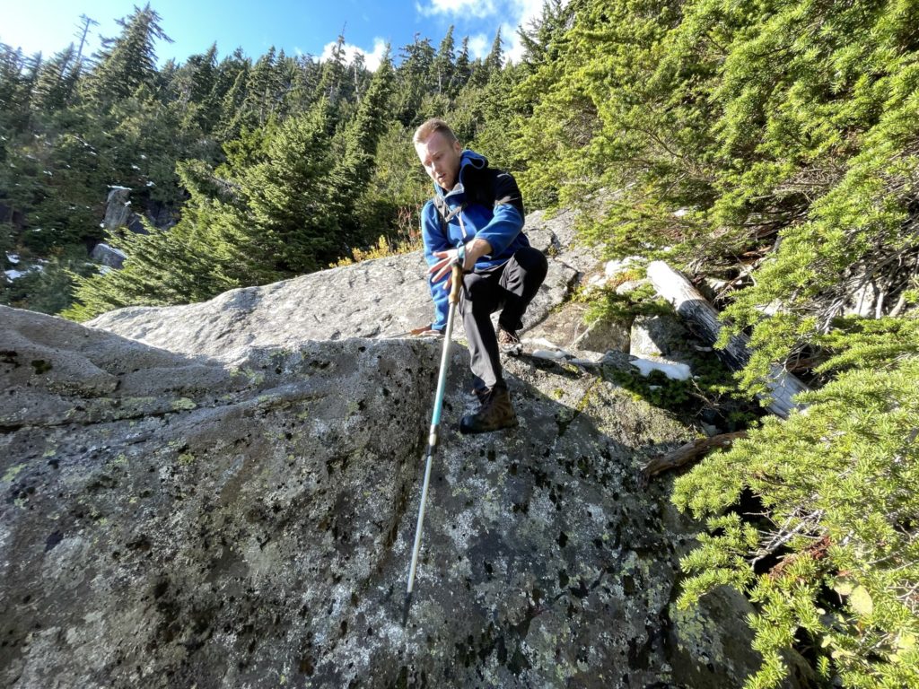
After the creek crossing, I had a harder time maintaining our ascent track and we had to make a few course corrections along the way. Eventually, we reached the key ramp up the bluffs near the road and started our down climb. It was even sketchier feeling coming down, so we took our time. From the ramp, we took the last dense section of bushwhack full on. It was almost dark and I kept running my face into branches, but we soon spotted an opening and finally walked out on to the road.
At long last we were back and just in time too. The adventure didn’t stop here though. My tire was now deflated down to 6 PSI and didn’t look like it was going to hold. No issue, I thought, we’ll put the spare on as planned. Kyle and I got to work, setting up the jack and then I went to loosen the first nut. The wrench slipped without any bite and I looked down, puzzled. My heart sank when I saw it was a lock nut… and I had no key for it. Now we were pretty screwed. The tire still had some air though, so the only choice we had was to try and limp the vehicle ~39km down rough service roads to Squamish. We loaded up and started the journey. I made sure not to exceed 10km/h in the hopes of maintaining enough tire pressure. Slowly but surely, we eased our way down to the bottom of Hixon Creek FSR and turned on to Indian Creek FSR. It was going to take at least 3-4 hours to get back to Squamish at this rate, but at least we were moving.
Somewhere around kilometer 26 on Indian Creek FSR our fortune turned. A group of three off roaders were heading our way and I managed to flag them down. Sure enough, one of them had an air compressor and we were able to re-inflate the tire up to full pressure. Kyle and I gave our heartfelt thanks and then hit the gas back up to a normal speed. I watched the tire pressure, but it only dropped 3-4 PSI by the time we reached Squamish. I filled up the tire one more time at the gas station and then we drove back home without any further events.
While it was a costly day, with a punctured tire and lost phone, it was 100% worth it. Mount Bonnycastle was everything I hoped for and I was super pleased to have finally summitted it. Near the top, I was questioning turning back, but Kyle convinced me otherwise and for that I am very thankful. I would suggest this summit for anyone looking for something remote with big views. A 4×4 high clearance vehicle is a must however and be sure you can take your tire off in case of an emergency 😀 .
We actually found a phone below Barnes Lake (Aug 5, 2023).