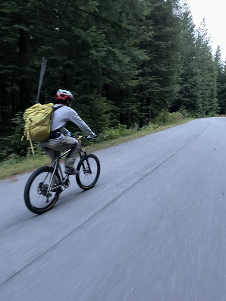
Note: stats include the bike ride (~26km + 500m elevation gain) and all 4 peaks
Elevation Gain: 2,946m
Distance: 44.91km
Total Time: 14 hours 2 minutes
Date: September 21st, 2021
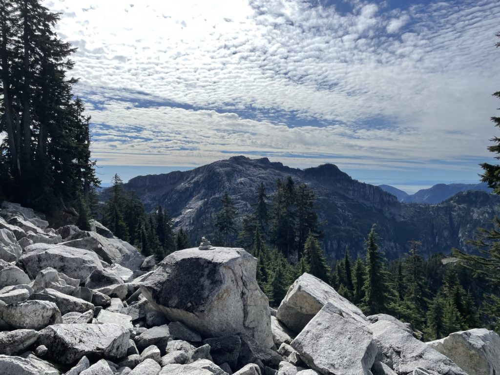
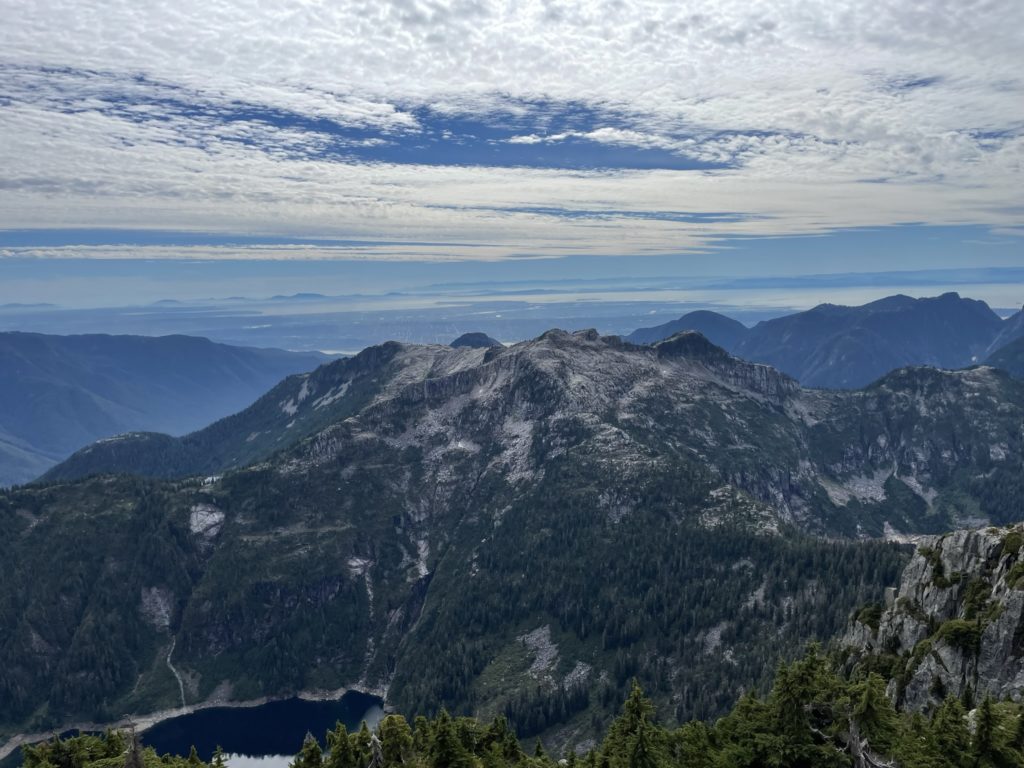
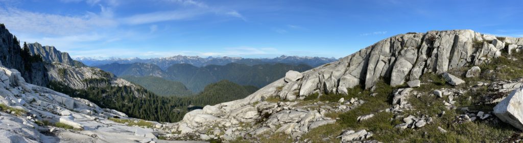
Considered by many to be the prize of the North Shore, Cathedral Mountain is mountain that needs few introductions. To reach it, one requires a 12km bike ride, 10km of hiking and over 2000m of elevation gain just to access the summit. Then you must retrace the ~22km of route in the reverse to get back to the trail head. Adding to that, the summit falls in between the Capilano and Seymour watersheds, muddying the legality of even attempting it. Historically, anyone climbing Cathedral would either do so in secret or provide obfuscated trip reports to mask their presence. It seems these days, attitudes have relaxed and many people reach the summit each year.
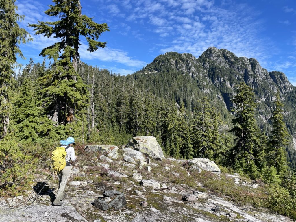
Steven had invited me along to do Cathedral Mountain in a single push for a nice weather window mid-week. I had heard plenty about this mountain, but didn’t fully grasp how long of an approach it actually was. We had just reached the summit of Mount Burwell, after a long hike up to Paton Peak and Coliseum Mountain. It was now 10:40am and we already been traveling for 5 hours and were yet to reach the summit. What stood before us was a discouraging 400m descent to the Cathedral Burwell col and then a 600m ascent up the south western ridge to gain the summit. Round trip back to Mount Burwell was also nearly 6km, so despite how close it looked the route was very foreshortening.
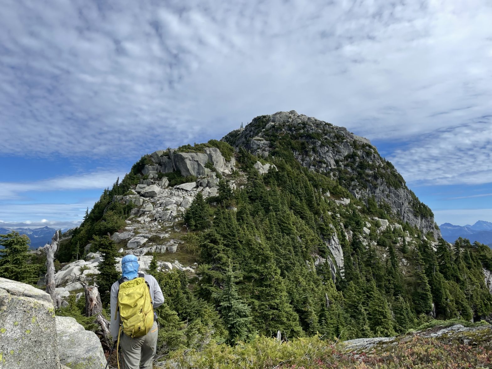
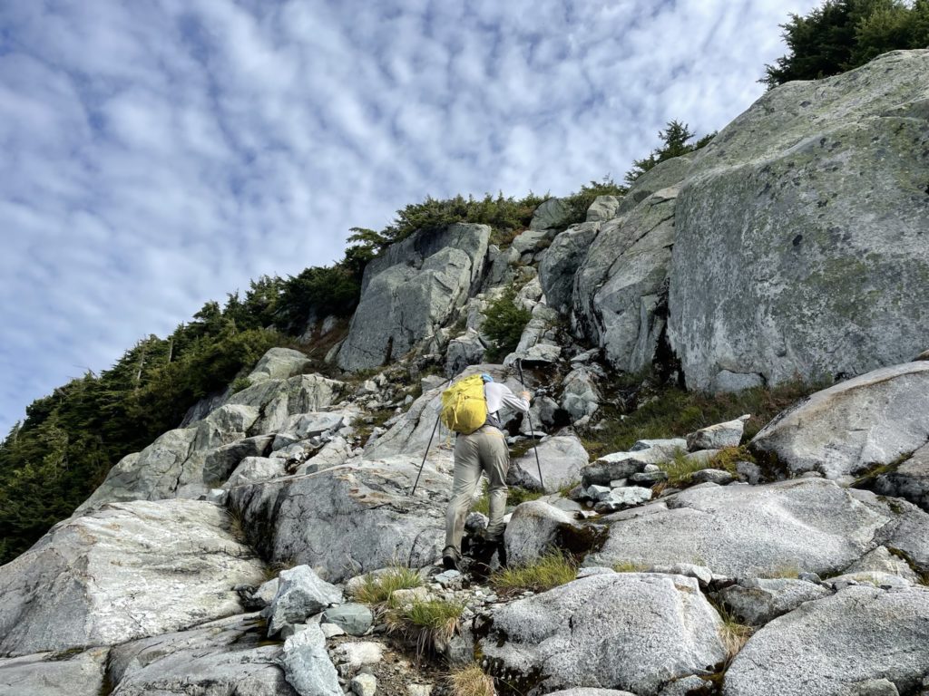
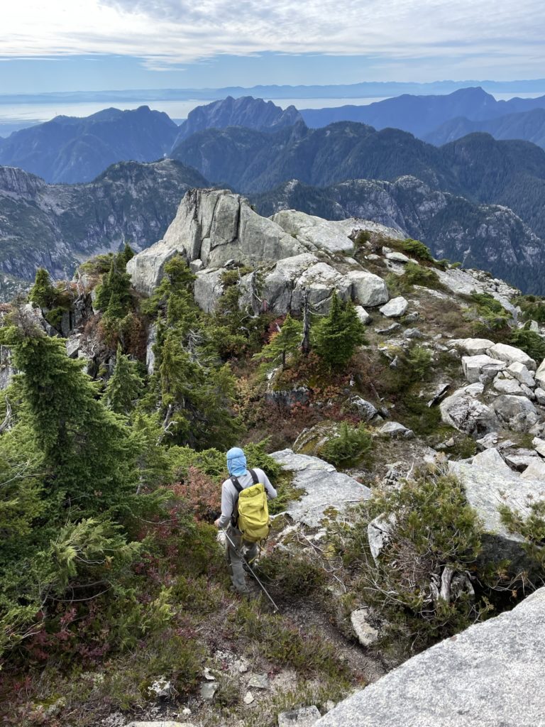
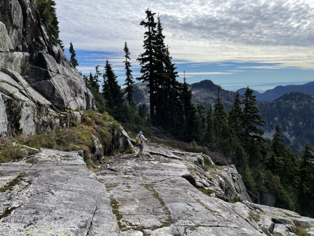
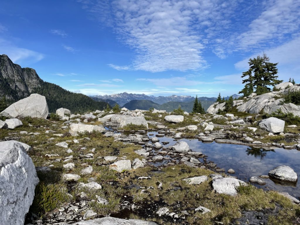
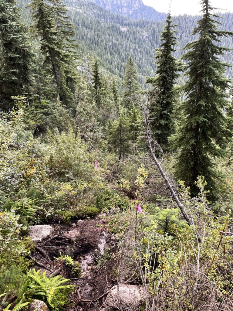
With lots of daylight left, Steven and I began the route down Mount Burwell’s northern ridge line. Not far from the summit we started to encounter lots of micro terrain created by the carved out granite steps from a bygone glacier. We navigated the upper ridge line easily enough, but eventually got cliffed out around 1380m. Here we had to descend further west to reach a ramp which ended up being the route marked by cairns. Once on the real route again, we hopped from cairn to cairn until we reached the col.
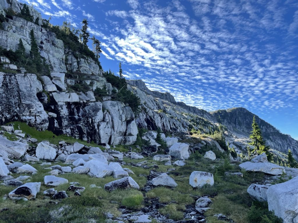
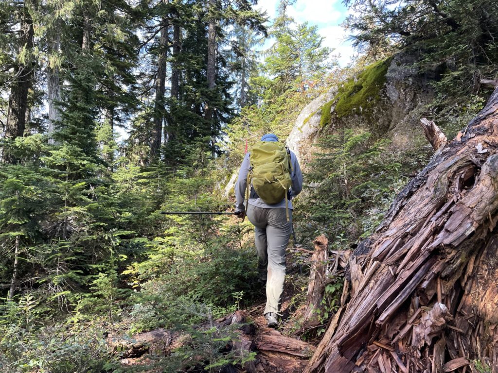
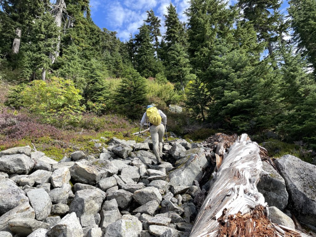
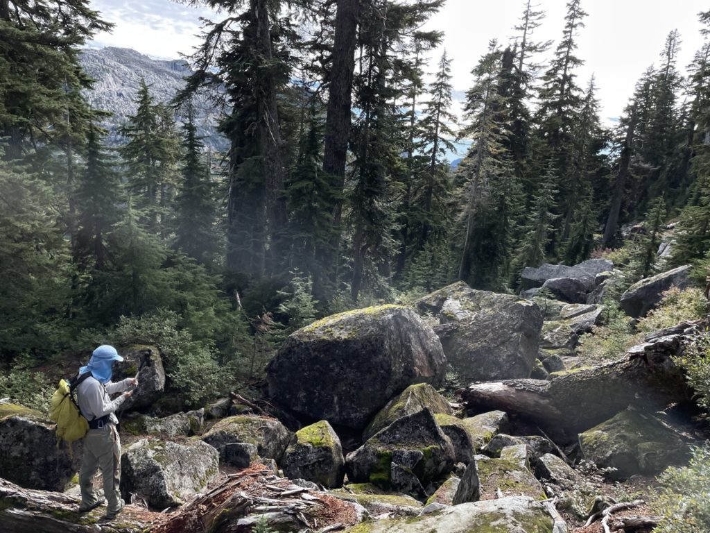
From the col, we pushed a small ways up into the lower forested ridge of Cathedral Mountain and then paused for some food. Here we ditched as much weight and gear as we could and then agreed on making the remaining 500m ascent in a single push. From this break point, we continued up through the woods and then hit a small boulder field that traversed a ways horizontally across the ridge. Then it’s back to ascending up through the forest. We ended up a bit off course at one point, getting further west than we should have, but a short bushwhack lead us back on to the trail.
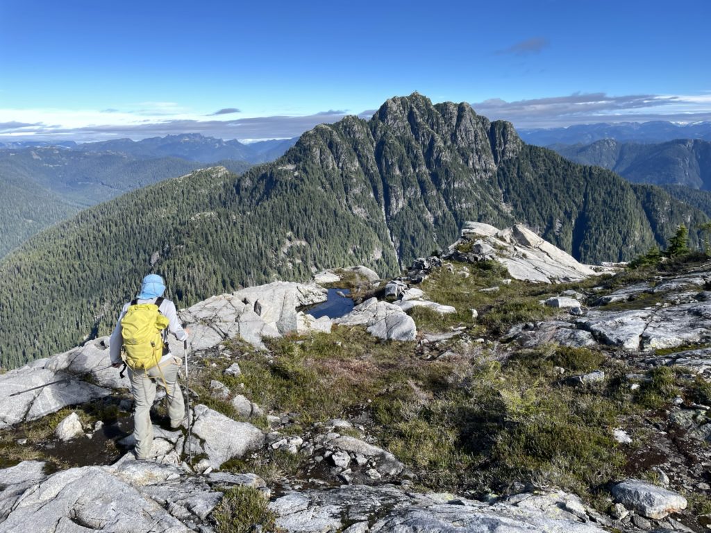
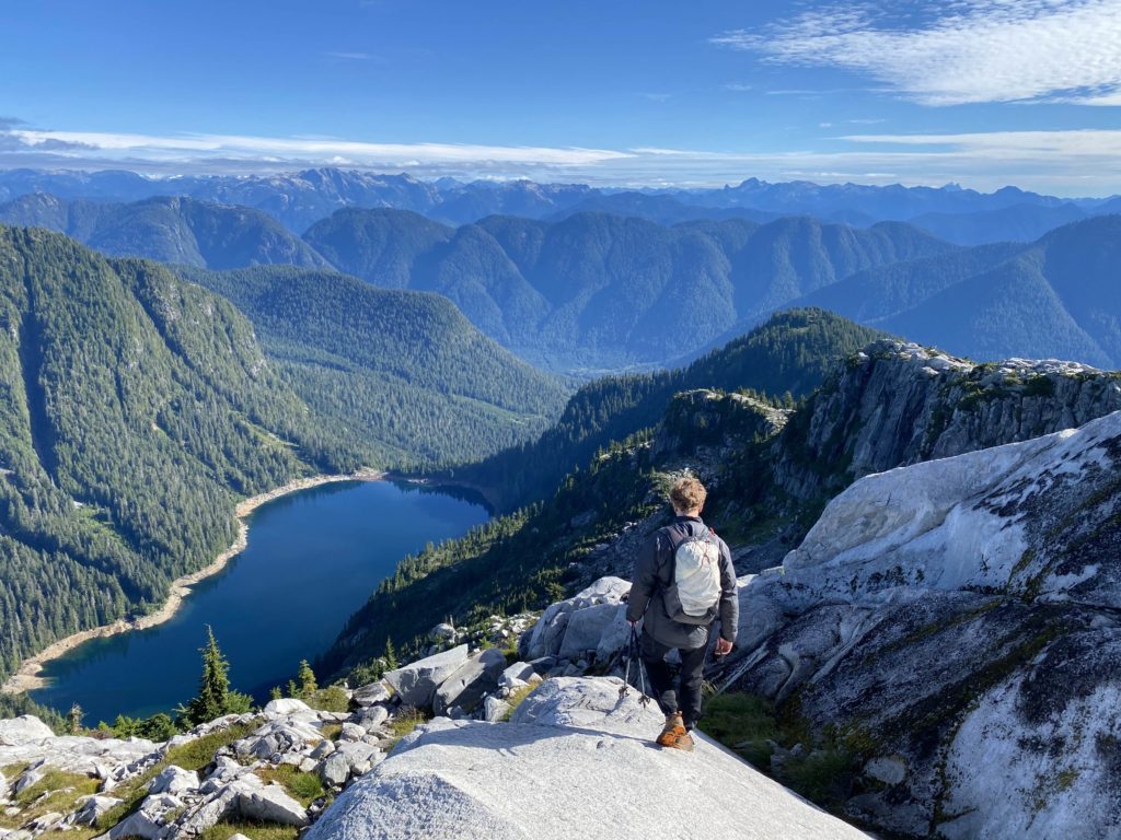
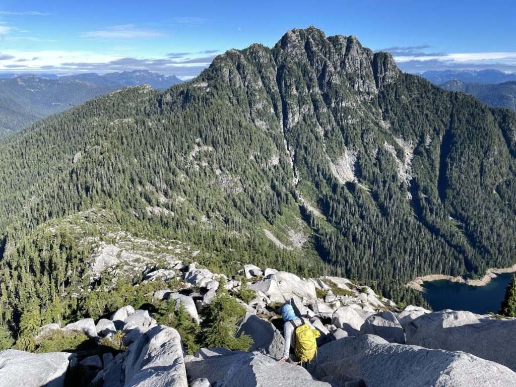
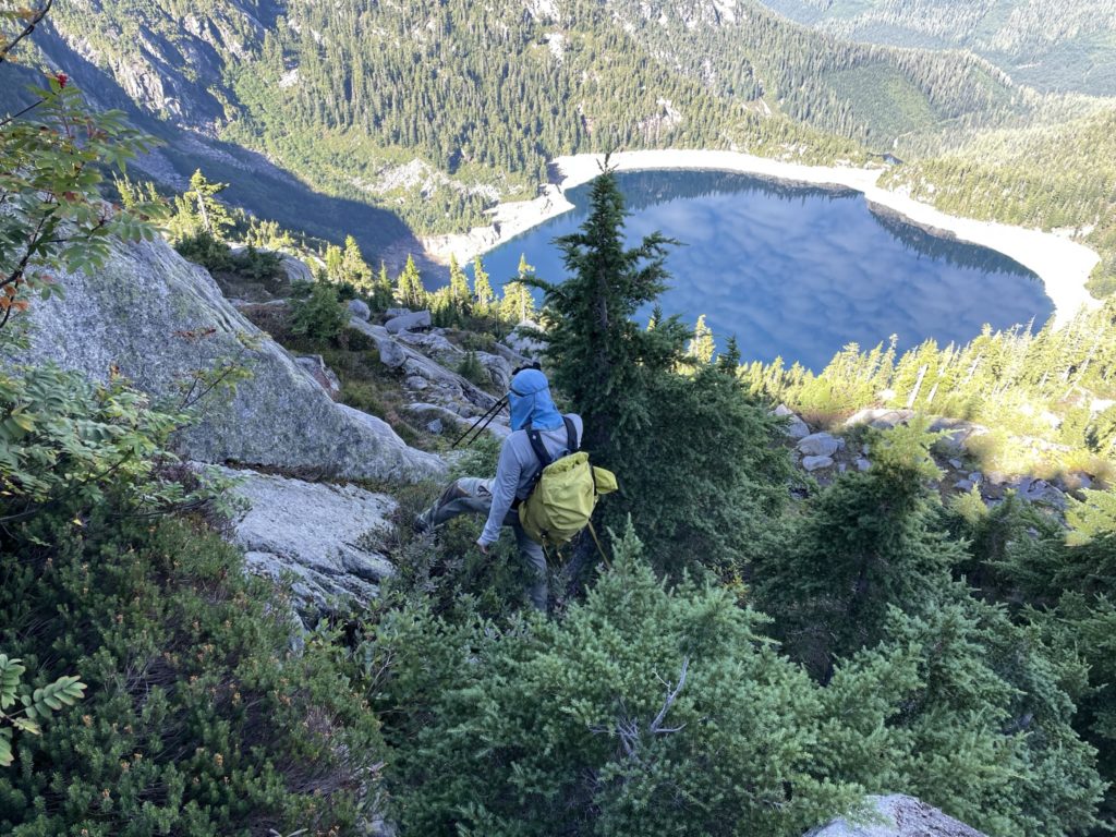
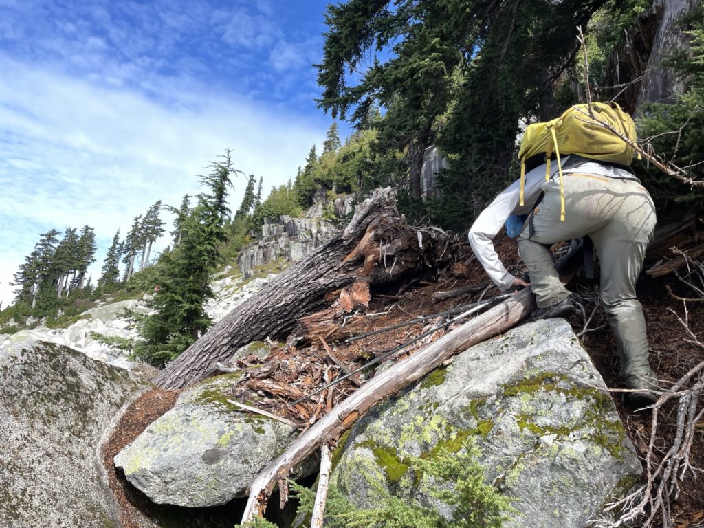
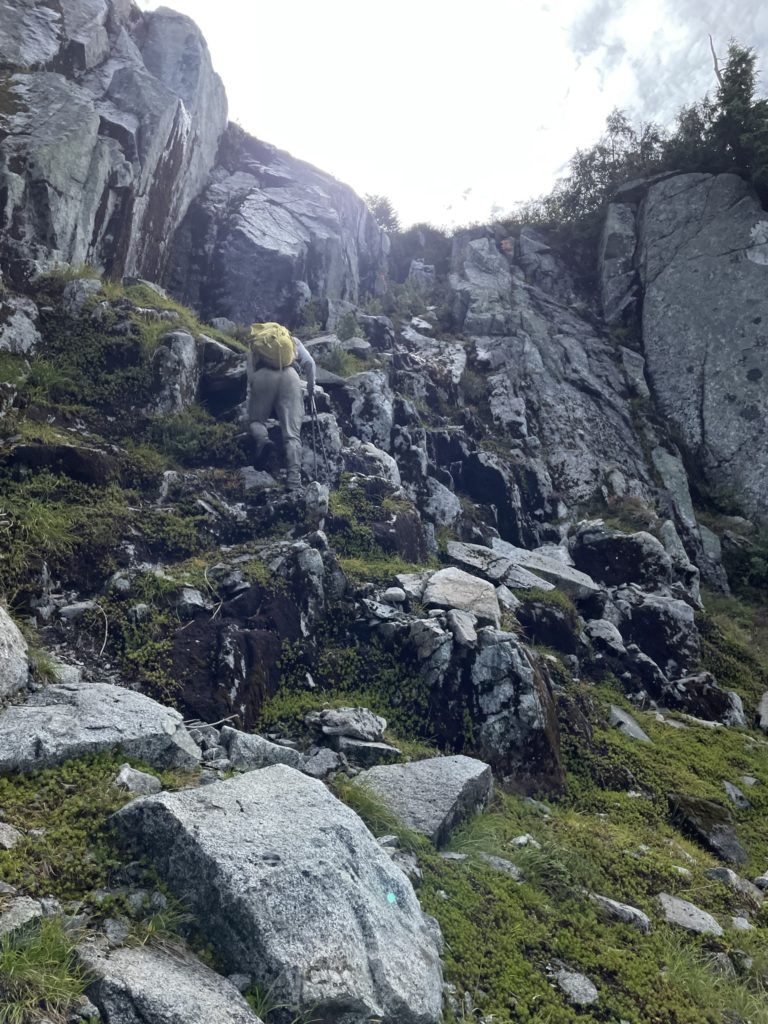
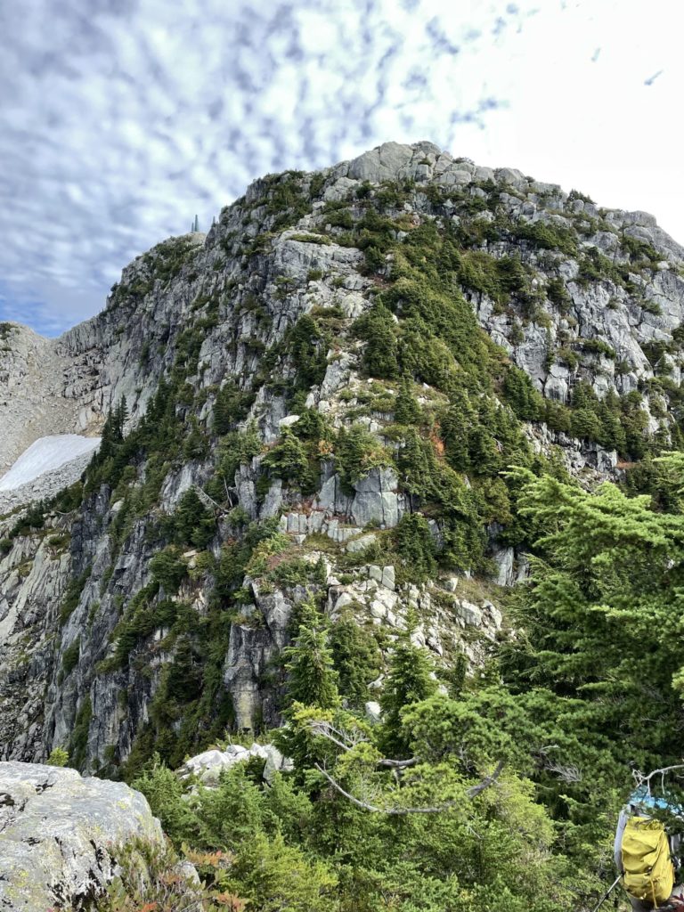
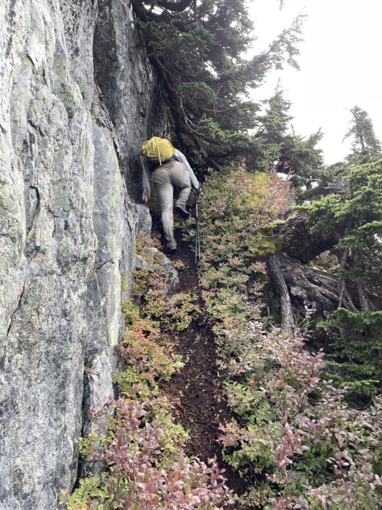
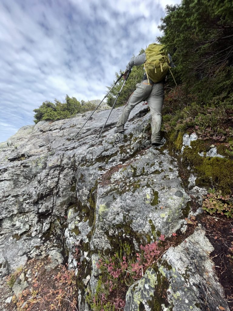
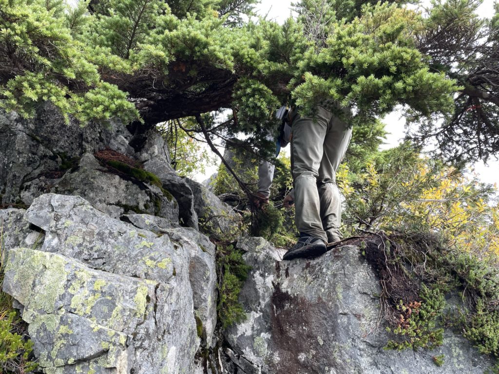
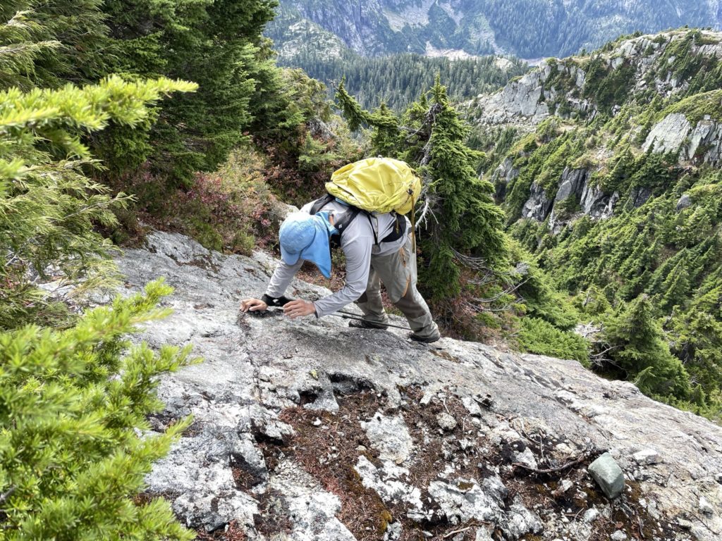
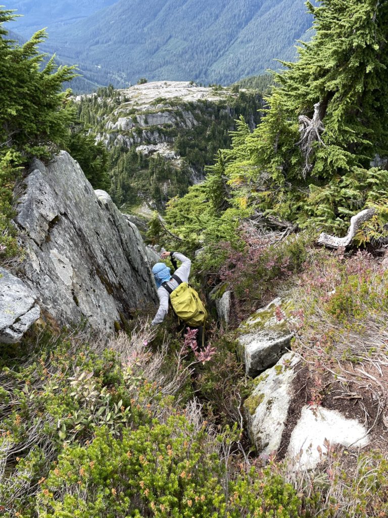
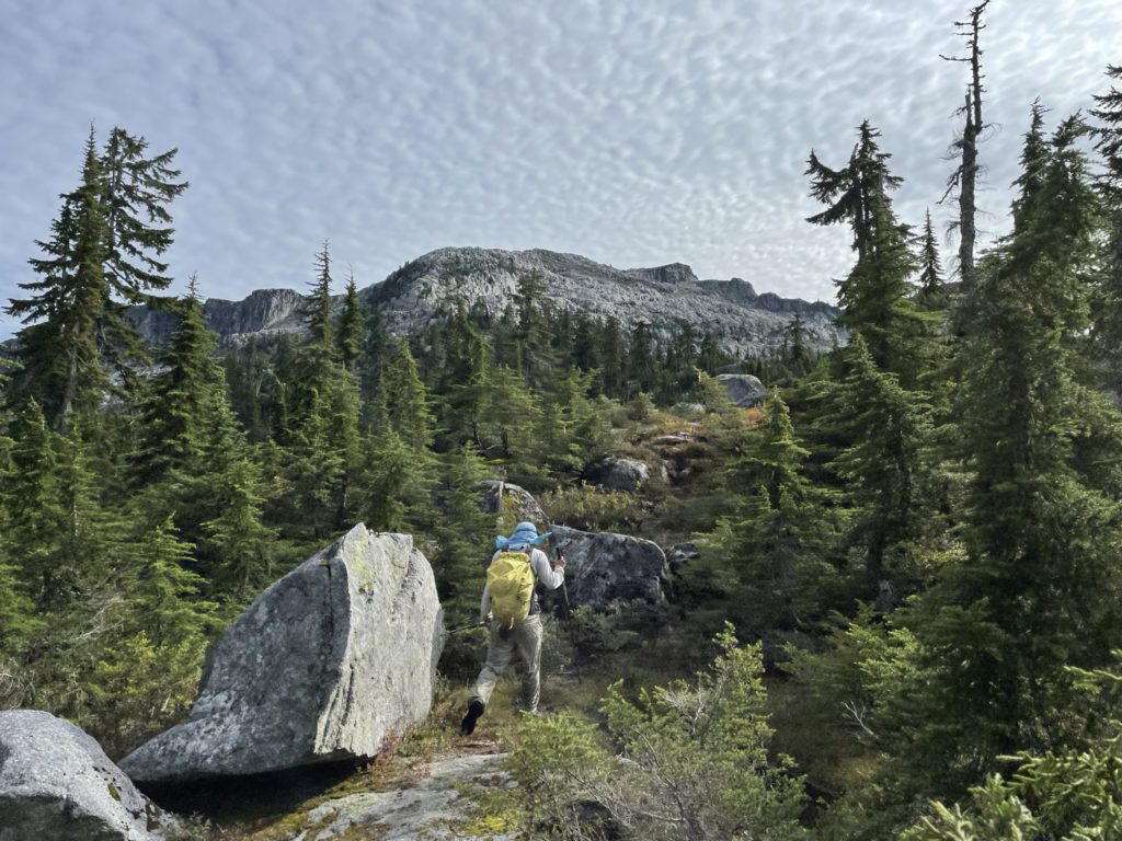
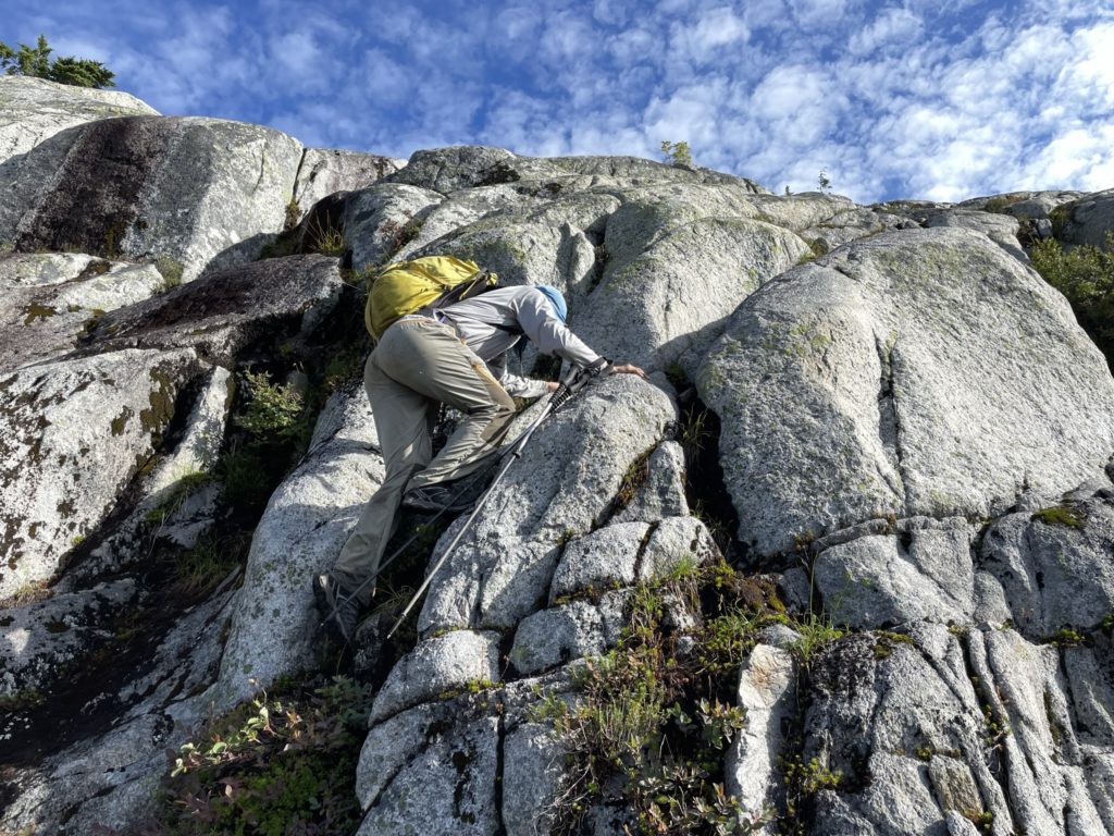
After this section was an open boulder field on the south side with that we traversed diagonally up until we came under a cliff band on the south western side. Here we scrambled up a few steep and narrow sections before topping out on the shoulder of Cathedral Mountain. From the shoulder we had to climb up another short roll and then descend to small connecting ridge between shoulder and the steep face to the summit. Ahead of the short ridge was a steep, vegetated cliff face that we would need to ascend to reach the summit. This section had a nice 3rd class step to start off, but was protected by dense bushes. After the step was more steep ascending up 2nd class terrain until we reached a series of wet sloping slabs. Thankfully the slabs had ample positive foot holds and a vege belay to work with. We made it over this section without incident and then topped out on the summit ridge. Somewhere along the way, I lost one of my poles and took a a terrible mental note of where it was before continuing on.
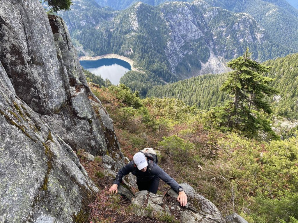

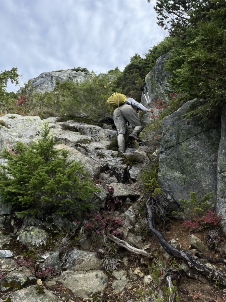
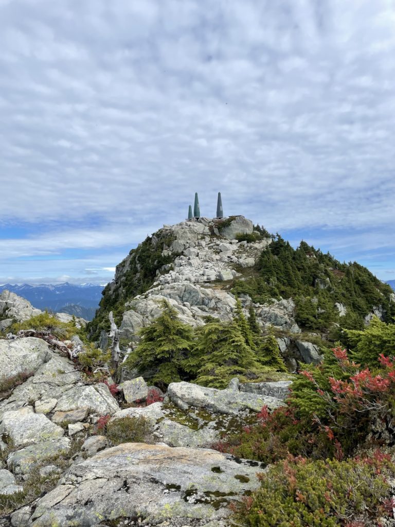
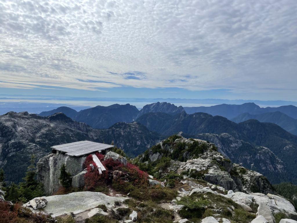
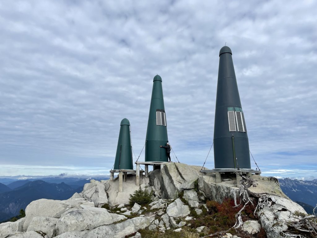
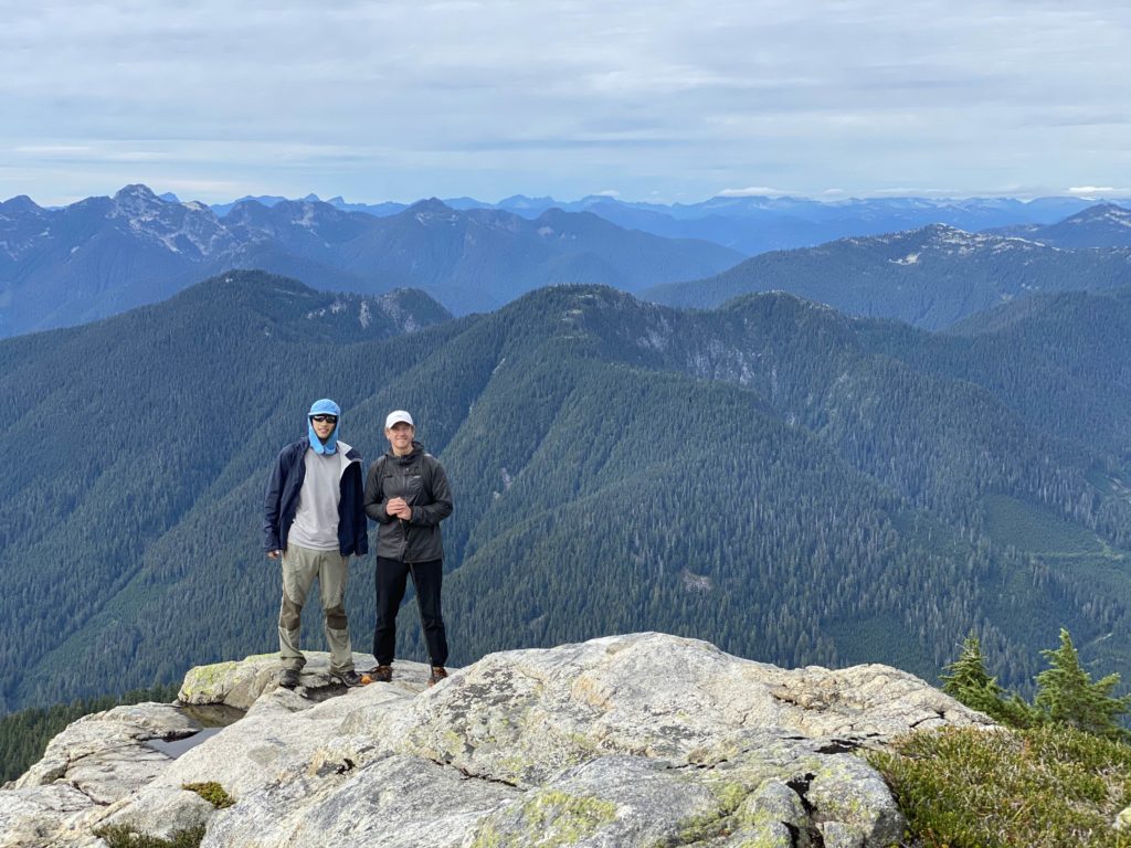
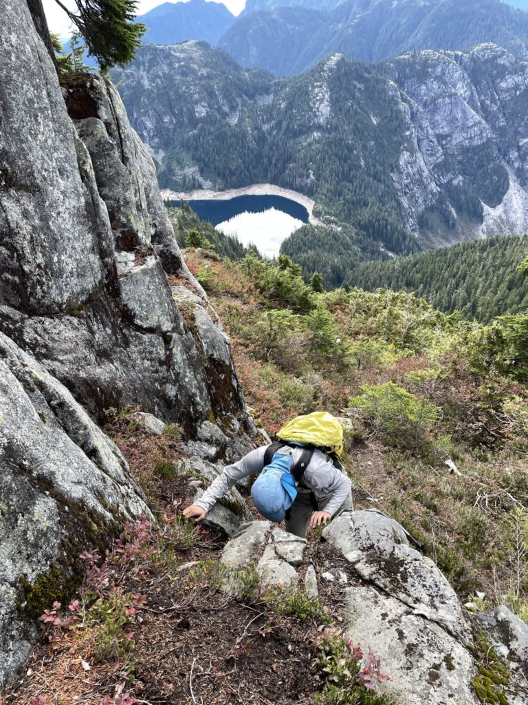
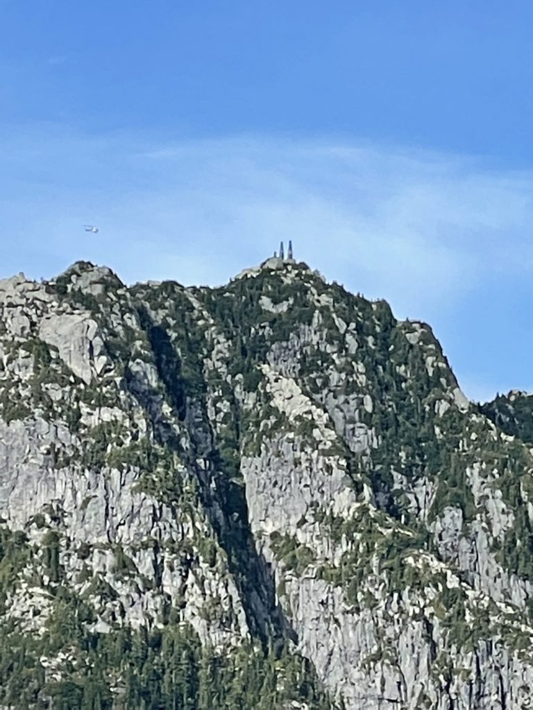
Now at the summit ridge there was one more minor drop to a narrow ridge and then 3rd class step but the summit was clearly in sight. We reached the top a few minutes later and took a break at long last. It was 1pm at the summit now, taking us a grand total of 7 hours and 15 minutes to reach what was effectively the half-way point in our route. The weather was fantastic and we spent a fair bit of time sitting on one of the radio repeater platforms, drying out our shoes and snacking.
At around 1:30 we decided it’s time to get on our way and began our descent down. I was keeping my eyes open for my missing pole, but after descending part way down the steep summit slope I still hadn’t seen it. I told Steven I was going to do a quick search and then dashed up our descent route to see if I could find it. I had no luck and figured it must have been further down that I lost it. We continued down to the wet slab section and with a bit of cursing we made it down fine. Then nearly at the col, I was getting more certain that the lost pole was now above us. I had an internal debate about leaving it, to avoid re-ascending all that terrain, but finally resolved to look for it. I asked Steven if, in any of the photos, he had seen me with two poles and sure enough I was still holding two poles on the wet slab section. So, I ran back up covering all the same terrain again, but this time following the ascent track more closely. Just before the top I located the pole! Feeling much better about the day now, I descended the face below the summit for a third time and rejoined with Steven at the western shoulder of Cathedral.
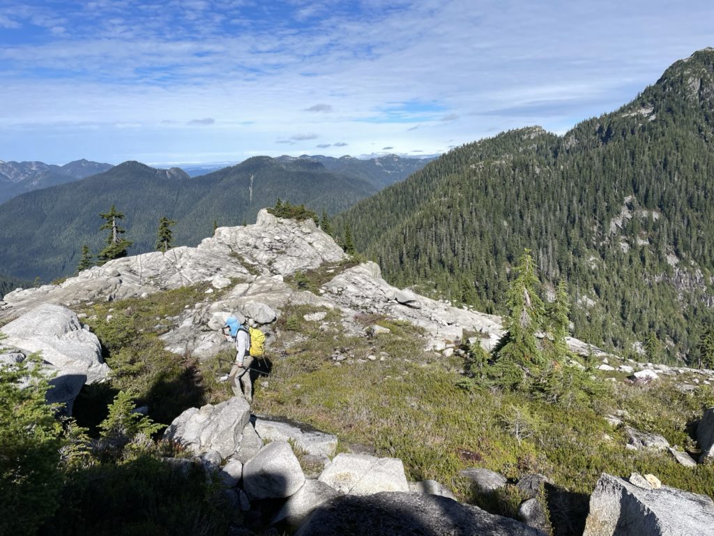
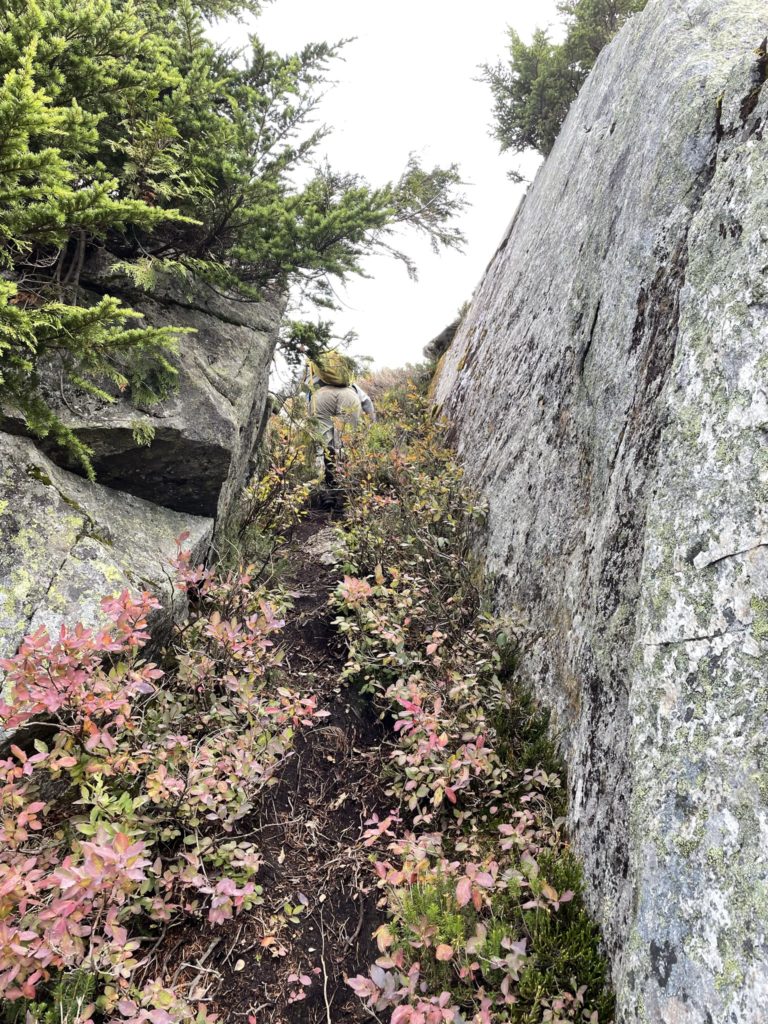
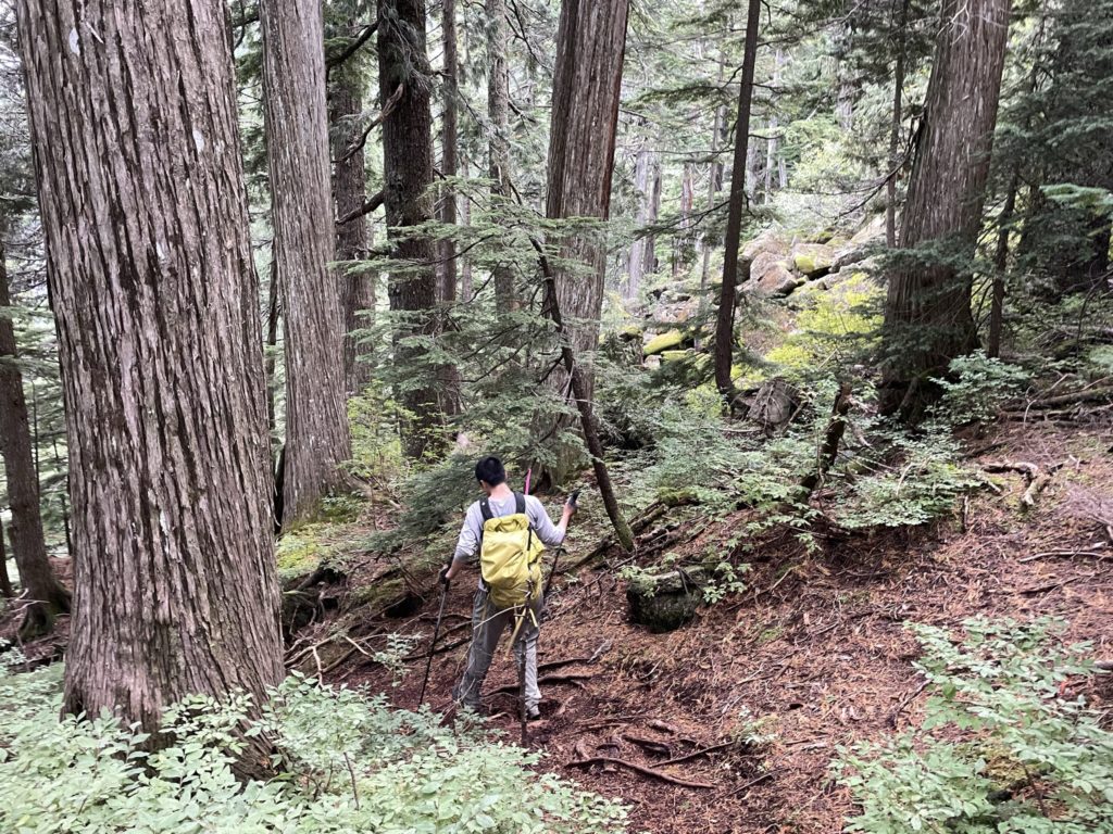
Now we retraced our steps down a short gully to the western boulder field and continued through the straightforward trail through the lower ridge. We found our gear where we left it and stopped again for more food. With some food to fuel us we got back on our feet and started the long ridge line ascent up to Mount Burwell. Going back up was much easier than descending but I was starting to gas out now. Around half way up the ridge, we had a discussion about tagging “West Burwell”, but neither of us felt strongly about grabbing the unofficial bump west of Mount Burwell. So with that, we continued up the ridge bypassing our descent ramp by scrambling straight some 3rd class steps.
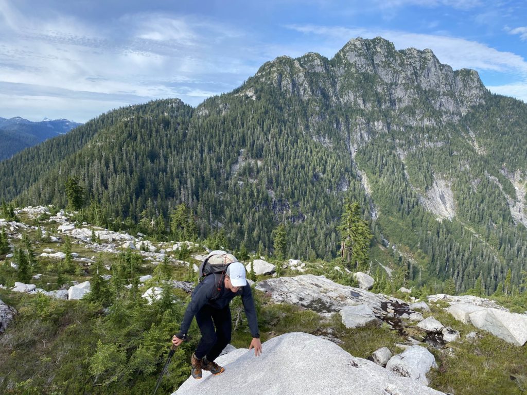
After what felt like a very long time we crested over the ridge to Mount Burwell. I went from getting gassed to just flat out deflated and had to stop for some water and food. I regained my composure and then we continued along an altered path to bypass the summit of Mount Burwell. This allowed us to avoid any unnecessary elevation gain and head more directly for Coliseum Mountain. It was ~4:30pm by the time we reached this bypass and the sun was going to be setting in the next few hours.
Not wanting to get caught in the dark on the steep descent from Paton, we pushed on towards Coliseum and then stopped for one last food break. After this point, it was a long push down to the bikes. Descending the trail from Paton Peak proved to be a bit treacherous with all the slippery routes and rocks. More than once I took a spill, but recovered quickly. This descent lasted forever, but there’s nothing to be said as it’s just a matter of putting one foot in front of the other.
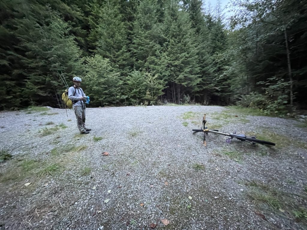
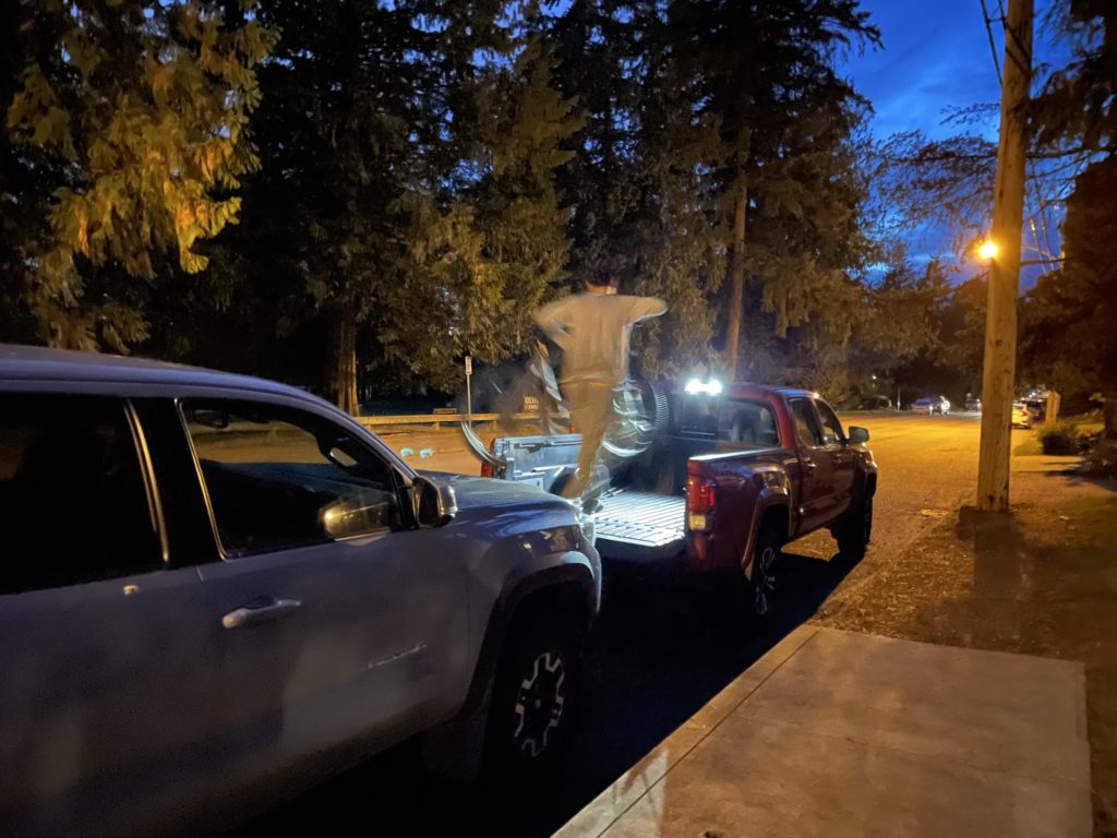
By 7pm we were once again rejoined with the bikes. We had a bit more food and then began the ~12km bike ride back to the trucks. Most of the way back was down hill and was very thankful for that. Perhaps 3/4 of the way down it was dark enough to warrant head lamps, but our eyes adjusted well enough and we made it all the way to the trucks without them. There was one short detour at the end when I passed the turn off for the parking and we had to bike back a block. But with all of that, we made it to the trucks for around 7:45pm. A total of 14 hours car to car.
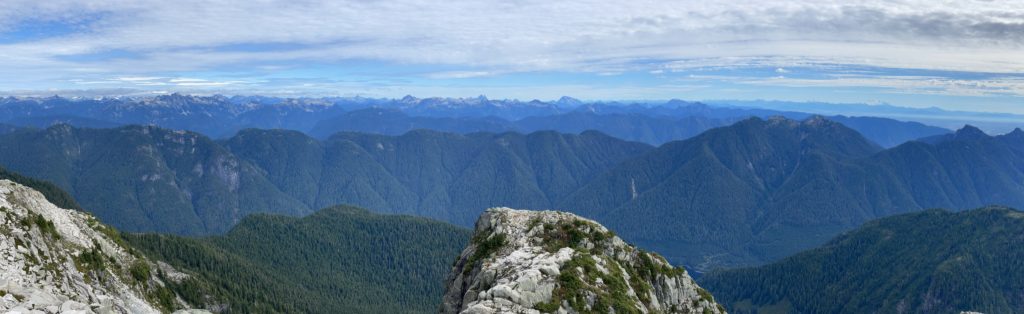
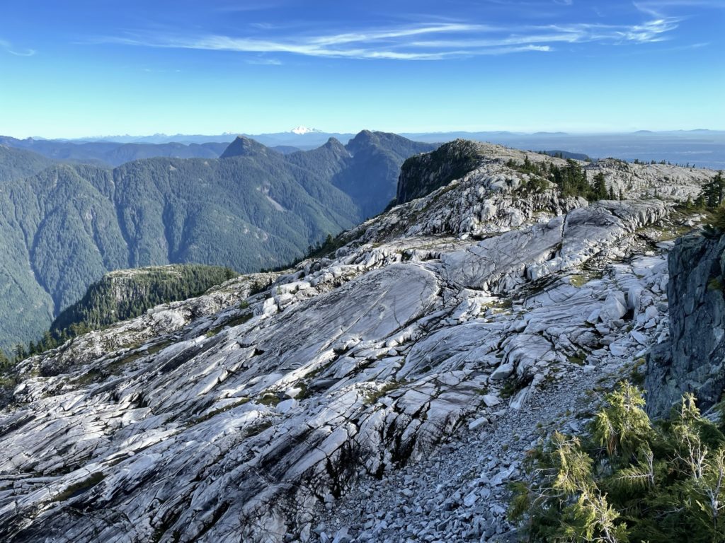
This felt like a monstrous day and I was wiped out by the end. However, these are the type 2 fun days that make it all worthwhile. I came into the day without any insights on the route, excedpt the GPS tracks and was pleasantly surprised by all the panoramic views from Coliseum, Burwell and Cathedral. Steven lead the entirety of the trip and was extremely thankful for that. I never felt at full energy from the beginning and so it was nice to take a back seat and just follow along while Steven chugged along with a great consistent pace. All in all a 10/10 day.