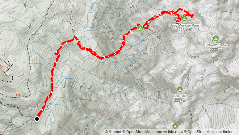
Elevation Gain: 1,478m
Distance: 12.09km
Total Time: 6 hours 54 minutes
Date: July 17th, 2021
Find the true summit post here: https://www.francisbaileyh.com/2021/08/11/baby-munday-peak-south-summit/
After a week long outing in Banff, I was back in Vancouver Friday night and hoping to get one last summit on the Saturday before I started work again. Jacob was interested as usual and suggested Mount Lindeman as an objective. I did some last minute research and discovered that Lindeman seemed to require a fair bit of bushwhacking and average trip time was over 8 hours. I was pretty beat from all the previous trips, so I looked for a shorter and less effort intensive objective. A quick rifle through Matt Gunn’s scramble book and the nearby peak of Baby Munday revealed itself. I barely read the page and started a search for a GPS track on AllTrails. Sure enough, one was already there and so equipped with that, I offered Baby Munday as an alternative. He was open to the idea and so we set that as our goal. Little did I know that my minimal research would net us a very different objective than originally expected.
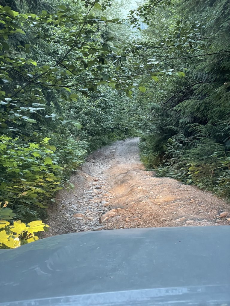
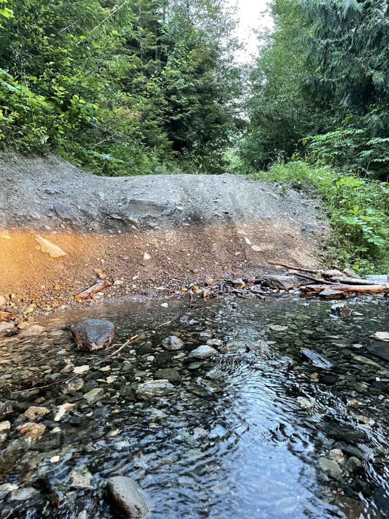
I woke up with a late start on Saturday and didn’t get rolling to Jacob’s until 10am. Thanks to the summer time hours, I wasn’t too fussed about an early start and figured we’d be back around 5pm considering the GPS track showed around 10km round trip and only 1400m elevation gain. We made it to the Foley Creek FSR turn off around 12pm and then started our way up Airplane Creek FSR. I had read previous reports about this FSR, but did not fully understand how rough of condition the road truly was. There were numerous washed out sections, pit holes and deep water bars to contend with. It wasn’t any major issue for the Tacoma, but it was very slow going nonetheless. We reached the trail head a full hour later, but still well within the daylight time window.
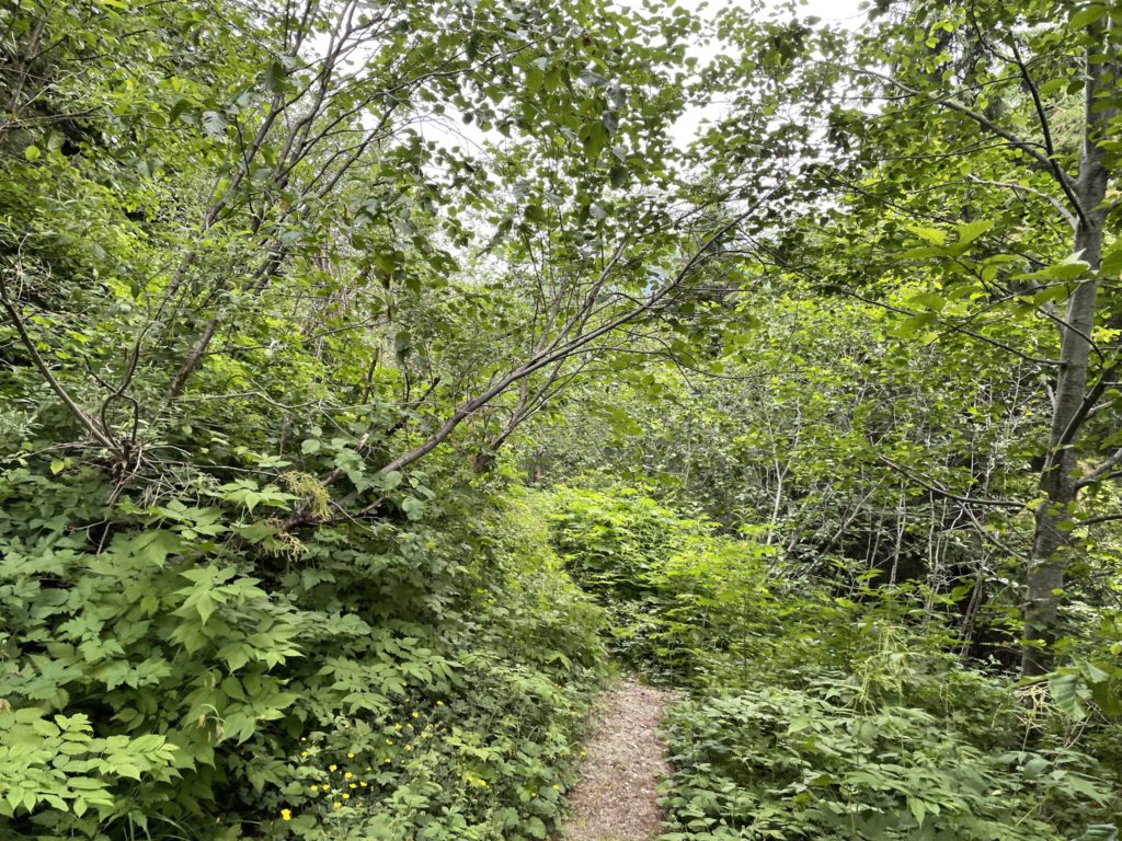
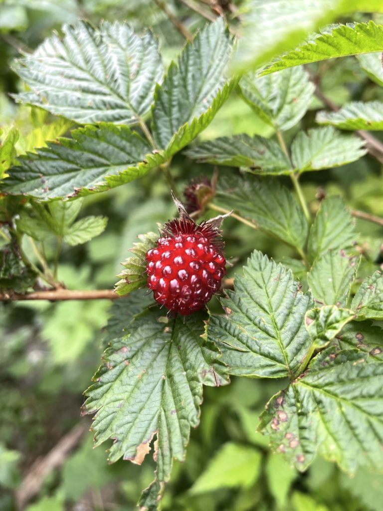
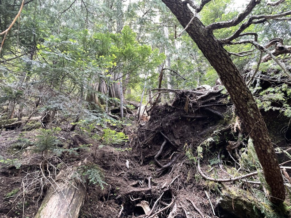
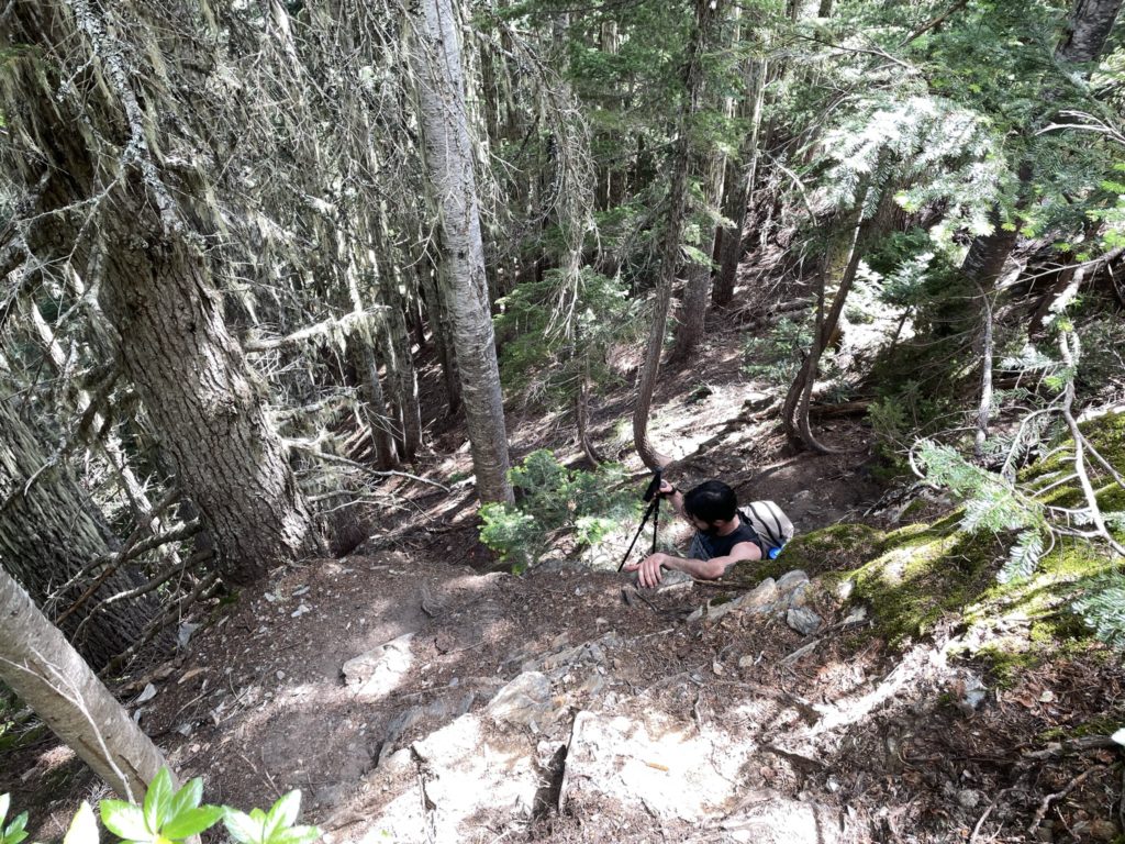
By 1:34 we had started down the trail. The first few km of the trail ran along a long-since deactivated FSR and the bush was really overgrown through most of it. The foot path itself was completely clear, but everything above the knees was covered in vegetation. This slowed us down a bit, but it wasn’t so hard to deal with. There were numerous raspberry bushes along the way so I made the most of it with some trail snacks as we walked through.
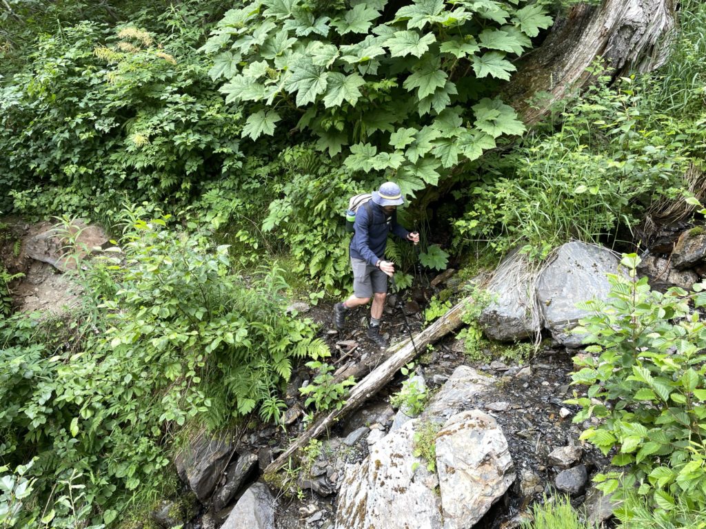
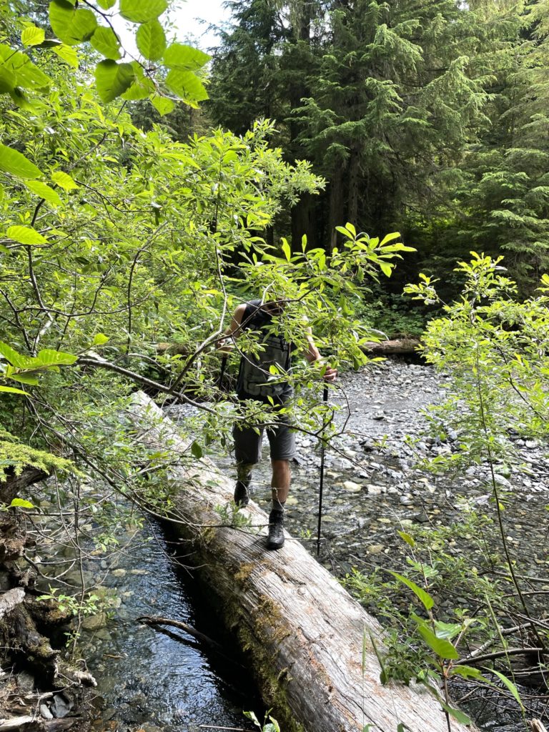
At around the 2.5km mark, the trail forked right into the forest down another section of deactivated FSR. Here the overgrown bush let up a bet and lead way to more open forest. Perhaps 200m later, the FSR terminated and we began a trek through proper forest. There was a minor amount of elevation loss before we reached Airplane Creek. After crossing it, we were met with a steep ascent up through the forest that was sustained for around 700m of elevation gain.
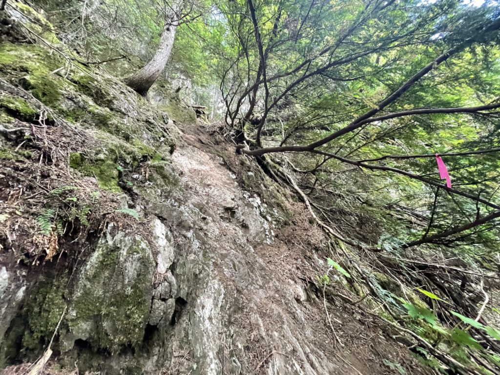
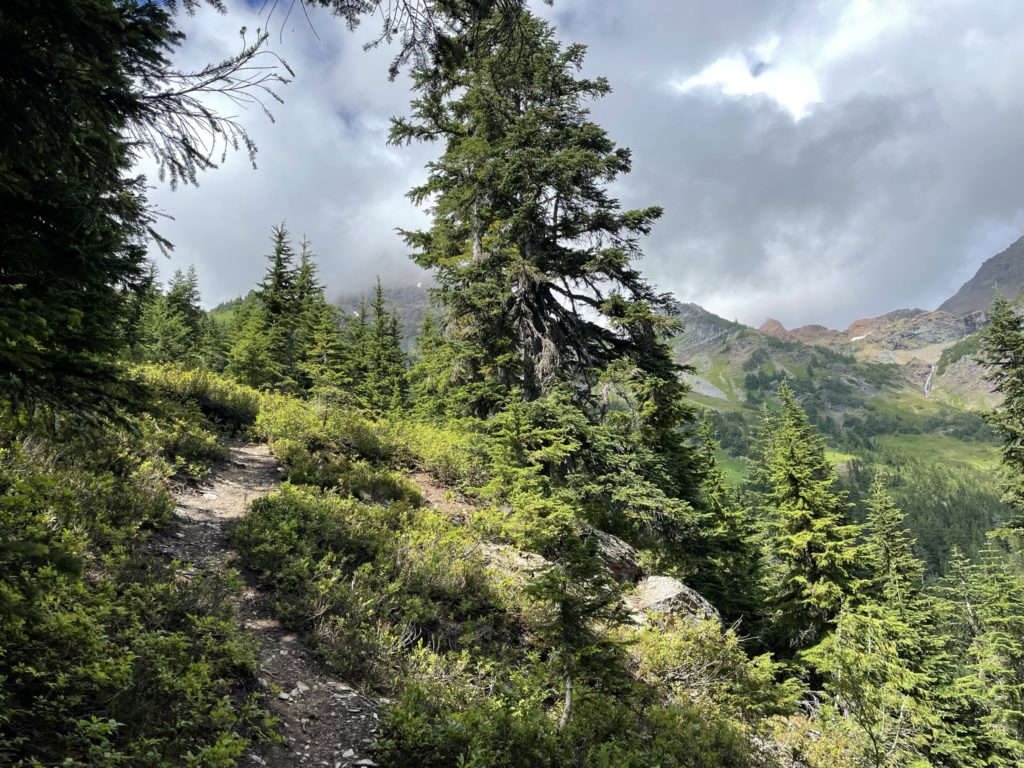
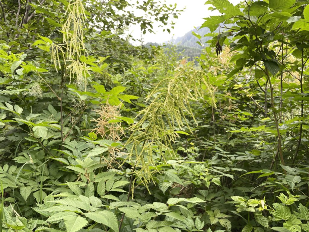
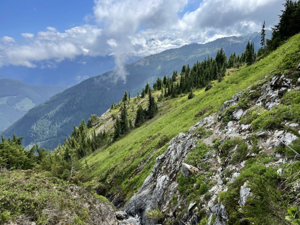
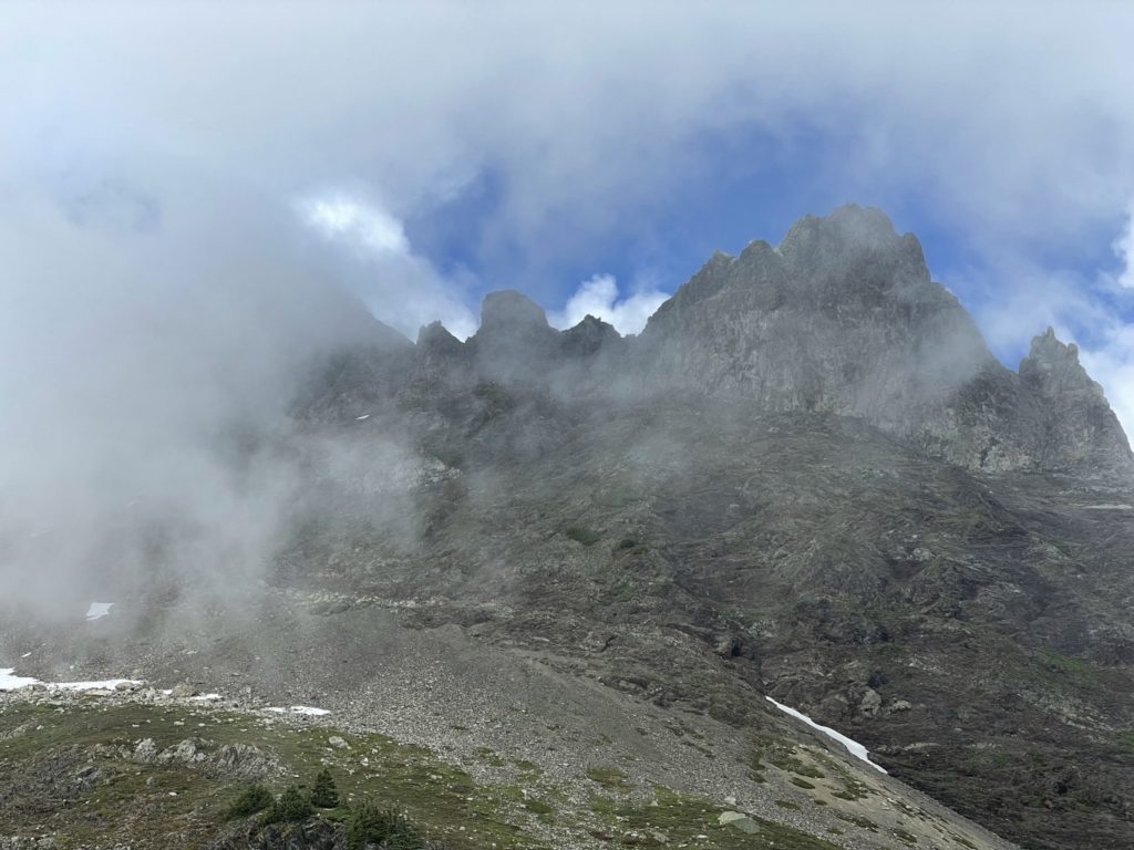
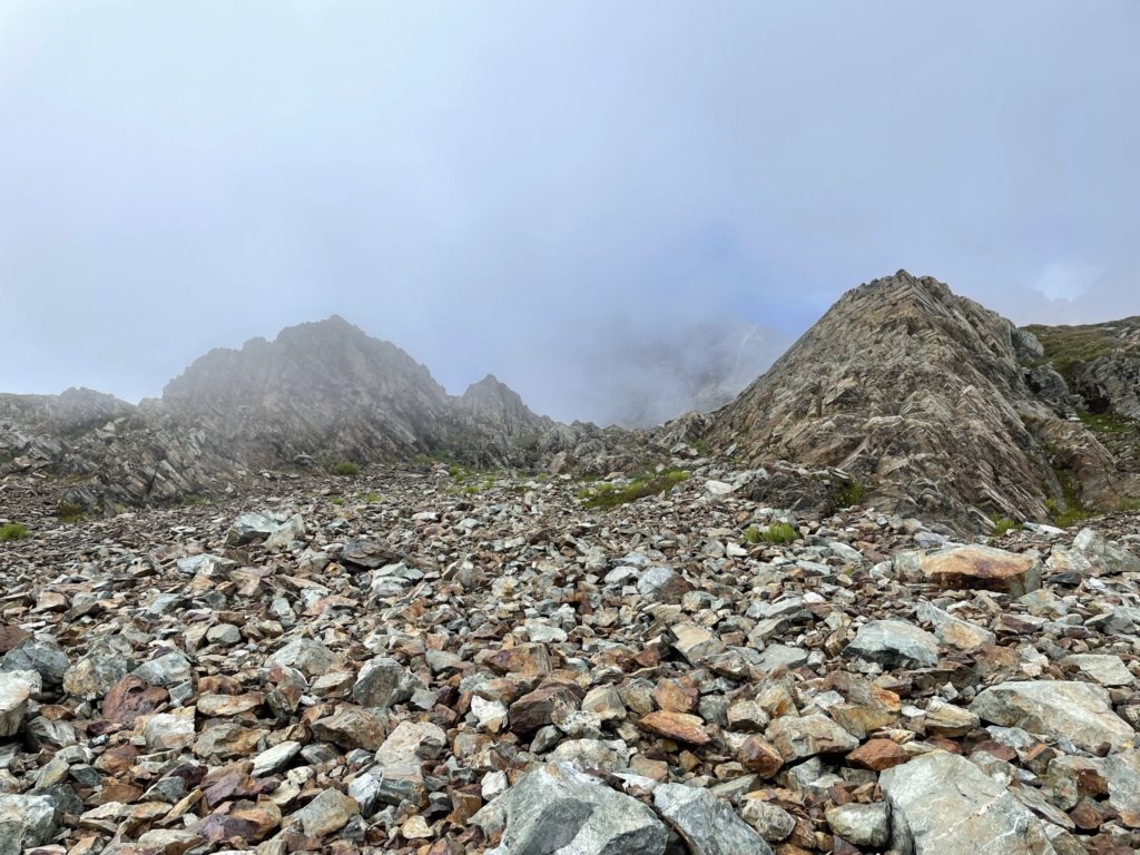
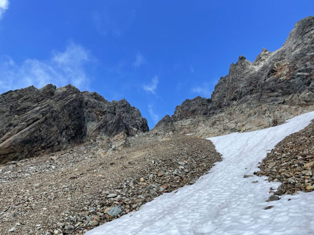
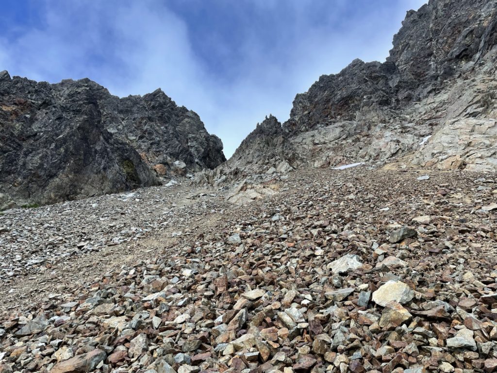
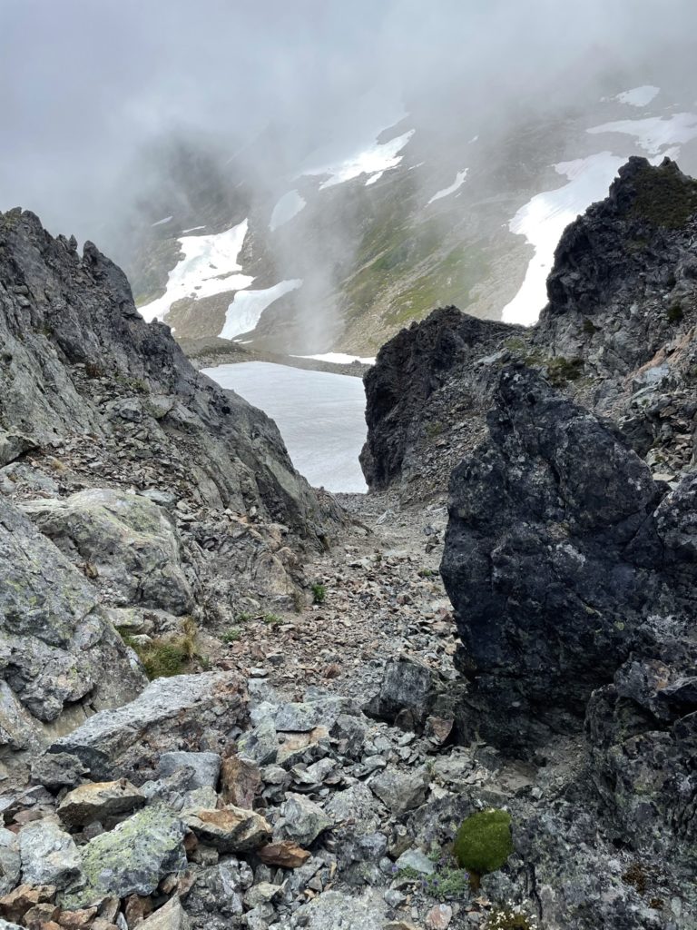
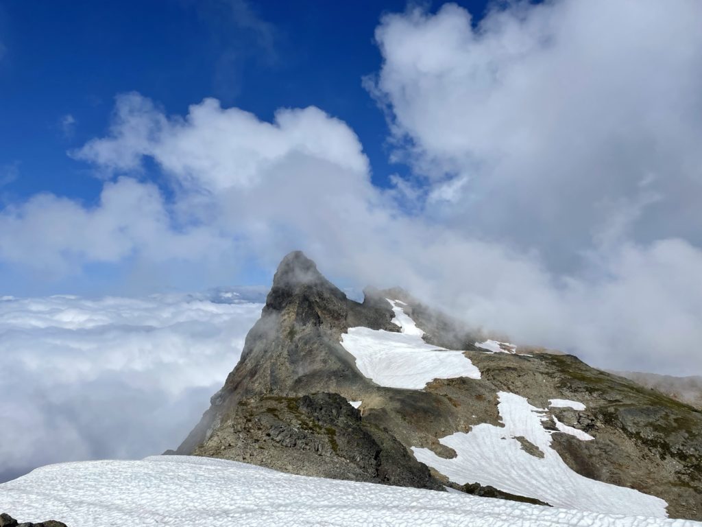
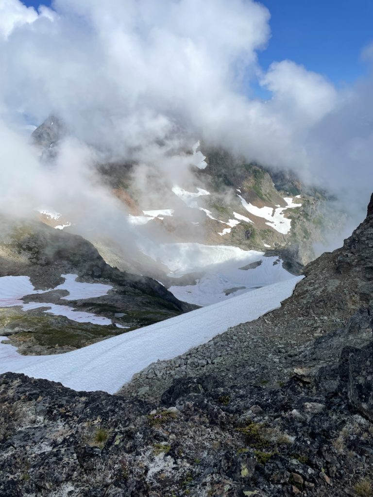
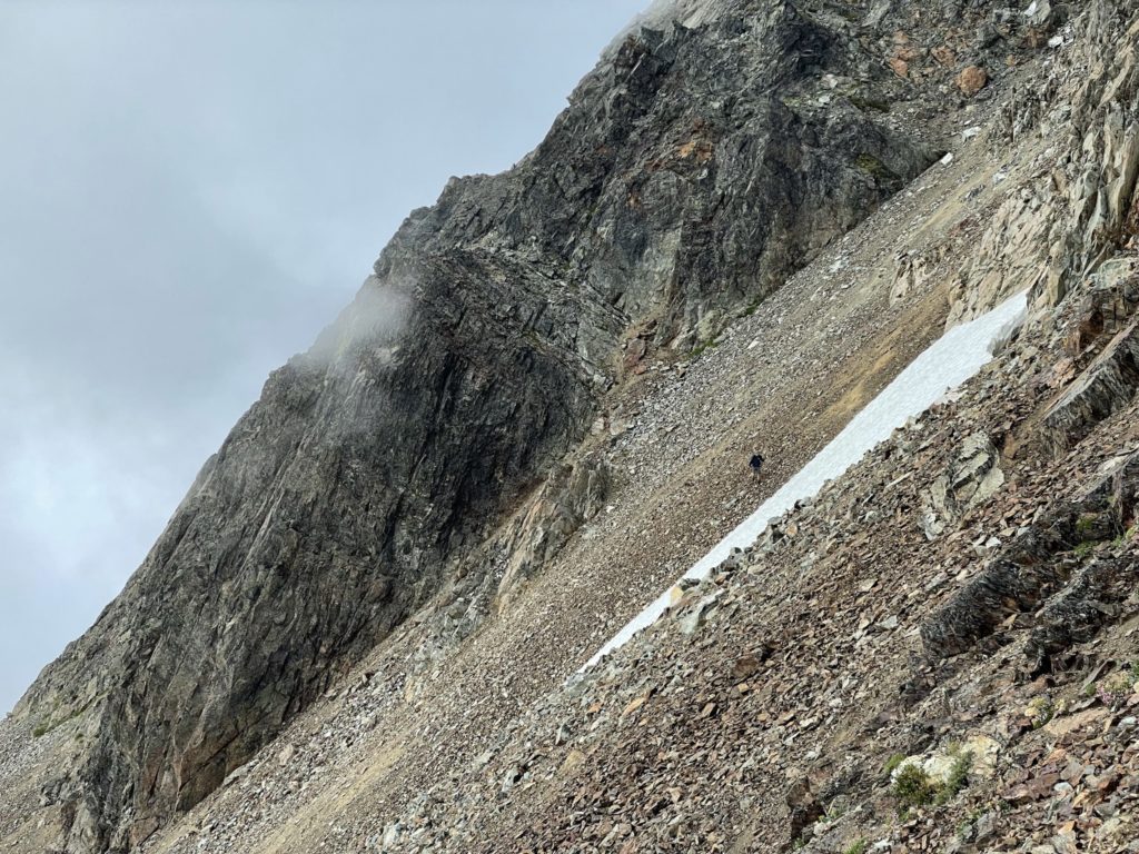
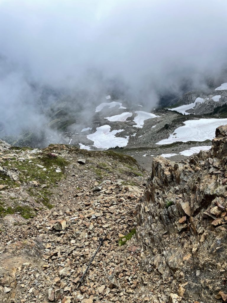
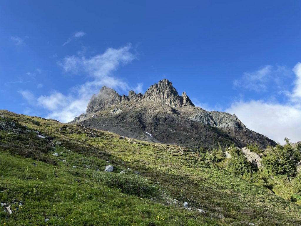
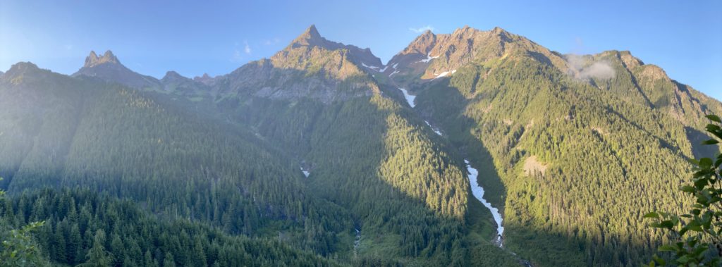
At around the 1730m mark, we broke out into alpine meadows and got our first glimpse of Baby Munday Peak. It was still shrouded in a layer of clouds, but occasionally we’d get a short view of what lay ahead. By this point, the trail had started to taper off and we had to make our own way through the alpine meadows before it gave out to a scree/talus field with rocky outcroppings.
This was the point that my minimal research started to bite back. I was consulting the GPS track and realized for the first time that the track went further North than the summit marker on the map. I assumed that the summit marker was simply placed incorrectly as that had been the case many times in the past using MapBox/OpenStreepMap based maps. Nonetheless, I scanned the area where the summit marker was on the map and saw a few possible avenues of ascent. I had read in Matt Gunn’s book that there were two possible ridge ascents and neither were particularly exposed. From my vantage that didn’t appear to be the case and as I would find out when I got home, I had also mixed up the Stewart Peak details with Baby Munday Peak, leading to this confusion.
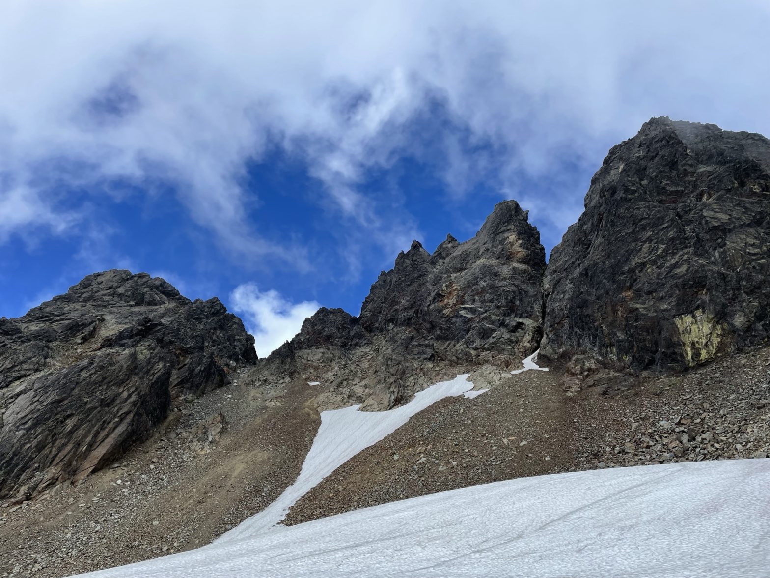
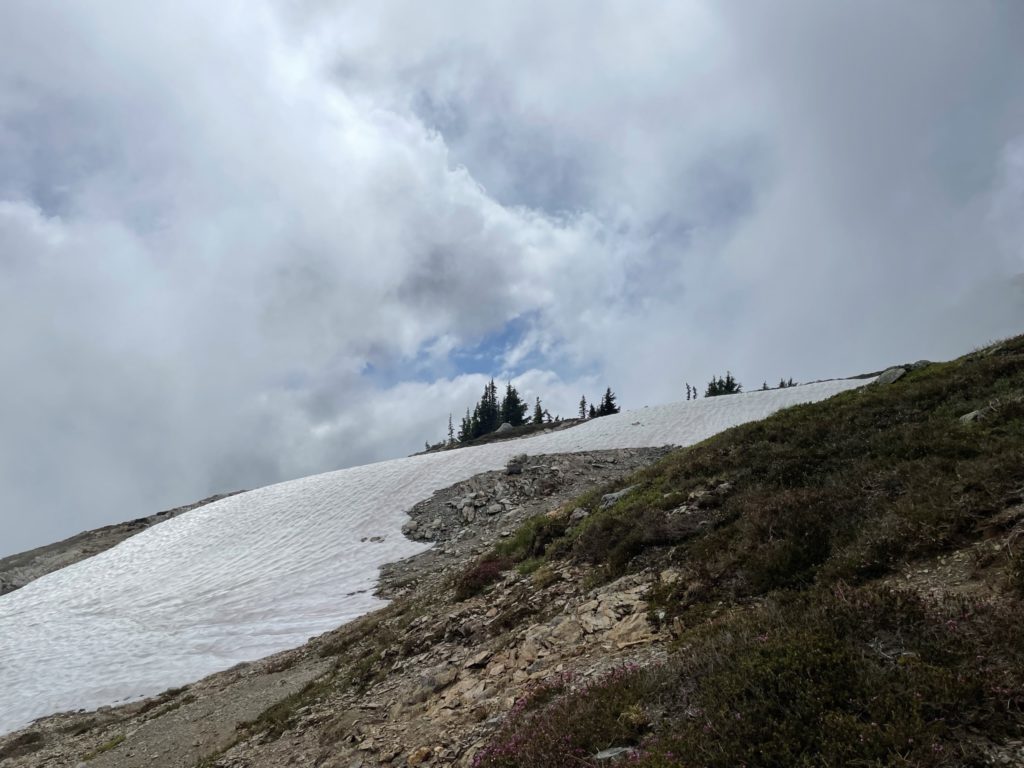
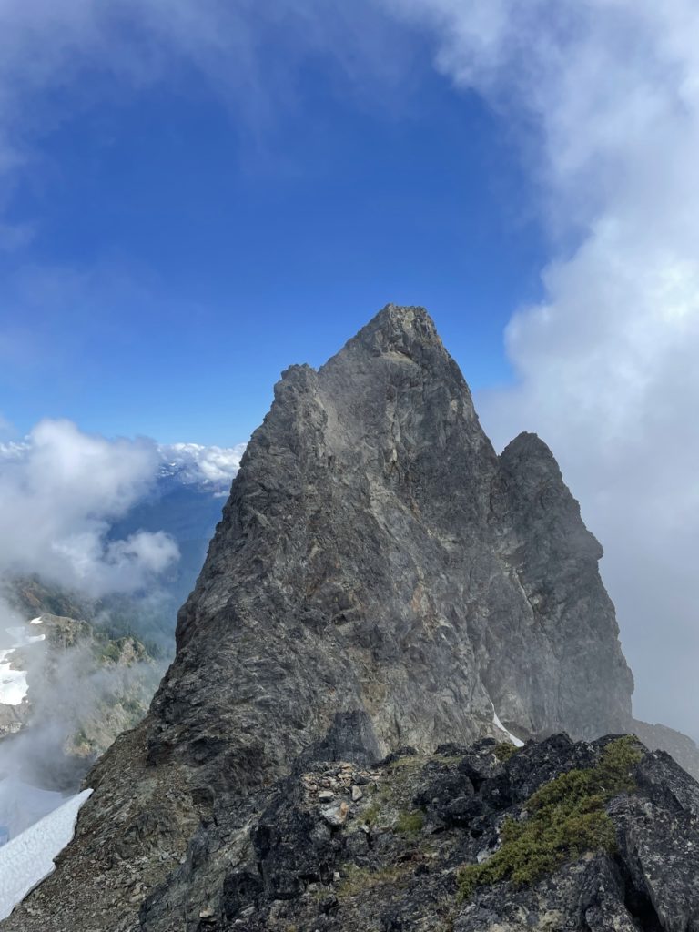
After looking at possible routes up, I decided to continue along the GPS track anyways, thinking it would lead us to the summit. The route took us towards the Knight-Baby Munday col and then directly up a 70-80m scree gully. It was quite steep and a bit of a treadmill, but we eventually made it to the notch between the two summits. Already, it looked unlikely that the GPS track was going to take us to the highest point, but I scrambled up the route anyways to check it out. Sure enough, looking South from the highest point, I could see that we weren’t on the true summit. Disappointed, I checked the time and it was nearly 5pm. We still had enough daylight to try for the true summit, so I told Jacob we should give it a go.
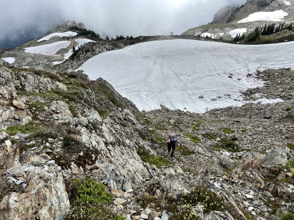
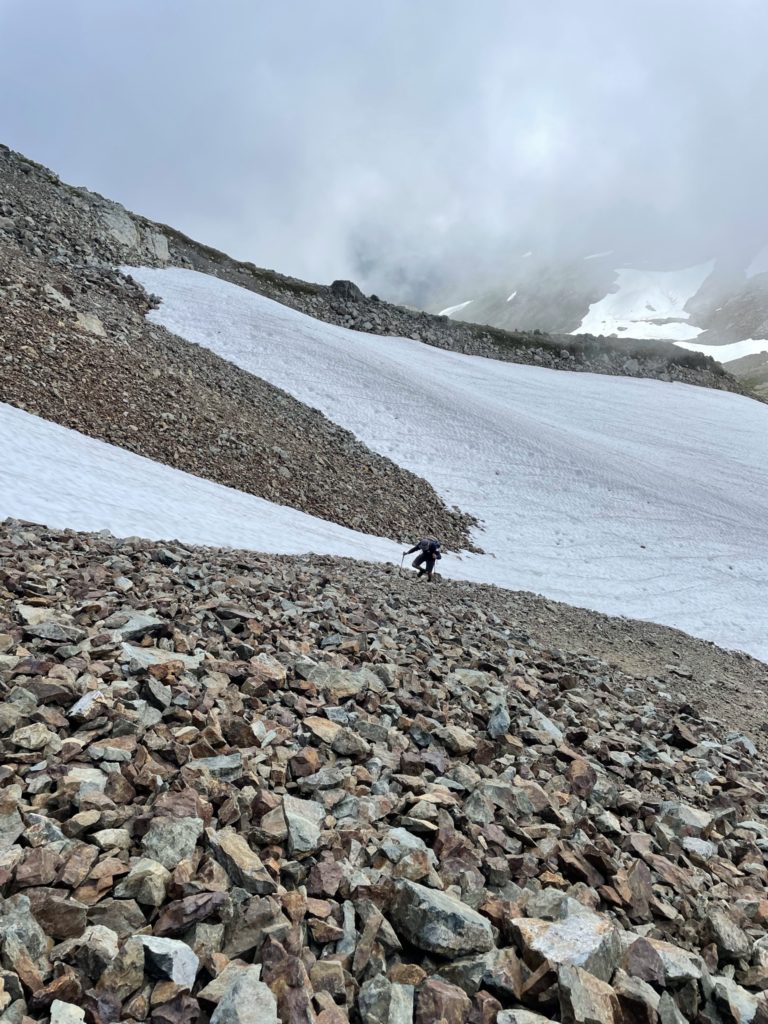
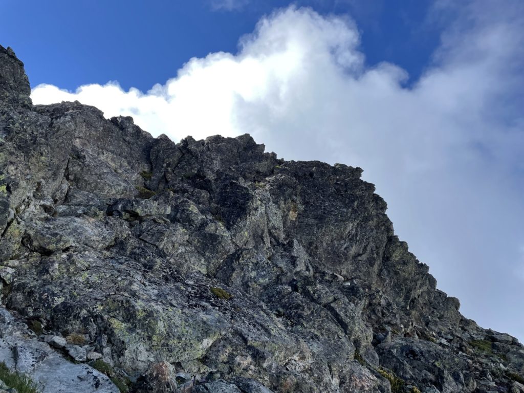
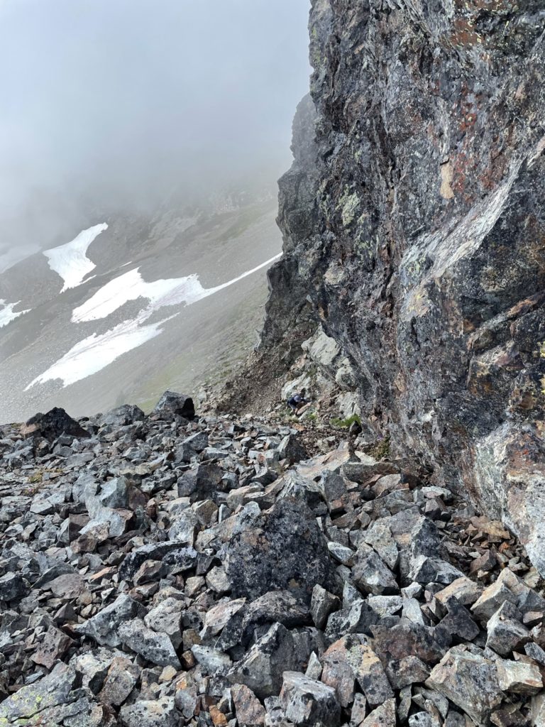
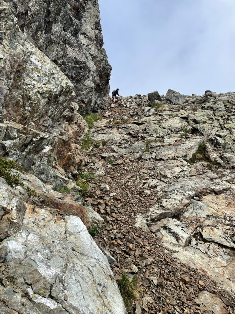
Before descending the scree gully, I had a look at the Northern ridge to see if there any routes up, but was all 5th class and turns out would only lead us to the central summit. I backed off and we started down the scree gully. Half way down, we cut across a patch of snow to avoid losing too much elevation and then continued along scree covered slopes near the base of the summit block. We continued side-hilling until I found a weakness in the ridgeline, nearly all the way to the Southern end of Baby Munday.
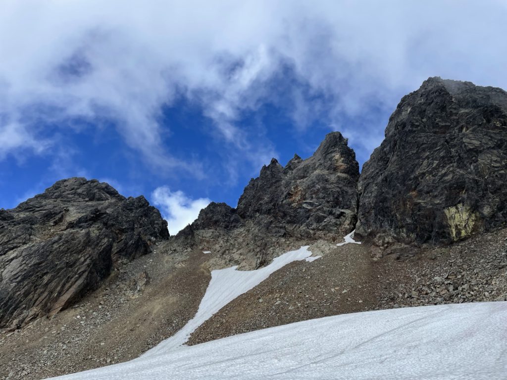
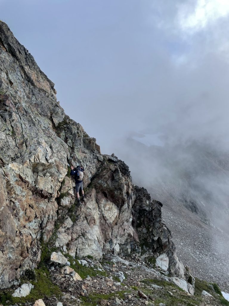
Jacob and I then started our scramble up the gully to gain the ridge. It was comprised of loose scree over hard slabby rock and was a tad sketchy to ascend. A slip here may have resulted in sliding down with the rocks over one of the many cliffs below us. Thankfully, we made it up with relative ease. Here we spotted a cairn that seemed to lead us around a large 5th class block. To reach it required a thin ledge traverse and an exposed stemming move to get around.
I checked the time again and it was now 5:30pm and getting quite late. I set a turnaround time of 6pm and then started scoping out our options. From the Southern side, we could see the top half of the route to the summit and from our perspective it already looked very exposed and tricky. I was not confident we’d be bagging this summit even without a looming turnaround time.
I started across the ledge and just before the stemming move, I decided to call it. I didn’t feel it was worth committing to, to only find out the summit was not attainable. I backed off and Jacob stepped up to the plate. I agreed, if he made it around and found a reasonable route up, I’d commit to coming as well. Jacob made the tricky move across and then went up and around the corner to see what was ahead. A few minutes later Jacob returned and came to the consensus that this route could not be easily scrambled up. Given our turnaround time being reached and the lack of any beta on the route, we decided to call it what it was and start heading back.
A tense few steps later and Jacob was back across the ledge and waiting for me to descend the ascent gully back to the Western slopes. We were careful with the foot placements so as not to kick off too much rock fall and avoided descending at the same time. Once we were both down, we picked a line down to the nearest scree slopes to avoid the numerous small cliffs below us. From the scree slope we simply retraced our steps back down through the alpine meadows and then took the original forest trail all the way back to the truck. There was some concern on the way up about how shitty the descent would be given the steepness, but it was actually quite easy to make good speed on the way down. By 8pm we were back at the truck and heading down Airplane Creek FSR.
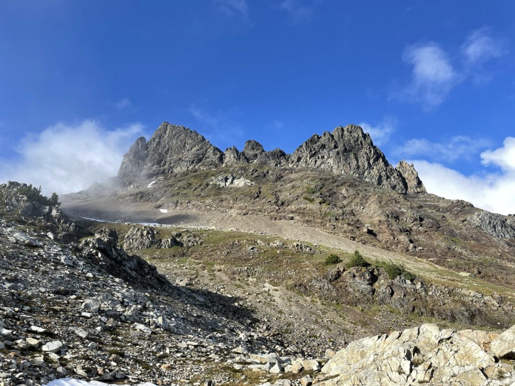
All the way back, I was running through my head about how we couldn’t get the true summit. After all Matt Gunn’s book had mentioned there were two easy routes with minimal exposure, but what we encountered was 4th and 5th class routes on either side of the ridge. It was only when I got home that I realized how poorly my lack of research had paid off. Firstly, Matt Gunn’s book only mentions the North summit, not the true summit. Secondly, I had mixed up the Stewart Peak beta with Baby Munday and that made things especially confusing. Finally, I had a look at trip reports of Baby Munday and all the ones I could find used ropes and protection to gain the summit. This helped alleviate some of the feeling that maybe we could have made it if we had enough time. Now I realized, there really wasn’t any way. So, with that, I conclude this trip as part failure and part success. We still grabbed a popular objective (the North summit), but truthfully, I would have selected a totally different objective if I knew it wouldn’t involve getting the true summit. Stewart Peak and Knight Peak are definitely on the list now and I’ll hopefully be back up there again some time soon. Perhaps even to gain the true summit of Baby Munday with the right equipment this time.