
Includes data for Zupjok, Lllama, Alpaca and Ottomite
Elevation Gain: 1,471m
Distance: 20km
Total Time: 6 hours 57 minutes
Date: June 20th, 2021
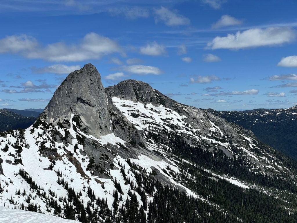
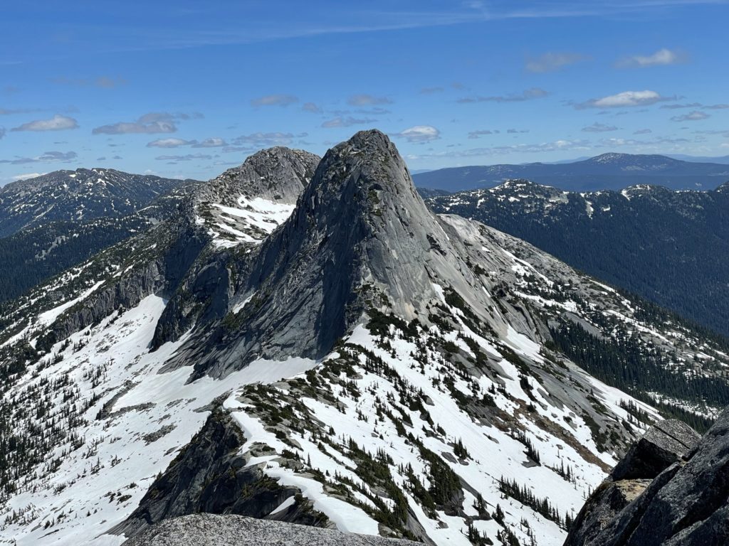
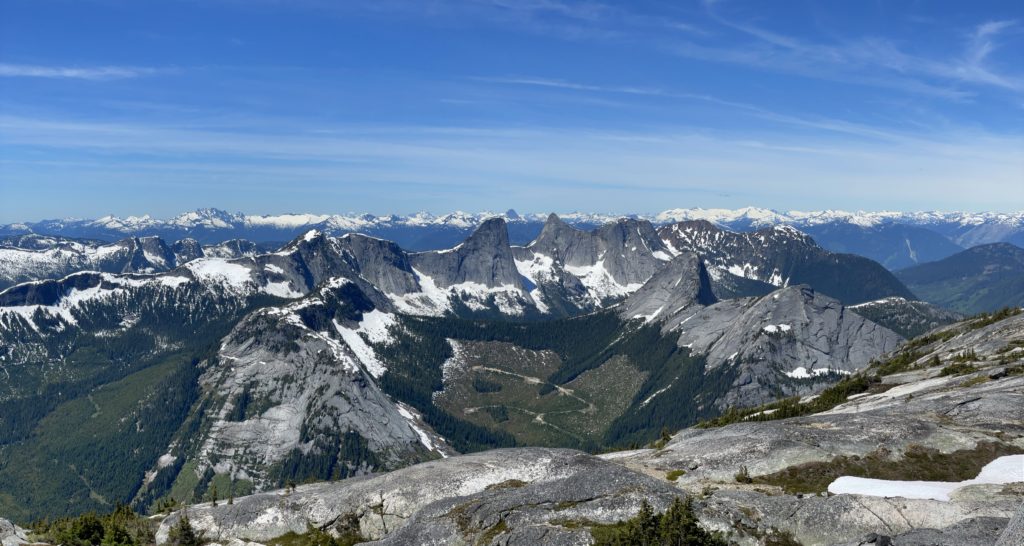
Alpaca Peak is a 2083m peak with an impressive headwall, visible from the valley that Coldwater River runs through; North of the Coquihalla Summit Recreating Area. I first spotted this peak when I was attempting Vicuna and Guanaco Peak in 2020, but didn’t know much about it until I came across Steven’s trip report. It was now the final peak of our long traverse from Zupjok Peak and Llama Peak and we were running a bit tight on time. I had a short 45 minute time span to get to the top from Llama Peak before having to turn around.
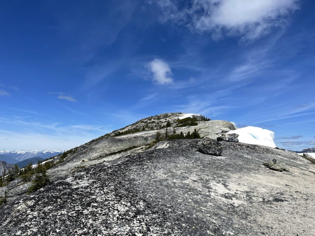
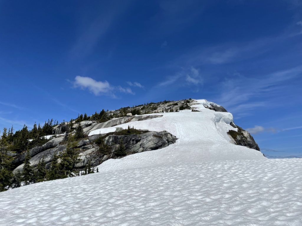
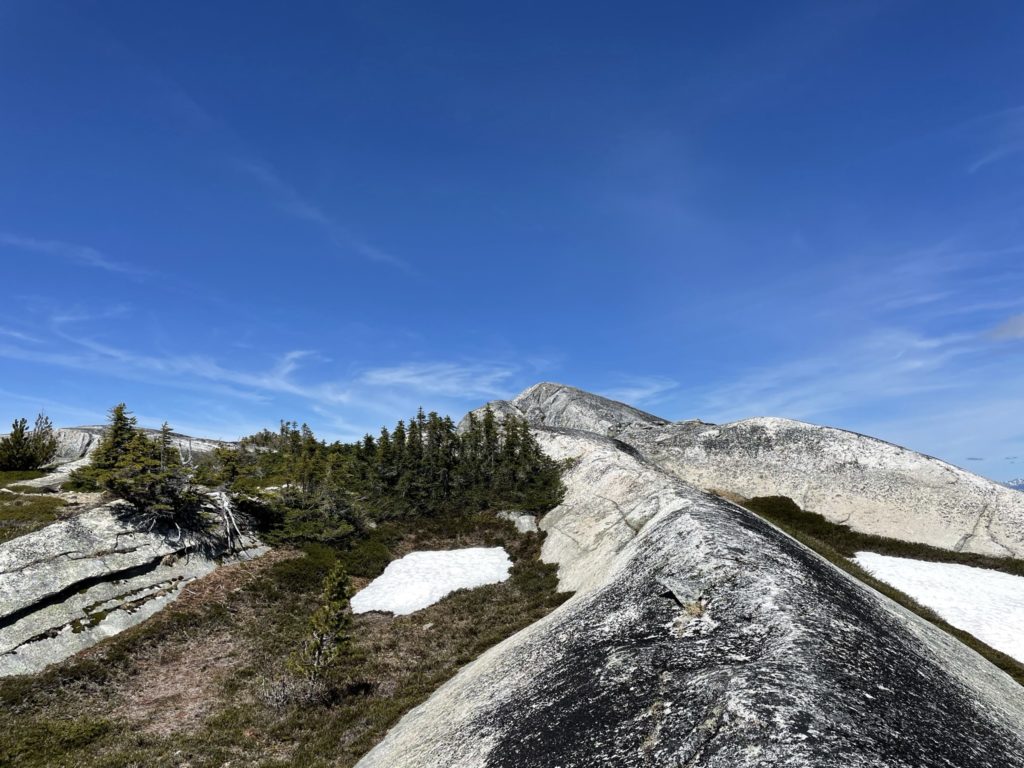
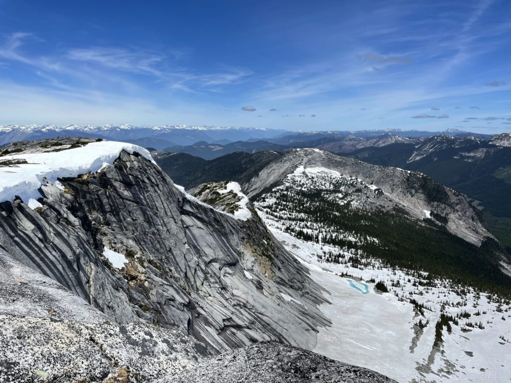
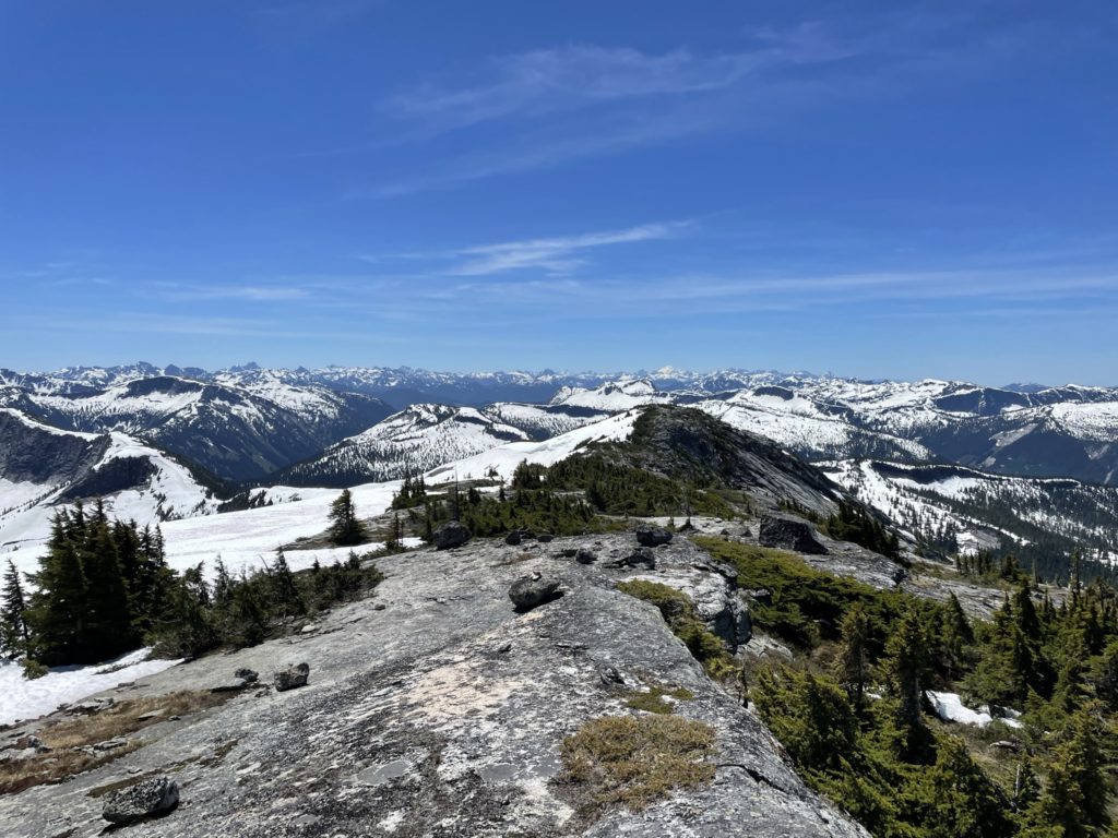
Thankfully, the route was straight forward and started by meandering through a broad ridge of solid rock and heather. At about 750m from Llama Peak, the ridge veers more West and creates a direct line to the summit. Here I saw some still corniced ridge line on climber’s right, but the remainder of the ridge was snow free on solid rock. At this point Shelby, had reached his limit for the day and encouraged me to push on the summit while he waited. I continued on as agreed and started up the ridge. I opted to avoid most of the snow and picked a line along the rocky slopes. There was perhaps one short class 2 section and the remainder was an easy hike up to the top.
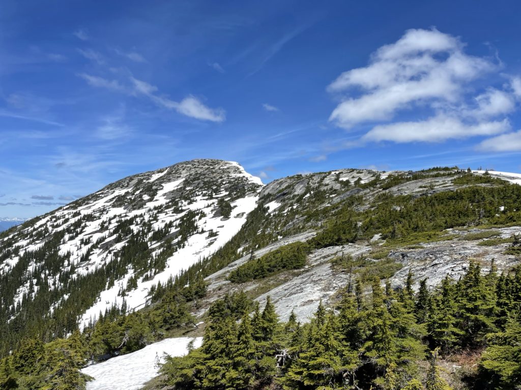
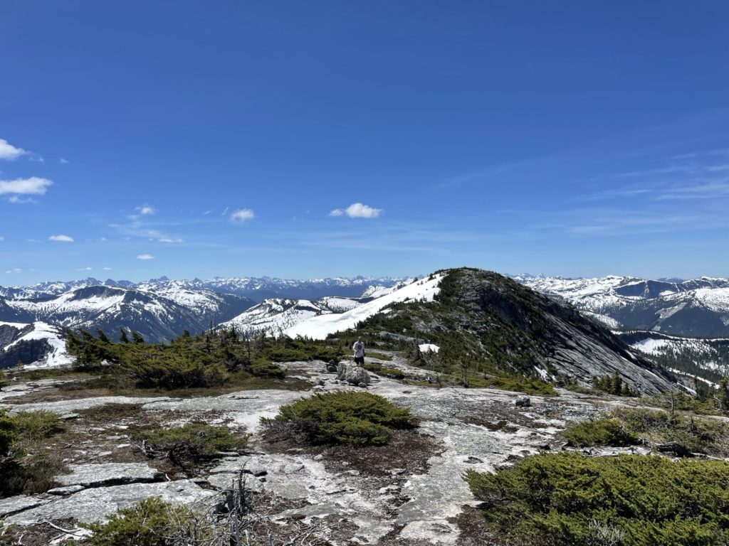
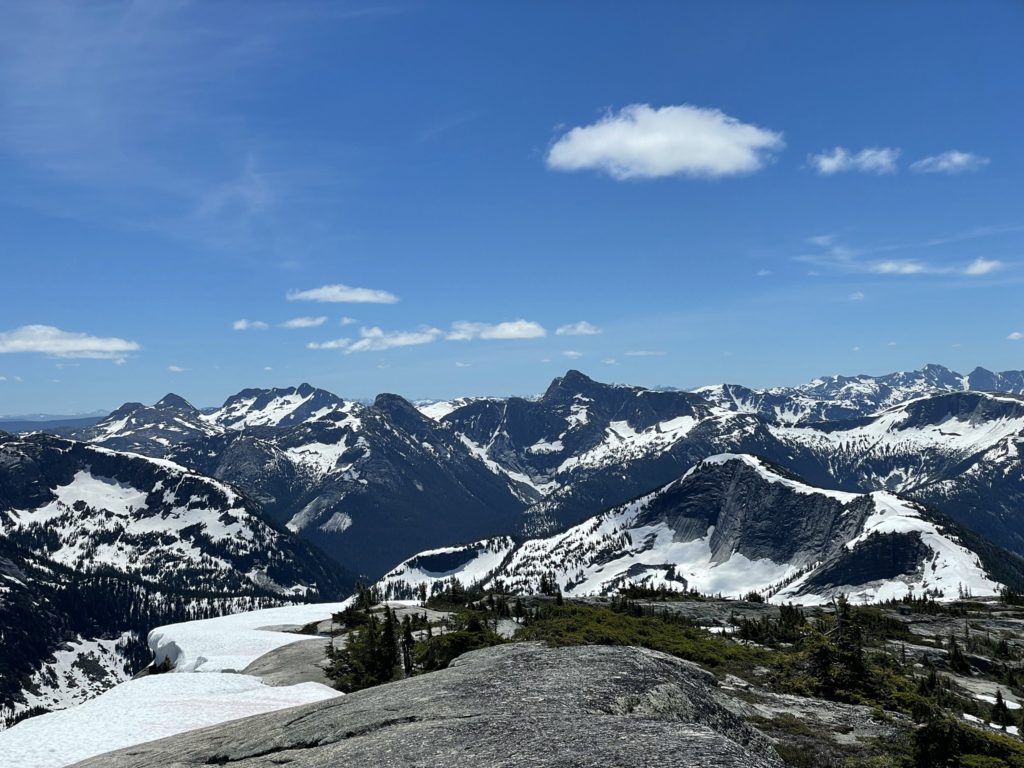
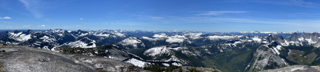
From the summit, there was fantastic views of the Anderson River group as well as Vicuna and Guanaco. I reached the top around 12:26, so I couldn’t stick around for long. I paused to take a few photos and then started a job back down the Shelby.
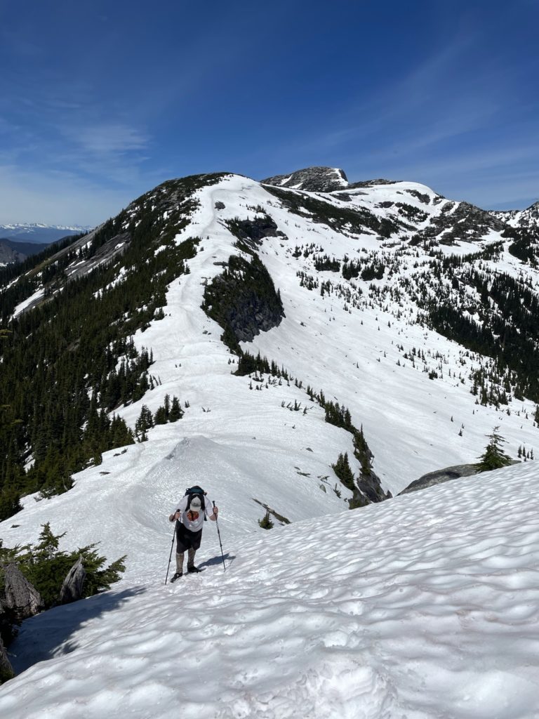
Once we rejoined, we headed back to Llama Peak together to grab our bags. Now looking back at Zupjok, we could see the long undulating ridge ahead of us and a decent amount of elevation loss and gain to reach the top again. The sun was bearing down on us quite heavily now too, but slowly and surely we slogged our way back to the top Zupjok. At Zupjok, it was a fast descent down the snowy forest until we reached the col to Ottomite Mountain. We had made good time on the descent and so I figured why not grab a 4th peak since it’s right there. Shelby agreed and so we started our way over.